-
Sandy Point Shoal Light [01]
![Sandy Point Shoal Light [01] (1874 visits) Sandy Point Shoal Light, a three-story brick lighthouse that was built in 1883. The lighthouse is l... Sandy Point Shoal Light [01]](../../i/upload/2024/07/19/20240719162410-1250af50-cu_s9999x250.jpg)
-
Sandy Point Shoal Light [02]
![Sandy Point Shoal Light [02] (1948 visits) Sandy Point Shoal Light, a three-story brick lighthouse that was built in 1883. The lighthouse is l... Sandy Point Shoal Light [02]](../../i/upload/2024/07/19/20240719162535-d27a11a8-cu_s9999x250.jpg)
-
Sandy Point Shoal Light [03]
![Sandy Point Shoal Light [03] (1902 visits) Sandy Point Shoal Light, a three-story brick lighthouse that was built in 1883. The lighthouse is l... Sandy Point Shoal Light [03]](../../i/upload/2024/07/19/20240719162328-0e1a4ebd-cu_s9999x250.jpg)
-
Sandy Point Shoal Light [04]
![Sandy Point Shoal Light [04] (2923 visits) Sandy Point Shoal Light, a three-story brick lighthouse that was built in 1883. The lighthouse is l... Sandy Point Shoal Light [04]](../../i/upload/2024/07/19/20240719162323-73076452-cu_s9999x250.jpg)
-
Sandy Point Shoal Light [05]
![Sandy Point Shoal Light [05] (1944 visits) Sandy Point Shoal Light, a three-story brick lighthouse that was built in 1883. The lighthouse is l... Sandy Point Shoal Light [05]](../../i/upload/2024/07/19/20240719162406-267c63db-cu_s9999x250.jpg)
-
Sandy Point Shoal Light [06]
![Sandy Point Shoal Light [06] (1986 visits) Sandy Point Shoal Light, a three-story brick lighthouse that was built in 1883. The lighthouse is l... Sandy Point Shoal Light [06]](../../i/upload/2024/07/19/20240719162450-71d7a4db-cu_s9999x250.jpg)
-
Sandy Point Shoal Light [07]
![Sandy Point Shoal Light [07] (1873 visits) Sandy Point Shoal Light, a three-story brick lighthouse that was built in 1883. The lighthouse is l... Sandy Point Shoal Light [07]](../../i/upload/2024/07/19/20240719162531-badec1f6-cu_s9999x250.jpg)
-
Sandy Point Shoal Light [08]
![Sandy Point Shoal Light [08] (1933 visits) Sandy Point Shoal Light, a three-story brick lighthouse that was built in 1883. The lighthouse is l... Sandy Point Shoal Light [08]](../../i/upload/2024/07/19/20240719162459-4d01b2a8-cu_s9999x250.jpg)
-
Sandy Point Shoal Light [09]
![Sandy Point Shoal Light [09] (1987 visits) Sandy Point Shoal Light, a three-story brick lighthouse that was built in 1883. The lighthouse is l... Sandy Point Shoal Light [09]](../../i/upload/2024/07/19/20240719162414-8ba70891-cu_s9999x250.jpg)
-
Sandy Point Shoal Light [10]
![Sandy Point Shoal Light [10] (1915 visits) Sandy Point Shoal Light, a three-story brick lighthouse that was built in 1883. The lighthouse is l... Sandy Point Shoal Light [10]](../../i/upload/2024/07/19/20240719162418-d1e29a27-cu_s9999x250.jpg)
-
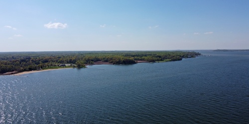
Sandy Point State Park from offshore
-
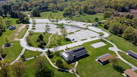
East beach parking area at Sandy Point State Park
-
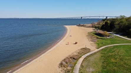
East beach at Sandy Point State Park
-
Chesapeake Bay Bridge [01]
![Chesapeake Bay Bridge [01] (1939 visits) The Chesapeake Bay Bridge, a pair of bridges approximately 4.35 miles in length that carry US Routes... Chesapeake Bay Bridge [01]](../../i/upload/2024/07/19/20240719162332-1d4f9ead-cu_s9999x250.jpg)
-
Chesapeake Bay Bridge [02]
![Chesapeake Bay Bridge [02] (2048 visits) The Chesapeake Bay Bridge, a pair of bridges approximately 4.35 miles in length that carry US Routes... Chesapeake Bay Bridge [02]](../../i/upload/2024/07/19/20240719162336-59620651-cu_s9999x250.jpg)
-
Chesapeake Bay Bridge [03]
![Chesapeake Bay Bridge [03] (1953 visits) The Chesapeake Bay Bridge, a pair of bridges approximately 4.35 miles in length that carry US Routes... Chesapeake Bay Bridge [03]](../../i/upload/2024/07/19/20240719162426-d7b27488-cu_s9999x250.jpg)
-
Chesapeake Bay Bridge [04]
![Chesapeake Bay Bridge [04] (2227 visits) The Chesapeake Bay Bridge, a pair of bridges approximately 4.35 miles in length that carry US Routes... Chesapeake Bay Bridge [04]](../../i/upload/2024/07/19/20240719162503-710cfed8-cu_s9999x250.jpg)
-
Communications antenna near Sandy Point [01]
![Communications antenna near Sandy Point [01] (1220 visits) Communications antenna off of College Parkway in Annapolis, Maryland, near Sandy Point State Park, o... Communications antenna near Sandy Point [01]](../../i/upload/2024/07/19/20240719162602-e02abfc3-cu_s9999x250.jpg)
-
Communications antenna near Sandy Point [02]
![Communications antenna near Sandy Point [02] (1269 visits) Communications antenna off of College Parkway in Annapolis, Maryland, near Sandy Point State Park, o... Communications antenna near Sandy Point [02]](../../i/upload/2024/07/19/20240719162507-ac6b866a-cu_s9999x250.jpg)
-
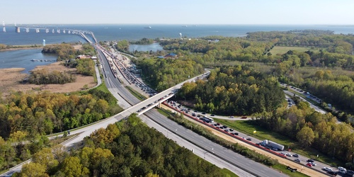
Traffic backup on Bay Bridge approach
-
Dock lights at Mike's Restaurant & Crabhouse [01]
![Dock lights at Mike's Restaurant & Crabhouse [01] (649 visits) Dock lights at Mike's Restaurant & Crabhouse, off of Riva Road near Annapolis, Maryland.
Ben Sc... Dock lights at Mike's Restaurant & Crabhouse [01]](../../i/upload/2024/07/19/20240719162607-1866de7b-cu_s9999x250.jpg)
-
Dock lights at Mike's Restaurant & Crabhouse [02]
![Dock lights at Mike's Restaurant & Crabhouse [02] (660 visits) Dock lights at Mike's Restaurant & Crabhouse, off of Riva Road near Annapolis, Maryland.
Ben Sc... Dock lights at Mike's Restaurant & Crabhouse [02]](../../i/upload/2024/07/19/20240719162439-0bb0019d-cu_s9999x250.jpg)
-
Bridge carrying Riva Road over the South River [01]
![Bridge carrying Riva Road over the South River [01] (900 visits) Bridge carrying Riva Road over the South River near Annapolis, Maryland.
Ben Schumin is a professio... Bridge carrying Riva Road over the South River [01]](../../i/upload/2024/07/19/20240719162612-4feeeb42-cu_s9999x250.jpg)
-
Bridge carrying Riva Road over the South River [02]
![Bridge carrying Riva Road over the South River [02] (901 visits) Bridge carrying Riva Road over the South River near Annapolis, Maryland.
Ben Schumin is a professio... Bridge carrying Riva Road over the South River [02]](../../i/upload/2024/07/19/20240719162516-6b4624c8-cu_s9999x250.jpg)
-
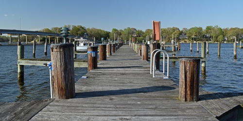
Docks at Mike's Restaurant & Crabhouse
-
Sign for Mike's Country Store [01]
![Sign for Mike's Country Store [01] (1110 visits) Sign advertising Mike's Country Store on a dock off of Riva Road near Annapolis, Maryland.
Ben Schu... Sign for Mike's Country Store [01]](../../i/upload/2024/07/19/20240719162354-073539d4-cu_s9999x250.jpg)
-
Sign for Mike's Country Store [02]
![Sign for Mike's Country Store [02] (1048 visits) Sign advertising Mike's Country Store on a dock off of Riva Road near Annapolis, Maryland.
Ben Schu... Sign for Mike's Country Store [02]](../../i/upload/2024/07/19/20240719162617-a18a3534-cu_s9999x250.jpg)
-
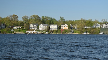
Houses fronting the South River
-
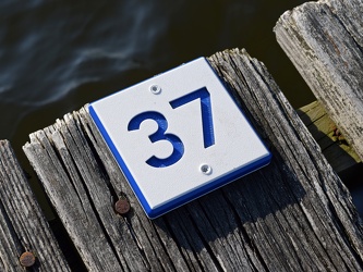
Marker for slip 37
-
Marker for slip 42 [01]
![Marker for slip 42 [01] (719 visits) Marker for slip 42 on the docks adjacent to Mike's Restaurant & Crabhouse near Annapolis, Maryla... Marker for slip 42 [01]](../../i/upload/2024/07/19/20240719162521-b3b6acac-cu_s9999x250.jpg)
-
Marker for slip 42 [02]
![Marker for slip 42 [02] (752 visits) Marker for slip 42 on the docks adjacent to Mike's Restaurant & Crabhouse near Annapolis, Maryla... Marker for slip 42 [02]](../../i/upload/2024/07/19/20240719162526-43487c8e-cu_s9999x250.jpg)
-
Lime wedge on the dock

-
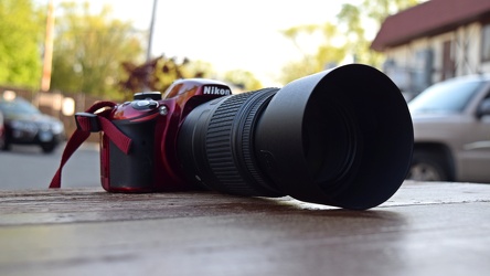
Nikon D3200 with zoom lens
-
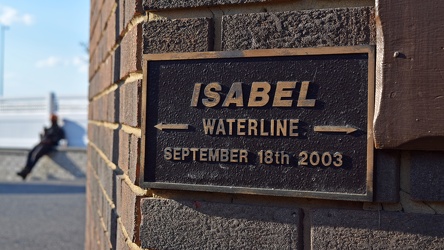
Hurricane Isabel waterline plaque
-
Marley Station Mall [01]
![Marley Station Mall [01] (1987 visits) Marley Station Mall, an enclosed shopping mall in Glen Burnie, Maryland, developed by Taubman Center... Marley Station Mall [01]](../../i/upload/2024/07/19/20240719162430-1b62b9a9-cu_s9999x250.jpg)
-
Marley Station Mall [02]
![Marley Station Mall [02] (2104 visits) Marley Station Mall, an enclosed shopping mall in Glen Burnie, Maryland, developed by Taubman Center... Marley Station Mall [02]](../../i/upload/2024/07/19/20240719162540-b4297df7-cu_s9999x250.jpg)
-
Marley Station Mall [03]
![Marley Station Mall [03] (2034 visits) Marley Station Mall, an enclosed shopping mall in Glen Burnie, Maryland, developed by Taubman Center... Marley Station Mall [03]](../../i/upload/2024/07/19/20240719162435-cdd79481-cu_s9999x250.jpg)
-
Marley Station Mall [04]
![Marley Station Mall [04] (2088 visits) Marley Station Mall, an enclosed shopping mall in Glen Burnie, Maryland, developed by Taubman Center... Marley Station Mall [04]](../../i/upload/2024/07/19/20240719162512-1cbff00c-cu_s9999x250.jpg)
-
Aerial view of Glen Burnie, Maryland [01]
![Aerial view of Glen Burnie, Maryland [01] (1108 visits) Aerial view of Glen Burnie, Maryland, taken near Marley Station Mall.
Ben Schumin is a professional... Aerial view of Glen Burnie, Maryland [01]](../../i/upload/2024/07/19/20240719162345-6a1470e1-cu_s9999x250.jpg)
-
Aerial view of Glen Burnie, Maryland [02]
![Aerial view of Glen Burnie, Maryland [02] (1241 visits) Aerial view of Glen Burnie, Maryland, taken near Marley Station Mall.
Ben Schumin is a professional... Aerial view of Glen Burnie, Maryland [02]](../../i/upload/2024/07/19/20240719162350-5a3dcd0c-cu_s9999x250.jpg)