-
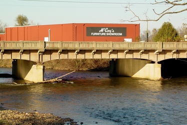
South River in Waynesboro
-
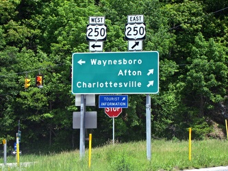
Directional signage at the end of the ramp for Interstate 64, Exit 99 at Rockfish Gap
-
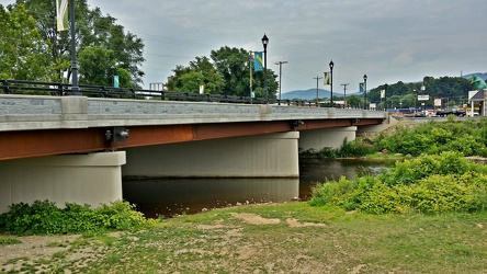
Broad Street bridge
-
U.S. Coast & Geodetic Survey benchmark [02]
![U.S. Coast & Geodetic Survey benchmark [02] (937 visits) U.S. Coast & Geodetic Survey elevation benchmark at the Williamsburg Transportation Center in Wi... U.S. Coast & Geodetic Survey benchmark [02]](../../i/upload/2024/07/19/20240719092903-7dd2c09e-cu_s9999x250.jpg)
-
U.S. Coast & Geodetic Survey benchmark [01]
![U.S. Coast & Geodetic Survey benchmark [01] (926 visits) U.S. Coast & Geodetic Survey elevation benchmark at the Williamsburg Transportation Center in Wi... U.S. Coast & Geodetic Survey benchmark [01]](../../i/upload/2024/07/19/20240719092944-44ada60d-cu_s9999x250.jpg)
-
Tan A Supermarket

-
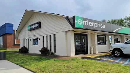
Enterprise Rent-A-Car on West Broad Street
-
Interstate 64 in Nelson County, Virginia [01]
![Interstate 64 in Nelson County, Virginia [01] (7616 visits) Interstate 64 in Nelson County, Virginia, near Rockfish Gap. US 250 runs adjacent to the freeway.
... Interstate 64 in Nelson County, Virginia [01]](../../i/upload/2024/07/19/20240719115200-c8a2ce39-cu_s9999x250.jpg)
-
Interstate 64 in Nelson County, Virginia [02]
![Interstate 64 in Nelson County, Virginia [02] (7706 visits) Interstate 64 in Nelson County, Virginia, near Rockfish Gap. US 250 runs adjacent to the freeway.
... Interstate 64 in Nelson County, Virginia [02]](../../i/upload/2024/07/19/20240719115847-184fa12a-cu_s9999x250.jpg)
-
Interstate 64 in Nelson County, Virginia [03]
![Interstate 64 in Nelson County, Virginia [03] (7897 visits) Interstate 64 in Nelson County, Virginia, near Rockfish Gap. US 250 runs adjacent to the freeway.
... Interstate 64 in Nelson County, Virginia [03]](../../i/upload/2024/07/19/20240719115902-ff5fb9e1-cu_s9999x250.jpg)
-
Interstate 64 near Rockfish Gap [01]
![Interstate 64 near Rockfish Gap [01] (47173 visits) Interstate 64, near Rockfish Gap in Virginia.
Ben Schumin is a professional photographer who captur... Interstate 64 near Rockfish Gap [01]](../../i/upload/2024/07/19/20240719120555-d0d3c2ce-cu_s9999x250.jpg)
-
Interstate 64 near Rockfish Gap [02]
![Interstate 64 near Rockfish Gap [02] (2109 visits) Interstate 64, near Rockfish Gap in Virginia. The bridge in the foreground carries Skyline Drive ov... Interstate 64 near Rockfish Gap [02]](../../i/upload/2024/07/19/20240719120604-e2ad25dd-cu_s9999x250.jpg)
-
Interstate 64 near Rockfish Gap [03]
![Interstate 64 near Rockfish Gap [03] (2124 visits) Interstate 64, near Rockfish Gap in Virginia. The bridge in the foreground carries Skyline Drive ov... Interstate 64 near Rockfish Gap [03]](../../i/upload/2024/07/19/20240719120613-6e2190f6-cu_s9999x250.jpg)
-
Interstate 64 near Rockfish Gap [04]
![Interstate 64 near Rockfish Gap [04] (2126 visits) Interstate 64, near Rockfish Gap in Virginia. The bridge in the foreground carries Skyline Drive ov... Interstate 64 near Rockfish Gap [04]](../../i/upload/2024/07/19/20240719120620-49d9b327-cu_s9999x250.jpg)
-
Interstate 64 near Rockfish Gap [05]
![Interstate 64 near Rockfish Gap [05] (7704 visits) Interstate 64, near Rockfish Gap in Virginia. The boundary between Augusta and Nelson Counties runs... Interstate 64 near Rockfish Gap [05]](../../i/upload/2024/07/19/20240719120629-90e00218-cu_s9999x250.jpg)
-
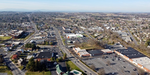
West Main and West Broad Streets, facing west
-
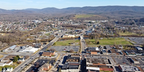
Main and Broad Streets, facing east
-
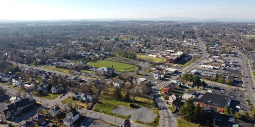
Downtown Waynesboro, Virginia, facing west
-
Pumping gas at an Exxon station in Waynesboro, Virginia [01]
![Pumping gas at an Exxon station in Waynesboro, Virginia [01] (9429 visits) Fueling a Honda HR-V at the Exxon gas station on West Main Street in Waynesboro, Virginia.
Ben Schu... Pumping gas at an Exxon station in Waynesboro, Virginia [01]](../../i/upload/2024/07/19/20240719160319-edcd2718-cu_s9999x250.jpg)
-
Pumping gas at an Exxon station in Waynesboro, Virginia [02]
![Pumping gas at an Exxon station in Waynesboro, Virginia [02] (7482 visits) Fueling a Honda HR-V at the Exxon gas station on West Main Street in Waynesboro, Virginia.
Ben Schu... Pumping gas at an Exxon station in Waynesboro, Virginia [02]](../../i/upload/2024/07/19/20240719160340-1e0fba3f-cu_s9999x250.jpg)
-
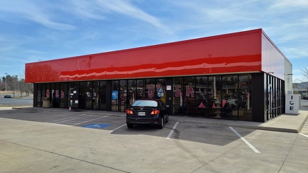
Convenience store at Exxon station on West Main Street
-
Flag in front of the Exxon on West Main Street

-
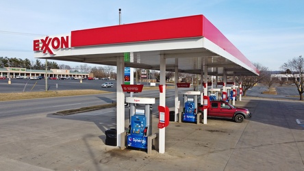
Exxon on West Main Street
-
Richmond Avenue in Staunton, Virginia [01]
![Richmond Avenue in Staunton, Virginia [01] (49796 visits) Aerial view of Richmond Avenue (US 250) in Staunton, Virginia, near the intersection with Frontier D... Richmond Avenue in Staunton, Virginia [01]](../../i/upload/2024/07/19/20240719161158-ddf9fe35-cu_s9999x250.jpg)
-
Richmond Avenue in Staunton, Virginia [02]
![Richmond Avenue in Staunton, Virginia [02] (49873 visits) Aerial view of Richmond Avenue (US 250) in Staunton, Virginia, near the intersection with Frontier D... Richmond Avenue in Staunton, Virginia [02]](../../i/upload/2024/07/19/20240719161203-233bb776-cu_s9999x250.jpg)
-
Richmond Avenue in Staunton, Virginia [03]
![Richmond Avenue in Staunton, Virginia [03] (49649 visits) Aerial view of Richmond Avenue (US 250) in Staunton, Virginia, near the intersection with Community ... Richmond Avenue in Staunton, Virginia [03]](../../i/upload/2024/07/19/20240719161212-297c1b53-cu_s9999x250.jpg)
-
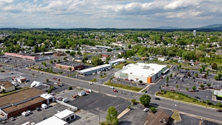
West Broad Street in Waynesboro, Virginia
-
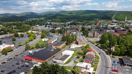
West Main and West Broad Streets in downtown Waynesboro
-
Vintage Seagrave fire truck at Churchville Volunteer Fire Department [01]
![Vintage Seagrave fire truck at Churchville Volunteer Fire Department [01] (1207 visits) Vintage Seagrave fire truck parked outside of the Churchville Volunteer Fire Department in Augusta C... Vintage Seagrave fire truck at Churchville Volunteer Fire Department [01]](../../i/upload/2024/07/19/20240719164407-74f7e276-cu_s9999x250.jpg)
-
Vintage Seagrave fire truck at Churchville Volunteer Fire Department [02]
![Vintage Seagrave fire truck at Churchville Volunteer Fire Department [02] (1198 visits) Vintage Seagrave fire truck parked outside of the Churchville Volunteer Fire Department in Augusta C... Vintage Seagrave fire truck at Churchville Volunteer Fire Department [02]](../../i/upload/2024/07/19/20240719164413-0b8113ea-cu_s9999x250.jpg)
-
Vintage Seagrave fire truck at Churchville Volunteer Fire Department [03]
![Vintage Seagrave fire truck at Churchville Volunteer Fire Department [03] (1223 visits) Vintage Seagrave fire truck parked outside of the Churchville Volunteer Fire Department in Augusta C... Vintage Seagrave fire truck at Churchville Volunteer Fire Department [03]](../../i/upload/2024/07/19/20240719164419-a2eacc42-cu_s9999x250.jpg)
-
Churchville Volunteer Fire Department [01]
![Churchville Volunteer Fire Department [01] (760 visits) Building for Churchville Volunteer Fire Department, on Churchville Road (US 250/SR 42) in Churchvill... Churchville Volunteer Fire Department [01]](../../i/upload/2024/07/19/20240719164426-c1be3535-cu_s9999x250.jpg)
-
Churchville Volunteer Fire Department [02]
![Churchville Volunteer Fire Department [02] (1126 visits) Building for Churchville Volunteer Fire Department, on Churchville Road (US 250/SR 42) in Churchvill... Churchville Volunteer Fire Department [02]](../../i/upload/2024/07/19/20240719164431-2ab245f9-cu_s9999x250.jpg)
-
West Main Street in Waynesboro, Virginia [01]
![West Main Street in Waynesboro, Virginia [01] (39886 visits) View down West Main Street (US 250) in the west end of Waynesboro, Virginia, near the former Kmart b... West Main Street in Waynesboro, Virginia [01]](../../i/upload/2024/07/19/20240719164545-b5a50599-cu_s9999x250.jpg)
-
West Main Street in Waynesboro, Virginia [02]
![West Main Street in Waynesboro, Virginia [02] (7370 visits) View down West Main Street (US 250) in the west end of Waynesboro, Virginia, near the Sheetz conveni... West Main Street in Waynesboro, Virginia [02]](../../i/upload/2024/07/19/20240719164551-0b8407a8-cu_s9999x250.jpg)
-
West Main Street in Waynesboro, Virginia [03]
![West Main Street in Waynesboro, Virginia [03] (7848 visits) View down West Main Street (US 250) in the west end of Waynesboro, Virginia, near St. Mark's United ... West Main Street in Waynesboro, Virginia [03]](../../i/upload/2024/07/19/20240719164555-f7feeafe-cu_s9999x250.jpg)
-
West Main Street in Waynesboro, Virginia [04]
![West Main Street in Waynesboro, Virginia [04] (243029 visits) View down West Main Street (US 250) in the west end of Waynesboro, Virginia, near the Westwood Villa... West Main Street in Waynesboro, Virginia [04]](../../i/upload/2024/07/19/20240719164600-4379cef1-cu_s9999x250.jpg)
-
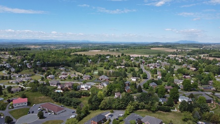
Pelham neighborhood in Waynesboro, Virginia
-
US 250 at the west end of Waynesboro, Virginia
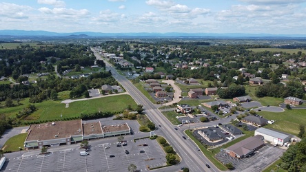
-
Waynesboro, Virginia, facing approximately east
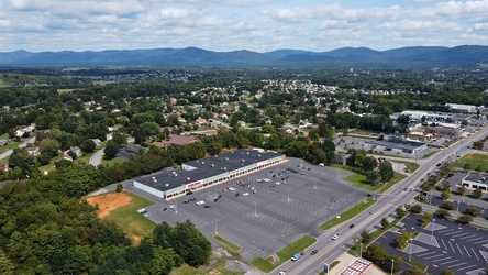
-
Snow-covered mileage sign on US 250
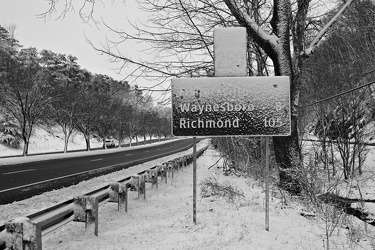
-
Snow-covered speed limit sign on US 250
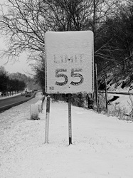
-
West Broad Street at Staples Mill Road [01]
![West Broad Street at Staples Mill Road [01] (2264 visits) Aerial view of West Broad Street at the intersection with Staples Mill Road in Richmond, Virginia. ... West Broad Street at Staples Mill Road [01]](../../i/upload/2024/07/20/20240720091824-c8526d69-cu_s9999x250.jpg)
-
West Broad Street at Staples Mill Road [02]
![West Broad Street at Staples Mill Road [02] (51879 visits) Aerial view of West Broad Street at the intersection with Staples Mill Road in Richmond, Virginia. ... West Broad Street at Staples Mill Road [02]](../../i/upload/2024/07/20/20240720092012-1df12de7-cu_s9999x250.jpg)
-
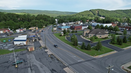
East Broad Street near East Avenue
-
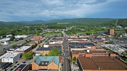
Downtown Waynesboro, facing east
-
Bottle cap embedded in gravel [02]
![Bottle cap embedded in gravel [02] (1353 visits) Bottle cap embedded in the gravel in the parking lot of the Fort Edward Johnson wayside along US 250... Bottle cap embedded in gravel [02]](../../i/upload/2024/07/20/20240720093935-e8bfbf5c-cu_s9999x250.jpg)
-
Sign at the border between Augusta and Highland Counties [03]
![Sign at the border between Augusta and Highland Counties [03] (1898 visits) Sign along US 250 at the border between Augusta and Highland Counties in Virginia. The sign is of t... Sign at the border between Augusta and Highland Counties [03]](../../i/upload/2024/07/20/20240720093939-e9041290-cu_s9999x250.jpg)
-
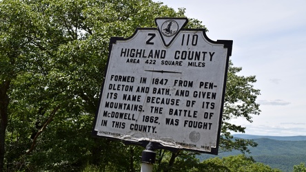
Historical marker for Highland County on US 250
-
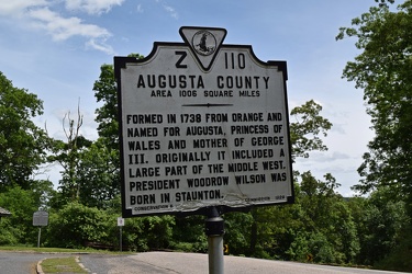
Historical marker for Augusta County on US 250
-
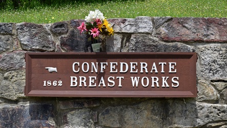
Confederate Breastworks sign
-
Sign at the border between Augusta and Highland Counties [02]
![Sign at the border between Augusta and Highland Counties [02] (1775 visits) Sign along US 250 at the border between Augusta and Highland Counties in Virginia. The sign is stan... Sign at the border between Augusta and Highland Counties [02]](../../i/upload/2024/07/20/20240720094001-d7689782-cu_s9999x250.jpg)
-
Bottle cap embedded in gravel [01]
![Bottle cap embedded in gravel [01] (1039 visits) Bottle cap embedded in the gravel in the parking lot of the Fort Edward Johnson wayside along US 250... Bottle cap embedded in gravel [01]](../../i/upload/2024/07/20/20240720094006-f13f59c7-cu_s9999x250.jpg)
-
Graffiti at Fort Edward Johnson wayside

-
Sign at the border between Augusta and Highland Counties [01]
![Sign at the border between Augusta and Highland Counties [01] (1859 visits) Sign along US 250 at the border between Augusta and Highland Counties in Virginia. The sign is stan... Sign at the border between Augusta and Highland Counties [01]](../../i/upload/2024/07/20/20240720094015-efe93712-cu_s9999x250.jpg)
-
"Littering is illegal" sign [02]
!["Littering is illegal" sign [02] (2046 visits) Sign along US 250 at the border between Augusta and Highland Counties in Virginia, reminding drivers... "Littering is illegal" sign [02]](../../i/upload/2024/07/20/20240720094020-cdd34053-cu_s9999x250.jpg)
-
Honda HR-V in Head Waters, Virginia

-
Hairpin turn on US 250 [01]
![Hairpin turn on US 250 [01] (2091 visits) Hairpin turn on US 250 in Highland County, Virginia, as it ascends Shenandoah Mountain.
Ben Schumin... Hairpin turn on US 250 [01]](../../i/upload/2024/07/20/20240720094126-511d5875-cu_s9999x250.jpg)
-
Hairpin turn on US 250 [02]
![Hairpin turn on US 250 [02] (2152 visits) Hairpin turn on US 250 in Highland County, Virginia, as it ascends Shenandoah Mountain.
Ben Schumin... Hairpin turn on US 250 [02]](../../i/upload/2024/07/20/20240720094131-dc588684-cu_s9999x250.jpg)
-
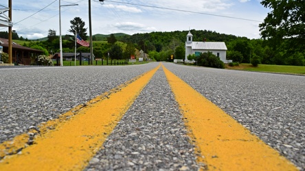
US 250 in Head Waters, Virginia
-
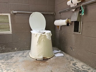
Restroom at Fort Edward Johnson wayside
-
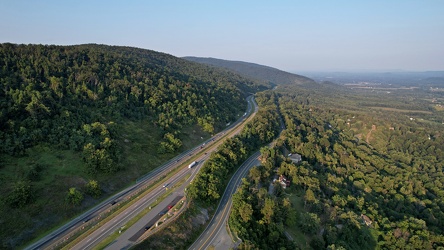
Interstate 64 east of Rockfish Gap
-
U.S. Coast & Geodetic Survey benchmark in downtown Crossville [01]
![U.S. Coast & Geodetic Survey benchmark in downtown Crossville [01] (892 visits) U.S. Coast & Geodetic Survey elevation benchmark in front of the Cumberland County Courthouse in... U.S. Coast & Geodetic Survey benchmark in downtown Crossville [01]](../../i/upload/2024/07/20/20240720113436-759851f9-cu_s9999x250.jpg)
-
U.S. Coast & Geodetic Survey benchmark in downtown Crossville [02]
![U.S. Coast & Geodetic Survey benchmark in downtown Crossville [02] (900 visits) U.S. Coast & Geodetic Survey elevation benchmark in front of the Cumberland County Courthouse in... U.S. Coast & Geodetic Survey benchmark in downtown Crossville [02]](../../i/upload/2024/07/20/20240720113506-022d092e-cu_s9999x250.jpg)
-
Abandoned loafer in front of 250 7th Avenue [01]
![Abandoned loafer in front of 250 7th Avenue [01] (1925 visits) An abandoned loafer on the sidewalk in front of 250 7th Avenue in New York City.
More at The Schumi... Abandoned loafer in front of 250 7th Avenue [01]](../../i/upload/2024/07/20/20240720143246-9415ce5c-cu_s9999x250.jpg)
-
Abandoned loafer in front of 250 7th Avenue [02]
![Abandoned loafer in front of 250 7th Avenue [02] (2042 visits) An abandoned loafer on the sidewalk in front of 250 7th Avenue in New York City.
More at The Schumi... Abandoned loafer in front of 250 7th Avenue [02]](../../i/upload/2024/07/20/20240720143359-a2694949-cu_s9999x250.jpg)
-
Woodrow Wilson Parkway at Churchville Avenue [01]
![Woodrow Wilson Parkway at Churchville Avenue [01] (987 visits) State Route 262 (Woodrow Wilson Parkway) at the interchange with US 250 (Churchville Avenue) in Stau... Woodrow Wilson Parkway at Churchville Avenue [01]](../../i/upload/2024/11/26/20241126004148-6fb2b2e4-cu_s9999x250.jpg)
-
Woodrow Wilson Parkway at Churchville Avenue [02]
![Woodrow Wilson Parkway at Churchville Avenue [02] (1007 visits) State Route 262 (Woodrow Wilson Parkway) at the interchange with US 250 (Churchville Avenue) in Stau... Woodrow Wilson Parkway at Churchville Avenue [02]](../../i/upload/2024/11/26/20241126004154-6decce28-cu_s9999x250.jpg)
-
Woodrow Wilson Parkway at Churchville Avenue [03]
![Woodrow Wilson Parkway at Churchville Avenue [03] (1010 visits) State Route 262 (Woodrow Wilson Parkway) at the interchange with US 250 (Churchville Avenue) in Stau... Woodrow Wilson Parkway at Churchville Avenue [03]](../../i/upload/2024/11/26/20241126004159-ac6ca342-cu_s9999x250.jpg)
-
Woodrow Wilson Parkway at Churchville Avenue [04]
![Woodrow Wilson Parkway at Churchville Avenue [04] (1020 visits) State Route 262 (Woodrow Wilson Parkway) at the interchange with US 250 (Churchville Avenue) in Stau... Woodrow Wilson Parkway at Churchville Avenue [04]](../../i/upload/2024/11/26/20241126004205-1752c829-cu_s9999x250.jpg)
-
Woodrow Wilson Parkway at Churchville Avenue [05]
![Woodrow Wilson Parkway at Churchville Avenue [05] (1027 visits) State Route 262 (Woodrow Wilson Parkway) at the interchange with US 250 (Churchville Avenue) in Stau... Woodrow Wilson Parkway at Churchville Avenue [05]](../../i/upload/2024/11/26/20241126004211-954cdd71-cu_s9999x250.jpg)
-
Woodrow Wilson Parkway at Churchville Avenue [06]
![Woodrow Wilson Parkway at Churchville Avenue [06] (1026 visits) State Route 262 (Woodrow Wilson Parkway) at the interchange with US 250 (Churchville Avenue) in Stau... Woodrow Wilson Parkway at Churchville Avenue [06]](../../i/upload/2024/11/26/20241126004217-db5f3f5c-cu_s9999x250.jpg)
-
Aerial view of Monterey, Virginia [01]
![Aerial view of Monterey, Virginia [01] (1120 visits) Aerial view of Monterey, Virginia, a small town comprising the seat of Highland County.
More at The... Aerial view of Monterey, Virginia [01]](../../i/upload/2025/01/02/20250102005918-685606f9-cu_s9999x250.jpg)
-
Aerial view of Monterey, Virginia [02]
![Aerial view of Monterey, Virginia [02] (1141 visits) Aerial view of Monterey, Virginia, a small town comprising the seat of Highland County.
More at The... Aerial view of Monterey, Virginia [02]](../../i/upload/2025/01/02/20250102005923-7f7b9b83-cu_s9999x250.jpg)
-
Aerial view of Monterey, Virginia [03]
![Aerial view of Monterey, Virginia [03] (1164 visits) Aerial view of Monterey, Virginia, a small town comprising the seat of Highland County.
More at The... Aerial view of Monterey, Virginia [03]](../../i/upload/2025/01/02/20250102005929-2e84a9d0-cu_s9999x250.jpg)
-
Aerial view of Monterey, Virginia [04]
![Aerial view of Monterey, Virginia [04] (1183 visits) Aerial view of Monterey, Virginia, a small town comprising the seat of Highland County.
More at The... Aerial view of Monterey, Virginia [04]](../../i/upload/2025/01/02/20250102005937-281fae65-cu_s9999x250.jpg)
-
Aerial view of Monterey, Virginia [05]
![Aerial view of Monterey, Virginia [05] (1170 visits) Aerial view of Monterey, Virginia, a small town comprising the seat of Highland County.
More at The... Aerial view of Monterey, Virginia [05]](../../i/upload/2025/01/02/20250102005946-79efaa38-cu_s9999x250.jpg)
-
Aerial view of Monterey, Virginia [06]
![Aerial view of Monterey, Virginia [06] (1173 visits) Aerial view of Monterey, Virginia, a small town comprising the seat of Highland County.
More at The... Aerial view of Monterey, Virginia [06]](../../i/upload/2025/01/02/20250102005956-29786301-cu_s9999x250.jpg)
-
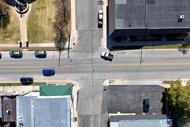
Intersection of US 250 and Spruce Street
-
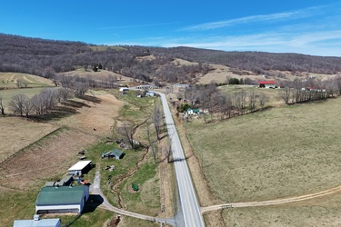
US 250 west of Monterey, Virginia
-
Dollar General on Rosser Avenue
