-
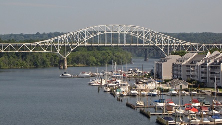
Thomas J. Hatem Memorial Bridge
-
Cupola on Martinsburg roundhouse complex

-
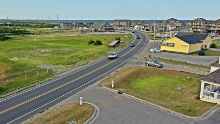
North Carolina Route 12 in Buxton
-
Hatteras Island Beach Access 38 [01]
![Hatteras Island Beach Access 38 [01] (4033 visits) Hatteras Island Beach Access 38, at the south end of Avon, North Carolina. The access consists of a... Hatteras Island Beach Access 38 [01]](../../../../i/upload/2024/07/17/20240717230623-ac88eb70-cu_s9999x250.jpg)
-
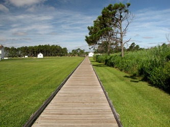
Walkway around Bodie Island Lighthouse
-
Park Place [01]
![Park Place [01] (2599 visits) Park Place, a rental cottage on Park Drive in the Askins Creek neighborhood of Avon, North Carolina.... Park Place [01]](../../../../i/upload/2024/07/17/20240717231311-417d895d-cu_s9999x250.jpg)
-
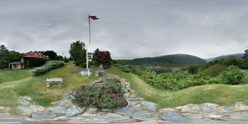
Potomac River viewed from Hilltop House
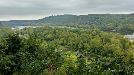
 View from Hilltop House
-
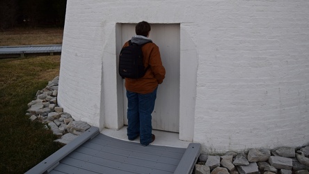
Elyse stands in a short doorway
-
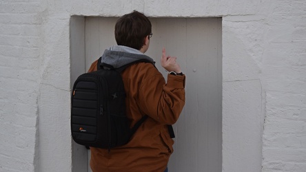
Elyse gives an obscene gesture
-
Park Place [02]
![Park Place [02] (2170 visits) Park Place, a rental cottage on Park Drive in the Askins Creek neighborhood of Avon, North Carolina.... Park Place [02]](../../../../i/upload/2024/07/18/20240718223058-9b18502e-cu_s9999x250.jpg)
-
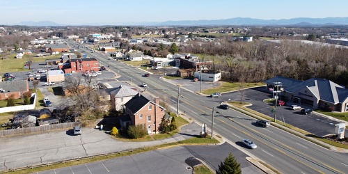
View up Route 11 from above Verona Fire Department
-
US 29 Business in Culpeper, Virginia [01]
![US 29 Business in Culpeper, Virginia [01] (3221 visits) Aerial view of US 29 Business on the north side of Culpeper, Virginia. View facing approximately ea... US 29 Business in Culpeper, Virginia [01]](../../../../i/upload/2024/07/19/20240719155959-cf1d0444-cu_s9999x250.jpg)
-
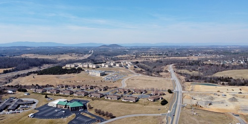
Fishersville, Virginia, near Augusta Health
-
Aerial view of Glen Burnie, Maryland [01]
![Aerial view of Glen Burnie, Maryland [01] (1735 visits) Aerial view of Glen Burnie, Maryland, taken near Marley Station Mall.
Ben Schumin is a professional... Aerial view of Glen Burnie, Maryland [01]](../../../../i/upload/2024/07/19/20240719162345-6a1470e1-cu_s9999x250.jpg)
-
Aerial view of Glen Burnie, Maryland [02]
![Aerial view of Glen Burnie, Maryland [02] (1797 visits) Aerial view of Glen Burnie, Maryland, taken near Marley Station Mall.
Ben Schumin is a professional... Aerial view of Glen Burnie, Maryland [02]](../../../../i/upload/2024/07/19/20240719162350-5a3dcd0c-cu_s9999x250.jpg)
-
Sign for Mike's Country Store [01]
![Sign for Mike's Country Store [01] (1838 visits) Sign advertising Mike's Country Store on a dock off of Riva Road near Annapolis, Maryland.
Ben Schu... Sign for Mike's Country Store [01]](../../../../i/upload/2024/07/19/20240719162354-073539d4-cu_s9999x250.jpg)
-
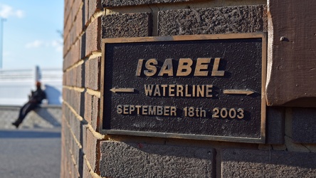
Hurricane Isabel waterline plaque
-
Dock lights at Mike's Restaurant & Crabhouse [02]
![Dock lights at Mike's Restaurant & Crabhouse [02] (1095 visits) Dock lights at Mike's Restaurant & Crabhouse, off of Riva Road near Annapolis, Maryland.
Ben Sc... Dock lights at Mike's Restaurant & Crabhouse [02]](../../../../i/upload/2024/07/19/20240719162439-0bb0019d-cu_s9999x250.jpg)
-
Nikon D3200 with zoom lens

-
Marker for slip 37
-
Bridge carrying Riva Road over the South River [02]
![Bridge carrying Riva Road over the South River [02] (1406 visits) Bridge carrying Riva Road over the South River near Annapolis, Maryland.
Ben Schumin is a professio... Bridge carrying Riva Road over the South River [02]](../../../../i/upload/2024/07/19/20240719162516-6b4624c8-cu_s9999x250.jpg)
-
Marker for slip 42 [01]
![Marker for slip 42 [01] (1164 visits) Marker for slip 42 on the docks adjacent to Mike's Restaurant & Crabhouse near Annapolis, Maryla... Marker for slip 42 [01]](../../../../i/upload/2024/07/19/20240719162521-b3b6acac-cu_s9999x250.jpg)
-
Marker for slip 42 [02]
![Marker for slip 42 [02] (1202 visits) Marker for slip 42 on the docks adjacent to Mike's Restaurant & Crabhouse near Annapolis, Maryla... Marker for slip 42 [02]](../../../../i/upload/2024/07/19/20240719162526-43487c8e-cu_s9999x250.jpg)
-
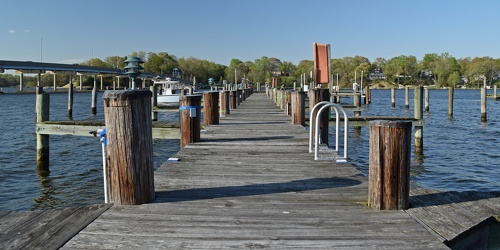
Docks at Mike's Restaurant & Crabhouse
-
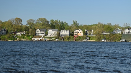
Houses fronting the South River
-
Dock lights at Mike's Restaurant & Crabhouse [01]
![Dock lights at Mike's Restaurant & Crabhouse [01] (1132 visits) Dock lights at Mike's Restaurant & Crabhouse, off of Riva Road near Annapolis, Maryland.
Ben Sc... Dock lights at Mike's Restaurant & Crabhouse [01]](../../../../i/upload/2024/07/19/20240719162607-1866de7b-cu_s9999x250.jpg)
-
Bridge carrying Riva Road over the South River [01]
![Bridge carrying Riva Road over the South River [01] (1431 visits) Bridge carrying Riva Road over the South River near Annapolis, Maryland.
Ben Schumin is a professio... Bridge carrying Riva Road over the South River [01]](../../../../i/upload/2024/07/19/20240719162612-4feeeb42-cu_s9999x250.jpg)
-
Sign for Mike's Country Store [02]
![Sign for Mike's Country Store [02] (1795 visits) Sign advertising Mike's Country Store on a dock off of Riva Road near Annapolis, Maryland.
Ben Schu... Sign for Mike's Country Store [02]](../../../../i/upload/2024/07/19/20240719162617-a18a3534-cu_s9999x250.jpg)
-
Lime wedge on the dock

-
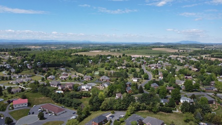
Pelham neighborhood in Waynesboro, Virginia
-
US 29 Business in Culpeper, Virginia [02]
![US 29 Business in Culpeper, Virginia [02] (457679 visits) Aerial view of US 29 Business on the north side of Culpeper, Virginia. View facing approximately we... US 29 Business in Culpeper, Virginia [02]](../../../../i/upload/2024/07/19/20240719165937-abc06307-cu_s9999x250.jpg)
-
Downtown Gettysburg, Pennsylvania [02]
![Downtown Gettysburg, Pennsylvania [02] (1951 visits) Aerial view of downtown Gettysburg, Pennsylvania, facing approximately east. The air was a bit hazy... Downtown Gettysburg, Pennsylvania [02]](../../../../i/upload/2024/07/19/20240719170259-27d78ed8-cu_s9999x250.jpg)
-
Downtown Gettysburg, Pennsylvania [01]
![Downtown Gettysburg, Pennsylvania [01] (9472 visits) Aerial view of downtown Gettysburg, Pennsylvania, facing southeast. The air was a bit hazy on this ... Downtown Gettysburg, Pennsylvania [01]](../../../../i/upload/2024/07/19/20240719170318-2077237a-cu_s9999x250.jpg)
-
Sign for Phillips Crab House

-
Cape Hatteras Lighthouse from move path [01]
![Cape Hatteras Lighthouse from move path [01] (2714 visits) The Cape Hatteras Lighthouse, viewed from the path along which the lighthouse was moved in 1999.
Mo... Cape Hatteras Lighthouse from move path [01]](../../../../i/upload/2024/07/19/20240719183107-8f43796a-cu_s9999x250.jpg)
-
Base of the Cape Hatteras Lighthouse [03]
![Base of the Cape Hatteras Lighthouse [03] (2616 visits) Base of the Cape Hatteras Lighthouse, near Cape Hatteras in Buxton, North Carolina, viewed from a ne... Base of the Cape Hatteras Lighthouse [03]](../../../../i/upload/2024/07/19/20240719183112-97c2882a-cu_s9999x250.jpg)
-
Cape Hatteras Lighthouse from move path [02]
![Cape Hatteras Lighthouse from move path [02] (2773 visits) The Cape Hatteras Lighthouse, viewed from the path along which the lighthouse was moved in 1999.
Mo... Cape Hatteras Lighthouse from move path [02]](../../../../i/upload/2024/07/19/20240719183117-12e94939-cu_s9999x250.jpg)
-
Cape Hatteras Lighthouse from move path [03]
![Cape Hatteras Lighthouse from move path [03] (2866 visits) The Cape Hatteras Lighthouse, viewed from the path along which the lighthouse was moved in 1999.
Mo... Cape Hatteras Lighthouse from move path [03]](../../../../i/upload/2024/07/19/20240719183121-622f72c2-cu_s9999x250.jpg)
-
Cape Hatteras Lighthouse from move path [04]
![Cape Hatteras Lighthouse from move path [04] (2738 visits) The Cape Hatteras Lighthouse, viewed from the path along which the lighthouse was moved in 1999.
Mo... Cape Hatteras Lighthouse from move path [04]](../../../../i/upload/2024/07/19/20240719183135-c42b91b6-cu_s9999x250.jpg)
-
Cape Hatteras Lighthouse from move path [05]
![Cape Hatteras Lighthouse from move path [05] (2827 visits) The Cape Hatteras Lighthouse, viewed from the path along which the lighthouse was moved in 1999.
Mo... Cape Hatteras Lighthouse from move path [05]](../../../../i/upload/2024/07/19/20240719183139-0d95f109-cu_s9999x250.jpg)
-
Lighthouse relocation path [01]
![Lighthouse relocation path [01] (3183 visits) The path along which the Cape Hatteras Lighthouse was moved in 1999, as viewed from the lighthouse's... Lighthouse relocation path [01]](../../../../i/upload/2024/07/19/20240719183204-0178f7f6-cu_s9999x250.jpg)
-
Lighthouse relocation path [02]
![Lighthouse relocation path [02] (2720 visits) The path along which the Cape Hatteras Lighthouse was moved in 1999, as viewed from the lighthouse's... Lighthouse relocation path [02]](../../../../i/upload/2024/07/19/20240719183211-3a56b8e6-cu_s9999x250.jpg)
-
Windward Towers and Leeward Marina [02]
![Windward Towers and Leeward Marina [02] (3306 visits) Aerial view of the Windward Towers condominium complex, with the Leeward Marina in front of it, in N... Windward Towers and Leeward Marina [02]](../../../../i/upload/2024/07/19/20240719202335-9d3149ac-cu_s9999x250.jpg)
-
Windward Towers and Leeward Marina [01]
![Windward Towers and Leeward Marina [01] (5174 visits) Aerial view of the Windward Towers condominium complex, with the Leeward Marina in front of it, in N... Windward Towers and Leeward Marina [01]](../../../../i/upload/2024/07/19/20240719202747-251158fb-cu_s9999x250.jpg)
-
North bank of the James River [01]
![North bank of the James River [01] (2743 visits) The north bank of the James River, about six miles from its mouth, in Newport News, Virginia.
More ... North bank of the James River [01]](../../../../i/upload/2024/07/19/20240719203203-43675d31-cu_s9999x250.jpg)
-
North bank of the James River [02]
![North bank of the James River [02] (2726 visits) The north bank of the James River, about six miles from its mouth, in Newport News, Virginia.
More ... North bank of the James River [02]](../../../../i/upload/2024/07/19/20240719203208-f0ca844f-cu_s9999x250.jpg)
-
North bank of the James River [03]
![North bank of the James River [03] (2760 visits) The north bank of the James River, about six miles from its mouth, in Newport News, Virginia.
More ... North bank of the James River [03]](../../../../i/upload/2024/07/19/20240719203213-033820a2-cu_s9999x250.jpg)
-
24 Museum Drive [01]
![24 Museum Drive [01] (2845 visits) Aerial view of 24 Museum Drive, a house fronting the James River in Newport News, Virginia.
More at... 24 Museum Drive [01]](../../../../i/upload/2024/07/19/20240719203218-370040ec-cu_s9999x250.jpg)
-
24 Museum Drive [02]
![24 Museum Drive [02] (3029 visits) Aerial view of 24 Museum Drive, a house fronting the James River in Newport News, Virginia.
More at... 24 Museum Drive [02]](../../../../i/upload/2024/07/19/20240719203223-adde7d22-cu_s9999x250.jpg)
-
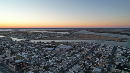
Atlantic City from near the Tropicana, facing north
-
Sign for State Route 188 [02]
![Sign for State Route 188 [02] (1491 visits) Signage pointing the way to State Route 188 at the intersection of Church Street and Commercial Aven... Sign for State Route 188 [02]](../../../../i/upload/2024/07/20/20240720021827-a0810db1-cu_s9999x250.jpg)
-
Sign for State Route 188 [03]
![Sign for State Route 188 [03] (1418 visits) Signage pointing the way to State Route 188 at the intersection of Church Street and Commercial Aven... Sign for State Route 188 [03]](../../../../i/upload/2024/07/20/20240720021833-b69f59a5-cu_s9999x250.jpg)
-
Sign for State Route 188 [04]
![Sign for State Route 188 [04] (1560 visits) Signage pointing the way to State Route 188 at the intersection of Church Street and Commercial Aven... Sign for State Route 188 [04]](../../../../i/upload/2024/07/20/20240720021852-b244dda6-cu_s9999x250.jpg)
-
Sign for State Route 188 [05]
![Sign for State Route 188 [05] (1536 visits) Signage pointing the way to State Route 188 at the intersection of Church Street and Commercial Aven... Sign for State Route 188 [05]](../../../../i/upload/2024/07/20/20240720021903-7bd9cd82-cu_s9999x250.jpg)
-
Sign for State Route 188 [06]
![Sign for State Route 188 [06] (1525 visits) Signage pointing the way to State Route 188 at the intersection of Church Street and Commercial Aven... Sign for State Route 188 [06]](../../../../i/upload/2024/07/20/20240720021915-40479437-cu_s9999x250.jpg)
-
West Broad Street at Staples Mill Road [01]
![West Broad Street at Staples Mill Road [01] (3391 visits) Aerial view of West Broad Street at the intersection with Staples Mill Road in Richmond, Virginia. ... West Broad Street at Staples Mill Road [01]](../../../../i/upload/2024/07/20/20240720091824-c8526d69-cu_s9999x250.jpg)
-
West Broad Street at Staples Mill Road [02]
![West Broad Street at Staples Mill Road [02] (70153 visits) Aerial view of West Broad Street at the intersection with Staples Mill Road in Richmond, Virginia. ... West Broad Street at Staples Mill Road [02]](../../../../i/upload/2024/07/20/20240720092012-1df12de7-cu_s9999x250.jpg)
-
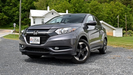
Honda HR-V in Head Waters, Virginia
-
Farm on the Virginia-West Virginia border [01]
![Farm on the Virginia-West Virginia border [01] (2957 visits) Farm on the border between Highland County, Virginia and Pendleton County, West Virginia. The bound... Farm on the Virginia-West Virginia border [01]](../../../../i/upload/2024/07/20/20240720094156-2b1215da-cu_s9999x250.jpg)
-
Aerial view of Pennsville Township, New Jersey [02]
![Aerial view of Pennsville Township, New Jersey [02] (3638 visits) Aerial view of Pennsville Township, New Jersey.
More at The Schumin Web:
www.schuminweb.com/2022... Aerial view of Pennsville Township, New Jersey [02]](../../../../i/upload/2024/07/20/20240720103102-6366e404-cu_s9999x250.jpg)
-
Aerial view of Pennsville Township, New Jersey [01]
![Aerial view of Pennsville Township, New Jersey [01] (1600 visits) Aerial view of Pennsville Township, New Jersey from over the Delaware River.
More at The Schumin ... Aerial view of Pennsville Township, New Jersey [01]](../../../../i/upload/2024/07/20/20240720103107-bd3ed35a-cu_s9999x250.jpg)
-
Aerial view of Roanoke, Virginia [01]
![Aerial view of Roanoke, Virginia [01] (1918 visits) Aerial view of Roanoke, Virginia.
More at The Schumin Web:
www.schuminweb.com/life-and-times/advent... Aerial view of Roanoke, Virginia [01]](../../../../i/upload/2024/07/20/20240720121757-bb58476c-cu_s9999x250.jpg)
-
Aerial view of Roanoke, Virginia [02]
![Aerial view of Roanoke, Virginia [02] (1820 visits) Aerial view of Roanoke, Virginia.
More at The Schumin Web:
www.schuminweb.com/life-and-times/advent... Aerial view of Roanoke, Virginia [02]](../../../../i/upload/2024/07/20/20240720121808-dccb83a0-cu_s9999x250.jpg)
-
Aerial view of Roanoke, Virginia [03]
![Aerial view of Roanoke, Virginia [03] (1861 visits) Aerial view of Roanoke, Virginia.
More at The Schumin Web:
www.schuminweb.com/life-and-times/advent... Aerial view of Roanoke, Virginia [03]](../../../../i/upload/2024/07/20/20240720121837-3c6bbb13-cu_s9999x250.jpg)
-
Aerial view of Roanoke, Virginia [04]
![Aerial view of Roanoke, Virginia [04] (1911 visits) Aerial view of Roanoke, Virginia.
More at The Schumin Web:
www.schuminweb.com/life-and-times/advent... Aerial view of Roanoke, Virginia [04]](../../../../i/upload/2024/07/20/20240720121854-34748718-cu_s9999x250.jpg)
-
Aerial view of Roanoke, Virginia [05]
![Aerial view of Roanoke, Virginia [05] (1812 visits) Aerial view of Roanoke, Virginia.
More at The Schumin Web:
www.schuminweb.com/life-and-times/advent... Aerial view of Roanoke, Virginia [05]](../../../../i/upload/2024/07/20/20240720121906-5f802cee-cu_s9999x250.jpg)
-
Aerial view of Roanoke, Virginia [06]
![Aerial view of Roanoke, Virginia [06] (1731 visits) Aerial view of Roanoke, Virginia.
More at The Schumin Web:
www.schuminweb.com/life-and-times/advent... Aerial view of Roanoke, Virginia [06]](../../../../i/upload/2024/07/20/20240720121917-3d4a6311-cu_s9999x250.jpg)
-
Intersection of Montgomery Village Avenue and Midcounty Highway [03]
![Intersection of Montgomery Village Avenue and Midcounty Highway [03] (3334 visits) Intersection of Montgomery Village Avenue and Midcounty Highway in Gaithersburg, Maryland, facing so... Intersection of Montgomery Village Avenue and Midcounty Highway [03]](../../../../i/upload/2024/07/20/20240720122313-30dc7995-cu_s9999x250.jpg)
-
Intersection of Montgomery Village Avenue and Midcounty Highway [04]
![Intersection of Montgomery Village Avenue and Midcounty Highway [04] (3373 visits) Intersection of Montgomery Village Avenue and Midcounty Highway in Gaithersburg, Maryland, facing ea... Intersection of Montgomery Village Avenue and Midcounty Highway [04]](../../../../i/upload/2024/07/20/20240720122318-8f69eabc-cu_s9999x250.jpg)
-
Intersection of Montgomery Village Avenue and Midcounty Highway [05]
![Intersection of Montgomery Village Avenue and Midcounty Highway [05] (3337 visits) Intersection of Montgomery Village Avenue and Midcounty Highway in Gaithersburg, Maryland, facing no... Intersection of Montgomery Village Avenue and Midcounty Highway [05]](../../../../i/upload/2024/07/20/20240720122324-2a205409-cu_s9999x250.jpg)
-
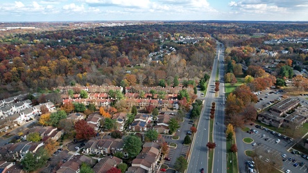
Midcounty Highway, facing east
-
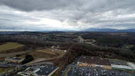
View west from Staunton Mall
-
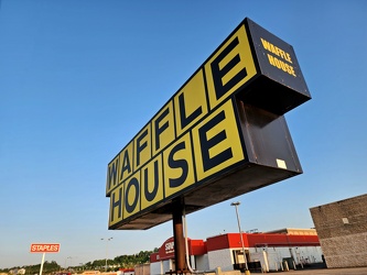
Waffle House sign at Washington Mall
-
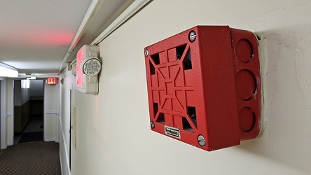
Fire alarm horn at Webster Towers
-
Aerial view of downtown Fredericksburg [01]
![Aerial view of downtown Fredericksburg [01] (1303 visits) Aerial view of downtown Fredericksburg, Virginia.
Ben Schumin is a professional photographer who ca... Aerial view of downtown Fredericksburg [01]](../../../../i/upload/2024/08/10/20240810113605-aeeec139-cu_s9999x250.jpg)
-
Aerial view of downtown Fredericksburg [02]
![Aerial view of downtown Fredericksburg [02] (1226 visits) Aerial view of downtown Fredericksburg, Virginia.
Ben Schumin is a professional photographer who ca... Aerial view of downtown Fredericksburg [02]](../../../../i/upload/2024/08/10/20240810113610-a8d79889-cu_s9999x250.jpg)
-
Alley between North Claremont and North Oakley Avenues [01]
![Alley between North Claremont and North Oakley Avenues [01] (962 visits) Alley running between the 4800 blocks of North Claremont Avenue and North Oakley Avenue in Chicago, ... Alley between North Claremont and North Oakley Avenues [01]](../../../../i/upload/2024/11/05/20241105002932-b7be2cfb-cu_s9999x250.jpg)
-
Alley between North Claremont and North Oakley Avenues [02]
![Alley between North Claremont and North Oakley Avenues [02] (1003 visits) Alley between North Claremont and North Oakley Avenues in Chicago, Illinois, facing west.
More at T... Alley between North Claremont and North Oakley Avenues [02]](../../../../i/upload/2024/11/05/20241105002951-b8ca015a-cu_s9999x250.jpg)
-
Alley between North Claremont and North Oakley Avenues [03]
![Alley between North Claremont and North Oakley Avenues [03] (1031 visits) Alley running between the back sides of the properties lining the 4800 blocks of North Claremont Ave... Alley between North Claremont and North Oakley Avenues [03]](../../../../i/upload/2024/11/05/20241105003005-82016820-cu_s9999x250.jpg)