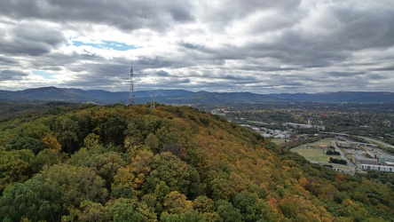
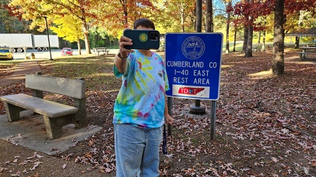
-
Selfie at I-40 rest area
-
Commercial area in Colonial Heights, Virginia [02]
![Commercial area in Colonial Heights, Virginia [02] (321681 visits) A commercial area in Colonial Heights, Virginia, consisting mostly of retail, restaurants, and lodgi... Commercial area in Colonial Heights, Virginia [02]](../../../i/upload/2024/07/19/20240719195754-22be50f4-cu_s9999x250.jpg)
-
Intersection of US 340 and VA 608 [01]
![Intersection of US 340 and VA 608 [01] (105893 visits) Intersection of US 340 and Virginia state secondary route 608 in Stuarts Draft, Virginia.
Ben Sch... Intersection of US 340 and VA 608 [01]](../../../i/upload/2024/07/19/20240719120550-1673ec68-cu_s9999x250.jpg)
-
Intersection of US 340 and VA 608 [02]
![Intersection of US 340 and VA 608 [02] (105861 visits) Intersection of US 340 and Virginia state secondary route 608 in Stuarts Draft, Virginia.
Ben Sch... Intersection of US 340 and VA 608 [02]](../../../i/upload/2024/07/19/20240719120559-2af4c901-cu_s9999x250.jpg)
-
US 340 south in Stuarts Draft
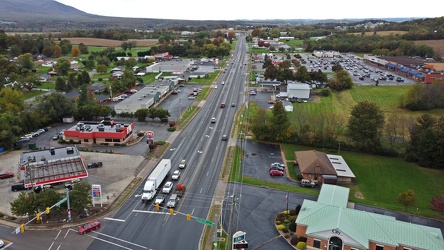
-
Electric Road
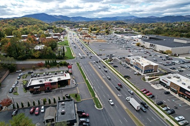
-
Interstate 64 near Rockfish Gap [01]
![Interstate 64 near Rockfish Gap [01] (66024 visits) Interstate 64, near Rockfish Gap in Virginia.
Ben Schumin is a professional photographer who captur... Interstate 64 near Rockfish Gap [01]](../../../i/upload/2024/07/19/20240719120555-d0d3c2ce-cu_s9999x250.jpg)
-
Commercial area in Colonial Heights, Virginia [01]
![Commercial area in Colonial Heights, Virginia [01] (54298 visits) A commercial area in Colonial Heights, Virginia, consisting mostly of retail, restaurants, and lodgi... Commercial area in Colonial Heights, Virginia [01]](../../../i/upload/2024/07/19/20240719195539-0ad1d227-cu_s9999x250.jpg)
-
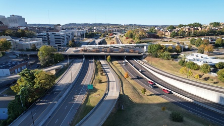
Neyland Drive and James White Parkway
-
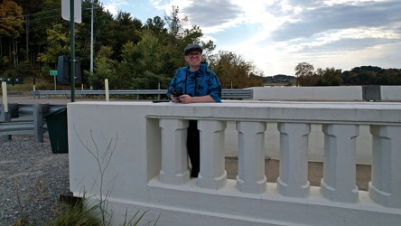
Drone selfie on Route 92 bridge
-
Mouth of the Trent River [01]
![Mouth of the Trent River [01] (11735 visits) The mouth of the Trent River, where it flows into the Neuse River, in New Bern, North Carolina.
Mor... Mouth of the Trent River [01]](../../../i/upload/2024/07/19/20240719201648-46964f22-cu_s9999x250.jpg)
-
Interstate 64 in Nelson County, Virginia [03]
![Interstate 64 in Nelson County, Virginia [03] (11042 visits) Interstate 64 in Nelson County, Virginia, near Rockfish Gap. US 250 runs adjacent to the freeway.
... Interstate 64 in Nelson County, Virginia [03]](../../../i/upload/2024/07/19/20240719115902-ff5fb9e1-cu_s9999x250.jpg)
-
Interstate 64 near Rockfish Gap [05]
![Interstate 64 near Rockfish Gap [05] (10856 visits) Interstate 64, near Rockfish Gap in Virginia. The boundary between Augusta and Nelson Counties runs... Interstate 64 near Rockfish Gap [05]](../../../i/upload/2024/07/19/20240719120629-90e00218-cu_s9999x250.jpg)
-
Interstate 64 in Nelson County, Virginia [02]
![Interstate 64 in Nelson County, Virginia [02] (10840 visits) Interstate 64 in Nelson County, Virginia, near Rockfish Gap. US 250 runs adjacent to the freeway.
... Interstate 64 in Nelson County, Virginia [02]](../../../i/upload/2024/07/19/20240719115847-184fa12a-cu_s9999x250.jpg)
-
Elyse photographs an I-40 shield [02]
![Elyse photographs an I-40 shield [02] (10736 visits) Elyse Horvath takes a selfie with an Interstate 40 shield on Strawberry Plains Pike in Knoxville, Te... Elyse photographs an I-40 shield [02]](../../../i/upload/2024/07/20/20240720113657-c61efdb7-cu_s9999x250.jpg)
-
Interstate 64 in Nelson County, Virginia [01]
![Interstate 64 in Nelson County, Virginia [01] (10679 visits) Interstate 64 in Nelson County, Virginia, near Rockfish Gap. US 250 runs adjacent to the freeway.
... Interstate 64 in Nelson County, Virginia [01]](../../../i/upload/2024/07/19/20240719115200-c8a2ce39-cu_s9999x250.jpg)
-
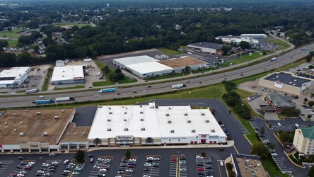
Interstate 95 through Colonial Heights
-
Buc-ee's in Crossville, Tennessee [37]
![Buc-ee's in Crossville, Tennessee [37] (10149 visits) Buc-ee's store in Crossville, Tennessee. Buc-ee's is a Texas-based chain of travel centers that was... Buc-ee's in Crossville, Tennessee [37]](../../../i/upload/2024/07/20/20240720113805-81a2af50-cu_s9999x250.jpg)
-
Selfie with Central Time sign [02]
![Selfie with Central Time sign [02] (10059 visits) Selfie with the sign at the boundary between Cumberland County and Roane County on westbound Interst... Selfie with Central Time sign [02]](../../../i/upload/2024/07/20/20240720112826-ea7f25a2-cu_s9999x250.jpg)
-
Selfie with Central Time sign [01]
![Selfie with Central Time sign [01] (10032 visits) Selfie with the sign at the boundary between Cumberland County and Roane County on westbound Interst... Selfie with Central Time sign [01]](../../../i/upload/2024/07/20/20240720112806-1fa071a1-cu_s9999x250.jpg)
-
US 17 Business in New Bern, North Carolina [02]
![US 17 Business in New Bern, North Carolina [02] (9904 visits) Aerial view of US 17 Business in New Bern, North Carolina, facing approximately northeast.
More at ... US 17 Business in New Bern, North Carolina [02]](../../../i/upload/2024/07/19/20240719201127-142439e0-cu_s9999x250.jpg)
-
US 17 Business in New Bern, North Carolina [01]
![US 17 Business in New Bern, North Carolina [01] (9775 visits) Aerial view of US 17 Business in New Bern, North Carolina, facing approximately southwest.
More at ... US 17 Business in New Bern, North Carolina [01]](../../../i/upload/2024/07/19/20240719201122-761c1808-cu_s9999x250.jpg)
-
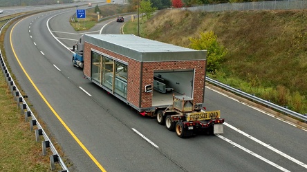
Sheetz car wash being transported by truck
-
Corridor on the USS Wisconsin [01]
![Corridor on the USS Wisconsin [01] (7091 visits) Corridor on board the USS Wisconsin, a former US Navy battleship turned museum ship at Nauticus in d... Corridor on the USS Wisconsin [01]](../../../i/upload/2024/07/19/20240719203032-fe4db7e6-cu_s9999x250.jpg)
-
Windward Towers and Leeward Marina [01]
![Windward Towers and Leeward Marina [01] (5174 visits) Aerial view of the Windward Towers condominium complex, with the Leeward Marina in front of it, in N... Windward Towers and Leeward Marina [01]](../../../i/upload/2024/07/19/20240719202747-251158fb-cu_s9999x250.jpg)
-
James River Bridge [09]
![James River Bridge [09] (5097 visits) The James River Bridge, carrying US 17, US 258, and VA 32 between Newport News and Isle of Wight Cou... James River Bridge [09]](../../../i/upload/2024/07/19/20240719202539-877160be-cu_s9999x250.jpg)
-
James River Bridge [06]
![James River Bridge [06] (5031 visits) The James River Bridge, carrying US 17, US 258, and VA 32 between Newport News and Isle of Wight Cou... James River Bridge [06]](../../../i/upload/2024/07/19/20240719202642-04c26af8-cu_s9999x250.jpg)
-
James River Bridge [02]
![James River Bridge [02] (4993 visits) The James River Bridge, carrying US 17, US 258, and VA 32 between Newport News and Isle of Wight Cou... James River Bridge [02]](../../../i/upload/2024/07/19/20240719202733-9fb73a13-cu_s9999x250.jpg)
-
James River Bridge [05]
![James River Bridge [05] (4982 visits) The James River Bridge, carrying US 17, US 258, and VA 32 between Newport News and Isle of Wight Cou... James River Bridge [05]](../../../i/upload/2024/07/19/20240719202330-be52e801-cu_s9999x250.jpg)
-
James River Bridge [10]
![James River Bridge [10] (4928 visits) The James River Bridge, carrying US 17, US 258, and VA 32 between Newport News and Isle of Wight Cou... James River Bridge [10]](../../../i/upload/2024/07/19/20240719202742-6238cd7f-cu_s9999x250.jpg)
-
James River Bridge [08]
![James River Bridge [08] (4901 visits) The James River Bridge, carrying US 17, US 258, and VA 32 between Newport News and Isle of Wight Cou... James River Bridge [08]](../../../i/upload/2024/07/19/20240719202534-7843f0b6-cu_s9999x250.jpg)
-
James River Bridge [11]
![James River Bridge [11] (4888 visits) The James River Bridge, carrying US 17, US 258, and VA 32 between Newport News and Isle of Wight Cou... James River Bridge [11]](../../../i/upload/2024/07/19/20240719202653-8658db60-cu_s9999x250.jpg)
-
James River Bridge [04]
![James River Bridge [04] (4873 visits) The James River Bridge, carrying US 17, US 258, and VA 32 between Newport News and Isle of Wight Cou... James River Bridge [04]](../../../i/upload/2024/07/19/20240719202325-4257c4a3-cu_s9999x250.jpg)
-
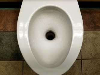
Composting toilet at a rest area
-
James River Bridge [07]
![James River Bridge [07] (4783 visits) The James River Bridge, carrying US 17, US 258, and VA 32 between Newport News and Isle of Wight Cou... James River Bridge [07]](../../../i/upload/2024/07/19/20240719202647-27533348-cu_s9999x250.jpg)
-
James River Bridge [03]
![James River Bridge [03] (4770 visits) The James River Bridge, carrying US 17, US 258, and VA 32 between Newport News and Isle of Wight Cou... James River Bridge [03]](../../../i/upload/2024/07/19/20240719202529-b0e807ab-cu_s9999x250.jpg)
-
James River Bridge from afar [02]
![James River Bridge from afar [02] (4674 visits) The James River Bridge, carrying US 17, US 258, and VA 32 between Newport News and Isle of Wight Cou... James River Bridge from afar [02]](../../../i/upload/2024/07/19/20240719203158-427c0626-cu_s9999x250.jpg)
-
James River Bridge [01]
![James River Bridge [01] (4651 visits) The James River Bridge, carrying US 17, US 258, and VA 32 between Newport News and Isle of Wight Cou... James River Bridge [01]](../../../i/upload/2024/07/19/20240719202759-cb89473a-cu_s9999x250.jpg)
-
James River Bridge from afar [01]
![James River Bridge from afar [01] (4636 visits) The James River Bridge, carrying US 17, US 258, and VA 32 between Newport News and Isle of Wight Cou... James River Bridge from afar [01]](../../../i/upload/2024/07/19/20240719203153-0a034e64-cu_s9999x250.jpg)
-
Sign assembly in Marathon, New York [03]
![Sign assembly in Marathon, New York [03] (4236 visits) Sign assembly at the intersection of Broome Street (US 11), Cortland Street (US 11) and Main Street ... Sign assembly in Marathon, New York [03]](../../../i/upload/2024/07/18/20240718230658-c073cb2b-cu_s9999x250.jpg)
 Western Maryland Scenic Railroad station [06]
![Western Maryland Scenic Railroad station [06] (4121 visits) Station for the Western Maryland Scenic Railroad in Cumberland, Maryland.
More at The Schumin Web:
... Western Maryland Scenic Railroad station [06]](../../../i/upload/2024/07/17/20240717233558-d030848d-cu_s9999x250.jpg)
-
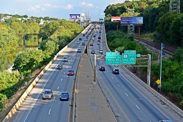
Schuylkill Expressway
 Western Maryland Scenic Railroad tracks [03]
![Western Maryland Scenic Railroad tracks [03] (4007 visits) Tracks for the Western Maryland Scenic Railroad in Cumberland, Maryland.
More at The Schumin Web:
w... Western Maryland Scenic Railroad tracks [03]](../../../i/upload/2024/07/17/20240717233606-3c9ba6bb-cu_s9999x250.jpg)
-
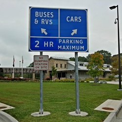
Sign with corrected lettering
-
Anonymous Ideal Org raid [29]
![Anonymous Ideal Org raid [29] (3681 visits) A masked demonstrator holds up a sign containing a quote of L. Ron Hubbard's during an Anonymous DC ... Anonymous Ideal Org raid [29]](../../../i/upload/2024/07/16/20240716002922-d958369e-cu_s9999x250.jpg)
 South Mountain rest area, westbound [03]
![South Mountain rest area, westbound [03] (3618 visits) South Mountain rest area and welcome center on Interstate 70 westbound in Frederick County, Maryland... South Mountain rest area, westbound [03]](../../../i/upload/2024/07/17/20240717233445-c0e160fc-cu_s9999x250.jpg)
-
Shields for Interstate 95 and North Carolina 561 near Enfield [01]
![Shields for Interstate 95 and North Carolina 561 near Enfield [01] (3591 visits) Signs near Enfield, North Carolina directing drivers on where to turn for southbound Interstate 95, ... Shields for Interstate 95 and North Carolina 561 near Enfield [01]](../../../i/upload/2024/07/19/20240719195732-fb281b46-cu_s9999x250.jpg)
-
US 17/US 70/NC 55 bridge over the Trent River [01]
![US 17/US 70/NC 55 bridge over the Trent River [01] (3521 visits) Bridge carrying US 17, US 70, and NC 55 over the Trent River in New Bern, North Carolina.
More at T... US 17/US 70/NC 55 bridge over the Trent River [01]](../../../i/upload/2024/07/19/20240719201705-e6625ff1-cu_s9999x250.jpg)
-
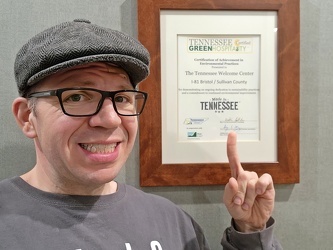
Pointing at something that says "Tennessee" on it
-
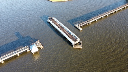
Swing bridge over the Trent River
-
Mouth of the Trent River [02]
![Mouth of the Trent River [02] (3444 visits) The mouth of the Trent River, where it flows into the Neuse River, in New Bern, North Carolina.
Mor... Mouth of the Trent River [02]](../../../i/upload/2024/07/19/20240719201615-baf284d1-cu_s9999x250.jpg)
-
US 17/NC 55 bridge over the Neuse River [01]
![US 17/NC 55 bridge over the Neuse River [01] (3437 visits) Bridge carrying US 17 and NC 55 over the Neuse River in New Bern, North Carolina.
More at The Schum... US 17/NC 55 bridge over the Neuse River [01]](../../../i/upload/2024/07/19/20240719201640-d3364b30-cu_s9999x250.jpg)
-
Footbridge over Interstate 68 at Sideling Hill [02]
![Footbridge over Interstate 68 at Sideling Hill [02] (3422 visits) Footbridge over Interstate 68 at the Sideling Hill rest area and overlook. This bridge connects the... Footbridge over Interstate 68 at Sideling Hill [02]](../../../i/upload/2024/07/19/20240719185616-2813b6d0-cu_s9999x250.jpg)
 South Mountain rest area, westbound [05]
![South Mountain rest area, westbound [05] (3414 visits) South Mountain rest area and welcome center on Interstate 70 westbound in Frederick County, Maryland... South Mountain rest area, westbound [05]](../../../i/upload/2024/07/17/20240717233455-aa6194ef-cu_s9999x250.jpg)
-
Douglas Lake [06]
![Douglas Lake [06] (3407 visits) Douglas Lake, a manmade reservoir in east Tennessee, which is operated by the Tennessee Valley Autho... Douglas Lake [06]](../../../i/upload/2024/07/20/20240720120405-67e59e34-cu_s9999x250.jpg)
 South Mountain rest area, westbound [02]
![South Mountain rest area, westbound [02] (3374 visits) South Mountain rest area and welcome center on Interstate 70 westbound in Frederick County, Maryland... South Mountain rest area, westbound [02]](../../../i/upload/2024/07/17/20240717233440-268e200a-cu_s9999x250.jpg)
-
US 17/NC 55 bridge over the Neuse River [03]
![US 17/NC 55 bridge over the Neuse River [03] (3370 visits) Bridge carrying US 17 and NC 55 over the Neuse River in New Bern, North Carolina.
More at The Schum... US 17/NC 55 bridge over the Neuse River [03]](../../../i/upload/2024/07/19/20240719201257-1230884e-cu_s9999x250.jpg)
-
Mercury Sable with ground lighting illuminated [02]
![Mercury Sable with ground lighting illuminated [02] (3368 visits) My 2004 Mercury Sable wagon with the ground-facing lights and the interior lights illuminated on the... Mercury Sable with ground lighting illuminated [02]](../../../i/upload/2024/07/15/20240715141715-42969fcc-cu_s9999x250.jpg)
 South Mountain rest area, westbound [04]
![South Mountain rest area, westbound [04] (3363 visits) South Mountain rest area and welcome center on Interstate 70 westbound in Frederick County, Maryland... South Mountain rest area, westbound [04]](../../../i/upload/2024/07/17/20240717233450-8d5d68a3-cu_s9999x250.jpg)
-
Aerial view of downtown Knoxville [02]
![Aerial view of downtown Knoxville [02] (3360 visits) Aerial view of downtown Knoxville, Tennessee, facing the interchange between Interstate 40, Intersta... Aerial view of downtown Knoxville [02]](../../../i/upload/2024/07/20/20240720114531-474df7df-cu_s9999x250.jpg)
-
Douglas Lake [05]
![Douglas Lake [05] (3352 visits) Douglas Lake, a manmade reservoir in east Tennessee, which is operated by the Tennessee Valley Autho... Douglas Lake [05]](../../../i/upload/2024/07/20/20240720120359-cbebbc4a-cu_s9999x250.jpg)
-
Mercury Sable with ground lighting illuminated [01]
![Mercury Sable with ground lighting illuminated [01] (3351 visits) My 2004 Mercury Sable wagon with the ground-facing lights and the interior lights illuminated on the... Mercury Sable with ground lighting illuminated [01]](../../../i/upload/2024/07/15/20240715141712-6e4690ee-cu_s9999x250.jpg)
-
Jeep Renegade at Central Time sign [02]
![Jeep Renegade at Central Time sign [02] (3348 visits) Our rented Jeep Renegade parked on the roadside near the sign at the boundary between Cumberland Cou... Jeep Renegade at Central Time sign [02]](../../../i/upload/2024/07/20/20240720112904-8f97d519-cu_s9999x250.jpg)
-
Footbridge over Interstate 68 at Sideling Hill [01]
![Footbridge over Interstate 68 at Sideling Hill [01] (3340 visits) Footbridge over Interstate 68 at the Sideling Hill rest area and overlook. This bridge connects the... Footbridge over Interstate 68 at Sideling Hill [01]](../../../i/upload/2024/07/19/20240719185639-81ae6791-cu_s9999x250.jpg)
-
Douglas Lake [07]
![Douglas Lake [07] (3338 visits) Douglas Lake, a manmade reservoir in east Tennessee, which is operated by the Tennessee Valley Autho... Douglas Lake [07]](../../../i/upload/2024/07/20/20240720120434-49f9d1b9-cu_s9999x250.jpg)
-
US 17/US 70/NC 55 bridge over the Trent River [03]
![US 17/US 70/NC 55 bridge over the Trent River [03] (3330 visits) Bridge carrying US 17, US 70, and NC 55 over the Trent River in New Bern, North Carolina.
More at T... US 17/US 70/NC 55 bridge over the Trent River [03]](../../../i/upload/2024/07/19/20240719201701-a0605be3-cu_s9999x250.jpg)
 South Mountain rest area, westbound [01]
![South Mountain rest area, westbound [01] (3314 visits) South Mountain rest area and welcome center on Interstate 70 westbound in Frederick County, Maryland... South Mountain rest area, westbound [01]](../../../i/upload/2024/07/17/20240717233435-e2f89cc0-cu_s9999x250.jpg)
-
Douglas Lake [01]
![Douglas Lake [01] (3314 visits) Douglas Lake, a manmade reservoir in east Tennessee, which is operated by the Tennessee Valley Autho... Douglas Lake [01]](../../../i/upload/2024/07/20/20240720120446-06709267-cu_s9999x250.jpg)
-
Windward Towers and Leeward Marina [02]
![Windward Towers and Leeward Marina [02] (3306 visits) Aerial view of the Windward Towers condominium complex, with the Leeward Marina in front of it, in N... Windward Towers and Leeward Marina [02]](../../../i/upload/2024/07/19/20240719202335-9d3149ac-cu_s9999x250.jpg)
-
Jeep Renegade at Central Time sign [01]
![Jeep Renegade at Central Time sign [01] (3305 visits) Our rented Jeep Renegade parked on the roadside near the sign at the boundary between Cumberland Cou... Jeep Renegade at Central Time sign [01]](../../../i/upload/2024/07/20/20240720112916-5207f8cb-cu_s9999x250.jpg)
-
Douglas Lake [08]
![Douglas Lake [08] (3299 visits) Douglas Lake, a manmade reservoir in east Tennessee, which is operated by the Tennessee Valley Autho... Douglas Lake [08]](../../../i/upload/2024/07/20/20240720120417-8d600905-cu_s9999x250.jpg)
-
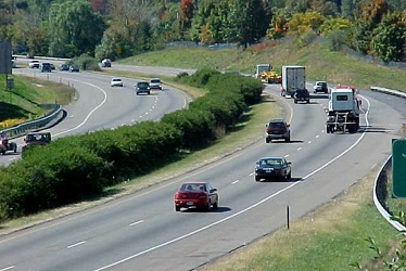
Interstate 81 through Harrisonburg, Virginia
-
US 17/US 70/NC 55 bridge over the Trent River [02]
![US 17/US 70/NC 55 bridge over the Trent River [02] (3261 visits) Bridge carrying US 17, US 70, and NC 55 over the Trent River in New Bern, North Carolina.
More at T... US 17/US 70/NC 55 bridge over the Trent River [02]](../../../i/upload/2024/07/19/20240719201747-70537f8f-cu_s9999x250.jpg)
-
Douglas Lake [03]
![Douglas Lake [03] (3255 visits) Douglas Lake, a manmade reservoir in east Tennessee, which is operated by the Tennessee Valley Autho... Douglas Lake [03]](../../../i/upload/2024/07/20/20240720120440-4ae673b8-cu_s9999x250.jpg)
-
US 17/NC 55 bridge over the Neuse River [02]
![US 17/NC 55 bridge over the Neuse River [02] (3247 visits) Bridge carrying US 17 and NC 55 over the Neuse River in New Bern, North Carolina.
More at The Schum... US 17/NC 55 bridge over the Neuse River [02]](../../../i/upload/2024/07/19/20240719201249-779b2711-cu_s9999x250.jpg)
-
End Interstate 795 [01]
![End Interstate 795 [01] (3239 visits) "End" signage for Interstate 795 in Wilson County, North Carolina, just before the interch... End Interstate 795 [01]](../../../i/upload/2024/07/19/20240719202101-740e602e-cu_s9999x250.jpg)
-
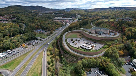
View south on Franklin Road
-
Douglas Lake [02]
![Douglas Lake [02] (3233 visits) Douglas Lake, a manmade reservoir in east Tennessee, which is operated by the Tennessee Valley Autho... Douglas Lake [02]](../../../i/upload/2024/07/20/20240720120452-7c1a4915-cu_s9999x250.jpg)
-
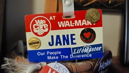
1980s-era Walmart name badge
-
View of Mill Mountain, facing west
