-
WTBO sign [09]
![WTBO sign [09] (2365 visits) "WTBO" in red and white channel letters at WTBO's office and transmitter site on Wills Mou... WTBO sign [09]](../../../i/upload/2024/07/18/20240718215937-a9bbc9d1-cu_s9999x250.jpg)
-
WTBO sign [08]
![WTBO sign [08] (2468 visits) "WTBO" in red and white channel letters at WTBO's office and transmitter site on Wills Mou... WTBO sign [08]](../../../i/upload/2024/07/18/20240718215941-b4a47bbc-cu_s9999x250.jpg)
-
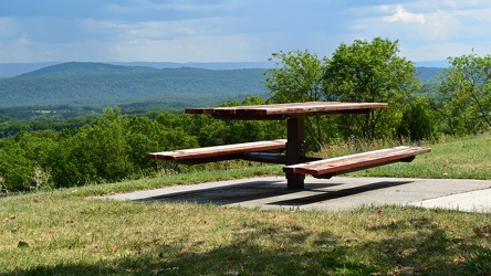
Picnic table at Sideling Hill Welcome Center
-
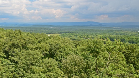
View from Sideling Hill Welcome Center
-
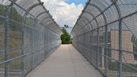
Footbridge over Interstate 68 at Sideling Hill
-
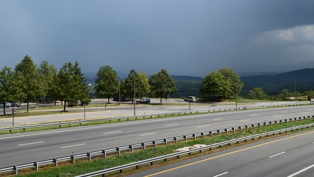
Rainstorm near Sideling Hill cut
-
Interstate 68 cut through Sideling Hill [04]
![Interstate 68 cut through Sideling Hill [04] (2564 visits) Cut in Sideling Hill, carrying Interstate 68 between Washington and Allegany Counties in Maryland.
... Interstate 68 cut through Sideling Hill [04]](../../../i/upload/2024/07/18/20240718220107-eeb97b29-cu_s9999x250.jpg)
-
Interstate 68 cut through Sideling Hill [03]
![Interstate 68 cut through Sideling Hill [03] (2365 visits) Cut in Sideling Hill, carrying Interstate 68 between Washington and Allegany Counties in Maryland.
... Interstate 68 cut through Sideling Hill [03]](../../../i/upload/2024/07/18/20240718220111-2f9132e9-cu_s9999x250.jpg)
-
Interstate 68 cut through Sideling Hill [02]
![Interstate 68 cut through Sideling Hill [02] (4224 visits) Cut in Sideling Hill, carrying Interstate 68 between Washington and Allegany Counties in Maryland.
... Interstate 68 cut through Sideling Hill [02]](../../../i/upload/2024/07/18/20240718220116-e8da0915-cu_s9999x250.jpg)
-
Interstate 68 cut through Sideling Hill [01]
![Interstate 68 cut through Sideling Hill [01] (4340 visits) Cut in Sideling Hill, carrying Interstate 68 between Washington and Allegany Counties in Maryland.
... Interstate 68 cut through Sideling Hill [01]](../../../i/upload/2024/07/18/20240718220120-0789991f-cu_s9999x250.jpg)
-
WTBO sign [10]
![WTBO sign [10] (2440 visits) "WTBO" in red and white channel letters at WTBO's office and transmitter site on Wills Mou... WTBO sign [10]](../../../i/upload/2024/07/18/20240718220134-3cb35edc-cu_s9999x250.jpg)
-
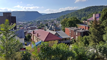
View of Cumberland, Maryland
-
View from Cathedral of Learning [01]
![View from Cathedral of Learning [01] (2776 visits) View from the 36th floor of the University of Pittsburgh's Cathedral of Learning, facing northwest.
... View from Cathedral of Learning [01]](../../../i/upload/2024/07/18/20240718220621-eac181bf-cu_s9999x250.jpg)
-
View from Cathedral of Learning [02]
![View from Cathedral of Learning [02] (2703 visits) View from the 36th floor of the University of Pittsburgh's Cathedral of Learning, facing approximate... View from Cathedral of Learning [02]](../../../i/upload/2024/07/18/20240718220624-48ed3f86-cu_s9999x250.jpg)
-
View from Cathedral of Learning [03]
![View from Cathedral of Learning [03] (2374 visits) View from the 36th floor of the University of Pittsburgh's Cathedral of Learning, facing approximate... View from Cathedral of Learning [03]](../../../i/upload/2024/07/18/20240718220627-e769ff2b-cu_s9999x250.jpg)
-
View from Cathedral of Learning [04]
![View from Cathedral of Learning [04] (2718 visits) View from the 36th floor of the University of Pittsburgh's Cathedral of Learning, facing approximate... View from Cathedral of Learning [04]](../../../i/upload/2024/07/18/20240718220631-6b814288-cu_s9999x250.jpg)
-
View of Pittsburgh from Duquesne Incline [01]
![View of Pittsburgh from Duquesne Incline [01] (2812 visits) View of Pittsburgh, Pennsylvania from the Duquesne Incline observation platform.
More at The Schumi... View of Pittsburgh from Duquesne Incline [01]](../../../i/upload/2024/07/18/20240718220754-1d033785-cu_s9999x250.jpg)
-
View of Pittsburgh from Duquesne Incline [02]
![View of Pittsburgh from Duquesne Incline [02] (2400 visits) View of Pittsburgh, Pennsylvania from the Duquesne Incline observation platform.
More at The Schumi... View of Pittsburgh from Duquesne Incline [02]](../../../i/upload/2024/07/18/20240718220757-bd2b9238-cu_s9999x250.jpg)
-
View of Pittsburgh from Duquesne Incline [03]
![View of Pittsburgh from Duquesne Incline [03] (2782 visits) View of Pittsburgh, Pennsylvania from the Duquesne Incline observation platform.
More at The Schumi... View of Pittsburgh from Duquesne Incline [03]](../../../i/upload/2024/07/18/20240718220802-b2ebac58-cu_s9999x250.jpg)
-
View of Pittsburgh from Duquesne Incline [04]
![View of Pittsburgh from Duquesne Incline [04] (2744 visits) View of Pittsburgh, Pennsylvania from the Duquesne Incline observation platform.
More at The Schumi... View of Pittsburgh from Duquesne Incline [04]](../../../i/upload/2024/07/18/20240718220806-bdd9aa68-cu_s9999x250.jpg)
-
View of Pittsburgh from Duquesne Incline [05]
![View of Pittsburgh from Duquesne Incline [05] (2716 visits) View of Pittsburgh, Pennsylvania from the Duquesne Incline observation platform.
More at The Schumi... View of Pittsburgh from Duquesne Incline [05]](../../../i/upload/2024/07/18/20240718220810-0960e30c-cu_s9999x250.jpg)
-
View of Pittsburgh from Duquesne Incline [06]
![View of Pittsburgh from Duquesne Incline [06] (2521 visits) View of Pittsburgh, Pennsylvania from the Duquesne Incline observation platform.
More at The Schumi... View of Pittsburgh from Duquesne Incline [06]](../../../i/upload/2024/07/18/20240718220814-a5ebfb24-cu_s9999x250.jpg)
-
View of Pittsburgh from Duquesne Incline [07]
![View of Pittsburgh from Duquesne Incline [07] (2493 visits) View of Pittsburgh, Pennsylvania from the Duquesne Incline observation platform.
More at The Schumi... View of Pittsburgh from Duquesne Incline [07]](../../../i/upload/2024/07/18/20240718220819-edb3bb0b-cu_s9999x250.jpg)
-
View of Pittsburgh from Duquesne Incline [08]
![View of Pittsburgh from Duquesne Incline [08] (2681 visits) View of Pittsburgh, Pennsylvania from the Duquesne Incline observation platform.
More at The Schumi... View of Pittsburgh from Duquesne Incline [08]](../../../i/upload/2024/07/18/20240718220822-cb0ab755-cu_s9999x250.jpg)
-
View of Pittsburgh from Grandview Overlook [01]
![View of Pittsburgh from Grandview Overlook [01] (2495 visits) View of Pittsburgh, Pennsylvania from the Grandview Overlook, off of Grandview Avenue in the Mount W... View of Pittsburgh from Grandview Overlook [01]](../../../i/upload/2024/07/18/20240718220826-1f7e05a3-cu_s9999x250.jpg)
-
View of Pittsburgh from Grandview Overlook [02]
![View of Pittsburgh from Grandview Overlook [02] (2633 visits) View of Pittsburgh, Pennsylvania from the Grandview Overlook, off of Grandview Avenue in the Mount W... View of Pittsburgh from Grandview Overlook [02]](../../../i/upload/2024/07/18/20240718220831-371371c4-cu_s9999x250.jpg)
-
View of Pittsburgh from Grandview Overlook [03]
![View of Pittsburgh from Grandview Overlook [03] (2618 visits) View of Pittsburgh, Pennsylvania from the Grandview Overlook, off of Grandview Avenue in the Mount W... View of Pittsburgh from Grandview Overlook [03]](../../../i/upload/2024/07/18/20240718220835-e6260e6f-cu_s9999x250.jpg)
-
View of Pittsburgh from Grandview Overlook [04]
![View of Pittsburgh from Grandview Overlook [04] (2684 visits) View of Pittsburgh, Pennsylvania from the Grandview Overlook, off of Grandview Avenue in the Mount W... View of Pittsburgh from Grandview Overlook [04]](../../../i/upload/2024/07/18/20240718220839-5997bb41-cu_s9999x250.jpg)
-
View of Pittsburgh from Grandview Overlook [05]
![View of Pittsburgh from Grandview Overlook [05] (2691 visits) View of Pittsburgh, Pennsylvania from the Grandview Overlook, off of Grandview Avenue in the Mount W... View of Pittsburgh from Grandview Overlook [05]](../../../i/upload/2024/07/18/20240718220843-76214780-cu_s9999x250.jpg)
-
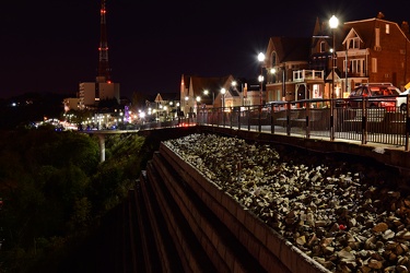
Grandview Overlook
-
View from Dirt Farm Brewing [02]
![View from Dirt Farm Brewing [02] (2670 visits) View from the patio at Dirt Farm Brewing in Bluemont, Virginia, facing approximately east. On a cle... View from Dirt Farm Brewing [02]](../../../i/upload/2024/07/18/20240718230423-b1ac8dea-cu_s9999x250.jpg)
-
View from Dirt Farm Brewing [01]
![View from Dirt Farm Brewing [01] (2813 visits) View from the patio at Dirt Farm Brewing in Bluemont, Virginia, facing approximately east. On a cle... View from Dirt Farm Brewing [01]](../../../i/upload/2024/07/18/20240718230427-e0fe1b23-cu_s9999x250.jpg)
-
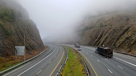
Sideling Hill cut
-
Myersville, Maryland and vicinity [01]
![Myersville, Maryland and vicinity [01] (1564 visits) Myersville, Maryland and the immediate surrounding area, viewed from above the Myersville Volunteer ... Myersville, Maryland and vicinity [01]](../../../i/upload/2024/07/19/20240719114529-b09266dc-cu_s9999x250.jpg)
-
Myersville, Maryland and vicinity [02]
![Myersville, Maryland and vicinity [02] (1451 visits) Myersville, Maryland and the immediate surrounding area, viewed from above the Myersville Volunteer ... Myersville, Maryland and vicinity [02]](../../../i/upload/2024/07/19/20240719114533-7da9ff27-cu_s9999x250.jpg)
-
Smithsburg, Maryland and vicinity [01]
![Smithsburg, Maryland and vicinity [01] (1590 visits) Aerial view of Smithsburg, Maryland and vicinity.
Ben Schumin is a professional photographer who ca... Smithsburg, Maryland and vicinity [01]](../../../i/upload/2024/07/19/20240719114610-c1a5ac24-cu_s9999x250.jpg)
-
Smithsburg, Maryland and vicinity [02]
![Smithsburg, Maryland and vicinity [02] (1636 visits) Aerial view of Smithsburg, Maryland and vicinity.
Ben Schumin is a professional photographer who ca... Smithsburg, Maryland and vicinity [02]](../../../i/upload/2024/07/19/20240719114614-27b7e477-cu_s9999x250.jpg)
-
Interstate 64 in Nelson County, Virginia [01]
![Interstate 64 in Nelson County, Virginia [01] (11465 visits) Interstate 64 in Nelson County, Virginia, near Rockfish Gap. US 250 runs adjacent to the freeway.
... Interstate 64 in Nelson County, Virginia [01]](../../../i/upload/2024/07/19/20240719115200-c8a2ce39-cu_s9999x250.jpg)
-
Interstate 64 in Nelson County, Virginia [02]
![Interstate 64 in Nelson County, Virginia [02] (11579 visits) Interstate 64 in Nelson County, Virginia, near Rockfish Gap. US 250 runs adjacent to the freeway.
... Interstate 64 in Nelson County, Virginia [02]](../../../i/upload/2024/07/19/20240719115847-184fa12a-cu_s9999x250.jpg)
-
Interstate 64 in Nelson County, Virginia [03]
![Interstate 64 in Nelson County, Virginia [03] (11738 visits) Interstate 64 in Nelson County, Virginia, near Rockfish Gap. US 250 runs adjacent to the freeway.
... Interstate 64 in Nelson County, Virginia [03]](../../../i/upload/2024/07/19/20240719115902-ff5fb9e1-cu_s9999x250.jpg)
-
Blue Ridge Mountains near Rockfish Gap [01]
![Blue Ridge Mountains near Rockfish Gap [01] (1980 visits) The Blue Ridge Mountains, viewed from above the Interstate 64 scenic overlook in Nelson County, Virg... Blue Ridge Mountains near Rockfish Gap [01]](../../../i/upload/2024/07/19/20240719115911-d105cde8-cu_s9999x250.jpg)
-
Blue Ridge Mountains near Rockfish Gap [02]
![Blue Ridge Mountains near Rockfish Gap [02] (1952 visits) The Blue Ridge Mountains, viewed from above the Interstate 64 scenic overlook in Nelson County, Virg... Blue Ridge Mountains near Rockfish Gap [02]](../../../i/upload/2024/07/19/20240719115926-47f38290-cu_s9999x250.jpg)
-
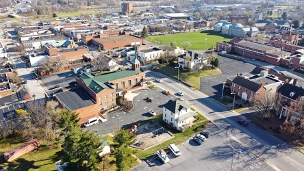
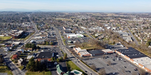
West Main Street in downtown Waynesboro
-
West Main and West Broad Streets, facing west
-
Downtown Waynesboro, Virginia, looking toward Invista [01]
![Downtown Waynesboro, Virginia, looking toward Invista [01] (2714 visits) Aerial view of downtown Waynesboro, Virginia, looking towards the Invista plant.
Ben Schumin is a p... Downtown Waynesboro, Virginia, looking toward Invista [01]](../../../i/upload/2024/07/19/20240719125947-ee92c8f8-cu_s9999x250.jpg)
-
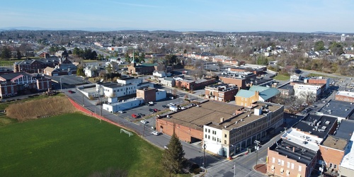
Downtown Waynesboro, Virginia near South Wayne Avenue and Federal Street
-
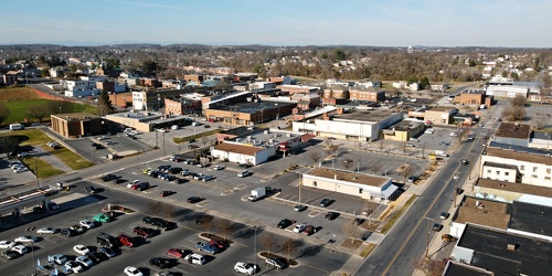
Downtown Waynesboro, Virginia, near Kroger store
-
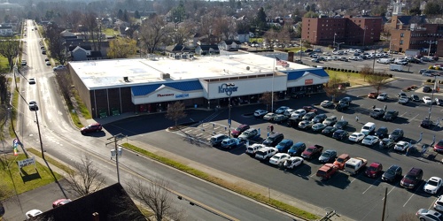
Kroger store in Waynesboro, Virginia
-
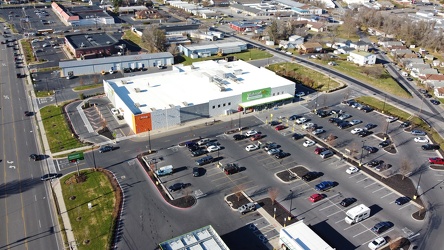
Walmart Neighborhood Market in Waynesboro, Virginia
-
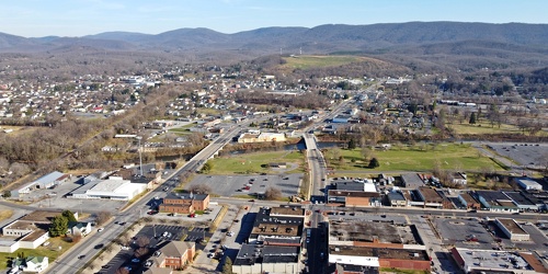
Main and Broad Streets, facing east
-
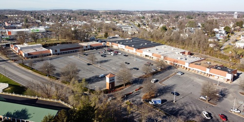
Willow Oak Plaza
-
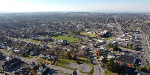
Downtown Waynesboro, Virginia, facing west
-
Satellite dish on former News Virginian building [03]
![Satellite dish on former News Virginian building [03] (2710 visits) Satellite dish on the roof of the former News Virginian building, at 544 West Main Street in Waynesb... Satellite dish on former News Virginian building [03]](../../../i/upload/2024/07/19/20240719130207-0d430d13-cu_s9999x250.jpg)
-
Satellite dish on former News Virginian building [02]
![Satellite dish on former News Virginian building [02] (2889 visits) Satellite dish on the roof of the former News Virginian building, at 544 West Main Street in Waynesb... Satellite dish on former News Virginian building [02]](../../../i/upload/2024/07/19/20240719130212-08c06a14-cu_s9999x250.jpg)
-
West Main Street in Waynesboro, Virginia [03]
![West Main Street in Waynesboro, Virginia [03] (14373 visits) Downtown Waynesboro, Virginia, looking east down West Main Street, near the intersection with Church... West Main Street in Waynesboro, Virginia [03]](../../../i/upload/2024/07/19/20240719130237-f1099710-cu_s9999x250.jpg)
-
Downtown Waynesboro, Virginia above Church Street and Federal Street
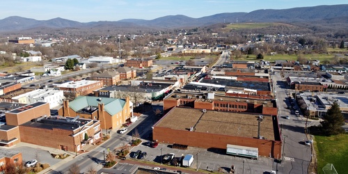
-
Satellite dish on former News Virginian building [04]
![Satellite dish on former News Virginian building [04] (2703 visits) Satellite dish on the roof of the former News Virginian building, at 544 West Main Street in Waynesb... Satellite dish on former News Virginian building [04]](../../../i/upload/2024/07/19/20240719130246-90d2803d-cu_s9999x250.jpg)
-
Downtown Waynesboro, Virginia, looking toward Invista [02]
![Downtown Waynesboro, Virginia, looking toward Invista [02] (5074 visits) Aerial view of downtown Waynesboro, Virginia, looking towards the Invista plant.
Ben Schumin is a p... Downtown Waynesboro, Virginia, looking toward Invista [02]](../../../i/upload/2024/07/19/20240719130254-ae1aac9d-cu_s9999x250.jpg)
-
West Main Street and Church Street
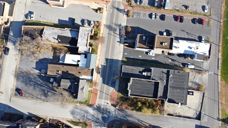
-
Mural on former Casco ice plant
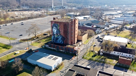
-
Water tower off of Highview Court [01]
![Water tower off of Highview Court [01] (4292 visits) Water tower located off of Highview Court in Culpeper, Virginia.
Ben Schumin is a professional phot... Water tower off of Highview Court [01]](../../../i/upload/2024/07/19/20240719155951-3e8ac8cb-cu_s9999x250.jpg)
-
The Cheese Shop [01]
![The Cheese Shop [01] (3279 visits) Aerial view of The Cheese Shop, an independent grocery store in Stuarts Draft, Virginia.
Ben Schumi... The Cheese Shop [01]](../../../i/upload/2024/07/19/20240719161301-a4fea2d4-cu_s9999x250.jpg)
-
The Cheese Shop [02]
![The Cheese Shop [02] (3299 visits) Aerial view of The Cheese Shop, an independent grocery store in Stuarts Draft, Virginia.
Ben Schumi... The Cheese Shop [02]](../../../i/upload/2024/07/19/20240719161306-36cfe9c4-cu_s9999x250.jpg)
-
The Cheese Shop [07]
![The Cheese Shop [07] (3326 visits) Sign for The Cheese Shop, an independent grocery store in Stuarts Draft, Virginia.
Ben Schumin is a... The Cheese Shop [07]](../../../i/upload/2024/07/19/20240719161313-a3ac7c57-cu_s9999x250.jpg)
-
The Cheese Shop [06]
![The Cheese Shop [06] (3369 visits) Aerial view of The Cheese Shop, an independent grocery store in Stuarts Draft, Virginia.
Ben Schumi... The Cheese Shop [06]](../../../i/upload/2024/07/19/20240719161317-08ae1eea-cu_s9999x250.jpg)
-
The Cheese Shop [05]
![The Cheese Shop [05] (3397 visits) Aerial view of The Cheese Shop, an independent grocery store in Stuarts Draft, Virginia.
Ben Schumi... The Cheese Shop [05]](../../../i/upload/2024/07/19/20240719161321-75da31a1-cu_s9999x250.jpg)
-
The Cheese Shop [04]
![The Cheese Shop [04] (3364 visits) Aerial view of The Cheese Shop, an independent grocery store in Stuarts Draft, Virginia.
Ben Schumi... The Cheese Shop [04]](../../../i/upload/2024/07/19/20240719161325-683c43ec-cu_s9999x250.jpg)
-
The Cheese Shop [03]
![The Cheese Shop [03] (3362 visits) Aerial view of The Cheese Shop, an independent grocery store in Stuarts Draft, Virginia.
Ben Schumi... The Cheese Shop [03]](../../../i/upload/2024/07/19/20240719161329-0bcf8617-cu_s9999x250.jpg)
-
West Main and West Broad Streets in downtown Waynesboro
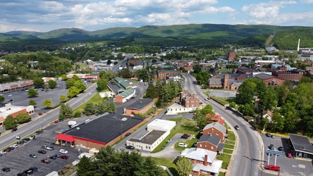
-
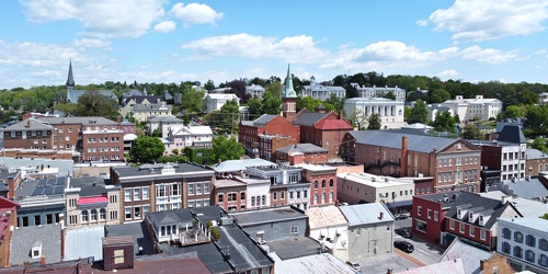
Downtown Staunton, Virginia, facing northeast
-
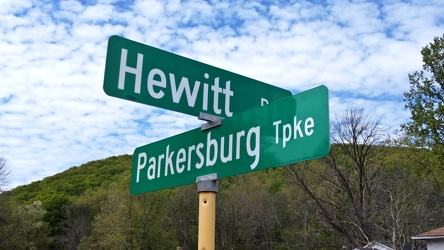
Hewitt Road and Parkersburg Turnpike
-
West Main Street in Waynesboro, Virginia [01]
![West Main Street in Waynesboro, Virginia [01] (56766 visits) View down West Main Street (US 250) in the west end of Waynesboro, Virginia, near the former Kmart b... West Main Street in Waynesboro, Virginia [01]](../../../i/upload/2024/07/19/20240719164545-b5a50599-cu_s9999x250.jpg)
-
West Main Street in Waynesboro, Virginia [02]
![West Main Street in Waynesboro, Virginia [02] (10940 visits) View down West Main Street (US 250) in the west end of Waynesboro, Virginia, near the Sheetz conveni... West Main Street in Waynesboro, Virginia [02]](../../../i/upload/2024/07/19/20240719164551-0b8407a8-cu_s9999x250.jpg)
-
West Main Street in Waynesboro, Virginia [03]
![West Main Street in Waynesboro, Virginia [03] (11893 visits) View down West Main Street (US 250) in the west end of Waynesboro, Virginia, near St. Mark's United ... West Main Street in Waynesboro, Virginia [03]](../../../i/upload/2024/07/19/20240719164555-f7feeafe-cu_s9999x250.jpg)
-
West Main Street in Waynesboro, Virginia [04]
![West Main Street in Waynesboro, Virginia [04] (325137 visits) View down West Main Street (US 250) in the west end of Waynesboro, Virginia, near the Westwood Villa... West Main Street in Waynesboro, Virginia [04]](../../../i/upload/2024/07/19/20240719164600-4379cef1-cu_s9999x250.jpg)
-
Essex Place, Candle Ridge, and Picton of Birlstone [02]
![Essex Place, Candle Ridge, and Picton of Birlstone [02] (3051 visits) Aerial view of the Essex Place, Candle Ridge, and Picton of Birlstone areas of Montgomery Village, M... Essex Place, Candle Ridge, and Picton of Birlstone [02]](../../../i/upload/2024/07/19/20240719165355-16cfcb21-cu_s9999x250.jpg)
-
Ravenglass Way [02]
![Ravenglass Way [02] (3102 visits) Aerial view of Ravenglass Way, a street in the Essex Place area of Montgomery Village, Maryland.
Be... Ravenglass Way [02]](../../../i/upload/2024/07/19/20240719165400-daa550de-cu_s9999x250.jpg)
-
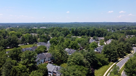
Essex Place and Candle Ridge
-
Montgomery Village, facing approximately west [01]
![Montgomery Village, facing approximately west [01] (3144 visits) View of Montgomery Village and beyond, facing approximately west, from above the Lake Marion Communi... Montgomery Village, facing approximately west [01]](../../../i/upload/2024/07/19/20240719165409-be458691-cu_s9999x250.jpg)
-
Essex Place, Candle Ridge, and Picton of Birlstone [03]
![Essex Place, Candle Ridge, and Picton of Birlstone [03] (2795 visits) Aerial view of the Essex Place, Candle Ridge, and Picton of Birlstone areas of Montgomery Village, M... Essex Place, Candle Ridge, and Picton of Birlstone [03]](../../../i/upload/2024/07/19/20240719165413-01ec57b3-cu_s9999x250.jpg)