-
Site of former P. Buckley Moss Museum [01]
![Site of former P. Buckley Moss Museum [01] (1002 visits) Site of the former P. Buckley Moss Museum in Waynesboro, Virginia. The museum, which featured works... Site of former P. Buckley Moss Museum [01]](../../../../i/upload/2025/03/03/20250303185841-9c77b6ab-cu_s9999x250.jpg)
-
Aerial view of Brunner Island Steam Electric Station [04]
![Aerial view of Brunner Island Steam Electric Station [04] (1006 visits) Aerial view of the large chimney at Brunner Island Steam Electric Station, a coal and natural gas-po... Aerial view of Brunner Island Steam Electric Station [04]](../../../../i/upload/2025/03/06/20250306154758-e371450c-cu_s9999x250.jpg)
-
Aerial view of Brunner Island Steam Electric Station [08]
![Aerial view of Brunner Island Steam Electric Station [08] (1018 visits) Aerial view of the large chimney at Brunner Island Steam Electric Station, a coal and natural gas-po... Aerial view of Brunner Island Steam Electric Station [08]](../../../../i/upload/2025/03/06/20250306154842-cec622f0-cu_s9999x250.jpg)
-
Sky above Croaker Road

-
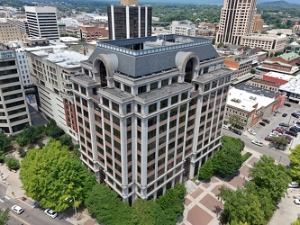
110 Franklin Road SE
-
Eastern terminus of Interstate 26 [01]
![Eastern terminus of Interstate 26 [01] (1022 visits) The eastern terminus of Interstate 26 in Charleston, South Carolina. I-26 ends at a signalized inte... Eastern terminus of Interstate 26 [01]](../../../../i/upload/2025/05/23/20250523172345-9b22a449-cu_s9999x250.jpg)
-
Site of former P. Buckley Moss Museum [02]
![Site of former P. Buckley Moss Museum [02] (1027 visits) Site of the former P. Buckley Moss Museum in Waynesboro, Virginia. The museum, which featured works... Site of former P. Buckley Moss Museum [02]](../../../../i/upload/2025/03/03/20250303185847-e161c5f3-cu_s9999x250.jpg)
-
Aerial view of Brunner Island Steam Electric Station [06]
![Aerial view of Brunner Island Steam Electric Station [06] (1028 visits) Aerial view of the large chimney at Brunner Island Steam Electric Station, a coal and natural gas-po... Aerial view of Brunner Island Steam Electric Station [06]](../../../../i/upload/2025/03/06/20250306154821-309332fc-cu_s9999x250.jpg)
-
Site of former P. Buckley Moss Museum [03]
![Site of former P. Buckley Moss Museum [03] (1032 visits) Site of the former P. Buckley Moss Museum in Waynesboro, Virginia. The museum, which featured works... Site of former P. Buckley Moss Museum [03]](../../../../i/upload/2025/03/03/20250303185852-c9c1e69f-cu_s9999x250.jpg)
-
Aerial view of Brunner Island Steam Electric Station [05]
![Aerial view of Brunner Island Steam Electric Station [05] (1034 visits) Aerial view of the large chimney at Brunner Island Steam Electric Station, a coal and natural gas-po... Aerial view of Brunner Island Steam Electric Station [05]](../../../../i/upload/2025/03/06/20250306154810-c92bcb67-cu_s9999x250.jpg)
-
Boat travels up the Susquehanna River

-
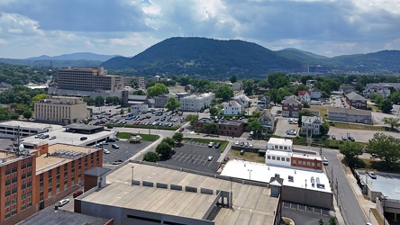
Downtown Roanoke facing Mill Mountain
-
Poff Federal Building [02]
![Poff Federal Building [02] (1053 visits) The Richard H. Poff Federal Building, a government office building at 210 Franklin Road SW in downto... Poff Federal Building [02]](../../../../i/upload/2025/03/02/20250302134720-6d41525c-cu_s9999x250.jpg)
-
Aerial view of Hampton Coliseum [01]
![Aerial view of Hampton Coliseum [01] (1060 visits) Aerial view of the Hampton Coliseum, a multi-purpose arena in Hampton, Virginia, completed in 1969.
... Aerial view of Hampton Coliseum [01]](../../../../i/upload/2025/02/17/20250217085721-26ccc815-cu_s9999x250.jpg)
-
Aerial view of Brunner Island Steam Electric Station [10]
![Aerial view of Brunner Island Steam Electric Station [10] (1064 visits) Aerial view of the large chimney at Brunner Island Steam Electric Station, a coal and natural gas-po... Aerial view of Brunner Island Steam Electric Station [10]](../../../../i/upload/2025/03/06/20250306154907-56a1ea71-cu_s9999x250.jpg)
-
Aerial view of Wayne Community College [01]
![Aerial view of Wayne Community College [01] (1067 visits) Aerial view of Wayne Community College, a public community college in Goldsboro, North Carolina.
Mo... Aerial view of Wayne Community College [01]](../../../../i/upload/2025/03/10/20250310201548-58e9769c-cu_s9999x250.jpg)
-
Former Rabbit Transit bus 321

-
Aerial view of Hampton Coliseum [02]
![Aerial view of Hampton Coliseum [02] (1072 visits) Overhead view of the Hampton Coliseum, a multi-purpose arena in Hampton, Virginia, completed in 1969... Aerial view of Hampton Coliseum [02]](../../../../i/upload/2025/02/17/20250217085700-fbcac1cc-cu_s9999x250.jpg)
-
Poff Federal Building [01]
![Poff Federal Building [01] (1075 visits) The Richard H. Poff Federal Building, a government office building at 210 Franklin Road SW in downto... Poff Federal Building [01]](../../../../i/upload/2025/03/02/20250302134711-675ab6c7-cu_s9999x250.jpg)
-
Wells Fargo Tower [02]
![Wells Fargo Tower [02] (1081 visits) The Wells Fargo Tower, an office building in downtown Roanoke, Virginia. The building, completed in... Wells Fargo Tower [02]](../../../../i/upload/2025/03/02/20250302134831-92a15775-cu_s9999x250.jpg)
-
Aerial view of Wayne Community College [03]
![Aerial view of Wayne Community College [03] (1087 visits) Aerial view of Wayne Community College, a public community college in Goldsboro, North Carolina.
Mo... Aerial view of Wayne Community College [03]](../../../../i/upload/2025/03/10/20250310201604-518deba5-cu_s9999x250.jpg)
-
Aerial view of Wayne Community College [02]
![Aerial view of Wayne Community College [02] (1091 visits) Aerial view of Wayne Community College, a public community college in Goldsboro, North Carolina.
Mo... Aerial view of Wayne Community College [02]](../../../../i/upload/2025/03/10/20250310201556-3666ee50-cu_s9999x250.jpg)
-
Rancocas Creek [02]
![Rancocas Creek [02] (1093 visits) Rancocas Creek, a tributary of the Delaware River that forms the boundary between Willingboro and Mo... Rancocas Creek [02]](../../../../i/upload/2025/03/20/20250320182430-63158fd0-cu_s9999x250.jpg)
-
Hampton Inn in downtown Roanoke [01]
![Hampton Inn in downtown Roanoke [01] (1098 visits) Hampton Inn hotel in downtown Roanoke, Virginia. This Hampton Inn is unusual in that it was built o... Hampton Inn in downtown Roanoke [01]](../../../../i/upload/2025/03/02/20250302134739-3fb23c16-cu_s9999x250.jpg)
-
Hampton Inn in downtown Roanoke [02]
![Hampton Inn in downtown Roanoke [02] (1098 visits) Hampton Inn hotel in downtown Roanoke, Virginia. This Hampton Inn is unusual in that it was built o... Hampton Inn in downtown Roanoke [02]](../../../../i/upload/2025/03/02/20250302134750-3bedaef7-cu_s9999x250.jpg)
-
Aerial view of Brunner Island Steam Electric Station [02]
![Aerial view of Brunner Island Steam Electric Station [02] (1101 visits) Aerial view of Brunner Island Steam Electric Station, a coal and natural gas-powered plant owned by ... Aerial view of Brunner Island Steam Electric Station [02]](../../../../i/upload/2025/03/06/20250306154734-3d668e24-cu_s9999x250.jpg)
-
Liberty Executive Park [05]
![Liberty Executive Park [05] (1106 visits) Liberty Executive Park, a complex of low-rise office buildings surrounding a small manmade lake in C... Liberty Executive Park [05]](../../../../i/upload/2025/02/19/20250219223144-7357dda8-cu_s9999x250.jpg)
-
Liberty Executive Park [04]
![Liberty Executive Park [04] (1107 visits) Liberty Executive Park, a complex of low-rise office buildings surrounding a small manmade lake in C... Liberty Executive Park [04]](../../../../i/upload/2025/02/19/20250219223057-320de988-cu_s9999x250.jpg)
-
Carilion Administrative Services Building [02]
![Carilion Administrative Services Building [02] (1107 visits) The Carilion Administrative Services Building, at 213 South Jefferson Street in downtown Roanoke, Vi... Carilion Administrative Services Building [02]](../../../../i/upload/2025/03/02/20250302134813-241abfec-cu_s9999x250.jpg)
-
Aerial view of Wayne Community College [04]
![Aerial view of Wayne Community College [04] (1109 visits) Aerial view of Wayne Community College, a public community college in Goldsboro, North Carolina.
Mo... Aerial view of Wayne Community College [04]](../../../../i/upload/2025/03/10/20250310201611-4991f2f2-cu_s9999x250.jpg)
-
Liberty Executive Park [03]
![Liberty Executive Park [03] (1113 visits) Liberty Executive Park, a complex of low-rise office buildings surrounding a small manmade lake in C... Liberty Executive Park [03]](../../../../i/upload/2025/02/19/20250219223009-037b6ca0-cu_s9999x250.jpg)
-
Carilion Administrative Services Building [01]
![Carilion Administrative Services Building [01] (1114 visits) The Carilion Administrative Services Building, at 213 South Jefferson Street in downtown Roanoke, Vi... Carilion Administrative Services Building [01]](../../../../i/upload/2025/03/02/20250302134801-6477a7f8-cu_s9999x250.jpg)
-
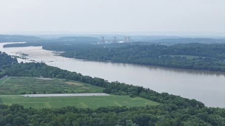
View of Three Mile Island from Brunner Island
-
President Heads [01]
![President Heads [01] (1126 visits) The President Heads, a collection of busts of United States presidents, on the property of the Hampt... President Heads [01]](../../../../i/upload/2025/02/22/20250222004408-ae6b4ea2-cu_s9999x250.jpg)
-
Liberty Executive Park [02]
![Liberty Executive Park [02] (1128 visits) Liberty Executive Park, a complex of low-rise office buildings surrounding a small manmade lake in C... Liberty Executive Park [02]](../../../../i/upload/2025/02/19/20250219222906-b05ca734-cu_s9999x250.jpg)
-
Former Waynesboro District Home [05]
![Former Waynesboro District Home [05] (1130 visits) Former Waynesboro District Home building at 1400 Duke Road in Waynesboro, Virginia. The facility, k... Former Waynesboro District Home [05]](../../../../i/upload/2025/03/03/20250303192359-c00a5a36-cu_s9999x250.jpg)
-
Former Waynesboro District Home [06]
![Former Waynesboro District Home [06] (1130 visits) Former Waynesboro District Home building at 1400 Duke Road in Waynesboro, Virginia. The facility, k... Former Waynesboro District Home [06]](../../../../i/upload/2025/03/03/20250303192406-eccb2fd6-cu_s9999x250.jpg)
-
President Heads [04]
![President Heads [04] (1131 visits) The President Heads, a collection of busts of United States presidents, on the property of the Hampt... President Heads [04]](../../../../i/upload/2025/02/22/20250222004427-8a077a64-cu_s9999x250.jpg)
-
Liberty Executive Park [06]
![Liberty Executive Park [06] (1133 visits) Liberty Executive Park, a complex of low-rise office buildings surrounding a small manmade lake in C... Liberty Executive Park [06]](../../../../i/upload/2025/02/19/20250219223234-b286ccff-cu_s9999x250.jpg)
-
Rancocas Creek [01]
![Rancocas Creek [01] (1136 visits) Rancocas Creek, a tributary of the Delaware River that forms the boundary between Willingboro and Mo... Rancocas Creek [01]](../../../../i/upload/2025/03/20/20250320182417-1fb43b90-cu_s9999x250.jpg)
-
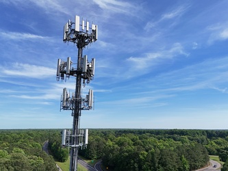
Cell tower above Interstate 64
-
Liberty Executive Park [01]
![Liberty Executive Park [01] (1142 visits) Liberty Executive Park, a complex of low-rise office buildings surrounding a small manmade lake in C... Liberty Executive Park [01]](../../../../i/upload/2025/02/19/20250219222850-50fd69b0-cu_s9999x250.jpg)
-
Aerial view of Brunner Island Steam Electric Station [01]
![Aerial view of Brunner Island Steam Electric Station [01] (1142 visits) Aerial view of Brunner Island Steam Electric Station, a coal and natural gas-powered plant owned by ... Aerial view of Brunner Island Steam Electric Station [01]](../../../../i/upload/2025/03/06/20250306154728-e4bb4f77-cu_s9999x250.jpg)
-
Roanoke from above Main Street SW

-
Roanoke Industrial Center [01]
![Roanoke Industrial Center [01] (1158 visits) Aerial view of the Roanoke Industrial Center, an industrial park in southeast Roanoke, Virginia.
... Roanoke Industrial Center [01]](../../../../i/upload/2025/03/03/20250303061242-c4450e31-cu_s9999x250.jpg)
-
Rooftop sign on Fulton Bank building [02]
![Rooftop sign on Fulton Bank building [02] (1159 visits) Rooftop sign on the Fulton Bank building in downtown Harrisburg, Pennsylvania.
More at The Schumin ... Rooftop sign on Fulton Bank building [02]](../../../../i/upload/2025/03/06/20250306093915-d69d414a-cu_s9999x250.jpg)
-
Storm near Poolesville, Maryland [07]
![Storm near Poolesville, Maryland [07] (1160 visits) Thunderstorm near Poolesville, Maryland.
Ben Schumin is a professional photographer who captures ... Storm near Poolesville, Maryland [07]](../../../../i/upload/2025/02/28/20250228153844-2249fb45-cu_s9999x250.jpg)
-
President Heads [02]
![President Heads [02] (1161 visits) The President Heads, a collection of busts of United States presidents, on the property of the Hampt... President Heads [02]](../../../../i/upload/2025/02/22/20250222004415-62d5dbbd-cu_s9999x250.jpg)
-
Storm near Poolesville, Maryland [04]
![Storm near Poolesville, Maryland [04] (1165 visits) Thunderstorm near Poolesville, Maryland.
Ben Schumin is a professional photographer who captures ... Storm near Poolesville, Maryland [04]](../../../../i/upload/2025/02/28/20250228153808-e077176b-cu_s9999x250.jpg)
-
Storm near Poolesville, Maryland [09]
![Storm near Poolesville, Maryland [09] (1165 visits) Thunderstorm near Poolesville, Maryland.
Ben Schumin is a professional photographer who captures ... Storm near Poolesville, Maryland [09]](../../../../i/upload/2025/02/28/20250228153911-3dad6484-cu_s9999x250.jpg)
-
Storm near Poolesville, Maryland [01]
![Storm near Poolesville, Maryland [01] (1167 visits) Thunderstorm near Poolesville, Maryland.
Ben Schumin is a professional photographer who captures ... Storm near Poolesville, Maryland [01]](../../../../i/upload/2025/02/28/20250228153603-4f5f8d84-cu_s9999x250.jpg)
-
Former Waynesboro District Home [04]
![Former Waynesboro District Home [04] (1168 visits) Former Waynesboro District Home building at 1400 Duke Road in Waynesboro, Virginia. The facility, k... Former Waynesboro District Home [04]](../../../../i/upload/2025/03/03/20250303192352-274cd5c8-cu_s9999x250.jpg)
-
Former Waynesboro District Home [02]
![Former Waynesboro District Home [02] (1170 visits) Former Waynesboro District Home building at 1400 Duke Road in Waynesboro, Virginia. The facility, k... Former Waynesboro District Home [02]](../../../../i/upload/2025/03/03/20250303192336-a1b1067a-cu_s9999x250.jpg)
-
Former Waynesboro District Home [07]
![Former Waynesboro District Home [07] (1170 visits) Former Waynesboro District Home building at 1400 Duke Road in Waynesboro, Virginia. The facility, k... Former Waynesboro District Home [07]](../../../../i/upload/2025/03/03/20250303192413-64732026-cu_s9999x250.jpg)
-
Rooftop sign on Fulton Bank building [04]
![Rooftop sign on Fulton Bank building [04] (1170 visits) Rooftop sign on the Fulton Bank building in downtown Harrisburg, Pennsylvania.
More at The Schumin ... Rooftop sign on Fulton Bank building [04]](../../../../i/upload/2025/03/06/20250306093930-b45efa2e-cu_s9999x250.jpg)
-
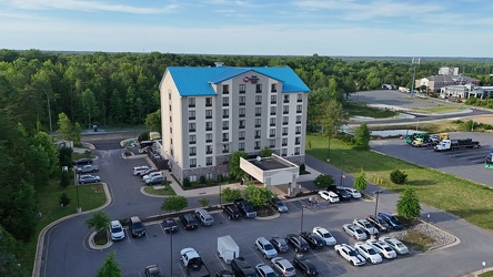
Best Western Plus in Thornburg, Virginia
-
Former Waynesboro District Home [03]
![Former Waynesboro District Home [03] (1173 visits) Former Waynesboro District Home building at 1400 Duke Road in Waynesboro, Virginia. The facility, k... Former Waynesboro District Home [03]](../../../../i/upload/2025/03/03/20250303192345-2775731c-cu_s9999x250.jpg)
-
Former Waynesboro District Home [01]
![Former Waynesboro District Home [01] (1175 visits) Former Waynesboro District Home building at 1400 Duke Road in Waynesboro, Virginia. The facility, k... Former Waynesboro District Home [01]](../../../../i/upload/2025/03/03/20250303192318-40de21a3-cu_s9999x250.jpg)
-
Storm near Poolesville, Maryland [02]
![Storm near Poolesville, Maryland [02] (1176 visits) Thunderstorm near Poolesville, Maryland.
Ben Schumin is a professional photographer who captures ... Storm near Poolesville, Maryland [02]](../../../../i/upload/2025/02/28/20250228153657-fd5e55c4-cu_s9999x250.jpg)
-
Former Waynesboro District Home [08]
![Former Waynesboro District Home [08] (1177 visits) Former Waynesboro District Home building at 1400 Duke Road in Waynesboro, Virginia. The facility, k... Former Waynesboro District Home [08]](../../../../i/upload/2025/03/03/20250303192421-d1941783-cu_s9999x250.jpg)
-
Aerial view of Willingboro, New Jersey [02]
![Aerial view of Willingboro, New Jersey [02] (1178 visits) Aerial view of Willingboro, a township in Burlington County, New Jersey.
More at The Schumin Web:
w... Aerial view of Willingboro, New Jersey [02]](../../../../i/upload/2025/03/20/20250320182317-a2b0e4b5-cu_s9999x250.jpg)
-
Rooftop sign on Fulton Bank building [01]
![Rooftop sign on Fulton Bank building [01] (1180 visits) Rooftop sign on the Fulton Bank building in downtown Harrisburg, Pennsylvania.
More at The Schumin ... Rooftop sign on Fulton Bank building [01]](../../../../i/upload/2025/03/06/20250306093907-add6d590-cu_s9999x250.jpg)
-
Storm near Poolesville, Maryland [06]
![Storm near Poolesville, Maryland [06] (1182 visits) Thunderstorm near Poolesville, Maryland.
Ben Schumin is a professional photographer who captures ... Storm near Poolesville, Maryland [06]](../../../../i/upload/2025/02/28/20250228153832-7a1b0103-cu_s9999x250.jpg)
-
Storm near Poolesville, Maryland [08]
![Storm near Poolesville, Maryland [08] (1185 visits) Thunderstorm near Poolesville, Maryland.
Ben Schumin is a professional photographer who captures ... Storm near Poolesville, Maryland [08]](../../../../i/upload/2025/02/28/20250228153859-de442d45-cu_s9999x250.jpg)
-
Storm near Poolesville, Maryland [05]
![Storm near Poolesville, Maryland [05] (1186 visits) Thunderstorm near Poolesville, Maryland.
Ben Schumin is a professional photographer who captures ... Storm near Poolesville, Maryland [05]](../../../../i/upload/2025/02/28/20250228153821-6695d99b-cu_s9999x250.jpg)
-
Wells Fargo Tower [01]
![Wells Fargo Tower [01] (1191 visits) The Wells Fargo Tower, an office building in downtown Roanoke, Virginia. The building, completed in... Wells Fargo Tower [01]](../../../../i/upload/2025/03/02/20250302134825-e3412be2-cu_s9999x250.jpg)
-
Aerial view of Willingboro, New Jersey [01]
![Aerial view of Willingboro, New Jersey [01] (1197 visits) Aerial view of Willingboro, a township in Burlington County, New Jersey.
More at The Schumin Web:
w... Aerial view of Willingboro, New Jersey [01]](../../../../i/upload/2025/03/20/20250320182300-6bef996a-cu_s9999x250.jpg)
-
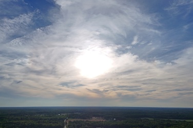
Sunset over Thornburg, Virginia
-
Storm near Poolesville, Maryland [10]
![Storm near Poolesville, Maryland [10] (1199 visits) Thunderstorm near Poolesville, Maryland.
Ben Schumin is a professional photographer who captures ... Storm near Poolesville, Maryland [10]](../../../../i/upload/2025/02/28/20250228153926-7c08236b-cu_s9999x250.jpg)
-
President Heads [03]
![President Heads [03] (1200 visits) The President Heads, a collection of busts of United States presidents, on the property of the Hampt... President Heads [03]](../../../../i/upload/2025/02/22/20250222004421-19c6797b-cu_s9999x250.jpg)
-
Aerial view of downtown Lynchburg [02]
![Aerial view of downtown Lynchburg [02] (1201 visits) Aerial view of downtown Lynchburg, Virginia, an independent city in central Virginia.
Ben Schumin i... Aerial view of downtown Lynchburg [02]](../../../../i/upload/2025/02/28/20250228215213-a5dd2779-cu_s9999x250.jpg)
-
Aerial view of downtown Lynchburg [03]
![Aerial view of downtown Lynchburg [03] (1202 visits) Aerial view of downtown Lynchburg, Virginia, an independent city in central Virginia.
Ben Schumin i... Aerial view of downtown Lynchburg [03]](../../../../i/upload/2025/02/28/20250228215218-ffa5d68d-cu_s9999x250.jpg)
-
Rooftop sign on Fulton Bank building [05]
![Rooftop sign on Fulton Bank building [05] (1202 visits) Rooftop sign on the Fulton Bank building in downtown Harrisburg, Pennsylvania.
More at The Schumin ... Rooftop sign on Fulton Bank building [05]](../../../../i/upload/2025/03/06/20250306093937-7839a948-cu_s9999x250.jpg)
-
Rooftop sign on Fulton Bank building [03]
![Rooftop sign on Fulton Bank building [03] (1207 visits) Rooftop sign on the Fulton Bank building in downtown Harrisburg, Pennsylvania.
More at The Schumin ... Rooftop sign on Fulton Bank building [03]](../../../../i/upload/2025/03/06/20250306093922-0931f53e-cu_s9999x250.jpg)
-
Cars at the Port of Charleston [01]
![Cars at the Port of Charleston [01] (1208 visits) Hundreds of recently imported cars, trucks, and SUVs wait on a lot at the Port of Charleston, South ... Cars at the Port of Charleston [01]](../../../../i/upload/2025/01/14/20250114203745-492ce989-cu_s9999x250.jpg)
-
Storm near Poolesville, Maryland [03]
![Storm near Poolesville, Maryland [03] (1208 visits) Thunderstorm near Poolesville, Maryland.
Ben Schumin is a professional photographer who captures ... Storm near Poolesville, Maryland [03]](../../../../i/upload/2025/02/28/20250228153757-ee5d80e8-cu_s9999x250.jpg)
-
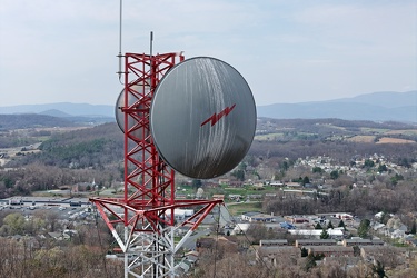
Radio tower on Mary Gray
-
Aerial view of downtown Lynchburg [01]
![Aerial view of downtown Lynchburg [01] (1211 visits) Aerial view of downtown Lynchburg, Virginia, an independent city in central Virginia.
Ben Schumin i... Aerial view of downtown Lynchburg [01]](../../../../i/upload/2025/02/28/20250228215207-816965cd-cu_s9999x250.jpg)
-
Former Southern California RTD bus 3131 in Willingboro, New Jersey

-
Bank of the James building [03]
![Bank of the James building [03] (1217 visits) Aerial view of the Bank of the James building, an office building in downtown Lynchburg, Virginia.
... Bank of the James building [03]](../../../../i/upload/2025/02/28/20250228215224-5dade886-cu_s9999x250.jpg)