-
West Main Street in downtown Waynesboro
-
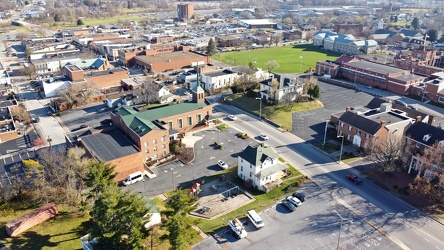
West Main and West Broad Streets, facing west
-
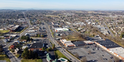
Downtown Waynesboro, Virginia near South Wayne Avenue and Federal Street
-
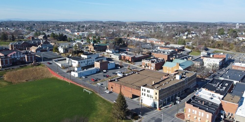
Downtown Waynesboro, Virginia, near Kroger store
-
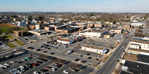
Main and Broad Streets, facing east
-
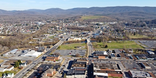
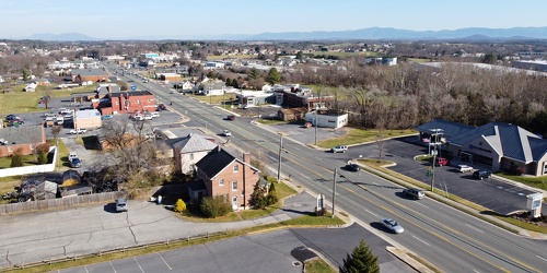
View up Route 11 from above Verona Fire Department
-
Forest Springs Drive [02]
![Forest Springs Drive [02] (3206 visits) Aerial view of Forest Springs Drive, a residential street in Stuarts Draft, Virginia. View facing n... Forest Springs Drive [02]](../../../i/upload/2024/07/19/20240719130110-e8de25d6-cu_s9999x250.jpg)
-
Forest Springs Drive [03]
![Forest Springs Drive [03] (3326 visits) Aerial view of Forest Springs Drive, a residential street in Stuarts Draft, Virginia. View facing s... Forest Springs Drive [03]](../../../i/upload/2024/07/19/20240719130115-cc787080-cu_s9999x250.jpg)
-
West Main Street in Waynesboro, Virginia [02]
![West Main Street in Waynesboro, Virginia [02] (3252 visits) Downtown Waynesboro, Virginia, looking east down West Main Street, near the intersection with Church... West Main Street in Waynesboro, Virginia [02]](../../../i/upload/2024/07/19/20240719130153-2ee52d33-cu_s9999x250.jpg)
-
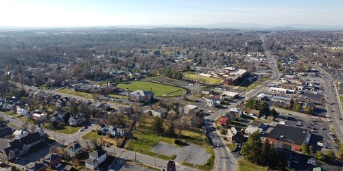
Downtown Waynesboro, Virginia, facing west
-
West Main Street in Waynesboro, Virginia [01]
![West Main Street in Waynesboro, Virginia [01] (3352 visits) Downtown Waynesboro, Virginia, looking east down West Main Street, near the intersection with Church... West Main Street in Waynesboro, Virginia [01]](../../../i/upload/2024/07/19/20240719130232-6088860d-cu_s9999x250.jpg)
-
West Main Street in Waynesboro, Virginia [03]
![West Main Street in Waynesboro, Virginia [03] (13226 visits) Downtown Waynesboro, Virginia, looking east down West Main Street, near the intersection with Church... West Main Street in Waynesboro, Virginia [03]](../../../i/upload/2024/07/19/20240719130237-f1099710-cu_s9999x250.jpg)
-
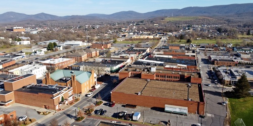
Downtown Waynesboro, Virginia above Church Street and Federal Street
-
Downtown Waynesboro, Virginia, looking toward Invista [02]
![Downtown Waynesboro, Virginia, looking toward Invista [02] (4021 visits) Aerial view of downtown Waynesboro, Virginia, looking towards the Invista plant.
Ben Schumin is a p... Downtown Waynesboro, Virginia, looking toward Invista [02]](../../../i/upload/2024/07/19/20240719130254-ae1aac9d-cu_s9999x250.jpg)
-
Variable message sign discouraging travel and encouraging mask wearing [02]
![Variable message sign discouraging travel and encouraging mask wearing [02] (3500 visits) Variable message sign displaying a message discouraging travel and encouraging mask wearing, ostensi... Variable message sign discouraging travel and encouraging mask wearing [02]](../../../i/upload/2024/07/19/20240719123458-c21fd7cf-cu_s9999x250.jpg)
-
Variable message sign discouraging travel and encouraging mask wearing [01]
![Variable message sign discouraging travel and encouraging mask wearing [01] (3455 visits) Variable message sign displaying a message discouraging travel and encouraging mask wearing, ostensi... Variable message sign discouraging travel and encouraging mask wearing [01]](../../../i/upload/2024/07/19/20240719123453-94f55986-cu_s9999x250.jpg)
-
East Village Avenue [02]
![East Village Avenue [02] (941 visits) East Village Avenue, near the intersection with Tyndal Springs Drive and Fulks Farm Road, in Montgom... East Village Avenue [02]](../../../i/upload/2024/07/19/20240719122836-3d056d6c-cu_s9999x250.jpg)
-
East Village Avenue [01]
![East Village Avenue [01] (972 visits) East Village Avenue, near the intersection with Tyndal Springs Drive and Fulks Farm Road, in Montgom... East Village Avenue [01]](../../../i/upload/2024/07/19/20240719122833-bc6ea083-cu_s9999x250.jpg)
-
Point of Rocks Bridge [03]
![Point of Rocks Bridge [03] (1320 visits) The Point of Rocks Bridge, which carries US Route 15 over the Potomac River between Loudoun County, ... Point of Rocks Bridge [03]](../../../i/upload/2024/07/19/20240719121604-b7b9e112-cu_s9999x250.jpg)
-
Point of Rocks Bridge [05]
![Point of Rocks Bridge [05] (1369 visits) Overhead view of the Point of Rocks Bridge, which carries US Route 15 over the Potomac River between... Point of Rocks Bridge [05]](../../../i/upload/2024/07/19/20240719121622-d2dfa3a8-cu_s9999x250.jpg)
-
Point of Rocks Bridge [02]
![Point of Rocks Bridge [02] (1363 visits) The Point of Rocks Bridge, which carries US Route 15 over the Potomac River between Loudoun County, ... Point of Rocks Bridge [02]](../../../i/upload/2024/07/19/20240719121627-117c91a4-cu_s9999x250.jpg)
-
Point of Rocks Bridge [01]
![Point of Rocks Bridge [01] (1323 visits) The Point of Rocks Bridge, which carries US Route 15 over the Potomac River between Loudoun County, ... Point of Rocks Bridge [01]](../../../i/upload/2024/07/19/20240719121631-a890c001-cu_s9999x250.jpg)
-
Point of Rocks Bridge [04]
![Point of Rocks Bridge [04] (1263 visits) The Point of Rocks Bridge, which carries US Route 15 over the Potomac River between Loudoun County, ... Point of Rocks Bridge [04]](../../../i/upload/2024/07/19/20240719122649-6c75d4bd-cu_s9999x250.jpg)
-
Interstate 64 near Rockfish Gap [05]
![Interstate 64 near Rockfish Gap [05] (10659 visits) Interstate 64, near Rockfish Gap in Virginia. The boundary between Augusta and Nelson Counties runs... Interstate 64 near Rockfish Gap [05]](../../../i/upload/2024/07/19/20240719120629-90e00218-cu_s9999x250.jpg)
-
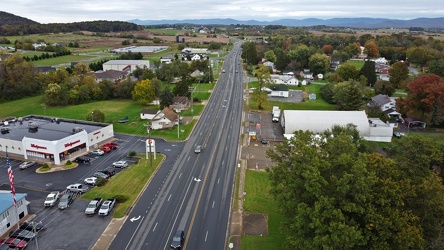
US 340 north in Stuarts Draft
-
Interstate 64 near Rockfish Gap [04]
![Interstate 64 near Rockfish Gap [04] (2861 visits) Interstate 64, near Rockfish Gap in Virginia. The bridge in the foreground carries Skyline Drive ov... Interstate 64 near Rockfish Gap [04]](../../../i/upload/2024/07/19/20240719120620-49d9b327-cu_s9999x250.jpg)
-
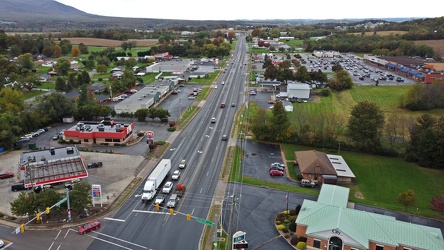
US 340 south in Stuarts Draft
-
Interstate 64 near Rockfish Gap [03]
![Interstate 64 near Rockfish Gap [03] (2854 visits) Interstate 64, near Rockfish Gap in Virginia. The bridge in the foreground carries Skyline Drive ov... Interstate 64 near Rockfish Gap [03]](../../../i/upload/2024/07/19/20240719120613-6e2190f6-cu_s9999x250.jpg)
-
Intersection of US 340 and VA 608 [02]
![Intersection of US 340 and VA 608 [02] (105569 visits) Intersection of US 340 and Virginia state secondary route 608 in Stuarts Draft, Virginia.
Ben Sch... Intersection of US 340 and VA 608 [02]](../../../i/upload/2024/07/19/20240719120559-2af4c901-cu_s9999x250.jpg)
-
Interstate 64 near Rockfish Gap [02]
![Interstate 64 near Rockfish Gap [02] (2846 visits) Interstate 64, near Rockfish Gap in Virginia. The bridge in the foreground carries Skyline Drive ov... Interstate 64 near Rockfish Gap [02]](../../../i/upload/2024/07/19/20240719120604-e2ad25dd-cu_s9999x250.jpg)
-
Intersection of US 340 and VA 608 [01]
![Intersection of US 340 and VA 608 [01] (105624 visits) Intersection of US 340 and Virginia state secondary route 608 in Stuarts Draft, Virginia.
Ben Sch... Intersection of US 340 and VA 608 [01]](../../../i/upload/2024/07/19/20240719120550-1673ec68-cu_s9999x250.jpg)
-
Interstate 64 near Rockfish Gap [01]
![Interstate 64 near Rockfish Gap [01] (65813 visits) Interstate 64, near Rockfish Gap in Virginia.
Ben Schumin is a professional photographer who captur... Interstate 64 near Rockfish Gap [01]](../../../i/upload/2024/07/19/20240719120555-d0d3c2ce-cu_s9999x250.jpg)
-
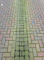
Green streak down Barristers Row
-
Interstate 64 in Nelson County, Virginia [03]
![Interstate 64 in Nelson County, Virginia [03] (10841 visits) Interstate 64 in Nelson County, Virginia, near Rockfish Gap. US 250 runs adjacent to the freeway.
... Interstate 64 in Nelson County, Virginia [03]](../../../i/upload/2024/07/19/20240719115902-ff5fb9e1-cu_s9999x250.jpg)
-
Interstate 64 in Nelson County, Virginia [02]
![Interstate 64 in Nelson County, Virginia [02] (10649 visits) Interstate 64 in Nelson County, Virginia, near Rockfish Gap. US 250 runs adjacent to the freeway.
... Interstate 64 in Nelson County, Virginia [02]](../../../i/upload/2024/07/19/20240719115847-184fa12a-cu_s9999x250.jpg)
-
Interstate 64 in Nelson County, Virginia [01]
![Interstate 64 in Nelson County, Virginia [01] (10494 visits) Interstate 64 in Nelson County, Virginia, near Rockfish Gap. US 250 runs adjacent to the freeway.
... Interstate 64 in Nelson County, Virginia [01]](../../../i/upload/2024/07/19/20240719115200-c8a2ce39-cu_s9999x250.jpg)
-
Intersection of Routes 64 and 418 [04]
![Intersection of Routes 64 and 418 [04] (1604 visits) Intersection of Routes 64 and 418 in Ringgold, Maryland. The two roads meet at a four-way stop, gov... Intersection of Routes 64 and 418 [04]](../../../i/upload/2024/07/19/20240719114443-599ce985-cu_s9999x250.jpg)
-
Intersection of Routes 64 and 418 [05]
![Intersection of Routes 64 and 418 [05] (1755 visits) Intersection of Routes 64 and 418 in Ringgold, Maryland. The two roads meet at a four-way stop, gov... Intersection of Routes 64 and 418 [05]](../../../i/upload/2024/07/19/20240719114438-ea16106f-cu_s9999x250.jpg)
-
Intersection of Routes 64 and 418 [02]
![Intersection of Routes 64 and 418 [02] (1569 visits) Intersection of Routes 64 and 418 in Ringgold, Maryland. The two roads meet at a four-way stop, gov... Intersection of Routes 64 and 418 [02]](../../../i/upload/2024/07/19/20240719114434-f7b1a6bf-cu_s9999x250.jpg)
-
Intersection of Routes 64 and 418 [03]
![Intersection of Routes 64 and 418 [03] (1707 visits) Intersection of Routes 64 and 418 in Ringgold, Maryland. The two roads meet at a four-way stop, gov... Intersection of Routes 64 and 418 [03]](../../../i/upload/2024/07/19/20240719114429-bdff0353-cu_s9999x250.jpg)
-
Mileage sign on US 1 near Fredericksburg [02]
![Mileage sign on US 1 near Fredericksburg [02] (2714 visits) Mileage sign on southbound US 1 near Fredericksburg, Virginia, giving distances to Thornburg, Ashlan... Mileage sign on US 1 near Fredericksburg [02]](../../../i/upload/2024/07/19/20240719093655-959f4e08-cu_s9999x250.jpg)
-
Speed limit and low ground clearance signs [01]
![Speed limit and low ground clearance signs [01] (1157 visits) Speed limit and low ground clearance signs on Mountville Road in Frederick County, Maryland.
Ben Sc... Speed limit and low ground clearance signs [01]](../../../i/upload/2024/07/19/20240719093423-402fb975-cu_s9999x250.jpg)
-
Signage for Exit 49 on Interstate 295 [01]
![Signage for Exit 49 on Interstate 295 [01] (2738 visits) Overhead sign for Exit 49 (US 33) on Interstate 295 eastbound in Glen Allen, Virginia.
More at The ... Signage for Exit 49 on Interstate 295 [01]](../../../i/upload/2024/07/19/20240719093116-72eb08f8-cu_s9999x250.jpg)
-
Signage for Exit 49 on Interstate 295 [03]
![Signage for Exit 49 on Interstate 295 [03] (2773 visits) Overhead sign for Exit 49 (US 33) on Interstate 295 eastbound in Glen Allen, Virginia.
More at The ... Signage for Exit 49 on Interstate 295 [03]](../../../i/upload/2024/07/19/20240719092934-ceaf9b98-cu_s9999x250.jpg)
-
Signage for Exit 49 on Interstate 295 [04]
![Signage for Exit 49 on Interstate 295 [04] (2781 visits) Overhead sign for Exit 49 (US 33) on Interstate 295 eastbound in Glen Allen, Virginia.
More at The ... Signage for Exit 49 on Interstate 295 [04]](../../../i/upload/2024/07/19/20240719092929-00e8a658-cu_s9999x250.jpg)
-
Interstate 264 after Midtown Tunnel [03]
![Interstate 264 after Midtown Tunnel [03] (2720 visits) Interstate 264 westbound in Portsmouth, Virginia, just after traffic exits the Midtown Tunnel.
More... Interstate 264 after Midtown Tunnel [03]](../../../i/upload/2024/07/19/20240719102008-7fa5c14e-cu_s9999x250.jpg)
-
Interstate 264 after Midtown Tunnel [04]
![Interstate 264 after Midtown Tunnel [04] (2889 visits) Interstate 264 westbound in Portsmouth, Virginia, just after traffic exits the Midtown Tunnel.
More... Interstate 264 after Midtown Tunnel [04]](../../../i/upload/2024/07/19/20240719102003-a91bfec6-cu_s9999x250.jpg)
-
Interstate 264 after Midtown Tunnel [01]
![Interstate 264 after Midtown Tunnel [01] (1465 visits) Interstate 264 westbound in Portsmouth, Virginia, just after traffic exits the Midtown Tunnel.
More... Interstate 264 after Midtown Tunnel [01]](../../../i/upload/2024/07/19/20240719101939-87dbaa40-cu_s9999x250.jpg)
-
South Norfolk Jordan Bridge [03]
![South Norfolk Jordan Bridge [03] (2912 visits) The South Norfolk Jordan Bridge, commonly known as simply the Jordan Bridge, is a privately owned an... South Norfolk Jordan Bridge [03]](../../../i/upload/2024/07/19/20240719101829-ff0de2c9-cu_s9999x250.jpg)
-
South Norfolk Jordan Bridge [04]
![South Norfolk Jordan Bridge [04] (2926 visits) The South Norfolk Jordan Bridge, commonly known as simply the Jordan Bridge, is a privately owned an... South Norfolk Jordan Bridge [04]](../../../i/upload/2024/07/19/20240719101811-3ebcdc7d-cu_s9999x250.jpg)
-
South Norfolk Jordan Bridge [01]
![South Norfolk Jordan Bridge [01] (2836 visits) The South Norfolk Jordan Bridge, commonly known as simply the Jordan Bridge, is a privately owned an... South Norfolk Jordan Bridge [01]](../../../i/upload/2024/07/19/20240719101801-ff660e17-cu_s9999x250.jpg)
-
South Norfolk Jordan Bridge [02]
![South Norfolk Jordan Bridge [02] (2631 visits) The South Norfolk Jordan Bridge, commonly known as simply the Jordan Bridge, is a privately owned an... South Norfolk Jordan Bridge [02]](../../../i/upload/2024/07/19/20240719101756-29d2696c-cu_s9999x250.jpg)
-
Speed camera on Benning Road NE [02]
![Speed camera on Benning Road NE [02] (2022 visits) Box-style speed camera monitoring eastbound traffic on Benning Road NE.
Ben Schumin is a profession... Speed camera on Benning Road NE [02]](../../../i/upload/2024/07/19/20240719090749-91cc6b64-cu_s9999x250.jpg)
-
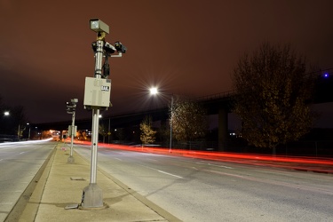
Speed cameras on Benning Road NE
-
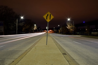
Lane ending sign on Benning Road NE
-
Speed camera on Benning Road NE [01]
![Speed camera on Benning Road NE [01] (2030 visits) Box-style speed camera monitoring eastbound traffic on Benning Road NE.
Ben Schumin is a profession... Speed camera on Benning Road NE [01]](../../../i/upload/2024/07/19/20240719090737-595ded57-cu_s9999x250.jpg)
-
Benning Road NE at Ethel Kennedy Bridge [02]
![Benning Road NE at Ethel Kennedy Bridge [02] (1519 visits) Benning Road NE, facing west, viewed from the median on the Ethel Kennedy Bridge.
Ben Schumin is a ... Benning Road NE at Ethel Kennedy Bridge [02]](../../../i/upload/2024/07/19/20240719090733-9625d547-cu_s9999x250.jpg)
-
Benning Road NE at Ethel Kennedy Bridge [01]
![Benning Road NE at Ethel Kennedy Bridge [01] (1620 visits) Benning Road NE, facing west, viewed from the median on the Ethel Kennedy Bridge.
Ben Schumin is a ... Benning Road NE at Ethel Kennedy Bridge [01]](../../../i/upload/2024/07/19/20240719090729-a6bef2cd-cu_s9999x250.jpg)
-
Camera on tripod photographing Benning Road NE [02]
![Camera on tripod photographing Benning Road NE [02] (3250 visits) Nikon D5300 SLR on a tripod in the median of Benning Road NE.
Ben Schumin is a professional photogr... Camera on tripod photographing Benning Road NE [02]](../../../i/upload/2024/07/19/20240719090725-359408fa-cu_s9999x250.jpg)
-
Camera on tripod photographing Benning Road NE [01]
![Camera on tripod photographing Benning Road NE [01] (6208 visits) Nikon D5300 SLR on a tripod in the median of Benning Road NE as it traverses the Ethel Kennedy Bridg... Camera on tripod photographing Benning Road NE [01]](../../../i/upload/2024/07/19/20240719090721-696b3e26-cu_s9999x250.jpg)
-
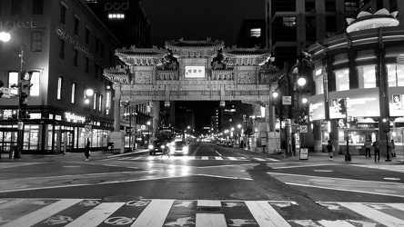
Friendship Archway
