-
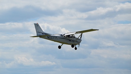
N2277T lands at the Montgomery County Airpark
-
Signage for Maryland Route 418 [02]
![Signage for Maryland Route 418 [02] (881 visits) Signage for Maryland Route 418 at the intersection with Maryland Route 64 in Ringgold.
Ben Schumin ... Signage for Maryland Route 418 [02]](../../../../i/upload/2024/07/19/20240719104708-e45266e6-cu_s9999x250.jpg)
-
N2927Q lands at the Montgomery County Airpark [01]
![N2927Q lands at the Montgomery County Airpark [01] (887 visits) N2927Q, a 1977 Piper PA-28R-201, lands at the Montgomery County Airpark, a small public-use airport ... N2927Q lands at the Montgomery County Airpark [01]](../../../../i/upload/2024/07/19/20240719110500-c0f21af8-cu_s9999x250.jpg)
-
Rocks in the Potomac River [03]
![Rocks in the Potomac River [03] (897 visits) Rocks in the Potomac River near Harpers Ferry. Viewed from the US 340 bridge.
Ben Schumin is a pro... Rocks in the Potomac River [03]](../../../../i/upload/2024/07/19/20240719103343-404e77e5-cu_s9999x250.jpg)
-
Rocks in the Potomac River [02]
![Rocks in the Potomac River [02] (899 visits) Rocks in the Potomac River near Harpers Ferry. Viewed from the US 340 bridge.
Ben Schumin is a pro... Rocks in the Potomac River [02]](../../../../i/upload/2024/07/19/20240719103338-04e1c1e1-cu_s9999x250.jpg)
-
N2927Q lands at the Montgomery County Airpark [02]
![N2927Q lands at the Montgomery County Airpark [02] (899 visits) N2927Q, a 1977 Piper PA-28R-201, lands at the Montgomery County Airpark, a small public-use airport ... N2927Q lands at the Montgomery County Airpark [02]](../../../../i/upload/2024/07/19/20240719110504-ffa5f90a-cu_s9999x250.jpg)
-
Rocks in the Potomac River [04]
![Rocks in the Potomac River [04] (908 visits) Rocks in the Potomac River near Harpers Ferry. Viewed from the US 340 bridge.
Ben Schumin is a pro... Rocks in the Potomac River [04]](../../../../i/upload/2024/07/19/20240719103348-1a3aef78-cu_s9999x250.jpg)
-
N8948C lands at the Montgomery County Airpark

-
Signage for Maryland Route 418 [01]
![Signage for Maryland Route 418 [01] (931 visits) Signage for Maryland Route 418 at the intersection with Maryland Route 64 in Ringgold.
Ben Schumin ... Signage for Maryland Route 418 [01]](../../../../i/upload/2024/07/19/20240719104816-bdac4667-cu_s9999x250.jpg)
-
Signage for Maryland Route 418 [03]
![Signage for Maryland Route 418 [03] (940 visits) Signage for Maryland Route 418 at the intersection with Maryland Route 64 in Ringgold.
Ben Schumin ... Signage for Maryland Route 418 [03]](../../../../i/upload/2024/07/19/20240719104810-b8c9b800-cu_s9999x250.jpg)
-
Rocks in the Potomac River [01]
![Rocks in the Potomac River [01] (954 visits) Rocks in the Potomac River near Harpers Ferry. Viewed from the US 340 bridge.
Ben Schumin is a pro... Rocks in the Potomac River [01]](../../../../i/upload/2024/07/19/20240719103333-6083493b-cu_s9999x250.jpg)
-
Rocks in the Potomac River [05]
![Rocks in the Potomac River [05] (983 visits) Rocks in the Potomac River near Harpers Ferry. Viewed from the US 340 bridge.
Ben Schumin is a pro... Rocks in the Potomac River [05]](../../../../i/upload/2024/07/19/20240719103353-ea395458-cu_s9999x250.jpg)
-
Potomac River from US 340 bridge [03]
![Potomac River from US 340 bridge [03] (983 visits) The Potomac River, viewed from the US 340 bridge between Maryland and Virginia.
Ben Schumin is a pr... Potomac River from US 340 bridge [03]](../../../../i/upload/2024/07/19/20240719103359-b66380e8-cu_s9999x250.jpg)
-
Smithsburg, Maryland and vicinity [01]
![Smithsburg, Maryland and vicinity [01] (987 visits) Aerial view of Smithsburg, Maryland and vicinity.
Ben Schumin is a professional photographer who ca... Smithsburg, Maryland and vicinity [01]](../../../../i/upload/2024/07/19/20240719114610-c1a5ac24-cu_s9999x250.jpg)
-
Signage for Maryland Route 64 [01]
![Signage for Maryland Route 64 [01] (990 visits) Signage for Maryland Route 64 at the intersection with Maryland Route 418 in Ringgold.
Alternate ... Signage for Maryland Route 64 [01]](../../../../i/upload/2024/07/19/20240719104825-f479389a-cu_s9999x250.jpg)
-
Smithsburg, Maryland and vicinity [02]
![Smithsburg, Maryland and vicinity [02] (1020 visits) Aerial view of Smithsburg, Maryland and vicinity.
Ben Schumin is a professional photographer who ca... Smithsburg, Maryland and vicinity [02]](../../../../i/upload/2024/07/19/20240719114614-27b7e477-cu_s9999x250.jpg)
-
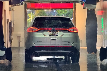
Ford Edge at the car wash
-
Signage for Maryland Route 64 [03]
![Signage for Maryland Route 64 [03] (1053 visits) Signage for Maryland Route 64 at the intersection with Maryland Route 418 in Ringgold.
Ben Schumin ... Signage for Maryland Route 64 [03]](../../../../i/upload/2024/07/19/20240719104750-3ae2140a-cu_s9999x250.jpg)
-
Potomac River from US 340 bridge [04]
![Potomac River from US 340 bridge [04] (1070 visits) The Potomac River, viewed from the US 340 bridge between Maryland and Virginia.
Ben Schumin is a pr... Potomac River from US 340 bridge [04]](../../../../i/upload/2024/07/19/20240719103405-18d26a8b-cu_s9999x250.jpg)
-
Potomac River from US 340 bridge [05]
![Potomac River from US 340 bridge [05] (1081 visits) The Potomac River, viewed from the US 340 bridge between Maryland and Virginia.
Ben Schumin is a pr... Potomac River from US 340 bridge [05]](../../../../i/upload/2024/07/19/20240719103412-5b42c5b9-cu_s9999x250.jpg)
-
Signage for Maryland Route 64 [02]
![Signage for Maryland Route 64 [02] (1088 visits) Signage for Maryland Route 64 at the intersection with Maryland Route 418 in Ringgold.
Alternate ... Signage for Maryland Route 64 [02]](../../../../i/upload/2024/07/19/20240719104820-3e6fadc3-cu_s9999x250.jpg)
-
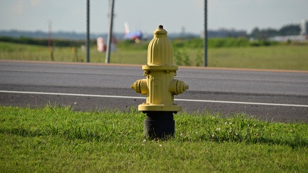
Fire hydrant along Maryland 176
-
N7862A departs from Baltimore-Washington International Airport (BWI) [01]
![N7862A departs from Baltimore-Washington International Airport (BWI) [01] (1192 visits) N7862A, a Boeing 737-79P operated by Southwest Airlines, departs Baltimore-Washington International ... N7862A departs from Baltimore-Washington International Airport (BWI) [01]](../../../../i/upload/2024/07/19/20240719110403-f67e30bb-cu_s9999x250.jpg)
-
N7862A departs from Baltimore-Washington International Airport (BWI) [02]
![N7862A departs from Baltimore-Washington International Airport (BWI) [02] (1206 visits) N7862A, a Boeing 737-79P operated by Southwest Airlines, departs Baltimore-Washington International ... N7862A departs from Baltimore-Washington International Airport (BWI) [02]](../../../../i/upload/2024/07/19/20240719110408-46157dac-cu_s9999x250.jpg)
-
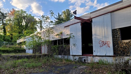
Former Aerolab Supply building
-
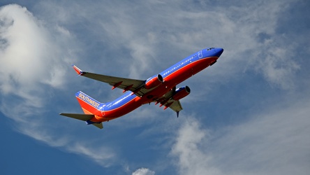
N8625A departs from Baltimore-Washington International Airport (BWI)
-
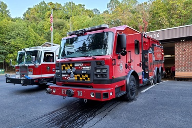
Rosenbauer Commander fire truck at Mt. Aetna fire department
-
N768AX departs from Baltimore-Washington International Airport (BWI)_7393 MOD

-
Burnt Mills Dam [06]
![Burnt Mills Dam [06] (1378 visits) Burnt Mills Dam, on the Northwest Branch of the Anacostia River, along US 29 in Silver Spring, Maryl... Burnt Mills Dam [06]](../../../../i/upload/2024/07/19/20240719101316-964f13d0-cu_s9999x250.jpg)
-
Burnt Mills Dam [07]
![Burnt Mills Dam [07] (1391 visits) Burnt Mills Dam, on the Northwest Branch of the Anacostia River, along US 29 in Silver Spring, Maryl... Burnt Mills Dam [07]](../../../../i/upload/2024/07/19/20240719101310-68ca36a5-cu_s9999x250.jpg)
-
Water tower at Waldorf Volunteer Fire Department [02]
![Water tower at Waldorf Volunteer Fire Department [02] (1394 visits) Water tower located behind the Waldorf Volunteer Fire Department, off of Old Washington Road in Wald... Water tower at Waldorf Volunteer Fire Department [02]](../../../../i/upload/2024/07/19/20240719104949-33d7c516-cu_s9999x250.jpg)
-
Burnt Mills Dam [05]
![Burnt Mills Dam [05] (1399 visits) Burnt Mills Dam, on the Northwest Branch of the Anacostia River, along US 29 in Silver Spring, Maryl... Burnt Mills Dam [05]](../../../../i/upload/2024/07/19/20240719101322-6e7c4f7c-cu_s9999x250.jpg)
-
Burnt Mills Dam [03]
![Burnt Mills Dam [03] (1414 visits) Burnt Mills Dam, on the Northwest Branch of the Anacostia River, along US 29 in Silver Spring, Maryl... Burnt Mills Dam [03]](../../../../i/upload/2024/07/19/20240719101332-fd5d1720-cu_s9999x250.jpg)
-
Water tower at Waldorf Volunteer Fire Department [01]
![Water tower at Waldorf Volunteer Fire Department [01] (1416 visits) Water tower located behind the Waldorf Volunteer Fire Department, off of Old Washington Road in Wald... Water tower at Waldorf Volunteer Fire Department [01]](../../../../i/upload/2024/07/19/20240719104954-a43f3235-cu_s9999x250.jpg)
-
Burnt Mills Dam [04]
![Burnt Mills Dam [04] (1427 visits) Burnt Mills Dam, on the Northwest Branch of the Anacostia River, along US 29 in Silver Spring, Maryl... Burnt Mills Dam [04]](../../../../i/upload/2024/07/19/20240719101327-824e73b8-cu_s9999x250.jpg)
-
Burnt Mills Dam [02]
![Burnt Mills Dam [02] (1462 visits) Burnt Mills Dam, on the Northwest Branch of the Anacostia River, along US 29 in Silver Spring, Maryl... Burnt Mills Dam [02]](../../../../i/upload/2024/07/19/20240719101258-fdd0aceb-cu_s9999x250.jpg)
-
Burnt Mills Dam [08]
![Burnt Mills Dam [08] (1500 visits) Burnt Mills Dam, on the Northwest Branch of the Anacostia River, along US 29 in Silver Spring, Maryl... Burnt Mills Dam [08]](../../../../i/upload/2024/07/19/20240719101304-3d6b6b84-cu_s9999x250.jpg)
-
Brighton Dam [08]
![Brighton Dam [08] (1542 visits) Brighton Dam, which impounds the Patuxent River to form Triadelphia Reservoir. The Patuxent River a... Brighton Dam [08]](../../../../i/upload/2024/07/19/20240719110529-8ccb0379-cu_s9999x250.jpg)
-
Intersection of Routes 64 and 418 [02]
![Intersection of Routes 64 and 418 [02] (1583 visits) Intersection of Routes 64 and 418 in Ringgold, Maryland. The two roads meet at a four-way stop, gov... Intersection of Routes 64 and 418 [02]](../../../../i/upload/2024/07/19/20240719114434-f7b1a6bf-cu_s9999x250.jpg)
-
Brighton Dam [09]
![Brighton Dam [09] (1592 visits) Brighton Dam, which impounds the Patuxent River to form Triadelphia Reservoir. The Patuxent River a... Brighton Dam [09]](../../../../i/upload/2024/07/19/20240719110525-a5167be8-cu_s9999x250.jpg)
-
Neon sign at Giant Food in Laurel, Maryland [01]
![Neon sign at Giant Food in Laurel, Maryland [01] (1614 visits) Vintage neon sign for the Giant Food store at Laurel Shopping Center in Laurel, Maryland.
Ben Schum... Neon sign at Giant Food in Laurel, Maryland [01]](../../../../i/upload/2024/07/19/20240719103953-25c5181a-cu_s9999x250.jpg)
-
Cellular tower in Smithsburg, Maryland [03]
![Cellular tower in Smithsburg, Maryland [03] (1623 visits) Cellular tower owned by American Towers, Inc. along Mapleville Road in Smithsburg, Maryland.
Ben Sc... Cellular tower in Smithsburg, Maryland [03]](../../../../i/upload/2024/07/19/20240719114550-50205a85-cu_s9999x250.jpg)
-
Intersection of Routes 64 and 418 [04]
![Intersection of Routes 64 and 418 [04] (1625 visits) Intersection of Routes 64 and 418 in Ringgold, Maryland. The two roads meet at a four-way stop, gov... Intersection of Routes 64 and 418 [04]](../../../../i/upload/2024/07/19/20240719114443-599ce985-cu_s9999x250.jpg)
-
Neon sign at Giant Food in Laurel, Maryland [04]
![Neon sign at Giant Food in Laurel, Maryland [04] (1626 visits) Vintage neon sign for the Giant Food store at Laurel Shopping Center in Laurel, Maryland.
Ben Schum... Neon sign at Giant Food in Laurel, Maryland [04]](../../../../i/upload/2024/07/19/20240719103939-4e125380-cu_s9999x250.jpg)
-
Neon sign at Giant Food in Laurel, Maryland [07]
![Neon sign at Giant Food in Laurel, Maryland [07] (1651 visits) Vintage neon sign for the Giant Food store at Laurel Shopping Center in Laurel, Maryland.
Ben Schum... Neon sign at Giant Food in Laurel, Maryland [07]](../../../../i/upload/2024/07/19/20240719103929-4009fcd8-cu_s9999x250.jpg)
-
Cellular tower in Smithsburg, Maryland [02]
![Cellular tower in Smithsburg, Maryland [02] (1662 visits) Cellular tower owned by American Towers, Inc. along Mapleville Road in Smithsburg, Maryland.
Ben Sc... Cellular tower in Smithsburg, Maryland [02]](../../../../i/upload/2024/07/19/20240719114546-41047adf-cu_s9999x250.jpg)
-
Cellular tower in Smithsburg, Maryland [05]
![Cellular tower in Smithsburg, Maryland [05] (1680 visits) Cellular tower owned by American Towers, Inc. along Mapleville Road in Smithsburg, Maryland.
Ben Sc... Cellular tower in Smithsburg, Maryland [05]](../../../../i/upload/2024/07/19/20240719114558-024680ac-cu_s9999x250.jpg)
-
Neon sign at Giant Food in Laurel, Maryland [09]
![Neon sign at Giant Food in Laurel, Maryland [09] (1696 visits) Vintage neon sign for the Giant Food store at Laurel Shopping Center in Laurel, Maryland.
Alterna... Neon sign at Giant Food in Laurel, Maryland [09]](../../../../i/upload/2024/07/19/20240719103919-da9d88cc-cu_s9999x250.jpg)
-
Cellular tower in Smithsburg, Maryland [07]
![Cellular tower in Smithsburg, Maryland [07] (1706 visits) Cellular tower owned by American Towers, Inc. along Mapleville Road in Smithsburg, Maryland.
Ben Sc... Cellular tower in Smithsburg, Maryland [07]](../../../../i/upload/2024/07/19/20240719114606-4c08f8f7-cu_s9999x250.jpg)
-
Brighton Dam [10]
![Brighton Dam [10] (1708 visits) Brighton Dam, which impounds the Patuxent River to form Triadelphia Reservoir. The Patuxent River a... Brighton Dam [10]](../../../../i/upload/2024/07/19/20240719110520-89caa82b-cu_s9999x250.jpg)
-
Cellular tower in Smithsburg, Maryland [04]
![Cellular tower in Smithsburg, Maryland [04] (1714 visits) Cellular tower owned by American Towers, Inc. along Mapleville Road in Smithsburg, Maryland.
Ben Sc... Cellular tower in Smithsburg, Maryland [04]](../../../../i/upload/2024/07/19/20240719114554-16372506-cu_s9999x250.jpg)
-
Neon sign at Giant Food in Laurel, Maryland [02]
![Neon sign at Giant Food in Laurel, Maryland [02] (1725 visits) Vintage neon sign for the Giant Food store at Laurel Shopping Center in Laurel, Maryland.
Ben Schum... Neon sign at Giant Food in Laurel, Maryland [02]](../../../../i/upload/2024/07/19/20240719103948-46cddff5-cu_s9999x250.jpg)
-
Intersection of Routes 64 and 418 [03]
![Intersection of Routes 64 and 418 [03] (1736 visits) Intersection of Routes 64 and 418 in Ringgold, Maryland. The two roads meet at a four-way stop, gov... Intersection of Routes 64 and 418 [03]](../../../../i/upload/2024/07/19/20240719114429-bdff0353-cu_s9999x250.jpg)
-
Intersection of Routes 64 and 418 [05]
![Intersection of Routes 64 and 418 [05] (1772 visits) Intersection of Routes 64 and 418 in Ringgold, Maryland. The two roads meet at a four-way stop, gov... Intersection of Routes 64 and 418 [05]](../../../../i/upload/2024/07/19/20240719114438-ea16106f-cu_s9999x250.jpg)
-
Intersection of Routes 64 and 418 [01]
![Intersection of Routes 64 and 418 [01] (1785 visits) Intersection of Routes 64 and 418 in Ringgold, Maryland. The two roads meet at a four-way stop, gov... Intersection of Routes 64 and 418 [01]](../../../../i/upload/2024/07/19/20240719114447-7f7699d7-cu_s9999x250.jpg)
-
Blinker signals in Ringgold, Maryland [05]
![Blinker signals in Ringgold, Maryland [05] (1786 visits) Blinker signals supplementing a four-way stop at the intersection of Maryland Routes 64 and 418 in R... Blinker signals in Ringgold, Maryland [05]](../../../../i/upload/2024/07/19/20240719104755-52af4492-cu_s9999x250.jpg)
-
Blinker signals in Ringgold, Maryland [01]
![Blinker signals in Ringgold, Maryland [01] (1795 visits) Blinker signals supplementing a four-way stop at the intersection of Maryland Routes 64 and 418 in R... Blinker signals in Ringgold, Maryland [01]](../../../../i/upload/2024/07/19/20240719104834-c83d81b6-cu_s9999x250.jpg)
-
Neon sign at Giant Food in Laurel, Maryland [08]
![Neon sign at Giant Food in Laurel, Maryland [08] (1808 visits) Vintage neon sign for the Giant Food store at Laurel Shopping Center in Laurel, Maryland.
Alterna... Neon sign at Giant Food in Laurel, Maryland [08]](../../../../i/upload/2024/07/19/20240719103924-8bb1061e-cu_s9999x250.jpg)
-
Neon sign at Giant Food in Laurel, Maryland [10]
![Neon sign at Giant Food in Laurel, Maryland [10] (1814 visits) Vintage neon sign for the Giant Food store at Laurel Shopping Center in Laurel, Maryland.
Ben Schum... Neon sign at Giant Food in Laurel, Maryland [10]](../../../../i/upload/2024/07/19/20240719103914-98743bec-cu_s9999x250.jpg)
-
Neon sign at Giant Food in Laurel, Maryland [05]
![Neon sign at Giant Food in Laurel, Maryland [05] (1818 visits) Vintage neon sign for the Giant Food store at Laurel Shopping Center in Laurel, Maryland.
Ben Schum... Neon sign at Giant Food in Laurel, Maryland [05]](../../../../i/upload/2024/07/19/20240719103854-6056903e-cu_s9999x250.jpg)
-
Cellular tower in Smithsburg, Maryland [06]
![Cellular tower in Smithsburg, Maryland [06] (1820 visits) Cellular tower owned by American Towers, Inc. along Mapleville Road in Smithsburg, Maryland.
Ben Sc... Cellular tower in Smithsburg, Maryland [06]](../../../../i/upload/2024/07/19/20240719114602-9b9e41ce-cu_s9999x250.jpg)
-
Blinker signals in Ringgold, Maryland [04]
![Blinker signals in Ringgold, Maryland [04] (1837 visits) Blinker signals supplementing a four-way stop at the intersection of Maryland Routes 64 and 418 in R... Blinker signals in Ringgold, Maryland [04]](../../../../i/upload/2024/07/19/20240719104800-95af76d6-cu_s9999x250.jpg)
-
Neon sign at Giant Food in Laurel, Maryland [06]
![Neon sign at Giant Food in Laurel, Maryland [06] (1848 visits) Vintage neon sign for the Giant Food store at Laurel Shopping Center in Laurel, Maryland.
Ben Schum... Neon sign at Giant Food in Laurel, Maryland [06]](../../../../i/upload/2024/07/19/20240719103934-84b3f041-cu_s9999x250.jpg)
-
Blinker signals in Ringgold, Maryland [03]
![Blinker signals in Ringgold, Maryland [03] (1879 visits) Blinker signals supplementing a four-way stop at the intersection of Maryland Routes 64 and 418 in R... Blinker signals in Ringgold, Maryland [03]](../../../../i/upload/2024/07/19/20240719104805-6afa45cc-cu_s9999x250.jpg)
-
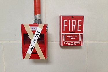
Old and new pull stations at Greenbelt station
-
Blinker signals in Ringgold, Maryland [02]
![Blinker signals in Ringgold, Maryland [02] (1926 visits) Blinker signals supplementing a four-way stop at the intersection of Maryland Routes 64 and 418 in R... Blinker signals in Ringgold, Maryland [02]](../../../../i/upload/2024/07/19/20240719104829-0c02a370-cu_s9999x250.jpg)
-
Neon sign at Giant Food in Laurel, Maryland [11]
![Neon sign at Giant Food in Laurel, Maryland [11] (1943 visits) Vintage neon sign for the Giant Food store at Laurel Shopping Center in Laurel, Maryland.
Ben Schum... Neon sign at Giant Food in Laurel, Maryland [11]](../../../../i/upload/2024/07/19/20240719103909-64e9c191-cu_s9999x250.jpg)
-
Neon sign at Giant Food in Laurel, Maryland [12]
![Neon sign at Giant Food in Laurel, Maryland [12] (2085 visits) Vintage neon sign for the Giant Food store at Laurel Shopping Center in Laurel, Maryland.
Ben Schum... Neon sign at Giant Food in Laurel, Maryland [12]](../../../../i/upload/2024/07/19/20240719103904-318215f7-cu_s9999x250.jpg)
-
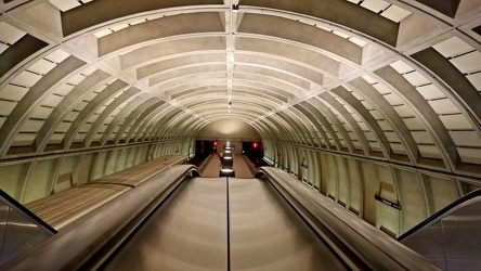
Glenmont station, viewed from escalators
-
Photographing Burnt Mills Dam [01]
![Photographing Burnt Mills Dam [01] (2270 visits) Photographing Burnt Mills Dam near White Oak, Maryland, using a Nikon D5300 camera.
More at The Sch... Photographing Burnt Mills Dam [01]](../../../../i/upload/2024/07/19/20240719101353-cb3c77d4-cu_s9999x250.jpg)
-
Photographing Burnt Mills Dam [02]
![Photographing Burnt Mills Dam [02] (2314 visits) Photographing Burnt Mills Dam near White Oak, Maryland, using a Nikon D5300 camera.
Ben Schumin is ... Photographing Burnt Mills Dam [02]](../../../../i/upload/2024/07/19/20240719101349-5649e11a-cu_s9999x250.jpg)
-
Neon sign at Giant Food in Laurel, Maryland [03]
![Neon sign at Giant Food in Laurel, Maryland [03] (2433 visits) Vintage neon sign for the Giant Food store at Laurel Shopping Center in Laurel, Maryland.
Ben Schum... Neon sign at Giant Food in Laurel, Maryland [03]](../../../../i/upload/2024/07/19/20240719103943-7135247e-cu_s9999x250.jpg)
-
Toys "R" Us trailer in Sandy Hook, Maryland [02]
![Toys "R" Us trailer in Sandy Hook, Maryland [02] (2615 visits) Former Toys "R" Us/Kids "R" Us trailer in the parking lot of a restaurant in Sandy Hook, Maryland.
... Toys "R" Us trailer in Sandy Hook, Maryland [02]](../../../../i/upload/2024/07/19/20240719103325-b7be049d-cu_s9999x250.jpg)
-
Toys "R" Us trailer in Sandy Hook, Maryland [01]
![Toys "R" Us trailer in Sandy Hook, Maryland [01] (2861 visits) Former Toys "R" Us/Kids "R" Us trailer in the parking lot of a restaurant in Sandy Hook, Maryland.
... Toys "R" Us trailer in Sandy Hook, Maryland [01]](../../../../i/upload/2024/07/19/20240719103320-5b64aad7-cu_s9999x250.jpg)
-
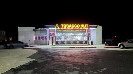
Tobacco Hut in former Sheetz
-
Restroom at New Carrollton station [02]
![Restroom at New Carrollton station [02] (3613 visits) Newly renovated restroom at the New Carrollton Metro station in Prince George's County, Maryland. T... Restroom at New Carrollton station [02]](../../../../i/upload/2024/07/19/20240719120723-921221f1-cu_s9999x250.jpg)
-
Cellular tower in Smithsburg, Maryland [01]
![Cellular tower in Smithsburg, Maryland [01] (4117 visits) Cellular tower owned by American Towers, Inc. along Mapleville Road in Smithsburg, Maryland.
Ben Sc... Cellular tower in Smithsburg, Maryland [01]](../../../../i/upload/2024/07/19/20240719114542-95bd3c13-cu_s9999x250.jpg)
-
Restroom at New Carrollton station [01]
![Restroom at New Carrollton station [01] (4158 visits) Newly renovated restroom at the New Carrollton Metro station in Prince George's County, Maryland. T... Restroom at New Carrollton station [01]](../../../../i/upload/2024/07/19/20240719120718-5aade7e2-cu_s9999x250.jpg)
-
Burnt Mills Dam [01]
![Burnt Mills Dam [01] (5878 visits) Burnt Mills Dam, on the Northwest Branch of the Anacostia River, along US 29 in Silver Spring, Maryl... Burnt Mills Dam [01]](../../../../i/upload/2024/07/19/20240719101253-1d0e8fd4-cu_s9999x250.jpg)
-
Toys "R" Us trailer in Sandy Hook, Maryland [03]
![Toys "R" Us trailer in Sandy Hook, Maryland [03] (6678 visits) Former Toys "R" Us/Kids "R" Us trailer in the parking lot of a restaurant in Sandy Hook, Maryland.
... Toys "R" Us trailer in Sandy Hook, Maryland [03]](../../../../i/upload/2024/07/19/20240719103329-aa90904e-cu_s9999x250.jpg)