-
Green Line train at Fort Totten [03]
![Green Line train at Fort Totten [03] (2023 visits) A Green Line train traveling towards Branch Avenue services Fort Totten station.
Ben Schumin is a p... Green Line train at Fort Totten [03]](../../../../i/upload/2024/07/19/20240719090703-1efc10e3-cu_s9999x250.jpg)
-
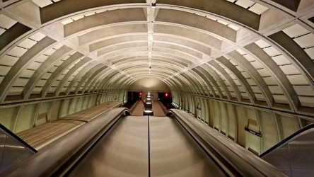
Glenmont station, viewed from escalators
-
Green Line train at Fort Totten [02]
![Green Line train at Fort Totten [02] (1990 visits) A Green Line train traveling towards Greenbelt closes its doors after servicing Fort Totten station.... Green Line train at Fort Totten [02]](../../../../i/upload/2024/07/19/20240719090710-b7717ad9-cu_s9999x250.jpg)
-
Green Line train at Fort Totten [01]
![Green Line train at Fort Totten [01] (1914 visits) A Green Line train traveling towards Greenbelt closes its doors after servicing Fort Totten station.... Green Line train at Fort Totten [01]](../../../../i/upload/2024/07/19/20240719090713-edce4cd0-cu_s9999x250.jpg)
-
Camera on tripod photographing Benning Road NE [01]
![Camera on tripod photographing Benning Road NE [01] (6348 visits) Nikon D5300 SLR on a tripod in the median of Benning Road NE as it traverses the Ethel Kennedy Bridg... Camera on tripod photographing Benning Road NE [01]](../../../../i/upload/2024/07/19/20240719090721-696b3e26-cu_s9999x250.jpg)
-
Camera on tripod photographing Benning Road NE [02]
![Camera on tripod photographing Benning Road NE [02] (3394 visits) Nikon D5300 SLR on a tripod in the median of Benning Road NE.
Ben Schumin is a professional photogr... Camera on tripod photographing Benning Road NE [02]](../../../../i/upload/2024/07/19/20240719090725-359408fa-cu_s9999x250.jpg)
-
Benning Road NE at Ethel Kennedy Bridge [01]
![Benning Road NE at Ethel Kennedy Bridge [01] (1727 visits) Benning Road NE, facing west, viewed from the median on the Ethel Kennedy Bridge.
Ben Schumin is a ... Benning Road NE at Ethel Kennedy Bridge [01]](../../../../i/upload/2024/07/19/20240719090729-a6bef2cd-cu_s9999x250.jpg)
-
Benning Road NE at Ethel Kennedy Bridge [02]
![Benning Road NE at Ethel Kennedy Bridge [02] (1613 visits) Benning Road NE, facing west, viewed from the median on the Ethel Kennedy Bridge.
Ben Schumin is a ... Benning Road NE at Ethel Kennedy Bridge [02]](../../../../i/upload/2024/07/19/20240719090733-9625d547-cu_s9999x250.jpg)
-
Speed camera on Benning Road NE [01]
![Speed camera on Benning Road NE [01] (2271 visits) Box-style speed camera monitoring eastbound traffic on Benning Road NE.
Ben Schumin is a profession... Speed camera on Benning Road NE [01]](../../../../i/upload/2024/07/19/20240719090737-595ded57-cu_s9999x250.jpg)
-
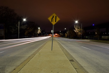
Lane ending sign on Benning Road NE
-
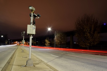
Speed cameras on Benning Road NE
-
Speed camera on Benning Road NE [02]
![Speed camera on Benning Road NE [02] (2274 visits) Box-style speed camera monitoring eastbound traffic on Benning Road NE.
Ben Schumin is a profession... Speed camera on Benning Road NE [02]](../../../../i/upload/2024/07/19/20240719090749-91cc6b64-cu_s9999x250.jpg)
-
Abandoned Days Inn near Warfordsburg, Pennsylvania [24]
![Abandoned Days Inn near Warfordsburg, Pennsylvania [24] (1906 visits) Main sign, facing Interstate 70, at the former Days Inn near Warfordsburg, Pennsylvania.
The 65-r... Abandoned Days Inn near Warfordsburg, Pennsylvania [24]](../../../../i/upload/2024/07/19/20240719091046-1f6c2ec2-cu_s9999x250.jpg)
-
Abandoned Days Inn near Warfordsburg, Pennsylvania [26]
![Abandoned Days Inn near Warfordsburg, Pennsylvania [26] (1983 visits) Main sign, facing Interstate 70, at the former Days Inn near Warfordsburg, Pennsylvania.
The 65-r... Abandoned Days Inn near Warfordsburg, Pennsylvania [26]](../../../../i/upload/2024/07/19/20240719091055-4c9414dd-cu_s9999x250.jpg)
-
Abandoned Days Inn near Warfordsburg, Pennsylvania [25]
![Abandoned Days Inn near Warfordsburg, Pennsylvania [25] (3145 visits) Main sign, facing Interstate 70, at the former Days Inn near Warfordsburg, Pennsylvania.
The 65-roo... Abandoned Days Inn near Warfordsburg, Pennsylvania [25]](../../../../i/upload/2024/07/19/20240719091100-5bc7dd63-cu_s9999x250.jpg)
-
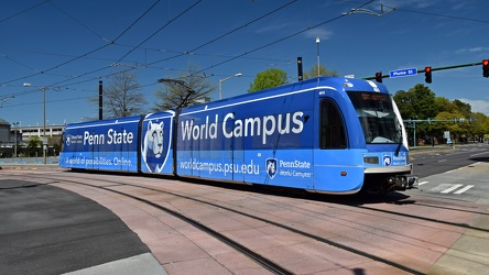
The Tide light rail at St. Paul's Boulevard and East Plume Street
-
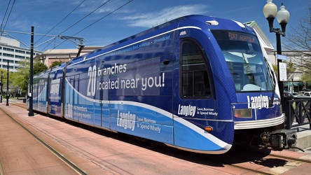
The Tide light rail at MacArthur Square station
-
AT&T Long Lines tower near Williamsburg, Virginia [08]
![AT&T Long Lines tower near Williamsburg, Virginia [08] (2901 visits) AT&T Long Lines tower off of Richmond Road in Lightfoot, Virginia, near Williamsburg.
More at T... AT&T Long Lines tower near Williamsburg, Virginia [08]](../../../../i/upload/2024/07/19/20240719093022-680378a6-cu_s9999x250.jpg)
-
AT&T Long Lines tower near Williamsburg, Virginia [07]
![AT&T Long Lines tower near Williamsburg, Virginia [07] (3074 visits) AT&T Long Lines tower off of Richmond Road in Lightfoot, Virginia, near Williamsburg.
More at T... AT&T Long Lines tower near Williamsburg, Virginia [07]](../../../../i/upload/2024/07/19/20240719093027-294258f8-cu_s9999x250.jpg)
-
AT&T Long Lines tower near Williamsburg, Virginia [06]
![AT&T Long Lines tower near Williamsburg, Virginia [06] (2889 visits) AT&T Long Lines tower off of Richmond Road in Lightfoot, Virginia, near Williamsburg.
More at T... AT&T Long Lines tower near Williamsburg, Virginia [06]](../../../../i/upload/2024/07/19/20240719093032-bb00ade3-cu_s9999x250.jpg)
-
AT&T Long Lines tower near Williamsburg, Virginia [05]
![AT&T Long Lines tower near Williamsburg, Virginia [05] (2964 visits) AT&T Long Lines tower off of Richmond Road in Lightfoot, Virginia, near Williamsburg.
More at T... AT&T Long Lines tower near Williamsburg, Virginia [05]](../../../../i/upload/2024/07/19/20240719093037-ece70e81-cu_s9999x250.jpg)
-
AT&T Long Lines tower near Williamsburg, Virginia [04]
![AT&T Long Lines tower near Williamsburg, Virginia [04] (2969 visits) AT&T Long Lines tower off of Richmond Road in Lightfoot, Virginia, near Williamsburg.
More at T... AT&T Long Lines tower near Williamsburg, Virginia [04]](../../../../i/upload/2024/07/19/20240719093041-e9611c2a-cu_s9999x250.jpg)
-
AT&T Long Lines tower near Williamsburg, Virginia [03]
![AT&T Long Lines tower near Williamsburg, Virginia [03] (5182 visits) AT&T Long Lines tower off of Richmond Road in Lightfoot, Virginia, near Williamsburg.
More at T... AT&T Long Lines tower near Williamsburg, Virginia [03]](../../../../i/upload/2024/07/19/20240719093046-dda5bc61-cu_s9999x250.jpg)
-
AT&T Long Lines tower near Williamsburg, Virginia [02]
![AT&T Long Lines tower near Williamsburg, Virginia [02] (2889 visits) AT&T Long Lines tower off of Richmond Road in Lightfoot, Virginia, near Williamsburg.
More at T... AT&T Long Lines tower near Williamsburg, Virginia [02]](../../../../i/upload/2024/07/19/20240719093052-38df7168-cu_s9999x250.jpg)
-
Goochland rest area, westbound [03]
![Goochland rest area, westbound [03] (1915 visits) Restroom building at the Goochland Safety Rest Area on Interstate 64 westbound in Manakin-Sabot, Vir... Goochland rest area, westbound [03]](../../../../i/upload/2024/07/19/20240719093121-0aeca88a-cu_s9999x250.jpg)
-
Goochland rest area, westbound [02]
![Goochland rest area, westbound [02] (1882 visits) Restroom building at the Goochland Safety Rest Area on Interstate 64 westbound in Manakin-Sabot, Vir... Goochland rest area, westbound [02]](../../../../i/upload/2024/07/19/20240719093125-c06aafb1-cu_s9999x250.jpg)
-
Goochland rest area, westbound [01]
![Goochland rest area, westbound [01] (1890 visits) Restroom building at the Goochland Safety Rest Area on Interstate 64 westbound in Manakin-Sabot, Vir... Goochland rest area, westbound [01]](../../../../i/upload/2024/07/19/20240719093130-dbdf3bb4-cu_s9999x250.jpg)
-
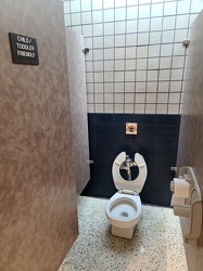
Child/toddler friendly stall at New Kent rest area
-
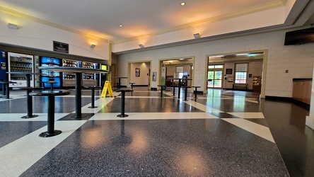
Interior of New Kent rest area, westbound
-
Potomac Avenue station [03]
![Potomac Avenue station [03] (2196 visits) Potomac Avenue, a station on the Blue, Orange, and Silver Lines of the Washington Metro system.
Ben... Potomac Avenue station [03]](../../../../i/upload/2024/07/19/20240719093227-511df0c1-cu_s9999x250.jpg)
-
Potomac Avenue station [02]
![Potomac Avenue station [02] (2036 visits) Potomac Avenue, a station on the Blue, Orange, and Silver Lines of the Washington Metro system.
Ben... Potomac Avenue station [02]](../../../../i/upload/2024/07/19/20240719093232-84dad4e3-cu_s9999x250.jpg)
-
Platform pylon at West Falls Church station [01]
![Platform pylon at West Falls Church station [01] (1689 visits) Lighted platform pylon at West Falls Church, a Washington Metro station in Fairfax County, Virginia.... Platform pylon at West Falls Church station [01]](../../../../i/upload/2024/07/19/20240719093237-32cc7f9a-cu_s9999x250.jpg)
-
Platform pylon at West Falls Church station [02]
![Platform pylon at West Falls Church station [02] (1584 visits) Lighted platform pylon at West Falls Church, a Washington Metro station in Fairfax County, Virginia.... Platform pylon at West Falls Church station [02]](../../../../i/upload/2024/07/19/20240719093243-8507b49e-cu_s9999x250.jpg)
-
Platform pylon at West Falls Church station [03]
![Platform pylon at West Falls Church station [03] (1685 visits) Lighted platform pylon at West Falls Church, a Washington Metro station in Fairfax County, Virginia.... Platform pylon at West Falls Church station [03]](../../../../i/upload/2024/07/19/20240719093249-093357b5-cu_s9999x250.jpg)
-
Platform pylon at West Falls Church station [04]
![Platform pylon at West Falls Church station [04] (1629 visits) Lighted platform pylon at West Falls Church, a Washington Metro station in Fairfax County, Virginia.... Platform pylon at West Falls Church station [04]](../../../../i/upload/2024/07/19/20240719093255-6bd9cf26-cu_s9999x250.jpg)
-
Platform pylon at West Falls Church station [05]
![Platform pylon at West Falls Church station [05] (1713 visits) Lighted platform pylon at West Falls Church, a Washington Metro station in Fairfax County, Virginia.... Platform pylon at West Falls Church station [05]](../../../../i/upload/2024/07/19/20240719093300-b3fdcc26-cu_s9999x250.jpg)
-
Platform pylon at West Falls Church station [06]
![Platform pylon at West Falls Church station [06] (1684 visits) Lighted platform pylon at West Falls Church, a Washington Metro station in Fairfax County, Virginia.... Platform pylon at West Falls Church station [06]](../../../../i/upload/2024/07/19/20240719093305-6be3d2bb-cu_s9999x250.jpg)
-
Ballenger Creek Pike and Mountville Road [01]
![Ballenger Creek Pike and Mountville Road [01] (2275 visits) Stop sign and street signs at the intersection of Ballenger Creek Pike and Mountville Road in Freder... Ballenger Creek Pike and Mountville Road [01]](../../../../i/upload/2024/07/19/20240719093409-99797621-cu_s9999x250.jpg)
-
Ballenger Creek Pike and Mountville Road [02]
![Ballenger Creek Pike and Mountville Road [02] (909 visits) Stop sign and street signs at the intersection of Ballenger Creek Pike and Mountville Road in Freder... Ballenger Creek Pike and Mountville Road [02]](../../../../i/upload/2024/07/19/20240719093414-dcebe5b4-cu_s9999x250.jpg)
-
Speed limit and low ground clearance signs [02]
![Speed limit and low ground clearance signs [02] (926 visits) Speed limit and low ground clearance signs on Mountville Road in Frederick County, Maryland.
Ben Sc... Speed limit and low ground clearance signs [02]](../../../../i/upload/2024/07/19/20240719093418-a79dc78b-cu_s9999x250.jpg)
-
Speed limit and low ground clearance signs [01]
![Speed limit and low ground clearance signs [01] (1228 visits) Speed limit and low ground clearance signs on Mountville Road in Frederick County, Maryland.
Ben Sc... Speed limit and low ground clearance signs [01]](../../../../i/upload/2024/07/19/20240719093423-402fb975-cu_s9999x250.jpg)
-
McPherson Square station [03]
![McPherson Square station [03] (1578 visits) McPherson Square, a station on the Blue, Orange, and Silver Lines of the Washington Metro system.
B... McPherson Square station [03]](../../../../i/upload/2024/07/19/20240719093500-29f20ba4-cu_s9999x250.jpg)
-
McPherson Square station [02]
![McPherson Square station [02] (1603 visits) McPherson Square, a station on the Blue, Orange, and Silver Lines of the Washington Metro system.
B... McPherson Square station [02]](../../../../i/upload/2024/07/19/20240719093505-b54939ae-cu_s9999x250.jpg)
-
Platform reconstruction at West Falls Church station [01]
![Platform reconstruction at West Falls Church station [01] (1918 visits) Early stages of reconstruction work on the platform at West Falls Church station in Fairfax County, ... Platform reconstruction at West Falls Church station [01]](../../../../i/upload/2024/07/19/20240719093509-8e502a6d-cu_s9999x250.jpg)
-
Platform reconstruction at West Falls Church station [02]
![Platform reconstruction at West Falls Church station [02] (1837 visits) Early stages of reconstruction work on the platform at West Falls Church station in Fairfax County, ... Platform reconstruction at West Falls Church station [02]](../../../../i/upload/2024/07/19/20240719093612-fc476a41-cu_s9999x250.jpg)
-
Platform reconstruction at West Falls Church station [03]
![Platform reconstruction at West Falls Church station [03] (1873 visits) Early stages of reconstruction work on the platform at West Falls Church station in Fairfax County, ... Platform reconstruction at West Falls Church station [03]](../../../../i/upload/2024/07/19/20240719093617-0023087e-cu_s9999x250.jpg)
-
Mileage sign on US 1 near Fredericksburg [01]
![Mileage sign on US 1 near Fredericksburg [01] (1692 visits) Mileage sign on southbound US 1 near Fredericksburg, Virginia, giving distances to Thornburg, Ashlan... Mileage sign on US 1 near Fredericksburg [01]](../../../../i/upload/2024/07/19/20240719093650-38b7882f-cu_s9999x250.jpg)
-
Mileage sign on US 1 near Fredericksburg [02]
![Mileage sign on US 1 near Fredericksburg [02] (2890 visits) Mileage sign on southbound US 1 near Fredericksburg, Virginia, giving distances to Thornburg, Ashlan... Mileage sign on US 1 near Fredericksburg [02]](../../../../i/upload/2024/07/19/20240719093655-959f4e08-cu_s9999x250.jpg)
-
Point of Rocks [01]
![Point of Rocks [01] (1829 visits) The Point of Rocks Bridge, which carries US 15 over the Potomac River between Loudoun County, Virgin... Point of Rocks [01]](../../../../i/upload/2024/07/19/20240719101023-a2888aa2-cu_s9999x250.jpg)
-
Point of Rocks [04]
![Point of Rocks [04] (1339 visits) The Potomac River at Point of Rocks, just downstream from the Point of Rocks Bridge.
More at The Sc... Point of Rocks [04]](../../../../i/upload/2024/07/19/20240719101050-da7edd4a-cu_s9999x250.jpg)
-
Former Kmart in Williamsburg, Virginia [01]
![Former Kmart in Williamsburg, Virginia [01] (2362 visits) Former Kmart store at the Kingsgate Green shopping center in Williamsburg, Virginia. This store clo... Former Kmart in Williamsburg, Virginia [01]](../../../../i/upload/2024/07/19/20240719101357-7581da75-cu_s9999x250.jpg)
-
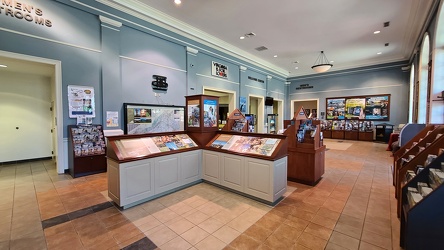
Interior of New Kent rest area, eastbound
-
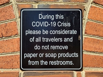
COVID-19 rest area signage
-
Former Kmart in Williamsburg, Virginia [02]
![Former Kmart in Williamsburg, Virginia [02] (2355 visits) Former Kmart store at the Kingsgate Green shopping center in Williamsburg, Virginia. This store clo... Former Kmart in Williamsburg, Virginia [02]](../../../../i/upload/2024/07/19/20240719101443-948dd990-cu_s9999x250.jpg)
-
Former Kmart in Williamsburg, Virginia [03]
![Former Kmart in Williamsburg, Virginia [03] (2311 visits) Former Kmart store at the Kingsgate Green shopping center in Williamsburg, Virginia. This store clo... Former Kmart in Williamsburg, Virginia [03]](../../../../i/upload/2024/07/19/20240719101448-4cdeb02c-cu_s9999x250.jpg)
-
Former Kmart in Williamsburg, Virginia [04]
![Former Kmart in Williamsburg, Virginia [04] (2334 visits) Former Kmart store at the Kingsgate Green shopping center in Williamsburg, Virginia. This store clo... Former Kmart in Williamsburg, Virginia [04]](../../../../i/upload/2024/07/19/20240719101454-0af63f6d-cu_s9999x250.jpg)
-
Former Kmart in Williamsburg, Virginia [05]
![Former Kmart in Williamsburg, Virginia [05] (2416 visits) Former Kmart store at the Kingsgate Green shopping center in Williamsburg, Virginia. This store clo... Former Kmart in Williamsburg, Virginia [05]](../../../../i/upload/2024/07/19/20240719101458-3e483eb7-cu_s9999x250.jpg)
-
Former Kmart in Williamsburg, Virginia [06]
![Former Kmart in Williamsburg, Virginia [06] (2706 visits) Former Kmart store at the Kingsgate Green shopping center in Williamsburg, Virginia. This store clo... Former Kmart in Williamsburg, Virginia [06]](../../../../i/upload/2024/07/19/20240719101504-799df051-cu_s9999x250.jpg)
-
Former Kmart in Williamsburg, Virginia [07]
![Former Kmart in Williamsburg, Virginia [07] (2461 visits) Former Kmart store at the Kingsgate Green shopping center in Williamsburg, Virginia. This store clo... Former Kmart in Williamsburg, Virginia [07]](../../../../i/upload/2024/07/19/20240719101509-76d806a7-cu_s9999x250.jpg)
-
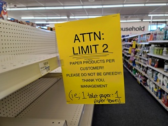
Limit on paper products at CVS
-
AT&T Long Lines tower near Williamsburg, Virginia [01]
![AT&T Long Lines tower near Williamsburg, Virginia [01] (2972 visits) AT&T Long Lines tower off of Richmond Road in Lightfoot, Virginia, near Williamsburg.
More at T... AT&T Long Lines tower near Williamsburg, Virginia [01]](../../../../i/upload/2024/07/19/20240719101637-49b22eb1-cu_s9999x250.jpg)
-
Eastern terminus of US 60 [01]
![Eastern terminus of US 60 [01] (1450 visits) "END" signage on a lamppost at the eastern terminus of US 60 in Virginia Beach, Virginia. ... Eastern terminus of US 60 [01]](../../../../i/upload/2024/07/19/20240719101721-73bf3c40-cu_s9999x250.jpg)
-
Eastern terminus of US 60 [02]
![Eastern terminus of US 60 [02] (1494 visits) "END" signage on a lamppost at the eastern terminus of US 60 in Virginia Beach, Virginia. ... Eastern terminus of US 60 [02]](../../../../i/upload/2024/07/19/20240719101751-9221fd2b-cu_s9999x250.jpg)
-
South Norfolk Jordan Bridge [02]
![South Norfolk Jordan Bridge [02] (2738 visits) The South Norfolk Jordan Bridge, commonly known as simply the Jordan Bridge, is a privately owned an... South Norfolk Jordan Bridge [02]](../../../../i/upload/2024/07/19/20240719101756-29d2696c-cu_s9999x250.jpg)
-
South Norfolk Jordan Bridge [01]
![South Norfolk Jordan Bridge [01] (2943 visits) The South Norfolk Jordan Bridge, commonly known as simply the Jordan Bridge, is a privately owned an... South Norfolk Jordan Bridge [01]](../../../../i/upload/2024/07/19/20240719101801-ff660e17-cu_s9999x250.jpg)
-
South Norfolk Jordan Bridge [04]
![South Norfolk Jordan Bridge [04] (3037 visits) The South Norfolk Jordan Bridge, commonly known as simply the Jordan Bridge, is a privately owned an... South Norfolk Jordan Bridge [04]](../../../../i/upload/2024/07/19/20240719101811-3ebcdc7d-cu_s9999x250.jpg)
-
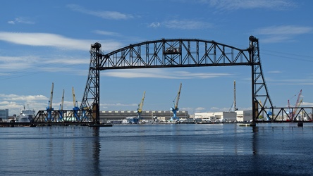
Vertical lift bridge across the Elizabeth River
-
South Norfolk Jordan Bridge [03]
![South Norfolk Jordan Bridge [03] (3022 visits) The South Norfolk Jordan Bridge, commonly known as simply the Jordan Bridge, is a privately owned an... South Norfolk Jordan Bridge [03]](../../../../i/upload/2024/07/19/20240719101829-ff0de2c9-cu_s9999x250.jpg)
-
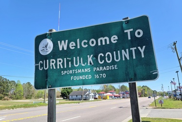
Welcome to Currituck County
-
Interstate 264 after Midtown Tunnel [01]
![Interstate 264 after Midtown Tunnel [01] (1572 visits) Interstate 264 westbound in Portsmouth, Virginia, just after traffic exits the Midtown Tunnel.
More... Interstate 264 after Midtown Tunnel [01]](../../../../i/upload/2024/07/19/20240719101939-87dbaa40-cu_s9999x250.jpg)
-
Interstate 264 after Midtown Tunnel [02]
![Interstate 264 after Midtown Tunnel [02] (1231 visits) Interstate 264 westbound in Portsmouth, Virginia, just after traffic exits the Midtown Tunnel.
More... Interstate 264 after Midtown Tunnel [02]](../../../../i/upload/2024/07/19/20240719101945-e18e6752-cu_s9999x250.jpg)
-
Interstate 264 after Midtown Tunnel [04]
![Interstate 264 after Midtown Tunnel [04] (3007 visits) Interstate 264 westbound in Portsmouth, Virginia, just after traffic exits the Midtown Tunnel.
More... Interstate 264 after Midtown Tunnel [04]](../../../../i/upload/2024/07/19/20240719102003-a91bfec6-cu_s9999x250.jpg)
-
Interstate 264 after Midtown Tunnel [03]
![Interstate 264 after Midtown Tunnel [03] (2835 visits) Interstate 264 westbound in Portsmouth, Virginia, just after traffic exits the Midtown Tunnel.
More... Interstate 264 after Midtown Tunnel [03]](../../../../i/upload/2024/07/19/20240719102008-7fa5c14e-cu_s9999x250.jpg)
-
Honda HR-V in a field near Martinsburg [01]
![Honda HR-V in a field near Martinsburg [01] (1314 visits) My Honda HR-V, parked in a field near Martinsburg, West Virginia.
Alternate treatment of same pho... Honda HR-V in a field near Martinsburg [01]](../../../../i/upload/2024/07/19/20240719103523-10c96365-cu_s9999x250.jpg)
-
Honda HR-V in a field near Martinsburg [02]
![Honda HR-V in a field near Martinsburg [02] (1299 visits) My Honda HR-V, parked in a field near Martinsburg, West Virginia.
Alternate treatment of same pho... Honda HR-V in a field near Martinsburg [02]](../../../../i/upload/2024/07/19/20240719103527-190606e6-cu_s9999x250.jpg)
-
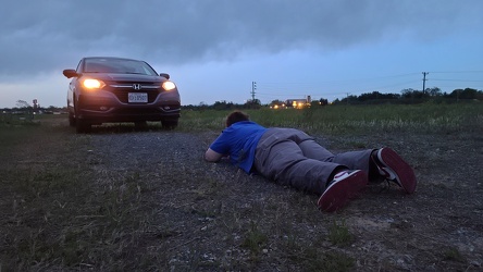
Elyse photographs the HR-V
-
Street sign at Backlick Road and Brookfield Plaza [02]
![Street sign at Backlick Road and Brookfield Plaza [02] (888 visits) Street sign at the Backlick Road entrance to the Brookfield Plaza shopping center in Springfield, Vi... Street sign at Backlick Road and Brookfield Plaza [02]](../../../../i/upload/2024/07/19/20240719104619-1bd22298-cu_s9999x250.jpg)
-
Street sign at Backlick Road and Brookfield Plaza [01]
![Street sign at Backlick Road and Brookfield Plaza [01] (892 visits) Street sign at the Backlick Road entrance to the Brookfield Plaza shopping center.
Alternate trea... Street sign at Backlick Road and Brookfield Plaza [01]](../../../../i/upload/2024/07/19/20240719104624-32193b87-cu_s9999x250.jpg)
-
Signage for Maryland Route 418 [02]
![Signage for Maryland Route 418 [02] (958 visits) Signage for Maryland Route 418 at the intersection with Maryland Route 64 in Ringgold.
Ben Schumin ... Signage for Maryland Route 418 [02]](../../../../i/upload/2024/07/19/20240719104708-e45266e6-cu_s9999x250.jpg)
-
Signage for Maryland Route 64 [03]
![Signage for Maryland Route 64 [03] (1135 visits) Signage for Maryland Route 64 at the intersection with Maryland Route 418 in Ringgold.
Ben Schumin ... Signage for Maryland Route 64 [03]](../../../../i/upload/2024/07/19/20240719104750-3ae2140a-cu_s9999x250.jpg)