-
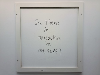
"Is there a microchip in my scalp?"
-
Signal governing exit to siding in White Sulphur Springs

-
CSX Clifton Forge rail yard [10]
![CSX Clifton Forge rail yard [10] (2844 visits) CSX rail yard in Clifton Forge, Virginia. West Ridgeway Street (US 60 Business) runs alongside the ... CSX Clifton Forge rail yard [10]](../../../../i/upload/2024/07/20/20240720022004-482675e4-cu_s9999x250.jpg)
-
Scott Hill Retirement Community [01]
![Scott Hill Retirement Community [01] (1727 visits) Scott Hill, a retirement community along US 60 Business in Clifton Forge, Virginia.
Ben Schumin is ... Scott Hill Retirement Community [01]](../../../../i/upload/2024/07/20/20240720022014-a14a5661-cu_s9999x250.jpg)
-
Scott Hill Retirement Community [02]
![Scott Hill Retirement Community [02] (1666 visits) Scott Hill, a retirement community along US 60 Business in Clifton Forge, Virginia.
Ben Schumin is ... Scott Hill Retirement Community [02]](../../../../i/upload/2024/07/20/20240720022019-7ad47a06-cu_s9999x250.jpg)
-
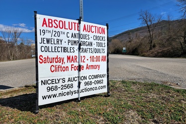
Sign advertising an auction
-
Cans of Campbell's soup [01]
![Cans of Campbell's soup [01] (2432 visits) Rows of Campbell's soup cans on a shelf at La Colonia International Supermarket in Chillum, Maryland... Cans of Campbell's soup [01]](../../../../i/upload/2024/07/20/20240720022344-7c98c4ae-cu_s9999x250.jpg)
-
Cans of Campbell's soup [02]
![Cans of Campbell's soup [02] (2334 visits) Rows of Campbell's soup cans on a shelf at La Colonia International Supermarket in Chillum, Maryland... Cans of Campbell's soup [02]](../../../../i/upload/2024/07/20/20240720022349-ef36fe2f-cu_s9999x250.jpg)
-
Cans of Campbell's soup [03]
![Cans of Campbell's soup [03] (2462 visits) Rows of Campbell's soup cans on a shelf at La Colonia International Supermarket in Chillum, Maryland... Cans of Campbell's soup [03]](../../../../i/upload/2024/07/20/20240720022354-c6fb7e9a-cu_s9999x250.jpg)
-
"Federal" graffiti on a Metro railcar

-
West Broad Street at Staples Mill Road [01]
![West Broad Street at Staples Mill Road [01] (3244 visits) Aerial view of West Broad Street at the intersection with Staples Mill Road in Richmond, Virginia. ... West Broad Street at Staples Mill Road [01]](../../../../i/upload/2024/07/20/20240720091824-c8526d69-cu_s9999x250.jpg)
-
Rejected Krispy Kreme donut [01]
![Rejected Krispy Kreme donut [01] (3921 visits) A donut that was determined to be unfit for sale due to its being misshapen.
More at The Schumin We... Rejected Krispy Kreme donut [01]](../../../../i/upload/2024/07/20/20240720091829-99d9062e-cu_s9999x250.jpg)
-
Rejected Krispy Kreme donut [02]
![Rejected Krispy Kreme donut [02] (3924 visits) A donut that was determined to be unfit for sale due to its being misshapen.
More at The Schumin We... Rejected Krispy Kreme donut [02]](../../../../i/upload/2024/07/20/20240720091930-8fd827e1-cu_s9999x250.jpg)
-
West Broad Street at Staples Mill Road [02]
![West Broad Street at Staples Mill Road [02] (70024 visits) Aerial view of West Broad Street at the intersection with Staples Mill Road in Richmond, Virginia. ... West Broad Street at Staples Mill Road [02]](../../../../i/upload/2024/07/20/20240720092012-1df12de7-cu_s9999x250.jpg)
-
Holiday Inn Express on Staples Mill Road [01]
![Holiday Inn Express on Staples Mill Road [01] (2167 visits) Holiday Inn Express hotel near the intersection of Staples Mill Road and West Broad Street in Richmo... Holiday Inn Express on Staples Mill Road [01]](../../../../i/upload/2024/07/20/20240720092024-05d8fbae-cu_s9999x250.jpg)
-
Holiday Inn Express on Staples Mill Road [02]
![Holiday Inn Express on Staples Mill Road [02] (2190 visits) Holiday Inn Express hotel near the intersection of Staples Mill Road and West Broad Street in Richmo... Holiday Inn Express on Staples Mill Road [02]](../../../../i/upload/2024/07/20/20240720092149-d50c6216-cu_s9999x250.jpg)
-
Sign for Krispy Kreme in Richmond, Virginia [01]
![Sign for Krispy Kreme in Richmond, Virginia [01] (1921 visits) Roadside sign for the Krispy Kreme donut shop on West Broad Street in Richmond, Virginia.
More at... Sign for Krispy Kreme in Richmond, Virginia [01]](../../../../i/upload/2024/07/20/20240720092641-f7684be0-cu_s9999x250.jpg)
-
Sign for Krispy Kreme in Richmond, Virginia [02]
![Sign for Krispy Kreme in Richmond, Virginia [02] (1925 visits) Roadside sign for the Krispy Kreme donut shop on West Broad Street in Richmond, Virginia.
More at T... Sign for Krispy Kreme in Richmond, Virginia [02]](../../../../i/upload/2024/07/20/20240720092647-7853f848-cu_s9999x250.jpg)
-
Sign for Krispy Kreme in Richmond, Virginia [03]
![Sign for Krispy Kreme in Richmond, Virginia [03] (2033 visits) Roadside sign for the Krispy Kreme donut shop on West Broad Street in Richmond, Virginia.
More at T... Sign for Krispy Kreme in Richmond, Virginia [03]](../../../../i/upload/2024/07/20/20240720092652-9fcb1a77-cu_s9999x250.jpg)
-
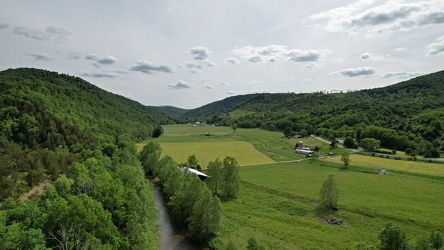
Farmland along the Virginia-West Virginia border
-
Bottle cap embedded in gravel [02]
![Bottle cap embedded in gravel [02] (1699 visits) Bottle cap embedded in the gravel in the parking lot of the Fort Edward Johnson wayside along US 250... Bottle cap embedded in gravel [02]](../../../../i/upload/2024/07/20/20240720093935-e8bfbf5c-cu_s9999x250.jpg)
-
Sign at the border between Augusta and Highland Counties [03]
![Sign at the border between Augusta and Highland Counties [03] (2769 visits) Sign along US 250 at the border between Augusta and Highland Counties in Virginia. The sign is of t... Sign at the border between Augusta and Highland Counties [03]](../../../../i/upload/2024/07/20/20240720093939-e9041290-cu_s9999x250.jpg)
-
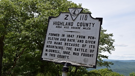
Historical marker for Highland County on US 250
-
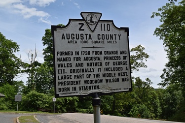
Historical marker for Augusta County on US 250
-
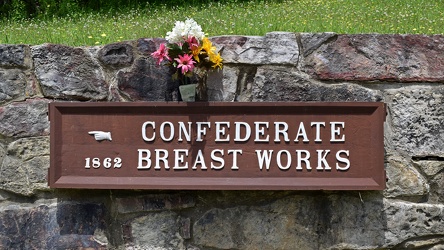
Confederate Breastworks sign
-
Sign at the border between Augusta and Highland Counties [02]
![Sign at the border between Augusta and Highland Counties [02] (2681 visits) Sign along US 250 at the border between Augusta and Highland Counties in Virginia. The sign is stan... Sign at the border between Augusta and Highland Counties [02]](../../../../i/upload/2024/07/20/20240720094001-d7689782-cu_s9999x250.jpg)
-
Bottle cap embedded in gravel [01]
![Bottle cap embedded in gravel [01] (1400 visits) Bottle cap embedded in the gravel in the parking lot of the Fort Edward Johnson wayside along US 250... Bottle cap embedded in gravel [01]](../../../../i/upload/2024/07/20/20240720094006-f13f59c7-cu_s9999x250.jpg)
-
Graffiti at Fort Edward Johnson wayside

-
Sign at the border between Augusta and Highland Counties [01]
![Sign at the border between Augusta and Highland Counties [01] (2780 visits) Sign along US 250 at the border between Augusta and Highland Counties in Virginia. The sign is stan... Sign at the border between Augusta and Highland Counties [01]](../../../../i/upload/2024/07/20/20240720094015-efe93712-cu_s9999x250.jpg)
-
"Littering is illegal" sign [02]
!["Littering is illegal" sign [02] (3042 visits) Sign along US 250 at the border between Augusta and Highland Counties in Virginia, reminding drivers... "Littering is illegal" sign [02]](../../../../i/upload/2024/07/20/20240720094020-cdd34053-cu_s9999x250.jpg)
-
Mountain with a bare patch [02]
![Mountain with a bare patch [02] (984 visits) A mountain with a bare patch along US 220 at the Virginia-West Virginia line in Pendleton County, We... Mountain with a bare patch [02]](../../../../i/upload/2024/07/20/20240720094112-5450497c-cu_s9999x250.jpg)
-
Farm on the Virginia-West Virginia border [01]
![Farm on the Virginia-West Virginia border [01] (2872 visits) Farm on the border between Highland County, Virginia and Pendleton County, West Virginia. The bound... Farm on the Virginia-West Virginia border [01]](../../../../i/upload/2024/07/20/20240720094156-2b1215da-cu_s9999x250.jpg)
-
Mountain with a bare patch [01]
![Mountain with a bare patch [01] (1003 visits) A mountain with a bare patch along US 220 at the Virginia-West Virginia line in Pendleton County, We... Mountain with a bare patch [01]](../../../../i/upload/2024/07/20/20240720094201-2326a710-cu_s9999x250.jpg)
-
Farm on the Virginia-West Virginia border [02]
![Farm on the Virginia-West Virginia border [02] (1294 visits) Farm on the border between Highland County, Virginia and Pendleton County, West Virginia. The bound... Farm on the Virginia-West Virginia border [02]](../../../../i/upload/2024/07/20/20240720094251-b9fab9db-cu_s9999x250.jpg)
-
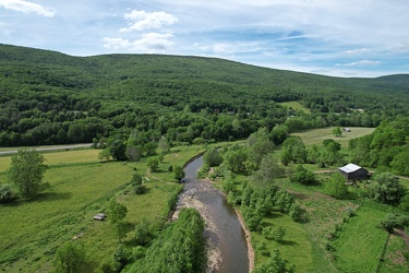
South Branch of the Potomac River
-
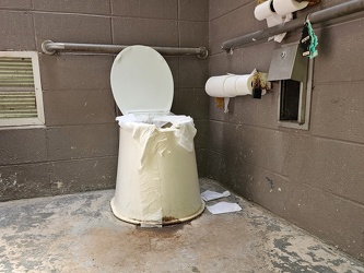
Restroom at Fort Edward Johnson wayside
-
Staunton Mall demolition progress [14]
![Staunton Mall demolition progress [14] (10862 visits) Demolition progress at the former Staunton Mall, on June 4, 2022. Staunton Mall closed at the end o... Staunton Mall demolition progress [14]](../../../../i/upload/2024/07/20/20240720095035-5b83b77b-cu_s9999x250.jpg)
-
Tourist information sign at West Virginia welcome center

-
Flags at West Virginia welcome center

-
Walmart penny wars

-
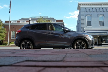
Honda HR-V on West Washington Street
-
Aerial view of Edge Hill Cemetery [02]
![Aerial view of Edge Hill Cemetery [02] (2679 visits) Aerial view of Edge Hill Cemetery, a large cemetery near downtown Charles Town, West Virginia.
Ben ... Aerial view of Edge Hill Cemetery [02]](../../../../i/upload/2024/07/20/20240720103934-2000c9d8-cu_s9999x250.jpg)
-
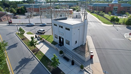
Josephine's of Ranson
-
Aerial view of Charles Town, West Virginia [01]
![Aerial view of Charles Town, West Virginia [01] (1701 visits) Aerial view of Charles Town, West Virginia, from above the downtown area.
Ben Schumin is a professi... Aerial view of Charles Town, West Virginia [01]](../../../../i/upload/2024/07/20/20240720103949-f4346f4c-cu_s9999x250.jpg)
-
West Washington Street in downtown Charles Town

-
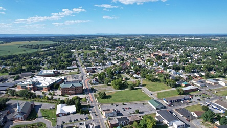
Aerial view of Charles Town and Ranson, West Virginia
-
Aerial view of Edge Hill Cemetery [01]
![Aerial view of Edge Hill Cemetery [01] (2671 visits) Aerial view of Edge Hill Cemetery, a large cemetery near downtown Charles Town, West Virginia.
Ben ... Aerial view of Edge Hill Cemetery [01]](../../../../i/upload/2024/07/20/20240720104003-b256f486-cu_s9999x250.jpg)
-
Aerial view of Charles Town, West Virginia [03]
![Aerial view of Charles Town, West Virginia [03] (2531 visits) Aerial view of Charles Town, West Virginia, from above the downtown area.
Ben Schumin is a professi... Aerial view of Charles Town, West Virginia [03]](../../../../i/upload/2024/07/20/20240720104008-7857c00b-cu_s9999x250.jpg)
-
American Public University System building

-
Aerial view of Charles Town, West Virginia [02]
![Aerial view of Charles Town, West Virginia [02] (1520 visits) Aerial view of Charles Town, West Virginia, from above the downtown area.
Ben Schumin is a professi... Aerial view of Charles Town, West Virginia [02]](../../../../i/upload/2024/07/20/20240720104018-5b8b2fcf-cu_s9999x250.jpg)
-
Locked gate at West Falls Church station

-
Interstate 40 signage on Strawberry Plains Pike [04]
![Interstate 40 signage on Strawberry Plains Pike [04] (1639 visits) Signage for Interstate 40 on Strawberry Plains Pike in Knoxville, Tennessee.
More at The Schumin We... Interstate 40 signage on Strawberry Plains Pike [04]](../../../../i/upload/2024/07/20/20240720113016-e67a2d49-cu_s9999x250.jpg)
-
Intersection of Western Avenue, West Summit Hill Drive, Henley Street, and Broadway [02]
![Intersection of Western Avenue, West Summit Hill Drive, Henley Street, and Broadway [02] (1129 visits) The intersection of Western Avenue, West Summit Hill Drive, Henley Street, and Broadway, viewed from... Intersection of Western Avenue, West Summit Hill Drive, Henley Street, and Broadway [02]](../../../../i/upload/2024/07/20/20240720113032-4b45897b-cu_s9999x250.jpg)
-
Intersection of Western Avenue, West Summit Hill Drive, Henley Street, and Broadway [01]
![Intersection of Western Avenue, West Summit Hill Drive, Henley Street, and Broadway [01] (1356 visits) The intersection of Western Avenue, West Summit Hill Drive, Henley Street, and Broadway, viewed from... Intersection of Western Avenue, West Summit Hill Drive, Henley Street, and Broadway [01]](../../../../i/upload/2024/07/20/20240720113048-94cc1968-cu_s9999x250.jpg)
-
Signage for Interstate 40 on Genesis Road [03]
![Signage for Interstate 40 on Genesis Road [03] (1881 visits) Signage for Interstate 40 on Genesis Road (SR 298) in Crossville, Tennessee, on the northbound appro... Signage for Interstate 40 on Genesis Road [03]](../../../../i/upload/2024/07/20/20240720113157-2a8f17f8-cu_s9999x250.jpg)
-
Signage for Interstate 40 on Genesis Road [01]
![Signage for Interstate 40 on Genesis Road [01] (1439 visits) Signage for Interstate 40 on Genesis Road (SR 298) in Crossville, Tennessee, on the northbound appro... Signage for Interstate 40 on Genesis Road [01]](../../../../i/upload/2024/07/20/20240720113203-80efb67f-cu_s9999x250.jpg)
-
Signage for Interstate 40 on Genesis Road [02]
![Signage for Interstate 40 on Genesis Road [02] (1342 visits) Signage for Interstate 40 on Genesis Road (SR 298) in Crossville, Tennessee, on the northbound appro... Signage for Interstate 40 on Genesis Road [02]](../../../../i/upload/2024/07/20/20240720113208-f46f6ed9-cu_s9999x250.jpg)
-
Interstate 40 signage on Strawberry Plains Pike [01]
![Interstate 40 signage on Strawberry Plains Pike [01] (1568 visits) Signage for Interstate 40 on Strawberry Plains Pike in Knoxville, Tennessee.
More at The Schumin We... Interstate 40 signage on Strawberry Plains Pike [01]](../../../../i/upload/2024/07/20/20240720113318-8b9f3d1e-cu_s9999x250.jpg)
-
Traffic signal at 4th and West Street

-
Interstate 40 signage on Strawberry Plains Pike [05]
![Interstate 40 signage on Strawberry Plains Pike [05] (1524 visits) Signage for Interstate 40 on Strawberry Plains Pike in Knoxville, Tennessee.
More at The Schumin We... Interstate 40 signage on Strawberry Plains Pike [05]](../../../../i/upload/2024/07/20/20240720113416-deebaf69-cu_s9999x250.jpg)
-
Signage for Interstate 40 on Genesis Road [04]
![Signage for Interstate 40 on Genesis Road [04] (1466 visits) Signage for Interstate 40 on Genesis Road (SR 298) in Crossville, Tennessee, on the northbound appro... Signage for Interstate 40 on Genesis Road [04]](../../../../i/upload/2024/07/20/20240720113442-60d8e19a-cu_s9999x250.jpg)
-
Elyse photographs an I-40 shield [01]
![Elyse photographs an I-40 shield [01] (3047 visits) Elyse Horvath photographs an Interstate 40 shield on Strawberry Plains Pike in Knoxville, Tennessee.... Elyse photographs an I-40 shield [01]](../../../../i/upload/2024/07/20/20240720113451-6fde2c8f-cu_s9999x250.jpg)
-
Signage for Interstate 40 on Genesis Road [05]
![Signage for Interstate 40 on Genesis Road [05] (1463 visits) Signage for Interstate 40 on Genesis Road (SR 298) in Crossville, Tennessee, on the northbound appro... Signage for Interstate 40 on Genesis Road [05]](../../../../i/upload/2024/07/20/20240720113518-ecc295f7-cu_s9999x250.jpg)
-
Signage for I-40 on US 321 [01]
![Signage for I-40 on US 321 [01] (1526 visits) Signage for Interstate 40 on US 321 in Lenoir City, Tennessee.
More at The Schumin Web:
www.schumin... Signage for I-40 on US 321 [01]](../../../../i/upload/2024/07/20/20240720113534-f6b63e08-cu_s9999x250.jpg)
-
Interstate 40 signage on Strawberry Plains Pike [02]
![Interstate 40 signage on Strawberry Plains Pike [02] (1603 visits) Signage for Interstate 40 on Strawberry Plains Pike in Knoxville, Tennessee.
More at The Schumin We... Interstate 40 signage on Strawberry Plains Pike [02]](../../../../i/upload/2024/07/20/20240720113550-7381a8d9-cu_s9999x250.jpg)
-
Signage for I-40 on US 321 [02]
![Signage for I-40 on US 321 [02] (1471 visits) Signage for westbound Interstate 40 on US 321 in Lenoir City, Tennessee.
More at The Schumin Web:
w... Signage for I-40 on US 321 [02]](../../../../i/upload/2024/07/20/20240720113601-2fc22be3-cu_s9999x250.jpg)
-
Interstate 40 signage on Strawberry Plains Pike [03]
![Interstate 40 signage on Strawberry Plains Pike [03] (1494 visits) Signage for Interstate 40 on Strawberry Plains Pike in Knoxville, Tennessee.
More at The Schumin We... Interstate 40 signage on Strawberry Plains Pike [03]](../../../../i/upload/2024/07/20/20240720113612-f39ffa17-cu_s9999x250.jpg)
-
Signage for I-40 on US 321 [03]
![Signage for I-40 on US 321 [03] (1561 visits) Signage for westbound Interstate 40 on US 321 in Lenoir City, Tennessee.
Alternate treatment of s... Signage for I-40 on US 321 [03]](../../../../i/upload/2024/07/20/20240720113623-c53233ee-cu_s9999x250.jpg)
-
Interstate 40 signage on Strawberry Plains Pike [06]
![Interstate 40 signage on Strawberry Plains Pike [06] (1580 visits) Signage for Interstate 40 on Strawberry Plains Pike in Knoxville, Tennessee.
More at The Schumin We... Interstate 40 signage on Strawberry Plains Pike [06]](../../../../i/upload/2024/07/20/20240720113634-417d2fb0-cu_s9999x250.jpg)
-
Signage for I-40 on US 321 [04]
![Signage for I-40 on US 321 [04] (1560 visits) Signage for westbound Interstate 40 on US 321 in Lenoir City, Tennessee.
Alternate treatment of s... Signage for I-40 on US 321 [04]](../../../../i/upload/2024/07/20/20240720113639-59f19d46-cu_s9999x250.jpg)
-
Elyse photographs an I-40 shield [02]
![Elyse photographs an I-40 shield [02] (10630 visits) Elyse Horvath takes a selfie with an Interstate 40 shield on Strawberry Plains Pike in Knoxville, Te... Elyse photographs an I-40 shield [02]](../../../../i/upload/2024/07/20/20240720113657-c61efdb7-cu_s9999x250.jpg)
-
Intersection of Western Avenue, West Summit Hill Drive, Henley Street, and Broadway [03]
![Intersection of Western Avenue, West Summit Hill Drive, Henley Street, and Broadway [03] (1272 visits) The intersection of Western Avenue, West Summit Hill Drive, Henley Street, and Broadway, viewed from... Intersection of Western Avenue, West Summit Hill Drive, Henley Street, and Broadway [03]](../../../../i/upload/2024/07/20/20240720114058-5a0ed76f-cu_s9999x250.jpg)
-
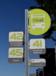
Bus stop at West Church Avenue and South Gay Street
-
620 South Gay Street

-
Former Eagle Springs Winery [02]
![Former Eagle Springs Winery [02] (1547 visits) The former Eagle Springs Winery, on West Dumplin Valley Road in Sevierville, Tennessee. The facilit... Former Eagle Springs Winery [02]](../../../../i/upload/2024/07/20/20240720120233-9e6f6e35-cu_s9999x250.jpg)
-
West Dumplin Valley Road [03]
![West Dumplin Valley Road [03] (2927 visits) Businesses along West Dumplin Valley Road, which runs just south of Interstate 40, in Sevierville, T... West Dumplin Valley Road [03]](../../../../i/upload/2024/07/20/20240720120238-68c626bc-cu_s9999x250.jpg)
-
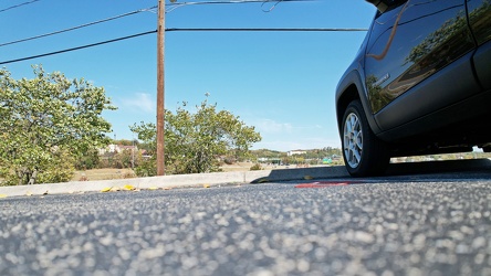
On the ground at Eagle Springs Winery
-
West Dumplin Valley Road [02]
![West Dumplin Valley Road [02] (2905 visits) Businesses along West Dumplin Valley Road, which runs just south of Interstate 40, in Sevierville, T... West Dumplin Valley Road [02]](../../../../i/upload/2024/07/20/20240720120306-846e6bb2-cu_s9999x250.jpg)
-
West Dumplin Valley Road [01]
![West Dumplin Valley Road [01] (2846 visits) Businesses along West Dumplin Valley Road, which runs just south of Interstate 40, in Sevierville, T... West Dumplin Valley Road [01]](../../../../i/upload/2024/07/20/20240720120315-42535554-cu_s9999x250.jpg)
-
Sign for US Route 11E northbound [01]
![Sign for US Route 11E northbound [01] (1620 visits) Reassurance marker for northbound US 11E in Hawkins County, Tennessee. US Route 11 is split into tw... Sign for US Route 11E northbound [01]](../../../../i/upload/2024/07/20/20240720120411-d39e2633-cu_s9999x250.jpg)