-
Water tower off of Highview Court [03]
![Water tower off of Highview Court [03] (2523 visits) Water tower located off of Highview Court in Culpeper, Virginia.
Ben Schumin is a professional phot... Water tower off of Highview Court [03]](../../../../i/upload/2024/07/19/20240719165926-2140749f-cu_s9999x250.jpg)
-
Water tower off of Highview Court [04]
![Water tower off of Highview Court [04] (2457 visits) Water tower located off of Highview Court in Culpeper, Virginia.
Ben Schumin is a professional phot... Water tower off of Highview Court [04]](../../../../i/upload/2024/07/19/20240719165929-ea38ce5a-cu_s9999x250.jpg)
-
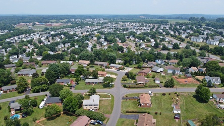
Neighborhood in Culpeper, Virginia
-
Water tower off of Highview Court [05]
![Water tower off of Highview Court [05] (2485 visits) Water tower located off of Highview Court in Culpeper, Virginia.
Ben Schumin is a professional phot... Water tower off of Highview Court [05]](../../../../i/upload/2024/07/19/20240719170010-e6966844-cu_s9999x250.jpg)
-
Water tower off of Highview Court [02]
![Water tower off of Highview Court [02] (2517 visits) Water tower located off of Highview Court in Culpeper, Virginia.
Ben Schumin is a professional phot... Water tower off of Highview Court [02]](../../../../i/upload/2024/07/19/20240719170014-68ef8ad3-cu_s9999x250.jpg)
-
US 29 North, near Hilton Heights Road [01]
![US 29 North, near Hilton Heights Road [01] (3074 visits) US 29 north of Charlottesville, Virginia, near Hilton Heights Road, facing northbound.
Ben Schumin ... US 29 North, near Hilton Heights Road [01]](../../../../i/upload/2024/07/19/20240719171702-b12048d7-cu_s9999x250.jpg)
-
US 29 North, near Hilton Heights Road [02]
![US 29 North, near Hilton Heights Road [02] (3091 visits) US 29 north of Charlottesville, Virginia, near Hilton Heights Road, facing northbound.
Ben Schumin ... US 29 North, near Hilton Heights Road [02]](../../../../i/upload/2024/07/19/20240719171717-5729f873-cu_s9999x250.jpg)
-
DoubleTree Hotel in Charlottesville, Virginia [01]
![DoubleTree Hotel in Charlottesville, Virginia [01] (1911 visits) DoubleTree Hotel on Hilton Heights Road in Charlottesville, Virginia. This hotel was built in 1984,... DoubleTree Hotel in Charlottesville, Virginia [01]](../../../../i/upload/2024/07/19/20240719171742-a365fe34-cu_s9999x250.jpg)
-
US 29 near Woodbrook Drive [01]
![US 29 near Woodbrook Drive [01] (11489 visits) US 29 north of Charlottesville, Virginia, near Woodbrook Drive, facing northbound.
Ben Schumin is a... US 29 near Woodbrook Drive [01]](../../../../i/upload/2024/07/19/20240719171851-a0a055c4-cu_s9999x250.jpg)
-
US 29 near Woodbrook Drive [02]
![US 29 near Woodbrook Drive [02] (11464 visits) US 29 north of Charlottesville, Virginia, near Woodbrook Drive, facing northbound.
Ben Schumin is a... US 29 near Woodbrook Drive [02]](../../../../i/upload/2024/07/19/20240719171856-fdca65ff-cu_s9999x250.jpg)
-
Delaware River between Camden and Philadelphia [04]
![Delaware River between Camden and Philadelphia [04] (3292 visits) The Delaware River, viewed as it passes between Camden, New Jersey (at left) and Philadelphia, Penns... Delaware River between Camden and Philadelphia [04]](../../../../i/upload/2024/07/19/20240719174528-d9bfa370-cu_s9999x250.jpg)
-
Philadelphia waterfront [04]
![Philadelphia waterfront [04] (1820 visits) The waterfront in Philadelphia, Pennsylvania, as viewed from a drone.
Ben Schumin is a professional... Philadelphia waterfront [04]](../../../../i/upload/2024/07/19/20240719174537-031ee3fb-cu_s9999x250.jpg)
-
Philadelphia waterfront [02]
![Philadelphia waterfront [02] (1567 visits) The waterfront in Philadelphia, Pennsylvania, as viewed from a drone.
Ben Schumin is a professional... Philadelphia waterfront [02]](../../../../i/upload/2024/07/19/20240719174557-47b0ba7e-cu_s9999x250.jpg)
-
Philadelphia waterfront [01]
![Philadelphia waterfront [01] (1524 visits) The waterfront in Philadelphia, Pennsylvania, as viewed from a drone.
Ben Schumin is a professional... Philadelphia waterfront [01]](../../../../i/upload/2024/07/19/20240719174617-09388151-cu_s9999x250.jpg)
-
Philadelphia waterfront [03]
![Philadelphia waterfront [03] (1784 visits) The waterfront in Philadelphia, Pennsylvania, as viewed from a drone.
Ben Schumin is a professional... Philadelphia waterfront [03]](../../../../i/upload/2024/07/19/20240719174621-83fb4ac1-cu_s9999x250.jpg)
-
Delaware River between Camden and Philadelphia [03]
![Delaware River between Camden and Philadelphia [03] (3203 visits) The Delaware River, viewed as it passes between Camden, New Jersey (at right) and Philadelphia, Penn... Delaware River between Camden and Philadelphia [03]](../../../../i/upload/2024/07/19/20240719174711-0286240d-cu_s9999x250.jpg)
-
Delaware River between Camden and Philadelphia [01]
![Delaware River between Camden and Philadelphia [01] (3328 visits) The Delaware River, viewed as it passes between Camden, New Jersey (at right) and Philadelphia, Penn... Delaware River between Camden and Philadelphia [01]](../../../../i/upload/2024/07/19/20240719174758-2ba1e8cc-cu_s9999x250.jpg)
-
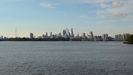
Philadelphia skyline from Camden
-
Delaware River between Camden and Philadelphia [02]
![Delaware River between Camden and Philadelphia [02] (3386 visits) The Delaware River, viewed as it passes between Camden, New Jersey (at right) and Philadelphia, Penn... Delaware River between Camden and Philadelphia [02]](../../../../i/upload/2024/07/19/20240719175026-266821c7-cu_s9999x250.jpg)
-
Madison Hotel [01]
![Madison Hotel [01] (1865 visits) Rooftop sign at the Madison Hotel, an historic hotel near the intersection of Pacific Avenue and Sou... Madison Hotel [01]](../../../../i/upload/2024/07/20/20240720014902-ccc903c3-cu_s9999x250.jpg)
-
Madison Hotel [02]
![Madison Hotel [02] (1870 visits) Penthouse at the Madison Hotel, an historic hotel near the intersection of Pacific Avenue and South ... Madison Hotel [02]](../../../../i/upload/2024/07/20/20240720015507-3572d677-cu_s9999x250.jpg)
-
Atlantic City from Pacific and MLK, facing east [01]
![Atlantic City from Pacific and MLK, facing east [01] (2436 visits) Aerial view of Atlantic City, New Jersey near the intersection of Pacific Avenue and South Dr. Marti... Atlantic City from Pacific and MLK, facing east [01]](../../../../i/upload/2024/07/20/20240720015517-fbb883e1-cu_s9999x250.jpg)
-
Atlantic City from Pacific and MLK, facing east [02]
![Atlantic City from Pacific and MLK, facing east [02] (2301 visits) Aerial view of Atlantic City, New Jersey near the intersection of Pacific Avenue and South Dr. Marti... Atlantic City from Pacific and MLK, facing east [02]](../../../../i/upload/2024/07/20/20240720015522-ed55cdc5-cu_s9999x250.jpg)
-
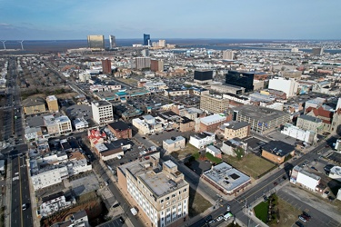
Atlantic City from Pacific and MLK, facing north
-
Roof of 100 Lakeforest Boulevard [01]
![Roof of 100 Lakeforest Boulevard [01] (3949 visits) The roof of 100 Lakeforest Boulevard in Gaithersburg, Maryland. Communications devices, mostly sate... Roof of 100 Lakeforest Boulevard [01]](../../../../i/upload/2024/07/20/20240720020331-daa31706-cu_s9999x250.jpg)
-
Roof of 100 Lakeforest Boulevard [02]
![Roof of 100 Lakeforest Boulevard [02] (4015 visits) The roof of 100 Lakeforest Boulevard in Gaithersburg, Maryland. Communications devices, mostly sate... Roof of 100 Lakeforest Boulevard [02]](../../../../i/upload/2024/07/20/20240720020337-a2fc18d7-cu_s9999x250.jpg)
-
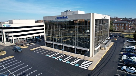
481 North Frederick Avenue
-
Roof of 100 Lakeforest Boulevard [03]
![Roof of 100 Lakeforest Boulevard [03] (4088 visits) The roof of 100 Lakeforest Boulevard in Gaithersburg, Maryland. Communications devices, mostly sate... Roof of 100 Lakeforest Boulevard [03]](../../../../i/upload/2024/07/20/20240720020519-c7df3877-cu_s9999x250.jpg)
-
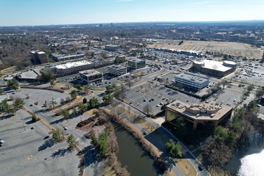
Office buildings along Lakeforest Boulevard and Russell Avenue
-
Delaware River between Camden and Philadelphia [05]
![Delaware River between Camden and Philadelphia [05] (3522 visits) The Delaware River, viewed as it passes between Camden, New Jersey (at right) and Philadelphia, Penn... Delaware River between Camden and Philadelphia [05]](../../../../i/upload/2024/07/20/20240720102512-379be749-cu_s9999x250.jpg)
-
Ocean City from 94th Street, facing north [01]
![Ocean City from 94th Street, facing north [01] (3242 visits) Aerial view of Ocean City, Maryland, viewed from approximately 94th Street, facing north towards Del... Ocean City from 94th Street, facing north [01]](../../../../i/upload/2024/07/20/20240720104406-80df0a79-cu_s9999x250.jpg)
-
Ocean City from 94th Street, facing north [02]
![Ocean City from 94th Street, facing north [02] (3072 visits) Aerial view of Ocean City, Maryland, viewed from approximately 94th Street, facing north towards Del... Ocean City from 94th Street, facing north [02]](../../../../i/upload/2024/07/20/20240720104427-c73095ad-cu_s9999x250.jpg)
-
Ocean City from 94th Street, facing north [03]
![Ocean City from 94th Street, facing north [03] (1710 visits) Aerial view of Ocean City, Maryland, viewed from approximately 94th Street, facing north towards Del... Ocean City from 94th Street, facing north [03]](../../../../i/upload/2024/07/20/20240720104448-80806e9c-cu_s9999x250.jpg)
-
Ocean City from 94th Street, facing south [01]
![Ocean City from 94th Street, facing south [01] (1725 visits) Aerial view of Ocean City, Maryland, viewed from approximately 94th Street, facing south.
Ben Schum... Ocean City from 94th Street, facing south [01]](../../../../i/upload/2024/07/20/20240720104509-718c78fb-cu_s9999x250.jpg)
-
Ocean City from 94th Street, facing south [02]
![Ocean City from 94th Street, facing south [02] (2204 visits) Aerial view of Ocean City, Maryland, viewed from approximately 94th Street, facing south.
Ben Schum... Ocean City from 94th Street, facing south [02]](../../../../i/upload/2024/07/20/20240720104525-1dff6c8d-cu_s9999x250.jpg)
-
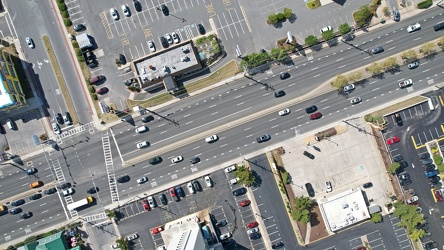
Coastal Highway and 94th Street
-
Verona, Virginia over Mill Place Commerce Park [01]
![Verona, Virginia over Mill Place Commerce Park [01] (1473 visits) Aerial view of Verona, Virginia from above the Mill Place Commerce Park. This photo shows a view fa... Verona, Virginia over Mill Place Commerce Park [01]](../../../../i/upload/2024/07/20/20240720110653-ef33b991-cu_s9999x250.jpg)
-
Verona, Virginia over Mill Place Commerce Park [02]
![Verona, Virginia over Mill Place Commerce Park [02] (1813 visits) Aerial view of Verona, Virginia from above the Mill Place Commerce Park. This view faces approximat... Verona, Virginia over Mill Place Commerce Park [02]](../../../../i/upload/2024/07/20/20240720110708-9b94d246-cu_s9999x250.jpg)
-
Verona, Virginia over Mill Place Commerce Park [05]
![Verona, Virginia over Mill Place Commerce Park [05] (1577 visits) Aerial view of Verona, Virginia from above the Mill Place Commerce Park. This photo shows a view fa... Verona, Virginia over Mill Place Commerce Park [05]](../../../../i/upload/2024/07/20/20240720110734-c309d24d-cu_s9999x250.jpg)
-
Aerial view of downtown Knoxville [02]
![Aerial view of downtown Knoxville [02] (3343 visits) Aerial view of downtown Knoxville, Tennessee, facing the interchange between Interstate 40, Intersta... Aerial view of downtown Knoxville [02]](../../../../i/upload/2024/07/20/20240720114531-474df7df-cu_s9999x250.jpg)
-
Aerial view of downtown Knoxville [03]
![Aerial view of downtown Knoxville [03] (1599 visits) Aerial view of downtown Knoxville, Tennessee, facing approximately east.
More at The Schumin Web:
w... Aerial view of downtown Knoxville [03]](../../../../i/upload/2024/07/20/20240720114541-1d95d752-cu_s9999x250.jpg)
-
Aerial view of downtown Knoxville [04]
![Aerial view of downtown Knoxville [04] (1778 visits) Aerial view of downtown Knoxville, Tennessee, facing approximately east.
More at The Schumin Web:
w... Aerial view of downtown Knoxville [04]](../../../../i/upload/2024/07/20/20240720114552-9e0ead0f-cu_s9999x250.jpg)
-
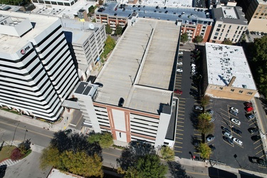
Aerial view of the Langley Garage
-
DoubleTree Hotel in Gaithersburg, Maryland [01]
![DoubleTree Hotel in Gaithersburg, Maryland [01] (1821 visits) The DoubleTree Hotel in Gaithersburg, Maryland, in a building that was originally built to house a M... DoubleTree Hotel in Gaithersburg, Maryland [01]](../../../../i/upload/2024/07/20/20240720122704-5183aec2-cu_s9999x250.jpg)
-
DoubleTree Hotel in Gaithersburg, Maryland [02]
![DoubleTree Hotel in Gaithersburg, Maryland [02] (1864 visits) The DoubleTree Hotel in Gaithersburg, Maryland, in a building that was originally built to house a M... DoubleTree Hotel in Gaithersburg, Maryland [02]](../../../../i/upload/2024/07/20/20240720122710-90dd60cf-cu_s9999x250.jpg)
-
DoubleTree Hotel in Gaithersburg, Maryland [03]
![DoubleTree Hotel in Gaithersburg, Maryland [03] (1863 visits) The DoubleTree Hotel in Gaithersburg, Maryland, in a building that was originally built to house a M... DoubleTree Hotel in Gaithersburg, Maryland [03]](../../../../i/upload/2024/07/20/20240720122715-3ca675b9-cu_s9999x250.jpg)
-
Aerial view of Interstate 70 Breezewood interchange [02]
![Aerial view of Interstate 70 Breezewood interchange [02] (1495 visits) Aerial view of Breezewood interchange for Interstate 70. View facing south.
More at The Schumin We... Aerial view of Interstate 70 Breezewood interchange [02]](../../../../i/upload/2024/07/20/20240720155940-3bb47f5f-cu_s9999x250.jpg)
-
Aerial view of Breezewood, Pennsylvania, May 2023 [04]
![Aerial view of Breezewood, Pennsylvania, May 2023 [04] (3129 visits) Aerial view of Breezewood, Pennsylvania. View facing approximately southeast.
More at The Schumin ... Aerial view of Breezewood, Pennsylvania, May 2023 [04]](../../../../i/upload/2024/07/20/20240720155944-8f8a6623-cu_s9999x250.jpg)
-
Aerial view of Breezewood, Pennsylvania, May 2023 [10]
![Aerial view of Breezewood, Pennsylvania, May 2023 [10] (11466 visits) Aerial view of Breezewood, Pennsylvania. View facing westbound along US 30.
More at The Schumin We... Aerial view of Breezewood, Pennsylvania, May 2023 [10]](../../../../i/upload/2024/07/20/20240720155949-83a44091-cu_s9999x250.jpg)
-
Aerial view of Breezewood, Pennsylvania, May 2023 [08]
![Aerial view of Breezewood, Pennsylvania, May 2023 [08] (3320 visits) Aerial view of Breezewood, Pennsylvania. View facing eastbound along US 30.
More at The Schumin We... Aerial view of Breezewood, Pennsylvania, May 2023 [08]](../../../../i/upload/2024/07/20/20240720155958-63b65479-cu_s9999x250.jpg)
-
Aerial view of Breezewood interchange for the Pennsylvania Turnpike [03]
![Aerial view of Breezewood interchange for the Pennsylvania Turnpike [03] (1497 visits) Aerial view of Breezewood interchange for the Pennsylvania Turnpike. North is to the right.
More a... Aerial view of Breezewood interchange for the Pennsylvania Turnpike [03]](../../../../i/upload/2024/07/20/20240720160003-184a95a1-cu_s9999x250.jpg)
-
Aerial view of Breezewood, Pennsylvania, May 2023 [01]
![Aerial view of Breezewood, Pennsylvania, May 2023 [01] (3175 visits) Aerial view of Breezewood, Pennsylvania. View facing north, showing North Breezewood Road, the SAC ... Aerial view of Breezewood, Pennsylvania, May 2023 [01]](../../../../i/upload/2024/07/20/20240720160008-4d52368a-cu_s9999x250.jpg)
-
Aerial view of Breezewood, Pennsylvania, May 2023 [06]
![Aerial view of Breezewood, Pennsylvania, May 2023 [06] (3187 visits) Aerial view of Breezewood, Pennsylvania. View facing approximately east.
More at The Schumin Web:
... Aerial view of Breezewood, Pennsylvania, May 2023 [06]](../../../../i/upload/2024/07/20/20240720160013-ca57d708-cu_s9999x250.jpg)
-
Aerial view of Breezewood, Pennsylvania, May 2023 [02]
![Aerial view of Breezewood, Pennsylvania, May 2023 [02] (11425 visits) Aerial view of Breezewood, Pennsylvania. View facing westbound along US 30.
More at The Schumin We... Aerial view of Breezewood, Pennsylvania, May 2023 [02]](../../../../i/upload/2024/07/20/20240720160018-4b6e07bf-cu_s9999x250.jpg)
-
Aerial view of Breezewood, Pennsylvania, May 2023 [09]
![Aerial view of Breezewood, Pennsylvania, May 2023 [09] (1770 visits) Aerial view of Breezewood, Pennsylvania. View facing westbound along US 30.
More at The Schumin We... Aerial view of Breezewood, Pennsylvania, May 2023 [09]](../../../../i/upload/2024/07/20/20240720160022-4b37e34b-cu_s9999x250.jpg)
-
Aerial view of Breezewood interchange for the Pennsylvania Turnpike [01]
![Aerial view of Breezewood interchange for the Pennsylvania Turnpike [01] (1549 visits) Aerial view of Breezewood interchange for the Pennsylvania Turnpike. View facing approximately east... Aerial view of Breezewood interchange for the Pennsylvania Turnpike [01]](../../../../i/upload/2024/07/20/20240720160031-be453ab5-cu_s9999x250.jpg)
-
Aerial view of Interstate 70 Breezewood interchange [01]
![Aerial view of Interstate 70 Breezewood interchange [01] (11133 visits) Aerial view of Breezewood interchange for Interstate 70. View facing approximately southeast.
More... Aerial view of Interstate 70 Breezewood interchange [01]](../../../../i/upload/2024/07/20/20240720160036-995b00e0-cu_s9999x250.jpg)
-
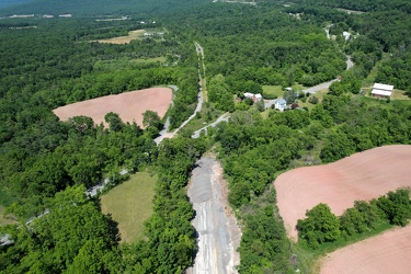
Abandoned Pennsylvania Turnpike and US 30
-
Aerial view of Breezewood, Pennsylvania, May 2023 [05]
![Aerial view of Breezewood, Pennsylvania, May 2023 [05] (11444 visits) Aerial view of Breezewood, Pennsylvania. View facing approximately west.
More at The Schumin Web:
... Aerial view of Breezewood, Pennsylvania, May 2023 [05]](../../../../i/upload/2024/07/20/20240720160044-7a0b5dab-cu_s9999x250.jpg)
-
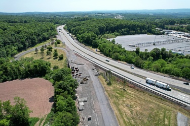
PTC-owned section of abandoned Pennsylvania Turnpike
-
Aerial view of Breezewood interchange for the Pennsylvania Turnpike [02]
![Aerial view of Breezewood interchange for the Pennsylvania Turnpike [02] (1602 visits) Aerial view of Breezewood interchange for the Pennsylvania Turnpike. View facing approximately sout... Aerial view of Breezewood interchange for the Pennsylvania Turnpike [02]](../../../../i/upload/2024/07/20/20240720160211-2048dec3-cu_s9999x250.jpg)
-
Aerial view of Breezewood, Pennsylvania, May 2023 [03]
![Aerial view of Breezewood, Pennsylvania, May 2023 [03] (11545 visits) Aerial view of Breezewood, Pennsylvania. View facing approximately southeast.
More at The Schumin ... Aerial view of Breezewood, Pennsylvania, May 2023 [03]](../../../../i/upload/2024/07/20/20240720160215-e2569c9a-cu_s9999x250.jpg)
-
Aerial view of Breezewood, Pennsylvania, May 2023 [07]
![Aerial view of Breezewood, Pennsylvania, May 2023 [07] (3183 visits) Aerial view of Breezewood, Pennsylvania. View facing eastbound along US 30.
More at The Schumin We... Aerial view of Breezewood, Pennsylvania, May 2023 [07]](../../../../i/upload/2024/07/20/20240720160220-bc205056-cu_s9999x250.jpg)
-
Point State Park [03]
![Point State Park [03] (1459 visits) Aerial view of Point State Park, at the location where the Allegheny and Monongahela Rivers join to ... Point State Park [03]](../../../../i/upload/2024/07/20/20240720160819-8b6d68d8-cu_s9999x250.jpg)
-
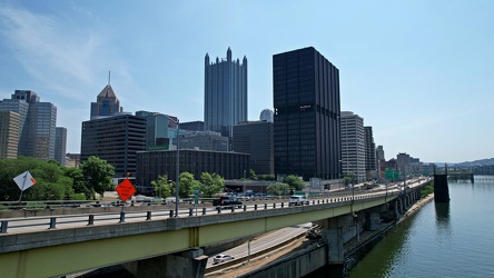
Interstate 376 in downtown Pittsburgh
-
Aerial view of downtown Pittsburgh [02]
![Aerial view of downtown Pittsburgh [02] (1400 visits) Golden Triangle area of Pittsburgh, Pennsylvania, viewed from above the Monongahela River.
More at ... Aerial view of downtown Pittsburgh [02]](../../../../i/upload/2024/07/20/20240720160827-b3b76350-cu_s9999x250.jpg)
-
Point State Park [02]
![Point State Park [02] (1418 visits) Aerial view of Point State Park, at the location where the Allegheny and Monongahela Rivers join to ... Point State Park [02]](../../../../i/upload/2024/07/20/20240720160835-290aa4ba-cu_s9999x250.jpg)
-
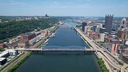
End of the Monongahela River
-
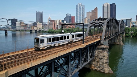
Panhandle Bridge
-
Fort Pitt Bridge [01]
![Fort Pitt Bridge [01] (3045 visits) The Fort Pitt Bridge, which carries traffic on Interstate 376 over the Monongahela River between the... Fort Pitt Bridge [01]](../../../../i/upload/2024/07/20/20240720160848-94f396df-cu_s9999x250.jpg)
-
Aerial view of downtown Pittsburgh [01]
![Aerial view of downtown Pittsburgh [01] (2895 visits) Golden Triangle area of Pittsburgh, Pennsylvania, viewed from above the Monongahela River.
More at ... Aerial view of downtown Pittsburgh [01]](../../../../i/upload/2024/07/20/20240720160852-35325d56-cu_s9999x250.jpg)
-
Fort Pitt Bridge [02]
![Fort Pitt Bridge [02] (3153 visits) The Fort Pitt Bridge, which carries traffic on Interstate 376 over the Monongahela River between the... Fort Pitt Bridge [02]](../../../../i/upload/2024/07/20/20240720160856-8c4cf883-cu_s9999x250.jpg)
-
Oakland neighborhood in Pittsburgh [02]
![Oakland neighborhood in Pittsburgh [02] (2858 visits) Aerial view of the Oakland neighborhood in Pittsburgh, Pennsylvania.
More at The Schumin Web:
www.s... Oakland neighborhood in Pittsburgh [02]](../../../../i/upload/2024/07/20/20240720160905-e13411a5-cu_s9999x250.jpg)
-
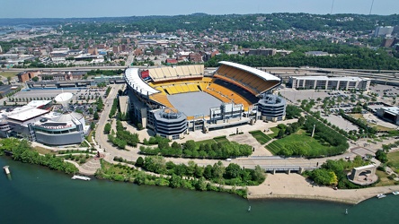
Acrisure Stadium
-
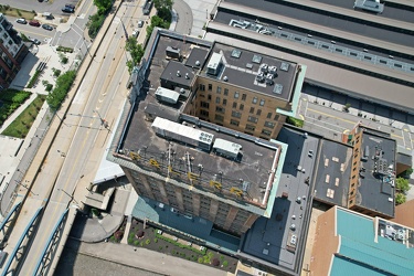
Landmarks Building
-
Point State Park [01]
![Point State Park [01] (1370 visits) Aerial view of Point State Park, at the location where the Allegheny and Monongahela Rivers join to ... Point State Park [01]](../../../../i/upload/2024/07/20/20240720160921-2109340f-cu_s9999x250.jpg)
-
Aerial view of the Cathedral of Learning [01]
![Aerial view of the Cathedral of Learning [01] (2591 visits) Aerial view of the Cathedral of Learning, a 42-story building on the campus of the University of Pit... Aerial view of the Cathedral of Learning [01]](../../../../i/upload/2024/07/20/20240720161042-d85d5a86-cu_s9999x250.jpg)
-
Fort Duquesne Bridge [01]
![Fort Duquesne Bridge [01] (1531 visits) The Fort Duquesne Bridge, which carries traffic on Interstate 279 over the Allegheny River into down... Fort Duquesne Bridge [01]](../../../../i/upload/2024/07/20/20240720161050-098d3868-cu_s9999x250.jpg)
-
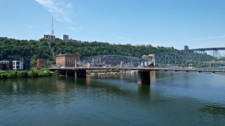
Smithfield Street Bridge
-
Aerial view of the Cathedral of Learning [02]
![Aerial view of the Cathedral of Learning [02] (2721 visits) Aerial view of the Cathedral of Learning, a 42-story building on the campus of the University of Pit... Aerial view of the Cathedral of Learning [02]](../../../../i/upload/2024/07/20/20240720161202-cd6b3ac5-cu_s9999x250.jpg)