-
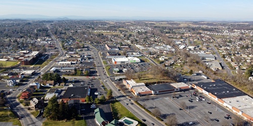
West Main and West Broad Streets, facing west
-
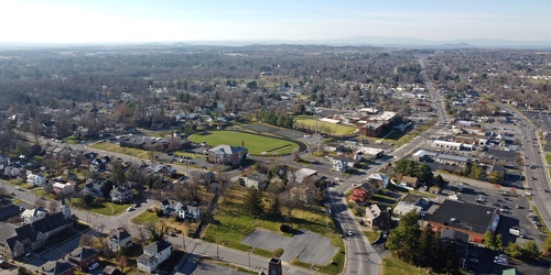
Downtown Waynesboro, Virginia, facing west
-
West Main Street in Waynesboro, Virginia [01]
![West Main Street in Waynesboro, Virginia [01] (55693 visits) View down West Main Street (US 250) in the west end of Waynesboro, Virginia, near the former Kmart b... West Main Street in Waynesboro, Virginia [01]](../../../../i/upload/2024/07/19/20240719164545-b5a50599-cu_s9999x250.jpg)
-
West Main Street in Waynesboro, Virginia [02]
![West Main Street in Waynesboro, Virginia [02] (9981 visits) View down West Main Street (US 250) in the west end of Waynesboro, Virginia, near the Sheetz conveni... West Main Street in Waynesboro, Virginia [02]](../../../../i/upload/2024/07/19/20240719164551-0b8407a8-cu_s9999x250.jpg)
-
West Main Street in Waynesboro, Virginia [03]
![West Main Street in Waynesboro, Virginia [03] (10803 visits) View down West Main Street (US 250) in the west end of Waynesboro, Virginia, near St. Mark's United ... West Main Street in Waynesboro, Virginia [03]](../../../../i/upload/2024/07/19/20240719164555-f7feeafe-cu_s9999x250.jpg)
-
West Main Street in Waynesboro, Virginia [04]
![West Main Street in Waynesboro, Virginia [04] (323326 visits) View down West Main Street (US 250) in the west end of Waynesboro, Virginia, near the Westwood Villa... West Main Street in Waynesboro, Virginia [04]](../../../../i/upload/2024/07/19/20240719164600-4379cef1-cu_s9999x250.jpg)
-
Water tower off of Highview Court [03]
![Water tower off of Highview Court [03] (2523 visits) Water tower located off of Highview Court in Culpeper, Virginia.
Ben Schumin is a professional phot... Water tower off of Highview Court [03]](../../../../i/upload/2024/07/19/20240719165926-2140749f-cu_s9999x250.jpg)
-
Water tower off of Highview Court [04]
![Water tower off of Highview Court [04] (2457 visits) Water tower located off of Highview Court in Culpeper, Virginia.
Ben Schumin is a professional phot... Water tower off of Highview Court [04]](../../../../i/upload/2024/07/19/20240719165929-ea38ce5a-cu_s9999x250.jpg)
-
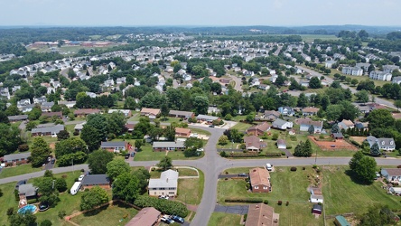
Neighborhood in Culpeper, Virginia
-
Water tower off of Highview Court [05]
![Water tower off of Highview Court [05] (2485 visits) Water tower located off of Highview Court in Culpeper, Virginia.
Ben Schumin is a professional phot... Water tower off of Highview Court [05]](../../../../i/upload/2024/07/19/20240719170010-e6966844-cu_s9999x250.jpg)
-
Water tower off of Highview Court [02]
![Water tower off of Highview Court [02] (2515 visits) Water tower located off of Highview Court in Culpeper, Virginia.
Ben Schumin is a professional phot... Water tower off of Highview Court [02]](../../../../i/upload/2024/07/19/20240719170014-68ef8ad3-cu_s9999x250.jpg)
-
US 29 North, near Hilton Heights Road [01]
![US 29 North, near Hilton Heights Road [01] (3071 visits) US 29 north of Charlottesville, Virginia, near Hilton Heights Road, facing northbound.
Ben Schumin ... US 29 North, near Hilton Heights Road [01]](../../../../i/upload/2024/07/19/20240719171702-b12048d7-cu_s9999x250.jpg)
-
US 29 North, near Hilton Heights Road [02]
![US 29 North, near Hilton Heights Road [02] (3089 visits) US 29 north of Charlottesville, Virginia, near Hilton Heights Road, facing northbound.
Ben Schumin ... US 29 North, near Hilton Heights Road [02]](../../../../i/upload/2024/07/19/20240719171717-5729f873-cu_s9999x250.jpg)
-
DoubleTree Hotel in Charlottesville, Virginia [01]
![DoubleTree Hotel in Charlottesville, Virginia [01] (1907 visits) DoubleTree Hotel on Hilton Heights Road in Charlottesville, Virginia. This hotel was built in 1984,... DoubleTree Hotel in Charlottesville, Virginia [01]](../../../../i/upload/2024/07/19/20240719171742-a365fe34-cu_s9999x250.jpg)
-
US 29 near Woodbrook Drive [01]
![US 29 near Woodbrook Drive [01] (11485 visits) US 29 north of Charlottesville, Virginia, near Woodbrook Drive, facing northbound.
Ben Schumin is a... US 29 near Woodbrook Drive [01]](../../../../i/upload/2024/07/19/20240719171851-a0a055c4-cu_s9999x250.jpg)
-
US 29 near Woodbrook Drive [02]
![US 29 near Woodbrook Drive [02] (11459 visits) US 29 north of Charlottesville, Virginia, near Woodbrook Drive, facing northbound.
Ben Schumin is a... US 29 near Woodbrook Drive [02]](../../../../i/upload/2024/07/19/20240719171856-fdca65ff-cu_s9999x250.jpg)
-
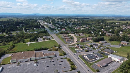
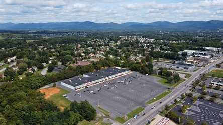
US 250 at the west end of Waynesboro, Virginia
-
Waynesboro, Virginia, facing approximately east
-
Delaware River between Camden and Philadelphia [04]
![Delaware River between Camden and Philadelphia [04] (3287 visits) The Delaware River, viewed as it passes between Camden, New Jersey (at left) and Philadelphia, Penns... Delaware River between Camden and Philadelphia [04]](../../../../i/upload/2024/07/19/20240719174528-d9bfa370-cu_s9999x250.jpg)
-
Philadelphia waterfront [04]
![Philadelphia waterfront [04] (1818 visits) The waterfront in Philadelphia, Pennsylvania, as viewed from a drone.
Ben Schumin is a professional... Philadelphia waterfront [04]](../../../../i/upload/2024/07/19/20240719174537-031ee3fb-cu_s9999x250.jpg)
-
Philadelphia waterfront [02]
![Philadelphia waterfront [02] (1562 visits) The waterfront in Philadelphia, Pennsylvania, as viewed from a drone.
Ben Schumin is a professional... Philadelphia waterfront [02]](../../../../i/upload/2024/07/19/20240719174557-47b0ba7e-cu_s9999x250.jpg)
-
Philadelphia waterfront [01]
![Philadelphia waterfront [01] (1523 visits) The waterfront in Philadelphia, Pennsylvania, as viewed from a drone.
Ben Schumin is a professional... Philadelphia waterfront [01]](../../../../i/upload/2024/07/19/20240719174617-09388151-cu_s9999x250.jpg)
-
Philadelphia waterfront [03]
![Philadelphia waterfront [03] (1781 visits) The waterfront in Philadelphia, Pennsylvania, as viewed from a drone.
Ben Schumin is a professional... Philadelphia waterfront [03]](../../../../i/upload/2024/07/19/20240719174621-83fb4ac1-cu_s9999x250.jpg)
-
Delaware River between Camden and Philadelphia [03]
![Delaware River between Camden and Philadelphia [03] (3198 visits) The Delaware River, viewed as it passes between Camden, New Jersey (at right) and Philadelphia, Penn... Delaware River between Camden and Philadelphia [03]](../../../../i/upload/2024/07/19/20240719174711-0286240d-cu_s9999x250.jpg)
-
Delaware River between Camden and Philadelphia [01]
![Delaware River between Camden and Philadelphia [01] (3325 visits) The Delaware River, viewed as it passes between Camden, New Jersey (at right) and Philadelphia, Penn... Delaware River between Camden and Philadelphia [01]](../../../../i/upload/2024/07/19/20240719174758-2ba1e8cc-cu_s9999x250.jpg)
-
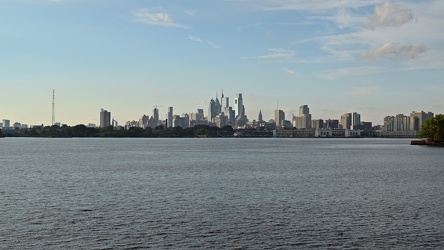
Philadelphia skyline from Camden
-
Delaware River between Camden and Philadelphia [02]
![Delaware River between Camden and Philadelphia [02] (3382 visits) The Delaware River, viewed as it passes between Camden, New Jersey (at right) and Philadelphia, Penn... Delaware River between Camden and Philadelphia [02]](../../../../i/upload/2024/07/19/20240719175026-266821c7-cu_s9999x250.jpg)
-
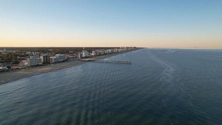
Aerial view of Virginia Beach from over the ocean
-
Madison Hotel [01]
![Madison Hotel [01] (1862 visits) Rooftop sign at the Madison Hotel, an historic hotel near the intersection of Pacific Avenue and Sou... Madison Hotel [01]](../../../../i/upload/2024/07/20/20240720014902-ccc903c3-cu_s9999x250.jpg)
-
Madison Hotel [02]
![Madison Hotel [02] (1869 visits) Penthouse at the Madison Hotel, an historic hotel near the intersection of Pacific Avenue and South ... Madison Hotel [02]](../../../../i/upload/2024/07/20/20240720015507-3572d677-cu_s9999x250.jpg)
-
Atlantic City from Pacific and MLK, facing east [01]
![Atlantic City from Pacific and MLK, facing east [01] (2429 visits) Aerial view of Atlantic City, New Jersey near the intersection of Pacific Avenue and South Dr. Marti... Atlantic City from Pacific and MLK, facing east [01]](../../../../i/upload/2024/07/20/20240720015517-fbb883e1-cu_s9999x250.jpg)
-
Atlantic City from Pacific and MLK, facing east [02]
![Atlantic City from Pacific and MLK, facing east [02] (2295 visits) Aerial view of Atlantic City, New Jersey near the intersection of Pacific Avenue and South Dr. Marti... Atlantic City from Pacific and MLK, facing east [02]](../../../../i/upload/2024/07/20/20240720015522-ed55cdc5-cu_s9999x250.jpg)
-
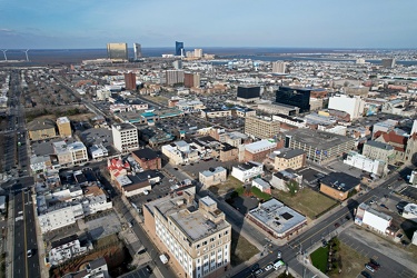
Atlantic City from Pacific and MLK, facing north
-
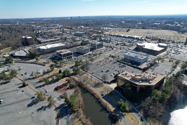
Office buildings along Lakeforest Boulevard and Russell Avenue
-
Church Hill neighborhood [01]
![Church Hill neighborhood [01] (11670 visits) Aerial view of the Church Hill neighborhood of Richmond, Virginia, photographed from west of Interst... Church Hill neighborhood [01]](../../../../i/upload/2024/07/20/20240720092724-5ad8079d-cu_s9999x250.jpg)
-
Church Hill neighborhood [02]
![Church Hill neighborhood [02] (11642 visits) Aerial view of the Church Hill neighborhood of Richmond, Virginia, photographed from west of Interst... Church Hill neighborhood [02]](../../../../i/upload/2024/07/20/20240720092729-c1c95489-cu_s9999x250.jpg)
-
Delaware River between Camden and Philadelphia [05]
![Delaware River between Camden and Philadelphia [05] (3518 visits) The Delaware River, viewed as it passes between Camden, New Jersey (at right) and Philadelphia, Penn... Delaware River between Camden and Philadelphia [05]](../../../../i/upload/2024/07/20/20240720102512-379be749-cu_s9999x250.jpg)
-
Verona, Virginia over Mill Place Commerce Park [01]
![Verona, Virginia over Mill Place Commerce Park [01] (1469 visits) Aerial view of Verona, Virginia from above the Mill Place Commerce Park. This photo shows a view fa... Verona, Virginia over Mill Place Commerce Park [01]](../../../../i/upload/2024/07/20/20240720110653-ef33b991-cu_s9999x250.jpg)
-
Verona, Virginia over Mill Place Commerce Park [02]
![Verona, Virginia over Mill Place Commerce Park [02] (1806 visits) Aerial view of Verona, Virginia from above the Mill Place Commerce Park. This view faces approximat... Verona, Virginia over Mill Place Commerce Park [02]](../../../../i/upload/2024/07/20/20240720110708-9b94d246-cu_s9999x250.jpg)
-
Verona, Virginia over Mill Place Commerce Park [05]
![Verona, Virginia over Mill Place Commerce Park [05] (1571 visits) Aerial view of Verona, Virginia from above the Mill Place Commerce Park. This photo shows a view fa... Verona, Virginia over Mill Place Commerce Park [05]](../../../../i/upload/2024/07/20/20240720110734-c309d24d-cu_s9999x250.jpg)
-
DoubleTree Hotel in Gaithersburg, Maryland [01]
![DoubleTree Hotel in Gaithersburg, Maryland [01] (1820 visits) The DoubleTree Hotel in Gaithersburg, Maryland, in a building that was originally built to house a M... DoubleTree Hotel in Gaithersburg, Maryland [01]](../../../../i/upload/2024/07/20/20240720122704-5183aec2-cu_s9999x250.jpg)
-
DoubleTree Hotel in Gaithersburg, Maryland [02]
![DoubleTree Hotel in Gaithersburg, Maryland [02] (1863 visits) The DoubleTree Hotel in Gaithersburg, Maryland, in a building that was originally built to house a M... DoubleTree Hotel in Gaithersburg, Maryland [02]](../../../../i/upload/2024/07/20/20240720122710-90dd60cf-cu_s9999x250.jpg)
-
DoubleTree Hotel in Gaithersburg, Maryland [03]
![DoubleTree Hotel in Gaithersburg, Maryland [03] (1862 visits) The DoubleTree Hotel in Gaithersburg, Maryland, in a building that was originally built to house a M... DoubleTree Hotel in Gaithersburg, Maryland [03]](../../../../i/upload/2024/07/20/20240720122715-3ca675b9-cu_s9999x250.jpg)
-
Point State Park [03]
![Point State Park [03] (1458 visits) Aerial view of Point State Park, at the location where the Allegheny and Monongahela Rivers join to ... Point State Park [03]](../../../../i/upload/2024/07/20/20240720160819-8b6d68d8-cu_s9999x250.jpg)
-
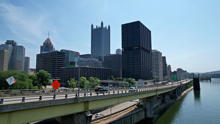
Interstate 376 in downtown Pittsburgh
-
Aerial view of downtown Pittsburgh [02]
![Aerial view of downtown Pittsburgh [02] (1399 visits) Golden Triangle area of Pittsburgh, Pennsylvania, viewed from above the Monongahela River.
More at ... Aerial view of downtown Pittsburgh [02]](../../../../i/upload/2024/07/20/20240720160827-b3b76350-cu_s9999x250.jpg)
-
Point State Park [02]
![Point State Park [02] (1417 visits) Aerial view of Point State Park, at the location where the Allegheny and Monongahela Rivers join to ... Point State Park [02]](../../../../i/upload/2024/07/20/20240720160835-290aa4ba-cu_s9999x250.jpg)
-
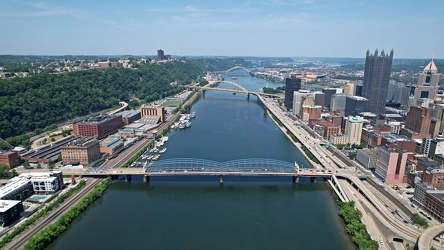
End of the Monongahela River
-
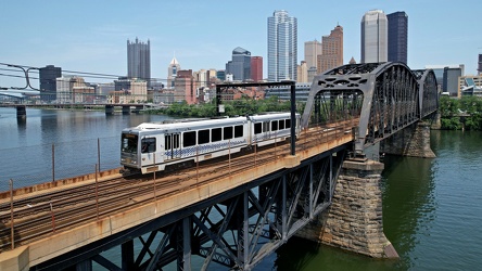
Panhandle Bridge
-
Fort Pitt Bridge [01]
![Fort Pitt Bridge [01] (3045 visits) The Fort Pitt Bridge, which carries traffic on Interstate 376 over the Monongahela River between the... Fort Pitt Bridge [01]](../../../../i/upload/2024/07/20/20240720160848-94f396df-cu_s9999x250.jpg)
-
Aerial view of downtown Pittsburgh [01]
![Aerial view of downtown Pittsburgh [01] (2895 visits) Golden Triangle area of Pittsburgh, Pennsylvania, viewed from above the Monongahela River.
More at ... Aerial view of downtown Pittsburgh [01]](../../../../i/upload/2024/07/20/20240720160852-35325d56-cu_s9999x250.jpg)
-
Fort Pitt Bridge [02]
![Fort Pitt Bridge [02] (3153 visits) The Fort Pitt Bridge, which carries traffic on Interstate 376 over the Monongahela River between the... Fort Pitt Bridge [02]](../../../../i/upload/2024/07/20/20240720160856-8c4cf883-cu_s9999x250.jpg)
-
Oakland neighborhood in Pittsburgh [02]
![Oakland neighborhood in Pittsburgh [02] (2858 visits) Aerial view of the Oakland neighborhood in Pittsburgh, Pennsylvania.
More at The Schumin Web:
www.s... Oakland neighborhood in Pittsburgh [02]](../../../../i/upload/2024/07/20/20240720160905-e13411a5-cu_s9999x250.jpg)
-
Acrisure Stadium
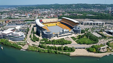
-
Landmarks Building
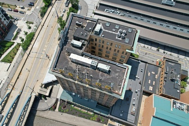
-
Point State Park [01]
![Point State Park [01] (1369 visits) Aerial view of Point State Park, at the location where the Allegheny and Monongahela Rivers join to ... Point State Park [01]](../../../../i/upload/2024/07/20/20240720160921-2109340f-cu_s9999x250.jpg)
-
Aerial view of the Cathedral of Learning [01]
![Aerial view of the Cathedral of Learning [01] (2589 visits) Aerial view of the Cathedral of Learning, a 42-story building on the campus of the University of Pit... Aerial view of the Cathedral of Learning [01]](../../../../i/upload/2024/07/20/20240720161042-d85d5a86-cu_s9999x250.jpg)
-
Fort Duquesne Bridge [01]
![Fort Duquesne Bridge [01] (1531 visits) The Fort Duquesne Bridge, which carries traffic on Interstate 279 over the Allegheny River into down... Fort Duquesne Bridge [01]](../../../../i/upload/2024/07/20/20240720161050-098d3868-cu_s9999x250.jpg)
-
Smithfield Street Bridge
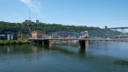
-
Aerial view of the Cathedral of Learning [02]
![Aerial view of the Cathedral of Learning [02] (2719 visits) Aerial view of the Cathedral of Learning, a 42-story building on the campus of the University of Pit... Aerial view of the Cathedral of Learning [02]](../../../../i/upload/2024/07/20/20240720161202-cd6b3ac5-cu_s9999x250.jpg)
-
Oakland neighborhood in Pittsburgh [01]
![Oakland neighborhood in Pittsburgh [01] (2853 visits) Aerial view of the Oakland neighborhood in Pittsburgh, Pennsylvania.
More at The Schumin Web:
www.s... Oakland neighborhood in Pittsburgh [01]](../../../../i/upload/2024/07/20/20240720161207-8545eba5-cu_s9999x250.jpg)
-
Aerial view of the Cathedral of Learning [03]
![Aerial view of the Cathedral of Learning [03] (2706 visits) Aerial view of the Cathedral of Learning, a 42-story building on the campus of the University of Pit... Aerial view of the Cathedral of Learning [03]](../../../../i/upload/2024/07/20/20240720161219-7d7180de-cu_s9999x250.jpg)
-
Aerial view of the Cathedral of Learning [04]
![Aerial view of the Cathedral of Learning [04] (2607 visits) Aerial view of the Cathedral of Learning, a 42-story building on the campus of the University of Pit... Aerial view of the Cathedral of Learning [04]](../../../../i/upload/2024/07/20/20240720161311-ac0cf271-cu_s9999x250.jpg)
-
Aerial view of the Cathedral of Learning [05]
![Aerial view of the Cathedral of Learning [05] (2672 visits) Aerial view of the Cathedral of Learning, a 42-story building on the campus of the University of Pit... Aerial view of the Cathedral of Learning [05]](../../../../i/upload/2024/07/20/20240720161336-9b38bf69-cu_s9999x250.jpg)
-
Aerial view of the Cathedral of Learning [06]
![Aerial view of the Cathedral of Learning [06] (2693 visits) Aerial view of the Cathedral of Learning, a 42-story building on the campus of the University of Pit... Aerial view of the Cathedral of Learning [06]](../../../../i/upload/2024/07/20/20240720161352-ef9aff34-cu_s9999x250.jpg)
-
Aerial view of the Cathedral of Learning [07]
![Aerial view of the Cathedral of Learning [07] (2774 visits) Aerial view of the Cathedral of Learning, a 42-story building on the campus of the University of Pit... Aerial view of the Cathedral of Learning [07]](../../../../i/upload/2024/07/20/20240720161414-4b0c53ca-cu_s9999x250.jpg)
-
Aerial view from Clark Street Beach, facing south [01]
![Aerial view from Clark Street Beach, facing south [01] (977 visits) Aerial view over Lake Michigan from near Clark Street Beach in Evanston, Illinois. View facing appr... Aerial view from Clark Street Beach, facing south [01]](../../../../i/upload/2024/11/09/20241109111014-d364cdbf-cu_s9999x250.jpg)
-
Aerial view from Clark Street Beach, facing south [02]
![Aerial view from Clark Street Beach, facing south [02] (922 visits) Aerial view over Lake Michigan from near Clark Street Beach in Evanston, Illinois. View facing appr... Aerial view from Clark Street Beach, facing south [02]](../../../../i/upload/2024/11/09/20241109111017-9276cd78-cu_s9999x250.jpg)
-
Aerial view from Clark Street Beach, facing south [03]
![Aerial view from Clark Street Beach, facing south [03] (2078 visits) Aerial view over Lake Michigan from near Clark Street Beach in Evanston, Illinois. View facing appr... Aerial view from Clark Street Beach, facing south [03]](../../../../i/upload/2024/11/09/20241109111021-2a94ef25-cu_s9999x250.jpg)
-
Aerial view from Clark Street Beach, facing south [04]
![Aerial view from Clark Street Beach, facing south [04] (2144 visits) Aerial view over Lake Michigan from near Clark Street Beach in Evanston, Illinois. View facing appr... Aerial view from Clark Street Beach, facing south [04]](../../../../i/upload/2024/11/09/20241109111026-85a83874-cu_s9999x250.jpg)
-
Aerial view from Clark Street Beach, facing south [05]
![Aerial view from Clark Street Beach, facing south [05] (928 visits) Aerial view over Lake Michigan from near Clark Street Beach in Evanston, Illinois. View facing appr... Aerial view from Clark Street Beach, facing south [05]](../../../../i/upload/2024/11/09/20241109111030-e05630ba-cu_s9999x250.jpg)
-
Aerial view of Myrtle Beach, South Carolina [01]
![Aerial view of Myrtle Beach, South Carolina [01] (883 visits) Aerial view of Myrtle Beach, South Carolina. This photo depicts a surface parking lot between Ocean... Aerial view of Myrtle Beach, South Carolina [01]](../../../../i/upload/2025/01/16/20250116011517-f8bb6ab8-cu_s9999x250.jpg)
-
Aerial view of Myrtle Beach, South Carolina [02]
![Aerial view of Myrtle Beach, South Carolina [02] (1011 visits) Aerial view of Myrtle Beach, South Carolina. This photo depicts the city from approximately 16th Av... Aerial view of Myrtle Beach, South Carolina [02]](../../../../i/upload/2025/01/16/20250116011527-f000c002-cu_s9999x250.jpg)
-
Aerial view of Myrtle Beach, South Carolina [03]
![Aerial view of Myrtle Beach, South Carolina [03] (1013 visits) Aerial view of Myrtle Beach, South Carolina. This photo depicts the Hilton Grand Vacations facility... Aerial view of Myrtle Beach, South Carolina [03]](../../../../i/upload/2025/01/16/20250116011535-e4909d01-cu_s9999x250.jpg)
-
Aerial view of Myrtle Beach, South Carolina [04]
![Aerial view of Myrtle Beach, South Carolina [04] (740 visits) Aerial view of Myrtle Beach, South Carolina. This photo depicts the coastline, facing approximately... Aerial view of Myrtle Beach, South Carolina [04]](../../../../i/upload/2025/01/16/20250116011543-c0352f82-cu_s9999x250.jpg)
-
Aerial view of Myrtle Beach, South Carolina [05]
![Aerial view of Myrtle Beach, South Carolina [05] (751 visits) Aerial view of Myrtle Beach, South Carolina. This photo depicts the coastline, facing approximately... Aerial view of Myrtle Beach, South Carolina [05]](../../../../i/upload/2025/01/16/20250116011549-fb2ac6b0-cu_s9999x250.jpg)
-
Aerial view of Myrtle Beach, South Carolina [06]
![Aerial view of Myrtle Beach, South Carolina [06] (780 visits) Aerial view of Myrtle Beach, South Carolina. This photo depicts the coastline, facing approximately... Aerial view of Myrtle Beach, South Carolina [06]](../../../../i/upload/2025/01/16/20250116011556-58eeb392-cu_s9999x250.jpg)
-
Aerial view of Myrtle Beach, South Carolina [07]
![Aerial view of Myrtle Beach, South Carolina [07] (970 visits) Aerial view of Myrtle Beach, South Carolina. This photo depicts the coastline, facing approximately... Aerial view of Myrtle Beach, South Carolina [07]](../../../../i/upload/2025/01/16/20250116011602-0271fcdd-cu_s9999x250.jpg)
-
Aerial view of Myrtle Beach, South Carolina [08]
![Aerial view of Myrtle Beach, South Carolina [08] (782 visits) Aerial view of Myrtle Beach, South Carolina. This photo depicts the coastline, facing approximately... Aerial view of Myrtle Beach, South Carolina [08]](../../../../i/upload/2025/01/16/20250116011610-80555640-cu_s9999x250.jpg)
-
Aerial view of Myrtle Beach, South Carolina [09]
![Aerial view of Myrtle Beach, South Carolina [09] (797 visits) Aerial view of Myrtle Beach, South Carolina. This photo depicts the coastline, facing approximately... Aerial view of Myrtle Beach, South Carolina [09]](../../../../i/upload/2025/01/16/20250116011616-86a3a1ed-cu_s9999x250.jpg)