-
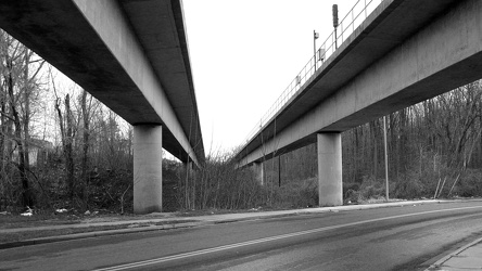
Metro tracks over Cabin Branch Road
-
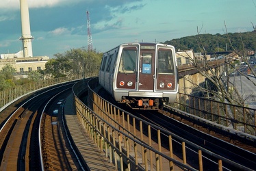
WMATA Breda 3000-Series car on D Route Bridge
-
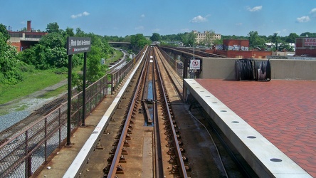
Track at Rhode Island Avenue, facing north
-
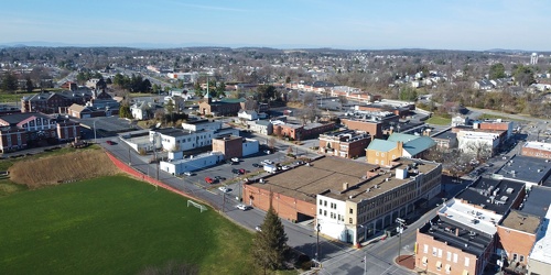
Downtown Waynesboro, Virginia near South Wayne Avenue and Federal Street
-
Downtown Waynesboro, Virginia, near Kroger store
-
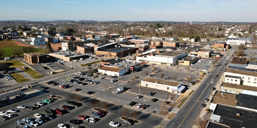
Downtown Waynesboro, Virginia above Church Street and Federal Street
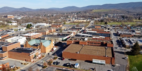
-
View down Lew Dewitt Boulevard
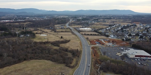
-
Richmond Avenue in Staunton, Virginia [01]
![Richmond Avenue in Staunton, Virginia [01] (66771 visits) Aerial view of Richmond Avenue (US 250) in Staunton, Virginia, near the intersection with Frontier D... Richmond Avenue in Staunton, Virginia [01]](../../../i/upload/2024/07/19/20240719161158-ddf9fe35-cu_s9999x250.jpg)
-
Richmond Avenue in Staunton, Virginia [02]
![Richmond Avenue in Staunton, Virginia [02] (66854 visits) Aerial view of Richmond Avenue (US 250) in Staunton, Virginia, near the intersection with Frontier D... Richmond Avenue in Staunton, Virginia [02]](../../../i/upload/2024/07/19/20240719161203-233bb776-cu_s9999x250.jpg)
-
Richmond Avenue in Staunton, Virginia [03]
![Richmond Avenue in Staunton, Virginia [03] (66670 visits) Aerial view of Richmond Avenue (US 250) in Staunton, Virginia, near the intersection with Community ... Richmond Avenue in Staunton, Virginia [03]](../../../i/upload/2024/07/19/20240719161212-297c1b53-cu_s9999x250.jpg)
-
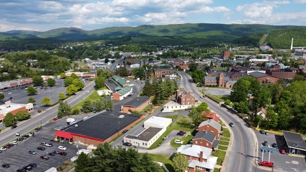
West Main and West Broad Streets in downtown Waynesboro
-
Montgomery Village, facing approximately west [01]
![Montgomery Village, facing approximately west [01] (2118 visits) View of Montgomery Village and beyond, facing approximately west, from above the Lake Marion Communi... Montgomery Village, facing approximately west [01]](../../../i/upload/2024/07/19/20240719165409-be458691-cu_s9999x250.jpg)
-
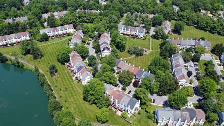
The Reach
-
Montgomery Village, facing approximately west [02]
![Montgomery Village, facing approximately west [02] (1849 visits) View of Montgomery Village and beyond, facing approximately west, from above the Lake Marion Communi... Montgomery Village, facing approximately west [02]](../../../i/upload/2024/07/19/20240719165500-7c01f836-cu_s9999x250.jpg)
-
US 29 North, near Hilton Heights Road [01]
![US 29 North, near Hilton Heights Road [01] (3023 visits) US 29 north of Charlottesville, Virginia, near Hilton Heights Road, facing northbound.
Ben Schumin ... US 29 North, near Hilton Heights Road [01]](../../../i/upload/2024/07/19/20240719171702-b12048d7-cu_s9999x250.jpg)
-
US 29 North, near Hilton Heights Road [02]
![US 29 North, near Hilton Heights Road [02] (3036 visits) US 29 north of Charlottesville, Virginia, near Hilton Heights Road, facing northbound.
Ben Schumin ... US 29 North, near Hilton Heights Road [02]](../../../i/upload/2024/07/19/20240719171717-5729f873-cu_s9999x250.jpg)
-
Walmart in Charlottesville, Virginia [01]
![Walmart in Charlottesville, Virginia [01] (4295 visits) Walmart Supercenter at the intersection of Seminole Trail (US 29) and Hilton Heights Road in Charlot... Walmart in Charlottesville, Virginia [01]](../../../i/upload/2024/07/19/20240719171721-a49eed32-cu_s9999x250.jpg)
-
Walmart in Charlottesville, Virginia [02]
![Walmart in Charlottesville, Virginia [02] (4187 visits) Walmart Supercenter at the intersection of Seminole Trail (US 29) and Hilton Heights Road in Charlot... Walmart in Charlottesville, Virginia [02]](../../../i/upload/2024/07/19/20240719171727-b2b4e13b-cu_s9999x250.jpg)
-
Walmart in Charlottesville, Virginia [03]
![Walmart in Charlottesville, Virginia [03] (4279 visits) Walmart Supercenter at the intersection of Seminole Trail (US 29) and Hilton Heights Road in Charlot... Walmart in Charlottesville, Virginia [03]](../../../i/upload/2024/07/19/20240719171732-3e186d60-cu_s9999x250.jpg)
-
DoubleTree Hotel in Charlottesville, Virginia [01]
![DoubleTree Hotel in Charlottesville, Virginia [01] (1820 visits) DoubleTree Hotel on Hilton Heights Road in Charlottesville, Virginia. This hotel was built in 1984,... DoubleTree Hotel in Charlottesville, Virginia [01]](../../../i/upload/2024/07/19/20240719171742-a365fe34-cu_s9999x250.jpg)
-
US 29 near Woodbrook Drive [01]
![US 29 near Woodbrook Drive [01] (11421 visits) US 29 north of Charlottesville, Virginia, near Woodbrook Drive, facing northbound.
Ben Schumin is a... US 29 near Woodbrook Drive [01]](../../../i/upload/2024/07/19/20240719171851-a0a055c4-cu_s9999x250.jpg)
-
US 29 near Woodbrook Drive [02]
![US 29 near Woodbrook Drive [02] (11402 visits) US 29 north of Charlottesville, Virginia, near Woodbrook Drive, facing northbound.
Ben Schumin is a... US 29 near Woodbrook Drive [02]](../../../i/upload/2024/07/19/20240719171856-fdca65ff-cu_s9999x250.jpg)
-
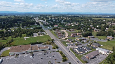
US 250 at the west end of Waynesboro, Virginia
-
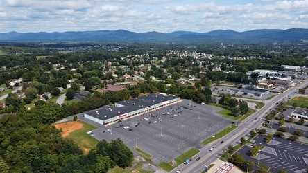
Waynesboro, Virginia, facing approximately east
-
Aerial view of downtown Petersburg, Virginia [03]
![Aerial view of downtown Petersburg, Virginia [03] (2350 visits) Aerial view of downtown Petersburg, Virginia.
More at The Schumin Web:
www.schuminweb.com/life-and-... Aerial view of downtown Petersburg, Virginia [03]](../../../i/upload/2024/07/19/20240719195444-cebbe66d-cu_s9999x250.jpg)
-
Aerial view of downtown Petersburg, Virginia [02]
![Aerial view of downtown Petersburg, Virginia [02] (2510 visits) Aerial view of downtown Petersburg, Virginia. Colonial Heights is visible in the distance.
More at... Aerial view of downtown Petersburg, Virginia [02]](../../../i/upload/2024/07/19/20240719195644-d8ed4c09-cu_s9999x250.jpg)
-
Aerial view of downtown Petersburg, Virginia [01]
![Aerial view of downtown Petersburg, Virginia [01] (2368 visits) Aerial view of downtown Petersburg, Virginia.
More at The Schumin Web:
www.schuminweb.com/life-and-... Aerial view of downtown Petersburg, Virginia [01]](../../../i/upload/2024/07/19/20240719195657-18bb1adc-cu_s9999x250.jpg)
-
Intersection of Baltimore Street, Frederick Street, Carlisle Street, and Broadway [01]
![Intersection of Baltimore Street, Frederick Street, Carlisle Street, and Broadway [01] (1274 visits) Intersection of Baltimore Street, Frederick Street, Carlisle Street, and Broadway in downtown Hanove... Intersection of Baltimore Street, Frederick Street, Carlisle Street, and Broadway [01]](../../../i/upload/2024/07/19/20240719213155-1e21226a-cu_s9999x250.jpg)
-
Intersection of Baltimore Street, Frederick Street, Carlisle Street, and Broadway [02]
![Intersection of Baltimore Street, Frederick Street, Carlisle Street, and Broadway [02] (1317 visits) Intersection of Baltimore Street, Frederick Street, Carlisle Street, and Broadway in downtown Hanove... Intersection of Baltimore Street, Frederick Street, Carlisle Street, and Broadway [02]](../../../i/upload/2024/07/19/20240719213200-60dd65d6-cu_s9999x250.jpg)
-
Downtown Lititz, Pennsylvania [03]
![Downtown Lititz, Pennsylvania [03] (10490 visits) Aerial view of downtown Lititz, Pennsylvania.
Ben Schumin is a professional photographer who captur... Downtown Lititz, Pennsylvania [03]](../../../i/upload/2024/07/19/20240719213401-26c489c3-cu_s9999x250.jpg)
-
Montgomery Village, facing approximately west [03]
![Montgomery Village, facing approximately west [03] (1784 visits) View of Montgomery Village and beyond, facing approximately west, from above the Essex Place neighbo... Montgomery Village, facing approximately west [03]](../../../i/upload/2024/07/20/20240720014535-43915a8f-cu_s9999x250.jpg)
-
Montgomery Village, facing approximately west [04]
![Montgomery Village, facing approximately west [04] (1762 visits) View of Montgomery Village and beyond, facing approximately west, from above the Picton of Birlstone... Montgomery Village, facing approximately west [04]](../../../i/upload/2024/07/20/20240720014545-c32fb66e-cu_s9999x250.jpg)
-
481 North Frederick Avenue

-
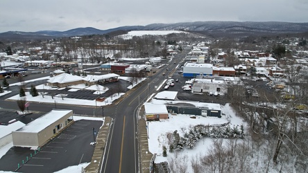
East Main Street in Waynesboro, Virginia
-
Aerial view of downtown Petersburg, Virginia [04]
![Aerial view of downtown Petersburg, Virginia [04] (3180 visits) Aerial view of downtown Petersburg, Virginia from near the intersection of Interstate 95 and East Wy... Aerial view of downtown Petersburg, Virginia [04]](../../../i/upload/2024/07/20/20240720091856-35107304-cu_s9999x250.jpg)
-
Downtown Hopewell, Virginia
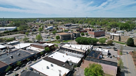
-
Church Hill neighborhood [01]
![Church Hill neighborhood [01] (11632 visits) Aerial view of the Church Hill neighborhood of Richmond, Virginia, photographed from west of Interst... Church Hill neighborhood [01]](../../../i/upload/2024/07/20/20240720092724-5ad8079d-cu_s9999x250.jpg)
-
Church Hill neighborhood [02]
![Church Hill neighborhood [02] (11606 visits) Aerial view of the Church Hill neighborhood of Richmond, Virginia, photographed from west of Interst... Church Hill neighborhood [02]](../../../i/upload/2024/07/20/20240720092729-c1c95489-cu_s9999x250.jpg)
-
East Main and Broad Streets in Waynesboro, Virginia
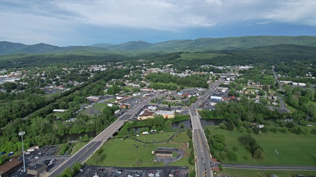
-
East Broad Street near East Avenue
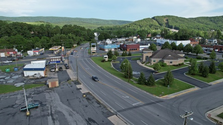
-
Downtown Waynesboro, facing east
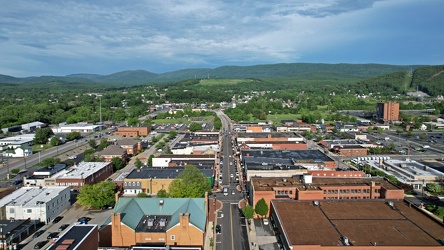
-
Stuarts Draft, Virginia above Wayne Avenue [02]
![Stuarts Draft, Virginia above Wayne Avenue [02] (2019 visits) View of Stuarts Draft, Virginia from above Wayne Avenue (VA-639).
Ben Schumin is a professional pho... Stuarts Draft, Virginia above Wayne Avenue [02]](../../../i/upload/2024/07/20/20240720094514-88dd2f1e-cu_s9999x250.jpg)
-
Stuarts Draft, Virginia above Wayne Avenue [01]
![Stuarts Draft, Virginia above Wayne Avenue [01] (2964 visits) View of Stuarts Draft, Virginia from above Wayne Avenue (VA-639).
Ben Schumin is a professional pho... Stuarts Draft, Virginia above Wayne Avenue [01]](../../../i/upload/2024/07/20/20240720094536-55029349-cu_s9999x250.jpg)
-
Stuarts Draft, Virginia above Wayne Avenue [03]
![Stuarts Draft, Virginia above Wayne Avenue [03] (2062 visits) View of Stuarts Draft, Virginia from above Wayne Avenue (VA-639).
Ben Schumin is a professional pho... Stuarts Draft, Virginia above Wayne Avenue [03]](../../../i/upload/2024/07/20/20240720094705-d02b94dc-cu_s9999x250.jpg)
-
Stuarts Draft, Virginia above Wayne Avenue [05]
![Stuarts Draft, Virginia above Wayne Avenue [05] (2984 visits) View of Stuarts Draft, Virginia from above Wayne Avenue (VA-639).
Ben Schumin is a professional pho... Stuarts Draft, Virginia above Wayne Avenue [05]](../../../i/upload/2024/07/20/20240720094711-10b1bf16-cu_s9999x250.jpg)
-
Stuarts Draft, Virginia above Wayne Avenue [04]
![Stuarts Draft, Virginia above Wayne Avenue [04] (2973 visits) View of Stuarts Draft, Virginia from above Wayne Avenue (VA-639).
Ben Schumin is a professional pho... Stuarts Draft, Virginia above Wayne Avenue [04]](../../../i/upload/2024/07/20/20240720094817-ef62e5b8-cu_s9999x250.jpg)
-
Aerial view of Pennsville Township, New Jersey [02]
![Aerial view of Pennsville Township, New Jersey [02] (3592 visits) Aerial view of Pennsville Township, New Jersey.
More at The Schumin Web:
www.schuminweb.com/2022... Aerial view of Pennsville Township, New Jersey [02]](../../../i/upload/2024/07/20/20240720103102-6366e404-cu_s9999x250.jpg)
-
Aerial view of Pennsville Township, New Jersey [01]
![Aerial view of Pennsville Township, New Jersey [01] (1553 visits) Aerial view of Pennsville Township, New Jersey from over the Delaware River.
More at The Schumin ... Aerial view of Pennsville Township, New Jersey [01]](../../../i/upload/2024/07/20/20240720103107-bd3ed35a-cu_s9999x250.jpg)
-
Forest Springs Estates [01]
![Forest Springs Estates [01] (2250 visits) Aerial view of the Forest Springs Estates neighborhood in Stuarts Draft, Virginia, taken from approx... Forest Springs Estates [01]](../../../i/upload/2024/07/20/20240720103408-ac9f7d40-cu_s9999x250.jpg)
-
Forest Springs Estates [02]
![Forest Springs Estates [02] (2832 visits) Aerial view of the Forest Springs Estates neighborhood in Stuarts Draft, Virginia, taken from approx... Forest Springs Estates [02]](../../../i/upload/2024/07/20/20240720103645-80215d0c-cu_s9999x250.jpg)
-
Forest Springs Estates [03]
![Forest Springs Estates [03] (2814 visits) Aerial view of the Forest Springs Estates neighborhood in Stuarts Draft, Virginia, showing the inter... Forest Springs Estates [03]](../../../i/upload/2024/07/20/20240720103650-60296a18-cu_s9999x250.jpg)
-
Forest Springs Estates [04]
![Forest Springs Estates [04] (2862 visits) Aerial view of the Forest Springs Estates neighborhood in Stuarts Draft, Virginia, showing Ceocia La... Forest Springs Estates [04]](../../../i/upload/2024/07/20/20240720103655-f8465d58-cu_s9999x250.jpg)
-
Forest Springs Estates [05]
![Forest Springs Estates [05] (1791 visits) Aerial view of the Forest Springs Estates neighborhood in Stuarts Draft, Virginia, taken above the i... Forest Springs Estates [05]](../../../i/upload/2024/07/20/20240720103700-12ed86ac-cu_s9999x250.jpg)
-
Forest Springs Estates [06]
![Forest Springs Estates [06] (1657 visits) Aerial view of the Forest Springs Estates neighborhood in Stuarts Draft, Virginia, facing south.
Be... Forest Springs Estates [06]](../../../i/upload/2024/07/20/20240720103705-68728b22-cu_s9999x250.jpg)
-
Forest Springs Estates [07]
![Forest Springs Estates [07] (2923 visits) Aerial view of the Forest Springs Estates neighborhood in Stuarts Draft, Virginia, showing the inter... Forest Springs Estates [07]](../../../i/upload/2024/07/20/20240720103710-4e810037-cu_s9999x250.jpg)
-
Forest Springs Estates [08]
![Forest Springs Estates [08] (2960 visits) Aerial view of the Forest Springs Estates neighborhood in Stuarts Draft, Virginia, showing Clements ... Forest Springs Estates [08]](../../../i/upload/2024/07/20/20240720103715-d25d2920-cu_s9999x250.jpg)
-
Forest Springs Estates [09]
![Forest Springs Estates [09] (2914 visits) Aerial view of the Forest Springs Estates neighborhood in Stuarts Draft, Virginia, showing Tomahawk ... Forest Springs Estates [09]](../../../i/upload/2024/07/20/20240720103720-56045695-cu_s9999x250.jpg)
-
Forest Springs Estates [10]
![Forest Springs Estates [10] (1719 visits) Aerial view of the Forest Springs Estates neighborhood in Stuarts Draft, Virginia, taken from above ... Forest Springs Estates [10]](../../../i/upload/2024/07/20/20240720103726-e7eeb2c5-cu_s9999x250.jpg)
-
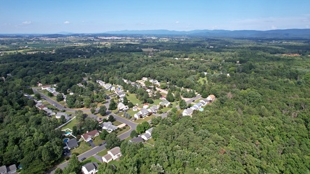
Southeastern end of Ridgeview Acres
-
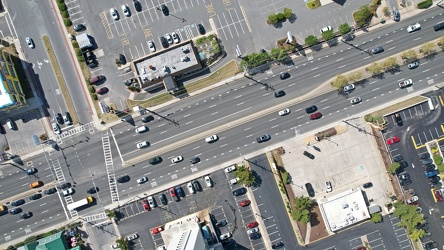
Coastal Highway and 94th Street
-
Verona, Virginia over Mill Place Commerce Park [01]
![Verona, Virginia over Mill Place Commerce Park [01] (1430 visits) Aerial view of Verona, Virginia from above the Mill Place Commerce Park. This photo shows a view fa... Verona, Virginia over Mill Place Commerce Park [01]](../../../i/upload/2024/07/20/20240720110653-ef33b991-cu_s9999x250.jpg)
-
Verona, Virginia over Mill Place Commerce Park [02]
![Verona, Virginia over Mill Place Commerce Park [02] (1759 visits) Aerial view of Verona, Virginia from above the Mill Place Commerce Park. This view faces approximat... Verona, Virginia over Mill Place Commerce Park [02]](../../../i/upload/2024/07/20/20240720110708-9b94d246-cu_s9999x250.jpg)
-
Verona, Virginia over Mill Place Commerce Park [05]
![Verona, Virginia over Mill Place Commerce Park [05] (1533 visits) Aerial view of Verona, Virginia from above the Mill Place Commerce Park. This photo shows a view fa... Verona, Virginia over Mill Place Commerce Park [05]](../../../i/upload/2024/07/20/20240720110734-c309d24d-cu_s9999x250.jpg)
-
Aerial view of downtown Crossville, Tennessee [01]
![Aerial view of downtown Crossville, Tennessee [01] (2457 visits) Aerial view of downtown Crossville, Tennessee.
More at The Schumin Web:
www.schuminweb.com/life-and... Aerial view of downtown Crossville, Tennessee [01]](../../../i/upload/2024/07/20/20240720113721-1bd631e7-cu_s9999x250.jpg)
-
Aerial view of downtown Crossville, Tennessee [02]
![Aerial view of downtown Crossville, Tennessee [02] (1349 visits) Aerial view of downtown Crossville, Tennessee.
More at The Schumin Web:
www.schuminweb.com/life-and... Aerial view of downtown Crossville, Tennessee [02]](../../../i/upload/2024/07/20/20240720113738-e7992a54-cu_s9999x250.jpg)
-
Aerial view of downtown Crossville, Tennessee [03]
![Aerial view of downtown Crossville, Tennessee [03] (2486 visits) Aerial view of downtown Crossville, Tennessee.
More at The Schumin Web:
www.schuminweb.com/life-and... Aerial view of downtown Crossville, Tennessee [03]](../../../i/upload/2024/07/20/20240720113748-d1062940-cu_s9999x250.jpg)
-
Aerial view of downtown Knoxville [01]
![Aerial view of downtown Knoxville [01] (1432 visits) Aerial view of downtown Knoxville, Tennessee, facing northwest.
More at The Schumin Web:
www.schumi... Aerial view of downtown Knoxville [01]](../../../i/upload/2024/07/20/20240720114522-2fed5282-cu_s9999x250.jpg)
-
Aerial view of downtown Knoxville [02]
![Aerial view of downtown Knoxville [02] (3305 visits) Aerial view of downtown Knoxville, Tennessee, facing the interchange between Interstate 40, Intersta... Aerial view of downtown Knoxville [02]](../../../i/upload/2024/07/20/20240720114531-474df7df-cu_s9999x250.jpg)
-
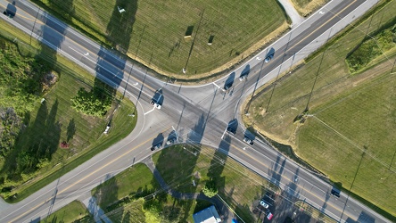
Intersection of Maryland Routes 64 and 77 in Smithsburg, Maryland
-
Aerial view of Interstate 70 Breezewood interchange [02]
![Aerial view of Interstate 70 Breezewood interchange [02] (1400 visits) Aerial view of Breezewood interchange for Interstate 70. View facing south.
More at The Schumin We... Aerial view of Interstate 70 Breezewood interchange [02]](../../../i/upload/2024/07/20/20240720155940-3bb47f5f-cu_s9999x250.jpg)
-
Aerial view of Breezewood, Pennsylvania, May 2023 [04]
![Aerial view of Breezewood, Pennsylvania, May 2023 [04] (2999 visits) Aerial view of Breezewood, Pennsylvania. View facing approximately southeast.
More at The Schumin ... Aerial view of Breezewood, Pennsylvania, May 2023 [04]](../../../i/upload/2024/07/20/20240720155944-8f8a6623-cu_s9999x250.jpg)
-
Aerial view of Breezewood, Pennsylvania, May 2023 [10]
![Aerial view of Breezewood, Pennsylvania, May 2023 [10] (11314 visits) Aerial view of Breezewood, Pennsylvania. View facing westbound along US 30.
More at The Schumin We... Aerial view of Breezewood, Pennsylvania, May 2023 [10]](../../../i/upload/2024/07/20/20240720155949-83a44091-cu_s9999x250.jpg)
-
Aerial view of Breezewood, Pennsylvania, May 2023 [08]
![Aerial view of Breezewood, Pennsylvania, May 2023 [08] (3198 visits) Aerial view of Breezewood, Pennsylvania. View facing eastbound along US 30.
More at The Schumin We... Aerial view of Breezewood, Pennsylvania, May 2023 [08]](../../../i/upload/2024/07/20/20240720155958-63b65479-cu_s9999x250.jpg)
-
Aerial view of Breezewood interchange for the Pennsylvania Turnpike [03]
![Aerial view of Breezewood interchange for the Pennsylvania Turnpike [03] (1403 visits) Aerial view of Breezewood interchange for the Pennsylvania Turnpike. North is to the right.
More a... Aerial view of Breezewood interchange for the Pennsylvania Turnpike [03]](../../../i/upload/2024/07/20/20240720160003-184a95a1-cu_s9999x250.jpg)
-
Aerial view of Breezewood, Pennsylvania, May 2023 [01]
![Aerial view of Breezewood, Pennsylvania, May 2023 [01] (3054 visits) Aerial view of Breezewood, Pennsylvania. View facing north, showing North Breezewood Road, the SAC ... Aerial view of Breezewood, Pennsylvania, May 2023 [01]](../../../i/upload/2024/07/20/20240720160008-4d52368a-cu_s9999x250.jpg)
-
Aerial view of Breezewood, Pennsylvania, May 2023 [06]
![Aerial view of Breezewood, Pennsylvania, May 2023 [06] (3020 visits) Aerial view of Breezewood, Pennsylvania. View facing approximately east.
More at The Schumin Web:
... Aerial view of Breezewood, Pennsylvania, May 2023 [06]](../../../i/upload/2024/07/20/20240720160013-ca57d708-cu_s9999x250.jpg)
-
Aerial view of Breezewood, Pennsylvania, May 2023 [02]
![Aerial view of Breezewood, Pennsylvania, May 2023 [02] (11279 visits) Aerial view of Breezewood, Pennsylvania. View facing westbound along US 30.
More at The Schumin We... Aerial view of Breezewood, Pennsylvania, May 2023 [02]](../../../i/upload/2024/07/20/20240720160018-4b6e07bf-cu_s9999x250.jpg)
-
Aerial view of Breezewood, Pennsylvania, May 2023 [09]
![Aerial view of Breezewood, Pennsylvania, May 2023 [09] (1616 visits) Aerial view of Breezewood, Pennsylvania. View facing westbound along US 30.
More at The Schumin We... Aerial view of Breezewood, Pennsylvania, May 2023 [09]](../../../i/upload/2024/07/20/20240720160022-4b37e34b-cu_s9999x250.jpg)
-
Aerial view of Breezewood interchange for the Pennsylvania Turnpike [01]
![Aerial view of Breezewood interchange for the Pennsylvania Turnpike [01] (1449 visits) Aerial view of Breezewood interchange for the Pennsylvania Turnpike. View facing approximately east... Aerial view of Breezewood interchange for the Pennsylvania Turnpike [01]](../../../i/upload/2024/07/20/20240720160031-be453ab5-cu_s9999x250.jpg)
-
Aerial view of Interstate 70 Breezewood interchange [01]
![Aerial view of Interstate 70 Breezewood interchange [01] (11029 visits) Aerial view of Breezewood interchange for Interstate 70. View facing approximately southeast.
More... Aerial view of Interstate 70 Breezewood interchange [01]](../../../i/upload/2024/07/20/20240720160036-995b00e0-cu_s9999x250.jpg)