-
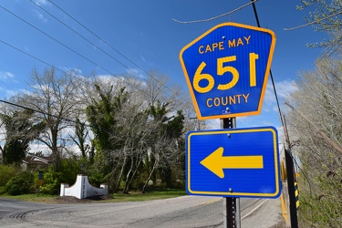
Shield for Cape May County Route 651
-
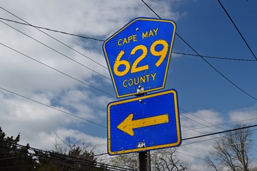
Shield for Cape May County Route 629
-
Garden State Parkway milepost 10 southbound [02]
![Garden State Parkway milepost 10 southbound [02] (717 visits) Sign assembly for milepost 10 southbound on the Garden State Parkway in Middle Township, New Jersey.... Garden State Parkway milepost 10 southbound [02]](../../../../i/upload/2025/01/09/20250109192436-7167312f-cu_s9999x250.jpg)
-
Garden State Parkway milepost 10 southbound [01]
![Garden State Parkway milepost 10 southbound [01] (734 visits) Sign assembly for milepost 10 southbound on the Garden State Parkway in Middle Township, New Jersey.... Garden State Parkway milepost 10 southbound [01]](../../../../i/upload/2025/01/09/20250109192431-f1398b04-cu_s9999x250.jpg)
-
Aerial view of Myrtle Beach, South Carolina [04]
![Aerial view of Myrtle Beach, South Carolina [04] (748 visits) Aerial view of Myrtle Beach, South Carolina. This photo depicts the coastline, facing approximately... Aerial view of Myrtle Beach, South Carolina [04]](../../../../i/upload/2025/01/16/20250116011543-c0352f82-cu_s9999x250.jpg)
-
Aerial view of Myrtle Beach, South Carolina [05]
![Aerial view of Myrtle Beach, South Carolina [05] (763 visits) Aerial view of Myrtle Beach, South Carolina. This photo depicts the coastline, facing approximately... Aerial view of Myrtle Beach, South Carolina [05]](../../../../i/upload/2025/01/16/20250116011549-fb2ac6b0-cu_s9999x250.jpg)
-
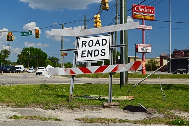
End of Dorsey Avenue
-
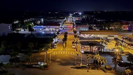
View down Center Street in Folly Beach
-
Aerial view of Myrtle Beach, South Carolina [06]
![Aerial view of Myrtle Beach, South Carolina [06] (787 visits) Aerial view of Myrtle Beach, South Carolina. This photo depicts the coastline, facing approximately... Aerial view of Myrtle Beach, South Carolina [06]](../../../../i/upload/2025/01/16/20250116011556-58eeb392-cu_s9999x250.jpg)
-
Aerial view of Myrtle Beach, South Carolina [10]
![Aerial view of Myrtle Beach, South Carolina [10] (789 visits) Aerial view of Myrtle Beach, South Carolina. This photo depicts the coastline, facing approximately... Aerial view of Myrtle Beach, South Carolina [10]](../../../../i/upload/2025/01/16/20250116011622-c227f7d2-cu_s9999x250.jpg)
-
Aerial view of Myrtle Beach, South Carolina [08]
![Aerial view of Myrtle Beach, South Carolina [08] (791 visits) Aerial view of Myrtle Beach, South Carolina. This photo depicts the coastline, facing approximately... Aerial view of Myrtle Beach, South Carolina [08]](../../../../i/upload/2025/01/16/20250116011610-80555640-cu_s9999x250.jpg)
-
Aerial view of Myrtle Beach, South Carolina [09]
![Aerial view of Myrtle Beach, South Carolina [09] (808 visits) Aerial view of Myrtle Beach, South Carolina. This photo depicts the coastline, facing approximately... Aerial view of Myrtle Beach, South Carolina [09]](../../../../i/upload/2025/01/16/20250116011616-86a3a1ed-cu_s9999x250.jpg)
-
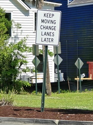
Sign advising motorists to change lanes later
-
Aerial view of Myrtle Beach, South Carolina [14]
![Aerial view of Myrtle Beach, South Carolina [14] (828 visits) Aerial view of Myrtle Beach, South Carolina. This photo depicts Pier 14, one of several fishing pie... Aerial view of Myrtle Beach, South Carolina [14]](../../../../i/upload/2025/01/16/20250116011649-2b82761b-cu_s9999x250.jpg)
-
Aerial view of Myrtle Beach, South Carolina [15]
![Aerial view of Myrtle Beach, South Carolina [15] (839 visits) Aerial view of Myrtle Beach, South Carolina. This photo depicts the city from approximately 16th Av... Aerial view of Myrtle Beach, South Carolina [15]](../../../../i/upload/2025/01/16/20250116011655-ed58c149-cu_s9999x250.jpg)
-
Aerial view of Myrtle Beach, South Carolina [12]
![Aerial view of Myrtle Beach, South Carolina [12] (847 visits) Aerial view of Myrtle Beach, South Carolina. This photo depicts Pier 14, one of several fishing pie... Aerial view of Myrtle Beach, South Carolina [12]](../../../../i/upload/2025/01/16/20250116011635-e2f59869-cu_s9999x250.jpg)
-
Aerial view of Myrtle Beach, South Carolina [13]
![Aerial view of Myrtle Beach, South Carolina [13] (851 visits) Aerial view of Myrtle Beach, South Carolina. This photo depicts Pier 14, one of several fishing pie... Aerial view of Myrtle Beach, South Carolina [13]](../../../../i/upload/2025/01/16/20250116011642-eaad0007-cu_s9999x250.jpg)
-
Aerial view of Myrtle Beach, South Carolina [16]
![Aerial view of Myrtle Beach, South Carolina [16] (855 visits) Aerial view of Myrtle Beach, South Carolina. This photo depicts the city from approximately 16th Av... Aerial view of Myrtle Beach, South Carolina [16]](../../../../i/upload/2025/01/16/20250116011701-1e30b28a-cu_s9999x250.jpg)
-
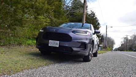
Honda HR-V parked along Sunset Boulevard in Cape May
-
Aerial view of Myrtle Beach, South Carolina [17]
![Aerial view of Myrtle Beach, South Carolina [17] (879 visits) Aerial view of Myrtle Beach, South Carolina. This photo depicts a vacant lot between 17th and 18th ... Aerial view of Myrtle Beach, South Carolina [17]](../../../../i/upload/2025/01/16/20250116011708-700a2aeb-cu_s9999x250.jpg)
-
Aerial view of Myrtle Beach, South Carolina [11]
![Aerial view of Myrtle Beach, South Carolina [11] (894 visits) Aerial view of Myrtle Beach, South Carolina. This photo depicts Pier 14, one of several fishing pie... Aerial view of Myrtle Beach, South Carolina [11]](../../../../i/upload/2025/01/16/20250116011628-3f5529d7-cu_s9999x250.jpg)
-
Aerial view of Myrtle Beach, South Carolina [01]
![Aerial view of Myrtle Beach, South Carolina [01] (901 visits) Aerial view of Myrtle Beach, South Carolina. This photo depicts a surface parking lot between Ocean... Aerial view of Myrtle Beach, South Carolina [01]](../../../../i/upload/2025/01/16/20250116011517-f8bb6ab8-cu_s9999x250.jpg)
-
Ballenger Creek Pike and Mountville Road [02]
![Ballenger Creek Pike and Mountville Road [02] (928 visits) Stop sign and street signs at the intersection of Ballenger Creek Pike and Mountville Road in Freder... Ballenger Creek Pike and Mountville Road [02]](../../../../i/upload/2024/07/19/20240719093414-dcebe5b4-cu_s9999x250.jpg)
-
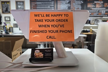
Sign regarding phone calls at East Bay Deli
-
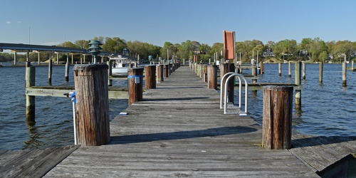
Docks at Mike's Restaurant & Crabhouse
-
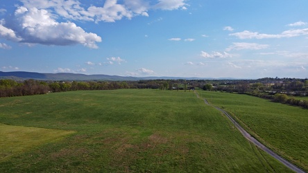
Field in Charles Town, West Virginia
-
Speed limit and low ground clearance signs [02]
![Speed limit and low ground clearance signs [02] (951 visits) Speed limit and low ground clearance signs on Mountville Road in Frederick County, Maryland.
Ben Sc... Speed limit and low ground clearance signs [02]](../../../../i/upload/2024/07/19/20240719093418-a79dc78b-cu_s9999x250.jpg)
-
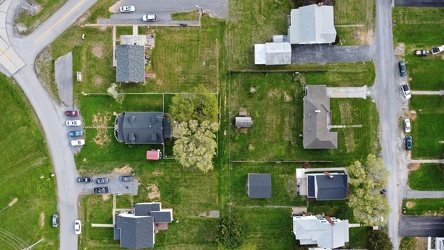
Neighborhood in Charles Town, West Virginia
-
Aerial view of Myrtle Beach, South Carolina [07]
![Aerial view of Myrtle Beach, South Carolina [07] (983 visits) Aerial view of Myrtle Beach, South Carolina. This photo depicts the coastline, facing approximately... Aerial view of Myrtle Beach, South Carolina [07]](../../../../i/upload/2025/01/16/20250116011602-0271fcdd-cu_s9999x250.jpg)
-
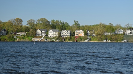
Houses fronting the South River
-
Holiday Inn Charleston-Riverview [10]
![Holiday Inn Charleston-Riverview [10] (997 visits) The Holiday Inn Charleston-Riverview, a 14-story hotel located between the two sides of US 17 across... Holiday Inn Charleston-Riverview [10]](../../../../i/upload/2025/01/13/20250113161207-77059b16-cu_s9999x250.jpg)
-
Aerial view of Myrtle Beach, South Carolina [18]
![Aerial view of Myrtle Beach, South Carolina [18] (1005 visits) Aerial view of Myrtle Beach, South Carolina. This photo depicts the Hilton Grand Vacations facility... Aerial view of Myrtle Beach, South Carolina [18]](../../../../i/upload/2025/01/16/20250116011716-7718fc67-cu_s9999x250.jpg)
-
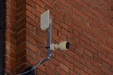
11-foot-8 camera
-
Reassurance markers for Interstate 95 business loop and US 301
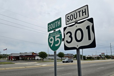
-
Aerial view of Myrtle Beach, South Carolina [02]
![Aerial view of Myrtle Beach, South Carolina [02] (1027 visits) Aerial view of Myrtle Beach, South Carolina. This photo depicts the city from approximately 16th Av... Aerial view of Myrtle Beach, South Carolina [02]](../../../../i/upload/2025/01/16/20250116011527-f000c002-cu_s9999x250.jpg)
-
Aerial view of Myrtle Beach, South Carolina [03]
![Aerial view of Myrtle Beach, South Carolina [03] (1033 visits) Aerial view of Myrtle Beach, South Carolina. This photo depicts the Hilton Grand Vacations facility... Aerial view of Myrtle Beach, South Carolina [03]](../../../../i/upload/2025/01/16/20250116011535-e4909d01-cu_s9999x250.jpg)
-
View from above the Port of Charleston
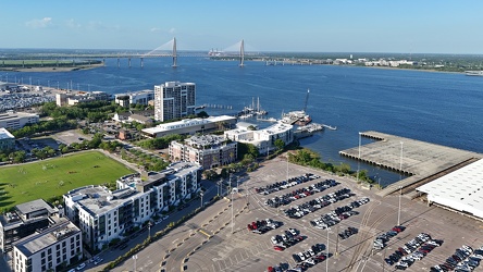
-
Dock lights at Mike's Restaurant & Crabhouse [02]
![Dock lights at Mike's Restaurant & Crabhouse [02] (1091 visits) Dock lights at Mike's Restaurant & Crabhouse, off of Riva Road near Annapolis, Maryland.
Ben Sc... Dock lights at Mike's Restaurant & Crabhouse [02]](../../../../i/upload/2024/07/19/20240719162439-0bb0019d-cu_s9999x250.jpg)
-
Aerial view of Myrtle Beach, South Carolina [19]
![Aerial view of Myrtle Beach, South Carolina [19] (1101 visits) Aerial view of Myrtle Beach, South Carolina. This photo depicts the Hilton Grand Vacations facility... Aerial view of Myrtle Beach, South Carolina [19]](../../../../i/upload/2025/01/16/20250116011723-729e4cea-cu_s9999x250.jpg)
-
Street signs for South Gregson Street and West Peabody Street
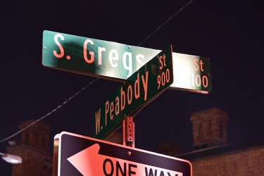
-
Barbed wire in Laytonsville, Maryland [01]
![Barbed wire in Laytonsville, Maryland [01] (1120 visits) Barbed wire, forming part of a fence along Fieldcrest Road near the intersection with Olney-Laytonsv... Barbed wire in Laytonsville, Maryland [01]](../../../../i/upload/2024/07/17/20240717224812-778e3f3c-cu_s9999x250.jpg)
-
Dock lights at Mike's Restaurant & Crabhouse [01]
![Dock lights at Mike's Restaurant & Crabhouse [01] (1129 visits) Dock lights at Mike's Restaurant & Crabhouse, off of Riva Road near Annapolis, Maryland.
Ben Sc... Dock lights at Mike's Restaurant & Crabhouse [01]](../../../../i/upload/2024/07/19/20240719162607-1866de7b-cu_s9999x250.jpg)
-
Fields and housing in Charles Town, West Virginia
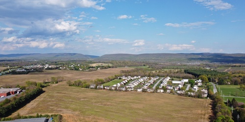
-
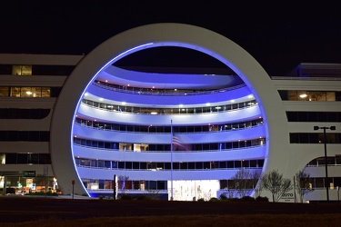
Toilet Bowl Building
-
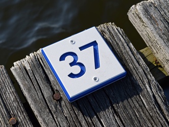
Marker for slip 37
-
Marker for slip 42 [01]
![Marker for slip 42 [01] (1159 visits) Marker for slip 42 on the docks adjacent to Mike's Restaurant & Crabhouse near Annapolis, Maryla... Marker for slip 42 [01]](../../../../i/upload/2024/07/19/20240719162521-b3b6acac-cu_s9999x250.jpg)
-
Aerial view of Myrtle Beach, South Carolina [20]
![Aerial view of Myrtle Beach, South Carolina [20] (1162 visits) Aerial view of Myrtle Beach, South Carolina. This photo depicts the city from approximately 16th Av... Aerial view of Myrtle Beach, South Carolina [20]](../../../../i/upload/2025/01/16/20250116011730-cd564b26-cu_s9999x250.jpg)
-
2931 Weisman Road [02]
![2931 Weisman Road [02] (1163 visits) House at 2931 Weisman Road in the Wheaton/Glenmont area, with a very obvious second-story addition, ... 2931 Weisman Road [02]](../../../../i/upload/2024/07/18/20240718213900-04ce2433-cu_s9999x250.jpg)
-
Marker for slip 42 [02]
![Marker for slip 42 [02] (1197 visits) Marker for slip 42 on the docks adjacent to Mike's Restaurant & Crabhouse near Annapolis, Maryla... Marker for slip 42 [02]](../../../../i/upload/2024/07/19/20240719162526-43487c8e-cu_s9999x250.jpg)
-
Speed limit and low ground clearance signs [01]
![Speed limit and low ground clearance signs [01] (1253 visits) Speed limit and low ground clearance signs on Mountville Road in Frederick County, Maryland.
Ben Sc... Speed limit and low ground clearance signs [01]](../../../../i/upload/2024/07/19/20240719093423-402fb975-cu_s9999x250.jpg)
-
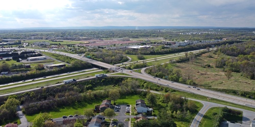
Intersection of US 340 and West Virginia Routes 9 and 51
-
Water tower in Charles Town, West Virginia [01]
![Water tower in Charles Town, West Virginia [01] (1366 visits) Water tower off of Keyes Ferry Road in Charles Town, West Virginia.
Ben Schumin is a professional p... Water tower in Charles Town, West Virginia [01]](../../../../i/upload/2024/07/19/20240719162240-13c189c6-cu_s9999x250.jpg)
-
Water tower in Charles Town, West Virginia [03]
![Water tower in Charles Town, West Virginia [03] (1368 visits) Water tower off of Keyes Ferry Road in Charles Town, West Virginia.
Ben Schumin is a professional p... Water tower in Charles Town, West Virginia [03]](../../../../i/upload/2024/07/19/20240719162312-7a4d222b-cu_s9999x250.jpg)
-
Water tower in Charles Town, West Virginia [04]
![Water tower in Charles Town, West Virginia [04] (1374 visits) Water tower off of Keyes Ferry Road in Charles Town, West Virginia.
Ben Schumin is a professional p... Water tower in Charles Town, West Virginia [04]](../../../../i/upload/2024/07/19/20240719162248-f64b8823-cu_s9999x250.jpg)
-
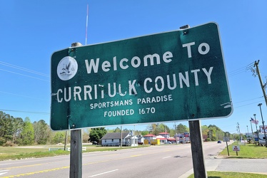
Welcome to Currituck County
-
Power transmission lines in Frederick County [01]
![Power transmission lines in Frederick County [01] (1392 visits) Power transmission lines near Ballenger Creek Pike and Mountville Road in Frederick County, Maryland... Power transmission lines in Frederick County [01]](../../../../i/upload/2024/07/19/20240719093435-6cd9373f-cu_s9999x250.jpg)
-
Lime wedge on the dock

-
Bridge carrying Riva Road over the South River [02]
![Bridge carrying Riva Road over the South River [02] (1402 visits) Bridge carrying Riva Road over the South River near Annapolis, Maryland.
Ben Schumin is a professio... Bridge carrying Riva Road over the South River [02]](../../../../i/upload/2024/07/19/20240719162516-6b4624c8-cu_s9999x250.jpg)
-
Tire track in the mud [01]
![Tire track in the mud [01] (1407 visits) A tire track, made in the mud near the entrance to the Lake Artemesia Natural Area in College Park, ... Tire track in the mud [01]](../../../../i/upload/2024/07/17/20240717225556-8621b514-cu_s9999x250.jpg)
-
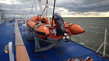
Rescue boat on the MV New Jersey
-
Water tower in Charles Town, West Virginia [02]
![Water tower in Charles Town, West Virginia [02] (1416 visits) Water tower off of Keyes Ferry Road in Charles Town, West Virginia.
Ben Schumin is a professional p... Water tower in Charles Town, West Virginia [02]](../../../../i/upload/2024/07/19/20240719162232-1fa6a18a-cu_s9999x250.jpg)
-
2931 Weisman Road [01]
![2931 Weisman Road [01] (1418 visits) House at 2931 Weisman Road in the Wheaton/Glenmont area, with a very obvious second-story addition, ... 2931 Weisman Road [01]](../../../../i/upload/2024/07/18/20240718213856-45ee5c74-cu_s9999x250.jpg)
-
Tire track in the mud [02]
![Tire track in the mud [02] (1419 visits) A tire track, made in the mud near the entrance to the Lake Artemesia Natural Area in College Park, ... Tire track in the mud [02]](../../../../i/upload/2024/07/17/20240717225559-312853a3-cu_s9999x250.jpg)
-
Bridge carrying Riva Road over the South River [01]
![Bridge carrying Riva Road over the South River [01] (1428 visits) Bridge carrying Riva Road over the South River near Annapolis, Maryland.
Ben Schumin is a professio... Bridge carrying Riva Road over the South River [01]](../../../../i/upload/2024/07/19/20240719162612-4feeeb42-cu_s9999x250.jpg)
-
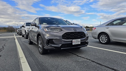
Honda HR-V in a ferry boarding lane
-
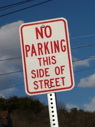
"No parking this side of street"
-
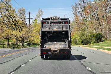
Garbage truck on Muncaster Mill Road
-
Power transmission lines in Frederick County [02]
![Power transmission lines in Frederick County [02] (1465 visits) Power transmission lines near Ballenger Creek Pike and Mountville Road in Frederick County, Maryland... Power transmission lines in Frederick County [02]](../../../../i/upload/2024/07/19/20240719093429-9f31f834-cu_s9999x250.jpg)
-
2931 Weisman Road [03]
![2931 Weisman Road [03] (1471 visits) House at 2931 Weisman Road in the Wheaton/Glenmont area, with a very obvious second-story addition, ... 2931 Weisman Road [03]](../../../../i/upload/2024/07/18/20240718213903-820db127-cu_s9999x250.jpg)
-
Sunset over the Delaware Bay [04]
![Sunset over the Delaware Bay [04] (1524 visits) Sunset over the Delaware Bay, as viewed from the MV New Jersey, a vessel operating the Cape May-Lewe... Sunset over the Delaware Bay [04]](../../../../i/upload/2025/01/10/20250110223500-173ccd0f-cu_s9999x250.jpg)
-
Sunset over the Delaware Bay [03]
![Sunset over the Delaware Bay [03] (1583 visits) Sunset over the Delaware Bay, as viewed from the MV New Jersey, a vessel operating the Cape May-Lewe... Sunset over the Delaware Bay [03]](../../../../i/upload/2025/01/10/20250110223358-aafe77b6-cu_s9999x250.jpg)
-
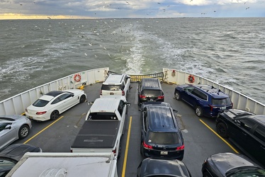
Fantail of the MV New Jersey
-
Sunset over the Delaware Bay [02]
![Sunset over the Delaware Bay [02] (1587 visits) Sunset over the Delaware Bay, as viewed from the MV New Jersey, a vessel operating the Cape May-Lewe... Sunset over the Delaware Bay [02]](../../../../i/upload/2025/01/10/20250110223300-3c549975-cu_s9999x250.jpg)
-
Sunset over the Delaware Bay [01]
![Sunset over the Delaware Bay [01] (1601 visits) Sunset over the Delaware Bay, as viewed from the MV New Jersey, a vessel operating the Cape May-Lewe... Sunset over the Delaware Bay [01]](../../../../i/upload/2025/01/10/20250110223154-eadac849-cu_s9999x250.jpg)
-
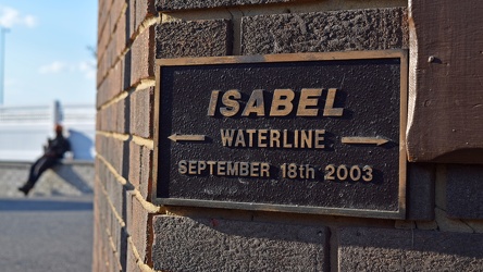
Hurricane Isabel waterline plaque
-
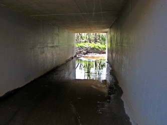
Box culvert under CSX tracks
-
Platform pylon at West Falls Church station [02]
![Platform pylon at West Falls Church station [02] (1670 visits) Lighted platform pylon at West Falls Church, a Washington Metro station in Fairfax County, Virginia.... Platform pylon at West Falls Church station [02]](../../../../i/upload/2024/07/19/20240719093243-8507b49e-cu_s9999x250.jpg)
-
Sunset over the Delaware Bay [05]
![Sunset over the Delaware Bay [05] (1674 visits) Sunset over the Delaware Bay, as viewed from the MV New Jersey, a vessel operating the Cape May-Lewe... Sunset over the Delaware Bay [05]](../../../../i/upload/2025/01/10/20250110223536-a69b79d5-cu_s9999x250.jpg)
-
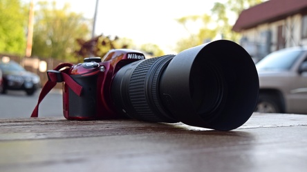
Nikon D3200 with zoom lens
-
Platform pylon at West Falls Church station [04]
![Platform pylon at West Falls Church station [04] (1712 visits) Lighted platform pylon at West Falls Church, a Washington Metro station in Fairfax County, Virginia.... Platform pylon at West Falls Church station [04]](../../../../i/upload/2024/07/19/20240719093255-6bd9cf26-cu_s9999x250.jpg)