-
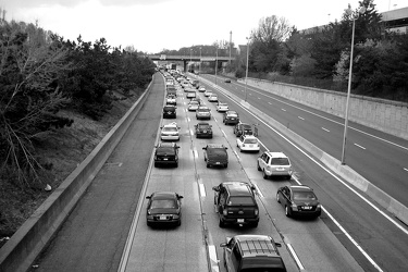
Westbound Interstate 66 near Nutley Street
-
Brighton Dam Road [01]
![Brighton Dam Road [01] (12820 visits) Low view along the double line down the middle of Brighton Dam Road, which runs across the top of Br... Brighton Dam Road [01]](../../../../i/upload/2024/07/17/20240717225049-0f96c3b6-cu_s9999x250.jpg)
-
Brighton Dam Road [02]
![Brighton Dam Road [02] (12465 visits) Low view along the double line down the middle of Brighton Dam Road, which runs across the top of Br... Brighton Dam Road [02]](../../../../i/upload/2024/07/17/20240717225052-1b323317-cu_s9999x250.jpg)
-
Brighton Dam Road [03]
![Brighton Dam Road [03] (12821 visits) Low view along the double line down the middle of Brighton Dam Road, which runs across the top of Br... Brighton Dam Road [03]](../../../../i/upload/2024/07/17/20240717225056-ac7d70e4-cu_s9999x250.jpg)
-
Brighton Dam Road [04]
![Brighton Dam Road [04] (12858 visits) Low view along the double line down the middle of Brighton Dam Road, which runs across the top of Br... Brighton Dam Road [04]](../../../../i/upload/2024/07/17/20240717225100-7f927d75-cu_s9999x250.jpg)
-
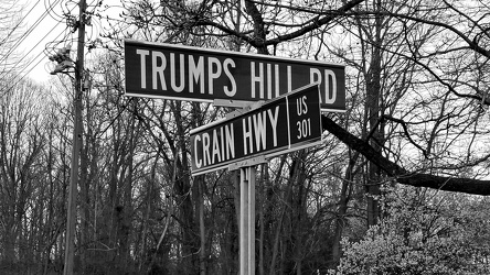
Intersection of Trumps Hill Road and Crain Highway
-
Icon Norfolk [05]
![Icon Norfolk [05] (1581 visits) Icon Norfolk, an apartment building in downtown Norfolk, Virginia. This building was built in 1967 ... Icon Norfolk [05]](../../../../i/upload/2024/07/19/20240719092601-25487cc3-cu_s9999x250.jpg)
-
Icon Norfolk [04]
![Icon Norfolk [04] (1600 visits) Icon Norfolk, an apartment building in downtown Norfolk, Virginia. This building was built in 1967 ... Icon Norfolk [04]](../../../../i/upload/2024/07/19/20240719092608-70e91670-cu_s9999x250.jpg)
-
Icon Norfolk [03]
![Icon Norfolk [03] (1598 visits) Icon Norfolk, an apartment building in downtown Norfolk, Virginia. This building was built in 1967 ... Icon Norfolk [03]](../../../../i/upload/2024/07/19/20240719092613-0490460c-cu_s9999x250.jpg)
-
Icon Norfolk [02]
![Icon Norfolk [02] (1545 visits) Icon Norfolk, an apartment building in downtown Norfolk, Virginia. This building was built in 1967 ... Icon Norfolk [02]](../../../../i/upload/2024/07/19/20240719092618-7c8e622c-cu_s9999x250.jpg)
-
Norfolk Waterside Marriott [02]
![Norfolk Waterside Marriott [02] (847 visits) The Norfolk Waterside Marriott, a high-rise hotel in downtown Norfolk, Virginia.
More at The Schumi... Norfolk Waterside Marriott [02]](../../../../i/upload/2024/07/19/20240719092701-7384cbfc-cu_s9999x250.jpg)
-
Dominion Tower [03]
![Dominion Tower [03] (922 visits) The Dominion Tower, an office building in downtown Norfolk, Virginia, built in 1987.
More at The Sc... Dominion Tower [03]](../../../../i/upload/2024/07/19/20240719092749-46a1b10f-cu_s9999x250.jpg)
-
Dominion Tower [02]
![Dominion Tower [02] (919 visits) The Dominion Tower, an office building in downtown Norfolk, Virginia, built in 1987.
More at The Sc... Dominion Tower [02]](../../../../i/upload/2024/07/19/20240719092753-a11599fe-cu_s9999x250.jpg)
-
Dominion Tower [01]
![Dominion Tower [01] (920 visits) The Dominion Tower, an office building in downtown Norfolk, Virginia, built in 1987.
More at The Sc... Dominion Tower [01]](../../../../i/upload/2024/07/19/20240719092757-c7e0cd2b-cu_s9999x250.jpg)
-
Norfolk City Hall [03]
![Norfolk City Hall [03] (929 visits) Norfolk City Hall, an eleven-story building in downtown Norfolk, Virginia housing government offices... Norfolk City Hall [03]](../../../../i/upload/2024/07/19/20240719092802-c1cd2908-cu_s9999x250.jpg)
-
Norfolk City Hall [02]
![Norfolk City Hall [02] (903 visits) Norfolk City Hall, an eleven-story building in downtown Norfolk, Virginia housing government offices... Norfolk City Hall [02]](../../../../i/upload/2024/07/19/20240719092807-5e8219eb-cu_s9999x250.jpg)
-
Norfolk City Hall [01]
![Norfolk City Hall [01] (939 visits) Norfolk City Hall, an eleven-story building in downtown Norfolk, Virginia housing government offices... Norfolk City Hall [01]](../../../../i/upload/2024/07/19/20240719092812-f9620385-cu_s9999x250.jpg)
-
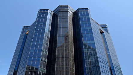
300 East Main Street
-
Norfolk Waterside Marriott [01]
![Norfolk Waterside Marriott [01] (840 visits) The Norfolk Waterside Marriott, a high-rise hotel in downtown Norfolk, Virginia.
More at The Schumi... Norfolk Waterside Marriott [01]](../../../../i/upload/2024/07/19/20240719092831-696580ee-cu_s9999x250.jpg)
-
Icon Norfolk [09]
![Icon Norfolk [09] (1729 visits) Icon Norfolk, an apartment building in downtown Norfolk, Virginia. This building was built in 1967 ... Icon Norfolk [09]](../../../../i/upload/2024/07/19/20240719092836-994177ff-cu_s9999x250.jpg)
-
Icon Norfolk [01]
![Icon Norfolk [01] (1645 visits) Icon Norfolk, an apartment building in downtown Norfolk, Virginia. This building was built in 1967 ... Icon Norfolk [01]](../../../../i/upload/2024/07/19/20240719092841-cd101c82-cu_s9999x250.jpg)
-
Goochland rest area, westbound [03]
![Goochland rest area, westbound [03] (2028 visits) Restroom building at the Goochland Safety Rest Area on Interstate 64 westbound in Manakin-Sabot, Vir... Goochland rest area, westbound [03]](../../../../i/upload/2024/07/19/20240719093121-0aeca88a-cu_s9999x250.jpg)
-
Goochland rest area, westbound [02]
![Goochland rest area, westbound [02] (1993 visits) Restroom building at the Goochland Safety Rest Area on Interstate 64 westbound in Manakin-Sabot, Vir... Goochland rest area, westbound [02]](../../../../i/upload/2024/07/19/20240719093125-c06aafb1-cu_s9999x250.jpg)
-
Goochland rest area, westbound [01]
![Goochland rest area, westbound [01] (2007 visits) Restroom building at the Goochland Safety Rest Area on Interstate 64 westbound in Manakin-Sabot, Vir... Goochland rest area, westbound [01]](../../../../i/upload/2024/07/19/20240719093130-dbdf3bb4-cu_s9999x250.jpg)
-
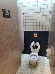
Child/toddler friendly stall at New Kent rest area
-
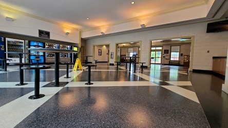
Interior of New Kent rest area, westbound
-
Mileage sign on US 1 near Fredericksburg [01]
![Mileage sign on US 1 near Fredericksburg [01] (1837 visits) Mileage sign on southbound US 1 near Fredericksburg, Virginia, giving distances to Thornburg, Ashlan... Mileage sign on US 1 near Fredericksburg [01]](../../../../i/upload/2024/07/19/20240719093650-38b7882f-cu_s9999x250.jpg)
-
Mileage sign on US 1 near Fredericksburg [02]
![Mileage sign on US 1 near Fredericksburg [02] (3039 visits) Mileage sign on southbound US 1 near Fredericksburg, Virginia, giving distances to Thornburg, Ashlan... Mileage sign on US 1 near Fredericksburg [02]](../../../../i/upload/2024/07/19/20240719093655-959f4e08-cu_s9999x250.jpg)
-
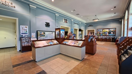
Interior of New Kent rest area, eastbound
-
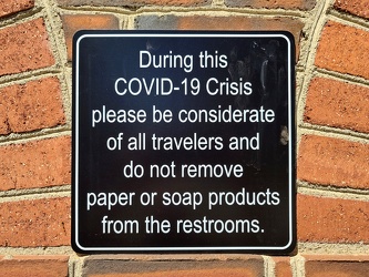
COVID-19 rest area signage
-
Eastern terminus of US 60 [01]
![Eastern terminus of US 60 [01] (1500 visits) "END" signage on a lamppost at the eastern terminus of US 60 in Virginia Beach, Virginia. ... Eastern terminus of US 60 [01]](../../../../i/upload/2024/07/19/20240719101721-73bf3c40-cu_s9999x250.jpg)
-
Eastern terminus of US 60 [02]
![Eastern terminus of US 60 [02] (1547 visits) "END" signage on a lamppost at the eastern terminus of US 60 in Virginia Beach, Virginia. ... Eastern terminus of US 60 [02]](../../../../i/upload/2024/07/19/20240719101751-9221fd2b-cu_s9999x250.jpg)
-
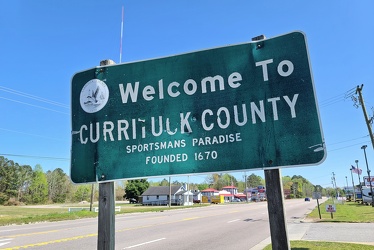
Welcome to Currituck County
-
Norfolk, Virginia at night [01]
![Norfolk, Virginia at night [01] (1609 visits) Downtown Norfolk, Virginia at night, viewed from across the Elizabeth River in Portsmouth.
More at ... Norfolk, Virginia at night [01]](../../../../i/upload/2024/07/19/20240719101930-588b26d8-cu_s9999x250.jpg)
-
Norfolk, Virginia at night [02]
![Norfolk, Virginia at night [02] (1500 visits) Downtown Norfolk, Virginia at night, viewed from across the Elizabeth River in Portsmouth.
More at ... Norfolk, Virginia at night [02]](../../../../i/upload/2024/07/19/20240719101934-44552460-cu_s9999x250.jpg)
-
Interstate 264 after Midtown Tunnel [01]
![Interstate 264 after Midtown Tunnel [01] (1614 visits) Interstate 264 westbound in Portsmouth, Virginia, just after traffic exits the Midtown Tunnel.
More... Interstate 264 after Midtown Tunnel [01]](../../../../i/upload/2024/07/19/20240719101939-87dbaa40-cu_s9999x250.jpg)
-
Interstate 264 after Midtown Tunnel [02]
![Interstate 264 after Midtown Tunnel [02] (1276 visits) Interstate 264 westbound in Portsmouth, Virginia, just after traffic exits the Midtown Tunnel.
More... Interstate 264 after Midtown Tunnel [02]](../../../../i/upload/2024/07/19/20240719101945-e18e6752-cu_s9999x250.jpg)
-
Interstate 264 after Midtown Tunnel [04]
![Interstate 264 after Midtown Tunnel [04] (3052 visits) Interstate 264 westbound in Portsmouth, Virginia, just after traffic exits the Midtown Tunnel.
More... Interstate 264 after Midtown Tunnel [04]](../../../../i/upload/2024/07/19/20240719102003-a91bfec6-cu_s9999x250.jpg)
-
Interstate 264 after Midtown Tunnel [03]
![Interstate 264 after Midtown Tunnel [03] (2881 visits) Interstate 264 westbound in Portsmouth, Virginia, just after traffic exits the Midtown Tunnel.
More... Interstate 264 after Midtown Tunnel [03]](../../../../i/upload/2024/07/19/20240719102008-7fa5c14e-cu_s9999x250.jpg)
-
Icon Norfolk [08]
![Icon Norfolk [08] (1689 visits) Icon Norfolk, an apartment building in downtown Norfolk, Virginia. This building was built in 1967 ... Icon Norfolk [08]](../../../../i/upload/2024/07/19/20240719102045-2b56c13a-cu_s9999x250.jpg)
-
Icon Norfolk [07]
![Icon Norfolk [07] (1660 visits) Icon Norfolk, an apartment building in downtown Norfolk, Virginia. This building was built in 1967 ... Icon Norfolk [07]](../../../../i/upload/2024/07/19/20240719102050-f4a652cc-cu_s9999x250.jpg)
-
Icon Norfolk [06]
![Icon Norfolk [06] (1618 visits) Icon Norfolk, an apartment building in downtown Norfolk, Virginia. This building was built in 1967 ... Icon Norfolk [06]](../../../../i/upload/2024/07/19/20240719102055-5db38dbb-cu_s9999x250.jpg)
-
US 340 in Charles Town [03]
![US 340 in Charles Town [03] (3230 visits) US 340 in Charles Town, West Virginia, east of the interchange with West Virginia Route 9.
Ben Schu... US 340 in Charles Town [03]](../../../../i/upload/2024/07/19/20240719162153-ebf4366a-cu_s9999x250.jpg)
-
US 340 in Charles Town [02]
![US 340 in Charles Town [02] (3216 visits) US 340 in Charles Town, West Virginia, east of the interchange with West Virginia Route 9.
Ben Schu... US 340 in Charles Town [02]](../../../../i/upload/2024/07/19/20240719162156-6d3ecd1b-cu_s9999x250.jpg)
-
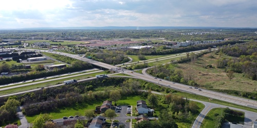
Intersection of US 340 and West Virginia Routes 9 and 51
-
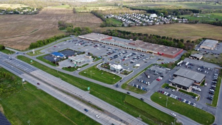
Somerset Village
-
US 340 in Charles Town [04]
![US 340 in Charles Town [04] (2568 visits) US 340 in Charles Town, West Virginia, east of the interchange with West Virginia Route 9.
Ben Schu... US 340 in Charles Town [04]](../../../../i/upload/2024/07/19/20240719162255-e1659465-cu_s9999x250.jpg)
-
US 340 in Charles Town [01]
![US 340 in Charles Town [01] (3269 visits) US 340 in Charles Town, West Virginia, east of the interchange with West Virginia Route 9.
Ben Schu... US 340 in Charles Town [01]](../../../../i/upload/2024/07/19/20240719162259-85e9531c-cu_s9999x250.jpg)
-
Chesapeake Bay Bridge [01]
![Chesapeake Bay Bridge [01] (3172 visits) The Chesapeake Bay Bridge, a pair of bridges approximately 4.35 miles in length that carry US Routes... Chesapeake Bay Bridge [01]](../../../../i/upload/2024/07/19/20240719162332-1d4f9ead-cu_s9999x250.jpg)
-
Chesapeake Bay Bridge [02]
![Chesapeake Bay Bridge [02] (3259 visits) The Chesapeake Bay Bridge, a pair of bridges approximately 4.35 miles in length that carry US Routes... Chesapeake Bay Bridge [02]](../../../../i/upload/2024/07/19/20240719162336-59620651-cu_s9999x250.jpg)
-
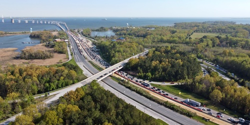
Traffic backup on Bay Bridge approach
-
Aerial view of Glen Burnie, Maryland [01]
![Aerial view of Glen Burnie, Maryland [01] (1728 visits) Aerial view of Glen Burnie, Maryland, taken near Marley Station Mall.
Ben Schumin is a professional... Aerial view of Glen Burnie, Maryland [01]](../../../../i/upload/2024/07/19/20240719162345-6a1470e1-cu_s9999x250.jpg)
-
Aerial view of Glen Burnie, Maryland [02]
![Aerial view of Glen Burnie, Maryland [02] (1789 visits) Aerial view of Glen Burnie, Maryland, taken near Marley Station Mall.
Ben Schumin is a professional... Aerial view of Glen Burnie, Maryland [02]](../../../../i/upload/2024/07/19/20240719162350-5a3dcd0c-cu_s9999x250.jpg)
-
Chesapeake Bay Bridge [03]
![Chesapeake Bay Bridge [03] (3211 visits) The Chesapeake Bay Bridge, a pair of bridges approximately 4.35 miles in length that carry US Routes... Chesapeake Bay Bridge [03]](../../../../i/upload/2024/07/19/20240719162426-d7b27488-cu_s9999x250.jpg)
-
Chesapeake Bay Bridge [04]
![Chesapeake Bay Bridge [04] (3469 visits) The Chesapeake Bay Bridge, a pair of bridges approximately 4.35 miles in length that carry US Routes... Chesapeake Bay Bridge [04]](../../../../i/upload/2024/07/19/20240719162503-710cfed8-cu_s9999x250.jpg)
-
Purple streetlight at Jennings Chapel Road and Route 97 [04]
![Purple streetlight at Jennings Chapel Road and Route 97 [04] (2003 visits) Streetlight at the intersection of Jennings Chapel Road and Maryland Route 97 in Howard County, Mary... Purple streetlight at Jennings Chapel Road and Route 97 [04]](../../../../i/upload/2024/07/20/20240720091715-4db229fd-cu_s9999x250.jpg)
-
Purple streetlight at Jennings Chapel Road and Route 97 [01]
![Purple streetlight at Jennings Chapel Road and Route 97 [01] (2389 visits) Streetlight at the intersection of Jennings Chapel Road and Maryland Route 97 in Howard County, Mary... Purple streetlight at Jennings Chapel Road and Route 97 [01]](../../../../i/upload/2024/07/20/20240720091721-aca69960-cu_s9999x250.jpg)
-
Purple streetlight at Jennings Chapel Road and Route 97 [02]
![Purple streetlight at Jennings Chapel Road and Route 97 [02] (1785 visits) Streetlight at the intersection of Jennings Chapel Road and Maryland Route 97 in Howard County, Mary... Purple streetlight at Jennings Chapel Road and Route 97 [02]](../../../../i/upload/2024/07/20/20240720091726-02de12bb-cu_s9999x250.jpg)
-
Purple streetlight at Jennings Chapel Road and Route 97 [06]
![Purple streetlight at Jennings Chapel Road and Route 97 [06] (1995 visits) Streetlight at the intersection of Jennings Chapel Road and Maryland Route 97 in Howard County, Mary... Purple streetlight at Jennings Chapel Road and Route 97 [06]](../../../../i/upload/2024/07/20/20240720091731-6756ae29-cu_s9999x250.jpg)
-
Purple streetlight at Jennings Chapel Road and Route 97 [05]
![Purple streetlight at Jennings Chapel Road and Route 97 [05] (1934 visits) Streetlight at the intersection of Jennings Chapel Road and Maryland Route 97 in Howard County, Mary... Purple streetlight at Jennings Chapel Road and Route 97 [05]](../../../../i/upload/2024/07/20/20240720091736-aa316a72-cu_s9999x250.jpg)
-
Purple streetlight at Jennings Chapel Road and Route 97 [03]
![Purple streetlight at Jennings Chapel Road and Route 97 [03] (1919 visits) Streetlight at the intersection of Jennings Chapel Road and Maryland Route 97 in Howard County, Mary... Purple streetlight at Jennings Chapel Road and Route 97 [03]](../../../../i/upload/2024/07/20/20240720091742-8c826bcc-cu_s9999x250.jpg)
-
West Broad Street at Staples Mill Road [01]
![West Broad Street at Staples Mill Road [01] (3378 visits) Aerial view of West Broad Street at the intersection with Staples Mill Road in Richmond, Virginia. ... West Broad Street at Staples Mill Road [01]](../../../../i/upload/2024/07/20/20240720091824-c8526d69-cu_s9999x250.jpg)
-
Interstate 85 split [01]
![Interstate 85 split [01] (3111 visits) Split between Interstate 85 and Interstate 95 at the northern terminus of Interstate 85 in Petersbur... Interstate 85 split [01]](../../../../i/upload/2024/07/20/20240720091907-16be82a7-cu_s9999x250.jpg)
-
Route 10 bridge over the Appomattox River [01]
![Route 10 bridge over the Appomattox River [01] (10000 visits) Route 10 bridge over the Appomattox River, which connects Chester, Virginia with Hopewell, Virginia.... Route 10 bridge over the Appomattox River [01]](../../../../i/upload/2024/07/20/20240720091917-bb5ff714-cu_s9999x250.jpg)
-
Interstate 85 split [02]
![Interstate 85 split [02] (3114 visits) Split between Interstate 85 and Interstate 95 at the northern terminus of Interstate 85 in Petersbur... Interstate 85 split [02]](../../../../i/upload/2024/07/20/20240720091956-f8385ec8-cu_s9999x250.jpg)
-
Route 10 bridge over the Appomattox River [02]
![Route 10 bridge over the Appomattox River [02] (9949 visits) Route 10 bridge over the Appomattox River, which connects Chester, Virginia with Hopewell, Virginia.... Route 10 bridge over the Appomattox River [02]](../../../../i/upload/2024/07/20/20240720092007-a0dcf942-cu_s9999x250.jpg)
-
West Broad Street at Staples Mill Road [02]
![West Broad Street at Staples Mill Road [02] (70139 visits) Aerial view of West Broad Street at the intersection with Staples Mill Road in Richmond, Virginia. ... West Broad Street at Staples Mill Road [02]](../../../../i/upload/2024/07/20/20240720092012-1df12de7-cu_s9999x250.jpg)
-
Holiday Inn Express on Staples Mill Road [01]
![Holiday Inn Express on Staples Mill Road [01] (2285 visits) Holiday Inn Express hotel near the intersection of Staples Mill Road and West Broad Street in Richmo... Holiday Inn Express on Staples Mill Road [01]](../../../../i/upload/2024/07/20/20240720092024-05d8fbae-cu_s9999x250.jpg)
-
Interstate 85 and US 460 reassurance markers [01]
![Interstate 85 and US 460 reassurance markers [01] (1677 visits) Reassurance markers for Interstate 85 southbound and US 460 westbound, about three miles from the sp... Interstate 85 and US 460 reassurance markers [01]](../../../../i/upload/2024/07/20/20240720092044-46d8955e-cu_s9999x250.jpg)
-
Route 10 bridge over the Appomattox River [03]
![Route 10 bridge over the Appomattox River [03] (10022 visits) Route 10 bridge over the Appomattox River, which connects Chester, Virginia with Hopewell, Virginia.... Route 10 bridge over the Appomattox River [03]](../../../../i/upload/2024/07/20/20240720092059-2caba99d-cu_s9999x250.jpg)
-
Interstate 85 and US 460 reassurance markers [02]
![Interstate 85 and US 460 reassurance markers [02] (1353 visits) Reassurance markers for Interstate 85 southbound and US 460 westbound, about three miles from the sp... Interstate 85 and US 460 reassurance markers [02]](../../../../i/upload/2024/07/20/20240720092125-c916fd33-cu_s9999x250.jpg)
-
Holiday Inn Express on Staples Mill Road [02]
![Holiday Inn Express on Staples Mill Road [02] (2315 visits) Holiday Inn Express hotel near the intersection of Staples Mill Road and West Broad Street in Richmo... Holiday Inn Express on Staples Mill Road [02]](../../../../i/upload/2024/07/20/20240720092149-d50c6216-cu_s9999x250.jpg)
-
Interstate 85 and US 460 reassurance markers [03]
![Interstate 85 and US 460 reassurance markers [03] (1375 visits) Reassurance markers for Interstate 85 southbound and US 460 westbound, about three miles from the sp... Interstate 85 and US 460 reassurance markers [03]](../../../../i/upload/2024/07/20/20240720092209-42a70fc2-cu_s9999x250.jpg)
-
Skyline of Richmond, Virginia from over the James River [05]
![Skyline of Richmond, Virginia from over the James River [05] (2608 visits) The skyline of Richmond, Virginia as viewed from the southwest, above the James River.
More at The ... Skyline of Richmond, Virginia from over the James River [05]](../../../../i/upload/2024/07/20/20240720092707-f5afb553-cu_s9999x250.jpg)
-
Church Hill neighborhood [01]
![Church Hill neighborhood [01] (11681 visits) Aerial view of the Church Hill neighborhood of Richmond, Virginia, photographed from west of Interst... Church Hill neighborhood [01]](../../../../i/upload/2024/07/20/20240720092724-5ad8079d-cu_s9999x250.jpg)
-
Church Hill neighborhood [02]
![Church Hill neighborhood [02] (11651 visits) Aerial view of the Church Hill neighborhood of Richmond, Virginia, photographed from west of Interst... Church Hill neighborhood [02]](../../../../i/upload/2024/07/20/20240720092729-c1c95489-cu_s9999x250.jpg)
-
Interstate 95 through downtown Richmond [04]
![Interstate 95 through downtown Richmond [04] (3784 visits) Interstate 95 as it passes through downtown Richmond, Virginia, facing approximately north. The Lei... Interstate 95 through downtown Richmond [04]](../../../../i/upload/2024/07/20/20240720092805-0fe0379c-cu_s9999x250.jpg)
-
Clock tower on Richmond Main Street Station [01]
![Clock tower on Richmond Main Street Station [01] (12663 visits) Clock tower on Richmond Main Street Station in downtown Richmond, Virginia, overlooking a large elev... Clock tower on Richmond Main Street Station [01]](../../../../i/upload/2024/07/20/20240720092945-196e9f26-cu_s9999x250.jpg)
-
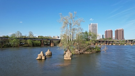
Small island in the James River
-
Interstate 95 through downtown Richmond [02]
![Interstate 95 through downtown Richmond [02] (12790 visits) Elevated section of Interstate 95 over downtown Richmond, Virginia, near the interchange with the Do... Interstate 95 through downtown Richmond [02]](../../../../i/upload/2024/07/20/20240720093017-3f2bee68-cu_s9999x250.jpg)