-
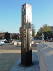
Waterfront-SEU station entrance pylon
-
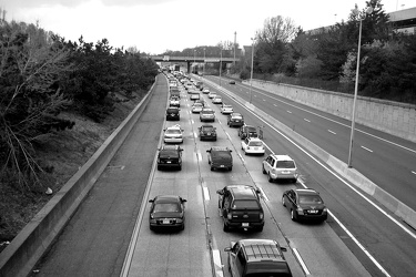
Westbound Interstate 66 near Nutley Street
-
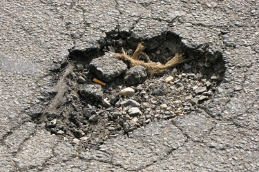
Pothole on 20th Street NW
-
Potomac River at Cumberland [01]
![Potomac River at Cumberland [01] (2763 visits) The Potomac River, forming the border between Maryland and West Virginia, photographed from a boat l... Potomac River at Cumberland [01]](../../../../i/upload/2024/07/17/20240717155947-1f8c1144-cu_s9999x250.jpg)
-
Goochland rest area, westbound [03]
![Goochland rest area, westbound [03] (1747 visits) Restroom building at the Goochland Safety Rest Area on Interstate 64 westbound in Manakin-Sabot, Vir... Goochland rest area, westbound [03]](../../../../i/upload/2024/07/19/20240719093121-0aeca88a-cu_s9999x250.jpg)
-
Goochland rest area, westbound [02]
![Goochland rest area, westbound [02] (1720 visits) Restroom building at the Goochland Safety Rest Area on Interstate 64 westbound in Manakin-Sabot, Vir... Goochland rest area, westbound [02]](../../../../i/upload/2024/07/19/20240719093125-c06aafb1-cu_s9999x250.jpg)
-
Goochland rest area, westbound [01]
![Goochland rest area, westbound [01] (1737 visits) Restroom building at the Goochland Safety Rest Area on Interstate 64 westbound in Manakin-Sabot, Vir... Goochland rest area, westbound [01]](../../../../i/upload/2024/07/19/20240719093130-dbdf3bb4-cu_s9999x250.jpg)
-
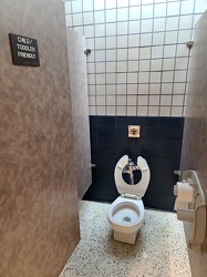
Child/toddler friendly stall at New Kent rest area
-
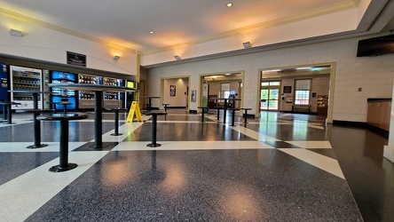
Interior of New Kent rest area, westbound
-
Platform pylon at West Falls Church station [01]
![Platform pylon at West Falls Church station [01] (1610 visits) Lighted platform pylon at West Falls Church, a Washington Metro station in Fairfax County, Virginia.... Platform pylon at West Falls Church station [01]](../../../../i/upload/2024/07/19/20240719093237-32cc7f9a-cu_s9999x250.jpg)
-
Platform pylon at West Falls Church station [02]
![Platform pylon at West Falls Church station [02] (1510 visits) Lighted platform pylon at West Falls Church, a Washington Metro station in Fairfax County, Virginia.... Platform pylon at West Falls Church station [02]](../../../../i/upload/2024/07/19/20240719093243-8507b49e-cu_s9999x250.jpg)
-
Platform pylon at West Falls Church station [03]
![Platform pylon at West Falls Church station [03] (1605 visits) Lighted platform pylon at West Falls Church, a Washington Metro station in Fairfax County, Virginia.... Platform pylon at West Falls Church station [03]](../../../../i/upload/2024/07/19/20240719093249-093357b5-cu_s9999x250.jpg)
-
Platform pylon at West Falls Church station [04]
![Platform pylon at West Falls Church station [04] (1538 visits) Lighted platform pylon at West Falls Church, a Washington Metro station in Fairfax County, Virginia.... Platform pylon at West Falls Church station [04]](../../../../i/upload/2024/07/19/20240719093255-6bd9cf26-cu_s9999x250.jpg)
-
Platform pylon at West Falls Church station [05]
![Platform pylon at West Falls Church station [05] (1631 visits) Lighted platform pylon at West Falls Church, a Washington Metro station in Fairfax County, Virginia.... Platform pylon at West Falls Church station [05]](../../../../i/upload/2024/07/19/20240719093300-b3fdcc26-cu_s9999x250.jpg)
-
Platform pylon at West Falls Church station [06]
![Platform pylon at West Falls Church station [06] (1610 visits) Lighted platform pylon at West Falls Church, a Washington Metro station in Fairfax County, Virginia.... Platform pylon at West Falls Church station [06]](../../../../i/upload/2024/07/19/20240719093305-6be3d2bb-cu_s9999x250.jpg)
-
Platform reconstruction at West Falls Church station [01]
![Platform reconstruction at West Falls Church station [01] (1845 visits) Early stages of reconstruction work on the platform at West Falls Church station in Fairfax County, ... Platform reconstruction at West Falls Church station [01]](../../../../i/upload/2024/07/19/20240719093509-8e502a6d-cu_s9999x250.jpg)
-
Platform reconstruction at West Falls Church station [02]
![Platform reconstruction at West Falls Church station [02] (1778 visits) Early stages of reconstruction work on the platform at West Falls Church station in Fairfax County, ... Platform reconstruction at West Falls Church station [02]](../../../../i/upload/2024/07/19/20240719093612-fc476a41-cu_s9999x250.jpg)
-
Platform reconstruction at West Falls Church station [03]
![Platform reconstruction at West Falls Church station [03] (1815 visits) Early stages of reconstruction work on the platform at West Falls Church station in Fairfax County, ... Platform reconstruction at West Falls Church station [03]](../../../../i/upload/2024/07/19/20240719093617-0023087e-cu_s9999x250.jpg)
-
US 340 in Charles Town [03]
![US 340 in Charles Town [03] (3191 visits) US 340 in Charles Town, West Virginia, east of the interchange with West Virginia Route 9.
Ben Schu... US 340 in Charles Town [03]](../../../../i/upload/2024/07/19/20240719162153-ebf4366a-cu_s9999x250.jpg)
-
US 340 in Charles Town [02]
![US 340 in Charles Town [02] (3179 visits) US 340 in Charles Town, West Virginia, east of the interchange with West Virginia Route 9.
Ben Schu... US 340 in Charles Town [02]](../../../../i/upload/2024/07/19/20240719162156-6d3ecd1b-cu_s9999x250.jpg)
-
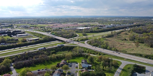
Intersection of US 340 and West Virginia Routes 9 and 51
-
Water tower in Charles Town, West Virginia [02]
![Water tower in Charles Town, West Virginia [02] (1378 visits) Water tower off of Keyes Ferry Road in Charles Town, West Virginia.
Ben Schumin is a professional p... Water tower in Charles Town, West Virginia [02]](../../../../i/upload/2024/07/19/20240719162232-1fa6a18a-cu_s9999x250.jpg)
-
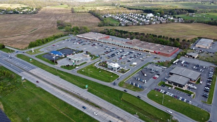
Somerset Village
-
Water tower in Charles Town, West Virginia [01]
![Water tower in Charles Town, West Virginia [01] (1333 visits) Water tower off of Keyes Ferry Road in Charles Town, West Virginia.
Ben Schumin is a professional p... Water tower in Charles Town, West Virginia [01]](../../../../i/upload/2024/07/19/20240719162240-13c189c6-cu_s9999x250.jpg)
-
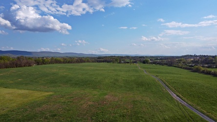
Field in Charles Town, West Virginia
-
Water tower in Charles Town, West Virginia [04]
![Water tower in Charles Town, West Virginia [04] (1342 visits) Water tower off of Keyes Ferry Road in Charles Town, West Virginia.
Ben Schumin is a professional p... Water tower in Charles Town, West Virginia [04]](../../../../i/upload/2024/07/19/20240719162248-f64b8823-cu_s9999x250.jpg)
-
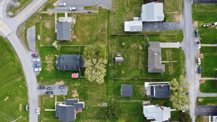
Neighborhood in Charles Town, West Virginia
-
US 340 in Charles Town [04]
![US 340 in Charles Town [04] (2528 visits) US 340 in Charles Town, West Virginia, east of the interchange with West Virginia Route 9.
Ben Schu... US 340 in Charles Town [04]](../../../../i/upload/2024/07/19/20240719162255-e1659465-cu_s9999x250.jpg)
-
US 340 in Charles Town [01]
![US 340 in Charles Town [01] (3220 visits) US 340 in Charles Town, West Virginia, east of the interchange with West Virginia Route 9.
Ben Schu... US 340 in Charles Town [01]](../../../../i/upload/2024/07/19/20240719162259-85e9531c-cu_s9999x250.jpg)
-
Water tower in Charles Town, West Virginia [03]
![Water tower in Charles Town, West Virginia [03] (1332 visits) Water tower off of Keyes Ferry Road in Charles Town, West Virginia.
Ben Schumin is a professional p... Water tower in Charles Town, West Virginia [03]](../../../../i/upload/2024/07/19/20240719162312-7a4d222b-cu_s9999x250.jpg)
-
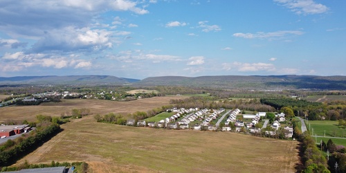
Fields and housing in Charles Town, West Virginia
-
West Broad Street at Staples Mill Road [01]
![West Broad Street at Staples Mill Road [01] (3208 visits) Aerial view of West Broad Street at the intersection with Staples Mill Road in Richmond, Virginia. ... West Broad Street at Staples Mill Road [01]](../../../../i/upload/2024/07/20/20240720091824-c8526d69-cu_s9999x250.jpg)
-
West Broad Street at Staples Mill Road [02]
![West Broad Street at Staples Mill Road [02] (69982 visits) Aerial view of West Broad Street at the intersection with Staples Mill Road in Richmond, Virginia. ... West Broad Street at Staples Mill Road [02]](../../../../i/upload/2024/07/20/20240720092012-1df12de7-cu_s9999x250.jpg)
-
Holiday Inn Express on Staples Mill Road [01]
![Holiday Inn Express on Staples Mill Road [01] (2128 visits) Holiday Inn Express hotel near the intersection of Staples Mill Road and West Broad Street in Richmo... Holiday Inn Express on Staples Mill Road [01]](../../../../i/upload/2024/07/20/20240720092024-05d8fbae-cu_s9999x250.jpg)
-
Interstate 85 and US 460 reassurance markers [01]
![Interstate 85 and US 460 reassurance markers [01] (1615 visits) Reassurance markers for Interstate 85 southbound and US 460 westbound, about three miles from the sp... Interstate 85 and US 460 reassurance markers [01]](../../../../i/upload/2024/07/20/20240720092044-46d8955e-cu_s9999x250.jpg)
-
Interstate 85 and US 460 reassurance markers [02]
![Interstate 85 and US 460 reassurance markers [02] (1290 visits) Reassurance markers for Interstate 85 southbound and US 460 westbound, about three miles from the sp... Interstate 85 and US 460 reassurance markers [02]](../../../../i/upload/2024/07/20/20240720092125-c916fd33-cu_s9999x250.jpg)
-
Holiday Inn Express on Staples Mill Road [02]
![Holiday Inn Express on Staples Mill Road [02] (2155 visits) Holiday Inn Express hotel near the intersection of Staples Mill Road and West Broad Street in Richmo... Holiday Inn Express on Staples Mill Road [02]](../../../../i/upload/2024/07/20/20240720092149-d50c6216-cu_s9999x250.jpg)
-
Interstate 85 and US 460 reassurance markers [03]
![Interstate 85 and US 460 reassurance markers [03] (1315 visits) Reassurance markers for Interstate 85 southbound and US 460 westbound, about three miles from the sp... Interstate 85 and US 460 reassurance markers [03]](../../../../i/upload/2024/07/20/20240720092209-42a70fc2-cu_s9999x250.jpg)
-
Norfolk Southern Gregson Street Overpass [01]
![Norfolk Southern Gregson Street Overpass [01] (6852 visits) Norfolk Southern railroad bridge over South Gregson Street near West Peabody Street in downtown Durh... Norfolk Southern Gregson Street Overpass [01]](../../../../i/upload/2025/01/16/20250116015512-a5790518-cu_s9999x250.jpg)
-
Norfolk Southern Gregson Street Overpass [02]
![Norfolk Southern Gregson Street Overpass [02] (6990 visits) Norfolk Southern railroad bridge over South Gregson Street near West Peabody Street in downtown Durh... Norfolk Southern Gregson Street Overpass [02]](../../../../i/upload/2025/01/16/20250116015518-558656fc-cu_s9999x250.jpg)
-
12'4" low clearance warning sign [01]
![12'4" low clearance warning sign [01] (1751 visits) Low clearance sign warning drivers of the bridge's low height of only 12'4". Until 2019, this ... 12'4" low clearance warning sign [01]](../../../../i/upload/2025/01/16/20250116015525-4456e6dc-cu_s9999x250.jpg)
-
12'4" low clearance warning sign [02]
![12'4" low clearance warning sign [02] (7201 visits) Low clearance sign warning drivers of the bridge's low height of only 12'4". Until 2019, this ... 12'4" low clearance warning sign [02]](../../../../i/upload/2025/01/16/20250116015531-9494d592-cu_s9999x250.jpg)
-
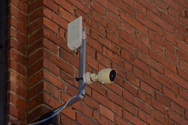
11-foot-8 camera
-
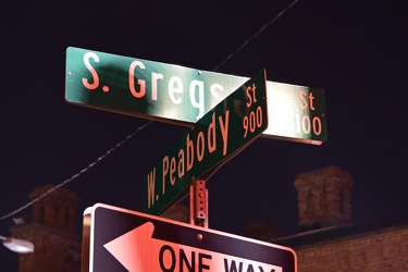
Street signs for South Gregson Street and West Peabody Street
