-
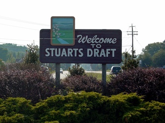
Welcome to Stuarts Draft
-
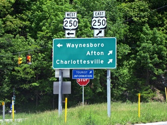
Directional signage at the end of the ramp for Interstate 64, Exit 99 at Rockfish Gap
-
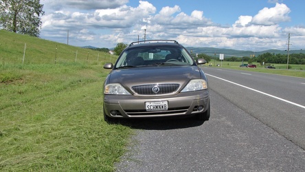
Mercury Sable wagon on US 340
-
Intersection of US 340 and VA 608 [01]
![Intersection of US 340 and VA 608 [01] (105805 visits) Intersection of US 340 and Virginia state secondary route 608 in Stuarts Draft, Virginia.
Ben Sch... Intersection of US 340 and VA 608 [01]](../../../../i/upload/2024/07/19/20240719120550-1673ec68-cu_s9999x250.jpg)
-
Interstate 64 near Rockfish Gap [01]
![Interstate 64 near Rockfish Gap [01] (65946 visits) Interstate 64, near Rockfish Gap in Virginia.
Ben Schumin is a professional photographer who captur... Interstate 64 near Rockfish Gap [01]](../../../../i/upload/2024/07/19/20240719120555-d0d3c2ce-cu_s9999x250.jpg)
-
Intersection of US 340 and VA 608 [02]
![Intersection of US 340 and VA 608 [02] (105765 visits) Intersection of US 340 and Virginia state secondary route 608 in Stuarts Draft, Virginia.
Ben Sch... Intersection of US 340 and VA 608 [02]](../../../../i/upload/2024/07/19/20240719120559-2af4c901-cu_s9999x250.jpg)
-
Interstate 64 near Rockfish Gap [02]
![Interstate 64 near Rockfish Gap [02] (2967 visits) Interstate 64, near Rockfish Gap in Virginia. The bridge in the foreground carries Skyline Drive ov... Interstate 64 near Rockfish Gap [02]](../../../../i/upload/2024/07/19/20240719120604-e2ad25dd-cu_s9999x250.jpg)
-
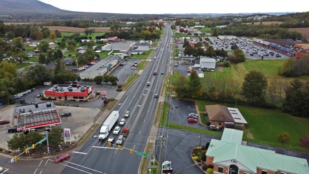
US 340 south in Stuarts Draft
-
Interstate 64 near Rockfish Gap [03]
![Interstate 64 near Rockfish Gap [03] (2974 visits) Interstate 64, near Rockfish Gap in Virginia. The bridge in the foreground carries Skyline Drive ov... Interstate 64 near Rockfish Gap [03]](../../../../i/upload/2024/07/19/20240719120613-6e2190f6-cu_s9999x250.jpg)
-
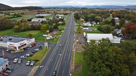
US 340 north in Stuarts Draft
-
Interstate 64 near Rockfish Gap [04]
![Interstate 64 near Rockfish Gap [04] (2976 visits) Interstate 64, near Rockfish Gap in Virginia. The bridge in the foreground carries Skyline Drive ov... Interstate 64 near Rockfish Gap [04]](../../../../i/upload/2024/07/19/20240719120620-49d9b327-cu_s9999x250.jpg)
-
Interstate 64 near Rockfish Gap [05]
![Interstate 64 near Rockfish Gap [05] (10783 visits) Interstate 64, near Rockfish Gap in Virginia. The boundary between Augusta and Nelson Counties runs... Interstate 64 near Rockfish Gap [05]](../../../../i/upload/2024/07/19/20240719120629-90e00218-cu_s9999x250.jpg)
-
"Littering is illegal" sign [01]
!["Littering is illegal" sign [01] (1747 visits) Sign on US Route 11 in Weyers Cave, Virginia reminding drivers that littering is illegal. I've alwa... "Littering is illegal" sign [01]](../../../../i/upload/2024/07/19/20240719124007-1b4f030c-cu_s9999x250.jpg)
-
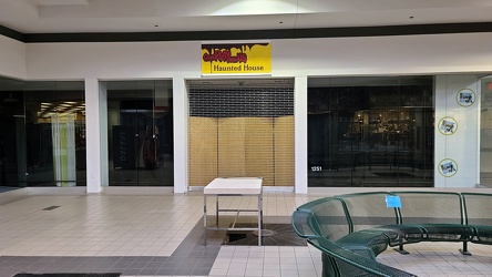
Former KB Toys space
-
Belk wing entrance corridor [03]
![Belk wing entrance corridor [03] (3211 visits) Entrance corridor for the Belk wing in Staunton Mall. The Belk wing was added when the mall was enc... Belk wing entrance corridor [03]](../../../../i/upload/2024/07/19/20240719124634-cbbc545f-cu_s9999x250.jpg)
-
Corridor at center entrance to Staunton Mall [02]
![Corridor at center entrance to Staunton Mall [02] (3163 visits) Corridor leading from Staunton Mall's center entrance, facing the entrance doors.
More at The Schum... Corridor at center entrance to Staunton Mall [02]](../../../../i/upload/2024/07/19/20240719124820-7dd5a679-cu_s9999x250.jpg)
-
Staunton Mall Belk wing [05]
![Staunton Mall Belk wing [05] (3145 visits) Belk wing at Staunton Mall. View near Montgomery Ward entrance, facing west.
More at The Schumin W... Staunton Mall Belk wing [05]](../../../../i/upload/2024/07/19/20240719124829-aec4607a-cu_s9999x250.jpg)
-
Corridor at center entrance to Staunton Mall [03]
![Corridor at center entrance to Staunton Mall [03] (2988 visits) Corridor leading from Staunton Mall's center entrance, facing the entrance doors.
More at The Schum... Corridor at center entrance to Staunton Mall [03]](../../../../i/upload/2024/07/19/20240719125731-6b493d84-cu_s9999x250.jpg)
-
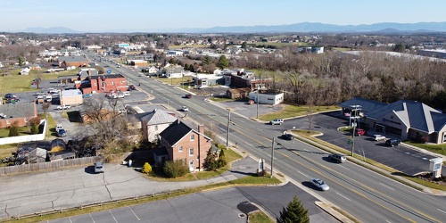
View up Route 11 from above Verona Fire Department
-
West Main Street in Waynesboro, Virginia [02]
![West Main Street in Waynesboro, Virginia [02] (3360 visits) Downtown Waynesboro, Virginia, looking east down West Main Street, near the intersection with Church... West Main Street in Waynesboro, Virginia [02]](../../../../i/upload/2024/07/19/20240719130153-2ee52d33-cu_s9999x250.jpg)
-
West Main Street in Waynesboro, Virginia [01]
![West Main Street in Waynesboro, Virginia [01] (3472 visits) Downtown Waynesboro, Virginia, looking east down West Main Street, near the intersection with Church... West Main Street in Waynesboro, Virginia [01]](../../../../i/upload/2024/07/19/20240719130232-6088860d-cu_s9999x250.jpg)
-
West Main Street in Waynesboro, Virginia [03]
![West Main Street in Waynesboro, Virginia [03] (13371 visits) Downtown Waynesboro, Virginia, looking east down West Main Street, near the intersection with Church... West Main Street in Waynesboro, Virginia [03]](../../../../i/upload/2024/07/19/20240719130237-f1099710-cu_s9999x250.jpg)
-
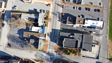
West Main Street and Church Street
-
Bull statue decorated for St. Patrick's Day [01]
![Bull statue decorated for St. Patrick's Day [01] (2575 visits) Bull statue on a farm in Stuarts Draft, Virginia, dressed for St. Patrick's Day. This bull overlook... Bull statue decorated for St. Patrick's Day [01]](../../../../i/upload/2024/07/19/20240719160911-f0a68371-cu_s9999x250.jpg)
-
Bull statue decorated for St. Patrick's Day [02]
![Bull statue decorated for St. Patrick's Day [02] (2521 visits) Bull statue on a farm in Stuarts Draft, Virginia, dressed for St. Patrick's Day. This bull overlook... Bull statue decorated for St. Patrick's Day [02]](../../../../i/upload/2024/07/19/20240719161000-73bc01c3-cu_s9999x250.jpg)
-
Bull statue decorated for St. Patrick's Day [03]
![Bull statue decorated for St. Patrick's Day [03] (2608 visits) Bull statue on a farm in Stuarts Draft, Virginia, dressed for St. Patrick's Day. This bull overlook... Bull statue decorated for St. Patrick's Day [03]](../../../../i/upload/2024/07/19/20240719161019-56b19c34-cu_s9999x250.jpg)
-
Richmond Avenue in Staunton, Virginia [02]
![Richmond Avenue in Staunton, Virginia [02] (66899 visits) Aerial view of Richmond Avenue (US 250) in Staunton, Virginia, near the intersection with Frontier D... Richmond Avenue in Staunton, Virginia [02]](../../../../i/upload/2024/07/19/20240719161203-233bb776-cu_s9999x250.jpg)
-
Vintage Seagrave fire truck at Churchville Volunteer Fire Department [01]
![Vintage Seagrave fire truck at Churchville Volunteer Fire Department [01] (1818 visits) Vintage Seagrave fire truck parked outside of the Churchville Volunteer Fire Department in Augusta C... Vintage Seagrave fire truck at Churchville Volunteer Fire Department [01]](../../../../i/upload/2024/07/19/20240719164407-74f7e276-cu_s9999x250.jpg)
-
Vintage Seagrave fire truck at Churchville Volunteer Fire Department [02]
![Vintage Seagrave fire truck at Churchville Volunteer Fire Department [02] (1836 visits) Vintage Seagrave fire truck parked outside of the Churchville Volunteer Fire Department in Augusta C... Vintage Seagrave fire truck at Churchville Volunteer Fire Department [02]](../../../../i/upload/2024/07/19/20240719164413-0b8113ea-cu_s9999x250.jpg)
-
Vintage Seagrave fire truck at Churchville Volunteer Fire Department [03]
![Vintage Seagrave fire truck at Churchville Volunteer Fire Department [03] (1798 visits) Vintage Seagrave fire truck parked outside of the Churchville Volunteer Fire Department in Augusta C... Vintage Seagrave fire truck at Churchville Volunteer Fire Department [03]](../../../../i/upload/2024/07/19/20240719164419-a2eacc42-cu_s9999x250.jpg)
-
Churchville Volunteer Fire Department [01]
![Churchville Volunteer Fire Department [01] (1184 visits) Building for Churchville Volunteer Fire Department, on Churchville Road (US 250/SR 42) in Churchvill... Churchville Volunteer Fire Department [01]](../../../../i/upload/2024/07/19/20240719164426-c1be3535-cu_s9999x250.jpg)
-
Churchville Volunteer Fire Department [02]
![Churchville Volunteer Fire Department [02] (1675 visits) Building for Churchville Volunteer Fire Department, on Churchville Road (US 250/SR 42) in Churchvill... Churchville Volunteer Fire Department [02]](../../../../i/upload/2024/07/19/20240719164431-2ab245f9-cu_s9999x250.jpg)
-
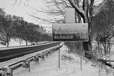
Snow-covered mileage sign on US 250
-
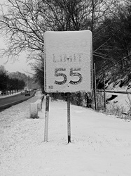
Snow-covered speed limit sign on US 250
-
Bottle cap embedded in gravel [02]
![Bottle cap embedded in gravel [02] (1739 visits) Bottle cap embedded in the gravel in the parking lot of the Fort Edward Johnson wayside along US 250... Bottle cap embedded in gravel [02]](../../../../i/upload/2024/07/20/20240720093935-e8bfbf5c-cu_s9999x250.jpg)
-
Sign at the border between Augusta and Highland Counties [03]
![Sign at the border between Augusta and Highland Counties [03] (2802 visits) Sign along US 250 at the border between Augusta and Highland Counties in Virginia. The sign is of t... Sign at the border between Augusta and Highland Counties [03]](../../../../i/upload/2024/07/20/20240720093939-e9041290-cu_s9999x250.jpg)
-
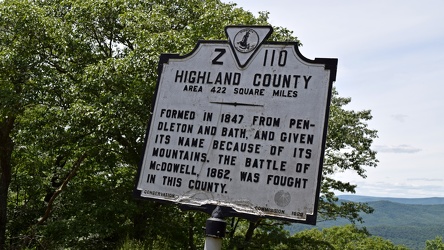
Historical marker for Highland County on US 250
-
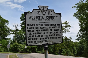
Historical marker for Augusta County on US 250
-
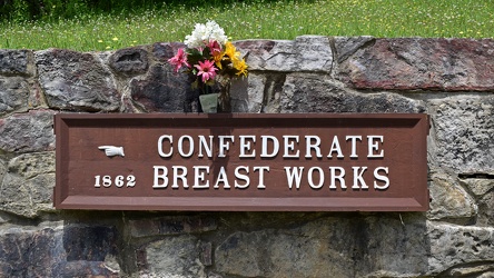
Confederate Breastworks sign
-
Sign at the border between Augusta and Highland Counties [02]
![Sign at the border between Augusta and Highland Counties [02] (2717 visits) Sign along US 250 at the border between Augusta and Highland Counties in Virginia. The sign is stan... Sign at the border between Augusta and Highland Counties [02]](../../../../i/upload/2024/07/20/20240720094001-d7689782-cu_s9999x250.jpg)
-
Bottle cap embedded in gravel [01]
![Bottle cap embedded in gravel [01] (1433 visits) Bottle cap embedded in the gravel in the parking lot of the Fort Edward Johnson wayside along US 250... Bottle cap embedded in gravel [01]](../../../../i/upload/2024/07/20/20240720094006-f13f59c7-cu_s9999x250.jpg)
-
Graffiti at Fort Edward Johnson wayside

-
Sign at the border between Augusta and Highland Counties [01]
![Sign at the border between Augusta and Highland Counties [01] (2832 visits) Sign along US 250 at the border between Augusta and Highland Counties in Virginia. The sign is stan... Sign at the border between Augusta and Highland Counties [01]](../../../../i/upload/2024/07/20/20240720094015-efe93712-cu_s9999x250.jpg)
-
"Littering is illegal" sign [02]
!["Littering is illegal" sign [02] (3088 visits) Sign along US 250 at the border between Augusta and Highland Counties in Virginia, reminding drivers... "Littering is illegal" sign [02]](../../../../i/upload/2024/07/20/20240720094020-cdd34053-cu_s9999x250.jpg)
-
Staunton Reservoir and Dam [01]
![Staunton Reservoir and Dam [01] (7675 visits) Sign in the George Washington National Forest describing Staunton Reservoir and Staunton Dam.
The s... Staunton Reservoir and Dam [01]](../../../../i/upload/2024/07/20/20240720094031-383bc35b-cu_s9999x250.jpg)
-
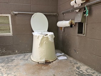
Restroom at Fort Edward Johnson wayside
-
Staunton Reservoir and Dam [02]
![Staunton Reservoir and Dam [02] (1410 visits) Staunton Dam, which impounds the North River to form Staunton Reservoir, in the George Washington Na... Staunton Reservoir and Dam [02]](../../../../i/upload/2024/07/20/20240720094322-57987a87-cu_s9999x250.jpg)
-
Staunton Reservoir and Dam [03]
![Staunton Reservoir and Dam [03] (1536 visits) Staunton Dam, which impounds the North River to form Staunton Reservoir, in the George Washington Na... Staunton Reservoir and Dam [03]](../../../../i/upload/2024/07/20/20240720094332-f7f74f79-cu_s9999x250.jpg)
-
Staunton Reservoir and Dam [04]
![Staunton Reservoir and Dam [04] (1451 visits) Staunton Dam, which impounds the North River to form Staunton Reservoir, in the George Washington Na... Staunton Reservoir and Dam [04]](../../../../i/upload/2024/07/20/20240720094342-7b10741f-cu_s9999x250.jpg)
-
Staunton Reservoir and Dam [05]
![Staunton Reservoir and Dam [05] (1427 visits) Staunton Dam, which impounds the North River to form Staunton Reservoir, in the George Washington Na... Staunton Reservoir and Dam [05]](../../../../i/upload/2024/07/20/20240720094347-5d03f5fe-cu_s9999x250.jpg)
-
Staunton Reservoir and Dam [06]
![Staunton Reservoir and Dam [06] (1529 visits) Staunton Dam, which impounds the North River to form Staunton Reservoir, in the George Washington Na... Staunton Reservoir and Dam [06]](../../../../i/upload/2024/07/20/20240720094352-ad87296e-cu_s9999x250.jpg)
-
Staunton Reservoir and Dam [07]
![Staunton Reservoir and Dam [07] (1515 visits) Staunton Reservoir, a manmade lake in George Washington National Forest near Churchville, Virginia, ... Staunton Reservoir and Dam [07]](../../../../i/upload/2024/07/20/20240720094357-d30df83b-cu_s9999x250.jpg)
-
Staunton Reservoir and Dam [08]
![Staunton Reservoir and Dam [08] (3487 visits) Staunton Reservoir, a manmade lake in George Washington National Forest near Churchville, Virginia, ... Staunton Reservoir and Dam [08]](../../../../i/upload/2024/07/20/20240720094402-23c1cb19-cu_s9999x250.jpg)
-
Staunton Reservoir and Dam [09]
![Staunton Reservoir and Dam [09] (1647 visits) Buoy in the Staunton Reservoir, warning of the presence of a dam. Staunton Reservoir is a manmade l... Staunton Reservoir and Dam [09]](../../../../i/upload/2024/07/20/20240720094407-f75c922a-cu_s9999x250.jpg)
-
Staunton Reservoir and Dam [10]
![Staunton Reservoir and Dam [10] (1542 visits) The North River, just downstream from Staunton Dam.
Ben Schumin is a professional photographer who ... Staunton Reservoir and Dam [10]](../../../../i/upload/2024/07/20/20240720094412-ad4c8b53-cu_s9999x250.jpg)
-
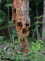
Weathered tree trunk along the Coal Road
-
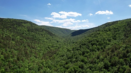
Mountains around Coles Run Reservoir
-
Coles Run Reservoir [05]
![Coles Run Reservoir [05] (1607 visits) Coles Run Reservoir, a manmade lake in the George Washington National Forest near Stuarts Draft, Vir... Coles Run Reservoir [05]](../../../../i/upload/2024/07/20/20240720094442-b7fc142b-cu_s9999x250.jpg)
-
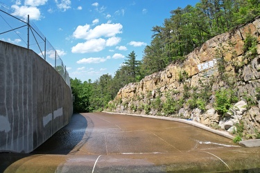
Spillway at Coles Run Reservoir
-
Coles Run Reservoir and Dam [03]
![Coles Run Reservoir and Dam [03] (1862 visits) Coles Run Reservoir and Dam, in the George Washington National Forest near Stuarts Draft, Virginia.
... Coles Run Reservoir and Dam [03]](../../../../i/upload/2024/07/20/20240720094453-45865af9-cu_s9999x250.jpg)
-
Coles Run Reservoir and Dam [04]
![Coles Run Reservoir and Dam [04] (1961 visits) Coles Run Reservoir and Dam, in the George Washington National Forest near Stuarts Draft, Virginia.
... Coles Run Reservoir and Dam [04]](../../../../i/upload/2024/07/20/20240720094458-05426f6f-cu_s9999x250.jpg)
-
Coles Run Reservoir [06]
![Coles Run Reservoir [06] (1596 visits) Coles Run Reservoir, a manmade lake in the George Washington National Forest near Stuarts Draft, Vir... Coles Run Reservoir [06]](../../../../i/upload/2024/07/20/20240720094503-ed97cdcc-cu_s9999x250.jpg)
-
Coles Run Reservoir and Dam [01]
![Coles Run Reservoir and Dam [01] (1883 visits) Coles Run Reservoir and Dam, in the George Washington National Forest near Stuarts Draft, Virginia.
... Coles Run Reservoir and Dam [01]](../../../../i/upload/2024/07/20/20240720094509-20eb1708-cu_s9999x250.jpg)
-
Coles Run Reservoir [01]
![Coles Run Reservoir [01] (1571 visits) Coles Run Reservoir, a manmade lake in the George Washington National Forest near Stuarts Draft, Vir... Coles Run Reservoir [01]](../../../../i/upload/2024/07/20/20240720094619-828ab63a-cu_s9999x250.jpg)
-
Coles Run Reservoir [02]
![Coles Run Reservoir [02] (1551 visits) Coles Run Reservoir, a manmade lake in the George Washington National Forest near Stuarts Draft, Vir... Coles Run Reservoir [02]](../../../../i/upload/2024/07/20/20240720094625-36f148ac-cu_s9999x250.jpg)
-
Coles Run Reservoir and Dam [02]
![Coles Run Reservoir and Dam [02] (2226 visits) Coles Run Reservoir and Dam, in the George Washington National Forest near Stuarts Draft, Virginia.
... Coles Run Reservoir and Dam [02]](../../../../i/upload/2024/07/20/20240720094630-6787809c-cu_s9999x250.jpg)
-
Coles Run Reservoir [04]
![Coles Run Reservoir [04] (13584 visits) Coles Run Reservoir, a manmade lake in the George Washington National Forest near Stuarts Draft, Vir... Coles Run Reservoir [04]](../../../../i/upload/2024/07/20/20240720094737-53d9fdc6-cu_s9999x250.jpg)
-
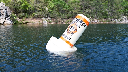
Buoy in Coles Run Reservoir
-
Coles Run Reservoir [07]
![Coles Run Reservoir [07] (1693 visits) Coles Run Reservoir, a manmade lake in the George Washington National Forest near Stuarts Draft, Vir... Coles Run Reservoir [07]](../../../../i/upload/2024/07/20/20240720094748-da81fa4e-cu_s9999x250.jpg)
-
Coles Run Reservoir [03]
![Coles Run Reservoir [03] (1535 visits) Coles Run Reservoir, a manmade lake in the George Washington National Forest near Stuarts Draft, Vir... Coles Run Reservoir [03]](../../../../i/upload/2024/07/20/20240720094756-eba3353a-cu_s9999x250.jpg)
-
Staunton Mall demolition progress [48]
![Staunton Mall demolition progress [48] (10677 visits) Demolition progress at the former Staunton Mall, on June 4, 2022. Staunton Mall closed at the end o... Staunton Mall demolition progress [48]](../../../../i/upload/2024/07/20/20240720095333-0b52b694-cu_s9999x250.jpg)
-
Staunton Mall demolition progress [49]
![Staunton Mall demolition progress [49] (10601 visits) Demolition progress at the former Staunton Mall, on June 4, 2022. Staunton Mall closed at the end o... Staunton Mall demolition progress [49]](../../../../i/upload/2024/07/20/20240720095339-88a18b7b-cu_s9999x250.jpg)
-
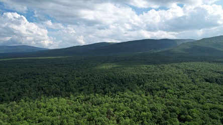
George Washington National Forest from above
-
Sherando Lake [02]
![Sherando Lake [02] (1484 visits) Sherando Lake, a manmade lake in the George Washington National Forest in Augusta County, Virginia, ... Sherando Lake [02]](../../../../i/upload/2024/07/20/20240720111103-fdc10257-cu_s9999x250.jpg)
-
Sherando Lake [04]
![Sherando Lake [04] (1389 visits) Sherando Lake, a manmade lake in the George Washington National Forest in Augusta County, Virginia, ... Sherando Lake [04]](../../../../i/upload/2024/07/20/20240720111109-3c71590a-cu_s9999x250.jpg)
-
Sherando Lake [05]
![Sherando Lake [05] (1403 visits) Sherando Lake, a manmade lake in the George Washington National Forest in Augusta County, Virginia, ... Sherando Lake [05]](../../../../i/upload/2024/07/20/20240720111114-4ec2c76a-cu_s9999x250.jpg)
-
Sherando Lake [09]
![Sherando Lake [09] (1537 visits) Sherando Lake, a manmade lake in the George Washington National Forest in Augusta County, Virginia, ... Sherando Lake [09]](../../../../i/upload/2024/07/20/20240720111120-d0f93192-cu_s9999x250.jpg)
-
Sherando Lake [11]
![Sherando Lake [11] (2086 visits) Sherando Lake, a manmade lake in the George Washington National Forest in Augusta County, Virginia, ... Sherando Lake [11]](../../../../i/upload/2024/07/20/20240720111125-b92e902d-cu_s9999x250.jpg)
-
Toilet at Sherando Lake
-
Sherando Lake [10]
![Sherando Lake [10] (1638 visits) Sherando Lake, a manmade lake in the George Washington National Forest in Augusta County, Virginia, ... Sherando Lake [10]](../../../../i/upload/2024/07/20/20240720111224-761f9e3b-cu_s9999x250.jpg)