-
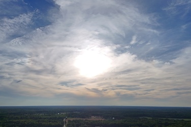
Sunset over Thornburg, Virginia
-
Sky above Croaker Road

-
Buffalo Gap [02]
![Buffalo Gap [02] (1730 visits) Buffalo Gap, a mountain pass through Little North Mountain, near Swoope, Virginia.
More at The Sc... Buffalo Gap [02]](../../../../../i/upload/2025/01/03/20250103200607-1abe8192-cu_s9999x250.jpg)
-
Monopine-style cell tower in Hot Springs, Virginia [06]
![Monopine-style cell tower in Hot Springs, Virginia [06] (2809 visits) Monopine-style cell phone tower in Hot Springs, Virginia. The tower is designed to resemble a pine ... Monopine-style cell tower in Hot Springs, Virginia [06]](../../../../../i/upload/2025/01/02/20250102180810-ab89514c-cu_s9999x250.jpg)
-
Monopine-style cell tower in Hot Springs, Virginia [05]
![Monopine-style cell tower in Hot Springs, Virginia [05] (2721 visits) Monopine-style cell phone tower in Hot Springs, Virginia. The tower is designed to resemble a pine ... Monopine-style cell tower in Hot Springs, Virginia [05]](../../../../../i/upload/2025/01/02/20250102180804-651fb2e5-cu_s9999x250.jpg)
-
Monopine-style cell tower in Hot Springs, Virginia [04]
![Monopine-style cell tower in Hot Springs, Virginia [04] (2736 visits) Monopine-style cell phone tower in Hot Springs, Virginia. The tower is designed to resemble a pine ... Monopine-style cell tower in Hot Springs, Virginia [04]](../../../../../i/upload/2025/01/02/20250102180757-98a25cf6-cu_s9999x250.jpg)
-
Monopine-style cell tower in Hot Springs, Virginia [03]
![Monopine-style cell tower in Hot Springs, Virginia [03] (2843 visits) Monopine-style cell phone tower in Hot Springs, Virginia. The tower is designed to resemble a pine ... Monopine-style cell tower in Hot Springs, Virginia [03]](../../../../../i/upload/2025/01/02/20250102180751-95c7a9be-cu_s9999x250.jpg)
-
Monopine-style cell tower in Hot Springs, Virginia [02]
![Monopine-style cell tower in Hot Springs, Virginia [02] (2743 visits) Monopine-style cell phone tower in Hot Springs, Virginia. The tower is designed to resemble a pine ... Monopine-style cell tower in Hot Springs, Virginia [02]](../../../../../i/upload/2025/01/02/20250102180745-dc321558-cu_s9999x250.jpg)
-
Monopine-style cell tower in Hot Springs, Virginia [01]
![Monopine-style cell tower in Hot Springs, Virginia [01] (2779 visits) Monopine-style cell phone tower in Hot Springs, Virginia. The tower is designed to resemble a pine ... Monopine-style cell tower in Hot Springs, Virginia [01]](../../../../../i/upload/2025/01/02/20250102180740-cc90582a-cu_s9999x250.jpg)
-
Wildfire in Wheatfield, Virginia [19]
![Wildfire in Wheatfield, Virginia [19] (1645 visits) Aerial view of a wildfire in Wheatfield, Virginia.
More at The Schumin Web:
www.schuminweb.com/2024... Wildfire in Wheatfield, Virginia [19]](../../../../../i/upload/2024/12/26/20241226113557-e900887b-cu_s9999x250.jpg)
-
Wildfire in Wheatfield, Virginia [18]
![Wildfire in Wheatfield, Virginia [18] (1688 visits) Aerial view of a wildfire in Wheatfield, Virginia.
More at The Schumin Web:
www.schuminweb.com/2024... Wildfire in Wheatfield, Virginia [18]](../../../../../i/upload/2024/12/26/20241226113546-653ce2b4-cu_s9999x250.jpg)
-
Wildfire in Wheatfield, Virginia [17]
![Wildfire in Wheatfield, Virginia [17] (1675 visits) Aerial view of a wildfire in Wheatfield, Virginia.
More at The Schumin Web:
www.schuminweb.com/2024... Wildfire in Wheatfield, Virginia [17]](../../../../../i/upload/2024/12/26/20241226113535-464ef6f3-cu_s9999x250.jpg)
-
Wildfire in Wheatfield, Virginia [16]
![Wildfire in Wheatfield, Virginia [16] (1562 visits) Aerial view of a wildfire in Wheatfield, Virginia.
More at The Schumin Web:
www.schuminweb.com/2024... Wildfire in Wheatfield, Virginia [16]](../../../../../i/upload/2024/12/26/20241226113524-b6ae32b2-cu_s9999x250.jpg)
-
Wildfire in Wheatfield, Virginia [15]
![Wildfire in Wheatfield, Virginia [15] (1561 visits) Aerial view of a wildfire in Wheatfield, Virginia.
More at The Schumin Web:
www.schuminweb.com/2024... Wildfire in Wheatfield, Virginia [15]](../../../../../i/upload/2024/12/26/20241226113515-58af561f-cu_s9999x250.jpg)
-
Wildfire in Wheatfield, Virginia [14]
![Wildfire in Wheatfield, Virginia [14] (1604 visits) Aerial view of a wildfire in Wheatfield, Virginia.
More at The Schumin Web:
www.schuminweb.com/2024... Wildfire in Wheatfield, Virginia [14]](../../../../../i/upload/2024/12/26/20241226113504-f310b6be-cu_s9999x250.jpg)
-
Wildfire in Wheatfield, Virginia [13]
![Wildfire in Wheatfield, Virginia [13] (1602 visits) Aerial view of a wildfire in Wheatfield, Virginia.
More at The Schumin Web:
www.schuminweb.com/2024... Wildfire in Wheatfield, Virginia [13]](../../../../../i/upload/2024/12/26/20241226113455-f989b84b-cu_s9999x250.jpg)
-
Wildfire in Wheatfield, Virginia [12]
![Wildfire in Wheatfield, Virginia [12] (1638 visits) Aerial view of a wildfire in Wheatfield, Virginia.
More at The Schumin Web:
www.schuminweb.com/2024... Wildfire in Wheatfield, Virginia [12]](../../../../../i/upload/2024/12/26/20241226113443-8c6bc962-cu_s9999x250.jpg)
-
Wildfire in Wheatfield, Virginia [11]
![Wildfire in Wheatfield, Virginia [11] (1572 visits) Aerial view of a wildfire in Wheatfield, Virginia.
More at The Schumin Web:
www.schuminweb.com/2024... Wildfire in Wheatfield, Virginia [11]](../../../../../i/upload/2024/12/26/20241226113433-bbfde6c6-cu_s9999x250.jpg)
-
Wildfire in Wheatfield, Virginia [10]
![Wildfire in Wheatfield, Virginia [10] (1555 visits) Aerial view of a wildfire in Wheatfield, Virginia.
More at The Schumin Web:
www.schuminweb.com/2024... Wildfire in Wheatfield, Virginia [10]](../../../../../i/upload/2024/12/26/20241226113424-ef021110-cu_s9999x250.jpg)
-
Wildfire in Wheatfield, Virginia [09]
![Wildfire in Wheatfield, Virginia [09] (1551 visits) Aerial view of a wildfire in Wheatfield, Virginia.
More at The Schumin Web:
www.schuminweb.com/2024... Wildfire in Wheatfield, Virginia [09]](../../../../../i/upload/2024/12/26/20241226113414-261ee473-cu_s9999x250.jpg)
-
Wildfire in Wheatfield, Virginia [03]
![Wildfire in Wheatfield, Virginia [03] (1633 visits) Aerial view of a wildfire in Wheatfield, Virginia.
More at The Schumin Web:
www.schuminweb.com/2024... Wildfire in Wheatfield, Virginia [03]](../../../../../i/upload/2024/12/26/20241226113316-fc2f1e85-cu_s9999x250.jpg)
-
Wildfire in Wheatfield, Virginia [04]
![Wildfire in Wheatfield, Virginia [04] (1631 visits) Aerial view of a wildfire in Wheatfield, Virginia.
More at The Schumin Web:
www.schuminweb.com/2024... Wildfire in Wheatfield, Virginia [04]](../../../../../i/upload/2024/12/26/20241226113325-158b68f2-cu_s9999x250.jpg)
-
Wildfire in Wheatfield, Virginia [05]
![Wildfire in Wheatfield, Virginia [05] (1614 visits) Aerial view of a wildfire in Wheatfield, Virginia.
More at The Schumin Web:
www.schuminweb.com/2024... Wildfire in Wheatfield, Virginia [05]](../../../../../i/upload/2024/12/26/20241226113335-8685ba7b-cu_s9999x250.jpg)
-
Wildfire in Wheatfield, Virginia [06]
![Wildfire in Wheatfield, Virginia [06] (1614 visits) Aerial view of a wildfire in Wheatfield, Virginia.
More at The Schumin Web:
www.schuminweb.com/2024... Wildfire in Wheatfield, Virginia [06]](../../../../../i/upload/2024/12/26/20241226113345-0e08706d-cu_s9999x250.jpg)
-
Wildfire in Wheatfield, Virginia [07]
![Wildfire in Wheatfield, Virginia [07] (1596 visits) Aerial view of a wildfire in Wheatfield, Virginia.
More at The Schumin Web:
www.schuminweb.com/2024... Wildfire in Wheatfield, Virginia [07]](../../../../../i/upload/2024/12/26/20241226113355-bdc9fea6-cu_s9999x250.jpg)
-
Wildfire in Wheatfield, Virginia [08]
![Wildfire in Wheatfield, Virginia [08] (1648 visits) Aerial view of a wildfire in Wheatfield, Virginia.
More at The Schumin Web:
www.schuminweb.com/2024... Wildfire in Wheatfield, Virginia [08]](../../../../../i/upload/2024/12/26/20241226113404-8540af70-cu_s9999x250.jpg)
-
Wildfire in Wheatfield, Virginia [20]
![Wildfire in Wheatfield, Virginia [20] (1923 visits) Aerial view of a wildfire in Wheatfield, Virginia. Here, the house at 1429 Coal Mine Road burns to ... Wildfire in Wheatfield, Virginia [20]](../../../../../i/upload/2024/12/26/20241226113603-cc8e09d4-cu_s9999x250.jpg)
-
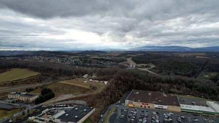
View west from Staunton Mall
-
Place where a plaque used to be at Ravens Roost overlook [03]
![Place where a plaque used to be at Ravens Roost overlook [03] (2046 visits) The place where a National Park Service plaque used to be located atop a raised portion of the retai... Place where a plaque used to be at Ravens Roost overlook [03]](../../../../../i/upload/2024/07/20/20240720111008-7c125d7a-cu_s9999x250.jpg)
-
View from Greenstone Overlook [02]
![View from Greenstone Overlook [02] (1559 visits) View from Greenstone Overlook on the Blue Ridge Parkway in Virginia. The city of Waynesboro is visi... View from Greenstone Overlook [02]](../../../../../i/upload/2024/07/20/20240720111014-00eb3527-cu_s9999x250.jpg)
-
View from Greenstone Overlook [04]
![View from Greenstone Overlook [04] (1617 visits) View from Greenstone Overlook on the Blue Ridge Parkway in Virginia. The city of Waynesboro is visi... View from Greenstone Overlook [04]](../../../../../i/upload/2024/07/20/20240720111020-03746e7e-cu_s9999x250.jpg)
-
View from Ravens Roost overlook [01]
![View from Ravens Roost overlook [01] (1843 visits) View from Ravens Roost overlook on the Blue Ridge Parkway in Virginia.
More at The Schumin Web:
www... View from Ravens Roost overlook [01]](../../../../../i/upload/2024/07/20/20240720111047-eedd86a4-cu_s9999x250.jpg)
-
View from Ravens Roost overlook [02]
![View from Ravens Roost overlook [02] (1845 visits) View from Ravens Roost overlook on the Blue Ridge Parkway in Virginia.
More at The Schumin Web:
www... View from Ravens Roost overlook [02]](../../../../../i/upload/2024/07/20/20240720111052-9d9ea25e-cu_s9999x250.jpg)
-
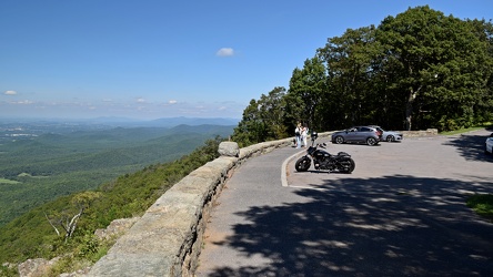
Ravens Roost overlook
-
View from Greenstone Overlook [03]
![View from Greenstone Overlook [03] (1700 visits) View from Greenstone Overlook on the Blue Ridge Parkway in Virginia. The city of Waynesboro is visi... View from Greenstone Overlook [03]](../../../../../i/upload/2024/07/20/20240720111131-8fba13c3-cu_s9999x250.jpg)
-
Place where a plaque used to be at Ravens Roost overlook [01]
![Place where a plaque used to be at Ravens Roost overlook [01] (2033 visits) The place where a National Park Service plaque used to be located atop a raised portion of the retai... Place where a plaque used to be at Ravens Roost overlook [01]](../../../../../i/upload/2024/07/20/20240720111142-228a886f-cu_s9999x250.jpg)
-
View from Greenstone Overlook [01]
![View from Greenstone Overlook [01] (1658 visits) View from Greenstone Overlook on the Blue Ridge Parkway in Virginia. The city of Waynesboro is visi... View from Greenstone Overlook [01]](../../../../../i/upload/2024/07/20/20240720111153-a1731cde-cu_s9999x250.jpg)
-
View from Ravens Roost overlook [03]
![View from Ravens Roost overlook [03] (1828 visits) View from Ravens Roost overlook on the Blue Ridge Parkway in Virginia.
More at The Schumin Web:
www... View from Ravens Roost overlook [03]](../../../../../i/upload/2024/07/20/20240720111242-329db50f-cu_s9999x250.jpg)
-
Place where a plaque used to be at Ravens Roost overlook [02]
![Place where a plaque used to be at Ravens Roost overlook [02] (1957 visits) The place where a National Park Service plaque used to be located atop a raised portion of the retai... Place where a plaque used to be at Ravens Roost overlook [02]](../../../../../i/upload/2024/07/20/20240720111248-a6c2e1fa-cu_s9999x250.jpg)
-
Aerial view of Charles Town, West Virginia [01]
![Aerial view of Charles Town, West Virginia [01] (2886 visits) Aerial view of Charles Town, West Virginia, from above the downtown area.
Ben Schumin is a professi... Aerial view of Charles Town, West Virginia [01]](../../../../../i/upload/2024/07/20/20240720103949-f4346f4c-cu_s9999x250.jpg)
-
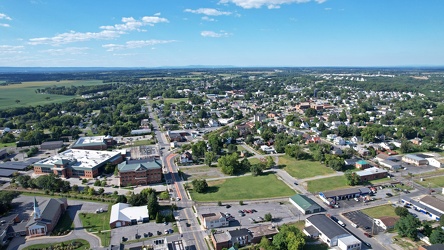
Aerial view of Charles Town and Ranson, West Virginia
-
Aerial view of Charles Town, West Virginia [03]
![Aerial view of Charles Town, West Virginia [03] (3172 visits) Aerial view of Charles Town, West Virginia, from above the downtown area.
Ben Schumin is a professi... Aerial view of Charles Town, West Virginia [03]](../../../../../i/upload/2024/07/20/20240720104008-7857c00b-cu_s9999x250.jpg)
-
Aerial view of Charles Town, West Virginia [02]
![Aerial view of Charles Town, West Virginia [02] (2318 visits) Aerial view of Charles Town, West Virginia, from above the downtown area.
Ben Schumin is a professi... Aerial view of Charles Town, West Virginia [02]](../../../../../i/upload/2024/07/20/20240720104018-5b8b2fcf-cu_s9999x250.jpg)
-
Sunset over Sterling, Virginia [04]
![Sunset over Sterling, Virginia [04] (2665 visits) The sun sets over Sterling, Virginia, viewed from above the intersection of Route 606 and Rock Hill ... Sunset over Sterling, Virginia [04]](../../../../../i/upload/2024/07/20/20240720103316-027f54cd-cu_s9999x250.jpg)
-
Sunset over Sterling, Virginia [03]
![Sunset over Sterling, Virginia [03] (2646 visits) The sun sets over Sterling, Virginia, viewed from above the intersection of Route 606 and Rock Hill ... Sunset over Sterling, Virginia [03]](../../../../../i/upload/2024/07/20/20240720103310-9c2855e8-cu_s9999x250.jpg)
-
Sunset over Sterling, Virginia [02]
![Sunset over Sterling, Virginia [02] (2579 visits) The sun sets over Sterling, Virginia, viewed from above the intersection of Route 606 and Rock Hill ... Sunset over Sterling, Virginia [02]](../../../../../i/upload/2024/07/20/20240720103305-c0323525-cu_s9999x250.jpg)
-
Sunset over Sterling, Virginia [01]
![Sunset over Sterling, Virginia [01] (2512 visits) The sun sets over Sterling, Virginia, viewed from above the intersection of Route 606 and Rock Hill ... Sunset over Sterling, Virginia [01]](../../../../../i/upload/2024/07/20/20240720103300-a3e8d662-cu_s9999x250.jpg)
-
View from Shenandoah Mountain [01]
![View from Shenandoah Mountain [01] (1951 visits) View of Highland County, Virginia from Shenandoah Mountain.
Ben Schumin is a professional photograp... View from Shenandoah Mountain [01]](../../../../../i/upload/2024/07/20/20240720093931-b1561721-cu_s9999x250.jpg)
-
View from Shenandoah Mountain [03]
![View from Shenandoah Mountain [03] (2046 visits) View of Highland County, Virginia from Shenandoah Mountain.
Ben Schumin is a professional photograp... View from Shenandoah Mountain [03]](../../../../../i/upload/2024/07/20/20240720094136-fc1446fb-cu_s9999x250.jpg)
-
View from Shenandoah Mountain [02]
![View from Shenandoah Mountain [02] (1983 visits) View of Highland County, Virginia from Shenandoah Mountain.
Ben Schumin is a professional photograp... View from Shenandoah Mountain [02]](../../../../../i/upload/2024/07/20/20240720094312-c9f54fe4-cu_s9999x250.jpg)
-
Former Kmart in Charlottesville, Virginia [04]
![Former Kmart in Charlottesville, Virginia [04] (5075 visits) Former Kmart store at 1801 Hydraulic Road in Charlottesville, Virginia. This store closed in the sp... Former Kmart in Charlottesville, Virginia [04]](../../../../../i/upload/2024/07/20/20240720093745-ab234bd7-cu_s9999x250.jpg)
-
Former Kmart in Charlottesville, Virginia [03]
![Former Kmart in Charlottesville, Virginia [03] (4780 visits) Former Kmart store at 1801 Hydraulic Road in Charlottesville, Virginia. This store closed in the sp... Former Kmart in Charlottesville, Virginia [03]](../../../../../i/upload/2024/07/20/20240720093740-95a526e2-cu_s9999x250.jpg)
-
Former Kmart in Charlottesville, Virginia [02]
![Former Kmart in Charlottesville, Virginia [02] (5195 visits) Former Kmart store at 1801 Hydraulic Road in Charlottesville, Virginia. This store closed in the sp... Former Kmart in Charlottesville, Virginia [02]](../../../../../i/upload/2024/07/20/20240720093734-d8f8d1ca-cu_s9999x250.jpg)
-
Former Kmart in Charlottesville, Virginia [01]
![Former Kmart in Charlottesville, Virginia [01] (4865 visits) Former Kmart store at 1801 Hydraulic Road in Charlottesville, Virginia. This store closed in the sp... Former Kmart in Charlottesville, Virginia [01]](../../../../../i/upload/2024/07/20/20240720093729-ec9ad03b-cu_s9999x250.jpg)
-
Sign for Krispy Kreme in Richmond, Virginia [01]
![Sign for Krispy Kreme in Richmond, Virginia [01] (2609 visits) Roadside sign for the Krispy Kreme donut shop on West Broad Street in Richmond, Virginia.
More at... Sign for Krispy Kreme in Richmond, Virginia [01]](../../../../../i/upload/2024/07/20/20240720092641-f7684be0-cu_s9999x250.jpg)
-
Sign for Krispy Kreme in Richmond, Virginia [02]
![Sign for Krispy Kreme in Richmond, Virginia [02] (2626 visits) Roadside sign for the Krispy Kreme donut shop on West Broad Street in Richmond, Virginia.
More at T... Sign for Krispy Kreme in Richmond, Virginia [02]](../../../../../i/upload/2024/07/20/20240720092647-7853f848-cu_s9999x250.jpg)
-
Sign for Krispy Kreme in Richmond, Virginia [03]
![Sign for Krispy Kreme in Richmond, Virginia [03] (2707 visits) Roadside sign for the Krispy Kreme donut shop on West Broad Street in Richmond, Virginia.
More at T... Sign for Krispy Kreme in Richmond, Virginia [03]](../../../../../i/upload/2024/07/20/20240720092652-9fcb1a77-cu_s9999x250.jpg)
-
Colonial Harley-Davidson

-
Sky over Rio Hill

-
Buffalo Gap [01]
![Buffalo Gap [01] (2689 visits) Buffalo Gap, a mountain pass through Little North Mountain, near Swoope, Virginia.
Ben Schumin is... Buffalo Gap [01]](../../../../../i/upload/2024/07/19/20240719164455-62064f1c-cu_s9999x250.jpg)
-
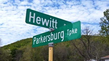
Hewitt Road and Parkersburg Turnpike
-
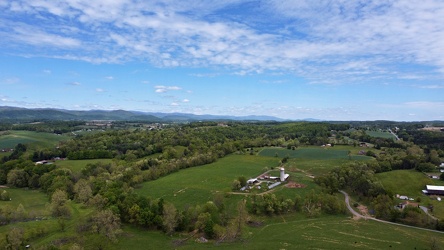
Churchville, Virginia, facing northeast
-
Field south of Waynesboro Town Center [02]
![Field south of Waynesboro Town Center [02] (1658 visits) Open fields south of Waynesboro Town Center, a shopping center in Waynesboro, Virginia.
Ben Schumin... Field south of Waynesboro Town Center [02]](../../../../../i/upload/2024/07/19/20240719164011-bfef621f-cu_s9999x250.jpg)
-
Field south of Waynesboro Town Center [03]
![Field south of Waynesboro Town Center [03] (1598 visits) Open fields south of Waynesboro Town Center, a shopping center in Waynesboro, Virginia.
Ben Schumin... Field south of Waynesboro Town Center [03]](../../../../../i/upload/2024/07/19/20240719164113-3872f41a-cu_s9999x250.jpg)
-
Field south of Waynesboro Town Center [01]
![Field south of Waynesboro Town Center [01] (1682 visits) Open fields south of Waynesboro Town Center, a shopping center in Waynesboro, Virginia.
Ben Schumin... Field south of Waynesboro Town Center [01]](../../../../../i/upload/2024/07/19/20240719164131-8c6e4a64-cu_s9999x250.jpg)
-
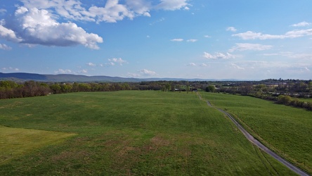
Field in Charles Town, West Virginia
-
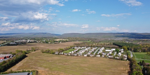
Fields and housing in Charles Town, West Virginia
-
Clouds over Shanghai, West Virginia

-
Lightning storm over Fredericksburg [01]
![Lightning storm over Fredericksburg [01] (2915 visits) A bolt of lightning strikes during a thunderstorm over Fredericksburg, Virginia. Viewed from the pa... Lightning storm over Fredericksburg [01]](../../../../../i/upload/2024/07/19/20240719105035-834fe4d8-cu_s9999x250.jpg)
-
Lightning storm over Fredericksburg [02]
![Lightning storm over Fredericksburg [02] (2940 visits) Bolts of lightning strike during a thunderstorm over Fredericksburg, Virginia. Viewed from the park... Lightning storm over Fredericksburg [02]](../../../../../i/upload/2024/07/19/20240719105031-868aab50-cu_s9999x250.jpg)
-
Platform pylon at West Falls Church station [06]
![Platform pylon at West Falls Church station [06] (2563 visits) Lighted platform pylon at West Falls Church, a Washington Metro station in Fairfax County, Virginia.... Platform pylon at West Falls Church station [06]](../../../../../i/upload/2024/07/19/20240719093305-6be3d2bb-cu_s9999x250.jpg)
-
Platform pylon at West Falls Church station [05]
![Platform pylon at West Falls Church station [05] (2622 visits) Lighted platform pylon at West Falls Church, a Washington Metro station in Fairfax County, Virginia.... Platform pylon at West Falls Church station [05]](../../../../../i/upload/2024/07/19/20240719093300-b3fdcc26-cu_s9999x250.jpg)
-
Platform pylon at West Falls Church station [04]
![Platform pylon at West Falls Church station [04] (2550 visits) Lighted platform pylon at West Falls Church, a Washington Metro station in Fairfax County, Virginia.... Platform pylon at West Falls Church station [04]](../../../../../i/upload/2024/07/19/20240719093255-6bd9cf26-cu_s9999x250.jpg)
-
Platform pylon at West Falls Church station [03]
![Platform pylon at West Falls Church station [03] (2589 visits) Lighted platform pylon at West Falls Church, a Washington Metro station in Fairfax County, Virginia.... Platform pylon at West Falls Church station [03]](../../../../../i/upload/2024/07/19/20240719093249-093357b5-cu_s9999x250.jpg)
-
Platform pylon at West Falls Church station [02]
![Platform pylon at West Falls Church station [02] (2466 visits) Lighted platform pylon at West Falls Church, a Washington Metro station in Fairfax County, Virginia.... Platform pylon at West Falls Church station [02]](../../../../../i/upload/2024/07/19/20240719093243-8507b49e-cu_s9999x250.jpg)
-
Platform pylon at West Falls Church station [01]
![Platform pylon at West Falls Church station [01] (2582 visits) Lighted platform pylon at West Falls Church, a Washington Metro station in Fairfax County, Virginia.... Platform pylon at West Falls Church station [01]](../../../../../i/upload/2024/07/19/20240719093237-32cc7f9a-cu_s9999x250.jpg)
-
View from Dirt Farm Brewing [01]
![View from Dirt Farm Brewing [01] (2800 visits) View from the patio at Dirt Farm Brewing in Bluemont, Virginia, facing approximately east. On a cle... View from Dirt Farm Brewing [01]](../../../../../i/upload/2024/07/18/20240718230427-e0fe1b23-cu_s9999x250.jpg)
-
View from Dirt Farm Brewing [02]
![View from Dirt Farm Brewing [02] (2649 visits) View from the patio at Dirt Farm Brewing in Bluemont, Virginia, facing approximately east. On a cle... View from Dirt Farm Brewing [02]](../../../../../i/upload/2024/07/18/20240718230423-b1ac8dea-cu_s9999x250.jpg)
-
Edge Hill Cemetery near sunset [02]
![Edge Hill Cemetery near sunset [02] (2693 visits) Edge Hill Cemetery, in Charles Town, West Virginia. Photographed in early evening.
More at The Sch... Edge Hill Cemetery near sunset [02]](../../../../../i/upload/2024/07/18/20240718223726-f30bd938-cu_s9999x250.jpg)
-
Edge Hill Cemetery near sunset [01]
![Edge Hill Cemetery near sunset [01] (2649 visits) Edge Hill Cemetery, in Charles Town, West Virginia. Photographed in early evening.
More at The Sch... Edge Hill Cemetery near sunset [01]](../../../../../i/upload/2024/07/18/20240718223722-7e967b29-cu_s9999x250.jpg)