-
Sunset from I-64 overlook [03]
![Sunset from I-64 overlook [03] (1646 visits) Sunset, viewed from the scenic overlook at milepost 103 on Interstate 64 eastbound in Albemarle Coun... Sunset from I-64 overlook [03]](../../../../../i/upload/2024/07/13/20240713234247-066d4e9b-cu_s9999x250.jpg)
-
Sunset from I-64 overlook [01]
![Sunset from I-64 overlook [01] (1630 visits) Sunset, viewed from the scenic overlook at milepost 103 on Interstate 64 eastbound in Albemarle Coun... Sunset from I-64 overlook [01]](../../../../../i/upload/2024/07/13/20240713234248-69674cad-cu_s9999x250.jpg)
-
Sunset from I-64 overlook [02]
![Sunset from I-64 overlook [02] (1650 visits) Sunset, viewed from the scenic overlook at milepost 103 on Interstate 64 eastbound in Albemarle Coun... Sunset from I-64 overlook [02]](../../../../../i/upload/2024/07/13/20240713234249-3f6e970a-cu_s9999x250.jpg)
-
Sunset from I-64 overlook [04]
![Sunset from I-64 overlook [04] (1608 visits) Sunset, viewed from the scenic overlook at milepost 103 on Interstate 64 eastbound in Albemarle Coun... Sunset from I-64 overlook [04]](../../../../../i/upload/2024/07/13/20240713234251-97a8e10e-cu_s9999x250.jpg)
-
Full moon over Afton Overlook [02]
![Full moon over Afton Overlook [02] (2888 visits) Long exposure photo taken from Afton Overlook on the Blue Ridge Parkway under a full moon. I was al... Full moon over Afton Overlook [02]](../../../../../i/upload/2024/07/14/20240714171102-67a435ab-cu_s9999x250.jpg)
-
Full moon over Afton Overlook [01]
![Full moon over Afton Overlook [01] (2718 visits) Long exposure photo taken from Afton Overlook on the Blue Ridge Parkway under a full moon. I was al... Full moon over Afton Overlook [01]](../../../../../i/upload/2024/07/14/20240714171103-4f67ea32-cu_s9999x250.jpg)
-
View from House Mountain overlook

-
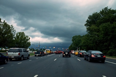
Storm clouds at Georgia Avenue and Norbeck Road
-
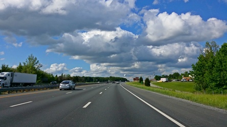
Interstate 95 near Fredericksburg
-
Power transmission lines in Montgomery Village [06]
![Power transmission lines in Montgomery Village [06] (3965 visits) Power transmission lines between Snouffer School Road and East Village Avenue in Montgomery Village,... Power transmission lines in Montgomery Village [06]](../../../../../i/upload/2024/07/19/20240719002542-992b6062-cu_s9999x250.jpg)
-
Power transmission lines in Montgomery Village [05]
![Power transmission lines in Montgomery Village [05] (2595 visits) Power transmission lines between Snouffer School Road and East Village Avenue in Montgomery Village,... Power transmission lines in Montgomery Village [05]](../../../../../i/upload/2024/07/19/20240719002545-bbd1ae24-cu_s9999x250.jpg)
-
Power transmission lines in Montgomery Village [04]
![Power transmission lines in Montgomery Village [04] (2335 visits) Power transmission lines between Snouffer School Road and East Village Avenue in Montgomery Village,... Power transmission lines in Montgomery Village [04]](../../../../../i/upload/2024/07/19/20240719002552-1698394d-cu_s9999x250.jpg)
-
Power transmission lines in Montgomery Village [03]
![Power transmission lines in Montgomery Village [03] (2323 visits) Power transmission lines between Snouffer School Road and East Village Avenue in Montgomery Village,... Power transmission lines in Montgomery Village [03]](../../../../../i/upload/2024/07/19/20240719002555-701edc67-cu_s9999x250.jpg)
-
Power transmission lines in Montgomery Village [02]
![Power transmission lines in Montgomery Village [02] (2080 visits) Power transmission lines between Snouffer School Road and East Village Avenue in Montgomery Village,... Power transmission lines in Montgomery Village [02]](../../../../../i/upload/2024/07/19/20240719002558-88e3b55e-cu_s9999x250.jpg)
-
Power transmission lines in Montgomery Village [01]
![Power transmission lines in Montgomery Village [01] (2257 visits) Power transmission lines between Snouffer School Road and East Village Avenue in Montgomery Village,... Power transmission lines in Montgomery Village [01]](../../../../../i/upload/2024/07/19/20240719002602-f6056c42-cu_s9999x250.jpg)
-
Platform pylon at West Falls Church station [01]
![Platform pylon at West Falls Church station [01] (1573 visits) Lighted platform pylon at West Falls Church, a Washington Metro station in Fairfax County, Virginia.... Platform pylon at West Falls Church station [01]](../../../../../i/upload/2024/07/19/20240719093237-32cc7f9a-cu_s9999x250.jpg)
-
Platform pylon at West Falls Church station [02]
![Platform pylon at West Falls Church station [02] (1466 visits) Lighted platform pylon at West Falls Church, a Washington Metro station in Fairfax County, Virginia.... Platform pylon at West Falls Church station [02]](../../../../../i/upload/2024/07/19/20240719093243-8507b49e-cu_s9999x250.jpg)
-
Platform pylon at West Falls Church station [03]
![Platform pylon at West Falls Church station [03] (1560 visits) Lighted platform pylon at West Falls Church, a Washington Metro station in Fairfax County, Virginia.... Platform pylon at West Falls Church station [03]](../../../../../i/upload/2024/07/19/20240719093249-093357b5-cu_s9999x250.jpg)
-
Platform pylon at West Falls Church station [04]
![Platform pylon at West Falls Church station [04] (1499 visits) Lighted platform pylon at West Falls Church, a Washington Metro station in Fairfax County, Virginia.... Platform pylon at West Falls Church station [04]](../../../../../i/upload/2024/07/19/20240719093255-6bd9cf26-cu_s9999x250.jpg)
-
Platform pylon at West Falls Church station [05]
![Platform pylon at West Falls Church station [05] (1592 visits) Lighted platform pylon at West Falls Church, a Washington Metro station in Fairfax County, Virginia.... Platform pylon at West Falls Church station [05]](../../../../../i/upload/2024/07/19/20240719093300-b3fdcc26-cu_s9999x250.jpg)
-
Platform pylon at West Falls Church station [06]
![Platform pylon at West Falls Church station [06] (1568 visits) Lighted platform pylon at West Falls Church, a Washington Metro station in Fairfax County, Virginia.... Platform pylon at West Falls Church station [06]](../../../../../i/upload/2024/07/19/20240719093305-6be3d2bb-cu_s9999x250.jpg)
-
Power transmission lines in Frederick County [02]
![Power transmission lines in Frederick County [02] (1373 visits) Power transmission lines near Ballenger Creek Pike and Mountville Road in Frederick County, Maryland... Power transmission lines in Frederick County [02]](../../../../../i/upload/2024/07/19/20240719093429-9f31f834-cu_s9999x250.jpg)
-
Power transmission lines in Frederick County [01]
![Power transmission lines in Frederick County [01] (1294 visits) Power transmission lines near Ballenger Creek Pike and Mountville Road in Frederick County, Maryland... Power transmission lines in Frederick County [01]](../../../../../i/upload/2024/07/19/20240719093435-6cd9373f-cu_s9999x250.jpg)
-
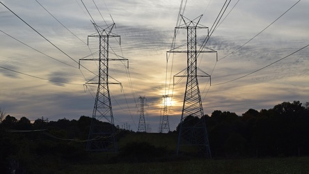
Power transmission lines in Laytonsville
-
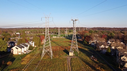
Power lines through Montgomery Village
-
Platform pylon at East Falls Church station [03]
![Platform pylon at East Falls Church station [03] (1336 visits) Lighted platform pylon at East Falls Church, a Washington Metro station in Arlington County, Virgini... Platform pylon at East Falls Church station [03]](../../../../../i/upload/2024/07/19/20240719123821-7d9daea8-cu_s9999x250.jpg)
-
Platform pylon at East Falls Church station [02]
![Platform pylon at East Falls Church station [02] (1362 visits) Lighted platform pylon at East Falls Church, a Washington Metro station in Arlington County, Virgini... Platform pylon at East Falls Church station [02]](../../../../../i/upload/2024/07/19/20240719123830-32f805f8-cu_s9999x250.jpg)
-
Platform pylon at East Falls Church station [01]
![Platform pylon at East Falls Church station [01] (1276 visits) Lighted platform pylon at East Falls Church, a Washington Metro station in Arlington County, Virgini... Platform pylon at East Falls Church station [01]](../../../../../i/upload/2024/07/19/20240719123835-c706ee80-cu_s9999x250.jpg)
-
Field in Charles Town, West Virginia
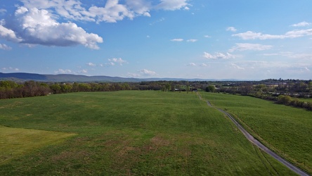
-
Fields and housing in Charles Town, West Virginia
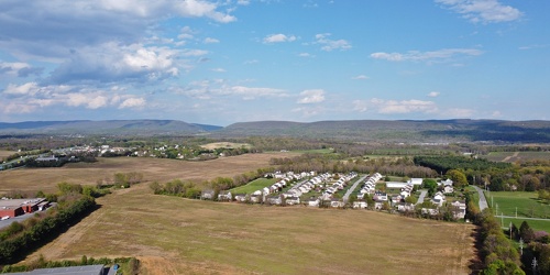
-
Hewitt Road and Parkersburg Turnpike
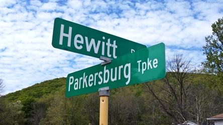
-
Buffalo Gap [01]
![Buffalo Gap [01] (1678 visits) Buffalo Gap, a mountain pass through Little North Mountain, near Swoope, Virginia.
Ben Schumin is... Buffalo Gap [01]](../../../../../i/upload/2024/07/19/20240719164455-62064f1c-cu_s9999x250.jpg)
-
Montgomery Village, facing approximately west [01]
![Montgomery Village, facing approximately west [01] (2036 visits) View of Montgomery Village and beyond, facing approximately west, from above the Lake Marion Communi... Montgomery Village, facing approximately west [01]](../../../../../i/upload/2024/07/19/20240719165409-be458691-cu_s9999x250.jpg)
-
Montgomery Village, facing approximately west [02]
![Montgomery Village, facing approximately west [02] (1788 visits) View of Montgomery Village and beyond, facing approximately west, from above the Lake Marion Communi... Montgomery Village, facing approximately west [02]](../../../../../i/upload/2024/07/19/20240719165500-7c01f836-cu_s9999x250.jpg)
-
Sunset near Gettysburg, Pennsylvania [01]
![Sunset near Gettysburg, Pennsylvania [01] (1404 visits) Sunset over fields along US 15 business near Gettysburg, Pennsylvania. The air was a bit hazy on th... Sunset near Gettysburg, Pennsylvania [01]](../../../../../i/upload/2024/07/19/20240719170930-530c41ea-cu_s9999x250.jpg)
-
Sunset near Gettysburg, Pennsylvania [02]
![Sunset near Gettysburg, Pennsylvania [02] (1453 visits) Sunset over fields along US 15 business near Gettysburg, Pennsylvania. The air was a bit hazy on th... Sunset near Gettysburg, Pennsylvania [02]](../../../../../i/upload/2024/07/19/20240719170934-9483611c-cu_s9999x250.jpg)
-
Sunset near Enfield, North Carolina [01]
![Sunset near Enfield, North Carolina [01] (1407 visits) The sun sets over Enfield, North Carolina. View from Route 561 near Interstate 95.
More at The Sch... Sunset near Enfield, North Carolina [01]](../../../../../i/upload/2024/07/19/20240719200004-755a08c5-cu_s9999x250.jpg)
-
Sunset near Enfield, North Carolina [02]
![Sunset near Enfield, North Carolina [02] (1347 visits) The sun sets over Enfield, North Carolina. View from Route 561 near Interstate 95.
More at The Sch... Sunset near Enfield, North Carolina [02]](../../../../../i/upload/2024/07/19/20240719200013-a94fdb0a-cu_s9999x250.jpg)
-
Linkythorn Lane
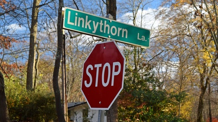
-
Montgomery Village, facing approximately west [03]
![Montgomery Village, facing approximately west [03] (1697 visits) View of Montgomery Village and beyond, facing approximately west, from above the Essex Place neighbo... Montgomery Village, facing approximately west [03]](../../../../../i/upload/2024/07/20/20240720014535-43915a8f-cu_s9999x250.jpg)
-
Montgomery Village, facing approximately west [04]
![Montgomery Village, facing approximately west [04] (1675 visits) View of Montgomery Village and beyond, facing approximately west, from above the Picton of Birlstone... Montgomery Village, facing approximately west [04]](../../../../../i/upload/2024/07/20/20240720014545-c32fb66e-cu_s9999x250.jpg)
-
View from Shenandoah Mountain [01]
![View from Shenandoah Mountain [01] (1253 visits) View of Highland County, Virginia from Shenandoah Mountain.
Ben Schumin is a professional photograp... View from Shenandoah Mountain [01]](../../../../../i/upload/2024/07/20/20240720093931-b1561721-cu_s9999x250.jpg)
-
View from Shenandoah Mountain [03]
![View from Shenandoah Mountain [03] (1334 visits) View of Highland County, Virginia from Shenandoah Mountain.
Ben Schumin is a professional photograp... View from Shenandoah Mountain [03]](../../../../../i/upload/2024/07/20/20240720094136-fc1446fb-cu_s9999x250.jpg)
-
Farm on the Virginia-West Virginia border [01]
![Farm on the Virginia-West Virginia border [01] (2769 visits) Farm on the border between Highland County, Virginia and Pendleton County, West Virginia. The bound... Farm on the Virginia-West Virginia border [01]](../../../../../i/upload/2024/07/20/20240720094156-2b1215da-cu_s9999x250.jpg)
-
View from Shenandoah Mountain [02]
![View from Shenandoah Mountain [02] (1290 visits) View of Highland County, Virginia from Shenandoah Mountain.
Ben Schumin is a professional photograp... View from Shenandoah Mountain [02]](../../../../../i/upload/2024/07/20/20240720094312-c9f54fe4-cu_s9999x250.jpg)
-
"DO NOT ENTER" and "ONE WAY" signs [01]
!["DO NOT ENTER" and "ONE WAY" signs [01] (968 visits) "DO NOT ENTER" and "ONE WAY" signs at the intersection of Columbus Avenue and Me... "DO NOT ENTER" and "ONE WAY" signs [01]](../../../../../i/upload/2024/07/20/20240720101859-20d5443c-cu_s9999x250.jpg)
-
"DO NOT ENTER" and "ONE WAY" signs [02]
!["DO NOT ENTER" and "ONE WAY" signs [02] (919 visits) "DO NOT ENTER" and "ONE WAY" signs at the intersection of Columbus Avenue and Me... "DO NOT ENTER" and "ONE WAY" signs [02]](../../../../../i/upload/2024/07/20/20240720101903-51f9dbdd-cu_s9999x250.jpg)
-
Traffic signals in Derwood, Maryland [01]
![Traffic signals in Derwood, Maryland [01] (1092 visits) Traffic signal at the intersection of Columbus Avenue and Metro Access Road in Derwood, Maryland. A... Traffic signals in Derwood, Maryland [01]](../../../../../i/upload/2024/07/20/20240720101908-de0aad1a-cu_s9999x250.jpg)
-
Traffic signals in Derwood, Maryland [02]
![Traffic signals in Derwood, Maryland [02] (7926 visits) Traffic signals at the intersection of Columbus Avenue and Metro Access Road in Derwood, Maryland. ... Traffic signals in Derwood, Maryland [02]](../../../../../i/upload/2024/07/20/20240720101912-698b18e1-cu_s9999x250.jpg)
-
Traffic signals in Derwood, Maryland [03]
![Traffic signals in Derwood, Maryland [03] (1238 visits) Traffic signal at the intersection of Columbus Avenue and Metro Access Road in Derwood, Maryland. A... Traffic signals in Derwood, Maryland [03]](../../../../../i/upload/2024/07/20/20240720101918-d2aa492d-cu_s9999x250.jpg)
-
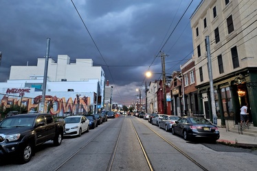
Storm over Frankford Avenue
-
Sunset over Sterling, Virginia [01]
![Sunset over Sterling, Virginia [01] (1530 visits) The sun sets over Sterling, Virginia, viewed from above the intersection of Route 606 and Rock Hill ... Sunset over Sterling, Virginia [01]](../../../../../i/upload/2024/07/20/20240720103300-a3e8d662-cu_s9999x250.jpg)
-
Sunset over Sterling, Virginia [02]
![Sunset over Sterling, Virginia [02] (1579 visits) The sun sets over Sterling, Virginia, viewed from above the intersection of Route 606 and Rock Hill ... Sunset over Sterling, Virginia [02]](../../../../../i/upload/2024/07/20/20240720103305-c0323525-cu_s9999x250.jpg)
-
Sunset over Sterling, Virginia [03]
![Sunset over Sterling, Virginia [03] (1574 visits) The sun sets over Sterling, Virginia, viewed from above the intersection of Route 606 and Rock Hill ... Sunset over Sterling, Virginia [03]](../../../../../i/upload/2024/07/20/20240720103310-9c2855e8-cu_s9999x250.jpg)
-
Sunset over Sterling, Virginia [04]
![Sunset over Sterling, Virginia [04] (1668 visits) The sun sets over Sterling, Virginia, viewed from above the intersection of Route 606 and Rock Hill ... Sunset over Sterling, Virginia [04]](../../../../../i/upload/2024/07/20/20240720103316-027f54cd-cu_s9999x250.jpg)
-
Aerial view of Charles Town, West Virginia [01]
![Aerial view of Charles Town, West Virginia [01] (1663 visits) Aerial view of Charles Town, West Virginia, from above the downtown area.
Ben Schumin is a professi... Aerial view of Charles Town, West Virginia [01]](../../../../../i/upload/2024/07/20/20240720103949-f4346f4c-cu_s9999x250.jpg)
-
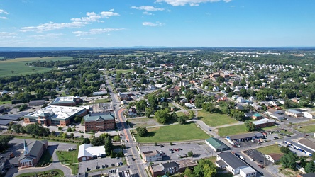
Aerial view of Charles Town and Ranson, West Virginia
-
Aerial view of Charles Town, West Virginia [03]
![Aerial view of Charles Town, West Virginia [03] (2491 visits) Aerial view of Charles Town, West Virginia, from above the downtown area.
Ben Schumin is a professi... Aerial view of Charles Town, West Virginia [03]](../../../../../i/upload/2024/07/20/20240720104008-7857c00b-cu_s9999x250.jpg)
-
Aerial view of Charles Town, West Virginia [02]
![Aerial view of Charles Town, West Virginia [02] (1466 visits) Aerial view of Charles Town, West Virginia, from above the downtown area.
Ben Schumin is a professi... Aerial view of Charles Town, West Virginia [02]](../../../../../i/upload/2024/07/20/20240720104018-5b8b2fcf-cu_s9999x250.jpg)
-
Aerial view of downtown Crossville, Tennessee [01]
![Aerial view of downtown Crossville, Tennessee [01] (2420 visits) Aerial view of downtown Crossville, Tennessee.
More at The Schumin Web:
www.schuminweb.com/life-and... Aerial view of downtown Crossville, Tennessee [01]](../../../../../i/upload/2024/07/20/20240720113721-1bd631e7-cu_s9999x250.jpg)
-
Aerial view of downtown Crossville, Tennessee [02]
![Aerial view of downtown Crossville, Tennessee [02] (1309 visits) Aerial view of downtown Crossville, Tennessee.
More at The Schumin Web:
www.schuminweb.com/life-and... Aerial view of downtown Crossville, Tennessee [02]](../../../../../i/upload/2024/07/20/20240720113738-e7992a54-cu_s9999x250.jpg)
-
Aerial view of downtown Crossville, Tennessee [03]
![Aerial view of downtown Crossville, Tennessee [03] (2448 visits) Aerial view of downtown Crossville, Tennessee.
More at The Schumin Web:
www.schuminweb.com/life-and... Aerial view of downtown Crossville, Tennessee [03]](../../../../../i/upload/2024/07/20/20240720113748-d1062940-cu_s9999x250.jpg)
-
Smoky conditions along I-95 [01]
![Smoky conditions along I-95 [01] (815 visits) Smoky atmospheric conditions along Interstate 95 southbound near the northern interchange with the B... Smoky conditions along I-95 [01]](../../../../../i/upload/2024/07/29/20240729110741-d798b31f-cu_s9999x250.jpg)
-
Sunset over Montgomery Village [01]
![Sunset over Montgomery Village [01] (1077 visits) The sun sets over Montgomery Village, Maryland on the evening of November 17, 2023.
More at The Sch... Sunset over Montgomery Village [01]](../../../../../i/upload/2024/11/20/20241120093359-6e4a8f21-cu_s9999x250.jpg)
-
Sunset over Montgomery Village [02]
![Sunset over Montgomery Village [02] (1031 visits) The sun sets over Montgomery Village, Maryland on the evening of November 17, 2023.
More at The Sch... Sunset over Montgomery Village [02]](../../../../../i/upload/2024/11/20/20241120093408-5c11a279-cu_s9999x250.jpg)
-
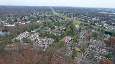
Montgomery Village, facing east
-
Aerial view of Swatara Township, Pennsylvania [03]
![Aerial view of Swatara Township, Pennsylvania [03] (2372 visits) Aerial view of Swatara Township, Pennsylvania at sunset.
Ben Schumin is a professional photographer... Aerial view of Swatara Township, Pennsylvania [03]](../../../../../i/upload/2024/12/05/20241205132711-8707ae71-cu_s9999x250.jpg)
-
Buffalo Gap [02]
![Buffalo Gap [02] (753 visits) Buffalo Gap, a mountain pass through Little North Mountain, near Swoope, Virginia.
More at The Sc... Buffalo Gap [02]](../../../../../i/upload/2025/01/03/20250103200607-1abe8192-cu_s9999x250.jpg)
-
Area around US 13 in Pocomoke City, Maryland [01]
![Area around US 13 in Pocomoke City, Maryland [01] (303 visits) Aerial view of an area around US 13 in Pocomoke City, Maryland in late afternoon.
More at The Schum... Area around US 13 in Pocomoke City, Maryland [01]](../../../../../i/upload/2025/02/16/20250216104958-9cfd679e-cu_s9999x250.jpg)
-
Area around US 13 in Pocomoke City, Maryland [02]
![Area around US 13 in Pocomoke City, Maryland [02] (291 visits) Aerial view of an area around US 13 in Pocomoke City, Maryland in late afternoon.
More at The Schum... Area around US 13 in Pocomoke City, Maryland [02]](../../../../../i/upload/2025/02/16/20250216105020-45970493-cu_s9999x250.jpg)
-
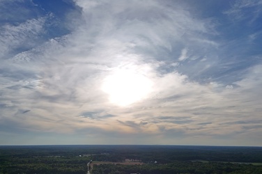
Sunset over Thornburg, Virginia
-
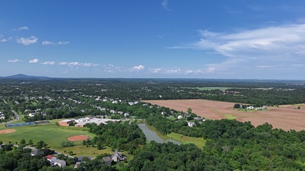
Aerial view of Poolesville, Maryland
-
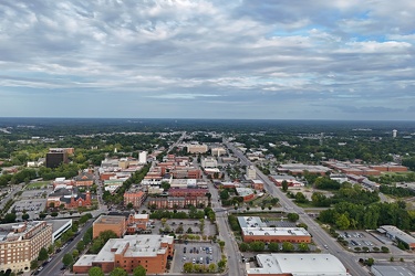
Aerial view of Fayetteville, North Carolina
-
Aerial view of Willingboro, New Jersey [01]

![Aerial view of Willingboro, New Jersey [01] (87 visits) Aerial view of Willingboro, a township in Burlington County, New Jersey.
More at The Schumin Web:
w... Aerial view of Willingboro, New Jersey [01]](../../../../../i/upload/2025/03/20/20250320182300-6bef996a-cu_s9999x250.jpg)
-
Aerial view of Willingboro, New Jersey [02]

![Aerial view of Willingboro, New Jersey [02] (80 visits) Aerial view of Willingboro, a township in Burlington County, New Jersey.
More at The Schumin Web:
w... Aerial view of Willingboro, New Jersey [02]](../../../../../i/upload/2025/03/20/20250320182317-a2b0e4b5-cu_s9999x250.jpg)