-
Ansonborough Square [03]
![Ansonborough Square [03] (73 visits) Aerial view of Ansonborough Square, a small shopping center at the intersection of East Bay Street a... Ansonborough Square [03]](../../../../../i/upload/2025/06/04/20250604104228-c96cacf6-cu_s9999x250.jpg)
-
Ansonborough Square [02]
![Ansonborough Square [02] (84 visits) Aerial view of Ansonborough Square, a small shopping center at the intersection of East Bay Street a... Ansonborough Square [02]](../../../../../i/upload/2025/06/04/20250604104311-2b511fd2-cu_s9999x250.jpg)
-
Ansonborough Square [04]
![Ansonborough Square [04] (92 visits) Ansonborough Square, a small shopping center at the intersection of East Bay Street and Inspection S... Ansonborough Square [04]](../../../../../i/upload/2025/06/04/20250604104148-0826078f-cu_s9999x250.jpg)
-
Ansonborough Square [01]
![Ansonborough Square [01] (136 visits) Aerial view of Ansonborough Square, a small shopping center at the intersection of East Bay Street a... Ansonborough Square [01]](../../../../../i/upload/2025/06/04/20250604110923-17734b3e-cu_s9999x250.jpg)
-
Roberto Clemente Bridge [02]
![Roberto Clemente Bridge [02] (1616 visits) The Roberto Clemente Bridge, one of several bridges spanning the Allegheny River near downtown Pitts... Roberto Clemente Bridge [02]](../../../../../i/upload/2024/07/20/20240720161340-c598682d-cu_s9999x250.jpg)
-
Roberto Clemente Bridge [01]
![Roberto Clemente Bridge [01] (1622 visits) The Roberto Clemente Bridge, one of several bridges spanning the Allegheny River near downtown Pitts... Roberto Clemente Bridge [01]](../../../../../i/upload/2024/07/20/20240720161306-2ba7a48e-cu_s9999x250.jpg)
-
Roberto Clemente Bridge [03]
![Roberto Clemente Bridge [03] (1657 visits) The Roberto Clemente Bridge, one of several bridges spanning the Allegheny River near downtown Pitts... Roberto Clemente Bridge [03]](../../../../../i/upload/2024/07/20/20240720161356-15e15812-cu_s9999x250.jpg)
-
View from Ottawa Marriott Hotel [01]
![View from Ottawa Marriott Hotel [01] (1661 visits) View of downtown Ottawa from room 1833 at the Ottawa Marriott Hotel.
More at The Schumin Web:
www.s... View from Ottawa Marriott Hotel [01]](../../../../../i/upload/2024/07/20/20240720155522-d1cb6c07-cu_s9999x250.jpg)
-
Andy Warhol Bridge [02]
![Andy Warhol Bridge [02] (1676 visits) The Andy Warhol Bridge, one of several bridges spanning the Allegheny River near downtown Pittsburgh... Andy Warhol Bridge [02]](../../../../../i/upload/2024/07/20/20240720161426-0a05c0dd-cu_s9999x250.jpg)
-
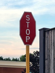
Stop sign with vertical text
-
Aerial view of Myrtle Beach, South Carolina [16]
![Aerial view of Myrtle Beach, South Carolina [16] (1729 visits) Aerial view of Myrtle Beach, South Carolina. This photo depicts the city from approximately 16th Av... Aerial view of Myrtle Beach, South Carolina [16]](../../../../../i/upload/2025/01/16/20250116011701-1e30b28a-cu_s9999x250.jpg)
-
Andy Warhol Bridge [01]
![Andy Warhol Bridge [01] (1732 visits) The Andy Warhol Bridge, one of several bridges spanning the Allegheny River near downtown Pittsburgh... Andy Warhol Bridge [01]](../../../../../i/upload/2024/07/20/20240720161418-5c7d3634-cu_s9999x250.jpg)
-
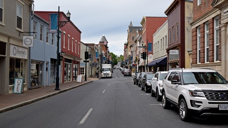
View down East Beverley Street
-
Honda HR-V at Sunset Park [02]
![Honda HR-V at Sunset Park [02] (1761 visits) My 2023 Honda HR-V, parked on the access road at Sunset Park, a new park under construction on the f... Honda HR-V at Sunset Park [02]](../../../../../i/upload/2024/11/28/20241128155042-d72ae2b1-cu_s9999x250.jpg)
-
Aerial view of Myrtle Beach, South Carolina [15]
![Aerial view of Myrtle Beach, South Carolina [15] (1763 visits) Aerial view of Myrtle Beach, South Carolina. This photo depicts the city from approximately 16th Av... Aerial view of Myrtle Beach, South Carolina [15]](../../../../../i/upload/2025/01/16/20250116011655-ed58c149-cu_s9999x250.jpg)
-
Aerial view of Myrtle Beach, South Carolina [01]
![Aerial view of Myrtle Beach, South Carolina [01] (1787 visits) Aerial view of Myrtle Beach, South Carolina. This photo depicts a surface parking lot between Ocean... Aerial view of Myrtle Beach, South Carolina [01]](../../../../../i/upload/2025/01/16/20250116011517-f8bb6ab8-cu_s9999x250.jpg)
-
Traffic light gantry at Fairfax County Parkway and Sunrise Valley Drive [03]
![Traffic light gantry at Fairfax County Parkway and Sunrise Valley Drive [03] (1851 visits) Traffic light gantry over the intersection of Fairfax County Parkway and Sunrise Valley Drive in Res... Traffic light gantry at Fairfax County Parkway and Sunrise Valley Drive [03]](../../../../../i/upload/2024/07/19/20240719123315-55b30c24-cu_s9999x250.jpg)
-
"WRONG WAY" sign at Devil's Den [01]
!["WRONG WAY" sign at Devil's Den [01] (1865 visits) "WRONG WAY" sign on the parking loop for Devil's Den, near Gettysburg, Pennsylvania.
Ben ... "WRONG WAY" sign at Devil's Den [01]](../../../../../i/upload/2024/07/19/20240719112651-9d21816c-cu_s9999x250.jpg)
-
Traffic light gantry at Fairfax County Parkway and Sunrise Valley Drive [04]
![Traffic light gantry at Fairfax County Parkway and Sunrise Valley Drive [04] (1866 visits) Traffic light gantry over the intersection of Fairfax County Parkway and Sunrise Valley Drive in Res... Traffic light gantry at Fairfax County Parkway and Sunrise Valley Drive [04]](../../../../../i/upload/2024/07/19/20240719123320-fcfd3e9c-cu_s9999x250.jpg)
-
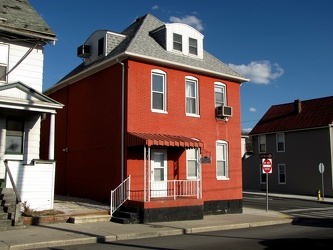
416 Park Street
-
300 Park Street
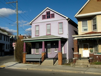
-
310 Park Street
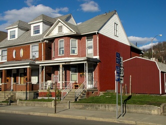
-
Honda HR-V at Sunset Park [01]
![Honda HR-V at Sunset Park [01] (1901 visits) My 2023 Honda HR-V, parked on the access road at Sunset Park, a new park under construction on the f... Honda HR-V at Sunset Park [01]](../../../../../i/upload/2024/11/28/20241128154956-21bc726b-cu_s9999x250.jpg)
-
Intersection of Jefferson Park Avenue, Harris Road, and Camellia Drive
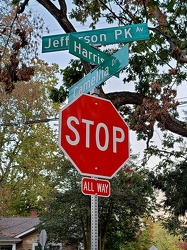
-
Aerial view of Myrtle Beach, South Carolina [03]
![Aerial view of Myrtle Beach, South Carolina [03] (1924 visits) Aerial view of Myrtle Beach, South Carolina. This photo depicts the Hilton Grand Vacations facility... Aerial view of Myrtle Beach, South Carolina [03]](../../../../../i/upload/2025/01/16/20250116011535-e4909d01-cu_s9999x250.jpg)
-
Bridge carrying Clinch Street over World's Fair Park
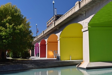
-
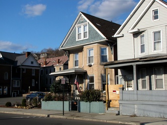
216 Park Street
-
Traffic light gantry at Fairfax County Parkway and Sunrise Valley Drive [05]
![Traffic light gantry at Fairfax County Parkway and Sunrise Valley Drive [05] (1942 visits) Traffic light gantry over the intersection of Fairfax County Parkway and Sunrise Valley Drive in Res... Traffic light gantry at Fairfax County Parkway and Sunrise Valley Drive [05]](../../../../../i/upload/2024/07/19/20240719123325-5e2bb623-cu_s9999x250.jpg)
-
Traffic light gantry at Fairfax County Parkway and Sunrise Valley Drive [06]
![Traffic light gantry at Fairfax County Parkway and Sunrise Valley Drive [06] (1953 visits) Traffic light gantry over the intersection of Fairfax County Parkway and Sunrise Valley Drive in Res... Traffic light gantry at Fairfax County Parkway and Sunrise Valley Drive [06]](../../../../../i/upload/2024/07/19/20240719123330-d3464033-cu_s9999x250.jpg)
-
Aerial view of Myrtle Beach, South Carolina [18]
![Aerial view of Myrtle Beach, South Carolina [18] (1955 visits) Aerial view of Myrtle Beach, South Carolina. This photo depicts the Hilton Grand Vacations facility... Aerial view of Myrtle Beach, South Carolina [18]](../../../../../i/upload/2025/01/16/20250116011716-7718fc67-cu_s9999x250.jpg)
-
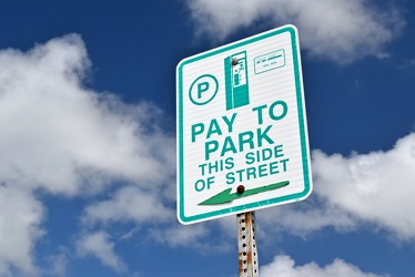
"Pay to park, this side of street"
-
Aerial view of Myrtle Beach, South Carolina [02]
![Aerial view of Myrtle Beach, South Carolina [02] (1984 visits) Aerial view of Myrtle Beach, South Carolina. This photo depicts the city from approximately 16th Av... Aerial view of Myrtle Beach, South Carolina [02]](../../../../../i/upload/2025/01/16/20250116011527-f000c002-cu_s9999x250.jpg)
-
Stop sign embedded in concrete

-
Traffic light gantry at Fairfax County Parkway and Sunrise Valley Drive [02]
![Traffic light gantry at Fairfax County Parkway and Sunrise Valley Drive [02] (2015 visits) Traffic light gantry over the intersection of Fairfax County Parkway and Sunrise Valley Drive in Res... Traffic light gantry at Fairfax County Parkway and Sunrise Valley Drive [02]](../../../../../i/upload/2024/07/19/20240719123309-f3f6006f-cu_s9999x250.jpg)
-
"WRONG WAY" sign at Devil's Den [02]
!["WRONG WAY" sign at Devil's Den [02] (2026 visits) "WRONG WAY" sign on the parking loop for Devil's Den, near Gettysburg, Pennsylvania.
Ben ... "WRONG WAY" sign at Devil's Den [02]](../../../../../i/upload/2024/07/19/20240719112657-4e4c319d-cu_s9999x250.jpg)
-
Aerial view of Myrtle Beach, South Carolina [19]
![Aerial view of Myrtle Beach, South Carolina [19] (2047 visits) Aerial view of Myrtle Beach, South Carolina. This photo depicts the Hilton Grand Vacations facility... Aerial view of Myrtle Beach, South Carolina [19]](../../../../../i/upload/2025/01/16/20250116011723-729e4cea-cu_s9999x250.jpg)
-
Fort Duquesne Bridge [02]
![Fort Duquesne Bridge [02] (2055 visits) The Fort Duquesne Bridge, which carries traffic on Interstate 279 over the Allegheny River into down... Fort Duquesne Bridge [02]](../../../../../i/upload/2024/07/20/20240720161434-45983a3e-cu_s9999x250.jpg)
-
"DO NOT ENTER" sign on North Central Avenue [01]
!["DO NOT ENTER" sign on North Central Avenue [01] (2094 visits) "DO NOT ENTER" sign at the intersection of North Central Avenue and West Johnson Street in... "DO NOT ENTER" sign on North Central Avenue [01]](../../../../../i/upload/2024/07/19/20240719120016-255808e6-cu_s9999x250.jpg)
-
River Park Tower Apartments [02]
![River Park Tower Apartments [02] (2116 visits) River Park Tower Apartments, at 2601 West Avenue in Newport News, Virginia.
More at The Schumin Web... River Park Tower Apartments [02]](../../../../../i/upload/2025/02/18/20250218102157-99fbbb4b-cu_s9999x250.jpg)
-
Aerial view of Myrtle Beach, South Carolina [20]
![Aerial view of Myrtle Beach, South Carolina [20] (2170 visits) Aerial view of Myrtle Beach, South Carolina. This photo depicts the city from approximately 16th Av... Aerial view of Myrtle Beach, South Carolina [20]](../../../../../i/upload/2025/01/16/20250116011730-cd564b26-cu_s9999x250.jpg)
-
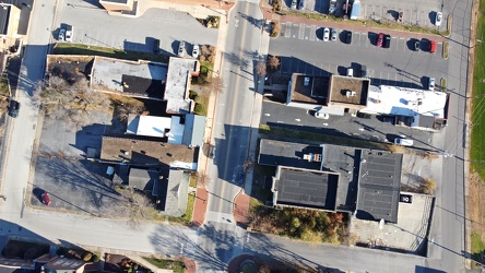
West Main Street and Church Street
-
"DO NOT ENTER" sign on North Central Avenue [02]
!["DO NOT ENTER" sign on North Central Avenue [02] (2212 visits) "DO NOT ENTER" sign at the intersection of North Central Avenue and West Johnson Street in... "DO NOT ENTER" sign on North Central Avenue [02]](../../../../../i/upload/2024/07/19/20240719120026-21151527-cu_s9999x250.jpg)
-
Stop sign at Apple Valley Marketplace [01]
![Stop sign at Apple Valley Marketplace [01] (2346 visits) A very faded and cracked stop sign in front of Sharp Shopper at the Apple Valley Marketplace shoppin... Stop sign at Apple Valley Marketplace [01]](../../../../../i/upload/2024/07/20/20240720112609-300b7fa1-cu_s9999x250.jpg)
-
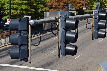
Traffic signals at Clinch Avenue and Henley Street
-
Stop sign at Apple Valley Marketplace [06]
![Stop sign at Apple Valley Marketplace [06] (2377 visits) A very faded and cracked stop sign in front of Sharp Shopper at the Apple Valley Marketplace shoppin... Stop sign at Apple Valley Marketplace [06]](../../../../../i/upload/2024/07/20/20240720112518-ae1ca7dc-cu_s9999x250.jpg)
-
Stop sign at Apple Valley Marketplace [04]
![Stop sign at Apple Valley Marketplace [04] (2390 visits) A very faded and cracked stop sign in front of Sharp Shopper at the Apple Valley Marketplace shoppin... Stop sign at Apple Valley Marketplace [04]](../../../../../i/upload/2024/07/20/20240720112524-89e59f0e-cu_s9999x250.jpg)
-
Stop sign at Apple Valley Marketplace [02]
![Stop sign at Apple Valley Marketplace [02] (2396 visits) A very faded and cracked stop sign in front of Sharp Shopper at the Apple Valley Marketplace shoppin... Stop sign at Apple Valley Marketplace [02]](../../../../../i/upload/2024/07/20/20240720112531-a9d663a4-cu_s9999x250.jpg)
-
Stop sign at Apple Valley Marketplace [07]
![Stop sign at Apple Valley Marketplace [07] (2399 visits) A very faded and cracked stop sign in front of Sharp Shopper at the Apple Valley Marketplace shoppin... Stop sign at Apple Valley Marketplace [07]](../../../../../i/upload/2024/07/20/20240720112550-820af92e-cu_s9999x250.jpg)
-
Stop sign at Apple Valley Marketplace [05]
![Stop sign at Apple Valley Marketplace [05] (2462 visits) A very faded and cracked stop sign in front of Sharp Shopper at the Apple Valley Marketplace shoppin... Stop sign at Apple Valley Marketplace [05]](../../../../../i/upload/2024/07/20/20240720112441-3b653164-cu_s9999x250.jpg)
-
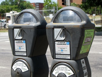
Parking meters on H Street NW
-
Stop sign at Apple Valley Marketplace [08]
![Stop sign at Apple Valley Marketplace [08] (2467 visits) A very faded and cracked stop sign in front of Sharp Shopper at the Apple Valley Marketplace shoppin... Stop sign at Apple Valley Marketplace [08]](../../../../../i/upload/2024/07/20/20240720112622-ca7bcfba-cu_s9999x250.jpg)
-
Traffic light gantry at Fairfax County Parkway and Sunrise Valley Drive [01]
![Traffic light gantry at Fairfax County Parkway and Sunrise Valley Drive [01] (2484 visits) Traffic light gantry over the intersection of Fairfax County Parkway and Sunrise Valley Drive in Res... Traffic light gantry at Fairfax County Parkway and Sunrise Valley Drive [01]](../../../../../i/upload/2024/07/19/20240719123304-52d5c28f-cu_s9999x250.jpg)
-
Stop sign at Apple Valley Marketplace [03]
![Stop sign at Apple Valley Marketplace [03] (2502 visits) A very faded and cracked stop sign in front of Sharp Shopper at the Apple Valley Marketplace shoppin... Stop sign at Apple Valley Marketplace [03]](../../../../../i/upload/2024/07/20/20240720112603-dd7e4488-cu_s9999x250.jpg)
-
Parking lot at Penn's Landing [02]
![Parking lot at Penn's Landing [02] (2528 visits) Surface parking lot along Columbus Boulevard in the Penn's Landing neighborhood of Philadelphia, pho... Parking lot at Penn's Landing [02]](../../../../../i/upload/2024/07/20/20240720143132-43a6f1c8-cu_s9999x250.jpg)
-
Downtown Waynesboro, Virginia, looking toward Invista [01]
![Downtown Waynesboro, Virginia, looking toward Invista [01] (2546 visits) Aerial view of downtown Waynesboro, Virginia, looking towards the Invista plant.
Ben Schumin is a p... Downtown Waynesboro, Virginia, looking toward Invista [01]](../../../../../i/upload/2024/07/19/20240719125947-ee92c8f8-cu_s9999x250.jpg)
-
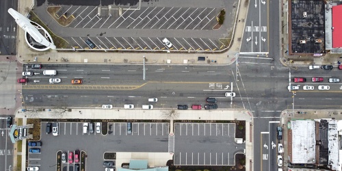
2200 block of Atlantic Avenue
-
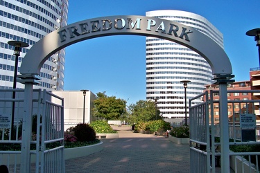
Entrance to Freedom Park
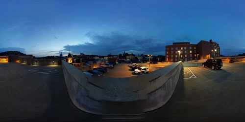
 Top of the New Street garage
-
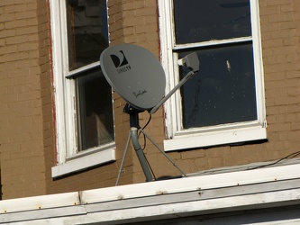
Satellite dish on roof of home
-
Parking lot at Penn's Landing [01]
![Parking lot at Penn's Landing [01] (2714 visits) Surface parking lot along Columbus Boulevard in the Penn's Landing neighborhood of Philadelphia, pho... Parking lot at Penn's Landing [01]](../../../../../i/upload/2024/07/20/20240720143217-921b557b-cu_s9999x250.jpg)
-
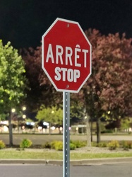
Bilingual stop sign at Walmart
-
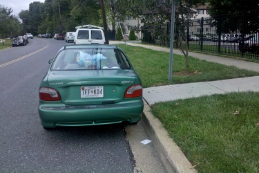
Illegal parking at bus stop
-
Wenonah Elementary School [01]
![Wenonah Elementary School [01] (2909 visits) Wenonah Elementary School, one of four elementary schools in the city.
Ben Schumin is a professiona... Wenonah Elementary School [01]](../../../../../i/upload/2024/07/20/20240720022130-0d6d5971-cu_s9999x250.jpg)
-
Commercial area south of University Boulevard [02]
![Commercial area south of University Boulevard [02] (2981 visits) Commercial area south of University Boulevard in Harrisonburg, Virginia. View facing approximately ... Commercial area south of University Boulevard [02]](../../../../../i/upload/2024/07/19/20240719163825-5d4964e5-cu_s9999x250.jpg)
-
Wesley Lake Drive and Cookman Avenue [01]
![Wesley Lake Drive and Cookman Avenue [01] (2992 visits) Street signs for Wesley Lake Drive and Cookman Avenue in Asbury Park, New Jersey. Wesley Lake Drive... Wesley Lake Drive and Cookman Avenue [01]](../../../../../i/upload/2024/07/17/20240717165151-967f28c2-cu_s9999x250.jpg)
-
Abandoned rowhouse at North Calvert and East Read Streets [01]
![Abandoned rowhouse at North Calvert and East Read Streets [01] (3059 visits) Fire-damaged and abandoned rowhouse at the intersection of North Calvert and East Read Streets in Ba... Abandoned rowhouse at North Calvert and East Read Streets [01]](../../../../../i/upload/2024/07/17/20240717231156-4875201d-cu_s9999x250.jpg)
-
Holiday Inn Express on Staples Mill Road [02]
![Holiday Inn Express on Staples Mill Road [02] (3060 visits) Holiday Inn Express hotel near the intersection of Staples Mill Road and West Broad Street in Richmo... Holiday Inn Express on Staples Mill Road [02]](../../../../../i/upload/2024/07/20/20240720092149-d50c6216-cu_s9999x250.jpg)
-
Holiday Inn Express on Staples Mill Road [01]
![Holiday Inn Express on Staples Mill Road [01] (3103 visits) Holiday Inn Express hotel near the intersection of Staples Mill Road and West Broad Street in Richmo... Holiday Inn Express on Staples Mill Road [01]](../../../../../i/upload/2024/07/20/20240720092024-05d8fbae-cu_s9999x250.jpg)
-
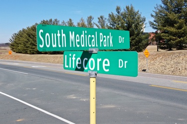
Intersection of South Medical Park Drive and Lifecore Drive
-
Commercial area south of University Boulevard [01]
![Commercial area south of University Boulevard [01] (3135 visits) Commercial area south of University Boulevard in Harrisonburg, Virginia. View facing approximately ... Commercial area south of University Boulevard [01]](../../../../../i/upload/2024/07/19/20240719163821-e0603027-cu_s9999x250.jpg)
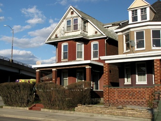
-
402 Park Street
-
Waynesboro Commons shopping center [02]
![Waynesboro Commons shopping center [02] (3221 visits) Former Kroger store at the Waynesboro Commons shopping center, at the intersection of Lew Dewitt Bou... Waynesboro Commons shopping center [02]](../../../../../i/upload/2024/07/19/20240719160202-fa69f3f2-cu_s9999x250.jpg)
-
Waynesboro Commons shopping center [01]
![Waynesboro Commons shopping center [01] (3222 visits) The Waynesboro Commons shopping center, at the intersection of Lew Dewitt Boulevard and West Main St... Waynesboro Commons shopping center [01]](../../../../../i/upload/2024/07/19/20240719160229-ef940787-cu_s9999x250.jpg)
-
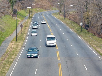
Rock Creek and Potomac Parkway
-
Abandoned rowhouse at North Calvert and East Read Streets [02]
![Abandoned rowhouse at North Calvert and East Read Streets [02] (3245 visits) Fire-damaged and abandoned rowhouse at the intersection of North Calvert and East Read Streets in Ba... Abandoned rowhouse at North Calvert and East Read Streets [02]](../../../../../i/upload/2024/07/17/20240717231200-c1bee20f-cu_s9999x250.jpg)
-
Waynesboro Commons shopping center [03]
![Waynesboro Commons shopping center [03] (3258 visits) Former Kroger store at the Waynesboro Commons shopping center, at the intersection of Lew Dewitt Bou... Waynesboro Commons shopping center [03]](../../../../../i/upload/2024/07/19/20240719160220-f8e167cb-cu_s9999x250.jpg)
-
Streetcar on Queen Street [01]
![Streetcar on Queen Street [01] (3282 visits) A CLRV streetcar, #4189, operating the 501 route westbound in the direction of Neville Park.
More a... Streetcar on Queen Street [01]](../../../../../i/upload/2024/07/19/20240719002744-bba9e4d3-cu_s9999x250.jpg)
-
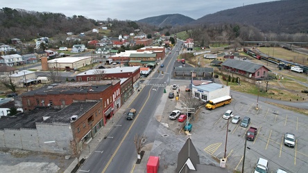
Main Street in Clifton Forge, Virginia
-
Waynesboro Commons shopping center [04]
![Waynesboro Commons shopping center [04] (3410 visits) Parking lot for the Waynesboro Commons shopping center, at the intersection of Lew Dewitt Boulevard ... Waynesboro Commons shopping center [04]](../../../../../i/upload/2024/07/19/20240719160328-087e674f-cu_s9999x250.jpg)
-
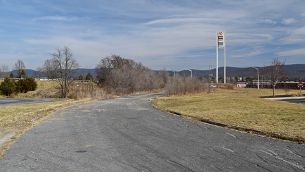
Former alignment of Shenandoah Village Drive
