-
View of I-395 from WMATA bridge [02]
![View of I-395 from WMATA bridge [02] (3188 visits) View of I-395 from the Washington Metro L Route (Yellow Line) bridge. These bridges, along with the... View of I-395 from WMATA bridge [02]](../../../../../i/upload/2024/07/20/20240720152054-84a76a6b-cu_s9999x250.jpg)
-
View of I-395 from WMATA bridge [01]
![View of I-395 from WMATA bridge [01] (2964 visits) View of I-395 from the Washington Metro L Route (Yellow Line) bridge. These bridges, along with the... View of I-395 from WMATA bridge [01]](../../../../../i/upload/2024/07/20/20240720152049-23fc29cb-cu_s9999x250.jpg)
-
Sign for US Route 11E northbound [03]
![Sign for US Route 11E northbound [03] (1755 visits) Reassurance marker for northbound US 11E in Hawkins County, Tennessee. US Route 11 is split into tw... Sign for US Route 11E northbound [03]](../../../../../i/upload/2024/07/20/20240720120558-0519ccde-cu_s9999x250.jpg)
-
Sign for US Route 11E northbound [02]
![Sign for US Route 11E northbound [02] (1614 visits) Reassurance marker for northbound US 11E in Hawkins County, Tennessee. US Route 11 is split into tw... Sign for US Route 11E northbound [02]](../../../../../i/upload/2024/07/20/20240720120527-a89e4f34-cu_s9999x250.jpg)
-
Sign for US Route 11E northbound [01]
![Sign for US Route 11E northbound [01] (1608 visits) Reassurance marker for northbound US 11E in Hawkins County, Tennessee. US Route 11 is split into tw... Sign for US Route 11E northbound [01]](../../../../../i/upload/2024/07/20/20240720120411-d39e2633-cu_s9999x250.jpg)
-
Signage for I-40 on US 321 [04]
![Signage for I-40 on US 321 [04] (1542 visits) Signage for westbound Interstate 40 on US 321 in Lenoir City, Tennessee.
Alternate treatment of s... Signage for I-40 on US 321 [04]](../../../../../i/upload/2024/07/20/20240720113639-59f19d46-cu_s9999x250.jpg)
-
Signage for I-40 on US 321 [03]
![Signage for I-40 on US 321 [03] (1541 visits) Signage for westbound Interstate 40 on US 321 in Lenoir City, Tennessee.
Alternate treatment of s... Signage for I-40 on US 321 [03]](../../../../../i/upload/2024/07/20/20240720113623-c53233ee-cu_s9999x250.jpg)
-
Signage for I-40 on US 321 [02]
![Signage for I-40 on US 321 [02] (1453 visits) Signage for westbound Interstate 40 on US 321 in Lenoir City, Tennessee.
More at The Schumin Web:
w... Signage for I-40 on US 321 [02]](../../../../../i/upload/2024/07/20/20240720113601-2fc22be3-cu_s9999x250.jpg)
-
Signage for I-40 on US 321 [01]
![Signage for I-40 on US 321 [01] (1510 visits) Signage for Interstate 40 on US 321 in Lenoir City, Tennessee.
More at The Schumin Web:
www.schumin... Signage for I-40 on US 321 [01]](../../../../../i/upload/2024/07/20/20240720113534-f6b63e08-cu_s9999x250.jpg)
-
Traffic signal at 4th and West Street

-
Honda HR-V in downtown Waynesboro
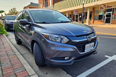
-
Restroom at Fort Edward Johnson wayside
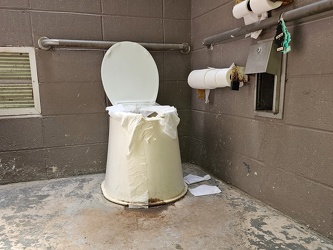
-
Bottle cap embedded in gravel [02]
![Bottle cap embedded in gravel [02] (1685 visits) Bottle cap embedded in the gravel in the parking lot of the Fort Edward Johnson wayside along US 250... Bottle cap embedded in gravel [02]](../../../../../i/upload/2024/07/20/20240720093935-e8bfbf5c-cu_s9999x250.jpg)
-
Sign at the border between Augusta and Highland Counties [03]
![Sign at the border between Augusta and Highland Counties [03] (2756 visits) Sign along US 250 at the border between Augusta and Highland Counties in Virginia. The sign is of t... Sign at the border between Augusta and Highland Counties [03]](../../../../../i/upload/2024/07/20/20240720093939-e9041290-cu_s9999x250.jpg)
-
Historical marker for Highland County on US 250
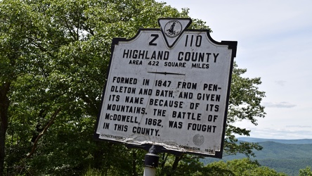
-
Historical marker for Augusta County on US 250
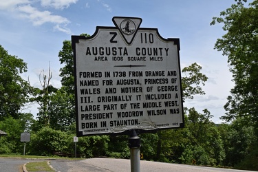
-
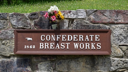
Confederate Breastworks sign
-
Sign at the border between Augusta and Highland Counties [02]
![Sign at the border between Augusta and Highland Counties [02] (2670 visits) Sign along US 250 at the border between Augusta and Highland Counties in Virginia. The sign is stan... Sign at the border between Augusta and Highland Counties [02]](../../../../../i/upload/2024/07/20/20240720094001-d7689782-cu_s9999x250.jpg)
-
Bottle cap embedded in gravel [01]
![Bottle cap embedded in gravel [01] (1386 visits) Bottle cap embedded in the gravel in the parking lot of the Fort Edward Johnson wayside along US 250... Bottle cap embedded in gravel [01]](../../../../../i/upload/2024/07/20/20240720094006-f13f59c7-cu_s9999x250.jpg)
-
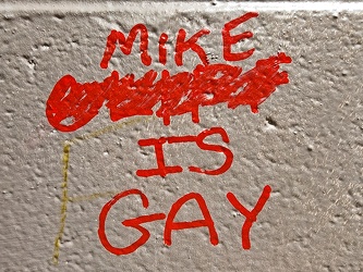
Graffiti at Fort Edward Johnson wayside
-
Sign at the border between Augusta and Highland Counties [01]
![Sign at the border between Augusta and Highland Counties [01] (2759 visits) Sign along US 250 at the border between Augusta and Highland Counties in Virginia. The sign is stan... Sign at the border between Augusta and Highland Counties [01]](../../../../../i/upload/2024/07/20/20240720094015-efe93712-cu_s9999x250.jpg)
-
"Littering is illegal" sign [02]
!["Littering is illegal" sign [02] (3028 visits) Sign along US 250 at the border between Augusta and Highland Counties in Virginia, reminding drivers... "Littering is illegal" sign [02]](../../../../../i/upload/2024/07/20/20240720094020-cdd34053-cu_s9999x250.jpg)
-
Farm on the Virginia-West Virginia border [01]
![Farm on the Virginia-West Virginia border [01] (2859 visits) Farm on the border between Highland County, Virginia and Pendleton County, West Virginia. The bound... Farm on the Virginia-West Virginia border [01]](../../../../../i/upload/2024/07/20/20240720094156-2b1215da-cu_s9999x250.jpg)
-
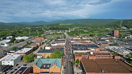
Downtown Waynesboro, facing east
-
Interstate 85 and US 460 reassurance markers [03]
![Interstate 85 and US 460 reassurance markers [03] (1329 visits) Reassurance markers for Interstate 85 southbound and US 460 westbound, about three miles from the sp... Interstate 85 and US 460 reassurance markers [03]](../../../../../i/upload/2024/07/20/20240720092209-42a70fc2-cu_s9999x250.jpg)
-
Interstate 85 and US 460 reassurance markers [02]
![Interstate 85 and US 460 reassurance markers [02] (1300 visits) Reassurance markers for Interstate 85 southbound and US 460 westbound, about three miles from the sp... Interstate 85 and US 460 reassurance markers [02]](../../../../../i/upload/2024/07/20/20240720092125-c916fd33-cu_s9999x250.jpg)
-
Interstate 85 and US 460 reassurance markers [01]
![Interstate 85 and US 460 reassurance markers [01] (1625 visits) Reassurance markers for Interstate 85 southbound and US 460 westbound, about three miles from the sp... Interstate 85 and US 460 reassurance markers [01]](../../../../../i/upload/2024/07/20/20240720092044-46d8955e-cu_s9999x250.jpg)
-
West Broad Street at Staples Mill Road [02]
![West Broad Street at Staples Mill Road [02] (70006 visits) Aerial view of West Broad Street at the intersection with Staples Mill Road in Richmond, Virginia. ... West Broad Street at Staples Mill Road [02]](../../../../../i/upload/2024/07/20/20240720092012-1df12de7-cu_s9999x250.jpg)
-
West Broad Street at Staples Mill Road [01]
![West Broad Street at Staples Mill Road [01] (3229 visits) Aerial view of West Broad Street at the intersection with Staples Mill Road in Richmond, Virginia. ... West Broad Street at Staples Mill Road [01]](../../../../../i/upload/2024/07/20/20240720091824-c8526d69-cu_s9999x250.jpg)
-
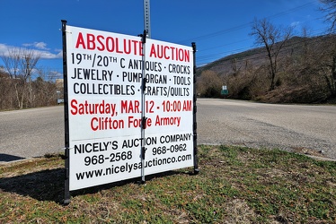
Sign advertising an auction
-
CSX Clifton Forge rail yard [10]
![CSX Clifton Forge rail yard [10] (2832 visits) CSX rail yard in Clifton Forge, Virginia. West Ridgeway Street (US 60 Business) runs alongside the ... CSX Clifton Forge rail yard [10]](../../../../../i/upload/2024/07/20/20240720022004-482675e4-cu_s9999x250.jpg)
-
Shields for US 60 and US 220 [01]
![Shields for US 60 and US 220 [01] (1732 visits) Shields for US 60 westbound and US 220 northbound in Clifton Forge, Virginia.
Ben Schumin is a prof... Shields for US 60 and US 220 [01]](../../../../../i/upload/2024/07/19/20240719212745-19a5aed3-cu_s9999x250.jpg)
-
Reassurance markers for US 13, US 70, and NC 111 [04]
![Reassurance markers for US 13, US 70, and NC 111 [04] (1419 visits) Sign assembly containing reassurance markers for southbound US Route 13, westbound US Route 70, and ... Reassurance markers for US 13, US 70, and NC 111 [04]](../../../../../i/upload/2024/07/19/20240719202050-eefad4c5-cu_s9999x250.jpg)
-
Reassurance markers for US 13, US 70, and NC 111 [01]
![Reassurance markers for US 13, US 70, and NC 111 [01] (1337 visits) Sign assembly containing reassurance markers for southbound US Route 13, westbound US Route 70, and ... Reassurance markers for US 13, US 70, and NC 111 [01]](../../../../../i/upload/2024/07/19/20240719202111-08757310-cu_s9999x250.jpg)
-
Reassurance markers for US 13, US 70, and NC 111 [03]
![Reassurance markers for US 13, US 70, and NC 111 [03] (2346 visits) Sign assembly containing reassurance markers for southbound US Route 13, westbound US Route 70, and ... Reassurance markers for US 13, US 70, and NC 111 [03]](../../../../../i/upload/2024/07/19/20240719202116-04523f40-cu_s9999x250.jpg)
-
Reassurance markers for US 13, US 70, and NC 111 [02]
![Reassurance markers for US 13, US 70, and NC 111 [02] (2686 visits) Sign assembly containing reassurance markers for southbound US Route 13, westbound US Route 70, and ... Reassurance markers for US 13, US 70, and NC 111 [02]](../../../../../i/upload/2024/07/19/20240719202130-777f3422-cu_s9999x250.jpg)
-
Reassurance marker for US 460 Business westbound [01]
![Reassurance marker for US 460 Business westbound [01] (1409 visits) Reassurance marker for westbound US 460 Business on South Crater Road in Petersburg, Virginia.
More... Reassurance marker for US 460 Business westbound [01]](../../../../../i/upload/2024/07/19/20240719195429-a75b711e-cu_s9999x250.jpg)
-
Reassurance marker for US 460 Business westbound [02]
![Reassurance marker for US 460 Business westbound [02] (1434 visits) Reassurance marker for westbound US 460 Business on South Crater Road in Petersburg, Virginia.
More... Reassurance marker for US 460 Business westbound [02]](../../../../../i/upload/2024/07/19/20240719195435-3d345c43-cu_s9999x250.jpg)
-
US 250 at the west end of Waynesboro, Virginia
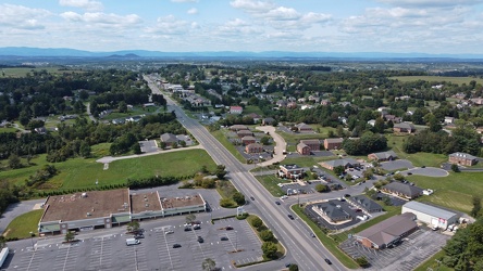
-
Waynesboro, Virginia, facing approximately east
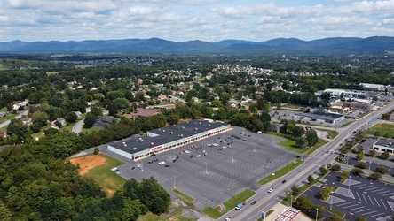
-
Pelham neighborhood in Waynesboro, Virginia
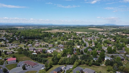
-
West Main Street in Waynesboro, Virginia [04]
![West Main Street in Waynesboro, Virginia [04] (323189 visits) View down West Main Street (US 250) in the west end of Waynesboro, Virginia, near the Westwood Villa... West Main Street in Waynesboro, Virginia [04]](../../../../../i/upload/2024/07/19/20240719164600-4379cef1-cu_s9999x250.jpg)
-
West Main Street in Waynesboro, Virginia [03]
![West Main Street in Waynesboro, Virginia [03] (10713 visits) View down West Main Street (US 250) in the west end of Waynesboro, Virginia, near St. Mark's United ... West Main Street in Waynesboro, Virginia [03]](../../../../../i/upload/2024/07/19/20240719164555-f7feeafe-cu_s9999x250.jpg)
-
West Main Street in Waynesboro, Virginia [02]
![West Main Street in Waynesboro, Virginia [02] (9916 visits) View down West Main Street (US 250) in the west end of Waynesboro, Virginia, near the Sheetz conveni... West Main Street in Waynesboro, Virginia [02]](../../../../../i/upload/2024/07/19/20240719164551-0b8407a8-cu_s9999x250.jpg)
-
West Main Street in Waynesboro, Virginia [01]
![West Main Street in Waynesboro, Virginia [01] (55615 visits) View down West Main Street (US 250) in the west end of Waynesboro, Virginia, near the former Kmart b... West Main Street in Waynesboro, Virginia [01]](../../../../../i/upload/2024/07/19/20240719164545-b5a50599-cu_s9999x250.jpg)
-
West Main and West Broad Streets in downtown Waynesboro
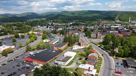
-
US 340 in Charles Town [03]
![US 340 in Charles Town [03] (3196 visits) US 340 in Charles Town, West Virginia, east of the interchange with West Virginia Route 9.
Ben Schu... US 340 in Charles Town [03]](../../../../../i/upload/2024/07/19/20240719162153-ebf4366a-cu_s9999x250.jpg)
-
US 340 in Charles Town [02]
![US 340 in Charles Town [02] (3186 visits) US 340 in Charles Town, West Virginia, east of the interchange with West Virginia Route 9.
Ben Schu... US 340 in Charles Town [02]](../../../../../i/upload/2024/07/19/20240719162156-6d3ecd1b-cu_s9999x250.jpg)
-
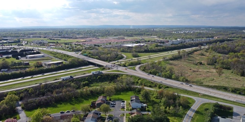
Intersection of US 340 and West Virginia Routes 9 and 51
-
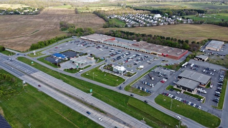
Somerset Village
-
US 340 in Charles Town [04]
![US 340 in Charles Town [04] (2532 visits) US 340 in Charles Town, West Virginia, east of the interchange with West Virginia Route 9.
Ben Schu... US 340 in Charles Town [04]](../../../../../i/upload/2024/07/19/20240719162255-e1659465-cu_s9999x250.jpg)
-
US 340 in Charles Town [01]
![US 340 in Charles Town [01] (3226 visits) US 340 in Charles Town, West Virginia, east of the interchange with West Virginia Route 9.
Ben Schu... US 340 in Charles Town [01]](../../../../../i/upload/2024/07/19/20240719162259-85e9531c-cu_s9999x250.jpg)
-
Pumping gas at an Exxon station in Waynesboro, Virginia [01]
![Pumping gas at an Exxon station in Waynesboro, Virginia [01] (12297 visits) Fueling a Honda HR-V at the Exxon gas station on West Main Street in Waynesboro, Virginia.
Ben Schu... Pumping gas at an Exxon station in Waynesboro, Virginia [01]](../../../../../i/upload/2024/07/19/20240719160319-edcd2718-cu_s9999x250.jpg)
-
Pumping gas at an Exxon station in Waynesboro, Virginia [02]
![Pumping gas at an Exxon station in Waynesboro, Virginia [02] (10288 visits) Fueling a Honda HR-V at the Exxon gas station on West Main Street in Waynesboro, Virginia.
Ben Schu... Pumping gas at an Exxon station in Waynesboro, Virginia [02]](../../../../../i/upload/2024/07/19/20240719160340-1e0fba3f-cu_s9999x250.jpg)
-
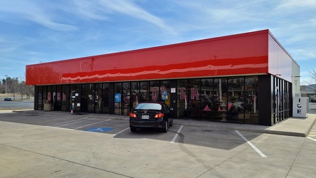
Convenience store at Exxon station on West Main Street
-
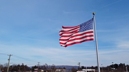
Flag in front of the Exxon on West Main Street
-
Exxon on West Main Street
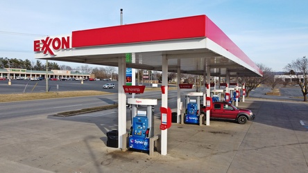
-
West Main and West Broad Streets, facing west
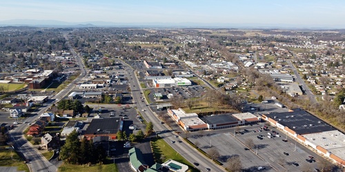
-
Main and Broad Streets, facing east
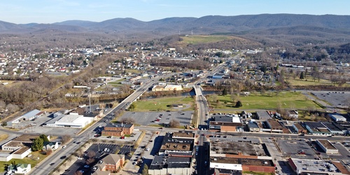
-
West Main Street in Waynesboro, Virginia [02]
![West Main Street in Waynesboro, Virginia [02] (3321 visits) Downtown Waynesboro, Virginia, looking east down West Main Street, near the intersection with Church... West Main Street in Waynesboro, Virginia [02]](../../../../../i/upload/2024/07/19/20240719130153-2ee52d33-cu_s9999x250.jpg)
-
Downtown Waynesboro, Virginia, facing west
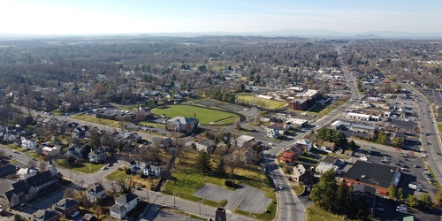
-
West Main Street in Waynesboro, Virginia [01]
![West Main Street in Waynesboro, Virginia [01] (3428 visits) Downtown Waynesboro, Virginia, looking east down West Main Street, near the intersection with Church... West Main Street in Waynesboro, Virginia [01]](../../../../../i/upload/2024/07/19/20240719130232-6088860d-cu_s9999x250.jpg)
-
West Main Street in Waynesboro, Virginia [03]
![West Main Street in Waynesboro, Virginia [03] (13313 visits) Downtown Waynesboro, Virginia, looking east down West Main Street, near the intersection with Church... West Main Street in Waynesboro, Virginia [03]](../../../../../i/upload/2024/07/19/20240719130237-f1099710-cu_s9999x250.jpg)
-
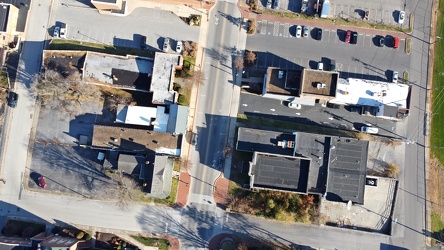
West Main Street and Church Street
-
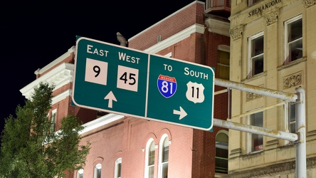
Overhead sign over South Queen Street
-
Potomac River from US 340 bridge [05]
![Potomac River from US 340 bridge [05] (1123 visits) The Potomac River, viewed from the US 340 bridge between Maryland and Virginia.
Ben Schumin is a pr... Potomac River from US 340 bridge [05]](../../../../../i/upload/2024/07/19/20240719103412-5b42c5b9-cu_s9999x250.jpg)
-
Potomac River from US 340 bridge [04]
![Potomac River from US 340 bridge [04] (1109 visits) The Potomac River, viewed from the US 340 bridge between Maryland and Virginia.
Ben Schumin is a pr... Potomac River from US 340 bridge [04]](../../../../../i/upload/2024/07/19/20240719103405-18d26a8b-cu_s9999x250.jpg)
-
Potomac River from US 340 bridge [03]
![Potomac River from US 340 bridge [03] (1032 visits) The Potomac River, viewed from the US 340 bridge between Maryland and Virginia.
Ben Schumin is a pr... Potomac River from US 340 bridge [03]](../../../../../i/upload/2024/07/19/20240719103359-b66380e8-cu_s9999x250.jpg)
-
Rocks in the Potomac River [05]
![Rocks in the Potomac River [05] (1019 visits) Rocks in the Potomac River near Harpers Ferry. Viewed from the US 340 bridge.
Ben Schumin is a pro... Rocks in the Potomac River [05]](../../../../../i/upload/2024/07/19/20240719103353-ea395458-cu_s9999x250.jpg)
-
Rocks in the Potomac River [04]
![Rocks in the Potomac River [04] (955 visits) Rocks in the Potomac River near Harpers Ferry. Viewed from the US 340 bridge.
Ben Schumin is a pro... Rocks in the Potomac River [04]](../../../../../i/upload/2024/07/19/20240719103348-1a3aef78-cu_s9999x250.jpg)
-
Rocks in the Potomac River [03]
![Rocks in the Potomac River [03] (944 visits) Rocks in the Potomac River near Harpers Ferry. Viewed from the US 340 bridge.
Ben Schumin is a pro... Rocks in the Potomac River [03]](../../../../../i/upload/2024/07/19/20240719103343-404e77e5-cu_s9999x250.jpg)
-
Rocks in the Potomac River [02]
![Rocks in the Potomac River [02] (941 visits) Rocks in the Potomac River near Harpers Ferry. Viewed from the US 340 bridge.
Ben Schumin is a pro... Rocks in the Potomac River [02]](../../../../../i/upload/2024/07/19/20240719103338-04e1c1e1-cu_s9999x250.jpg)
-
Rocks in the Potomac River [01]
![Rocks in the Potomac River [01] (993 visits) Rocks in the Potomac River near Harpers Ferry. Viewed from the US 340 bridge.
Ben Schumin is a pro... Rocks in the Potomac River [01]](../../../../../i/upload/2024/07/19/20240719103333-6083493b-cu_s9999x250.jpg)
-
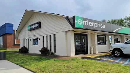
Enterprise Rent-A-Car on West Broad Street
-
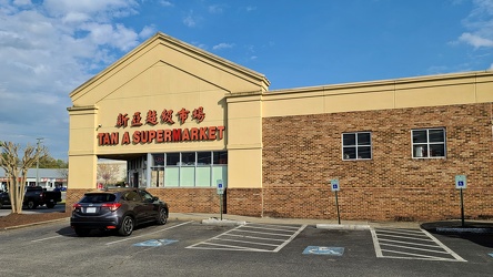
Tan A Supermarket
-
Former McDonald's in Catonsville, Maryland [01]
![Former McDonald's in Catonsville, Maryland [01] (2918 visits) Former McDonald's restaurant at the 40 West Plaza shopping center in Catonsville, Maryland. The bui... Former McDonald's in Catonsville, Maryland [01]](../../../../../i/upload/2024/07/18/20240718215413-abfa66e7-cu_s9999x250.jpg)
-
Former McDonald's in Catonsville, Maryland [02]
![Former McDonald's in Catonsville, Maryland [02] (3159 visits) Former McDonald's restaurant at the 40 West Plaza shopping center in Catonsville, Maryland. The bui... Former McDonald's in Catonsville, Maryland [02]](../../../../../i/upload/2024/07/18/20240718215406-d60ddc3d-cu_s9999x250.jpg)
-
Former McDonald's in Catonsville, Maryland [03]
![Former McDonald's in Catonsville, Maryland [03] (3263 visits) Former McDonald's restaurant at the 40 West Plaza shopping center in Catonsville, Maryland. The bui... Former McDonald's in Catonsville, Maryland [03]](../../../../../i/upload/2024/07/18/20240718215402-1dd77175-cu_s9999x250.jpg)
-
Former McDonald's in Catonsville, Maryland [04]
![Former McDonald's in Catonsville, Maryland [04] (3708 visits) Dumpster enclosure for the former McDonald's restaurant at the 40 West Plaza shopping center in Cato... Former McDonald's in Catonsville, Maryland [04]](../../../../../i/upload/2024/07/18/20240718215357-708d113b-cu_s9999x250.jpg)
-
Former McDonald's in Catonsville, Maryland [05]
![Former McDonald's in Catonsville, Maryland [05] (3219 visits) Former McDonald's restaurant at the 40 West Plaza shopping center in Catonsville, Maryland. The bui... Former McDonald's in Catonsville, Maryland [05]](../../../../../i/upload/2024/07/18/20240718215354-77979e6f-cu_s9999x250.jpg)