-
Hampton Roads Bridge-Tunnel, westbound tube
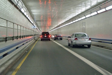
-
Hampton Roads Bridge-Tunnel, westbound [03]
![Hampton Roads Bridge-Tunnel, westbound [03] (47807 visits) Approach to the east portal of the Hampton Roads Bridge Tunnel on the westbound side.
More at The S... Hampton Roads Bridge-Tunnel, westbound [03]](../../../../../i/upload/2024/07/14/20240714234950-d2db0c37-cu_s9999x250.jpg)
-
Hampton Roads Bridge-Tunnel, westbound [02]
![Hampton Roads Bridge-Tunnel, westbound [02] (47208 visits) Eastbound side of the Hampton Roads Bridge-Tunnel, viewed from the westbound span.
More at The Schu... Hampton Roads Bridge-Tunnel, westbound [02]](../../../../../i/upload/2024/07/14/20240714234951-dbc0fd5f-cu_s9999x250.jpg)
-
Sign for Exit 268
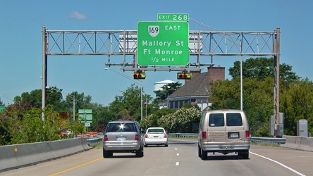
-
Hampton Roads Bridge-Tunnel, westbound [01]
![Hampton Roads Bridge-Tunnel, westbound [01] (10271 visits) Sign marking the beginning of the Hampton Roads Bridge-Tunnel complex on Interstate 64 westbound, in... Hampton Roads Bridge-Tunnel, westbound [01]](../../../../../i/upload/2024/07/14/20240714234955-62e4e126-cu_s9999x250.jpg)
-
Interstate 64 westbound in Hampton, Virginia
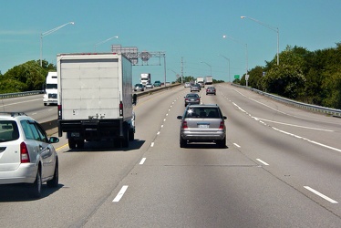
-
Hampton Roads Bridge-Tunnel, westbound [05]
![Hampton Roads Bridge-Tunnel, westbound [05] (4044 visits) Westbound traffic exits the west portal of the Hampton Roads Bridge-Tunnel.
More at The Schumin Web... Hampton Roads Bridge-Tunnel, westbound [05]](../../../../../i/upload/2024/07/14/20240714234958-245d8a80-cu_s9999x250.jpg)
-
Hampton Roads Bridge-Tunnel, westbound [04]
![Hampton Roads Bridge-Tunnel, westbound [04] (3829 visits) East portal of the Hampton Roads Bridge Tunnel on the westbound side.
More at The Schumin Web:
www.... Hampton Roads Bridge-Tunnel, westbound [04]](../../../../../i/upload/2024/07/14/20240714234959-48ab2d91-cu_s9999x250.jpg)
-
Westbound Interstate 66 near Nutley Street
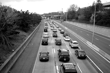
-
Traffic backup on Interstate 64
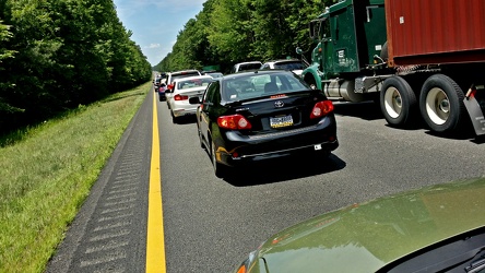
-
Ivy rest area [01]
![Ivy rest area [01] (2963 visits) Rest area on Interstate 64 westbound, near Ivy, Virginia (milepost 113).
Ben Schumin is a professio... Ivy rest area [01]](../../../../../i/upload/2024/07/17/20240717232803-9c60e629-cu_s9999x250.jpg)
-
Ivy rest area [02]
![Ivy rest area [02] (3024 visits) Rest area on Interstate 64 westbound, near Ivy, Virginia (milepost 113).
Ben Schumin is a professio... Ivy rest area [02]](../../../../../i/upload/2024/07/17/20240717232807-2e81efde-cu_s9999x250.jpg)
-
Ivy rest area [03]
![Ivy rest area [03] (3047 visits) Rest area on Interstate 64 westbound, near Ivy, Virginia (milepost 113).
Ben Schumin is a professio... Ivy rest area [03]](../../../../../i/upload/2024/07/17/20240717232811-236d66ef-cu_s9999x250.jpg)
-
Interstate 66 westbound, near Gainesville
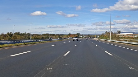
-
Goochland rest area, westbound [03]
![Goochland rest area, westbound [03] (2132 visits) Restroom building at the Goochland Safety Rest Area on Interstate 64 westbound in Manakin-Sabot, Vir... Goochland rest area, westbound [03]](../../../../../i/upload/2024/07/19/20240719093121-0aeca88a-cu_s9999x250.jpg)
-
Goochland rest area, westbound [02]
![Goochland rest area, westbound [02] (2100 visits) Restroom building at the Goochland Safety Rest Area on Interstate 64 westbound in Manakin-Sabot, Vir... Goochland rest area, westbound [02]](../../../../../i/upload/2024/07/19/20240719093125-c06aafb1-cu_s9999x250.jpg)
-
Goochland rest area, westbound [01]
![Goochland rest area, westbound [01] (2109 visits) Restroom building at the Goochland Safety Rest Area on Interstate 64 westbound in Manakin-Sabot, Vir... Goochland rest area, westbound [01]](../../../../../i/upload/2024/07/19/20240719093130-dbdf3bb4-cu_s9999x250.jpg)
-
Child/toddler friendly stall at New Kent rest area
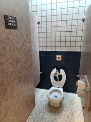
-
Interior of New Kent rest area, westbound
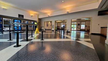
-
Rocks in the Potomac River [01]
![Rocks in the Potomac River [01] (1314 visits) Rocks in the Potomac River near Harpers Ferry. Viewed from the US 340 bridge.
Ben Schumin is a pro... Rocks in the Potomac River [01]](../../../../../i/upload/2024/07/19/20240719103333-6083493b-cu_s9999x250.jpg)
-
Rocks in the Potomac River [02]
![Rocks in the Potomac River [02] (1246 visits) Rocks in the Potomac River near Harpers Ferry. Viewed from the US 340 bridge.
Ben Schumin is a pro... Rocks in the Potomac River [02]](../../../../../i/upload/2024/07/19/20240719103338-04e1c1e1-cu_s9999x250.jpg)
-
Rocks in the Potomac River [03]
![Rocks in the Potomac River [03] (1265 visits) Rocks in the Potomac River near Harpers Ferry. Viewed from the US 340 bridge.
Ben Schumin is a pro... Rocks in the Potomac River [03]](../../../../../i/upload/2024/07/19/20240719103343-404e77e5-cu_s9999x250.jpg)
-
Rocks in the Potomac River [04]
![Rocks in the Potomac River [04] (1284 visits) Rocks in the Potomac River near Harpers Ferry. Viewed from the US 340 bridge.
Ben Schumin is a pro... Rocks in the Potomac River [04]](../../../../../i/upload/2024/07/19/20240719103348-1a3aef78-cu_s9999x250.jpg)
-
Rocks in the Potomac River [05]
![Rocks in the Potomac River [05] (1334 visits) Rocks in the Potomac River near Harpers Ferry. Viewed from the US 340 bridge.
Ben Schumin is a pro... Rocks in the Potomac River [05]](../../../../../i/upload/2024/07/19/20240719103353-ea395458-cu_s9999x250.jpg)
-
Potomac River from US 340 bridge [03]
![Potomac River from US 340 bridge [03] (1340 visits) The Potomac River, viewed from the US 340 bridge between Maryland and Virginia.
Ben Schumin is a pr... Potomac River from US 340 bridge [03]](../../../../../i/upload/2024/07/19/20240719103359-b66380e8-cu_s9999x250.jpg)
-
Potomac River from US 340 bridge [04]
![Potomac River from US 340 bridge [04] (1421 visits) The Potomac River, viewed from the US 340 bridge between Maryland and Virginia.
Ben Schumin is a pr... Potomac River from US 340 bridge [04]](../../../../../i/upload/2024/07/19/20240719103405-18d26a8b-cu_s9999x250.jpg)
-
Potomac River from US 340 bridge [05]
![Potomac River from US 340 bridge [05] (1427 visits) The Potomac River, viewed from the US 340 bridge between Maryland and Virginia.
Ben Schumin is a pr... Potomac River from US 340 bridge [05]](../../../../../i/upload/2024/07/19/20240719103412-5b42c5b9-cu_s9999x250.jpg)
-
Low clearance sign at West Falls Church station
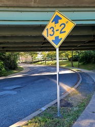
-
Main and Broad Streets, facing east
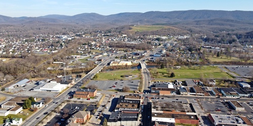
-
Downtown Waynesboro, Virginia, looking toward Invista [02]
![Downtown Waynesboro, Virginia, looking toward Invista [02] (4232 visits) Aerial view of downtown Waynesboro, Virginia, looking towards the Invista plant.
Ben Schumin is a p... Downtown Waynesboro, Virginia, looking toward Invista [02]](../../../../../i/upload/2024/07/19/20240719130254-ae1aac9d-cu_s9999x250.jpg)
-
Shield for State Route 254 [01]
![Shield for State Route 254 [01] (1395 visits) Shield for State Route 254 on West Frederick Street in downtown Staunton, Virginia. This style of s... Shield for State Route 254 [01]](../../../../../i/upload/2024/07/19/20240719160500-1fdaedc1-cu_s9999x250.jpg)
-
Shield for State Route 254 [02]
![Shield for State Route 254 [02] (1409 visits) Shield for State Route 254 on West Frederick Street in downtown Staunton, Virginia. This style of s... Shield for State Route 254 [02]](../../../../../i/upload/2024/07/19/20240719160516-e72119d6-cu_s9999x250.jpg)
-
West Main Street in Waynesboro, Virginia [01]
![West Main Street in Waynesboro, Virginia [01] (55797 visits) View down West Main Street (US 250) in the west end of Waynesboro, Virginia, near the former Kmart b... West Main Street in Waynesboro, Virginia [01]](../../../../../i/upload/2024/07/19/20240719164545-b5a50599-cu_s9999x250.jpg)
-
West Main Street in Waynesboro, Virginia [02]
![West Main Street in Waynesboro, Virginia [02] (10084 visits) View down West Main Street (US 250) in the west end of Waynesboro, Virginia, near the Sheetz conveni... West Main Street in Waynesboro, Virginia [02]](../../../../../i/upload/2024/07/19/20240719164551-0b8407a8-cu_s9999x250.jpg)
-
West Main Street in Waynesboro, Virginia [03]
![West Main Street in Waynesboro, Virginia [03] (10927 visits) View down West Main Street (US 250) in the west end of Waynesboro, Virginia, near St. Mark's United ... West Main Street in Waynesboro, Virginia [03]](../../../../../i/upload/2024/07/19/20240719164555-f7feeafe-cu_s9999x250.jpg)
-
West Main Street in Waynesboro, Virginia [04]
![West Main Street in Waynesboro, Virginia [04] (323473 visits) View down West Main Street (US 250) in the west end of Waynesboro, Virginia, near the Westwood Villa... West Main Street in Waynesboro, Virginia [04]](../../../../../i/upload/2024/07/19/20240719164600-4379cef1-cu_s9999x250.jpg)
-
Pelham neighborhood in Waynesboro, Virginia
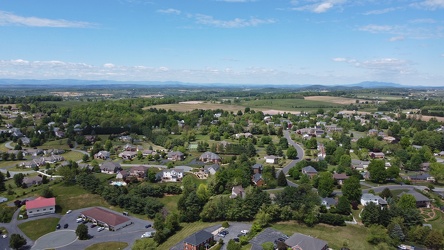
-
Zero Effluent Discharge sign at Ivy rest area [02]
![Zero Effluent Discharge sign at Ivy rest area [02] (2429 visits) Sign at the rest area along Interstate 64 westbound near Ivy, Virginia explaining that the rest area... Zero Effluent Discharge sign at Ivy rest area [02]](../../../../../i/upload/2024/07/19/20240719165901-5f1abe0b-cu_s9999x250.jpg)
-
Zero Effluent Discharge sign at Ivy rest area [01]
![Zero Effluent Discharge sign at Ivy rest area [01] (2375 visits) Sign at the rest area along Interstate 64 westbound near Ivy, Virginia explaining that the rest area... Zero Effluent Discharge sign at Ivy rest area [01]](../../../../../i/upload/2024/07/19/20240719165907-357f8f51-cu_s9999x250.jpg)
-
US 250 at the west end of Waynesboro, Virginia
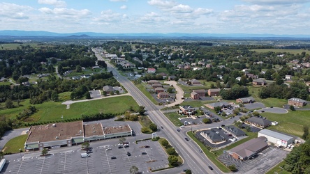
-
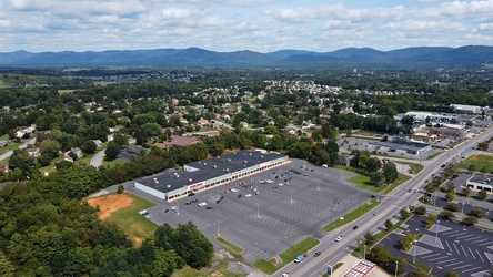
Waynesboro, Virginia, facing approximately east
-
Reassurance marker for US 460 Business westbound [01]
![Reassurance marker for US 460 Business westbound [01] (1543 visits) Reassurance marker for westbound US 460 Business on South Crater Road in Petersburg, Virginia.
More... Reassurance marker for US 460 Business westbound [01]](../../../../../i/upload/2024/07/19/20240719195429-a75b711e-cu_s9999x250.jpg)
-
Reassurance marker for US 460 Business westbound [02]
![Reassurance marker for US 460 Business westbound [02] (1571 visits) Reassurance marker for westbound US 460 Business on South Crater Road in Petersburg, Virginia.
More... Reassurance marker for US 460 Business westbound [02]](../../../../../i/upload/2024/07/19/20240719195435-3d345c43-cu_s9999x250.jpg)
-
Shields for US 60 and US 220 [01]
![Shields for US 60 and US 220 [01] (1862 visits) Shields for US 60 westbound and US 220 northbound in Clifton Forge, Virginia.
Ben Schumin is a prof... Shields for US 60 and US 220 [01]](../../../../../i/upload/2024/07/19/20240719212745-19a5aed3-cu_s9999x250.jpg)
-
WestRock facility in Covington, Virginia [01]
![WestRock facility in Covington, Virginia [01] (2012 visits) WestRock paper mill in Covington, Virginia. The Jackson River runs through the middle of the facili... WestRock facility in Covington, Virginia [01]](../../../../../i/upload/2024/07/20/20240720021532-4b05d77c-cu_s9999x250.jpg)
-
WestRock facility in Covington, Virginia [02]
![WestRock facility in Covington, Virginia [02] (1981 visits) WestRock paper mill in Covington, Virginia. The Jackson River runs through the middle of the facili... WestRock facility in Covington, Virginia [02]](../../../../../i/upload/2024/07/20/20240720021559-1be02d8d-cu_s9999x250.jpg)
-
WestRock facility in Covington, Virginia [03]
![WestRock facility in Covington, Virginia [03] (1736 visits) Wastewater clarifier at the WestRock paper mill in Covington, Virginia.
Ben Schumin is a profession... WestRock facility in Covington, Virginia [03]](../../../../../i/upload/2024/07/20/20240720021631-e74d807c-cu_s9999x250.jpg)
-
WestRock facility in Covington, Virginia [04]
![WestRock facility in Covington, Virginia [04] (1785 visits) Water settlement basin with baffles at the WestRock paper mill in Covington, Virginia.
Ben Schumin ... WestRock facility in Covington, Virginia [04]](../../../../../i/upload/2024/07/20/20240720021651-02d88c0d-cu_s9999x250.jpg)
-
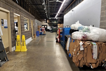
Back hallway at Food Lion in White Sulphur Springs, West Virginia
-
WestRock facility in Covington, Virginia [05]
![WestRock facility in Covington, Virginia [05] (1890 visits) Steam emits from smokestacks at the WestRock paper mill in Covington, Virginia.
Ben Schumin is a pr... WestRock facility in Covington, Virginia [05]](../../../../../i/upload/2024/07/20/20240720021707-3a72a418-cu_s9999x250.jpg)
-
WestRock facility in Covington, Virginia [06]
![WestRock facility in Covington, Virginia [06] (2081 visits) Steam emits from smokestacks at the WestRock paper mill in Covington, Virginia.
Ben Schumin is a pr... WestRock facility in Covington, Virginia [06]](../../../../../i/upload/2024/07/20/20240720021730-c12dcfc2-cu_s9999x250.jpg)
-
WestRock facility in Covington, Virginia [07]
![WestRock facility in Covington, Virginia [07] (2015 visits) Steam emits from smokestacks at the WestRock paper mill in Covington, Virginia.
Ben Schumin is a pr... WestRock facility in Covington, Virginia [07]](../../../../../i/upload/2024/07/20/20240720021746-bdfefcba-cu_s9999x250.jpg)
-
WestRock facility in Covington, Virginia [08]
![WestRock facility in Covington, Virginia [08] (2019 visits) Steam emits from a smokestack at the WestRock paper mill in Covington, Virginia.
Ben Schumin is a p... WestRock facility in Covington, Virginia [08]](../../../../../i/upload/2024/07/20/20240720021804-3c0a3d76-cu_s9999x250.jpg)
-
WestRock facility in Covington, Virginia [09]
![WestRock facility in Covington, Virginia [09] (2005 visits) Steam emits from a smokestack at the WestRock paper mill in Covington, Virginia.
Ben Schumin is a p... WestRock facility in Covington, Virginia [09]](../../../../../i/upload/2024/07/20/20240720021821-5f461f6b-cu_s9999x250.jpg)
-
WestRock facility in Covington, Virginia [10]
![WestRock facility in Covington, Virginia [10] (2172 visits) Steam emits from a smokestack at the WestRock paper mill in Covington, Virginia.
Ben Schumin is a p... WestRock facility in Covington, Virginia [10]](../../../../../i/upload/2024/07/20/20240720021839-3eca0672-cu_s9999x250.jpg)
-
WestRock facility in Covington, Virginia [11]
![WestRock facility in Covington, Virginia [11] (2019 visits) Steam emits from a smokestack at the WestRock paper mill in Covington, Virginia.
Ben Schumin is a p... WestRock facility in Covington, Virginia [11]](../../../../../i/upload/2024/07/20/20240720021845-8ffc00b2-cu_s9999x250.jpg)
-
WestRock facility in Covington, Virginia [12]
![WestRock facility in Covington, Virginia [12] (2026 visits) Steam emits from smokestacks at the WestRock paper mill in Covington, Virginia.
Ben Schumin is a pr... WestRock facility in Covington, Virginia [12]](../../../../../i/upload/2024/07/20/20240720021857-d4910598-cu_s9999x250.jpg)
-
WestRock facility in Covington, Virginia [13]
![WestRock facility in Covington, Virginia [13] (2093 visits) Steam emits from a smokestack at the WestRock paper mill in Covington, Virginia.
Ben Schumin is a p... WestRock facility in Covington, Virginia [13]](../../../../../i/upload/2024/07/20/20240720021909-e4a3bcc1-cu_s9999x250.jpg)
-
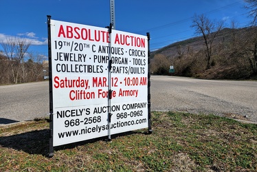
Sign advertising an auction
-
West Broad Street at Staples Mill Road [01]
![West Broad Street at Staples Mill Road [01] (3485 visits) Aerial view of West Broad Street at the intersection with Staples Mill Road in Richmond, Virginia. ... West Broad Street at Staples Mill Road [01]](../../../../../i/upload/2024/07/20/20240720091824-c8526d69-cu_s9999x250.jpg)
-
West Broad Street at Staples Mill Road [02]
![West Broad Street at Staples Mill Road [02] (70237 visits) Aerial view of West Broad Street at the intersection with Staples Mill Road in Richmond, Virginia. ... West Broad Street at Staples Mill Road [02]](../../../../../i/upload/2024/07/20/20240720092012-1df12de7-cu_s9999x250.jpg)
-
Interstate 85 and US 460 reassurance markers [01]
![Interstate 85 and US 460 reassurance markers [01] (1700 visits) Reassurance markers for Interstate 85 southbound and US 460 westbound, about three miles from the sp... Interstate 85 and US 460 reassurance markers [01]](../../../../../i/upload/2024/07/20/20240720092044-46d8955e-cu_s9999x250.jpg)
-
Interstate 85 and US 460 reassurance markers [02]
![Interstate 85 and US 460 reassurance markers [02] (1386 visits) Reassurance markers for Interstate 85 southbound and US 460 westbound, about three miles from the sp... Interstate 85 and US 460 reassurance markers [02]](../../../../../i/upload/2024/07/20/20240720092125-c916fd33-cu_s9999x250.jpg)
-
Interstate 85 and US 460 reassurance markers [03]
![Interstate 85 and US 460 reassurance markers [03] (1408 visits) Reassurance markers for Interstate 85 southbound and US 460 westbound, about three miles from the sp... Interstate 85 and US 460 reassurance markers [03]](../../../../../i/upload/2024/07/20/20240720092209-42a70fc2-cu_s9999x250.jpg)
-
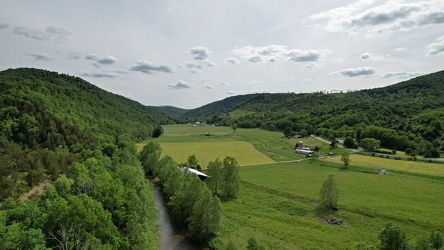
Farmland along the Virginia-West Virginia border
-
"Littering is illegal" sign [02]
!["Littering is illegal" sign [02] (3203 visits) Sign along US 250 at the border between Augusta and Highland Counties in Virginia, reminding drivers... "Littering is illegal" sign [02]](../../../../../i/upload/2024/07/20/20240720094020-cdd34053-cu_s9999x250.jpg)
-
Farm on the Virginia-West Virginia border [01]
![Farm on the Virginia-West Virginia border [01] (3010 visits) Farm on the border between Highland County, Virginia and Pendleton County, West Virginia. The bound... Farm on the Virginia-West Virginia border [01]](../../../../../i/upload/2024/07/20/20240720094156-2b1215da-cu_s9999x250.jpg)
-
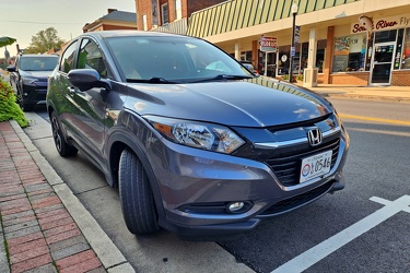
Honda HR-V in downtown Waynesboro
-
Hampton Roads Bridge-Tunnel, westbound [01]
![Hampton Roads Bridge-Tunnel, westbound [01] (603 visits) The westbound tube of the Hampton Roads Bridge-Tunnel, a tunnel that carries Interstate 64 between N... Hampton Roads Bridge-Tunnel, westbound [01]](../../../../../i/upload/2025/02/17/20250217012510-5b2ab7ac-cu_s9999x250.jpg)
-
Hampton Roads Bridge-Tunnel, westbound [02]
![Hampton Roads Bridge-Tunnel, westbound [02] (635 visits) The westbound tube of the Hampton Roads Bridge-Tunnel, a tunnel that carries Interstate 64 between N... Hampton Roads Bridge-Tunnel, westbound [02]](../../../../../i/upload/2025/02/17/20250217012521-81ed217b-cu_s9999x250.jpg)
-
Tunnel under Roanoke-Blacksburg Regional Airport [01]
![Tunnel under Roanoke-Blacksburg Regional Airport [01] (454 visits) Tunnel under the northeastern end of runway 06/24 at Roanoke-Blacksburg Regional Airport, helping ca... Tunnel under Roanoke-Blacksburg Regional Airport [01]](../../../../../i/upload/2025/03/07/20250307082638-881970da-cu_s9999x250.jpg)
-
Tunnel under Roanoke-Blacksburg Regional Airport [02]
![Tunnel under Roanoke-Blacksburg Regional Airport [02] (453 visits) Tunnel under the northeastern end of runway 06/24 at Roanoke-Blacksburg Regional Airport, helping ca... Tunnel under Roanoke-Blacksburg Regional Airport [02]](../../../../../i/upload/2025/03/07/20250307082646-1ee32362-cu_s9999x250.jpg)
-
Tunnel under Roanoke-Blacksburg Regional Airport [03]
![Tunnel under Roanoke-Blacksburg Regional Airport [03] (484 visits) Tunnel under the northeastern end of runway 06/24 at Roanoke-Blacksburg Regional Airport, helping ca... Tunnel under Roanoke-Blacksburg Regional Airport [03]](../../../../../i/upload/2025/03/07/20250307082655-ed6dde73-cu_s9999x250.jpg)
-
Tunnel under Roanoke-Blacksburg Regional Airport [04]
![Tunnel under Roanoke-Blacksburg Regional Airport [04] (479 visits) Tunnel under the northeastern end of runway 06/24 at Roanoke-Blacksburg Regional Airport, helping ca... Tunnel under Roanoke-Blacksburg Regional Airport [04]](../../../../../i/upload/2025/03/07/20250307082705-95dbd6b4-cu_s9999x250.jpg)
-
Photographing the tunnel under Roanoke-Blacksburg Regional Airport
