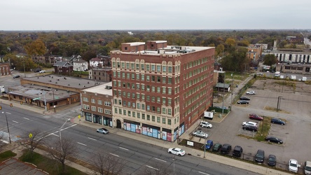
-
View from Rhode Island Avenue station, facing south
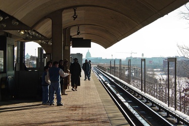
-
"Historic Gainsboro" sign
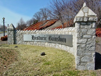
-
View from John Hancock Center [01]
![View from John Hancock Center [01] (2946 visits) View from the John Hancock Center in Chicago, Illinois, looking down on the intersection of North Mi... View from John Hancock Center [01]](../../../../i/upload/2024/07/15/20240715204858-184cb7a6-cu_s9999x250.jpg)
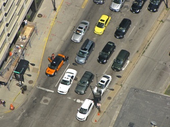
-
Traffic at a signal on North Lake Shore Drive
-
East Liberty Presbyterian Church [01]
![East Liberty Presbyterian Church [01] (1802 visits) Exterior of East Liberty Presbyterian Church, viewed from the east.
More at The Schumin Web:
www.sc... East Liberty Presbyterian Church [01]](../../../../i/upload/2024/07/18/20240718220433-8605f0f2-cu_s9999x250.jpg)
-
East Liberty Presbyterian Church [02]
![East Liberty Presbyterian Church [02] (1705 visits) Exterior of East Liberty Presbyterian Church, viewed from the northwest.
More at The Schumin Web:
w... East Liberty Presbyterian Church [02]](../../../../i/upload/2024/07/18/20240718220454-b8584ae2-cu_s9999x250.jpg)
-
East Liberty Presbyterian Church [03]
![East Liberty Presbyterian Church [03] (1673 visits) Exterior of East Liberty Presbyterian Church, viewed from the northwest.
More at The Schumin Web:
w... East Liberty Presbyterian Church [03]](../../../../i/upload/2024/07/18/20240718220458-47d51108-cu_s9999x250.jpg)
-
East Liberty Presbyterian Church [04]
![East Liberty Presbyterian Church [04] (1685 visits) Exterior of East Liberty Presbyterian Church, viewed from the northwest.
More at The Schumin Web:
w... East Liberty Presbyterian Church [04]](../../../../i/upload/2024/07/18/20240718220502-4a7a8670-cu_s9999x250.jpg)
-
East Liberty Presbyterian Church [08]
![East Liberty Presbyterian Church [08] (1823 visits) Exterior of East Liberty Presbyterian Church, viewed from the east.
More at The Schumin Web:
www.sc... East Liberty Presbyterian Church [08]](../../../../i/upload/2024/07/18/20240718220521-5a93ed20-cu_s9999x250.jpg)
-
Staunton Clock Tower [01]
![Staunton Clock Tower [01] (925 visits) The Clock Tower, over the intersection of East Beverley Street and North Central Avenue in downtown ... Staunton Clock Tower [01]](../../../../i/upload/2024/07/19/20240719115857-a88dc372-cu_s9999x250.jpg)
-
Staunton Clock Tower [02]
![Staunton Clock Tower [02] (877 visits) The Clock Tower, over the intersection of East Beverley Street and North Central Avenue in downtown ... Staunton Clock Tower [02]](../../../../i/upload/2024/07/19/20240719115915-2d83ab3f-cu_s9999x250.jpg)
-
Staunton Clock Tower [03]
![Staunton Clock Tower [03] (930 visits) The Clock Tower, over the intersection of East Beverley Street and North Central Avenue in downtown ... Staunton Clock Tower [03]](../../../../i/upload/2024/07/19/20240719115934-d5879976-cu_s9999x250.jpg)
-
Staunton Clock Tower [10]
![Staunton Clock Tower [10] (1382 visits) The Clock Tower, over the intersection of East Beverley Street and North Central Avenue in downtown ... Staunton Clock Tower [10]](../../../../i/upload/2024/07/19/20240719160058-dd43b1e1-cu_s9999x250.jpg)
-
Staunton Clock Tower [04]
![Staunton Clock Tower [04] (1341 visits) The Clock Tower, over the intersection of East Beverley Street and North Central Avenue in downtown ... Staunton Clock Tower [04]](../../../../i/upload/2024/07/19/20240719160116-c9540996-cu_s9999x250.jpg)
-
Staunton Clock Tower [13]
![Staunton Clock Tower [13] (1381 visits) The Clock Tower, over the intersection of East Beverley Street and North Central Avenue in downtown ... Staunton Clock Tower [13]](../../../../i/upload/2024/07/19/20240719160124-669a56d5-cu_s9999x250.jpg)
-
Staunton Clock Tower [09]
![Staunton Clock Tower [09] (1368 visits) The Clock Tower, over the intersection of East Beverley Street and North Central Avenue in downtown ... Staunton Clock Tower [09]](../../../../i/upload/2024/07/19/20240719160128-bed95bb6-cu_s9999x250.jpg)
-
Staunton Clock Tower [05]
![Staunton Clock Tower [05] (2143 visits) The Clock Tower, over the intersection of East Beverley Street and North Central Avenue in downtown ... Staunton Clock Tower [05]](../../../../i/upload/2024/07/19/20240719160137-3608ac98-cu_s9999x250.jpg)
-
Staunton Clock Tower [11]
![Staunton Clock Tower [11] (1522 visits) A "Black Lives Matter" sign hangs in a window in the Clock Tower, over the intersection of... Staunton Clock Tower [11]](../../../../i/upload/2024/07/19/20240719160145-6b3f0140-cu_s9999x250.jpg)
-
Staunton Clock Tower [08]
![Staunton Clock Tower [08] (1355 visits) The Clock Tower, over the intersection of East Beverley Street and North Central Avenue in downtown ... Staunton Clock Tower [08]](../../../../i/upload/2024/07/19/20240719160150-5519befb-cu_s9999x250.jpg)
-
Staunton Clock Tower [06]
![Staunton Clock Tower [06] (1372 visits) The Clock Tower, over the intersection of East Beverley Street and North Central Avenue in downtown ... Staunton Clock Tower [06]](../../../../i/upload/2024/07/19/20240719160154-c78fc755-cu_s9999x250.jpg)
-
Staunton Clock Tower [07]
![Staunton Clock Tower [07] (1334 visits) The Clock Tower, over the intersection of East Beverley Street and North Central Avenue in downtown ... Staunton Clock Tower [07]](../../../../i/upload/2024/07/19/20240719160232-5fccc12c-cu_s9999x250.jpg)
-
Staunton Clock Tower [12]
![Staunton Clock Tower [12] (1350 visits) The Clock Tower, over the intersection of East Beverley Street and North Central Avenue in downtown ... Staunton Clock Tower [12]](../../../../i/upload/2024/07/19/20240719160244-284b4f43-cu_s9999x250.jpg)
-
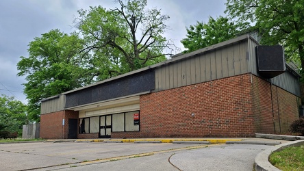
Former 7-Eleven at 20th Street and Rhode Island Avenue NE
-
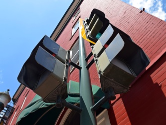
Traffic and pedestrian signals at East Johnson Street and South New Street
-
Essex Place, Candle Ridge, and Picton of Birlstone [02]
![Essex Place, Candle Ridge, and Picton of Birlstone [02] (2089 visits) Aerial view of the Essex Place, Candle Ridge, and Picton of Birlstone areas of Montgomery Village, M... Essex Place, Candle Ridge, and Picton of Birlstone [02]](../../../../i/upload/2024/07/19/20240719165355-16cfcb21-cu_s9999x250.jpg)
-
Essex Place, Candle Ridge, and Picton of Birlstone [03]
![Essex Place, Candle Ridge, and Picton of Birlstone [03] (1863 visits) Aerial view of the Essex Place, Candle Ridge, and Picton of Birlstone areas of Montgomery Village, M... Essex Place, Candle Ridge, and Picton of Birlstone [03]](../../../../i/upload/2024/07/19/20240719165413-01ec57b3-cu_s9999x250.jpg)
-
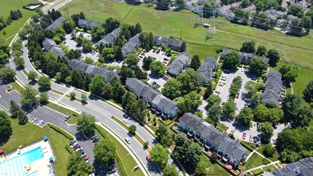
Hawk Run Terrace
-
Essex Place, Candle Ridge, and Picton of Birlstone [01]
![Essex Place, Candle Ridge, and Picton of Birlstone [01] (1905 visits) Aerial view of the Essex Place, Candle Ridge, and Picton of Birlstone areas of Montgomery Village, M... Essex Place, Candle Ridge, and Picton of Birlstone [01]](../../../../i/upload/2024/07/19/20240719165455-a51c05df-cu_s9999x250.jpg)
-
Gaithersburg, Maryland near Summit and Diamond Avenues [01]
![Gaithersburg, Maryland near Summit and Diamond Avenues [01] (1241 visits) View of Old Town Gaithersburg, Maryland from near the railroad tracks.
Ben Schumin is a professiona... Gaithersburg, Maryland near Summit and Diamond Avenues [01]](../../../../i/upload/2024/07/19/20240719170939-b6228236-cu_s9999x250.jpg)
-
Gaithersburg, Maryland near Summit and Diamond Avenues [02]
![Gaithersburg, Maryland near Summit and Diamond Avenues [02] (1432 visits) View of Old Town Gaithersburg, Maryland from near the railroad tracks.
Ben Schumin is a professiona... Gaithersburg, Maryland near Summit and Diamond Avenues [02]](../../../../i/upload/2024/07/19/20240719170943-06a2a87f-cu_s9999x250.jpg)
-
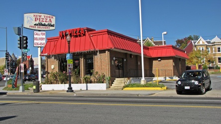
New York Pizza on Florida Avenue NE
-
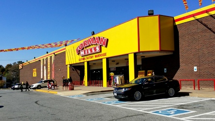
Forman Mills
-
Big Lots and Save A Lot [02]
![Big Lots and Save A Lot [02] (4608 visits) Big Lots and Save A Lot in the Rhode Island Avenue Shopping Center in DC, splitting a space that for... Big Lots and Save A Lot [02]](../../../../i/upload/2024/07/19/20240719190015-53f4ab04-cu_s9999x250.jpg)
-
Big Lots and Save A Lot [01]
![Big Lots and Save A Lot [01] (4656 visits) Big Lots and Save A Lot in the Rhode Island Avenue Shopping Center in DC, splitting a space that for... Big Lots and Save A Lot [01]](../../../../i/upload/2024/07/19/20240719190018-aa01beb9-cu_s9999x250.jpg)
-
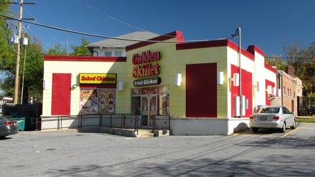
Golden Skillet
-
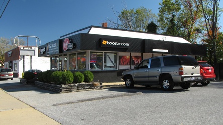
US-Mobile1
-
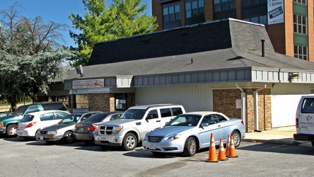
Bennett Babies
-
East Main Street in Waynesboro, Virginia
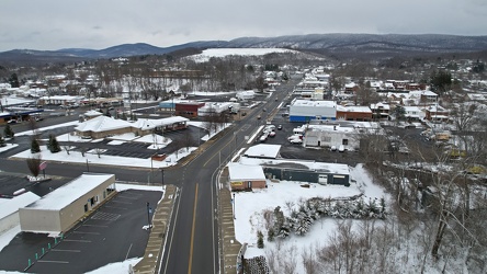
-
East Main and Broad Streets in Waynesboro, Virginia
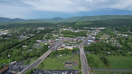
-
Essex Place and The Reach
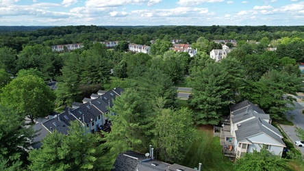
-
Top of the Empire State Building [01]
![Top of the Empire State Building [01] (1923 visits) The top of the Empire State Building, viewed from the intersection of Fifth Avenue and East 26th Str... Top of the Empire State Building [01]](../../../../i/upload/2024/07/20/20240720150721-8ecf28e7-cu_s9999x250.jpg)
-
View from Madison Avenue and East 23rd Street, facing south [01]
![View from Madison Avenue and East 23rd Street, facing south [01] (1473 visits) View from the intersection of Madison Avenue and East 23rd Street, facing south.
More at The Schumi... View from Madison Avenue and East 23rd Street, facing south [01]](../../../../i/upload/2024/07/20/20240720150841-f1593e74-cu_s9999x250.jpg)
-
View from Madison Avenue and East 23rd Street, facing south [02]
![View from Madison Avenue and East 23rd Street, facing south [02] (1435 visits) View from the intersection of Madison Avenue and East 23rd Street, facing south.
More at The Schumi... View from Madison Avenue and East 23rd Street, facing south [02]](../../../../i/upload/2024/07/20/20240720150847-ce89c61c-cu_s9999x250.jpg)
-
Empire State Building with nearby buildings [01]
![Empire State Building with nearby buildings [01] (1838 visits) The Empire State building with nearby buildings, viewed from the intersection of Fifth Avenue and Ea... Empire State Building with nearby buildings [01]](../../../../i/upload/2024/07/20/20240720151251-f86dc545-cu_s9999x250.jpg)
-
Empire State Building with nearby buildings [02]
![Empire State Building with nearby buildings [02] (1734 visits) The Empire State building with nearby buildings, viewed from the intersection of Fifth Avenue and Ea... Empire State Building with nearby buildings [02]](../../../../i/upload/2024/07/20/20240720151256-733646c3-cu_s9999x250.jpg)
-
Empire State Building with nearby buildings [03]
![Empire State Building with nearby buildings [03] (1826 visits) The Empire State building with nearby buildings, viewed from the intersection of Fifth Avenue and Ea... Empire State Building with nearby buildings [03]](../../../../i/upload/2024/07/20/20240720151302-aeaeb4bf-cu_s9999x250.jpg)
-
Empire State Building with nearby buildings [04]
![Empire State Building with nearby buildings [04] (1855 visits) The Empire State building with nearby buildings, viewed from the intersection of Fifth Avenue and Ea... Empire State Building with nearby buildings [04]](../../../../i/upload/2024/07/20/20240720151308-b57075b5-cu_s9999x250.jpg)
-
Traffic signal at Lexington Avenue and East 41st Street
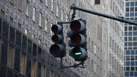
-
Aerial view of East Liberty Presbyterian Church [02]
![Aerial view of East Liberty Presbyterian Church [02] (2930 visits) Aerial view of East Liberty Presbyterian Church, also known as the Cathedral of Hope, a large church... Aerial view of East Liberty Presbyterian Church [02]](../../../../i/upload/2024/07/20/20240720160925-113a640a-cu_s9999x250.jpg)
-
Aerial view of East Liberty Presbyterian Church [04]
![Aerial view of East Liberty Presbyterian Church [04] (2925 visits) Aerial view of East Liberty Presbyterian Church, also known as the Cathedral of Hope, a large church... Aerial view of East Liberty Presbyterian Church [04]](../../../../i/upload/2024/07/20/20240720160929-16fd7e34-cu_s9999x250.jpg)
-
Aerial view of East Liberty Presbyterian Church [06]
![Aerial view of East Liberty Presbyterian Church [06] (2905 visits) Aerial view of East Liberty Presbyterian Church, also known as the Cathedral of Hope, a large church... Aerial view of East Liberty Presbyterian Church [06]](../../../../i/upload/2024/07/20/20240720160933-a6419b30-cu_s9999x250.jpg)
-
Aerial view of East Liberty Presbyterian Church [11]
![Aerial view of East Liberty Presbyterian Church [11] (2888 visits) Aerial view of East Liberty Presbyterian Church, also known as the Cathedral of Hope, a large church... Aerial view of East Liberty Presbyterian Church [11]](../../../../i/upload/2024/07/20/20240720160938-8f5a529e-cu_s9999x250.jpg)
-
Aerial view of East Liberty Presbyterian Church [12]
![Aerial view of East Liberty Presbyterian Church [12] (2974 visits) Aerial view of East Liberty Presbyterian Church, also known as the Cathedral of Hope, a large church... Aerial view of East Liberty Presbyterian Church [12]](../../../../i/upload/2024/07/20/20240720160942-7f513a92-cu_s9999x250.jpg)
-
Aerial view of East Liberty Presbyterian Church [20]
![Aerial view of East Liberty Presbyterian Church [20] (2980 visits) Aerial view of East Liberty Presbyterian Church, also known as the Cathedral of Hope, a large church... Aerial view of East Liberty Presbyterian Church [20]](../../../../i/upload/2024/07/20/20240720160946-69e2d66b-cu_s9999x250.jpg)
-
Aerial view of East Liberty Presbyterian Church [23]
![Aerial view of East Liberty Presbyterian Church [23] (3000 visits) Aerial view of East Liberty Presbyterian Church, also known as the Cathedral of Hope, a large church... Aerial view of East Liberty Presbyterian Church [23]](../../../../i/upload/2024/07/20/20240720160950-71281329-cu_s9999x250.jpg)
-
Aerial view of East Liberty Presbyterian Church [10]
![Aerial view of East Liberty Presbyterian Church [10] (2922 visits) Aerial view of East Liberty Presbyterian Church, also known as the Cathedral of Hope, a large church... Aerial view of East Liberty Presbyterian Church [10]](../../../../i/upload/2024/07/20/20240720161000-0209603e-cu_s9999x250.jpg)
-
Aerial view of East Liberty Presbyterian Church [13]
![Aerial view of East Liberty Presbyterian Church [13] (2889 visits) Aerial view of East Liberty Presbyterian Church, also known as the Cathedral of Hope, a large church... Aerial view of East Liberty Presbyterian Church [13]](../../../../i/upload/2024/07/20/20240720161004-3f71162c-cu_s9999x250.jpg)
-
Aerial view of East Liberty Presbyterian Church [18]
![Aerial view of East Liberty Presbyterian Church [18] (2975 visits) Aerial view of East Liberty Presbyterian Church, also known as the Cathedral of Hope, a large church... Aerial view of East Liberty Presbyterian Church [18]](../../../../i/upload/2024/07/20/20240720161008-f23a38fa-cu_s9999x250.jpg)
-
Aerial view of East Liberty Presbyterian Church [21]
![Aerial view of East Liberty Presbyterian Church [21] (2945 visits) Aerial view of East Liberty Presbyterian Church, also known as the Cathedral of Hope, a large church... Aerial view of East Liberty Presbyterian Church [21]](../../../../i/upload/2024/07/20/20240720161013-99e0adfe-cu_s9999x250.jpg)
-
Aerial view of East Liberty Presbyterian Church [08]
![Aerial view of East Liberty Presbyterian Church [08] (2940 visits) Aerial view of East Liberty Presbyterian Church, also known as the Cathedral of Hope, a large church... Aerial view of East Liberty Presbyterian Church [08]](../../../../i/upload/2024/07/20/20240720161021-d331e071-cu_s9999x250.jpg)
-
Aerial view of East Liberty Presbyterian Church [17]
![Aerial view of East Liberty Presbyterian Church [17] (2928 visits) Aerial view of East Liberty Presbyterian Church, also known as the Cathedral of Hope, a large church... Aerial view of East Liberty Presbyterian Church [17]](../../../../i/upload/2024/07/20/20240720161026-6ad4630b-cu_s9999x250.jpg)
-
Aerial view of East Liberty Presbyterian Church [19]
![Aerial view of East Liberty Presbyterian Church [19] (3019 visits) Aerial view of East Liberty Presbyterian Church, also known as the Cathedral of Hope, a large church... Aerial view of East Liberty Presbyterian Church [19]](../../../../i/upload/2024/07/20/20240720161030-5a181c2c-cu_s9999x250.jpg)
-
Aerial view of East Liberty Presbyterian Church [15]
![Aerial view of East Liberty Presbyterian Church [15] (2884 visits) Aerial view of East Liberty Presbyterian Church, also known as the Cathedral of Hope, a large church... Aerial view of East Liberty Presbyterian Church [15]](../../../../i/upload/2024/07/20/20240720161034-6b35469d-cu_s9999x250.jpg)
-
Aerial view of East Liberty Presbyterian Church [03]
![Aerial view of East Liberty Presbyterian Church [03] (2953 visits) Aerial view of East Liberty Presbyterian Church, also known as the Cathedral of Hope, a large church... Aerial view of East Liberty Presbyterian Church [03]](../../../../i/upload/2024/07/20/20240720161105-e2137cac-cu_s9999x250.jpg)
-
Aerial view of East Liberty Presbyterian Church [05]
![Aerial view of East Liberty Presbyterian Church [05] (3052 visits) Aerial view of East Liberty Presbyterian Church, also known as the Cathedral of Hope, a large church... Aerial view of East Liberty Presbyterian Church [05]](../../../../i/upload/2024/07/20/20240720161109-bae1d6d3-cu_s9999x250.jpg)
-
Aerial view of East Liberty Presbyterian Church [22]
![Aerial view of East Liberty Presbyterian Church [22] (2999 visits) Aerial view of East Liberty Presbyterian Church, also known as the Cathedral of Hope, a large church... Aerial view of East Liberty Presbyterian Church [22]](../../../../i/upload/2024/07/20/20240720161113-6de998b7-cu_s9999x250.jpg)
-
Aerial view of East Liberty Presbyterian Church [01]
![Aerial view of East Liberty Presbyterian Church [01] (3005 visits) Aerial view of East Liberty Presbyterian Church, also known as the Cathedral of Hope, a large church... Aerial view of East Liberty Presbyterian Church [01]](../../../../i/upload/2024/07/20/20240720161117-a77350d6-cu_s9999x250.jpg)
-
Aerial view of East Liberty Presbyterian Church [14]
![Aerial view of East Liberty Presbyterian Church [14] (2980 visits) Aerial view of East Liberty Presbyterian Church, also known as the Cathedral of Hope, a large church... Aerial view of East Liberty Presbyterian Church [14]](../../../../i/upload/2024/07/20/20240720161121-2f08111b-cu_s9999x250.jpg)
-
Aerial view of East Liberty Presbyterian Church [16]
![Aerial view of East Liberty Presbyterian Church [16] (2949 visits) Aerial view of East Liberty Presbyterian Church, also known as the Cathedral of Hope, a large church... Aerial view of East Liberty Presbyterian Church [16]](../../../../i/upload/2024/07/20/20240720161125-66b55a4b-cu_s9999x250.jpg)
-
Aerial view of East Liberty Presbyterian Church [09]
![Aerial view of East Liberty Presbyterian Church [09] (2956 visits) Aerial view of East Liberty Presbyterian Church, also known as the Cathedral of Hope, a large church... Aerial view of East Liberty Presbyterian Church [09]](../../../../i/upload/2024/07/20/20240720161129-5fb4069e-cu_s9999x250.jpg)
-
Aerial view of East Liberty Presbyterian Church [07]
![Aerial view of East Liberty Presbyterian Church [07] (2916 visits) Aerial view of East Liberty Presbyterian Church, also known as the Cathedral of Hope, a large church... Aerial view of East Liberty Presbyterian Church [07]](../../../../i/upload/2024/07/20/20240720161134-5af0a002-cu_s9999x250.jpg)
-
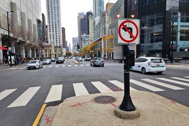
Turn restriction at North Michigan Avenue and East Chestnut Street
-
View from observation deck at 875 North Michigan Avenue [04]
![View from observation deck at 875 North Michigan Avenue [04] (962 visits) View of Chicago, Illinois from the observation deck at 875 North Michigan Avenue, formerly known as ... View from observation deck at 875 North Michigan Avenue [04]](../../../../i/upload/2024/11/14/20241114220637-e64d934a-cu_s9999x250.jpg)
-
View from observation deck at 875 North Michigan Avenue [05]
![View from observation deck at 875 North Michigan Avenue [05] (965 visits) View of Chicago, Illinois from the observation deck at 875 North Michigan Avenue, formerly known as ... View from observation deck at 875 North Michigan Avenue [05]](../../../../i/upload/2024/11/14/20241114220656-6eb1fe7e-cu_s9999x250.jpg)
-
131 East 5th Avenue
