-
2 Concord Street

-
Sudley Road just south of I-66


-
Aerial view of downtown Charleston, South Carolina [06]
![Aerial view of downtown Charleston, South Carolina [06] (143 visits) Aerial view of downtown Charleston, South Carolina, from above the Port of Charleston. View facing ... Aerial view of downtown Charleston, South Carolina [06]](../../../../i/upload/2025/06/04/20250604104347-7b5162a7-cu_s9999x250.jpg)
-
Aerial view of downtown Charleston, South Carolina [06]
![Aerial view of downtown Charleston, South Carolina [06] (150 visits) Aerial view of downtown Charleston, South Carolina, approxomately above the intersection of Drake an... Aerial view of downtown Charleston, South Carolina [06]](../../../../i/upload/2025/05/24/20250524005451-350fe369-cu_s9999x250.jpg)
-
Aerial view of downtown Charleston, South Carolina [08]
![Aerial view of downtown Charleston, South Carolina [08] (199 visits) Aerial view of downtown Charleston, South Carolina, from above the intersection of Meeting and John ... Aerial view of downtown Charleston, South Carolina [08]](../../../../i/upload/2025/05/24/20250524005706-36f418bf-cu_s9999x250.jpg)
-
Aerial view of downtown Charleston, South Carolina [02]
![Aerial view of downtown Charleston, South Carolina [02] (205 visits) Aerial view of downtown Charleston, South Carolina, from above the intersection of King and Reid Str... Aerial view of downtown Charleston, South Carolina [02]](../../../../i/upload/2025/05/23/20250523172216-d0ec7d8b-cu_s9999x250.jpg)
-
Toyota 4Runner on Reid Street

-
Aerial view of downtown Charleston, South Carolina [09]
![Aerial view of downtown Charleston, South Carolina [09] (240 visits) Aerial view of downtown Charleston, South Carolina, from above the intersection of Meeting and John ... Aerial view of downtown Charleston, South Carolina [09]](../../../../i/upload/2025/05/24/20250524005756-e84d9c06-cu_s9999x250.jpg)
-
Intersections of King Street with Tobacco and Vanderhorst Streets

-
Aerial view of downtown Charleston, South Carolina [05]
![Aerial view of downtown Charleston, South Carolina [05] (260 visits) Aerial view of downtown Charleston, South Carolina, from above the intersection of King and Ann Stre... Aerial view of downtown Charleston, South Carolina [05]](../../../../i/upload/2025/05/24/20250524005405-6d254e98-cu_s9999x250.jpg)
-
Aerial view of Folly Beach, South Carolina [02]
![Aerial view of Folly Beach, South Carolina [02] (269 visits) Aerial view of Folly Beach, South Carolina, roughly centered on Center Street, facing approximately ... Aerial view of Folly Beach, South Carolina [02]](../../../../i/upload/2025/05/14/20250514110306-1f7c3170-cu_s9999x250.jpg)
-
Aerial view of Folly Beach, South Carolina [01]
![Aerial view of Folly Beach, South Carolina [01] (299 visits) Aerial view of Folly Beach, South Carolina, roughly centered on Center Street, facing approximately ... Aerial view of Folly Beach, South Carolina [01]](../../../../i/upload/2025/05/14/20250514110300-74440381-cu_s9999x250.jpg)
-
View down King Street in downtown Charleston

-
Aerial view of downtown Charleston, South Carolina [01]
![Aerial view of downtown Charleston, South Carolina [01] (319 visits) Aerial view of downtown Charleston, South Carolina, from above the intersection of King and Reid Str... Aerial view of downtown Charleston, South Carolina [01]](../../../../i/upload/2025/05/23/20250523172204-ea3abf92-cu_s9999x250.jpg)
-
King Street between Reid and Woolfe Streets

-
Aerial view of Folly Beach, South Carolina [03]
![Aerial view of Folly Beach, South Carolina [03] (381 visits) Aerial view of Folly Beach, South Carolina, roughly centered on Center Street, facing approximately ... Aerial view of Folly Beach, South Carolina [03]](../../../../i/upload/2025/05/14/20250514110312-219b9712-cu_s9999x250.jpg)
-
Aerial view of downtown Charleston, South Carolina [03]
![Aerial view of downtown Charleston, South Carolina [03] (393 visits) Aerial view of downtown Charleston, South Carolina, from above the intersection of King and Reid Str... Aerial view of downtown Charleston, South Carolina [03]](../../../../i/upload/2025/05/23/20250523172248-b46c5c77-cu_s9999x250.jpg)
-
Clouds over downtown Charleston

-
Aerial view of Folly Beach, South Carolina [04]
![Aerial view of Folly Beach, South Carolina [04] (445 visits) Aerial view of Folly Beach, South Carolina, roughly centered on Center Street, facing approximately ... Aerial view of Folly Beach, South Carolina [04]](../../../../i/upload/2025/05/14/20250514110319-69d4f7ad-cu_s9999x250.jpg)
-
Aerial view of downtown Charleston, South Carolina [04]
![Aerial view of downtown Charleston, South Carolina [04] (446 visits) Aerial view of downtown Charleston, South Carolina, from above the intersection of King and Reid Str... Aerial view of downtown Charleston, South Carolina [04]](../../../../i/upload/2025/05/23/20250523172257-0a28d4e7-cu_s9999x250.jpg)
-
Aerial view of Folly Beach, South Carolina [05]
![Aerial view of Folly Beach, South Carolina [05] (555 visits) Aerial view of Folly Beach, South Carolina, roughly centered on the fishing pier, facing approximate... Aerial view of Folly Beach, South Carolina [05]](../../../../i/upload/2025/05/15/20250515155646-ff4d6f07-cu_s9999x250.jpg)
-
Pennsylvania State Capitol from the northeast [02]
![Pennsylvania State Capitol from the northeast [02] (914 visits) The Pennsylvania State Capitol, viewed from the northeast about half a mile away, up State Street.
... Pennsylvania State Capitol from the northeast [02]](../../../../i/upload/2025/02/28/20250228133516-926a99a2-cu_s9999x250.jpg)
-
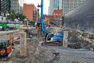
Construction site at Yonge and Elm Streets
-
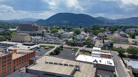
Downtown Roanoke facing Mill Mountain
-
Roanoke from above Main Street SW

-
View above Locust Street [01]
![View above Locust Street [01] (1136 visits) View above the 100 block of Locust Street in downtown Harrisburg, Pennsylvania.
More at The Schumin... View above Locust Street [01]](../../../../i/upload/2025/03/06/20250306092215-56587593-cu_s9999x250.jpg)
-
View above Locust Street [02]
![View above Locust Street [02] (1160 visits) View above the 100 block of Locust Street in downtown Harrisburg, Pennsylvania.
More at The Schumin... View above Locust Street [02]](../../../../i/upload/2025/03/06/20250306092222-32925c3b-cu_s9999x250.jpg)
-
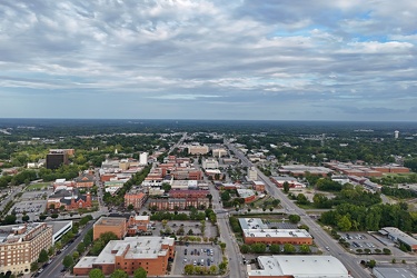
Aerial view of Fayetteville, North Carolina
-
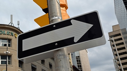
One way sign at Bank and Sparks Streets
-
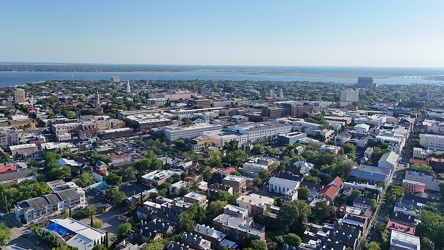
Downtown Charleston in early evening
-
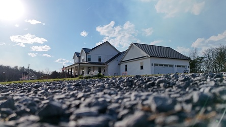
279 Brooklee Ridge Lane
-
Entrance to Omni Charlottesville Hotel [05]
![Entrance to Omni Charlottesville Hotel [05] (1260 visits) Main entrance to the Omni Charlottesville Hotel, at the head of the Downtown Mall.
Ben Schumin is a... Entrance to Omni Charlottesville Hotel [05]](../../../../i/upload/2024/07/19/20240719115818-68848870-cu_s9999x250.jpg)
-
Entrance to Omni Charlottesville Hotel [06]
![Entrance to Omni Charlottesville Hotel [06] (1272 visits) Main entrance to the Omni Charlottesville Hotel, at the head of the Downtown Mall.
Ben Schumin is a... Entrance to Omni Charlottesville Hotel [06]](../../../../i/upload/2024/07/19/20240719115823-1607bd7f-cu_s9999x250.jpg)
-
Entrance to Omni Charlottesville Hotel [07]
![Entrance to Omni Charlottesville Hotel [07] (1278 visits) Main entrance to the Omni Charlottesville Hotel, at the head of the Downtown Mall.
Ben Schumin is a... Entrance to Omni Charlottesville Hotel [07]](../../../../i/upload/2024/07/19/20240719115619-d7172b54-cu_s9999x250.jpg)
-
Entrance to Omni Charlottesville Hotel [08]
![Entrance to Omni Charlottesville Hotel [08] (1292 visits) Main entrance to the Omni Charlottesville Hotel, at the head of the Downtown Mall.
Ben Schumin is a... Entrance to Omni Charlottesville Hotel [08]](../../../../i/upload/2024/07/19/20240719115449-562db7cf-cu_s9999x250.jpg)
-
Entrance to Omni Charlottesville Hotel [04]
![Entrance to Omni Charlottesville Hotel [04] (1299 visits) Main entrance to the Omni Charlottesville Hotel, at the head of the Downtown Mall.
Ben Schumin is a... Entrance to Omni Charlottesville Hotel [04]](../../../../i/upload/2024/07/19/20240719115445-df7873a0-cu_s9999x250.jpg)
-
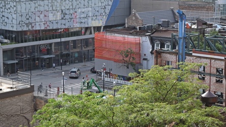
Looking down on Yonge and Elm
-
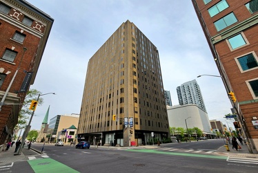
170 Laurier Avenue West
-
150 Sudbury Street [02]
![150 Sudbury Street [02] (1359 visits) 150 Sudbury Street, an apartment building at the corner of Sudbury and Abell Streets.
More at The S... 150 Sudbury Street [02]](../../../../i/upload/2024/07/19/20240719003125-80db5da5-cu_s9999x250.jpg)
-
150 Sudbury Street [01]
![150 Sudbury Street [01] (1360 visits) 150 Sudbury Street, an apartment building at the corner of Sudbury and Abell Streets.
More at The S... 150 Sudbury Street [01]](../../../../i/upload/2024/07/19/20240719003122-02962f52-cu_s9999x250.jpg)
-
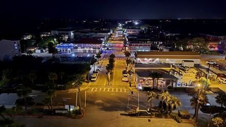
View down Center Street in Folly Beach
-
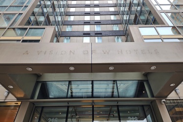
Labelscar on Aloft Hotel in Brooklyn
-
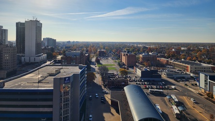
View of Windsor from the DoubleTree
-
"Autistic child area" sign

-
View from Ottawa Marriott Hotel [03]
![View from Ottawa Marriott Hotel [03] (1445 visits) View of downtown Ottawa from room 1833 at the Ottawa Marriott Hotel.
More at The Schumin Web:
www.s... View from Ottawa Marriott Hotel [03]](../../../../i/upload/2024/07/20/20240720155518-c87f6b57-cu_s9999x250.jpg)
-
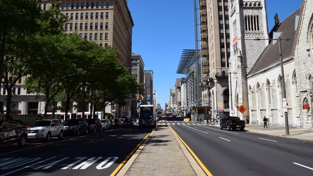
North Broad Street
-
View from Ottawa Marriott Hotel [02]
![View from Ottawa Marriott Hotel [02] (1490 visits) View of downtown Ottawa from room 1833 at the Ottawa Marriott Hotel.
More at The Schumin Web:
www.s... View from Ottawa Marriott Hotel [02]](../../../../i/upload/2024/07/20/20240720155445-93b88b51-cu_s9999x250.jpg)
-
Aerial view of Myrtle Beach, South Carolina [04]
![Aerial view of Myrtle Beach, South Carolina [04] (1522 visits) Aerial view of Myrtle Beach, South Carolina. This photo depicts the coastline, facing approximately... Aerial view of Myrtle Beach, South Carolina [04]](../../../../i/upload/2025/01/16/20250116011543-c0352f82-cu_s9999x250.jpg)
-
Aerial view of Myrtle Beach, South Carolina [05]
![Aerial view of Myrtle Beach, South Carolina [05] (1562 visits) Aerial view of Myrtle Beach, South Carolina. This photo depicts the coastline, facing approximately... Aerial view of Myrtle Beach, South Carolina [05]](../../../../i/upload/2025/01/16/20250116011549-fb2ac6b0-cu_s9999x250.jpg)
-
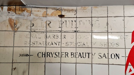
Vintage wall signage at the Chrysler Building
-
Aerial view of Myrtle Beach, South Carolina [06]
![Aerial view of Myrtle Beach, South Carolina [06] (1575 visits) Aerial view of Myrtle Beach, South Carolina. This photo depicts the coastline, facing approximately... Aerial view of Myrtle Beach, South Carolina [06]](../../../../i/upload/2025/01/16/20250116011556-58eeb392-cu_s9999x250.jpg)
-
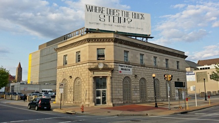
1901 North Charles Street
-
Aerial view of Myrtle Beach, South Carolina [10]
![Aerial view of Myrtle Beach, South Carolina [10] (1599 visits) Aerial view of Myrtle Beach, South Carolina. This photo depicts the coastline, facing approximately... Aerial view of Myrtle Beach, South Carolina [10]](../../../../i/upload/2025/01/16/20250116011622-c227f7d2-cu_s9999x250.jpg)
-
Photographing 1750 Crystal Drive [01]
![Photographing 1750 Crystal Drive [01] (1606 visits) Photographing 1750 Crystal Drive with my Nikon D5300 DSLR, using a tripod.
Ben Schumin is a profe... Photographing 1750 Crystal Drive [01]](../../../../i/upload/2024/07/19/20240719104135-a21ab6ce-cu_s9999x250.jpg)
-
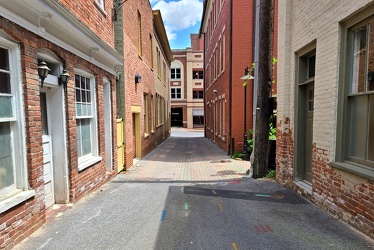
Barristers Row
-
Aerial view of Myrtle Beach, South Carolina [08]
![Aerial view of Myrtle Beach, South Carolina [08] (1619 visits) Aerial view of Myrtle Beach, South Carolina. This photo depicts the coastline, facing approximately... Aerial view of Myrtle Beach, South Carolina [08]](../../../../i/upload/2025/01/16/20250116011610-80555640-cu_s9999x250.jpg)
-
Chancellor Street [01]
![Chancellor Street [01] (1620 visits) 1700 block of Chancellor Street, an alley in Center City Philadelphia.
More at The Schumin Web:
www... Chancellor Street [01]](../../../../i/upload/2024/07/18/20240718214029-ac2b7b93-cu_s9999x250.jpg)
-
Roberto Clemente Bridge [02]
![Roberto Clemente Bridge [02] (1633 visits) The Roberto Clemente Bridge, one of several bridges spanning the Allegheny River near downtown Pitts... Roberto Clemente Bridge [02]](../../../../i/upload/2024/07/20/20240720161340-c598682d-cu_s9999x250.jpg)
-
Roberto Clemente Bridge [01]
![Roberto Clemente Bridge [01] (1636 visits) The Roberto Clemente Bridge, one of several bridges spanning the Allegheny River near downtown Pitts... Roberto Clemente Bridge [01]](../../../../i/upload/2024/07/20/20240720161306-2ba7a48e-cu_s9999x250.jpg)
-
Chancellor Street [02]
![Chancellor Street [02] (1637 visits) 1700 block of Chancellor Street, an alley in Center City Philadelphia.
More at The Schumin Web:
www... Chancellor Street [02]](../../../../i/upload/2024/07/18/20240718214026-5cfe90b4-cu_s9999x250.jpg)
-
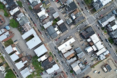
Central Oakland
-
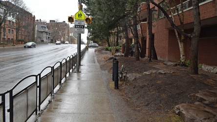
Sidewalk on Avenue Road
-
View from Ottawa Marriott Hotel [01]
![View from Ottawa Marriott Hotel [01] (1663 visits) View of downtown Ottawa from room 1833 at the Ottawa Marriott Hotel.
More at The Schumin Web:
www.s... View from Ottawa Marriott Hotel [01]](../../../../i/upload/2024/07/20/20240720155522-d1cb6c07-cu_s9999x250.jpg)
-
Aerial view of Myrtle Beach, South Carolina [12]
![Aerial view of Myrtle Beach, South Carolina [12] (1663 visits) Aerial view of Myrtle Beach, South Carolina. This photo depicts Pier 14, one of several fishing pie... Aerial view of Myrtle Beach, South Carolina [12]](../../../../i/upload/2025/01/16/20250116011635-e2f59869-cu_s9999x250.jpg)
-
Aerial view of Myrtle Beach, South Carolina [14]
![Aerial view of Myrtle Beach, South Carolina [14] (1666 visits) Aerial view of Myrtle Beach, South Carolina. This photo depicts Pier 14, one of several fishing pie... Aerial view of Myrtle Beach, South Carolina [14]](../../../../i/upload/2025/01/16/20250116011649-2b82761b-cu_s9999x250.jpg)
-
Roberto Clemente Bridge [03]
![Roberto Clemente Bridge [03] (1668 visits) The Roberto Clemente Bridge, one of several bridges spanning the Allegheny River near downtown Pitts... Roberto Clemente Bridge [03]](../../../../i/upload/2024/07/20/20240720161356-15e15812-cu_s9999x250.jpg)
-
West Main Street in Fairfield, Pennsylvania [01]
![West Main Street in Fairfield, Pennsylvania [01] (1677 visits) Aerial view of West Main Street in Fairfield, Pennsylvania.
Ben Schumin is a professional photograp... West Main Street in Fairfield, Pennsylvania [01]](../../../../i/upload/2024/07/19/20240719170843-1e4117b0-cu_s9999x250.jpg)
-
Aerial view of Myrtle Beach, South Carolina [09]
![Aerial view of Myrtle Beach, South Carolina [09] (1677 visits) Aerial view of Myrtle Beach, South Carolina. This photo depicts the coastline, facing approximately... Aerial view of Myrtle Beach, South Carolina [09]](../../../../i/upload/2025/01/16/20250116011616-86a3a1ed-cu_s9999x250.jpg)
-
Photographing 1750 Crystal Drive [02]
![Photographing 1750 Crystal Drive [02] (1682 visits) Photographing 1750 Crystal Drive with my Nikon D5300 DSLR, using a tripod.
Ben Schumin is a profe... Photographing 1750 Crystal Drive [02]](../../../../i/upload/2024/07/19/20240719104132-158c0089-cu_s9999x250.jpg)
-
Andy Warhol Bridge [02]
![Andy Warhol Bridge [02] (1686 visits) The Andy Warhol Bridge, one of several bridges spanning the Allegheny River near downtown Pittsburgh... Andy Warhol Bridge [02]](../../../../i/upload/2024/07/20/20240720161426-0a05c0dd-cu_s9999x250.jpg)
-
Below-grade passage at the Chrysler Building [01]
![Below-grade passage at the Chrysler Building [01] (1693 visits) Below-grade passageway to the Subway at the Chrysler Building, an Art Deco skyscraper located at the... Below-grade passage at the Chrysler Building [01]](../../../../i/upload/2024/12/06/20241206014004-ad130a2b-cu_s9999x250.jpg)
-
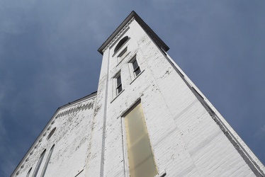
Second Presbyterian Church in Staunton, Virginia
-
Below-grade passage at the Chrysler Building [02]
![Below-grade passage at the Chrysler Building [02] (1705 visits) Below-grade passageway to the Subway at the Chrysler Building, an Art Deco skyscraper located at the... Below-grade passage at the Chrysler Building [02]](../../../../i/upload/2024/12/06/20241206014008-de9ad467-cu_s9999x250.jpg)
-
Traffic circle under construction [03]
![Traffic circle under construction [03] (1709 visits) Traffic circle under construction north of Mudd Tavern Road (VA 606) in Thornburg, Virginia.
More a... Traffic circle under construction [03]](../../../../i/upload/2025/02/22/20250222022342-e895dd00-cu_s9999x250.jpg)
-
Traffic circle under construction [01]
![Traffic circle under construction [01] (1714 visits) Traffic circle under construction north of Mudd Tavern Road (VA 606) in Thornburg, Virginia.
More a... Traffic circle under construction [01]](../../../../i/upload/2025/02/22/20250222022330-4bbf063c-cu_s9999x250.jpg)
-
Intersection of Western Avenue, West Summit Hill Drive, Henley Street, and Broadway [02]
![Intersection of Western Avenue, West Summit Hill Drive, Henley Street, and Broadway [02] (1721 visits) The intersection of Western Avenue, West Summit Hill Drive, Henley Street, and Broadway, viewed from... Intersection of Western Avenue, West Summit Hill Drive, Henley Street, and Broadway [02]](../../../../i/upload/2024/07/20/20240720113032-4b45897b-cu_s9999x250.jpg)
-
West Main Street in Fairfield, Pennsylvania [02]
![West Main Street in Fairfield, Pennsylvania [02] (1731 visits) Aerial view of West Main Street in Fairfield, Pennsylvania.
Ben Schumin is a professional photograp... West Main Street in Fairfield, Pennsylvania [02]](../../../../i/upload/2024/07/19/20240719170840-c2db35da-cu_s9999x250.jpg)
-
Aerial view of Myrtle Beach, South Carolina [16]
![Aerial view of Myrtle Beach, South Carolina [16] (1733 visits) Aerial view of Myrtle Beach, South Carolina. This photo depicts the city from approximately 16th Av... Aerial view of Myrtle Beach, South Carolina [16]](../../../../i/upload/2025/01/16/20250116011701-1e30b28a-cu_s9999x250.jpg)
-
Aerial view of Myrtle Beach, South Carolina [11]
![Aerial view of Myrtle Beach, South Carolina [11] (1747 visits) Aerial view of Myrtle Beach, South Carolina. This photo depicts Pier 14, one of several fishing pie... Aerial view of Myrtle Beach, South Carolina [11]](../../../../i/upload/2025/01/16/20250116011628-3f5529d7-cu_s9999x250.jpg)
-
Aerial view of Myrtle Beach, South Carolina [13]
![Aerial view of Myrtle Beach, South Carolina [13] (1748 visits) Aerial view of Myrtle Beach, South Carolina. This photo depicts Pier 14, one of several fishing pie... Aerial view of Myrtle Beach, South Carolina [13]](../../../../i/upload/2025/01/16/20250116011642-eaad0007-cu_s9999x250.jpg)