-
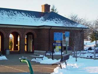
New Market rest area, I-81 northbound
-
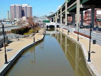
Canal Walk near Shockoe Bottom
-
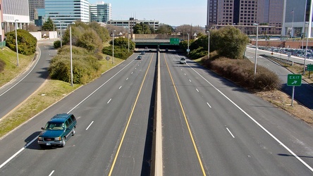
Downtown Expressway
-
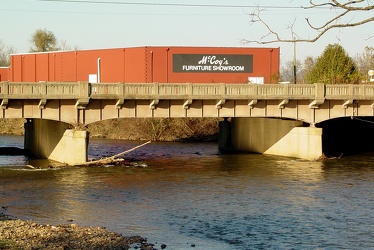
South River in Waynesboro
-
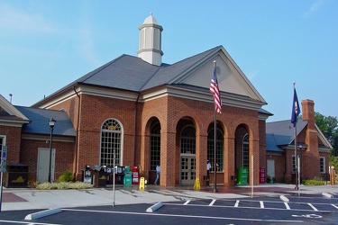
New Kent rest area, eastbound
-
Goochland rest area, westbound [03]
![Goochland rest area, westbound [03] (1729 visits) Restroom building at the Goochland Safety Rest Area on Interstate 64 westbound in Manakin-Sabot, Vir... Goochland rest area, westbound [03]](../../../../../i/upload/2024/07/19/20240719093121-0aeca88a-cu_s9999x250.jpg)
-
Goochland rest area, westbound [02]
![Goochland rest area, westbound [02] (1689 visits) Restroom building at the Goochland Safety Rest Area on Interstate 64 westbound in Manakin-Sabot, Vir... Goochland rest area, westbound [02]](../../../../../i/upload/2024/07/19/20240719093125-c06aafb1-cu_s9999x250.jpg)
-
Goochland rest area, westbound [01]
![Goochland rest area, westbound [01] (1713 visits) Restroom building at the Goochland Safety Rest Area on Interstate 64 westbound in Manakin-Sabot, Vir... Goochland rest area, westbound [01]](../../../../../i/upload/2024/07/19/20240719093130-dbdf3bb4-cu_s9999x250.jpg)
-
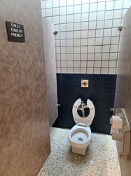
Child/toddler friendly stall at New Kent rest area
-
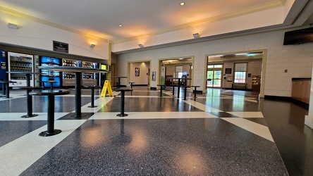
Interior of New Kent rest area, westbound
-
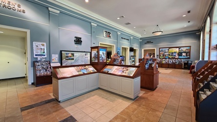
Interior of New Kent rest area, eastbound
-
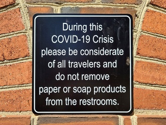
COVID-19 rest area signage
-
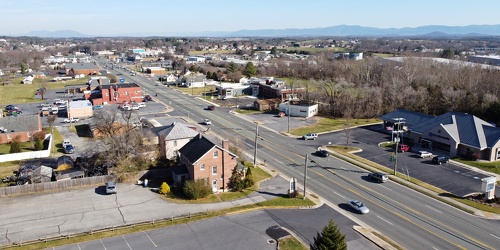
View up Route 11 from above Verona Fire Department
-
US 29 Business in Culpeper, Virginia [01]
![US 29 Business in Culpeper, Virginia [01] (3114 visits) Aerial view of US 29 Business on the north side of Culpeper, Virginia. View facing approximately ea... US 29 Business in Culpeper, Virginia [01]](../../../../../i/upload/2024/07/19/20240719155959-cf1d0444-cu_s9999x250.jpg)
-
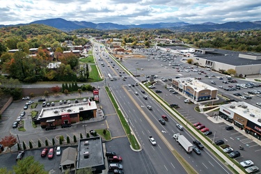
Richmond Avenue in Staunton, Virginia [01]
![Richmond Avenue in Staunton, Virginia [01] (66693 visits) Aerial view of Richmond Avenue (US 250) in Staunton, Virginia, near the intersection with Frontier D... Richmond Avenue in Staunton, Virginia [01]](../../../../../i/upload/2024/07/19/20240719161158-ddf9fe35-cu_s9999x250.jpg)
-
Richmond Avenue in Staunton, Virginia [02]
![Richmond Avenue in Staunton, Virginia [02] (66772 visits) Aerial view of Richmond Avenue (US 250) in Staunton, Virginia, near the intersection with Frontier D... Richmond Avenue in Staunton, Virginia [02]](../../../../../i/upload/2024/07/19/20240719161203-233bb776-cu_s9999x250.jpg)
-
Richmond Avenue in Staunton, Virginia [03]
![Richmond Avenue in Staunton, Virginia [03] (66605 visits) Aerial view of Richmond Avenue (US 250) in Staunton, Virginia, near the intersection with Community ... Richmond Avenue in Staunton, Virginia [03]](../../../../../i/upload/2024/07/19/20240719161212-297c1b53-cu_s9999x250.jpg)
-
Commercial area south of Interstate 81 in Harrisonburg [01]
![Commercial area south of Interstate 81 in Harrisonburg [01] (3287 visits) Commercial area on the west side of East Market Street (US 33), facing north.
Ben Schumin is a prof... Commercial area south of Interstate 81 in Harrisonburg [01]](../../../../../i/upload/2024/07/19/20240719163715-46af96f9-cu_s9999x250.jpg)
-
Harrisonburg Crossing [01]
![Harrisonburg Crossing [01] (11515 visits) Harrisonburg Crossing shopping center, built in 2003, replacing a Dunham-Bush factory on the site.
... Harrisonburg Crossing [01]](../../../../../i/upload/2024/07/19/20240719163753-972e0345-cu_s9999x250.jpg)
-
Harrisonburg Crossing [02]
![Harrisonburg Crossing [02] (3814 visits) Walmart Supercenter in the Harrisonburg Crossing shopping center in Harrisonburg, Virginia. This st... Harrisonburg Crossing [02]](../../../../../i/upload/2024/07/19/20240719163758-5453496b-cu_s9999x250.jpg)
-
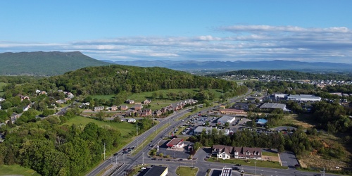
East Market Street in Harrisonburg, facing south
-
Commercial area south of University Boulevard [01]
![Commercial area south of University Boulevard [01] (2470 visits) Commercial area south of University Boulevard in Harrisonburg, Virginia. View facing approximately ... Commercial area south of University Boulevard [01]](../../../../../i/upload/2024/07/19/20240719163821-e0603027-cu_s9999x250.jpg)
-
Commercial area south of University Boulevard [02]
![Commercial area south of University Boulevard [02] (2405 visits) Commercial area south of University Boulevard in Harrisonburg, Virginia. View facing approximately ... Commercial area south of University Boulevard [02]](../../../../../i/upload/2024/07/19/20240719163825-5d4964e5-cu_s9999x250.jpg)
-
Commercial area south of Interstate 81 in Harrisonburg [02]
![Commercial area south of Interstate 81 in Harrisonburg [02] (3889 visits) Commercial area on the west side of East Market Street (US 33), facing north.
Ben Schumin is a prof... Commercial area south of Interstate 81 in Harrisonburg [02]](../../../../../i/upload/2024/07/19/20240719163830-45dce8e7-cu_s9999x250.jpg)
-
Churchville Volunteer Fire Department [01]
![Churchville Volunteer Fire Department [01] (1051 visits) Building for Churchville Volunteer Fire Department, on Churchville Road (US 250/SR 42) in Churchvill... Churchville Volunteer Fire Department [01]](../../../../../i/upload/2024/07/19/20240719164426-c1be3535-cu_s9999x250.jpg)
-
Churchville Volunteer Fire Department [02]
![Churchville Volunteer Fire Department [02] (1500 visits) Building for Churchville Volunteer Fire Department, on Churchville Road (US 250/SR 42) in Churchvill... Churchville Volunteer Fire Department [02]](../../../../../i/upload/2024/07/19/20240719164431-2ab245f9-cu_s9999x250.jpg)
-
Buffalo Gap High School [01]
![Buffalo Gap High School [01] (3019 visits) Aerial view of Buffalo Gap High School, a public high school in Augusta County, Virginia, near Swoop... Buffalo Gap High School [01]](../../../../../i/upload/2024/07/19/20240719164459-267a0d43-cu_s9999x250.jpg)
-
Buffalo Gap High School [02]
![Buffalo Gap High School [02] (3127 visits) Aerial view of Buffalo Gap High School, a public high school in Augusta County, Virginia, near Swoop... Buffalo Gap High School [02]](../../../../../i/upload/2024/07/19/20240719164505-bdd29e59-cu_s9999x250.jpg)
-
Buffalo Gap High School [03]
![Buffalo Gap High School [03] (3129 visits) Aerial view of Buffalo Gap High School, a public high school in Augusta County, Virginia, near Swoop... Buffalo Gap High School [03]](../../../../../i/upload/2024/07/19/20240719164509-fab8ad49-cu_s9999x250.jpg)
-
Buffalo Gap High School [04]
![Buffalo Gap High School [04] (3227 visits) Aerial view of Buffalo Gap High School, a public high school in Augusta County, Virginia, near Swoop... Buffalo Gap High School [04]](../../../../../i/upload/2024/07/19/20240719164514-e0a1e82e-cu_s9999x250.jpg)
-
Buffalo Gap High School [05]
![Buffalo Gap High School [05] (3057 visits) Aerial view of Buffalo Gap High School, a public high school in Augusta County, Virginia, near Swoop... Buffalo Gap High School [05]](../../../../../i/upload/2024/07/19/20240719164519-518a0909-cu_s9999x250.jpg)
-
Buffalo Gap High School [06]
![Buffalo Gap High School [06] (3101 visits) Aerial view of Buffalo Gap High School, a public high school in Augusta County, Virginia, near Swoop... Buffalo Gap High School [06]](../../../../../i/upload/2024/07/19/20240719164523-e9a7db09-cu_s9999x250.jpg)
-
West Main Street in Waynesboro, Virginia [01]
![West Main Street in Waynesboro, Virginia [01] (55561 visits) View down West Main Street (US 250) in the west end of Waynesboro, Virginia, near the former Kmart b... West Main Street in Waynesboro, Virginia [01]](../../../../../i/upload/2024/07/19/20240719164545-b5a50599-cu_s9999x250.jpg)
-
West Main Street in Waynesboro, Virginia [02]
![West Main Street in Waynesboro, Virginia [02] (9870 visits) View down West Main Street (US 250) in the west end of Waynesboro, Virginia, near the Sheetz conveni... West Main Street in Waynesboro, Virginia [02]](../../../../../i/upload/2024/07/19/20240719164551-0b8407a8-cu_s9999x250.jpg)
-
West Main Street in Waynesboro, Virginia [03]
![West Main Street in Waynesboro, Virginia [03] (10661 visits) View down West Main Street (US 250) in the west end of Waynesboro, Virginia, near St. Mark's United ... West Main Street in Waynesboro, Virginia [03]](../../../../../i/upload/2024/07/19/20240719164555-f7feeafe-cu_s9999x250.jpg)
-
West Main Street in Waynesboro, Virginia [04]
![West Main Street in Waynesboro, Virginia [04] (323104 visits) View down West Main Street (US 250) in the west end of Waynesboro, Virginia, near the Westwood Villa... West Main Street in Waynesboro, Virginia [04]](../../../../../i/upload/2024/07/19/20240719164600-4379cef1-cu_s9999x250.jpg)
-
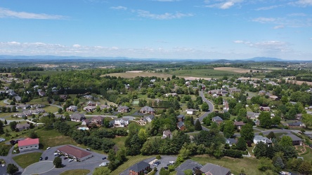
Pelham neighborhood in Waynesboro, Virginia
-
AT&T Long Lines tower in Dumfries, Virginia [32]
![AT&T Long Lines tower in Dumfries, Virginia [32] (3326 visits) AT&T Long Lines tower at 13989 Dumfries Road (SR 234) between Dumfries and Manassas, Virginia.
... AT&T Long Lines tower in Dumfries, Virginia [32]](../../../../../i/upload/2024/07/19/20240719165051-b8547ba1-cu_s9999x250.jpg)
-
AT&T Long Lines tower in Dumfries, Virginia [31]
![AT&T Long Lines tower in Dumfries, Virginia [31] (3336 visits) AT&T Long Lines tower at 13989 Dumfries Road (SR 234) between Dumfries and Manassas, Virginia.
... AT&T Long Lines tower in Dumfries, Virginia [31]](../../../../../i/upload/2024/07/19/20240719165332-7037db10-cu_s9999x250.jpg)
-
US 29 Business in Culpeper, Virginia [02]
![US 29 Business in Culpeper, Virginia [02] (457489 visits) Aerial view of US 29 Business on the north side of Culpeper, Virginia. View facing approximately we... US 29 Business in Culpeper, Virginia [02]](../../../../../i/upload/2024/07/19/20240719165937-abc06307-cu_s9999x250.jpg)
-
US 29 North, near Hilton Heights Road [01]
![US 29 North, near Hilton Heights Road [01] (2975 visits) US 29 north of Charlottesville, Virginia, near Hilton Heights Road, facing northbound.
Ben Schumin ... US 29 North, near Hilton Heights Road [01]](../../../../../i/upload/2024/07/19/20240719171702-b12048d7-cu_s9999x250.jpg)
-
US 29 North, near Hilton Heights Road [02]
![US 29 North, near Hilton Heights Road [02] (2977 visits) US 29 north of Charlottesville, Virginia, near Hilton Heights Road, facing northbound.
Ben Schumin ... US 29 North, near Hilton Heights Road [02]](../../../../../i/upload/2024/07/19/20240719171717-5729f873-cu_s9999x250.jpg)
-
DoubleTree Hotel in Charlottesville, Virginia [01]
![DoubleTree Hotel in Charlottesville, Virginia [01] (1742 visits) DoubleTree Hotel on Hilton Heights Road in Charlottesville, Virginia. This hotel was built in 1984,... DoubleTree Hotel in Charlottesville, Virginia [01]](../../../../../i/upload/2024/07/19/20240719171742-a365fe34-cu_s9999x250.jpg)
-
US 29 near Woodbrook Drive [01]
![US 29 near Woodbrook Drive [01] (11356 visits) US 29 north of Charlottesville, Virginia, near Woodbrook Drive, facing northbound.
Ben Schumin is a... US 29 near Woodbrook Drive [01]](../../../../../i/upload/2024/07/19/20240719171851-a0a055c4-cu_s9999x250.jpg)
-
US 29 near Woodbrook Drive [02]
![US 29 near Woodbrook Drive [02] (11338 visits) US 29 north of Charlottesville, Virginia, near Woodbrook Drive, facing northbound.
Ben Schumin is a... US 29 near Woodbrook Drive [02]](../../../../../i/upload/2024/07/19/20240719171856-fdca65ff-cu_s9999x250.jpg)
-
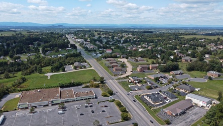
US 250 at the west end of Waynesboro, Virginia
-
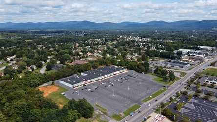
Waynesboro, Virginia, facing approximately east
-
Interstate 95 in Woodbridge, Virginia [02]
![Interstate 95 in Woodbridge, Virginia [02] (1708 visits) Interstate 95 as it passes near the Potomac Mills shopping mall in Woodbridge, Virginia.
Ben Schumi... Interstate 95 in Woodbridge, Virginia [02]](../../../../../i/upload/2024/07/19/20240719212229-ff1f3c31-cu_s9999x250.jpg)
-
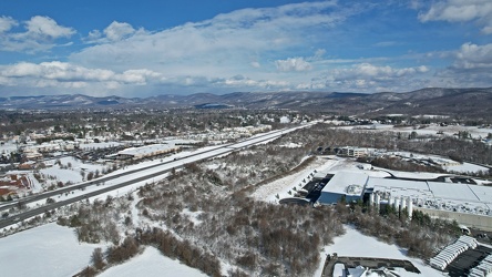
Interstate 64 corridor through Waynesboro, Virginia
-
West Broad Street at Staples Mill Road [01]
![West Broad Street at Staples Mill Road [01] (3190 visits) Aerial view of West Broad Street at the intersection with Staples Mill Road in Richmond, Virginia. ... West Broad Street at Staples Mill Road [01]](../../../../../i/upload/2024/07/20/20240720091824-c8526d69-cu_s9999x250.jpg)
-
West Broad Street at Staples Mill Road [02]
![West Broad Street at Staples Mill Road [02] (69961 visits) Aerial view of West Broad Street at the intersection with Staples Mill Road in Richmond, Virginia. ... West Broad Street at Staples Mill Road [02]](../../../../../i/upload/2024/07/20/20240720092012-1df12de7-cu_s9999x250.jpg)
-
Church Hill neighborhood [01]
![Church Hill neighborhood [01] (11585 visits) Aerial view of the Church Hill neighborhood of Richmond, Virginia, photographed from west of Interst... Church Hill neighborhood [01]](../../../../../i/upload/2024/07/20/20240720092724-5ad8079d-cu_s9999x250.jpg)
-
Church Hill neighborhood [02]
![Church Hill neighborhood [02] (11558 visits) Aerial view of the Church Hill neighborhood of Richmond, Virginia, photographed from west of Interst... Church Hill neighborhood [02]](../../../../../i/upload/2024/07/20/20240720092729-c1c95489-cu_s9999x250.jpg)
-
Interstate 95 through downtown Richmond [04]
![Interstate 95 through downtown Richmond [04] (3671 visits) Interstate 95 as it passes through downtown Richmond, Virginia, facing approximately north. The Lei... Interstate 95 through downtown Richmond [04]](../../../../../i/upload/2024/07/20/20240720092805-0fe0379c-cu_s9999x250.jpg)
-
Clock tower on Richmond Main Street Station [01]
![Clock tower on Richmond Main Street Station [01] (12533 visits) Clock tower on Richmond Main Street Station in downtown Richmond, Virginia, overlooking a large elev... Clock tower on Richmond Main Street Station [01]](../../../../../i/upload/2024/07/20/20240720092945-196e9f26-cu_s9999x250.jpg)
-
Small island in the James River

-
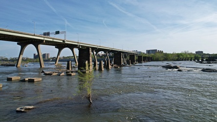
Manchester Bridge
-
Remains of Richmond and Petersburg Railroad Bridge [01]
![Remains of Richmond and Petersburg Railroad Bridge [01] (3323 visits) An abandoned stone pier from what was once the Richmond and Petersburg Railroad Bridge spanning the ... Remains of Richmond and Petersburg Railroad Bridge [01]](../../../../../i/upload/2024/07/20/20240720093002-8c94d1f5-cu_s9999x250.jpg)
-
Remains of Richmond and Petersburg Railroad Bridge [02]
![Remains of Richmond and Petersburg Railroad Bridge [02] (6898 visits) An abandoned stone pier from what was once the Richmond and Petersburg Railroad Bridge spanning the ... Remains of Richmond and Petersburg Railroad Bridge [02]](../../../../../i/upload/2024/07/20/20240720093007-71c83e39-cu_s9999x250.jpg)
-
Rapids on the James River [01]
![Rapids on the James River [01] (2556 visits) Rapids and a small waterfall on the James River in Richmond, Virginia. The Manchester Bridge and T.... Rapids on the James River [01]](../../../../../i/upload/2024/07/20/20240720093011-a767724e-cu_s9999x250.jpg)
-
Interstate 95 through downtown Richmond [02]
![Interstate 95 through downtown Richmond [02] (12629 visits) Elevated section of Interstate 95 over downtown Richmond, Virginia, near the interchange with the Do... Interstate 95 through downtown Richmond [02]](../../../../../i/upload/2024/07/20/20240720093017-3f2bee68-cu_s9999x250.jpg)
-
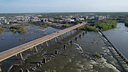
Bridges over the James River
-
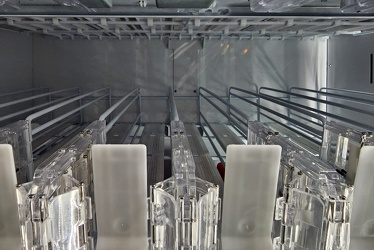
Empty rack in vending machine at Ladysmith rest area
-
Bang energy drink at Ladysmith rest area

-
Rapids on the James River [02]
![Rapids on the James River [02] (2451 visits) Rapids and a small waterfall on the James River in Richmond, Virginia. The Manchester Bridge and T.... Rapids on the James River [02]](../../../../../i/upload/2024/07/20/20240720093135-219eaaa3-cu_s9999x250.jpg)
-
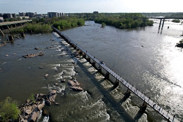
T. Tyler Potterfield Bridge
-
Clock tower on Richmond Main Street Station [02]
![Clock tower on Richmond Main Street Station [02] (12091 visits) Clock tower on Richmond Main Street Station in downtown Richmond, Virginia, overlooking a large elev... Clock tower on Richmond Main Street Station [02]](../../../../../i/upload/2024/07/20/20240720093156-e35dc707-cu_s9999x250.jpg)
-
Interstate 95 through downtown Richmond [03]
![Interstate 95 through downtown Richmond [03] (12456 visits) Elevated section of Interstate 95 over downtown Richmond, Virginia, near the interchange with the Do... Interstate 95 through downtown Richmond [03]](../../../../../i/upload/2024/07/20/20240720093212-fa09ec51-cu_s9999x250.jpg)
-
CoStar Richmond office [04]
![CoStar Richmond office [04] (1694 visits) Signage for the Richmond, Virginia offices for CoStar Group, a commercial real estate information fi... CoStar Richmond office [04]](../../../../../i/upload/2024/07/20/20240720093239-a22e968a-cu_s9999x250.jpg)
-
CoStar Richmond office [05]
![CoStar Richmond office [05] (1780 visits) Signage for the Richmond, Virginia offices for CoStar Group, a commercial real estate information fi... CoStar Richmond office [05]](../../../../../i/upload/2024/07/20/20240720093244-45f5b31e-cu_s9999x250.jpg)
-
Interstate 95 through downtown Richmond [01]
![Interstate 95 through downtown Richmond [01] (12330 visits) Elevated section of Interstate 95 over downtown Richmond, Virginia, near the interchange with the Do... Interstate 95 through downtown Richmond [01]](../../../../../i/upload/2024/07/20/20240720093319-14a1e75d-cu_s9999x250.jpg)
-
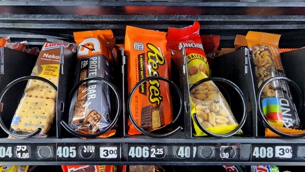
Candy machine at Ladysmith rest area
-
Farm on the Virginia-West Virginia border [01]
![Farm on the Virginia-West Virginia border [01] (2791 visits) Farm on the border between Highland County, Virginia and Pendleton County, West Virginia. The bound... Farm on the Virginia-West Virginia border [01]](../../../../../i/upload/2024/07/20/20240720094156-2b1215da-cu_s9999x250.jpg)
-
Electric Road
-
Elm Avenue interchange [02]
![Elm Avenue interchange [02] (2860 visits) Interchange between Interstate 581/US 220 and Elm Avenue (SR 24) in Roanoke, Virginia. The I-581 de... Elm Avenue interchange [02]](../../../../../i/upload/2024/07/20/20240720121652-6267da79-cu_s9999x250.jpg)
-
Aerial view of Roanoke, Virginia [01]
![Aerial view of Roanoke, Virginia [01] (1783 visits) Aerial view of Roanoke, Virginia.
More at The Schumin Web:
www.schuminweb.com/life-and-times/advent... Aerial view of Roanoke, Virginia [01]](../../../../../i/upload/2024/07/20/20240720121757-bb58476c-cu_s9999x250.jpg)
-
Aerial view of Roanoke, Virginia [02]
![Aerial view of Roanoke, Virginia [02] (1692 visits) Aerial view of Roanoke, Virginia.
More at The Schumin Web:
www.schuminweb.com/life-and-times/advent... Aerial view of Roanoke, Virginia [02]](../../../../../i/upload/2024/07/20/20240720121808-dccb83a0-cu_s9999x250.jpg)
-
Aerial view of Roanoke, Virginia [03]
![Aerial view of Roanoke, Virginia [03] (1725 visits) Aerial view of Roanoke, Virginia.
More at The Schumin Web:
www.schuminweb.com/life-and-times/advent... Aerial view of Roanoke, Virginia [03]](../../../../../i/upload/2024/07/20/20240720121837-3c6bbb13-cu_s9999x250.jpg)
-
Aerial view of Roanoke, Virginia [04]
![Aerial view of Roanoke, Virginia [04] (1777 visits) Aerial view of Roanoke, Virginia.
More at The Schumin Web:
www.schuminweb.com/life-and-times/advent... Aerial view of Roanoke, Virginia [04]](../../../../../i/upload/2024/07/20/20240720121854-34748718-cu_s9999x250.jpg)
-
Aerial view of Roanoke, Virginia [05]
![Aerial view of Roanoke, Virginia [05] (1682 visits) Aerial view of Roanoke, Virginia.
More at The Schumin Web:
www.schuminweb.com/life-and-times/advent... Aerial view of Roanoke, Virginia [05]](../../../../../i/upload/2024/07/20/20240720121906-5f802cee-cu_s9999x250.jpg)