-
"DO NOT ENTER" and "ONE WAY" signs [01]
!["DO NOT ENTER" and "ONE WAY" signs [01] (1018 visits) "DO NOT ENTER" and "ONE WAY" signs at the intersection of Columbus Avenue and Me... "DO NOT ENTER" and "ONE WAY" signs [01]](../../../../i/upload/2024/07/20/20240720101859-20d5443c-cu_s9999x250.jpg)
-
"DO NOT ENTER" and "ONE WAY" signs [02]
!["DO NOT ENTER" and "ONE WAY" signs [02] (960 visits) "DO NOT ENTER" and "ONE WAY" signs at the intersection of Columbus Avenue and Me... "DO NOT ENTER" and "ONE WAY" signs [02]](../../../../i/upload/2024/07/20/20240720101903-51f9dbdd-cu_s9999x250.jpg)
-
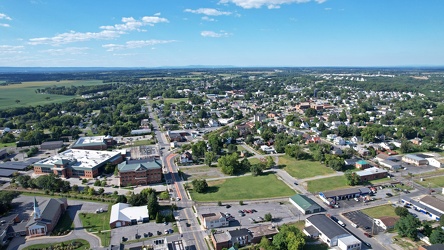
Aerial view of Charles Town and Ranson, West Virginia
-
Aerial view of Charles Town, West Virginia [01]
![Aerial view of Charles Town, West Virginia [01] (1701 visits) Aerial view of Charles Town, West Virginia, from above the downtown area.
Ben Schumin is a professi... Aerial view of Charles Town, West Virginia [01]](../../../../i/upload/2024/07/20/20240720103949-f4346f4c-cu_s9999x250.jpg)
-
Aerial view of Charles Town, West Virginia [02]
![Aerial view of Charles Town, West Virginia [02] (1520 visits) Aerial view of Charles Town, West Virginia, from above the downtown area.
Ben Schumin is a professi... Aerial view of Charles Town, West Virginia [02]](../../../../i/upload/2024/07/20/20240720104018-5b8b2fcf-cu_s9999x250.jpg)
-
Aerial view of Charles Town, West Virginia [03]
![Aerial view of Charles Town, West Virginia [03] (2531 visits) Aerial view of Charles Town, West Virginia, from above the downtown area.
Ben Schumin is a professi... Aerial view of Charles Town, West Virginia [03]](../../../../i/upload/2024/07/20/20240720104008-7857c00b-cu_s9999x250.jpg)
-
Aerial view of downtown Crossville, Tennessee [01]
![Aerial view of downtown Crossville, Tennessee [01] (2455 visits) Aerial view of downtown Crossville, Tennessee.
More at The Schumin Web:
www.schuminweb.com/life-and... Aerial view of downtown Crossville, Tennessee [01]](../../../../i/upload/2024/07/20/20240720113721-1bd631e7-cu_s9999x250.jpg)
-
Aerial view of downtown Crossville, Tennessee [02]
![Aerial view of downtown Crossville, Tennessee [02] (1347 visits) Aerial view of downtown Crossville, Tennessee.
More at The Schumin Web:
www.schuminweb.com/life-and... Aerial view of downtown Crossville, Tennessee [02]](../../../../i/upload/2024/07/20/20240720113738-e7992a54-cu_s9999x250.jpg)
-
Aerial view of downtown Crossville, Tennessee [03]
![Aerial view of downtown Crossville, Tennessee [03] (2484 visits) Aerial view of downtown Crossville, Tennessee.
More at The Schumin Web:
www.schuminweb.com/life-and... Aerial view of downtown Crossville, Tennessee [03]](../../../../i/upload/2024/07/20/20240720113748-d1062940-cu_s9999x250.jpg)
-
Aerial view of downtown Fredericksburg [01]
![Aerial view of downtown Fredericksburg [01] (1236 visits) Aerial view of downtown Fredericksburg, Virginia.
Ben Schumin is a professional photographer who ca... Aerial view of downtown Fredericksburg [01]](../../../../i/upload/2024/08/10/20240810113605-aeeec139-cu_s9999x250.jpg)
-
Aerial view of downtown Fredericksburg [02]
![Aerial view of downtown Fredericksburg [02] (1164 visits) Aerial view of downtown Fredericksburg, Virginia.
Ben Schumin is a professional photographer who ca... Aerial view of downtown Fredericksburg [02]](../../../../i/upload/2024/08/10/20240810113610-a8d79889-cu_s9999x250.jpg)
-
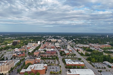
Aerial view of Fayetteville, North Carolina
-
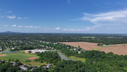
Aerial view of Poolesville, Maryland
-
Aerial view of Smithsburg, Maryland [01]
![Aerial view of Smithsburg, Maryland [01] (1111 visits) Aerial view of Smithsburg, Maryland.
Ben Schumin is a professional photographer who captures the in... Aerial view of Smithsburg, Maryland [01]](../../../../i/upload/2024/07/20/20240720155756-7d354d6c-cu_s9999x250.jpg)
-
Aerial view of Smithsburg, Maryland [02]
![Aerial view of Smithsburg, Maryland [02] (1222 visits) Aerial view of Smithsburg, Maryland.
Ben Schumin is a professional photographer who captures the in... Aerial view of Smithsburg, Maryland [02]](../../../../i/upload/2024/07/20/20240720155800-cb15da92-cu_s9999x250.jpg)
-
Aerial view of Smithsburg, Maryland [03]
![Aerial view of Smithsburg, Maryland [03] (1024 visits) Aerial view of Smithsburg, Maryland.
Ben Schumin is a professional photographer who captures the in... Aerial view of Smithsburg, Maryland [03]](../../../../i/upload/2024/07/20/20240720155805-a9f3e7ed-cu_s9999x250.jpg)
-
Aerial view of Willingboro, New Jersey [01]
![Aerial view of Willingboro, New Jersey [01] (139 visits) Aerial view of Willingboro, a township in Burlington County, New Jersey.
More at The Schumin Web:
w... Aerial view of Willingboro, New Jersey [01]](../../../../i/upload/2025/03/20/20250320182300-6bef996a-cu_s9999x250.jpg)
-
Aerial view of Willingboro, New Jersey [02]
![Aerial view of Willingboro, New Jersey [02] (136 visits) Aerial view of Willingboro, a township in Burlington County, New Jersey.
More at The Schumin Web:
w... Aerial view of Willingboro, New Jersey [02]](../../../../i/upload/2025/03/20/20250320182317-a2b0e4b5-cu_s9999x250.jpg)
-
American flag over Frederick in late afternoon

-
Area around US 13 in Pocomoke City, Maryland [01]
![Area around US 13 in Pocomoke City, Maryland [01] (354 visits) Aerial view of an area around US 13 in Pocomoke City, Maryland in late afternoon.
More at The Schum... Area around US 13 in Pocomoke City, Maryland [01]](../../../../i/upload/2025/02/16/20250216104958-9cfd679e-cu_s9999x250.jpg)
-
Area around US 13 in Pocomoke City, Maryland [02]
![Area around US 13 in Pocomoke City, Maryland [02] (331 visits) Aerial view of an area around US 13 in Pocomoke City, Maryland in late afternoon.
More at The Schum... Area around US 13 in Pocomoke City, Maryland [02]](../../../../i/upload/2025/02/16/20250216105020-45970493-cu_s9999x250.jpg)
-
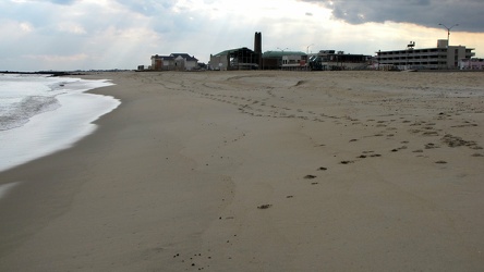
Asbury Park beach
-
Buffalo Gap [01]
![Buffalo Gap [01] (1741 visits) Buffalo Gap, a mountain pass through Little North Mountain, near Swoope, Virginia.
Ben Schumin is... Buffalo Gap [01]](../../../../i/upload/2024/07/19/20240719164455-62064f1c-cu_s9999x250.jpg)
-
Buffalo Gap [02]
![Buffalo Gap [02] (838 visits) Buffalo Gap, a mountain pass through Little North Mountain, near Swoope, Virginia.
More at The Sc... Buffalo Gap [02]](../../../../i/upload/2025/01/03/20250103200607-1abe8192-cu_s9999x250.jpg)
-
Bus stop on Nicholson Lane [01]
![Bus stop on Nicholson Lane [01] (2207 visits) Bus stop for the Metrobus C8 route and the Ride On 38 route on Nicholson Lane in Rockville, Maryland... Bus stop on Nicholson Lane [01]](../../../../i/upload/2024/07/20/20240720101838-387ee2d0-cu_s9999x250.jpg)
-
Bus stop on Nicholson Lane [01]
![Bus stop on Nicholson Lane [01] (2233 visits) Bus stop for the Metrobus C8 route and the Ride On 38 route on Nicholson Lane in Rockville, Maryland... Bus stop on Nicholson Lane [01]](../../../../i/upload/2024/07/20/20240720101843-1c1bfd02-cu_s9999x250.jpg)
-
Bus stop on Nicholson Lane [01]
![Bus stop on Nicholson Lane [01] (2198 visits) Bus stop for the Metrobus C8 route and the Ride On 38 route on Nicholson Lane in Rockville, Maryland... Bus stop on Nicholson Lane [01]](../../../../i/upload/2024/07/20/20240720101848-136e7761-cu_s9999x250.jpg)
-
Bus stop on Nicholson Lane [01]
![Bus stop on Nicholson Lane [01] (2335 visits) Bus stop for the Metrobus C8 route and the Ride On 38 route on Nicholson Lane in Rockville, Maryland... Bus stop on Nicholson Lane [01]](../../../../i/upload/2024/07/20/20240720101853-91ba7ba7-cu_s9999x250.jpg)
-
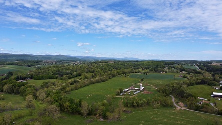
Churchville, Virginia, facing northeast
-
Cloud over Germantown, Maryland

-
Cloud over Lake Artemesia [01]
![Cloud over Lake Artemesia [01] (1076 visits) A cloud briefly hides the sun over Lake Artemesia, a manmade lake in Prince George's County, Marylan... Cloud over Lake Artemesia [01]](../../../../i/upload/2024/07/17/20240717225625-c1f513c9-cu_s9999x250.jpg)
-
Cloud over Lake Artemesia [02]
![Cloud over Lake Artemesia [02] (1129 visits) A cloud briefly hides the sun over Lake Artemesia, a manmade lake in Prince George's County, Marylan... Cloud over Lake Artemesia [02]](../../../../i/upload/2024/07/17/20240717225628-b4880a1f-cu_s9999x250.jpg)
-
Cloud over Richmond

-
Clouds over Bretton Woods Recreation Center [01]
![Clouds over Bretton Woods Recreation Center [01] (1227 visits) Clouds over the Bretton Woods Recreation Center in Darnestown, Maryland in late afternoon.
Ben Schu... Clouds over Bretton Woods Recreation Center [01]](../../../../i/upload/2024/07/17/20240717231051-ce691452-cu_s9999x250.jpg)
-
Clouds over Bretton Woods Recreation Center [02]
![Clouds over Bretton Woods Recreation Center [02] (1182 visits) Clouds over the Bretton Woods Recreation Center in Darnestown, Maryland in late afternoon.
Ben Schu... Clouds over Bretton Woods Recreation Center [02]](../../../../i/upload/2024/07/17/20240717231053-dd51ba69-cu_s9999x250.jpg)
-
Clouds over Hagerstown, Maryland

-
Clouds over Philadelphia [01]
![Clouds over Philadelphia [01] (1084 visits) Clouds over the Schuylkill River in Philadelphia, viewed from the Green Lane Bridge.
More at The Sc... Clouds over Philadelphia [01]](../../../../i/upload/2024/07/18/20240718220307-82fcad3f-cu_s9999x250.jpg)
-
Clouds over Philadelphia [02]
![Clouds over Philadelphia [02] (1079 visits) Clouds over the Schuylkill River in Philadelphia, viewed from the Green Lane Bridge.
More at The Sc... Clouds over Philadelphia [02]](../../../../i/upload/2024/07/18/20240718220304-d1ba0cf4-cu_s9999x250.jpg)
-
Clouds over Philadelphia [03]
![Clouds over Philadelphia [03] (1078 visits) Clouds over the Schuylkill River in Philadelphia, viewed from the Green Lane Bridge.
More at The Sc... Clouds over Philadelphia [03]](../../../../i/upload/2024/07/18/20240718220300-653ddf7c-cu_s9999x250.jpg)
-
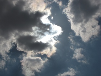
Clouds over Richmond
-
Clouds over Shanghai, West Virginia

-
Clouds over Spring Run, Pennsylvania

-
Clouds over the Asbury Park beach [01]
![Clouds over the Asbury Park beach [01] (1742 visits) Clouds in the sky over the Asbury Park beach, photographed from a rock jetty near Convention Hall.
... Clouds over the Asbury Park beach [01]](../../../../i/upload/2024/07/17/20240717165315-1b15278b-cu_s9999x250.jpg)
-
Clouds over the Asbury Park beach [02]
![Clouds over the Asbury Park beach [02] (1860 visits) Clouds in the sky over the Asbury Park beach, photographed from the boardwalk.
More at The Schumin ... Clouds over the Asbury Park beach [02]](../../../../i/upload/2024/07/17/20240717165259-1e894f6a-cu_s9999x250.jpg)
-
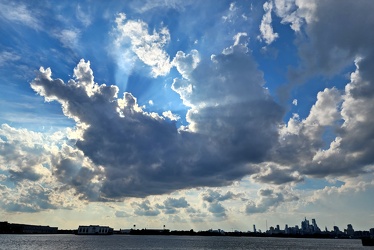
Clouds over the Delaware River
-
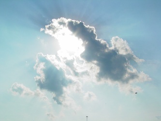
Clouds over Virginia Beach
-
Clouds over Waynesboro, Virginia [01]
![Clouds over Waynesboro, Virginia [01] (1348 visits) Clouds in the sky over Waynesboro, Virginia.
More at The Schumin Web:
www.schuminweb.com/2022/10/06... Clouds over Waynesboro, Virginia [01]](../../../../i/upload/2024/07/20/20240720111926-e95c8b35-cu_s9999x250.jpg)
-
Clouds over Waynesboro, Virginia [02]
![Clouds over Waynesboro, Virginia [02] (1419 visits) Clouds in the sky over Waynesboro, Virginia.
More at The Schumin Web:
www.schuminweb.com/2022/10/06... Clouds over Waynesboro, Virginia [02]](../../../../i/upload/2024/07/20/20240720111930-78edff55-cu_s9999x250.jpg)
-
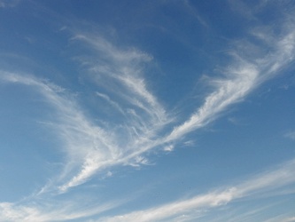
Clouds over Westminster, Maryland
-
Cloudy skies over Lake Michigan [03]
![Cloudy skies over Lake Michigan [03] (1158 visits) Cloudy skies over Lake Michigan, seen from Evanston, Illinois.
Ben Schumin is a professional photog... Cloudy skies over Lake Michigan [03]](../../../../i/upload/2024/07/17/20240717160708-fc8bdc4b-cu_s9999x250.jpg)
-
Cloudy skies over Lake Michigan [04]
![Cloudy skies over Lake Michigan [04] (1265 visits) Cloudy skies over Lake Michigan, seen from Evanston, Illinois.
Ben Schumin is a professional photog... Cloudy skies over Lake Michigan [04]](../../../../i/upload/2024/07/17/20240717160714-d52fcd77-cu_s9999x250.jpg)
-
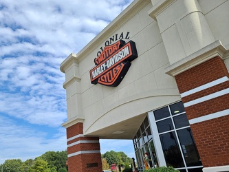
Colonial Harley-Davidson
-
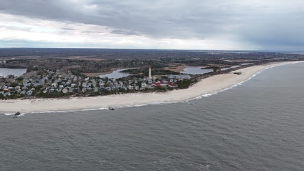
Coral Beach
-
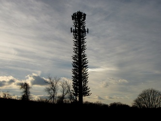
Disguised cell phone tower
-
Empire State Building from West 34th Street, facing southeast [01]
![Empire State Building from West 34th Street, facing southeast [01] (1644 visits) The Empire State Building, viewed from up the block on the north side of West 34th Street, facing so... Empire State Building from West 34th Street, facing southeast [01]](../../../../i/upload/2024/07/20/20240720143531-e4520deb-cu_s9999x250.jpg)
-
Empire State Building from West 34th Street, facing southeast [02]
![Empire State Building from West 34th Street, facing southeast [02] (1738 visits) The Empire State Building, viewed from up the block on the north side of West 34th Street, facing so... Empire State Building from West 34th Street, facing southeast [02]](../../../../i/upload/2024/07/20/20240720143853-94062ec8-cu_s9999x250.jpg)
-
Empire State Building from West 34th Street, facing southeast [03]
![Empire State Building from West 34th Street, facing southeast [03] (1812 visits) The Empire State Building, viewed from up the block on the north side of West 34th Street, facing so... Empire State Building from West 34th Street, facing southeast [03]](../../../../i/upload/2024/07/20/20240720143930-990f5e3f-cu_s9999x250.jpg)
-
Empire State Building from West 34th Street, facing southeast [04]
![Empire State Building from West 34th Street, facing southeast [04] (1817 visits) The Empire State Building, viewed from up the block on the north side of West 34th Street, facing so... Empire State Building from West 34th Street, facing southeast [04]](../../../../i/upload/2024/07/20/20240720143955-1d6f5f97-cu_s9999x250.jpg)
-
Empire State Building with nearby buildings [01]
![Empire State Building with nearby buildings [01] (1856 visits) The Empire State building with nearby buildings, viewed from the intersection of Fifth Avenue and Ea... Empire State Building with nearby buildings [01]](../../../../i/upload/2024/07/20/20240720151251-f86dc545-cu_s9999x250.jpg)
-
Empire State Building with nearby buildings [02]
![Empire State Building with nearby buildings [02] (1753 visits) The Empire State building with nearby buildings, viewed from the intersection of Fifth Avenue and Ea... Empire State Building with nearby buildings [02]](../../../../i/upload/2024/07/20/20240720151256-733646c3-cu_s9999x250.jpg)
-
Empire State Building with nearby buildings [03]
![Empire State Building with nearby buildings [03] (1844 visits) The Empire State building with nearby buildings, viewed from the intersection of Fifth Avenue and Ea... Empire State Building with nearby buildings [03]](../../../../i/upload/2024/07/20/20240720151302-aeaeb4bf-cu_s9999x250.jpg)
-
Empire State Building with nearby buildings [04]
![Empire State Building with nearby buildings [04] (1876 visits) The Empire State building with nearby buildings, viewed from the intersection of Fifth Avenue and Ea... Empire State Building with nearby buildings [04]](../../../../i/upload/2024/07/20/20240720151308-b57075b5-cu_s9999x250.jpg)
-
Field in Charles Town, West Virginia
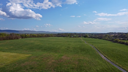
-
Field south of Waynesboro Town Center [01]
![Field south of Waynesboro Town Center [01] (1191 visits) Open fields south of Waynesboro Town Center, a shopping center in Waynesboro, Virginia.
Ben Schumin... Field south of Waynesboro Town Center [01]](../../../../i/upload/2024/07/19/20240719164131-8c6e4a64-cu_s9999x250.jpg)
-
Field south of Waynesboro Town Center [02]
![Field south of Waynesboro Town Center [02] (1147 visits) Open fields south of Waynesboro Town Center, a shopping center in Waynesboro, Virginia.
Ben Schumin... Field south of Waynesboro Town Center [02]](../../../../i/upload/2024/07/19/20240719164011-bfef621f-cu_s9999x250.jpg)
-
Field south of Waynesboro Town Center [03]
![Field south of Waynesboro Town Center [03] (1151 visits) Open fields south of Waynesboro Town Center, a shopping center in Waynesboro, Virginia.
Ben Schumin... Field south of Waynesboro Town Center [03]](../../../../i/upload/2024/07/19/20240719164113-3872f41a-cu_s9999x250.jpg)
-
Fields and housing in Charles Town, West Virginia
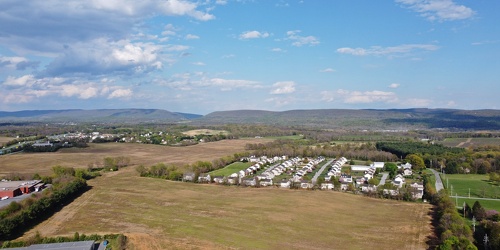
-
Flying over Cunningham Falls State Park
-
Former Kmart in Charlottesville, Virginia [01]
![Former Kmart in Charlottesville, Virginia [01] (4031 visits) Former Kmart store at 1801 Hydraulic Road in Charlottesville, Virginia. This store closed in the sp... Former Kmart in Charlottesville, Virginia [01]](../../../../i/upload/2024/07/20/20240720093729-ec9ad03b-cu_s9999x250.jpg)
-
Former Kmart in Charlottesville, Virginia [02]
![Former Kmart in Charlottesville, Virginia [02] (4431 visits) Former Kmart store at 1801 Hydraulic Road in Charlottesville, Virginia. This store closed in the sp... Former Kmart in Charlottesville, Virginia [02]](../../../../i/upload/2024/07/20/20240720093734-d8f8d1ca-cu_s9999x250.jpg)
-
Former Kmart in Charlottesville, Virginia [03]
![Former Kmart in Charlottesville, Virginia [03] (4003 visits) Former Kmart store at 1801 Hydraulic Road in Charlottesville, Virginia. This store closed in the sp... Former Kmart in Charlottesville, Virginia [03]](../../../../i/upload/2024/07/20/20240720093740-95a526e2-cu_s9999x250.jpg)
-
Former Kmart in Charlottesville, Virginia [04]
![Former Kmart in Charlottesville, Virginia [04] (4303 visits) Former Kmart store at 1801 Hydraulic Road in Charlottesville, Virginia. This store closed in the sp... Former Kmart in Charlottesville, Virginia [04]](../../../../i/upload/2024/07/20/20240720093745-ab234bd7-cu_s9999x250.jpg)
-
Harrisonburg east of Route 33
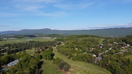
-
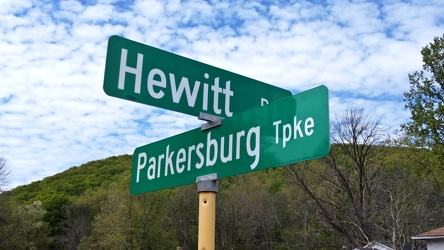
Hewitt Road and Parkersburg Turnpike
-
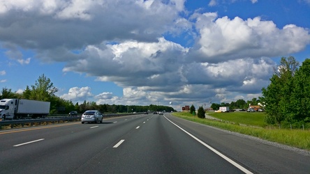
Interstate 95 near Fredericksburg
-
John Hancock Center, with fog at the top [01]
![John Hancock Center, with fog at the top [01] (1889 visits) Michigan Avenue facade of the John Hancock Center in Chicago, Illinois. Fog slightly obscures the t... John Hancock Center, with fog at the top [01]](../../../../i/upload/2024/07/15/20240715204847-7c1dde70-cu_s9999x250.jpg)
-
John Hancock Center, with fog at the top [02]
![John Hancock Center, with fog at the top [02] (1853 visits) Michigan Avenue facade of the John Hancock Center in Chicago, Illinois. Fog slightly obscures the t... John Hancock Center, with fog at the top [02]](../../../../i/upload/2024/07/15/20240715204849-f4b17041-cu_s9999x250.jpg)
-
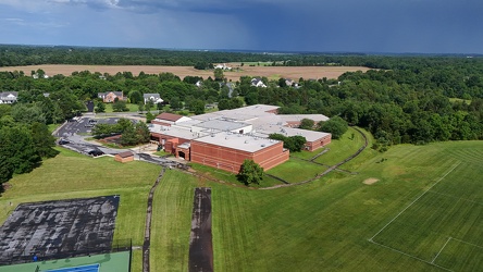
John Poole Middle School
-
Lightning storm over Fredericksburg [01]
![Lightning storm over Fredericksburg [01] (2137 visits) A bolt of lightning strikes during a thunderstorm over Fredericksburg, Virginia. Viewed from the pa... Lightning storm over Fredericksburg [01]](../../../../i/upload/2024/07/19/20240719105035-834fe4d8-cu_s9999x250.jpg)
-
Lightning storm over Fredericksburg [02]
![Lightning storm over Fredericksburg [02] (2058 visits) Bolts of lightning strike during a thunderstorm over Fredericksburg, Virginia. Viewed from the park... Lightning storm over Fredericksburg [02]](../../../../i/upload/2024/07/19/20240719105031-868aab50-cu_s9999x250.jpg)