-
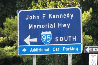
Sign for Interstate 95 southbound at Maryland House
-
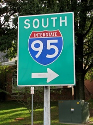
Interstate 95 sign at Maryland House
-
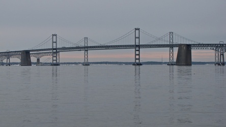
Chesapeake Bay Bridge from Sandy Point State Park
-
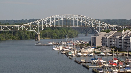
Thomas J. Hatem Memorial Bridge
-
Interstate 70 Park and Ride [20]
![Interstate 70 Park and Ride [20] (5176 visits) Park and Ride lot at the eastern terminus of Interstate 70, just inside the city limits of Baltimore... Interstate 70 Park and Ride [20]](../../../../../i/upload/2024/07/17/20240717101455-55518c25-cu_s9999x250.jpg)
-
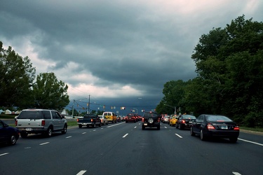
Storm clouds at Georgia Avenue and Norbeck Road
-
Brighton Dam Road [01]
![Brighton Dam Road [01] (15045 visits) Low view along the double line down the middle of Brighton Dam Road, which runs across the top of Br... Brighton Dam Road [01]](../../../../../i/upload/2024/07/17/20240717225049-0f96c3b6-cu_s9999x250.jpg)
-
Brighton Dam Road [02]
![Brighton Dam Road [02] (14758 visits) Low view along the double line down the middle of Brighton Dam Road, which runs across the top of Br... Brighton Dam Road [02]](../../../../../i/upload/2024/07/17/20240717225052-1b323317-cu_s9999x250.jpg)
-
Brighton Dam Road [03]
![Brighton Dam Road [03] (14975 visits) Low view along the double line down the middle of Brighton Dam Road, which runs across the top of Br... Brighton Dam Road [03]](../../../../../i/upload/2024/07/17/20240717225056-ac7d70e4-cu_s9999x250.jpg)
-
Brighton Dam Road [04]
![Brighton Dam Road [04] (15052 visits) Low view along the double line down the middle of Brighton Dam Road, which runs across the top of Br... Brighton Dam Road [04]](../../../../../i/upload/2024/07/17/20240717225100-7f927d75-cu_s9999x250.jpg)
-
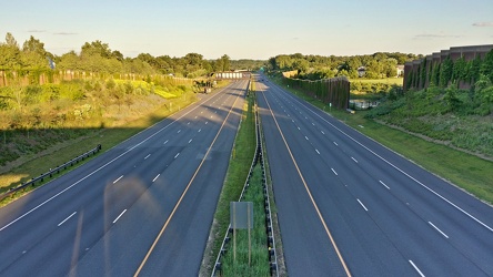
Intercounty Connector at Longmead Crossing Drive
-
Intercounty Connector bike trail [01]
![Intercounty Connector bike trail [01] (2832 visits) Bike trail paralleling the Intercounty Connector and Wintergate Drive, facing westbound.
Ben Schumi... Intercounty Connector bike trail [01]](../../../../../i/upload/2024/07/17/20240717230853-3f3f70f4-cu_s9999x250.jpg)
-
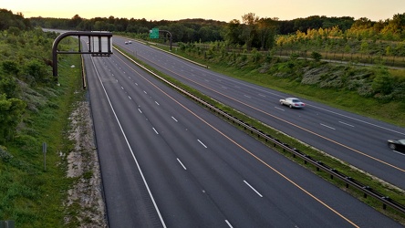
Intercounty Connector at Norbeck Road
-
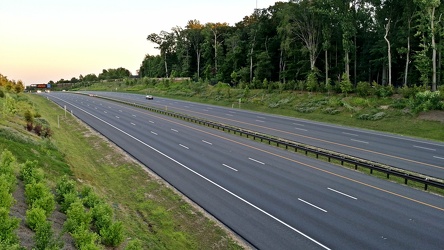
Intercounty Connector
-
Intercounty Connector bike trail [02]
![Intercounty Connector bike trail [02] (2816 visits) Bike trail paralleling the Intercounty Connector, facing westbound.
Ben Schumin is a professional p... Intercounty Connector bike trail [02]](../../../../../i/upload/2024/07/17/20240717230902-e4af2704-cu_s9999x250.jpg)
-
Intercounty Connector bike trail [03]
![Intercounty Connector bike trail [03] (2759 visits) Bike trail paralleling the Intercounty Connector, facing eastbound.
Ben Schumin is a professional p... Intercounty Connector bike trail [03]](../../../../../i/upload/2024/07/17/20240717230905-fd85639a-cu_s9999x250.jpg)
-
Intercounty Connector toll gantry
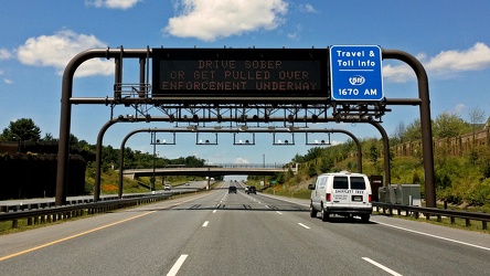
 South Mountain rest area, westbound [01]
![South Mountain rest area, westbound [01] (4008 visits) South Mountain rest area and welcome center on Interstate 70 westbound in Frederick County, Maryland... South Mountain rest area, westbound [01]](../../../../../i/upload/2024/07/17/20240717233435-e2f89cc0-cu_s9999x250.jpg)
 South Mountain rest area, westbound [02]
![South Mountain rest area, westbound [02] (4049 visits) South Mountain rest area and welcome center on Interstate 70 westbound in Frederick County, Maryland... South Mountain rest area, westbound [02]](../../../../../i/upload/2024/07/17/20240717233440-268e200a-cu_s9999x250.jpg)
 South Mountain rest area, westbound [03]
![South Mountain rest area, westbound [03] (4441 visits) South Mountain rest area and welcome center on Interstate 70 westbound in Frederick County, Maryland... South Mountain rest area, westbound [03]](../../../../../i/upload/2024/07/17/20240717233445-c0e160fc-cu_s9999x250.jpg)
 South Mountain rest area, westbound [04]
![South Mountain rest area, westbound [04] (4057 visits) South Mountain rest area and welcome center on Interstate 70 westbound in Frederick County, Maryland... South Mountain rest area, westbound [04]](../../../../../i/upload/2024/07/17/20240717233450-8d5d68a3-cu_s9999x250.jpg)
 South Mountain rest area, westbound [05]
![South Mountain rest area, westbound [05] (4086 visits) South Mountain rest area and welcome center on Interstate 70 westbound in Frederick County, Maryland... South Mountain rest area, westbound [05]](../../../../../i/upload/2024/07/17/20240717233455-aa6194ef-cu_s9999x250.jpg)
 Sideling Hill rest area [01]
![Sideling Hill rest area [01] (3328 visits) Eastbound side of the Sideling Hill rest area, located along Interstate 68 in Washington County, Mar... Sideling Hill rest area [01]](../../../../../i/upload/2024/07/17/20240717233459-e7ba195c-cu_s9999x250.jpg)
 Sideling Hill rest area [02]
![Sideling Hill rest area [02] (2990 visits) Eastbound access to the footbridge across the highway at the Sideling Hill rest area, located along ... Sideling Hill rest area [02]](../../../../../i/upload/2024/07/17/20240717233505-c4590774-cu_s9999x250.jpg)
 Sideling Hill rest area [03]
![Sideling Hill rest area [03] (2675 visits) Footbridge across Interstate 68, allowing views of the cut through the mountain, at the Sideling Hil... Sideling Hill rest area [03]](../../../../../i/upload/2024/07/17/20240717233511-e61616ff-cu_s9999x250.jpg)
 Sideling Hill rest area [04]
![Sideling Hill rest area [04] (3027 visits) Westbound access to the footbridge across the highway at the Sideling Hill rest area, located along ... Sideling Hill rest area [04]](../../../../../i/upload/2024/07/17/20240717233516-e5cc17b4-cu_s9999x250.jpg)
 Sideling Hill rest area [05]
![Sideling Hill rest area [05] (2880 visits) Path to the westbound parking area and restrooms at the Sideling Hill rest area, located along Inter... Sideling Hill rest area [05]](../../../../../i/upload/2024/07/17/20240717233521-b99b80cb-cu_s9999x250.jpg)
 Sideling Hill rest area [06]
![Sideling Hill rest area [06] (2669 visits) Stairs to a raised viewing area on the eastbound side of the Sideling Hill rest area, located along ... Sideling Hill rest area [06]](../../../../../i/upload/2024/07/17/20240717233527-43e4656c-cu_s9999x250.jpg)
 Sideling Hill rest area [07]
![Sideling Hill rest area [07] (2981 visits) Raised viewing area on the eastbound side of the Sideling Hill rest area, located along Interstate 6... Sideling Hill rest area [07]](../../../../../i/upload/2024/07/17/20240717233531-9f6ca0ea-cu_s9999x250.jpg)
 Sideling Hill rest area [08]
![Sideling Hill rest area [08] (3350 visits) Eastbound parking lot at the Sideling Hill rest area, located along Interstate 68 in Washington Coun... Sideling Hill rest area [08]](../../../../../i/upload/2024/07/17/20240717233537-4406b863-cu_s9999x250.jpg)
 Sideling Hill rest area [09]
![Sideling Hill rest area [09] (3525 visits) Eastbound parking lot at the Sideling Hill rest area, located along Interstate 68 in Washington Coun... Sideling Hill rest area [09]](../../../../../i/upload/2024/07/17/20240717233542-efb1100b-cu_s9999x250.jpg)
 Sideling Hill rest area [10]
![Sideling Hill rest area [10] (3018 visits) Eastbound side of the Sideling Hill rest area, located along Interstate 68 in Washington County, Mar... Sideling Hill rest area [10]](../../../../../i/upload/2024/07/17/20240717233547-516b9676-cu_s9999x250.jpg)
 Western Maryland Scenic Railroad station [06]
![Western Maryland Scenic Railroad station [06] (5017 visits) Station for the Western Maryland Scenic Railroad in Cumberland, Maryland.
More at The Schumin Web:
... Western Maryland Scenic Railroad station [06]](../../../../../i/upload/2024/07/17/20240717233558-d030848d-cu_s9999x250.jpg)
 Western Maryland Scenic Railroad tracks [03]
![Western Maryland Scenic Railroad tracks [03] (4933 visits) Tracks for the Western Maryland Scenic Railroad in Cumberland, Maryland.
More at The Schumin Web:
w... Western Maryland Scenic Railroad tracks [03]](../../../../../i/upload/2024/07/17/20240717233606-3c9ba6bb-cu_s9999x250.jpg)
-
Amtrak 120 arriving at Cumberland
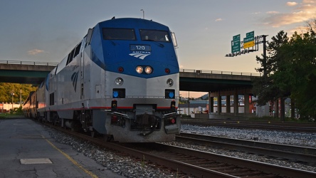
-
Footbridge over Interstate 68 at Sideling Hill
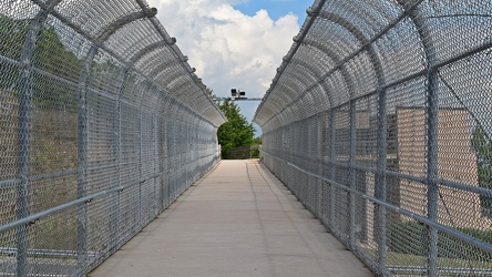
-
Rainstorm near Sideling Hill cut
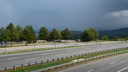
-
Interstate 68 cut through Sideling Hill [04]
![Interstate 68 cut through Sideling Hill [04] (2504 visits) Cut in Sideling Hill, carrying Interstate 68 between Washington and Allegany Counties in Maryland.
... Interstate 68 cut through Sideling Hill [04]](../../../../../i/upload/2024/07/18/20240718220107-eeb97b29-cu_s9999x250.jpg)
-
Interstate 68 cut through Sideling Hill [03]
![Interstate 68 cut through Sideling Hill [03] (2315 visits) Cut in Sideling Hill, carrying Interstate 68 between Washington and Allegany Counties in Maryland.
... Interstate 68 cut through Sideling Hill [03]](../../../../../i/upload/2024/07/18/20240718220111-2f9132e9-cu_s9999x250.jpg)
-
Interstate 68 cut through Sideling Hill [02]
![Interstate 68 cut through Sideling Hill [02] (3775 visits) Cut in Sideling Hill, carrying Interstate 68 between Washington and Allegany Counties in Maryland.
... Interstate 68 cut through Sideling Hill [02]](../../../../../i/upload/2024/07/18/20240718220116-e8da0915-cu_s9999x250.jpg)
-
Interstate 68 cut through Sideling Hill [01]
![Interstate 68 cut through Sideling Hill [01] (4285 visits) Cut in Sideling Hill, carrying Interstate 68 between Washington and Allegany Counties in Maryland.
... Interstate 68 cut through Sideling Hill [01]](../../../../../i/upload/2024/07/18/20240718220120-0789991f-cu_s9999x250.jpg)
-
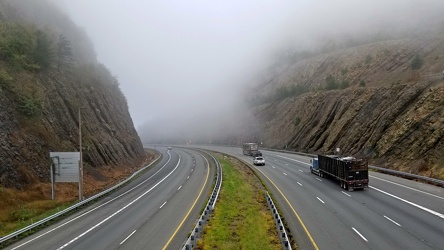
Sideling Hill cut
-
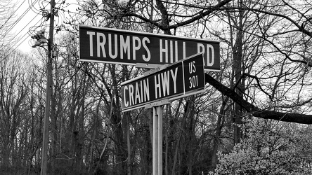
Intersection of Trumps Hill Road and Crain Highway
-
Maryland 68 vs. Interstate 68 sign [01]
![Maryland 68 vs. Interstate 68 sign [01] (3766 visits) Sign on westbound Interstate 70 ahead of exit 18, indicating that the next exit is for Maryland Rout... Maryland 68 vs. Interstate 68 sign [01]](../../../../../i/upload/2024/07/19/20240719004016-a5d58dda-cu_s9999x250.jpg)
-
Maryland 68 vs. Interstate 68 sign [02]
![Maryland 68 vs. Interstate 68 sign [02] (2877 visits) Sign on westbound Interstate 70 ahead of exit 18, indicating that the next exit is for Maryland Rout... Maryland 68 vs. Interstate 68 sign [02]](../../../../../i/upload/2024/07/19/20240719004125-0cff4906-cu_s9999x250.jpg)
-
Point of Rocks [01]
![Point of Rocks [01] (2603 visits) The Point of Rocks Bridge, which carries US 15 over the Potomac River between Loudoun County, Virgin... Point of Rocks [01]](../../../../../i/upload/2024/07/19/20240719101023-a2888aa2-cu_s9999x250.jpg)
-
Point of Rocks [04]
![Point of Rocks [04] (2113 visits) The Potomac River at Point of Rocks, just downstream from the Point of Rocks Bridge.
More at The Sc... Point of Rocks [04]](../../../../../i/upload/2024/07/19/20240719101050-da7edd4a-cu_s9999x250.jpg)
-
Rocks in the Potomac River [01]
![Rocks in the Potomac River [01] (2041 visits) Rocks in the Potomac River near Harpers Ferry. Viewed from the US 340 bridge.
Ben Schumin is a pro... Rocks in the Potomac River [01]](../../../../../i/upload/2024/07/19/20240719103333-6083493b-cu_s9999x250.jpg)
-
Rocks in the Potomac River [02]
![Rocks in the Potomac River [02] (1955 visits) Rocks in the Potomac River near Harpers Ferry. Viewed from the US 340 bridge.
Ben Schumin is a pro... Rocks in the Potomac River [02]](../../../../../i/upload/2024/07/19/20240719103338-04e1c1e1-cu_s9999x250.jpg)
-
Rocks in the Potomac River [03]
![Rocks in the Potomac River [03] (1960 visits) Rocks in the Potomac River near Harpers Ferry. Viewed from the US 340 bridge.
Ben Schumin is a pro... Rocks in the Potomac River [03]](../../../../../i/upload/2024/07/19/20240719103343-404e77e5-cu_s9999x250.jpg)
-
Rocks in the Potomac River [04]
![Rocks in the Potomac River [04] (1995 visits) Rocks in the Potomac River near Harpers Ferry. Viewed from the US 340 bridge.
Ben Schumin is a pro... Rocks in the Potomac River [04]](../../../../../i/upload/2024/07/19/20240719103348-1a3aef78-cu_s9999x250.jpg)
-
Rocks in the Potomac River [05]
![Rocks in the Potomac River [05] (2031 visits) Rocks in the Potomac River near Harpers Ferry. Viewed from the US 340 bridge.
Ben Schumin is a pro... Rocks in the Potomac River [05]](../../../../../i/upload/2024/07/19/20240719103353-ea395458-cu_s9999x250.jpg)
-
Potomac River from US 340 bridge [03]
![Potomac River from US 340 bridge [03] (2042 visits) The Potomac River, viewed from the US 340 bridge between Maryland and Virginia.
Ben Schumin is a pr... Potomac River from US 340 bridge [03]](../../../../../i/upload/2024/07/19/20240719103359-b66380e8-cu_s9999x250.jpg)
-
Potomac River from US 340 bridge [04]
![Potomac River from US 340 bridge [04] (2124 visits) The Potomac River, viewed from the US 340 bridge between Maryland and Virginia.
Ben Schumin is a pr... Potomac River from US 340 bridge [04]](../../../../../i/upload/2024/07/19/20240719103405-18d26a8b-cu_s9999x250.jpg)
-
Potomac River from US 340 bridge [05]
![Potomac River from US 340 bridge [05] (2139 visits) The Potomac River, viewed from the US 340 bridge between Maryland and Virginia.
Ben Schumin is a pr... Potomac River from US 340 bridge [05]](../../../../../i/upload/2024/07/19/20240719103412-5b42c5b9-cu_s9999x250.jpg)
-
Signage for Maryland Route 418 [02]
![Signage for Maryland Route 418 [02] (1535 visits) Signage for Maryland Route 418 at the intersection with Maryland Route 64 in Ringgold.
Ben Schumin ... Signage for Maryland Route 418 [02]](../../../../../i/upload/2024/07/19/20240719104708-e45266e6-cu_s9999x250.jpg)
-
Signage for Maryland Route 64 [03]
![Signage for Maryland Route 64 [03] (1802 visits) Signage for Maryland Route 64 at the intersection with Maryland Route 418 in Ringgold.
Ben Schumin ... Signage for Maryland Route 64 [03]](../../../../../i/upload/2024/07/19/20240719104750-3ae2140a-cu_s9999x250.jpg)
-
Blinker signals in Ringgold, Maryland [05]
![Blinker signals in Ringgold, Maryland [05] (2761 visits) Blinker signals supplementing a four-way stop at the intersection of Maryland Routes 64 and 418 in R... Blinker signals in Ringgold, Maryland [05]](../../../../../i/upload/2024/07/19/20240719104755-52af4492-cu_s9999x250.jpg)
-
Blinker signals in Ringgold, Maryland [04]
![Blinker signals in Ringgold, Maryland [04] (2790 visits) Blinker signals supplementing a four-way stop at the intersection of Maryland Routes 64 and 418 in R... Blinker signals in Ringgold, Maryland [04]](../../../../../i/upload/2024/07/19/20240719104800-95af76d6-cu_s9999x250.jpg)
-
Blinker signals in Ringgold, Maryland [03]
![Blinker signals in Ringgold, Maryland [03] (2832 visits) Blinker signals supplementing a four-way stop at the intersection of Maryland Routes 64 and 418 in R... Blinker signals in Ringgold, Maryland [03]](../../../../../i/upload/2024/07/19/20240719104805-6afa45cc-cu_s9999x250.jpg)
-
Signage for Maryland Route 418 [03]
![Signage for Maryland Route 418 [03] (1647 visits) Signage for Maryland Route 418 at the intersection with Maryland Route 64 in Ringgold.
Ben Schumin ... Signage for Maryland Route 418 [03]](../../../../../i/upload/2024/07/19/20240719104810-b8c9b800-cu_s9999x250.jpg)
-
Signage for Maryland Route 418 [01]
![Signage for Maryland Route 418 [01] (1647 visits) Signage for Maryland Route 418 at the intersection with Maryland Route 64 in Ringgold.
Ben Schumin ... Signage for Maryland Route 418 [01]](../../../../../i/upload/2024/07/19/20240719104816-bdac4667-cu_s9999x250.jpg)
-
Signage for Maryland Route 64 [02]
![Signage for Maryland Route 64 [02] (1837 visits) Signage for Maryland Route 64 at the intersection with Maryland Route 418 in Ringgold.
Alternate ... Signage for Maryland Route 64 [02]](../../../../../i/upload/2024/07/19/20240719104820-3e6fadc3-cu_s9999x250.jpg)
-
Signage for Maryland Route 64 [01]
![Signage for Maryland Route 64 [01] (1677 visits) Signage for Maryland Route 64 at the intersection with Maryland Route 418 in Ringgold.
Alternate ... Signage for Maryland Route 64 [01]](../../../../../i/upload/2024/07/19/20240719104825-f479389a-cu_s9999x250.jpg)
-
Blinker signals in Ringgold, Maryland [02]
![Blinker signals in Ringgold, Maryland [02] (2875 visits) Blinker signals supplementing a four-way stop at the intersection of Maryland Routes 64 and 418 in R... Blinker signals in Ringgold, Maryland [02]](../../../../../i/upload/2024/07/19/20240719104829-0c02a370-cu_s9999x250.jpg)
-
Blinker signals in Ringgold, Maryland [01]
![Blinker signals in Ringgold, Maryland [01] (2769 visits) Blinker signals supplementing a four-way stop at the intersection of Maryland Routes 64 and 418 in R... Blinker signals in Ringgold, Maryland [01]](../../../../../i/upload/2024/07/19/20240719104834-c83d81b6-cu_s9999x250.jpg)
-
South Mountain rest area and welcome center, westbound [02]
![South Mountain rest area and welcome center, westbound [02] (1809 visits) Restroom building at the South Mountain rest area and welcome center on Interstate 70 westbound in F... South Mountain rest area and welcome center, westbound [02]](../../../../../i/upload/2024/07/19/20240719104930-9f63ecbf-cu_s9999x250.jpg)
-
South Mountain rest area and welcome center, westbound [01]
![South Mountain rest area and welcome center, westbound [01] (1764 visits) Restroom building at the South Mountain rest area and welcome center on Interstate 70 westbound in F... South Mountain rest area and welcome center, westbound [01]](../../../../../i/upload/2024/07/19/20240719104934-09257e0d-cu_s9999x250.jpg)
-
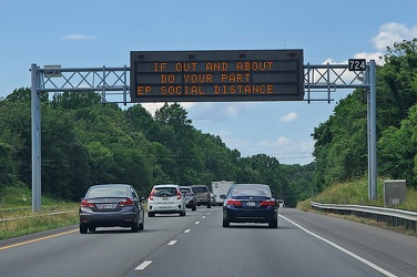
Variable message sign encouraging social distancing
-
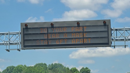
Variable message sign encouraging mask wearing and social distancing
-
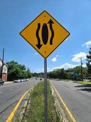
Sign indicating that traffic moves around the median
-
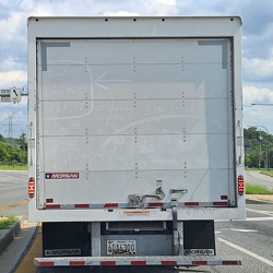
Dirt graffiti
-
Intersection of Routes 64 and 418 [03]
![Intersection of Routes 64 and 418 [03] (2942 visits) Intersection of Routes 64 and 418 in Ringgold, Maryland. The two roads meet at a four-way stop, gov... Intersection of Routes 64 and 418 [03]](../../../../../i/upload/2024/07/19/20240719114429-bdff0353-cu_s9999x250.jpg)
-
Intersection of Routes 64 and 418 [02]
![Intersection of Routes 64 and 418 [02] (2775 visits) Intersection of Routes 64 and 418 in Ringgold, Maryland. The two roads meet at a four-way stop, gov... Intersection of Routes 64 and 418 [02]](../../../../../i/upload/2024/07/19/20240719114434-f7b1a6bf-cu_s9999x250.jpg)
-
Intersection of Routes 64 and 418 [05]
![Intersection of Routes 64 and 418 [05] (3077 visits) Intersection of Routes 64 and 418 in Ringgold, Maryland. The two roads meet at a four-way stop, gov... Intersection of Routes 64 and 418 [05]](../../../../../i/upload/2024/07/19/20240719114438-ea16106f-cu_s9999x250.jpg)
-
Intersection of Routes 64 and 418 [04]
![Intersection of Routes 64 and 418 [04] (2797 visits) Intersection of Routes 64 and 418 in Ringgold, Maryland. The two roads meet at a four-way stop, gov... Intersection of Routes 64 and 418 [04]](../../../../../i/upload/2024/07/19/20240719114443-599ce985-cu_s9999x250.jpg)
-
Intersection of Routes 64 and 418 [01]
![Intersection of Routes 64 and 418 [01] (3044 visits) Intersection of Routes 64 and 418 in Ringgold, Maryland. The two roads meet at a four-way stop, gov... Intersection of Routes 64 and 418 [01]](../../../../../i/upload/2024/07/19/20240719114447-7f7699d7-cu_s9999x250.jpg)
-
Point of Rocks Bridge [03]
![Point of Rocks Bridge [03] (2565 visits) The Point of Rocks Bridge, which carries US Route 15 over the Potomac River between Loudoun County, ... Point of Rocks Bridge [03]](../../../../../i/upload/2024/07/19/20240719121604-b7b9e112-cu_s9999x250.jpg)
-
Point of Rocks Bridge [05]
![Point of Rocks Bridge [05] (2636 visits) Overhead view of the Point of Rocks Bridge, which carries US Route 15 over the Potomac River between... Point of Rocks Bridge [05]](../../../../../i/upload/2024/07/19/20240719121622-d2dfa3a8-cu_s9999x250.jpg)
-
Point of Rocks Bridge [02]
![Point of Rocks Bridge [02] (2579 visits) The Point of Rocks Bridge, which carries US Route 15 over the Potomac River between Loudoun County, ... Point of Rocks Bridge [02]](../../../../../i/upload/2024/07/19/20240719121627-117c91a4-cu_s9999x250.jpg)