-
Red Line at New Hampshire Avenue [01]
![Red Line at New Hampshire Avenue [01] (3432 visits) The Red Line, just south of New Hampshire Avenue NE. The Fort Totten collision would occur at this ... Red Line at New Hampshire Avenue [01]](../../../../i/upload/2024/07/15/20240715214643-f5d4a186-cu_s9999x250.jpg)
-
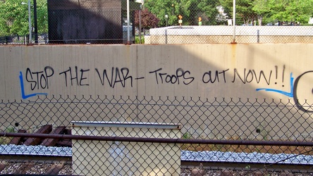
Anti-war graffiti at Brookland
-
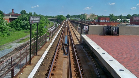
Track at Rhode Island Avenue, facing north
-
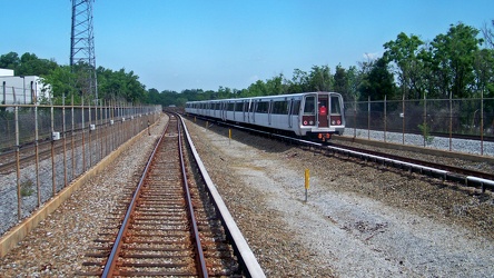
Red Line north of Fort Totten
-
Crowds at Rhode Island Avenue station following June 22, 2009 Metro collision [01]
![Crowds at Rhode Island Avenue station following June 22, 2009 Metro collision [01] (2233 visits) Rush hour crowds on the evening of June 22, 2009 waiting to board shuttle buses to get around the ar... Crowds at Rhode Island Avenue station following June 22, 2009 Metro collision [01]](../../../../i/upload/2024/07/16/20240716002547-ffb49565-cu_s9999x250.jpg)
-
Crowds at Rhode Island Avenue station following June 22, 2009 Metro collision [02]
![Crowds at Rhode Island Avenue station following June 22, 2009 Metro collision [02] (2401 visits) Rush hour crowds on the evening of June 22, 2009 waiting to board shuttle buses to get around the ar... Crowds at Rhode Island Avenue station following June 22, 2009 Metro collision [02]](../../../../i/upload/2024/07/16/20240716002549-47a3fb9e-cu_s9999x250.jpg)
-
Crowds at Rhode Island Avenue station following June 22, 2009 Metro collision [03]
![Crowds at Rhode Island Avenue station following June 22, 2009 Metro collision [03] (2282 visits) Rush hour crowds on the evening of June 22, 2009 waiting to board shuttle buses to get around the ar... Crowds at Rhode Island Avenue station following June 22, 2009 Metro collision [03]](../../../../i/upload/2024/07/16/20240716002550-46252d71-cu_s9999x250.jpg)
-
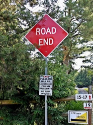
"ROAD END" sign
-
Abandoned rowhouse at North Calvert and East Read Streets [01]
![Abandoned rowhouse at North Calvert and East Read Streets [01] (2386 visits) Fire-damaged and abandoned rowhouse at the intersection of North Calvert and East Read Streets in Ba... Abandoned rowhouse at North Calvert and East Read Streets [01]](../../../../i/upload/2024/07/17/20240717231156-4875201d-cu_s9999x250.jpg)
-
Abandoned rowhouse at North Calvert and East Read Streets [02]
![Abandoned rowhouse at North Calvert and East Read Streets [02] (2574 visits) Fire-damaged and abandoned rowhouse at the intersection of North Calvert and East Read Streets in Ba... Abandoned rowhouse at North Calvert and East Read Streets [02]](../../../../i/upload/2024/07/17/20240717231200-c1bee20f-cu_s9999x250.jpg)
-
Abandoned rowhouse at North Calvert and East Read Streets [03]
![Abandoned rowhouse at North Calvert and East Read Streets [03] (3460 visits) Fire-damaged and abandoned rowhouse at the intersection of North Calvert and East Read Streets in Ba... Abandoned rowhouse at North Calvert and East Read Streets [03]](../../../../i/upload/2024/07/17/20240717231204-3ffcc48a-cu_s9999x250.jpg)
-
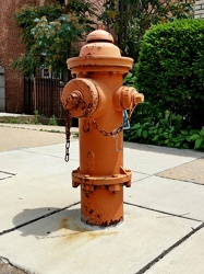
Fire hydrant on North Calvert Street
-
Signage for Maryland Route 418 [02]
![Signage for Maryland Route 418 [02] (1063 visits) Signage for Maryland Route 418 at the intersection with Maryland Route 64 in Ringgold.
Ben Schumin ... Signage for Maryland Route 418 [02]](../../../../i/upload/2024/07/19/20240719104708-e45266e6-cu_s9999x250.jpg)
-
Signage for Maryland Route 64 [03]
![Signage for Maryland Route 64 [03] (1259 visits) Signage for Maryland Route 64 at the intersection with Maryland Route 418 in Ringgold.
Ben Schumin ... Signage for Maryland Route 64 [03]](../../../../i/upload/2024/07/19/20240719104750-3ae2140a-cu_s9999x250.jpg)
-
Signage for Maryland Route 418 [03]
![Signage for Maryland Route 418 [03] (1146 visits) Signage for Maryland Route 418 at the intersection with Maryland Route 64 in Ringgold.
Ben Schumin ... Signage for Maryland Route 418 [03]](../../../../i/upload/2024/07/19/20240719104810-b8c9b800-cu_s9999x250.jpg)
-
Signage for Maryland Route 418 [01]
![Signage for Maryland Route 418 [01] (1127 visits) Signage for Maryland Route 418 at the intersection with Maryland Route 64 in Ringgold.
Ben Schumin ... Signage for Maryland Route 418 [01]](../../../../i/upload/2024/07/19/20240719104816-bdac4667-cu_s9999x250.jpg)
-
Signage for Maryland Route 64 [02]
![Signage for Maryland Route 64 [02] (1268 visits) Signage for Maryland Route 64 at the intersection with Maryland Route 418 in Ringgold.
Alternate ... Signage for Maryland Route 64 [02]](../../../../i/upload/2024/07/19/20240719104820-3e6fadc3-cu_s9999x250.jpg)
-
Signage for Maryland Route 64 [01]
![Signage for Maryland Route 64 [01] (1172 visits) Signage for Maryland Route 64 at the intersection with Maryland Route 418 in Ringgold.
Alternate ... Signage for Maryland Route 64 [01]](../../../../i/upload/2024/07/19/20240719104825-f479389a-cu_s9999x250.jpg)
-
Sign for Turf Motel [01]
![Sign for Turf Motel [01] (1549 visits) Sign for Turf Motel on East Washington Street in Charles Town, West Virginia.
Ben Schumin is a prof... Sign for Turf Motel [01]](../../../../i/upload/2024/07/19/20240719105135-cf488fe7-cu_s9999x250.jpg)
-
Sign for Turf Motel [02]
![Sign for Turf Motel [02] (1462 visits) Sign for Turf Motel on East Washington Street in Charles Town, West Virginia.
Ben Schumin is a prof... Sign for Turf Motel [02]](../../../../i/upload/2024/07/19/20240719105140-ae1e9541-cu_s9999x250.jpg)
-
Sign for Turf Motel [03]
![Sign for Turf Motel [03] (1555 visits) Sign for Turf Motel on East Washington Street in Charles Town, West Virginia.
Ben Schumin is a prof... Sign for Turf Motel [03]](../../../../i/upload/2024/07/19/20240719105145-b1c2c92e-cu_s9999x250.jpg)
-
Sign for Turf Motel [04]
![Sign for Turf Motel [04] (1547 visits) Sign for Turf Motel on East Washington Street in Charles Town, West Virginia.
Ben Schumin is a prof... Sign for Turf Motel [04]](../../../../i/upload/2024/07/19/20240719105156-e7d1b8d6-cu_s9999x250.jpg)
-
Sign for Turf Motel [05]
![Sign for Turf Motel [05] (1530 visits) Sign for Turf Motel on East Washington Street in Charles Town, West Virginia.
Ben Schumin is a prof... Sign for Turf Motel [05]](../../../../i/upload/2024/07/19/20240719105201-f579f161-cu_s9999x250.jpg)
-
Boss's 2 On the Level Entertainment [01]
![Boss's 2 On the Level Entertainment [01] (1707 visits) Boss's 2 On the Level Entertainment, an adult entertainment venue on East Washington Street in Charl... Boss's 2 On the Level Entertainment [01]](../../../../i/upload/2024/07/19/20240719105228-1feb1896-cu_s9999x250.jpg)
-
Boss's 2 On the Level Entertainment [02]
![Boss's 2 On the Level Entertainment [02] (1735 visits) Boss's 2 On the Level Entertainment, an adult entertainment venue on East Washington Street in Charl... Boss's 2 On the Level Entertainment [02]](../../../../i/upload/2024/07/19/20240719105234-092a0546-cu_s9999x250.jpg)
-
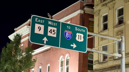
Overhead sign over South Queen Street
-
Sign for Turf Motel [06]
![Sign for Turf Motel [06] (16500 visits) Sign for Turf Motel on East Washington Street in Charles Town, West Virginia, lit up at night.
Ben ... Sign for Turf Motel [06]](../../../../i/upload/2024/07/19/20240719105546-b0b48763-cu_s9999x250.jpg)
-
East Washington Street and Allawilla Drive [01]
![East Washington Street and Allawilla Drive [01] (2244 visits) Street sign assembly at the intersection of East Washington Street and Allawilla Drive in Charles To... East Washington Street and Allawilla Drive [01]](../../../../i/upload/2024/07/19/20240719105551-a08e131e-cu_s9999x250.jpg)
-
East Washington Street and Allawilla Drive [02]
![East Washington Street and Allawilla Drive [02] (10415 visits) Street sign assembly at the intersection of East Washington Street and Allawilla Drive in Charles To... East Washington Street and Allawilla Drive [02]](../../../../i/upload/2024/07/19/20240719105556-79e2b58f-cu_s9999x250.jpg)
-
Boss's 2 On the Level Entertainment [03]
![Boss's 2 On the Level Entertainment [03] (16015 visits) Boss's 2 On the Level Entertainment, an adult entertainment venue on East Washington Street in Charl... Boss's 2 On the Level Entertainment [03]](../../../../i/upload/2024/07/19/20240719105601-e28fae94-cu_s9999x250.jpg)
-
Boss's 2 On the Level Entertainment [04]
![Boss's 2 On the Level Entertainment [04] (2168 visits) Boss's 2 On the Level Entertainment, an adult entertainment venue on East Washington Street in Charl... Boss's 2 On the Level Entertainment [04]](../../../../i/upload/2024/07/19/20240719105606-51113ca3-cu_s9999x250.jpg)
-
Boss's 2 On the Level Entertainment [05]
![Boss's 2 On the Level Entertainment [05] (2328 visits) Boss's 2 On the Level Entertainment, an adult entertainment venue on East Washington Street in Charl... Boss's 2 On the Level Entertainment [05]](../../../../i/upload/2024/07/19/20240719105611-62b9050a-cu_s9999x250.jpg)
-
Essex Place, Candle Ridge, and Picton of Birlstone [02]
![Essex Place, Candle Ridge, and Picton of Birlstone [02] (2216 visits) Aerial view of the Essex Place, Candle Ridge, and Picton of Birlstone areas of Montgomery Village, M... Essex Place, Candle Ridge, and Picton of Birlstone [02]](../../../../i/upload/2024/07/19/20240719165355-16cfcb21-cu_s9999x250.jpg)
-
Ravenglass Way [02]
![Ravenglass Way [02] (2344 visits) Aerial view of Ravenglass Way, a street in the Essex Place area of Montgomery Village, Maryland.
Be... Ravenglass Way [02]](../../../../i/upload/2024/07/19/20240719165400-daa550de-cu_s9999x250.jpg)
-
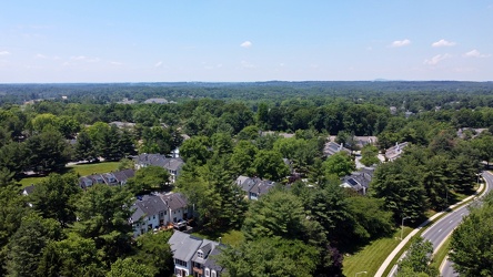
Essex Place and Candle Ridge
-
Montgomery Village, facing approximately west [01]
![Montgomery Village, facing approximately west [01] (2248 visits) View of Montgomery Village and beyond, facing approximately west, from above the Lake Marion Communi... Montgomery Village, facing approximately west [01]](../../../../i/upload/2024/07/19/20240719165409-be458691-cu_s9999x250.jpg)
-
Essex Place, Candle Ridge, and Picton of Birlstone [03]
![Essex Place, Candle Ridge, and Picton of Birlstone [03] (1981 visits) Aerial view of the Essex Place, Candle Ridge, and Picton of Birlstone areas of Montgomery Village, M... Essex Place, Candle Ridge, and Picton of Birlstone [03]](../../../../i/upload/2024/07/19/20240719165413-01ec57b3-cu_s9999x250.jpg)
-
Ravenglass Way [06]
![Ravenglass Way [06] (1743 visits) Aerial view of Ravenglass Way, a street in the Essex Place area of Montgomery Village, Maryland.
Be... Ravenglass Way [06]](../../../../i/upload/2024/07/19/20240719165418-83524ec4-cu_s9999x250.jpg)
-
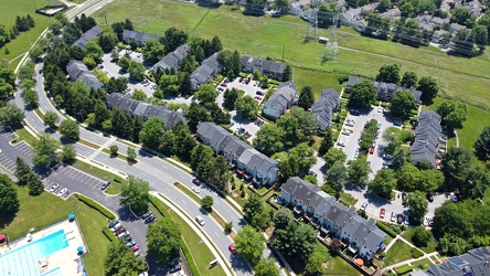
Hawk Run Terrace
-
The Reach
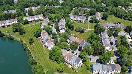
-
Lake Marion Community Center pool [06]
![Lake Marion Community Center pool [06] (7499 visits) Swimming pool at the Lake Marion Community Center in Montgomery Village, Maryland.
Ben Schumin is a... Lake Marion Community Center pool [06]](../../../../i/upload/2024/07/19/20240719165432-05e5d3a1-cu_s9999x250.jpg)
-
Lake Marion Community Center pool [05]
![Lake Marion Community Center pool [05] (3519 visits) Swimming pool at the Lake Marion Community Center in Montgomery Village, Maryland.
Ben Schumin is a... Lake Marion Community Center pool [05]](../../../../i/upload/2024/07/19/20240719165437-13657538-cu_s9999x250.jpg)
-
Ravenglass Way [04]
![Ravenglass Way [04] (1793 visits) Aerial view of Ravenglass Way, a street in the Essex Place area of Montgomery Village, Maryland.
Be... Ravenglass Way [04]](../../../../i/upload/2024/07/19/20240719165443-3e6bc6d8-cu_s9999x250.jpg)
-
Ravenglass Way [03]
![Ravenglass Way [03] (1809 visits) Aerial view of Ravenglass Way, a street in the Essex Place area of Montgomery Village, Maryland.
Be... Ravenglass Way [03]](../../../../i/upload/2024/07/19/20240719165447-3df0a484-cu_s9999x250.jpg)
-
Ravenglass Way [01]
![Ravenglass Way [01] (2019 visits) Aerial view of Ravenglass Way, a street in the Essex Place area of Montgomery Village, Maryland.
Be... Ravenglass Way [01]](../../../../i/upload/2024/07/19/20240719165451-c6237496-cu_s9999x250.jpg)
-
Essex Place, Candle Ridge, and Picton of Birlstone [01]
![Essex Place, Candle Ridge, and Picton of Birlstone [01] (2019 visits) Aerial view of the Essex Place, Candle Ridge, and Picton of Birlstone areas of Montgomery Village, M... Essex Place, Candle Ridge, and Picton of Birlstone [01]](../../../../i/upload/2024/07/19/20240719165455-a51c05df-cu_s9999x250.jpg)
-
Montgomery Village, facing approximately west [02]
![Montgomery Village, facing approximately west [02] (1934 visits) View of Montgomery Village and beyond, facing approximately west, from above the Lake Marion Communi... Montgomery Village, facing approximately west [02]](../../../../i/upload/2024/07/19/20240719165500-7c01f836-cu_s9999x250.jpg)
-
Ravenglass Way [05]
![Ravenglass Way [05] (1814 visits) Aerial view of Ravenglass Way, a street in the Essex Place area of Montgomery Village, Maryland.
Be... Ravenglass Way [05]](../../../../i/upload/2024/07/19/20240719165505-1a967166-cu_s9999x250.jpg)
-
Picton of Birlstone and Glenbrooke
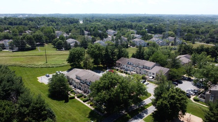
-
Shoes on a power line [01]
![Shoes on a power line [01] (2788 visits) A pair of Nike Air Max shoes hanging from a power line by their laces over the intersection of Queen... Shoes on a power line [01]](../../../../i/upload/2024/07/19/20240719165654-4ce50545-cu_s9999x250.jpg)
-
Shoes on a power line [02]
![Shoes on a power line [02] (2861 visits) A pair of Nike Air Max shoes hanging from a power line by their laces over the intersection of Queen... Shoes on a power line [02]](../../../../i/upload/2024/07/19/20240719165659-84bc17e9-cu_s9999x250.jpg)
-
East Main and Broad Streets in Waynesboro, Virginia
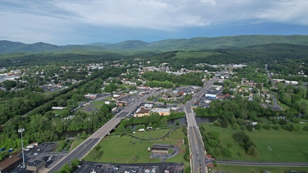
-
East Broad Street near East Avenue
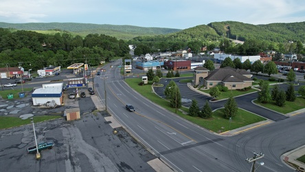
-
Ravenglass Way [07]
![Ravenglass Way [07] (1712 visits) Aerial view of Ravenglass Way, a street in the Essex Place area of Montgomery Village, Maryland.
Be... Ravenglass Way [07]](../../../../i/upload/2024/07/20/20240720095503-d67a39a0-cu_s9999x250.jpg)
-
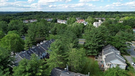
Essex Place and The Reach
-
Ravenglass Way [09]
![Ravenglass Way [09] (2035 visits) Aerial view of Ravenglass Way, a street in the Essex Place area of Montgomery Village, Maryland.
Be... Ravenglass Way [09]](../../../../i/upload/2024/07/20/20240720095518-d5c71399-cu_s9999x250.jpg)
-
Ravenglass Way [08]
![Ravenglass Way [08] (1773 visits) Aerial view of Ravenglass Way, a street in the Essex Place area of Montgomery Village, Maryland.
Be... Ravenglass Way [08]](../../../../i/upload/2024/07/20/20240720095523-39780d00-cu_s9999x250.jpg)
-
"Joy of Life" fountain [01]
!["Joy of Life" fountain [01] (1694 visits) "Joy of Life" fountain at the intersection of Whitfield Street and Baum Boulevard in the E... "Joy of Life" fountain [01]](../../../../i/upload/2024/07/20/20240720160900-39d90714-cu_s9999x250.jpg)
-
Aerial view of East Liberty Presbyterian Church [02]
![Aerial view of East Liberty Presbyterian Church [02] (3040 visits) Aerial view of East Liberty Presbyterian Church, also known as the Cathedral of Hope, a large church... Aerial view of East Liberty Presbyterian Church [02]](../../../../i/upload/2024/07/20/20240720160925-113a640a-cu_s9999x250.jpg)
-
Aerial view of East Liberty Presbyterian Church [04]
![Aerial view of East Liberty Presbyterian Church [04] (3047 visits) Aerial view of East Liberty Presbyterian Church, also known as the Cathedral of Hope, a large church... Aerial view of East Liberty Presbyterian Church [04]](../../../../i/upload/2024/07/20/20240720160929-16fd7e34-cu_s9999x250.jpg)
-
Aerial view of East Liberty Presbyterian Church [06]
![Aerial view of East Liberty Presbyterian Church [06] (3010 visits) Aerial view of East Liberty Presbyterian Church, also known as the Cathedral of Hope, a large church... Aerial view of East Liberty Presbyterian Church [06]](../../../../i/upload/2024/07/20/20240720160933-a6419b30-cu_s9999x250.jpg)
-
Aerial view of East Liberty Presbyterian Church [11]
![Aerial view of East Liberty Presbyterian Church [11] (3012 visits) Aerial view of East Liberty Presbyterian Church, also known as the Cathedral of Hope, a large church... Aerial view of East Liberty Presbyterian Church [11]](../../../../i/upload/2024/07/20/20240720160938-8f5a529e-cu_s9999x250.jpg)
-
Aerial view of East Liberty Presbyterian Church [12]
![Aerial view of East Liberty Presbyterian Church [12] (3076 visits) Aerial view of East Liberty Presbyterian Church, also known as the Cathedral of Hope, a large church... Aerial view of East Liberty Presbyterian Church [12]](../../../../i/upload/2024/07/20/20240720160942-7f513a92-cu_s9999x250.jpg)
-
Aerial view of East Liberty Presbyterian Church [20]
![Aerial view of East Liberty Presbyterian Church [20] (3086 visits) Aerial view of East Liberty Presbyterian Church, also known as the Cathedral of Hope, a large church... Aerial view of East Liberty Presbyterian Church [20]](../../../../i/upload/2024/07/20/20240720160946-69e2d66b-cu_s9999x250.jpg)
-
Aerial view of East Liberty Presbyterian Church [23]
![Aerial view of East Liberty Presbyterian Church [23] (3104 visits) Aerial view of East Liberty Presbyterian Church, also known as the Cathedral of Hope, a large church... Aerial view of East Liberty Presbyterian Church [23]](../../../../i/upload/2024/07/20/20240720160950-71281329-cu_s9999x250.jpg)
-
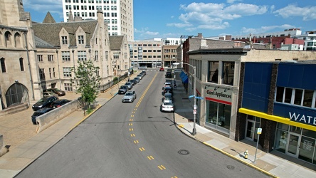
Baum Boulevard, facing east
-
Aerial view of East Liberty Presbyterian Church [10]
![Aerial view of East Liberty Presbyterian Church [10] (3040 visits) Aerial view of East Liberty Presbyterian Church, also known as the Cathedral of Hope, a large church... Aerial view of East Liberty Presbyterian Church [10]](../../../../i/upload/2024/07/20/20240720161000-0209603e-cu_s9999x250.jpg)
-
Aerial view of East Liberty Presbyterian Church [13]
![Aerial view of East Liberty Presbyterian Church [13] (3011 visits) Aerial view of East Liberty Presbyterian Church, also known as the Cathedral of Hope, a large church... Aerial view of East Liberty Presbyterian Church [13]](../../../../i/upload/2024/07/20/20240720161004-3f71162c-cu_s9999x250.jpg)
-
Aerial view of East Liberty Presbyterian Church [18]
![Aerial view of East Liberty Presbyterian Church [18] (3080 visits) Aerial view of East Liberty Presbyterian Church, also known as the Cathedral of Hope, a large church... Aerial view of East Liberty Presbyterian Church [18]](../../../../i/upload/2024/07/20/20240720161008-f23a38fa-cu_s9999x250.jpg)
-
Aerial view of East Liberty Presbyterian Church [21]
![Aerial view of East Liberty Presbyterian Church [21] (3046 visits) Aerial view of East Liberty Presbyterian Church, also known as the Cathedral of Hope, a large church... Aerial view of East Liberty Presbyterian Church [21]](../../../../i/upload/2024/07/20/20240720161013-99e0adfe-cu_s9999x250.jpg)
-
Aerial view of East Liberty Presbyterian Church [08]
![Aerial view of East Liberty Presbyterian Church [08] (3052 visits) Aerial view of East Liberty Presbyterian Church, also known as the Cathedral of Hope, a large church... Aerial view of East Liberty Presbyterian Church [08]](../../../../i/upload/2024/07/20/20240720161021-d331e071-cu_s9999x250.jpg)
-
Aerial view of East Liberty Presbyterian Church [17]
![Aerial view of East Liberty Presbyterian Church [17] (3040 visits) Aerial view of East Liberty Presbyterian Church, also known as the Cathedral of Hope, a large church... Aerial view of East Liberty Presbyterian Church [17]](../../../../i/upload/2024/07/20/20240720161026-6ad4630b-cu_s9999x250.jpg)
-
Aerial view of East Liberty Presbyterian Church [19]
![Aerial view of East Liberty Presbyterian Church [19] (3128 visits) Aerial view of East Liberty Presbyterian Church, also known as the Cathedral of Hope, a large church... Aerial view of East Liberty Presbyterian Church [19]](../../../../i/upload/2024/07/20/20240720161030-5a181c2c-cu_s9999x250.jpg)
-
Aerial view of East Liberty Presbyterian Church [15]
![Aerial view of East Liberty Presbyterian Church [15] (2990 visits) Aerial view of East Liberty Presbyterian Church, also known as the Cathedral of Hope, a large church... Aerial view of East Liberty Presbyterian Church [15]](../../../../i/upload/2024/07/20/20240720161034-6b35469d-cu_s9999x250.jpg)
-
Aerial view of East Liberty Presbyterian Church [03]
![Aerial view of East Liberty Presbyterian Church [03] (3095 visits) Aerial view of East Liberty Presbyterian Church, also known as the Cathedral of Hope, a large church... Aerial view of East Liberty Presbyterian Church [03]](../../../../i/upload/2024/07/20/20240720161105-e2137cac-cu_s9999x250.jpg)
-
Aerial view of East Liberty Presbyterian Church [05]
![Aerial view of East Liberty Presbyterian Church [05] (3169 visits) Aerial view of East Liberty Presbyterian Church, also known as the Cathedral of Hope, a large church... Aerial view of East Liberty Presbyterian Church [05]](../../../../i/upload/2024/07/20/20240720161109-bae1d6d3-cu_s9999x250.jpg)
-
Aerial view of East Liberty Presbyterian Church [22]
![Aerial view of East Liberty Presbyterian Church [22] (3105 visits) Aerial view of East Liberty Presbyterian Church, also known as the Cathedral of Hope, a large church... Aerial view of East Liberty Presbyterian Church [22]](../../../../i/upload/2024/07/20/20240720161113-6de998b7-cu_s9999x250.jpg)
-
Aerial view of East Liberty Presbyterian Church [01]
![Aerial view of East Liberty Presbyterian Church [01] (3126 visits) Aerial view of East Liberty Presbyterian Church, also known as the Cathedral of Hope, a large church... Aerial view of East Liberty Presbyterian Church [01]](../../../../i/upload/2024/07/20/20240720161117-a77350d6-cu_s9999x250.jpg)
-
Aerial view of East Liberty Presbyterian Church [14]
![Aerial view of East Liberty Presbyterian Church [14] (3094 visits) Aerial view of East Liberty Presbyterian Church, also known as the Cathedral of Hope, a large church... Aerial view of East Liberty Presbyterian Church [14]](../../../../i/upload/2024/07/20/20240720161121-2f08111b-cu_s9999x250.jpg)
-
Aerial view of East Liberty Presbyterian Church [16]
![Aerial view of East Liberty Presbyterian Church [16] (3058 visits) Aerial view of East Liberty Presbyterian Church, also known as the Cathedral of Hope, a large church... Aerial view of East Liberty Presbyterian Church [16]](../../../../i/upload/2024/07/20/20240720161125-66b55a4b-cu_s9999x250.jpg)