-
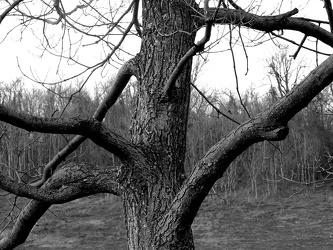
Tree at scenic overlook
-
Sunset from I-64 overlook [03]
![Sunset from I-64 overlook [03] (2298 visits) Sunset, viewed from the scenic overlook at milepost 103 on Interstate 64 eastbound in Albemarle Coun... Sunset from I-64 overlook [03]](../../../i/upload/2024/07/13/20240713234247-066d4e9b-cu_s9999x250.jpg)
-
Sunset from I-64 overlook [01]
![Sunset from I-64 overlook [01] (2280 visits) Sunset, viewed from the scenic overlook at milepost 103 on Interstate 64 eastbound in Albemarle Coun... Sunset from I-64 overlook [01]](../../../i/upload/2024/07/13/20240713234248-69674cad-cu_s9999x250.jpg)
-
Sunset from I-64 overlook [02]
![Sunset from I-64 overlook [02] (2296 visits) Sunset, viewed from the scenic overlook at milepost 103 on Interstate 64 eastbound in Albemarle Coun... Sunset from I-64 overlook [02]](../../../i/upload/2024/07/13/20240713234249-3f6e970a-cu_s9999x250.jpg)
-
Sunset from I-64 overlook [04]
![Sunset from I-64 overlook [04] (2245 visits) Sunset, viewed from the scenic overlook at milepost 103 on Interstate 64 eastbound in Albemarle Coun... Sunset from I-64 overlook [04]](../../../i/upload/2024/07/13/20240713234251-97a8e10e-cu_s9999x250.jpg)
-
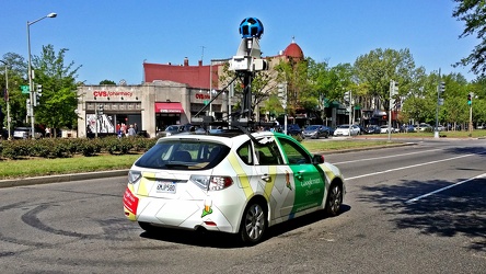
Google Street View car on Pennsylvania Avenue SE
 Sideling Hill rest area [01]
![Sideling Hill rest area [01] (2358 visits) Eastbound side of the Sideling Hill rest area, located along Interstate 68 in Washington County, Mar... Sideling Hill rest area [01]](../../../i/upload/2024/07/17/20240717233459-e7ba195c-cu_s9999x250.jpg)
 Sideling Hill rest area [02]
![Sideling Hill rest area [02] (2088 visits) Eastbound access to the footbridge across the highway at the Sideling Hill rest area, located along ... Sideling Hill rest area [02]](../../../i/upload/2024/07/17/20240717233505-c4590774-cu_s9999x250.jpg)
 Sideling Hill rest area [06]
![Sideling Hill rest area [06] (1949 visits) Stairs to a raised viewing area on the eastbound side of the Sideling Hill rest area, located along ... Sideling Hill rest area [06]](../../../i/upload/2024/07/17/20240717233527-43e4656c-cu_s9999x250.jpg)
 Sideling Hill rest area [07]
![Sideling Hill rest area [07] (2121 visits) Raised viewing area on the eastbound side of the Sideling Hill rest area, located along Interstate 6... Sideling Hill rest area [07]](../../../i/upload/2024/07/17/20240717233531-9f6ca0ea-cu_s9999x250.jpg)
 Sideling Hill rest area [08]
![Sideling Hill rest area [08] (2334 visits) Eastbound parking lot at the Sideling Hill rest area, located along Interstate 68 in Washington Coun... Sideling Hill rest area [08]](../../../i/upload/2024/07/17/20240717233537-4406b863-cu_s9999x250.jpg)
 Sideling Hill rest area [09]
![Sideling Hill rest area [09] (2378 visits) Eastbound parking lot at the Sideling Hill rest area, located along Interstate 68 in Washington Coun... Sideling Hill rest area [09]](../../../i/upload/2024/07/17/20240717233542-efb1100b-cu_s9999x250.jpg)
 Sideling Hill rest area [10]
![Sideling Hill rest area [10] (2176 visits) Eastbound side of the Sideling Hill rest area, located along Interstate 68 in Washington County, Mar... Sideling Hill rest area [10]](../../../i/upload/2024/07/17/20240717233547-516b9676-cu_s9999x250.jpg)
-
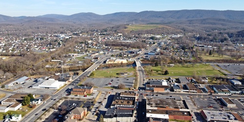
Main and Broad Streets, facing east
-
Downtown Waynesboro, Virginia, looking toward Invista [02]
![Downtown Waynesboro, Virginia, looking toward Invista [02] (4226 visits) Aerial view of downtown Waynesboro, Virginia, looking towards the Invista plant.
Ben Schumin is a p... Downtown Waynesboro, Virginia, looking toward Invista [02]](../../../i/upload/2024/07/19/20240719130254-ae1aac9d-cu_s9999x250.jpg)
-
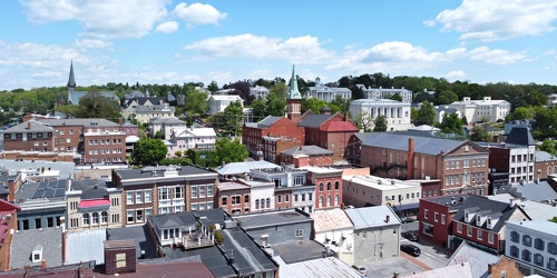
Downtown Staunton, Virginia, facing northeast
-
Essex Place, Candle Ridge, and Picton of Birlstone [02]
![Essex Place, Candle Ridge, and Picton of Birlstone [02] (2211 visits) Aerial view of the Essex Place, Candle Ridge, and Picton of Birlstone areas of Montgomery Village, M... Essex Place, Candle Ridge, and Picton of Birlstone [02]](../../../i/upload/2024/07/19/20240719165355-16cfcb21-cu_s9999x250.jpg)
-
Ravenglass Way [02]
![Ravenglass Way [02] (2341 visits) Aerial view of Ravenglass Way, a street in the Essex Place area of Montgomery Village, Maryland.
Be... Ravenglass Way [02]](../../../i/upload/2024/07/19/20240719165400-daa550de-cu_s9999x250.jpg)
-
Essex Place and Candle Ridge
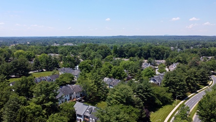
-
Montgomery Village, facing approximately west [01]
![Montgomery Village, facing approximately west [01] (2243 visits) View of Montgomery Village and beyond, facing approximately west, from above the Lake Marion Communi... Montgomery Village, facing approximately west [01]](../../../i/upload/2024/07/19/20240719165409-be458691-cu_s9999x250.jpg)
-
Essex Place, Candle Ridge, and Picton of Birlstone [03]
![Essex Place, Candle Ridge, and Picton of Birlstone [03] (1977 visits) Aerial view of the Essex Place, Candle Ridge, and Picton of Birlstone areas of Montgomery Village, M... Essex Place, Candle Ridge, and Picton of Birlstone [03]](../../../i/upload/2024/07/19/20240719165413-01ec57b3-cu_s9999x250.jpg)
-
Ravenglass Way [06]
![Ravenglass Way [06] (1741 visits) Aerial view of Ravenglass Way, a street in the Essex Place area of Montgomery Village, Maryland.
Be... Ravenglass Way [06]](../../../i/upload/2024/07/19/20240719165418-83524ec4-cu_s9999x250.jpg)
-
Hawk Run Terrace
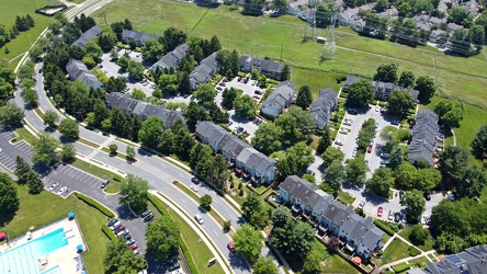
-
The Reach
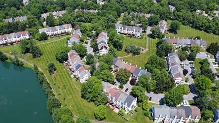
-
Lake Marion Community Center pool [06]
![Lake Marion Community Center pool [06] (7494 visits) Swimming pool at the Lake Marion Community Center in Montgomery Village, Maryland.
Ben Schumin is a... Lake Marion Community Center pool [06]](../../../i/upload/2024/07/19/20240719165432-05e5d3a1-cu_s9999x250.jpg)
-
Lake Marion Community Center pool [05]
![Lake Marion Community Center pool [05] (3515 visits) Swimming pool at the Lake Marion Community Center in Montgomery Village, Maryland.
Ben Schumin is a... Lake Marion Community Center pool [05]](../../../i/upload/2024/07/19/20240719165437-13657538-cu_s9999x250.jpg)
-
Ravenglass Way [04]
![Ravenglass Way [04] (1789 visits) Aerial view of Ravenglass Way, a street in the Essex Place area of Montgomery Village, Maryland.
Be... Ravenglass Way [04]](../../../i/upload/2024/07/19/20240719165443-3e6bc6d8-cu_s9999x250.jpg)
-
Ravenglass Way [03]
![Ravenglass Way [03] (1806 visits) Aerial view of Ravenglass Way, a street in the Essex Place area of Montgomery Village, Maryland.
Be... Ravenglass Way [03]](../../../i/upload/2024/07/19/20240719165447-3df0a484-cu_s9999x250.jpg)
-
Ravenglass Way [01]
![Ravenglass Way [01] (2013 visits) Aerial view of Ravenglass Way, a street in the Essex Place area of Montgomery Village, Maryland.
Be... Ravenglass Way [01]](../../../i/upload/2024/07/19/20240719165451-c6237496-cu_s9999x250.jpg)
-
Essex Place, Candle Ridge, and Picton of Birlstone [01]
![Essex Place, Candle Ridge, and Picton of Birlstone [01] (2015 visits) Aerial view of the Essex Place, Candle Ridge, and Picton of Birlstone areas of Montgomery Village, M... Essex Place, Candle Ridge, and Picton of Birlstone [01]](../../../i/upload/2024/07/19/20240719165455-a51c05df-cu_s9999x250.jpg)
-
Montgomery Village, facing approximately west [02]
![Montgomery Village, facing approximately west [02] (1930 visits) View of Montgomery Village and beyond, facing approximately west, from above the Lake Marion Communi... Montgomery Village, facing approximately west [02]](../../../i/upload/2024/07/19/20240719165500-7c01f836-cu_s9999x250.jpg)
-
Ravenglass Way [05]
![Ravenglass Way [05] (1804 visits) Aerial view of Ravenglass Way, a street in the Essex Place area of Montgomery Village, Maryland.
Be... Ravenglass Way [05]](../../../i/upload/2024/07/19/20240719165505-1a967166-cu_s9999x250.jpg)
-
Picton of Birlstone and Glenbrooke
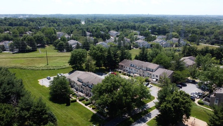
-
Staunton, Virginia from above Sears Hill [01]
![Staunton, Virginia from above Sears Hill [01] (1574 visits) Aerial view of downtown Staunton, Virginia from above the Sears Hill neighborhood.
Ben Schumin is a... Staunton, Virginia from above Sears Hill [01]](../../../i/upload/2024/07/19/20240719170157-81396bfe-cu_s9999x250.jpg)
-
Staunton, Virginia from above Sears Hill [04]
![Staunton, Virginia from above Sears Hill [04] (1673 visits) Aerial view of downtown Staunton, Virginia from above the Sears Hill neighborhood.
Ben Schumin is a... Staunton, Virginia from above Sears Hill [04]](../../../i/upload/2024/07/19/20240719170206-26a0cea4-cu_s9999x250.jpg)
-
Staunton, Virginia from above Sears Hill [03]
![Staunton, Virginia from above Sears Hill [03] (1671 visits) Aerial view of downtown Staunton, Virginia from above the Sears Hill neighborhood.
Ben Schumin is a... Staunton, Virginia from above Sears Hill [03]](../../../i/upload/2024/07/19/20240719170210-52003e52-cu_s9999x250.jpg)
-
Staunton, Virginia from above Sears Hill [02]
![Staunton, Virginia from above Sears Hill [02] (1624 visits) Aerial view of downtown Staunton, Virginia from above the Sears Hill neighborhood.
Ben Schumin is a... Staunton, Virginia from above Sears Hill [02]](../../../i/upload/2024/07/19/20240719170215-6698e5b6-cu_s9999x250.jpg)
-
Montgomery Village, facing approximately west [03]
![Montgomery Village, facing approximately west [03] (1924 visits) View of Montgomery Village and beyond, facing approximately west, from above the Essex Place neighbo... Montgomery Village, facing approximately west [03]](../../../i/upload/2024/07/20/20240720014535-43915a8f-cu_s9999x250.jpg)
-
Montgomery Village, facing approximately west [04]
![Montgomery Village, facing approximately west [04] (1908 visits) View of Montgomery Village and beyond, facing approximately west, from above the Picton of Birlstone... Montgomery Village, facing approximately west [04]](../../../i/upload/2024/07/20/20240720014545-c32fb66e-cu_s9999x250.jpg)
-
East Main Street in Waynesboro, Virginia
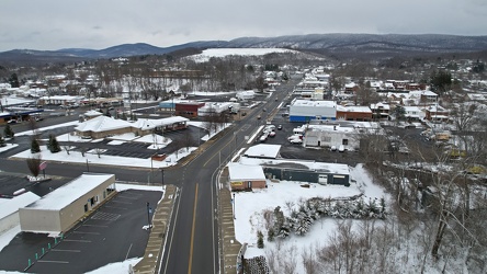
-
East Main and Broad Streets in Waynesboro, Virginia
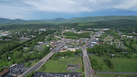
-
East Broad Street near East Avenue
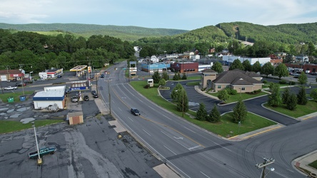
-
Ravenglass Way [07]
![Ravenglass Way [07] (1703 visits) Aerial view of Ravenglass Way, a street in the Essex Place area of Montgomery Village, Maryland.
Be... Ravenglass Way [07]](../../../i/upload/2024/07/20/20240720095503-d67a39a0-cu_s9999x250.jpg)
-
Essex Place and The Reach
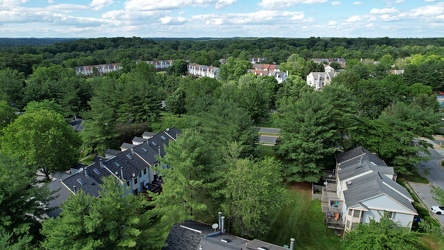
-
Ravenglass Way [09]
![Ravenglass Way [09] (2031 visits) Aerial view of Ravenglass Way, a street in the Essex Place area of Montgomery Village, Maryland.
Be... Ravenglass Way [09]](../../../i/upload/2024/07/20/20240720095518-d5c71399-cu_s9999x250.jpg)
-
Ravenglass Way [08]
![Ravenglass Way [08] (1768 visits) Aerial view of Ravenglass Way, a street in the Essex Place area of Montgomery Village, Maryland.
Be... Ravenglass Way [08]](../../../i/upload/2024/07/20/20240720095523-39780d00-cu_s9999x250.jpg)
-
House in Belmont [01]
![House in Belmont [01] (1467 visits) House in Roanoke, Virginia's Belmont neighborhood.
More at The Schumin Web:
www.schuminweb.com/life... House in Belmont [01]](../../../i/upload/2024/07/20/20240720121631-c3e23ae1-cu_s9999x250.jpg)
-
House in Belmont [02]
![House in Belmont [02] (1497 visits) House in Roanoke, Virginia's Belmont neighborhood.
More at The Schumin Web:
www.schuminweb.com/life... House in Belmont [02]](../../../i/upload/2024/07/20/20240720121752-e4abc76f-cu_s9999x250.jpg)
-
House in Belmont [03]
![House in Belmont [03] (1530 visits) House in Roanoke, Virginia's Belmont neighborhood.
More at The Schumin Web:
www.schuminweb.com/life... House in Belmont [03]](../../../i/upload/2024/07/20/20240720121814-c2af82f0-cu_s9999x250.jpg)
-
House in Belmont [04]
![House in Belmont [04] (1481 visits) House in Roanoke, Virginia's Belmont neighborhood.
More at The Schumin Web:
www.schuminweb.com/life... House in Belmont [04]](../../../i/upload/2024/07/20/20240720121849-d834dd26-cu_s9999x250.jpg)
-
Parliament Hill viewed from the Canadian Museum of History [03]
![Parliament Hill viewed from the Canadian Museum of History [03] (3125 visits) Parliament Hill in Ottawa, viewed from the campus of the Canadian Museum of History in Gatineau, Que... Parliament Hill viewed from the Canadian Museum of History [03]](../../../i/upload/2024/07/20/20240720153205-0ed4bb97-cu_s9999x250.jpg)
-
Parliament Hill viewed from the Canadian Museum of History [04]
![Parliament Hill viewed from the Canadian Museum of History [04] (3076 visits) Parliament Hill in Ottawa, viewed from the campus of the Canadian Museum of History in Gatineau, Que... Parliament Hill viewed from the Canadian Museum of History [04]](../../../i/upload/2024/07/20/20240720153433-5c535764-cu_s9999x250.jpg)
-
Parliament Hill viewed from the Canadian Museum of History [02]
![Parliament Hill viewed from the Canadian Museum of History [02] (2995 visits) Parliament Hill in Ottawa, viewed from the campus of the Canadian Museum of History in Gatineau, Que... Parliament Hill viewed from the Canadian Museum of History [02]](../../../i/upload/2024/07/20/20240720153545-9d416a4d-cu_s9999x250.jpg)
-
Parliament Hill viewed from the Canadian Museum of History [01]
![Parliament Hill viewed from the Canadian Museum of History [01] (2927 visits) Parliament Hill in Ottawa, viewed from the campus of the Canadian Museum of History in Gatineau, Que... Parliament Hill viewed from the Canadian Museum of History [01]](../../../i/upload/2024/07/20/20240720153642-acef43b1-cu_s9999x250.jpg)
-
Aerial view of East Liberty Presbyterian Church [02]
![Aerial view of East Liberty Presbyterian Church [02] (3036 visits) Aerial view of East Liberty Presbyterian Church, also known as the Cathedral of Hope, a large church... Aerial view of East Liberty Presbyterian Church [02]](../../../i/upload/2024/07/20/20240720160925-113a640a-cu_s9999x250.jpg)
-
Aerial view of East Liberty Presbyterian Church [04]
![Aerial view of East Liberty Presbyterian Church [04] (3039 visits) Aerial view of East Liberty Presbyterian Church, also known as the Cathedral of Hope, a large church... Aerial view of East Liberty Presbyterian Church [04]](../../../i/upload/2024/07/20/20240720160929-16fd7e34-cu_s9999x250.jpg)
-
Aerial view of East Liberty Presbyterian Church [06]
![Aerial view of East Liberty Presbyterian Church [06] (3004 visits) Aerial view of East Liberty Presbyterian Church, also known as the Cathedral of Hope, a large church... Aerial view of East Liberty Presbyterian Church [06]](../../../i/upload/2024/07/20/20240720160933-a6419b30-cu_s9999x250.jpg)
-
Aerial view of East Liberty Presbyterian Church [11]
![Aerial view of East Liberty Presbyterian Church [11] (3008 visits) Aerial view of East Liberty Presbyterian Church, also known as the Cathedral of Hope, a large church... Aerial view of East Liberty Presbyterian Church [11]](../../../i/upload/2024/07/20/20240720160938-8f5a529e-cu_s9999x250.jpg)
-
Aerial view of East Liberty Presbyterian Church [12]
![Aerial view of East Liberty Presbyterian Church [12] (3073 visits) Aerial view of East Liberty Presbyterian Church, also known as the Cathedral of Hope, a large church... Aerial view of East Liberty Presbyterian Church [12]](../../../i/upload/2024/07/20/20240720160942-7f513a92-cu_s9999x250.jpg)
-
Aerial view of East Liberty Presbyterian Church [20]
![Aerial view of East Liberty Presbyterian Church [20] (3083 visits) Aerial view of East Liberty Presbyterian Church, also known as the Cathedral of Hope, a large church... Aerial view of East Liberty Presbyterian Church [20]](../../../i/upload/2024/07/20/20240720160946-69e2d66b-cu_s9999x250.jpg)
-
Aerial view of East Liberty Presbyterian Church [23]
![Aerial view of East Liberty Presbyterian Church [23] (3101 visits) Aerial view of East Liberty Presbyterian Church, also known as the Cathedral of Hope, a large church... Aerial view of East Liberty Presbyterian Church [23]](../../../i/upload/2024/07/20/20240720160950-71281329-cu_s9999x250.jpg)
-
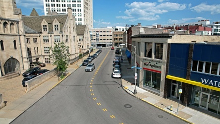
Baum Boulevard, facing east
-
Aerial view of East Liberty Presbyterian Church [10]
![Aerial view of East Liberty Presbyterian Church [10] (3036 visits) Aerial view of East Liberty Presbyterian Church, also known as the Cathedral of Hope, a large church... Aerial view of East Liberty Presbyterian Church [10]](../../../i/upload/2024/07/20/20240720161000-0209603e-cu_s9999x250.jpg)
-
Aerial view of East Liberty Presbyterian Church [13]
![Aerial view of East Liberty Presbyterian Church [13] (3007 visits) Aerial view of East Liberty Presbyterian Church, also known as the Cathedral of Hope, a large church... Aerial view of East Liberty Presbyterian Church [13]](../../../i/upload/2024/07/20/20240720161004-3f71162c-cu_s9999x250.jpg)
-
Aerial view of East Liberty Presbyterian Church [18]
![Aerial view of East Liberty Presbyterian Church [18] (3076 visits) Aerial view of East Liberty Presbyterian Church, also known as the Cathedral of Hope, a large church... Aerial view of East Liberty Presbyterian Church [18]](../../../i/upload/2024/07/20/20240720161008-f23a38fa-cu_s9999x250.jpg)
-
Aerial view of East Liberty Presbyterian Church [21]
![Aerial view of East Liberty Presbyterian Church [21] (3043 visits) Aerial view of East Liberty Presbyterian Church, also known as the Cathedral of Hope, a large church... Aerial view of East Liberty Presbyterian Church [21]](../../../i/upload/2024/07/20/20240720161013-99e0adfe-cu_s9999x250.jpg)
-
Aerial view of East Liberty Presbyterian Church [08]
![Aerial view of East Liberty Presbyterian Church [08] (3048 visits) Aerial view of East Liberty Presbyterian Church, also known as the Cathedral of Hope, a large church... Aerial view of East Liberty Presbyterian Church [08]](../../../i/upload/2024/07/20/20240720161021-d331e071-cu_s9999x250.jpg)
-
Aerial view of East Liberty Presbyterian Church [17]
![Aerial view of East Liberty Presbyterian Church [17] (3035 visits) Aerial view of East Liberty Presbyterian Church, also known as the Cathedral of Hope, a large church... Aerial view of East Liberty Presbyterian Church [17]](../../../i/upload/2024/07/20/20240720161026-6ad4630b-cu_s9999x250.jpg)
-
Aerial view of East Liberty Presbyterian Church [19]
![Aerial view of East Liberty Presbyterian Church [19] (3125 visits) Aerial view of East Liberty Presbyterian Church, also known as the Cathedral of Hope, a large church... Aerial view of East Liberty Presbyterian Church [19]](../../../i/upload/2024/07/20/20240720161030-5a181c2c-cu_s9999x250.jpg)
-
Aerial view of East Liberty Presbyterian Church [15]
![Aerial view of East Liberty Presbyterian Church [15] (2986 visits) Aerial view of East Liberty Presbyterian Church, also known as the Cathedral of Hope, a large church... Aerial view of East Liberty Presbyterian Church [15]](../../../i/upload/2024/07/20/20240720161034-6b35469d-cu_s9999x250.jpg)
-
Aerial view of East Liberty Presbyterian Church [03]
![Aerial view of East Liberty Presbyterian Church [03] (3085 visits) Aerial view of East Liberty Presbyterian Church, also known as the Cathedral of Hope, a large church... Aerial view of East Liberty Presbyterian Church [03]](../../../i/upload/2024/07/20/20240720161105-e2137cac-cu_s9999x250.jpg)
-
Aerial view of East Liberty Presbyterian Church [05]
![Aerial view of East Liberty Presbyterian Church [05] (3163 visits) Aerial view of East Liberty Presbyterian Church, also known as the Cathedral of Hope, a large church... Aerial view of East Liberty Presbyterian Church [05]](../../../i/upload/2024/07/20/20240720161109-bae1d6d3-cu_s9999x250.jpg)
-
Aerial view of East Liberty Presbyterian Church [22]
![Aerial view of East Liberty Presbyterian Church [22] (3102 visits) Aerial view of East Liberty Presbyterian Church, also known as the Cathedral of Hope, a large church... Aerial view of East Liberty Presbyterian Church [22]](../../../i/upload/2024/07/20/20240720161113-6de998b7-cu_s9999x250.jpg)
-
Aerial view of East Liberty Presbyterian Church [01]
![Aerial view of East Liberty Presbyterian Church [01] (3124 visits) Aerial view of East Liberty Presbyterian Church, also known as the Cathedral of Hope, a large church... Aerial view of East Liberty Presbyterian Church [01]](../../../i/upload/2024/07/20/20240720161117-a77350d6-cu_s9999x250.jpg)
-
Aerial view of East Liberty Presbyterian Church [14]
![Aerial view of East Liberty Presbyterian Church [14] (3092 visits) Aerial view of East Liberty Presbyterian Church, also known as the Cathedral of Hope, a large church... Aerial view of East Liberty Presbyterian Church [14]](../../../i/upload/2024/07/20/20240720161121-2f08111b-cu_s9999x250.jpg)
-
Aerial view of East Liberty Presbyterian Church [16]
![Aerial view of East Liberty Presbyterian Church [16] (3054 visits) Aerial view of East Liberty Presbyterian Church, also known as the Cathedral of Hope, a large church... Aerial view of East Liberty Presbyterian Church [16]](../../../i/upload/2024/07/20/20240720161125-66b55a4b-cu_s9999x250.jpg)
-
Aerial view of East Liberty Presbyterian Church [09]
![Aerial view of East Liberty Presbyterian Church [09] (3064 visits) Aerial view of East Liberty Presbyterian Church, also known as the Cathedral of Hope, a large church... Aerial view of East Liberty Presbyterian Church [09]](../../../i/upload/2024/07/20/20240720161129-5fb4069e-cu_s9999x250.jpg)
-
Aerial view of East Liberty Presbyterian Church [07]
![Aerial view of East Liberty Presbyterian Church [07] (3027 visits) Aerial view of East Liberty Presbyterian Church, also known as the Cathedral of Hope, a large church... Aerial view of East Liberty Presbyterian Church [07]](../../../i/upload/2024/07/20/20240720161134-5af0a002-cu_s9999x250.jpg)
-
Aerial view of downtown Staunton, Virginia [01]
![Aerial view of downtown Staunton, Virginia [01] (1202 visits) Aerial view of downtown Staunton, Virginia. View facing approximately north.
Ben Schumin is a prof... Aerial view of downtown Staunton, Virginia [01]](../../../i/upload/2024/08/24/20240824104621-87f086a2-cu_s9999x250.jpg)
-
Aerial view of downtown Staunton, Virginia [02]
![Aerial view of downtown Staunton, Virginia [02] (1082 visits) Aerial view of downtown Staunton, Virginia. View facing approximately northeast.
Ben Schumin is a ... Aerial view of downtown Staunton, Virginia [02]](../../../i/upload/2024/08/24/20240824104624-5fe809bd-cu_s9999x250.jpg)