-
Aerial view of Wayne Community College [04]
![Aerial view of Wayne Community College [04] (254 visits) Aerial view of Wayne Community College, a public community college in Goldsboro, North Carolina.
Mo... Aerial view of Wayne Community College [04]](../../../../i/upload/2025/03/10/20250310201611-4991f2f2-cu_s9999x250.jpg)
-
Aerial view of Wayne Community College [03]
![Aerial view of Wayne Community College [03] (266 visits) Aerial view of Wayne Community College, a public community college in Goldsboro, North Carolina.
Mo... Aerial view of Wayne Community College [03]](../../../../i/upload/2025/03/10/20250310201604-518deba5-cu_s9999x250.jpg)
-
Aerial view of Wayne Community College [01]
![Aerial view of Wayne Community College [01] (286 visits) Aerial view of Wayne Community College, a public community college in Goldsboro, North Carolina.
Mo... Aerial view of Wayne Community College [01]](../../../../i/upload/2025/03/10/20250310201548-58e9769c-cu_s9999x250.jpg)
-
Aerial view of Wayne Community College [02]
![Aerial view of Wayne Community College [02] (301 visits) Aerial view of Wayne Community College, a public community college in Goldsboro, North Carolina.
Mo... Aerial view of Wayne Community College [02]](../../../../i/upload/2025/03/10/20250310201556-3666ee50-cu_s9999x250.jpg)
-
Area around US 13 in Pocomoke City, Maryland [02]
![Area around US 13 in Pocomoke City, Maryland [02] (314 visits) Aerial view of an area around US 13 in Pocomoke City, Maryland in late afternoon.
More at The Schum... Area around US 13 in Pocomoke City, Maryland [02]](../../../../i/upload/2025/02/16/20250216105020-45970493-cu_s9999x250.jpg)
-
Area around US 13 in Pocomoke City, Maryland [01]
![Area around US 13 in Pocomoke City, Maryland [01] (333 visits) Aerial view of an area around US 13 in Pocomoke City, Maryland in late afternoon.
More at The Schum... Area around US 13 in Pocomoke City, Maryland [01]](../../../../i/upload/2025/02/16/20250216104958-9cfd679e-cu_s9999x250.jpg)
-
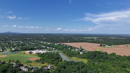
Aerial view of Poolesville, Maryland
-
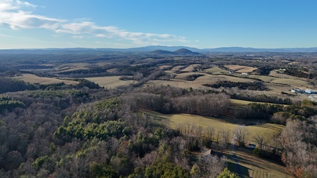
Open land in Fishersville, Virginia
-
Buffalo Gap [02]
![Buffalo Gap [02] (796 visits) Buffalo Gap, a mountain pass through Little North Mountain, near Swoope, Virginia.
More at The Sc... Buffalo Gap [02]](../../../../i/upload/2025/01/03/20250103200607-1abe8192-cu_s9999x250.jpg)
-
Zable Stadium and Cary Field [02]
![Zable Stadium and Cary Field [02] (864 visits) Aerial view of Zable Stadium and Cary Field, which together comprise the football venue at the Colle... Zable Stadium and Cary Field [02]](../../../../i/upload/2025/02/22/20250222000936-370ac2e6-cu_s9999x250.jpg)
-
Zable Stadium and Cary Field [01]
![Zable Stadium and Cary Field [01] (885 visits) Aerial view of Zable Stadium and Cary Field, which together comprise the football venue at the Colle... Zable Stadium and Cary Field [01]](../../../../i/upload/2025/02/22/20250222000929-3373536a-cu_s9999x250.jpg)
-
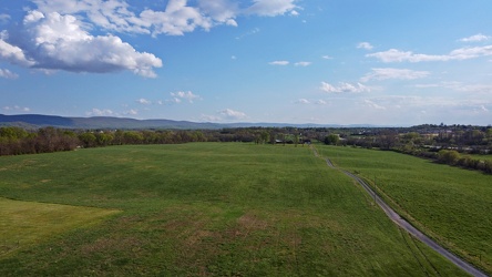
Field in Charles Town, West Virginia
-
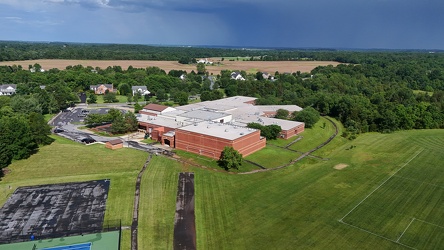
John Poole Middle School
-
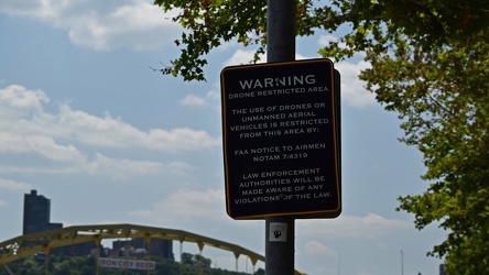
Drone warning sign near Acrisure Stadium
-
Myersville, Maryland and vicinity [01]
![Myersville, Maryland and vicinity [01] (1000 visits) Myersville, Maryland and the immediate surrounding area, viewed from above the Myersville Volunteer ... Myersville, Maryland and vicinity [01]](../../../../i/upload/2024/07/19/20240719114529-b09266dc-cu_s9999x250.jpg)
-
Aerial view of Smithsburg, Maryland [03]
![Aerial view of Smithsburg, Maryland [03] (1002 visits) Aerial view of Smithsburg, Maryland.
Ben Schumin is a professional photographer who captures the in... Aerial view of Smithsburg, Maryland [03]](../../../../i/upload/2024/07/20/20240720155805-a9f3e7ed-cu_s9999x250.jpg)
-
Barbed wire in Laytonsville, Maryland [01]
![Barbed wire in Laytonsville, Maryland [01] (1039 visits) Barbed wire, forming part of a fence along Fieldcrest Road near the intersection with Olney-Laytonsv... Barbed wire in Laytonsville, Maryland [01]](../../../../i/upload/2024/07/17/20240717224812-778e3f3c-cu_s9999x250.jpg)
-
Barbed wire in Laytonsville, Maryland [02]
![Barbed wire in Laytonsville, Maryland [02] (1060 visits) Barbed wire, forming part of a fence along Fieldcrest Road near the intersection with Olney-Laytonsv... Barbed wire in Laytonsville, Maryland [02]](../../../../i/upload/2024/07/19/20240719114810-85a21e17-cu_s9999x250.jpg)
-
Mountains near New Market, Virginia

-
Field of cotton in Goldsboro, North Carolina [10]
![Field of cotton in Goldsboro, North Carolina [10] (1069 visits) Cotton grows in a field along US 117 in Goldsboro, North Carolina.
More at The Schumin Web:
www.sch... Field of cotton in Goldsboro, North Carolina [10]](../../../../i/upload/2024/07/19/20240719201008-d30d3329-cu_s9999x250.jpg)
-
Field of cotton in Goldsboro, North Carolina [06]
![Field of cotton in Goldsboro, North Carolina [06] (1071 visits) Cotton grows in a field along US 117 in Goldsboro, North Carolina.
More at The Schumin Web:
www.sch... Field of cotton in Goldsboro, North Carolina [06]](../../../../i/upload/2024/07/19/20240719200927-92c721b1-cu_s9999x250.jpg)
-
Field of cotton in Goldsboro, North Carolina [08]
![Field of cotton in Goldsboro, North Carolina [08] (1079 visits) Cotton grows in a field along US 117 in Goldsboro, North Carolina.
More at The Schumin Web:
www.sch... Field of cotton in Goldsboro, North Carolina [08]](../../../../i/upload/2024/07/19/20240719200945-18ed26c5-cu_s9999x250.jpg)
-
Field of cotton in Goldsboro, North Carolina [04]
![Field of cotton in Goldsboro, North Carolina [04] (1083 visits) Cotton grows in a field along US 117 in Goldsboro, North Carolina.
More at The Schumin Web:
www.sch... Field of cotton in Goldsboro, North Carolina [04]](../../../../i/upload/2024/07/19/20240719200856-4b8302ec-cu_s9999x250.jpg)
-
Field of cotton in Goldsboro, North Carolina [09]
![Field of cotton in Goldsboro, North Carolina [09] (1086 visits) Cotton grows in a field along US 117 in Goldsboro, North Carolina.
More at The Schumin Web:
www.sch... Field of cotton in Goldsboro, North Carolina [09]](../../../../i/upload/2024/07/19/20240719200959-775444c5-cu_s9999x250.jpg)
-
Aerial view of Smithsburg, Maryland [01]
![Aerial view of Smithsburg, Maryland [01] (1087 visits) Aerial view of Smithsburg, Maryland.
Ben Schumin is a professional photographer who captures the in... Aerial view of Smithsburg, Maryland [01]](../../../../i/upload/2024/07/20/20240720155756-7d354d6c-cu_s9999x250.jpg)
-
Field of cotton in Goldsboro, North Carolina [03]
![Field of cotton in Goldsboro, North Carolina [03] (1089 visits) Cotton grows in a field along US 117 in Goldsboro, North Carolina.
More at The Schumin Web:
www.sch... Field of cotton in Goldsboro, North Carolina [03]](../../../../i/upload/2024/07/19/20240719200833-9b953c76-cu_s9999x250.jpg)
-
Field of cotton in Goldsboro, North Carolina [05]
![Field of cotton in Goldsboro, North Carolina [05] (1091 visits) Cotton grows in a field along US 117 in Goldsboro, North Carolina.
More at The Schumin Web:
www.sch... Field of cotton in Goldsboro, North Carolina [05]](../../../../i/upload/2024/07/19/20240719200901-3ad6c5f2-cu_s9999x250.jpg)
-
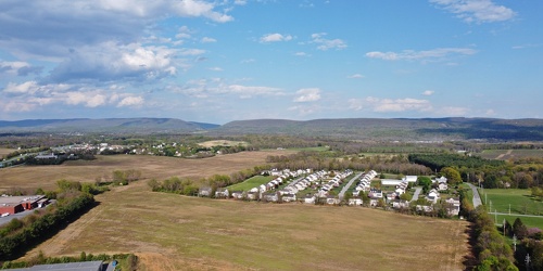
Fields and housing in Charles Town, West Virginia
-
Field of cotton in Goldsboro, North Carolina [07]
![Field of cotton in Goldsboro, North Carolina [07] (1099 visits) Cotton grows in a field along US 117 in Goldsboro, North Carolina.
More at The Schumin Web:
www.sch... Field of cotton in Goldsboro, North Carolina [07]](../../../../i/upload/2024/07/19/20240719200932-11eb34e8-cu_s9999x250.jpg)
-
Field of cotton in Goldsboro, North Carolina [02]
![Field of cotton in Goldsboro, North Carolina [02] (1101 visits) Cotton grows in a field along US 117 in Goldsboro, North Carolina.
More at The Schumin Web:
www.sch... Field of cotton in Goldsboro, North Carolina [02]](../../../../i/upload/2024/07/19/20240719200819-151fba02-cu_s9999x250.jpg)
-
Field of cotton in Goldsboro, North Carolina [11]
![Field of cotton in Goldsboro, North Carolina [11] (1120 visits) Cotton grows in a field along US 117 in Goldsboro, North Carolina.
More at The Schumin Web:
www.sch... Field of cotton in Goldsboro, North Carolina [11]](../../../../i/upload/2024/07/19/20240719201013-cca7f6a8-cu_s9999x250.jpg)
-
Field of cotton in Goldsboro, North Carolina [01]
![Field of cotton in Goldsboro, North Carolina [01] (1122 visits) Cotton grows in a field along US 117 in Goldsboro, North Carolina.
More at The Schumin Web:
www.sch... Field of cotton in Goldsboro, North Carolina [01]](../../../../i/upload/2024/07/19/20240719200140-3f2f49c8-cu_s9999x250.jpg)
-
Field south of Waynesboro Town Center [02]
![Field south of Waynesboro Town Center [02] (1133 visits) Open fields south of Waynesboro Town Center, a shopping center in Waynesboro, Virginia.
Ben Schumin... Field south of Waynesboro Town Center [02]](../../../../i/upload/2024/07/19/20240719164011-bfef621f-cu_s9999x250.jpg)
-
Field south of Waynesboro Town Center [03]
![Field south of Waynesboro Town Center [03] (1134 visits) Open fields south of Waynesboro Town Center, a shopping center in Waynesboro, Virginia.
Ben Schumin... Field south of Waynesboro Town Center [03]](../../../../i/upload/2024/07/19/20240719164113-3872f41a-cu_s9999x250.jpg)
-
Field of cotton in Goldsboro, North Carolina [12]
![Field of cotton in Goldsboro, North Carolina [12] (1147 visits) Cotton grows in a field along US 117 in Goldsboro, North Carolina.
More at The Schumin Web:
www.sch... Field of cotton in Goldsboro, North Carolina [12]](../../../../i/upload/2024/07/19/20240719201019-0510e072-cu_s9999x250.jpg)
-
Field off of Buchanan Valley Road [01]
![Field off of Buchanan Valley Road [01] (1152 visits) Field off of Buchanan Valley Road near Cashtown, Pennsylvania.
Ben Schumin is a professional photog... Field off of Buchanan Valley Road [01]](../../../../i/upload/2024/07/20/20240720151904-0d791d12-cu_s9999x250.jpg)
-
Honda HR-V in a field near Martinsburg [02]
![Honda HR-V in a field near Martinsburg [02] (1156 visits) My Honda HR-V, parked in a field near Martinsburg, West Virginia.
Alternate treatment of same pho... Honda HR-V in a field near Martinsburg [02]](../../../../i/upload/2024/07/19/20240719103527-190606e6-cu_s9999x250.jpg)
-
Field of cotton in Goldsboro, North Carolina [13]
![Field of cotton in Goldsboro, North Carolina [13] (1161 visits) Cotton grows in a field along US 117 in Goldsboro, North Carolina.
More at The Schumin Web:
www.sch... Field of cotton in Goldsboro, North Carolina [13]](../../../../i/upload/2024/07/19/20240719201023-cf0514ea-cu_s9999x250.jpg)
-
Field off of Buchanan Valley Road [02]
![Field off of Buchanan Valley Road [02] (1176 visits) Field off of Buchanan Valley Road near Cashtown, Pennsylvania.
Ben Schumin is a professional photog... Field off of Buchanan Valley Road [02]](../../../../i/upload/2024/07/20/20240720151916-e473a17f-cu_s9999x250.jpg)
-
Field south of Waynesboro Town Center [01]
![Field south of Waynesboro Town Center [01] (1177 visits) Open fields south of Waynesboro Town Center, a shopping center in Waynesboro, Virginia.
Ben Schumin... Field south of Waynesboro Town Center [01]](../../../../i/upload/2024/07/19/20240719164131-8c6e4a64-cu_s9999x250.jpg)
-
Honda HR-V in a field near Martinsburg [01]
![Honda HR-V in a field near Martinsburg [01] (1189 visits) My Honda HR-V, parked in a field near Martinsburg, West Virginia.
Alternate treatment of same pho... Honda HR-V in a field near Martinsburg [01]](../../../../i/upload/2024/07/19/20240719103523-10c96365-cu_s9999x250.jpg)
-
Aerial view of Smithsburg, Maryland [02]
![Aerial view of Smithsburg, Maryland [02] (1193 visits) Aerial view of Smithsburg, Maryland.
Ben Schumin is a professional photographer who captures the in... Aerial view of Smithsburg, Maryland [02]](../../../../i/upload/2024/07/20/20240720155800-cb15da92-cu_s9999x250.jpg)
-
Trees near Cashtown, Pennsylvania

-
Power transmission lines in Frederick County [01]
![Power transmission lines in Frederick County [01] (1318 visits) Power transmission lines near Ballenger Creek Pike and Mountville Road in Frederick County, Maryland... Power transmission lines in Frederick County [01]](../../../../i/upload/2024/07/19/20240719093435-6cd9373f-cu_s9999x250.jpg)
-
Field of cotton in Goldsboro, North Carolina [14]
![Field of cotton in Goldsboro, North Carolina [14] (1318 visits) Elyse Horvath holds up a clump of freshly picked cotton, from a field along US 117 in Goldsboro, Nor... Field of cotton in Goldsboro, North Carolina [14]](../../../../i/upload/2024/07/19/20240719201028-54607776-cu_s9999x250.jpg)
-
Augusta County Industrial Sites sign [03]
![Augusta County Industrial Sites sign [03] (1345 visits) Sign in a field near Interstate 81 promoting industrial sites in Augusta County, Virginia, near the ... Augusta County Industrial Sites sign [03]](../../../../i/upload/2024/07/20/20240720110806-3fc5b067-cu_s9999x250.jpg)
-
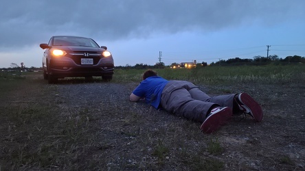
Elyse photographs the HR-V
-
Augusta County Industrial Sites sign [04]
![Augusta County Industrial Sites sign [04] (1389 visits) Sign in a field near Interstate 81 promoting industrial sites in Augusta County, Virginia, near the ... Augusta County Industrial Sites sign [04]](../../../../i/upload/2024/07/20/20240720110817-4685b8f3-cu_s9999x250.jpg)
-
Power transmission lines in Frederick County [02]
![Power transmission lines in Frederick County [02] (1395 visits) Power transmission lines near Ballenger Creek Pike and Mountville Road in Frederick County, Maryland... Power transmission lines in Frederick County [02]](../../../../i/upload/2024/07/19/20240719093429-9f31f834-cu_s9999x250.jpg)
-
Field of cotton in Goldsboro, North Carolina [15]
![Field of cotton in Goldsboro, North Carolina [15] (1417 visits) Elyse Horvath photographs cotton in a field along US 117 in Goldsboro, North Carolina.
More at The ... Field of cotton in Goldsboro, North Carolina [15]](../../../../i/upload/2024/07/19/20240719201034-cbf04685-cu_s9999x250.jpg)
-
Sunset near Gettysburg, Pennsylvania [01]
![Sunset near Gettysburg, Pennsylvania [01] (1435 visits) Sunset over fields along US 15 business near Gettysburg, Pennsylvania. The air was a bit hazy on th... Sunset near Gettysburg, Pennsylvania [01]](../../../../i/upload/2024/07/19/20240719170930-530c41ea-cu_s9999x250.jpg)
-
Augusta County Industrial Sites sign [05]
![Augusta County Industrial Sites sign [05] (1435 visits) Sign in a field near Interstate 81 promoting industrial sites in Augusta County, Virginia, near the ... Augusta County Industrial Sites sign [05]](../../../../i/upload/2024/07/20/20240720110828-d0f587e4-cu_s9999x250.jpg)
-
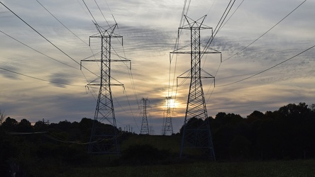
Power transmission lines in Laytonsville
-
FedEx Field from Largo Town Center garage
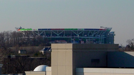
-
N88327 travels over Scarborough
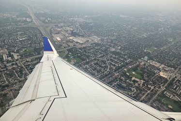
-
Fairfield, Pennsylvania [02]
![Fairfield, Pennsylvania [02] (1451 visits) Aerial view of Fairfield, a town in Adams County, Pennsylvania. The air was a bit hazy on this part... Fairfield, Pennsylvania [02]](../../../../i/upload/2024/07/19/20240719170855-9f47cc5b-cu_s9999x250.jpg)
-
Augusta County Industrial Sites sign [06]
![Augusta County Industrial Sites sign [06] (1479 visits) Sign in a field near Interstate 81 promoting industrial sites in Augusta County, Virginia, near the ... Augusta County Industrial Sites sign [06]](../../../../i/upload/2024/07/20/20240720110839-ba9d0dab-cu_s9999x250.jpg)
-
Sunset near Gettysburg, Pennsylvania [02]
![Sunset near Gettysburg, Pennsylvania [02] (1480 visits) Sunset over fields along US 15 business near Gettysburg, Pennsylvania. The air was a bit hazy on th... Sunset near Gettysburg, Pennsylvania [02]](../../../../i/upload/2024/07/19/20240719170934-9483611c-cu_s9999x250.jpg)
-
Churchville, Virginia, facing northeast
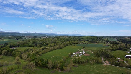
-
Payphone in Head Waters, Virginia [01]
![Payphone in Head Waters, Virginia [01] (1517 visits) A payphone in a relatively random location on the side of US 250 in Head Waters, Virginia. This pay... Payphone in Head Waters, Virginia [01]](../../../../i/upload/2024/07/20/20240720094301-6db6c91c-cu_s9999x250.jpg)
-
Elyse holds Woomy by the arm

-
Schneider Community Park
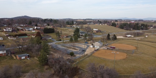
-
Hangar at Hagerstown airport
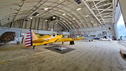
-
Payphone in Head Waters, Virginia [02]
![Payphone in Head Waters, Virginia [02] (1573 visits) A payphone in a relatively random location on the side of US 250 in Head Waters, Virginia. This pay... Payphone in Head Waters, Virginia [02]](../../../../i/upload/2024/07/20/20240720094306-5ef3c0a3-cu_s9999x250.jpg)
-
Woomy tries to drive a Jeep

-
US 250 west of Monterey, Virginia
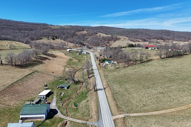
-
Empty store at Cromwell Field Shopping Center
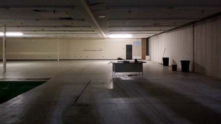
-
US 220 south of Monterey, Virginia
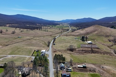
-
Buffalo Gap [01]
![Buffalo Gap [01] (1708 visits) Buffalo Gap, a mountain pass through Little North Mountain, near Swoope, Virginia.
Ben Schumin is... Buffalo Gap [01]](../../../../i/upload/2024/07/19/20240719164455-62064f1c-cu_s9999x250.jpg)
-
View of Pittsburgh from Duquesne Incline [05]
![View of Pittsburgh from Duquesne Incline [05] (1760 visits) View of Pittsburgh, Pennsylvania from the Duquesne Incline observation platform.
More at The Schumi... View of Pittsburgh from Duquesne Incline [05]](../../../../i/upload/2024/07/18/20240718220810-0960e30c-cu_s9999x250.jpg)
-
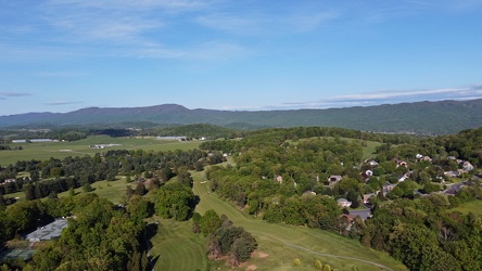
Harrisonburg east of Route 33
-
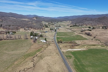
US 220 north of Monterey, Virginia
-
Communications antenna near Sandy Point [02]
![Communications antenna near Sandy Point [02] (1798 visits) Communications antenna off of College Parkway in Annapolis, Maryland, near Sandy Point State Park, o... Communications antenna near Sandy Point [02]](../../../../i/upload/2024/07/19/20240719162507-ac6b866a-cu_s9999x250.jpg)
-
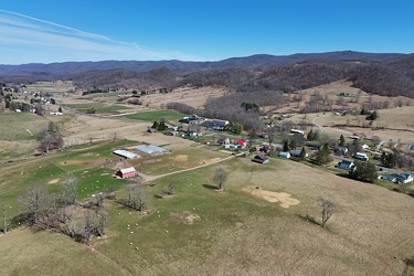
North end of Monterey, Virginia
-
Communications antenna near Sandy Point [01]
![Communications antenna near Sandy Point [01] (1841 visits) Communications antenna off of College Parkway in Annapolis, Maryland, near Sandy Point State Park, o... Communications antenna near Sandy Point [01]](../../../../i/upload/2024/07/19/20240719162602-e02abfc3-cu_s9999x250.jpg)
-
Paint Branch High School [11]
![Paint Branch High School [11] (1870 visits) Lights over the football statium at Paint Branch High School, a public high school on Old Columbia P... Paint Branch High School [11]](../../../../i/upload/2024/12/22/20241222233237-dd57e6bd-cu_s9999x250.jpg)
-
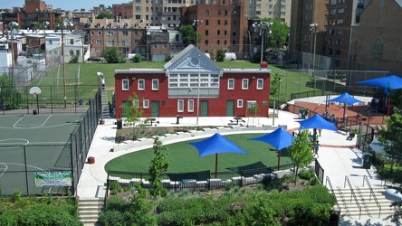
Stead Park, viewed from 1616 P Street NW
-
Paint Branch High School [13]
![Paint Branch High School [13] (1909 visits) Lights over the football statium at Paint Branch High School, a public high school on Old Columbia P... Paint Branch High School [13]](../../../../i/upload/2024/12/22/20241222233246-0ecb0ec8-cu_s9999x250.jpg)
-
Paint Branch High School [17]
![Paint Branch High School [17] (1912 visits) Aerial view of the football field at Paint Branch High School, a public high school on Old Columbia ... Paint Branch High School [17]](../../../../i/upload/2024/12/22/20241222233304-e492dd5c-cu_s9999x250.jpg)
-
Paint Branch High School [03]
![Paint Branch High School [03] (1922 visits) Aerial view of Paint Branch High School, a public high school on Old Columbia Pike in Burtonsville, ... Paint Branch High School [03]](../../../../i/upload/2024/12/22/20241222233155-1e477559-cu_s9999x250.jpg)