-
Triple Crossing area [01]
![Triple Crossing area [01] (8252 visits) Area around the Triple Crossing, in the Shockoe Bottom neighborhood of Richmond, Virginia.
More at ... Triple Crossing area [01]](../../../../i/upload/2024/07/17/20240717155358-ef286524-cu_s9999x250.jpg)
-
Canal Walk through Shockoe Bottom [02]
![Canal Walk through Shockoe Bottom [02] (1673 visits) The Canal Walk as it passes through the Shockoe Bottom neighborhood, in the shadow of the Downtown E... Canal Walk through Shockoe Bottom [02]](../../../../i/upload/2024/07/17/20240717155340-89b9c324-cu_s9999x250.jpg)
-
Canal Walk through Shockoe Bottom [01]
![Canal Walk through Shockoe Bottom [01] (2490 visits) The Canal Walk as it passes through the Shockoe Bottom neighborhood, in the shadow of the Downtown E... Canal Walk through Shockoe Bottom [01]](../../../../i/upload/2024/07/17/20240717155345-29a96509-cu_s9999x250.jpg)
-
Triple Crossing area [02]
![Triple Crossing area [02] (4379 visits) Area around the Triple Crossing, in the Shockoe Bottom neighborhood of Richmond, Virginia.
More at ... Triple Crossing area [02]](../../../../i/upload/2024/07/17/20240717155355-a9821d17-cu_s9999x250.jpg)
-
Canal Walk through Shockoe Bottom [03]
![Canal Walk through Shockoe Bottom [03] (1460 visits) The Canal Walk as it passes through the Shockoe Bottom neighborhood, in the shadow of the Downtown E... Canal Walk through Shockoe Bottom [03]](../../../../i/upload/2024/07/17/20240717155332-20a25b99-cu_s9999x250.jpg)
-
Robert E. Lee Memorial Bridge
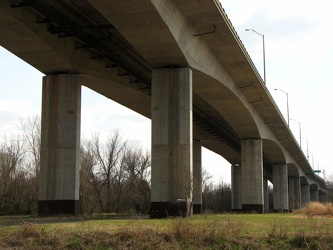
-
Robert E. Lee Memorial Bridge and Belle Isle pedestrian bridge [02]
![Robert E. Lee Memorial Bridge and Belle Isle pedestrian bridge [02] (2113 visits) The Robert E. Lee Memorial Bridge, with the Belle Isle pedestrian bridge suspended beneath by cables... Robert E. Lee Memorial Bridge and Belle Isle pedestrian bridge [02]](../../../../i/upload/2024/07/17/20240717155125-6acbde52-cu_s9999x250.jpg)
-
Robert E. Lee Memorial Bridge and Belle Isle pedestrian bridge [01]
![Robert E. Lee Memorial Bridge and Belle Isle pedestrian bridge [01] (3410 visits) The Robert E. Lee Memorial Bridge, with the Belle Isle pedestrian bridge suspended beneath by cables... Robert E. Lee Memorial Bridge and Belle Isle pedestrian bridge [01]](../../../../i/upload/2024/07/17/20240717155128-6aa706b6-cu_s9999x250.jpg)
-
Canal Walk through Shockoe Bottom [04]
![Canal Walk through Shockoe Bottom [04] (2649 visits) The Canal Walk as it passes through Richmond, Virginia's Shockoe Bottom neighborhood, in the shadow ... Canal Walk through Shockoe Bottom [04]](../../../../i/upload/2024/07/17/20240717155024-693f8160-cu_s9999x250.jpg)
-
Ramp to Downtown Expressway [02]
![Ramp to Downtown Expressway [02] (3035 visits) Highway ramp connecting northbound Interstate 95 to the Downtown Expressway over the Canal in Richmo... Ramp to Downtown Expressway [02]](../../../../i/upload/2024/07/17/20240717155008-eff88bf6-cu_s9999x250.jpg)
-
Ramp to Downtown Expressway [01]
![Ramp to Downtown Expressway [01] (3506 visits) Highway ramp connecting northbound Interstate 95 to the Downtown Expressway over the Canal in Richmo... Ramp to Downtown Expressway [01]](../../../../i/upload/2024/07/17/20240717155016-33eaba18-cu_s9999x250.jpg)
-
Canal Walk through Shockoe Bottom [05]
![Canal Walk through Shockoe Bottom [05] (2585 visits) The Canal Walk as it passes through Richmond, Virginia's Shockoe Bottom neighborhood, in the shadow ... Canal Walk through Shockoe Bottom [05]](../../../../i/upload/2024/07/17/20240717155021-9a708136-cu_s9999x250.jpg)
-
Interstate 95 near Fredericksburg
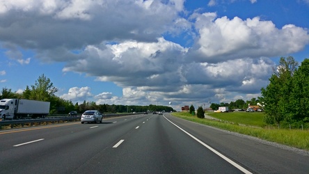
-
Roosevelt Bridge
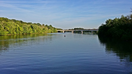
-
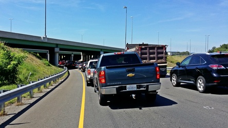
Traffic backup on Interstate 64
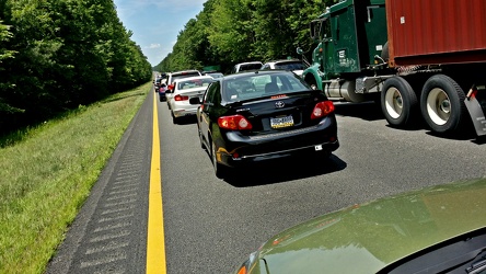
-
Interstate 66, Exit 43A westbound
-
Date stamp on rest area pavement
-
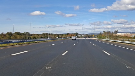
Interstate 66 westbound, near Gainesville
-
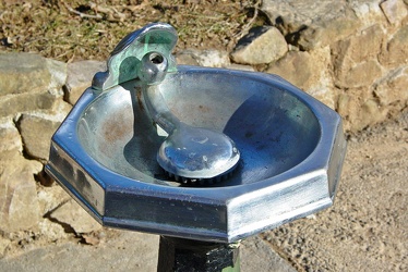
Water fountain at Troutville rest area
-
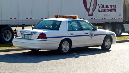
Virginia Motorist Assistance vehicle
-
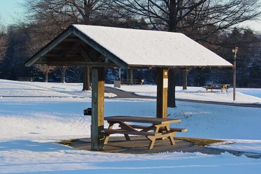
Picnic table at New Market rest area northbound
-
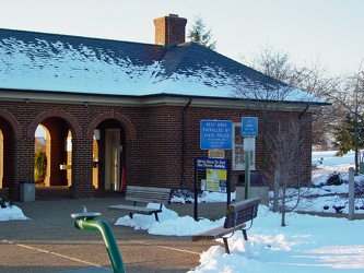
New Market rest area, I-81 northbound
-
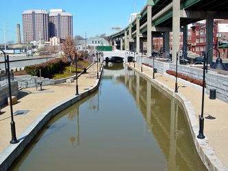
Canal Walk near Shockoe Bottom
-
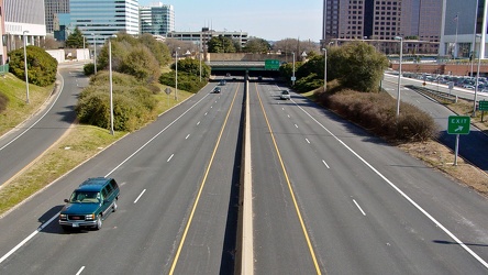
Downtown Expressway
-
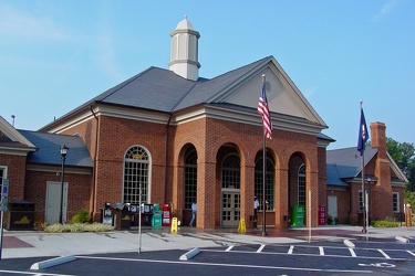
New Kent rest area, eastbound
-
Hampton Roads Bridge-Tunnel, westbound [01]
![Hampton Roads Bridge-Tunnel, westbound [01] (9600 visits) Sign marking the beginning of the Hampton Roads Bridge-Tunnel complex on Interstate 64 westbound, in... Hampton Roads Bridge-Tunnel, westbound [01]](../../../../i/upload/2024/07/14/20240714234955-62e4e126-cu_s9999x250.jpg)
-
Hampton Roads Bridge-Tunnel, westbound [02]
![Hampton Roads Bridge-Tunnel, westbound [02] (46535 visits) Eastbound side of the Hampton Roads Bridge-Tunnel, viewed from the westbound span.
More at The Schu... Hampton Roads Bridge-Tunnel, westbound [02]](../../../../i/upload/2024/07/14/20240714234951-dbc0fd5f-cu_s9999x250.jpg)
-
Hampton Roads Bridge-Tunnel, westbound [03]
![Hampton Roads Bridge-Tunnel, westbound [03] (47108 visits) Approach to the east portal of the Hampton Roads Bridge Tunnel on the westbound side.
More at The S... Hampton Roads Bridge-Tunnel, westbound [03]](../../../../i/upload/2024/07/14/20240714234950-d2db0c37-cu_s9999x250.jpg)
-
Hampton Roads Bridge-Tunnel, westbound [04]
![Hampton Roads Bridge-Tunnel, westbound [04] (3353 visits) East portal of the Hampton Roads Bridge Tunnel on the westbound side.
More at The Schumin Web:
www.... Hampton Roads Bridge-Tunnel, westbound [04]](../../../../i/upload/2024/07/14/20240714234959-48ab2d91-cu_s9999x250.jpg)
-
Hampton Roads Bridge-Tunnel, westbound [05]
![Hampton Roads Bridge-Tunnel, westbound [05] (3552 visits) Westbound traffic exits the west portal of the Hampton Roads Bridge-Tunnel.
More at The Schumin Web... Hampton Roads Bridge-Tunnel, westbound [05]](../../../../i/upload/2024/07/14/20240714234958-245d8a80-cu_s9999x250.jpg)
-
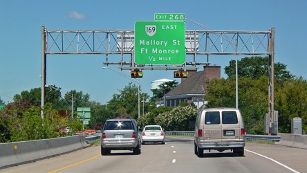
Sign for Exit 268
-
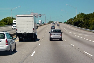
Interstate 64 westbound in Hampton, Virginia
-
Westbound Interstate 66 near Nutley Street
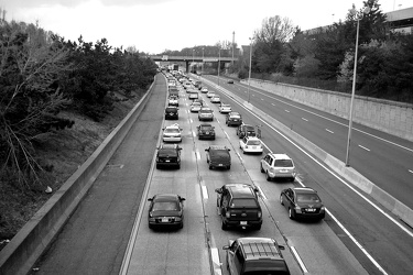
-
Picnic table at New Market rest area, I-81 northbound [01]
![Picnic table at New Market rest area, I-81 northbound [01] (1520 visits) Picnic table at the rest area on Interstate 81 northbound, near New Market, Virginia.
Ben Schumin i... Picnic table at New Market rest area, I-81 northbound [01]](../../../../i/upload/2024/07/15/20240715214504-0bd029bd-cu_s9999x250.jpg)
-
Picnic table at New Market rest area, I-81 northbound [02]
![Picnic table at New Market rest area, I-81 northbound [02] (1564 visits) Picnic table at the rest area on Interstate 81 northbound, near New Market, Virginia.
Ben Schumin i... Picnic table at New Market rest area, I-81 northbound [02]](../../../../i/upload/2024/07/15/20240715214459-0df29e63-cu_s9999x250.jpg)
-
Bench at New Market rest area [02]
![Bench at New Market rest area [02] (1541 visits) Bench at the rest area on Interstate 81 northbound, near New Market, Virginia.
Alternate treatmen... Bench at New Market rest area [02]](../../../../i/upload/2024/07/15/20240715214500-d6effc3b-cu_s9999x250.jpg)
-
Bench at New Market rest area [01]
![Bench at New Market rest area [01] (1551 visits) Bench at the rest area on Interstate 81 northbound, near New Market, Virginia.
Alternate treatmen... Bench at New Market rest area [01]](../../../../i/upload/2024/07/15/20240715214502-89d88a56-cu_s9999x250.jpg)
-
Dulles Toll Road eastern plaza
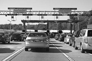
-
Payphone at New Market rest area [02]
![Payphone at New Market rest area [02] (2662 visits) Payphone at the rest area on Interstate 81 northbound, near New Market, Virginia.
Ben Schumin is a ... Payphone at New Market rest area [02]](../../../../i/upload/2024/07/17/20240717101528-9876c113-cu_s9999x250.jpg)
-
Payphone at New Market rest area [01]
![Payphone at New Market rest area [01] (2720 visits) Payphone at the rest area on Interstate 81 northbound, near New Market, Virginia.
Ben Schumin is a ... Payphone at New Market rest area [01]](../../../../i/upload/2024/07/17/20240717101532-2c8ed3e3-cu_s9999x250.jpg)
-
Interstate 81 through Harrisonburg, Virginia
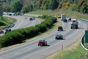
-
Bridge over Canal in Richmond, Virginia
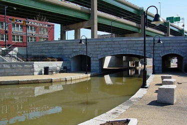
-
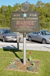
Blue Star Memorial Highway marker at New Market rest area
-
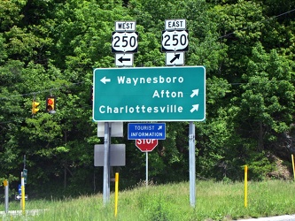
Directional signage at the end of the ramp for Interstate 64, Exit 99 at Rockfish Gap
-
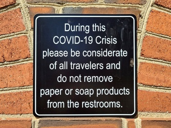
COVID-19 rest area signage
-
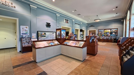
Interior of New Kent rest area, eastbound
-
South Norfolk Jordan Bridge [02]
![South Norfolk Jordan Bridge [02] (2648 visits) The South Norfolk Jordan Bridge, commonly known as simply the Jordan Bridge, is a privately owned an... South Norfolk Jordan Bridge [02]](../../../../i/upload/2024/07/19/20240719101756-29d2696c-cu_s9999x250.jpg)
-
South Norfolk Jordan Bridge [01]
![South Norfolk Jordan Bridge [01] (2850 visits) The South Norfolk Jordan Bridge, commonly known as simply the Jordan Bridge, is a privately owned an... South Norfolk Jordan Bridge [01]](../../../../i/upload/2024/07/19/20240719101801-ff660e17-cu_s9999x250.jpg)
-
South Norfolk Jordan Bridge [04]
![South Norfolk Jordan Bridge [04] (2948 visits) The South Norfolk Jordan Bridge, commonly known as simply the Jordan Bridge, is a privately owned an... South Norfolk Jordan Bridge [04]](../../../../i/upload/2024/07/19/20240719101811-3ebcdc7d-cu_s9999x250.jpg)
-
South Norfolk Jordan Bridge [03]
![South Norfolk Jordan Bridge [03] (2933 visits) The South Norfolk Jordan Bridge, commonly known as simply the Jordan Bridge, is a privately owned an... South Norfolk Jordan Bridge [03]](../../../../i/upload/2024/07/19/20240719101829-ff0de2c9-cu_s9999x250.jpg)
-
Interstate 264 after Midtown Tunnel [01]
![Interstate 264 after Midtown Tunnel [01] (1475 visits) Interstate 264 westbound in Portsmouth, Virginia, just after traffic exits the Midtown Tunnel.
More... Interstate 264 after Midtown Tunnel [01]](../../../../i/upload/2024/07/19/20240719101939-87dbaa40-cu_s9999x250.jpg)
-
Interstate 264 after Midtown Tunnel [02]
![Interstate 264 after Midtown Tunnel [02] (1127 visits) Interstate 264 westbound in Portsmouth, Virginia, just after traffic exits the Midtown Tunnel.
More... Interstate 264 after Midtown Tunnel [02]](../../../../i/upload/2024/07/19/20240719101945-e18e6752-cu_s9999x250.jpg)
-
Interstate 264 after Midtown Tunnel [03]
![Interstate 264 after Midtown Tunnel [03] (2739 visits) Interstate 264 westbound in Portsmouth, Virginia, just after traffic exits the Midtown Tunnel.
More... Interstate 264 after Midtown Tunnel [03]](../../../../i/upload/2024/07/19/20240719102008-7fa5c14e-cu_s9999x250.jpg)
-
Interstate 264 after Midtown Tunnel [04]
![Interstate 264 after Midtown Tunnel [04] (2904 visits) Interstate 264 westbound in Portsmouth, Virginia, just after traffic exits the Midtown Tunnel.
More... Interstate 264 after Midtown Tunnel [04]](../../../../i/upload/2024/07/19/20240719102003-a91bfec6-cu_s9999x250.jpg)
-
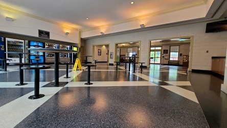
Interior of New Kent rest area, westbound
-
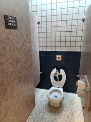
Child/toddler friendly stall at New Kent rest area
-
Goochland rest area, westbound [02]
![Goochland rest area, westbound [02] (1683 visits) Restroom building at the Goochland Safety Rest Area on Interstate 64 westbound in Manakin-Sabot, Vir... Goochland rest area, westbound [02]](../../../../i/upload/2024/07/19/20240719093125-c06aafb1-cu_s9999x250.jpg)
-
Goochland rest area, westbound [01]
![Goochland rest area, westbound [01] (1708 visits) Restroom building at the Goochland Safety Rest Area on Interstate 64 westbound in Manakin-Sabot, Vir... Goochland rest area, westbound [01]](../../../../i/upload/2024/07/19/20240719093130-dbdf3bb4-cu_s9999x250.jpg)
-
Signage for Exit 49 on Interstate 295 [01]
![Signage for Exit 49 on Interstate 295 [01] (2764 visits) Overhead sign for Exit 49 (US 33) on Interstate 295 eastbound in Glen Allen, Virginia.
More at The ... Signage for Exit 49 on Interstate 295 [01]](../../../../i/upload/2024/07/19/20240719093116-72eb08f8-cu_s9999x250.jpg)
-
Goochland rest area, westbound [03]
![Goochland rest area, westbound [03] (1722 visits) Restroom building at the Goochland Safety Rest Area on Interstate 64 westbound in Manakin-Sabot, Vir... Goochland rest area, westbound [03]](../../../../i/upload/2024/07/19/20240719093121-0aeca88a-cu_s9999x250.jpg)
-
Signage for Exit 49 on Interstate 295 [02]
![Signage for Exit 49 on Interstate 295 [02] (1405 visits) Overhead sign for Exit 49 (US 33) on Interstate 295 eastbound in Glen Allen, Virginia.
More at The ... Signage for Exit 49 on Interstate 295 [02]](../../../../i/upload/2024/07/19/20240719092939-b220cdd7-cu_s9999x250.jpg)
-
Signage for Exit 49 on Interstate 295 [04]
![Signage for Exit 49 on Interstate 295 [04] (2797 visits) Overhead sign for Exit 49 (US 33) on Interstate 295 eastbound in Glen Allen, Virginia.
More at The ... Signage for Exit 49 on Interstate 295 [04]](../../../../i/upload/2024/07/19/20240719092929-00e8a658-cu_s9999x250.jpg)
-
Signage for Exit 49 on Interstate 295 [03]
![Signage for Exit 49 on Interstate 295 [03] (2795 visits) Overhead sign for Exit 49 (US 33) on Interstate 295 eastbound in Glen Allen, Virginia.
More at The ... Signage for Exit 49 on Interstate 295 [03]](../../../../i/upload/2024/07/19/20240719092934-ceaf9b98-cu_s9999x250.jpg)
-
Signage for Exit 49 on Interstate 295 [05]
![Signage for Exit 49 on Interstate 295 [05] (1511 visits) Overhead sign for Exit 49 (US 33) on Interstate 295 eastbound in Glen Allen, Virginia.
More at The ... Signage for Exit 49 on Interstate 295 [05]](../../../../i/upload/2024/07/19/20240719092857-ab204ec0-cu_s9999x250.jpg)
-
Signage for Exit 49 on Interstate 295 [06]
![Signage for Exit 49 on Interstate 295 [06] (1483 visits) Overhead sign for Exit 49 (US 33) on Interstate 295 eastbound in Glen Allen, Virginia.
More at The ... Signage for Exit 49 on Interstate 295 [06]](../../../../i/upload/2024/07/19/20240719092924-a67ffbc2-cu_s9999x250.jpg)
-
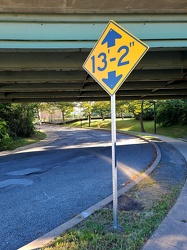
Low clearance sign at West Falls Church station
-
Interstate 64 in Nelson County, Virginia [01]
![Interstate 64 in Nelson County, Virginia [01] (10513 visits) Interstate 64 in Nelson County, Virginia, near Rockfish Gap. US 250 runs adjacent to the freeway.
... Interstate 64 in Nelson County, Virginia [01]](../../../../i/upload/2024/07/19/20240719115200-c8a2ce39-cu_s9999x250.jpg)
-
Interstate 64 in Nelson County, Virginia [02]
![Interstate 64 in Nelson County, Virginia [02] (10671 visits) Interstate 64 in Nelson County, Virginia, near Rockfish Gap. US 250 runs adjacent to the freeway.
... Interstate 64 in Nelson County, Virginia [02]](../../../../i/upload/2024/07/19/20240719115847-184fa12a-cu_s9999x250.jpg)
-
Interstate 64 in Nelson County, Virginia [03]
![Interstate 64 in Nelson County, Virginia [03] (10858 visits) Interstate 64 in Nelson County, Virginia, near Rockfish Gap. US 250 runs adjacent to the freeway.
... Interstate 64 in Nelson County, Virginia [03]](../../../../i/upload/2024/07/19/20240719115902-ff5fb9e1-cu_s9999x250.jpg)
-
Blue Ridge Mountains near Rockfish Gap [01]
![Blue Ridge Mountains near Rockfish Gap [01] (1451 visits) The Blue Ridge Mountains, viewed from above the Interstate 64 scenic overlook in Nelson County, Virg... Blue Ridge Mountains near Rockfish Gap [01]](../../../../i/upload/2024/07/19/20240719115911-d105cde8-cu_s9999x250.jpg)
-
Blue Ridge Mountains near Rockfish Gap [02]
![Blue Ridge Mountains near Rockfish Gap [02] (1413 visits) The Blue Ridge Mountains, viewed from above the Interstate 64 scenic overlook in Nelson County, Virg... Blue Ridge Mountains near Rockfish Gap [02]](../../../../i/upload/2024/07/19/20240719115926-47f38290-cu_s9999x250.jpg)
-
Interstate 64 near Rockfish Gap [01]
![Interstate 64 near Rockfish Gap [01] (65833 visits) Interstate 64, near Rockfish Gap in Virginia.
Ben Schumin is a professional photographer who captur... Interstate 64 near Rockfish Gap [01]](../../../../i/upload/2024/07/19/20240719120555-d0d3c2ce-cu_s9999x250.jpg)
-
Interstate 64 near Rockfish Gap [02]
![Interstate 64 near Rockfish Gap [02] (2861 visits) Interstate 64, near Rockfish Gap in Virginia. The bridge in the foreground carries Skyline Drive ov... Interstate 64 near Rockfish Gap [02]](../../../../i/upload/2024/07/19/20240719120604-e2ad25dd-cu_s9999x250.jpg)
-
Interstate 64 near Rockfish Gap [03]
![Interstate 64 near Rockfish Gap [03] (2872 visits) Interstate 64, near Rockfish Gap in Virginia. The bridge in the foreground carries Skyline Drive ov... Interstate 64 near Rockfish Gap [03]](../../../../i/upload/2024/07/19/20240719120613-6e2190f6-cu_s9999x250.jpg)
-
Interstate 64 near Rockfish Gap [04]
![Interstate 64 near Rockfish Gap [04] (2883 visits) Interstate 64, near Rockfish Gap in Virginia. The bridge in the foreground carries Skyline Drive ov... Interstate 64 near Rockfish Gap [04]](../../../../i/upload/2024/07/19/20240719120620-49d9b327-cu_s9999x250.jpg)
-
Interstate 64 near Rockfish Gap [05]
![Interstate 64 near Rockfish Gap [05] (10684 visits) Interstate 64, near Rockfish Gap in Virginia. The boundary between Augusta and Nelson Counties runs... Interstate 64 near Rockfish Gap [05]](../../../../i/upload/2024/07/19/20240719120629-90e00218-cu_s9999x250.jpg)
-
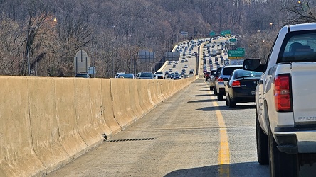
Rubbernecking on the Capital Beltway
-
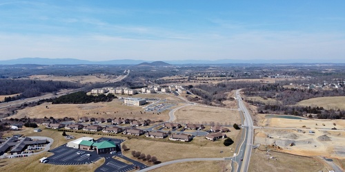
Fishersville, Virginia, near Augusta Health
-
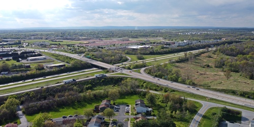
Intersection of US 340 and West Virginia Routes 9 and 51
-
Zero Effluent Discharge sign at Ivy rest area [01]
![Zero Effluent Discharge sign at Ivy rest area [01] (2071 visits) Sign at the rest area along Interstate 64 westbound near Ivy, Virginia explaining that the rest area... Zero Effluent Discharge sign at Ivy rest area [01]](../../../../i/upload/2024/07/19/20240719165907-357f8f51-cu_s9999x250.jpg)