-
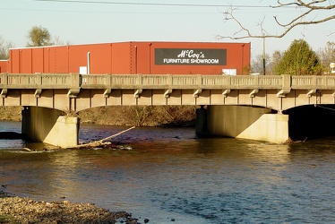
South River in Waynesboro
-
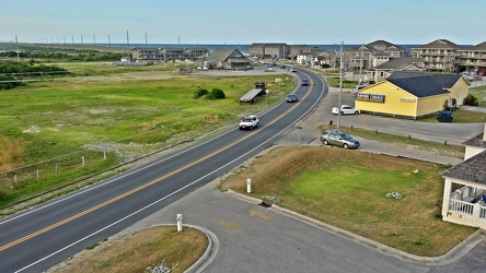
North Carolina Route 12 in Buxton
-
Hatteras Island Beach Access 38 [01]
![Hatteras Island Beach Access 38 [01] (3761 visits) Hatteras Island Beach Access 38, at the south end of Avon, North Carolina. The access consists of a... Hatteras Island Beach Access 38 [01]](../../../../i/upload/2024/07/17/20240717230623-ac88eb70-cu_s9999x250.jpg)
-
Variable message sign discouraging travel and encouraging mask wearing [01]
![Variable message sign discouraging travel and encouraging mask wearing [01] (3560 visits) Variable message sign displaying a message discouraging travel and encouraging mask wearing, ostensi... Variable message sign discouraging travel and encouraging mask wearing [01]](../../../../i/upload/2024/07/19/20240719123453-94f55986-cu_s9999x250.jpg)
-
Variable message sign discouraging travel and encouraging mask wearing [02]
![Variable message sign discouraging travel and encouraging mask wearing [02] (3613 visits) Variable message sign displaying a message discouraging travel and encouraging mask wearing, ostensi... Variable message sign discouraging travel and encouraging mask wearing [02]](../../../../i/upload/2024/07/19/20240719123458-c21fd7cf-cu_s9999x250.jpg)
-
US 29 Business in Culpeper, Virginia [01]
![US 29 Business in Culpeper, Virginia [01] (3146 visits) Aerial view of US 29 Business on the north side of Culpeper, Virginia. View facing approximately ea... US 29 Business in Culpeper, Virginia [01]](../../../../i/upload/2024/07/19/20240719155959-cf1d0444-cu_s9999x250.jpg)
-
Aerial view of Glen Burnie, Maryland [01]
![Aerial view of Glen Burnie, Maryland [01] (1619 visits) Aerial view of Glen Burnie, Maryland, taken near Marley Station Mall.
Ben Schumin is a professional... Aerial view of Glen Burnie, Maryland [01]](../../../../i/upload/2024/07/19/20240719162345-6a1470e1-cu_s9999x250.jpg)
-
Aerial view of Glen Burnie, Maryland [02]
![Aerial view of Glen Burnie, Maryland [02] (1712 visits) Aerial view of Glen Burnie, Maryland, taken near Marley Station Mall.
Ben Schumin is a professional... Aerial view of Glen Burnie, Maryland [02]](../../../../i/upload/2024/07/19/20240719162350-5a3dcd0c-cu_s9999x250.jpg)
-
Harrisonburg Crossing [01]
![Harrisonburg Crossing [01] (11554 visits) Harrisonburg Crossing shopping center, built in 2003, replacing a Dunham-Bush factory on the site.
... Harrisonburg Crossing [01]](../../../../i/upload/2024/07/19/20240719163753-972e0345-cu_s9999x250.jpg)
-
Harrisonburg Crossing [02]
![Harrisonburg Crossing [02] (3838 visits) Walmart Supercenter in the Harrisonburg Crossing shopping center in Harrisonburg, Virginia. This st... Harrisonburg Crossing [02]](../../../../i/upload/2024/07/19/20240719163758-5453496b-cu_s9999x250.jpg)
-
Commercial area south of Interstate 81 in Harrisonburg [02]
![Commercial area south of Interstate 81 in Harrisonburg [02] (3928 visits) Commercial area on the west side of East Market Street (US 33), facing north.
Ben Schumin is a prof... Commercial area south of Interstate 81 in Harrisonburg [02]](../../../../i/upload/2024/07/19/20240719163830-45dce8e7-cu_s9999x250.jpg)
-
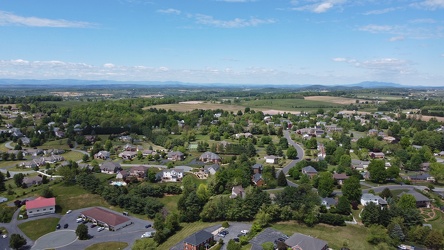
Pelham neighborhood in Waynesboro, Virginia
-
Downtown Gettysburg, Pennsylvania [02]
![Downtown Gettysburg, Pennsylvania [02] (1824 visits) Aerial view of downtown Gettysburg, Pennsylvania, facing approximately east. The air was a bit hazy... Downtown Gettysburg, Pennsylvania [02]](../../../../i/upload/2024/07/19/20240719170259-27d78ed8-cu_s9999x250.jpg)
-
Downtown Gettysburg, Pennsylvania [01]
![Downtown Gettysburg, Pennsylvania [01] (9334 visits) Aerial view of downtown Gettysburg, Pennsylvania, facing southeast. The air was a bit hazy on this ... Downtown Gettysburg, Pennsylvania [01]](../../../../i/upload/2024/07/19/20240719170318-2077237a-cu_s9999x250.jpg)
-
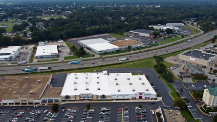
Interstate 95 through Colonial Heights
-
Sign for State Route 188 [02]
![Sign for State Route 188 [02] (1391 visits) Signage pointing the way to State Route 188 at the intersection of Church Street and Commercial Aven... Sign for State Route 188 [02]](../../../../i/upload/2024/07/20/20240720021827-a0810db1-cu_s9999x250.jpg)
-
Sign for State Route 188 [03]
![Sign for State Route 188 [03] (1341 visits) Signage pointing the way to State Route 188 at the intersection of Church Street and Commercial Aven... Sign for State Route 188 [03]](../../../../i/upload/2024/07/20/20240720021833-b69f59a5-cu_s9999x250.jpg)
-
Sign for State Route 188 [04]
![Sign for State Route 188 [04] (1460 visits) Signage pointing the way to State Route 188 at the intersection of Church Street and Commercial Aven... Sign for State Route 188 [04]](../../../../i/upload/2024/07/20/20240720021852-b244dda6-cu_s9999x250.jpg)
-
Sign for State Route 188 [05]
![Sign for State Route 188 [05] (1428 visits) Signage pointing the way to State Route 188 at the intersection of Church Street and Commercial Aven... Sign for State Route 188 [05]](../../../../i/upload/2024/07/20/20240720021903-7bd9cd82-cu_s9999x250.jpg)
-
Sign for State Route 188 [06]
![Sign for State Route 188 [06] (1413 visits) Signage pointing the way to State Route 188 at the intersection of Church Street and Commercial Aven... Sign for State Route 188 [06]](../../../../i/upload/2024/07/20/20240720021915-40479437-cu_s9999x250.jpg)
-
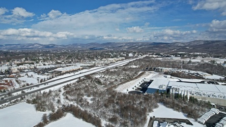
Interstate 64 corridor through Waynesboro, Virginia
-
West Broad Street at Staples Mill Road [01]
![West Broad Street at Staples Mill Road [01] (3219 visits) Aerial view of West Broad Street at the intersection with Staples Mill Road in Richmond, Virginia. ... West Broad Street at Staples Mill Road [01]](../../../../i/upload/2024/07/20/20240720091824-c8526d69-cu_s9999x250.jpg)
-
West Broad Street at Staples Mill Road [02]
![West Broad Street at Staples Mill Road [02] (69998 visits) Aerial view of West Broad Street at the intersection with Staples Mill Road in Richmond, Virginia. ... West Broad Street at Staples Mill Road [02]](../../../../i/upload/2024/07/20/20240720092012-1df12de7-cu_s9999x250.jpg)
-
Farm on the Virginia-West Virginia border [01]
![Farm on the Virginia-West Virginia border [01] (2855 visits) Farm on the border between Highland County, Virginia and Pendleton County, West Virginia. The bound... Farm on the Virginia-West Virginia border [01]](../../../../i/upload/2024/07/20/20240720094156-2b1215da-cu_s9999x250.jpg)
-
West Dumplin Valley Road [03]
![West Dumplin Valley Road [03] (2907 visits) Businesses along West Dumplin Valley Road, which runs just south of Interstate 40, in Sevierville, T... West Dumplin Valley Road [03]](../../../../i/upload/2024/07/20/20240720120238-68c626bc-cu_s9999x250.jpg)
-
West Dumplin Valley Road [02]
![West Dumplin Valley Road [02] (2881 visits) Businesses along West Dumplin Valley Road, which runs just south of Interstate 40, in Sevierville, T... West Dumplin Valley Road [02]](../../../../i/upload/2024/07/20/20240720120306-846e6bb2-cu_s9999x250.jpg)
-
West Dumplin Valley Road [01]
![West Dumplin Valley Road [01] (2825 visits) Businesses along West Dumplin Valley Road, which runs just south of Interstate 40, in Sevierville, T... West Dumplin Valley Road [01]](../../../../i/upload/2024/07/20/20240720120315-42535554-cu_s9999x250.jpg)
-
Scion xA decorated for Halloween

-
Intersection of Montgomery Village Avenue and Midcounty Highway [03]
![Intersection of Montgomery Village Avenue and Midcounty Highway [03] (3268 visits) Intersection of Montgomery Village Avenue and Midcounty Highway in Gaithersburg, Maryland, facing so... Intersection of Montgomery Village Avenue and Midcounty Highway [03]](../../../../i/upload/2024/07/20/20240720122313-30dc7995-cu_s9999x250.jpg)
-
Intersection of Montgomery Village Avenue and Midcounty Highway [04]
![Intersection of Montgomery Village Avenue and Midcounty Highway [04] (3306 visits) Intersection of Montgomery Village Avenue and Midcounty Highway in Gaithersburg, Maryland, facing ea... Intersection of Montgomery Village Avenue and Midcounty Highway [04]](../../../../i/upload/2024/07/20/20240720122318-8f69eabc-cu_s9999x250.jpg)
-
Intersection of Montgomery Village Avenue and Midcounty Highway [05]
![Intersection of Montgomery Village Avenue and Midcounty Highway [05] (3278 visits) Intersection of Montgomery Village Avenue and Midcounty Highway in Gaithersburg, Maryland, facing no... Intersection of Montgomery Village Avenue and Midcounty Highway [05]](../../../../i/upload/2024/07/20/20240720122324-2a205409-cu_s9999x250.jpg)
-
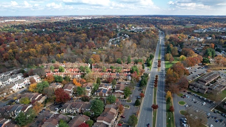
Midcounty Highway, facing east
-
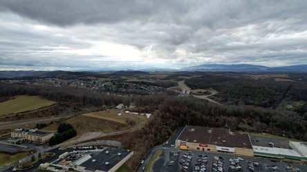
View west from Staunton Mall
-
View of Gatineau from Parliament Hill [02]
![View of Gatineau from Parliament Hill [02] (3072 visits) View of Gatineau, Quebec from Parliament Hill in Ottawa, Ontario.
More at The Schumin Web:
www.schu... View of Gatineau from Parliament Hill [02]](../../../../i/upload/2024/07/20/20240720154447-8a6b0258-cu_s9999x250.jpg)
-
N88327 travels over Scarborough
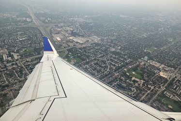
-
Aerial view of Monterey, Virginia [01]
![Aerial view of Monterey, Virginia [01] (1972 visits) Aerial view of Monterey, Virginia, a small town comprising the seat of Highland County.
More at The... Aerial view of Monterey, Virginia [01]](../../../../i/upload/2025/01/02/20250102005918-685606f9-cu_s9999x250.jpg)
-
Aerial view of Monterey, Virginia [02]
![Aerial view of Monterey, Virginia [02] (1990 visits) Aerial view of Monterey, Virginia, a small town comprising the seat of Highland County.
More at The... Aerial view of Monterey, Virginia [02]](../../../../i/upload/2025/01/02/20250102005923-7f7b9b83-cu_s9999x250.jpg)
-
Aerial view of Monterey, Virginia [03]
![Aerial view of Monterey, Virginia [03] (1952 visits) Aerial view of Monterey, Virginia, a small town comprising the seat of Highland County.
More at The... Aerial view of Monterey, Virginia [03]](../../../../i/upload/2025/01/02/20250102005929-2e84a9d0-cu_s9999x250.jpg)
-
Aerial view of Monterey, Virginia [04]
![Aerial view of Monterey, Virginia [04] (1943 visits) Aerial view of Monterey, Virginia, a small town comprising the seat of Highland County.
More at The... Aerial view of Monterey, Virginia [04]](../../../../i/upload/2025/01/02/20250102005937-281fae65-cu_s9999x250.jpg)
-
Aerial view of Monterey, Virginia [05]
![Aerial view of Monterey, Virginia [05] (2014 visits) Aerial view of Monterey, Virginia, a small town comprising the seat of Highland County.
More at The... Aerial view of Monterey, Virginia [05]](../../../../i/upload/2025/01/02/20250102005946-79efaa38-cu_s9999x250.jpg)
-
Aerial view of Monterey, Virginia [06]
![Aerial view of Monterey, Virginia [06] (1963 visits) Aerial view of Monterey, Virginia, a small town comprising the seat of Highland County.
More at The... Aerial view of Monterey, Virginia [06]](../../../../i/upload/2025/01/02/20250102005956-29786301-cu_s9999x250.jpg)
-
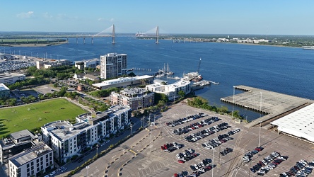
View from above the Port of Charleston
