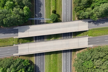
-
Interstate 81 through Harrisonburg, Virginia
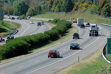
-
Canal Walk near Shockoe Bottom
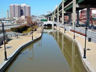
-
Skyline of Richmond, Virginia
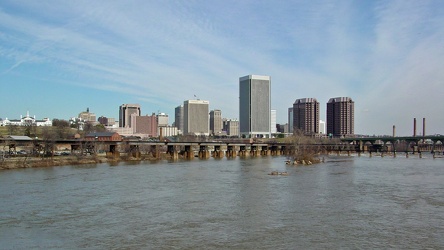
-
Richmond skyline [12]
![Richmond skyline [12] (3253 visits) The skyline of Richmond, Virginia as viewed from the Belle Isle pedestrian bridge.
More at The Schu... Richmond skyline [12]](../../../../i/upload/2024/07/17/20240717155057-1b70ebec-cu_s9999x250.jpg)
-
Richmond skyline [11]
![Richmond skyline [11] (3187 visits) The skyline of Richmond, Virginia as viewed from Belle Isle.
More at The Schumin Web:
www.schuminwe... Richmond skyline [11]](../../../../i/upload/2024/07/17/20240717155100-1121e622-cu_s9999x250.jpg)
-
Richmond skyline [10]
![Richmond skyline [10] (2768 visits) The skyline of Richmond, Virginia as viewed from Belle Isle.
More at The Schumin Web:
www.schuminwe... Richmond skyline [10]](../../../../i/upload/2024/07/17/20240717155103-0850cb89-cu_s9999x250.jpg)
-
Richmond skyline [09]
![Richmond skyline [09] (2995 visits) The skyline of Richmond, Virginia as viewed from Belle Isle.
More at The Schumin Web:
www.schuminwe... Richmond skyline [09]](../../../../i/upload/2024/07/17/20240717155106-9423a503-cu_s9999x250.jpg)
-
Richmond skyline [08]
![Richmond skyline [08] (2596 visits) The skyline of Richmond, Virginia as viewed from Belle Isle.
More at The Schumin Web:
www.schuminwe... Richmond skyline [08]](../../../../i/upload/2024/07/17/20240717155110-33b853b1-cu_s9999x250.jpg)
-
Richmond skyline [07]
![Richmond skyline [07] (2972 visits) The skyline of Richmond, Virginia as viewed from Belle Isle.
More at The Schumin Web:
www.schuminwe... Richmond skyline [07]](../../../../i/upload/2024/07/17/20240717155113-cec25ff6-cu_s9999x250.jpg)
-
Richmond skyline [05]
![Richmond skyline [05] (3017 visits) The skyline of Richmond, Virginia as viewed from Belle Isle.
More at The Schumin Web:
www.schuminwe... Richmond skyline [05]](../../../../i/upload/2024/07/17/20240717155118-d2e7b5b2-cu_s9999x250.jpg)
-
Richmond skyline [04]
![Richmond skyline [04] (2875 visits) The skyline of Richmond, Virginia as viewed from Belle Isle.
More at The Schumin Web:
www.schuminwe... Richmond skyline [04]](../../../../i/upload/2024/07/17/20240717155122-17d9c4b8-cu_s9999x250.jpg)
-
Richmond skyline [03]
![Richmond skyline [03] (4574 visits) The skyline of Richmond, Virginia as viewed from Belle Isle.
More at The Schumin Web:
www.schuminwe... Richmond skyline [03]](../../../../i/upload/2024/07/17/20240717155130-cfb4a095-cu_s9999x250.jpg)
-
Richmond skyline [02]
![Richmond skyline [02] (2813 visits) The skyline of Richmond, Virginia as viewed from the Belle Isle pedestrian bridge.
More at The Schu... Richmond skyline [02]](../../../../i/upload/2024/07/17/20240717155153-fa296849-cu_s9999x250.jpg)
-
Richmond skyline [01]
![Richmond skyline [01] (2696 visits) The skyline of Richmond, Virginia as viewed from the Belle Isle pedestrian bridge.
More at The Schu... Richmond skyline [01]](../../../../i/upload/2024/07/17/20240717155204-034e37ba-cu_s9999x250.jpg)
-
US 29 Business in Culpeper, Virginia [01]
![US 29 Business in Culpeper, Virginia [01] (3135 visits) Aerial view of US 29 Business on the north side of Culpeper, Virginia. View facing approximately ea... US 29 Business in Culpeper, Virginia [01]](../../../../i/upload/2024/07/19/20240719155959-cf1d0444-cu_s9999x250.jpg)
-
Traffic signals at US 15 and Lucketts Road [02]
![Traffic signals at US 15 and Lucketts Road [02] (1197 visits) Traffic signals at the intersection of US 15 and Lucketts Road in Loudoun County, Virginia.
Ben Sch... Traffic signals at US 15 and Lucketts Road [02]](../../../../i/upload/2024/07/19/20240719161422-d1e94014-cu_s9999x250.jpg)
-
Traffic signals at US 15 and Lucketts Road [01]
![Traffic signals at US 15 and Lucketts Road [01] (1264 visits) Traffic signals at the intersection of US 15 and Lucketts Road in Loudoun County, Virginia.
Ben Sch... Traffic signals at US 15 and Lucketts Road [01]](../../../../i/upload/2024/07/19/20240719161531-79fec9f3-cu_s9999x250.jpg)
-
Street signs at intersection of US 15 and Lucketts Road [01]
![Street signs at intersection of US 15 and Lucketts Road [01] (937 visits) Street signs at the intersection of US 15 and Lucketts Road in Loudoun County, Virginia.
Ben Schumi... Street signs at intersection of US 15 and Lucketts Road [01]](../../../../i/upload/2024/07/19/20240719161537-a75c3dac-cu_s9999x250.jpg)
-
Street signs at intersection of US 15 and Lucketts Road [02]
![Street signs at intersection of US 15 and Lucketts Road [02] (951 visits) Street signs at the intersection of US 15 and Lucketts Road in Loudoun County, Virginia.
Ben Schumi... Street signs at intersection of US 15 and Lucketts Road [02]](../../../../i/upload/2024/07/19/20240719161623-789e37f5-cu_s9999x250.jpg)
-
US 29 Business in Culpeper, Virginia [02]
![US 29 Business in Culpeper, Virginia [02] (457538 visits) Aerial view of US 29 Business on the north side of Culpeper, Virginia. View facing approximately we... US 29 Business in Culpeper, Virginia [02]](../../../../i/upload/2024/07/19/20240719165937-abc06307-cu_s9999x250.jpg)
-
James River Bridge [04]
![James River Bridge [04] (4295 visits) The James River Bridge, carrying US 17, US 258, and VA 32 between Newport News and Isle of Wight Cou... James River Bridge [04]](../../../../i/upload/2024/07/19/20240719202325-4257c4a3-cu_s9999x250.jpg)
-
James River Bridge [05]
![James River Bridge [05] (4355 visits) The James River Bridge, carrying US 17, US 258, and VA 32 between Newport News and Isle of Wight Cou... James River Bridge [05]](../../../../i/upload/2024/07/19/20240719202330-be52e801-cu_s9999x250.jpg)
-
Windward Towers and Leeward Marina [02]
![Windward Towers and Leeward Marina [02] (2930 visits) Aerial view of the Windward Towers condominium complex, with the Leeward Marina in front of it, in N... Windward Towers and Leeward Marina [02]](../../../../i/upload/2024/07/19/20240719202335-9d3149ac-cu_s9999x250.jpg)
-
James River Bridge [03]
![James River Bridge [03] (4204 visits) The James River Bridge, carrying US 17, US 258, and VA 32 between Newport News and Isle of Wight Cou... James River Bridge [03]](../../../../i/upload/2024/07/19/20240719202529-b0e807ab-cu_s9999x250.jpg)
-
James River Bridge [08]
![James River Bridge [08] (4315 visits) The James River Bridge, carrying US 17, US 258, and VA 32 between Newport News and Isle of Wight Cou... James River Bridge [08]](../../../../i/upload/2024/07/19/20240719202534-7843f0b6-cu_s9999x250.jpg)
-
James River Bridge [09]
![James River Bridge [09] (4431 visits) The James River Bridge, carrying US 17, US 258, and VA 32 between Newport News and Isle of Wight Cou... James River Bridge [09]](../../../../i/upload/2024/07/19/20240719202539-877160be-cu_s9999x250.jpg)
-
James River Bridge [06]
![James River Bridge [06] (4439 visits) The James River Bridge, carrying US 17, US 258, and VA 32 between Newport News and Isle of Wight Cou... James River Bridge [06]](../../../../i/upload/2024/07/19/20240719202642-04c26af8-cu_s9999x250.jpg)
-
James River Bridge [07]
![James River Bridge [07] (4215 visits) The James River Bridge, carrying US 17, US 258, and VA 32 between Newport News and Isle of Wight Cou... James River Bridge [07]](../../../../i/upload/2024/07/19/20240719202647-27533348-cu_s9999x250.jpg)
-
James River Bridge [11]
![James River Bridge [11] (4331 visits) The James River Bridge, carrying US 17, US 258, and VA 32 between Newport News and Isle of Wight Cou... James River Bridge [11]](../../../../i/upload/2024/07/19/20240719202653-8658db60-cu_s9999x250.jpg)
-
James River Bridge [02]
![James River Bridge [02] (4414 visits) The James River Bridge, carrying US 17, US 258, and VA 32 between Newport News and Isle of Wight Cou... James River Bridge [02]](../../../../i/upload/2024/07/19/20240719202733-9fb73a13-cu_s9999x250.jpg)
-
James River Bridge [10]
![James River Bridge [10] (4361 visits) The James River Bridge, carrying US 17, US 258, and VA 32 between Newport News and Isle of Wight Cou... James River Bridge [10]](../../../../i/upload/2024/07/19/20240719202742-6238cd7f-cu_s9999x250.jpg)
-
Windward Towers and Leeward Marina [01]
![Windward Towers and Leeward Marina [01] (4604 visits) Aerial view of the Windward Towers condominium complex, with the Leeward Marina in front of it, in N... Windward Towers and Leeward Marina [01]](../../../../i/upload/2024/07/19/20240719202747-251158fb-cu_s9999x250.jpg)
-
James River Bridge [01]
![James River Bridge [01] (4118 visits) The James River Bridge, carrying US 17, US 258, and VA 32 between Newport News and Isle of Wight Cou... James River Bridge [01]](../../../../i/upload/2024/07/19/20240719202759-cb89473a-cu_s9999x250.jpg)
-
James River Bridge from afar [01]
![James River Bridge from afar [01] (4099 visits) The James River Bridge, carrying US 17, US 258, and VA 32 between Newport News and Isle of Wight Cou... James River Bridge from afar [01]](../../../../i/upload/2024/07/19/20240719203153-0a034e64-cu_s9999x250.jpg)
-
James River Bridge from afar [02]
![James River Bridge from afar [02] (4129 visits) The James River Bridge, carrying US 17, US 258, and VA 32 between Newport News and Isle of Wight Cou... James River Bridge from afar [02]](../../../../i/upload/2024/07/19/20240719203158-427c0626-cu_s9999x250.jpg)
-
Skyline of Richmond, Virginia from over the James River [05]
![Skyline of Richmond, Virginia from over the James River [05] (2512 visits) The skyline of Richmond, Virginia as viewed from the southwest, above the James River.
More at The ... Skyline of Richmond, Virginia from over the James River [05]](../../../../i/upload/2024/07/20/20240720092707-f5afb553-cu_s9999x250.jpg)
-
Clock tower on Richmond Main Street Station [01]
![Clock tower on Richmond Main Street Station [01] (12561 visits) Clock tower on Richmond Main Street Station in downtown Richmond, Virginia, overlooking a large elev... Clock tower on Richmond Main Street Station [01]](../../../../i/upload/2024/07/20/20240720092945-196e9f26-cu_s9999x250.jpg)
-
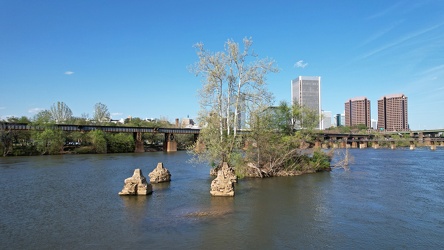
Small island in the James River
-
Richmond skyline from the James River [02]
![Richmond skyline from the James River [02] (4251 visits) The skyline of Richmond, Virginia, viewed from the James River just south of Brown's Island.
More a... Richmond skyline from the James River [02]](../../../../i/upload/2024/07/20/20240720093043-34fedc56-cu_s9999x250.jpg)
-
Richmond skyline from the James River [01]
![Richmond skyline from the James River [01] (2687 visits) The skyline of Richmond, Virginia, viewed from the James River just south of Brown's Island.
More a... Richmond skyline from the James River [01]](../../../../i/upload/2024/07/20/20240720093109-1fb6414b-cu_s9999x250.jpg)
-
Skyline of Richmond, Virginia from over the James River [06]
![Skyline of Richmond, Virginia from over the James River [06] (2269 visits) The skyline of Richmond, Virginia as viewed from the southwest, above the James River.
More at The ... Skyline of Richmond, Virginia from over the James River [06]](../../../../i/upload/2024/07/20/20240720093145-04645085-cu_s9999x250.jpg)
-
Clock tower on Richmond Main Street Station [02]
![Clock tower on Richmond Main Street Station [02] (12117 visits) Clock tower on Richmond Main Street Station in downtown Richmond, Virginia, overlooking a large elev... Clock tower on Richmond Main Street Station [02]](../../../../i/upload/2024/07/20/20240720093156-e35dc707-cu_s9999x250.jpg)
-
Federal Reserve and Riverfront Plaza [02]
![Federal Reserve and Riverfront Plaza [02] (2594 visits) The Federal Reserve Bank building and Riverfront Plaza towers, viewed from above the Canal.
More at... Federal Reserve and Riverfront Plaza [02]](../../../../i/upload/2024/07/20/20240720093206-5733a975-cu_s9999x250.jpg)
-
Skyline of Richmond, Virginia from over the James River [01]
![Skyline of Richmond, Virginia from over the James River [01] (2230 visits) The skyline of Richmond, Virginia as viewed from the southwest, above the James River.
More at The ... Skyline of Richmond, Virginia from over the James River [01]](../../../../i/upload/2024/07/20/20240720093217-566c68d2-cu_s9999x250.jpg)
-
Skyline of Richmond, Virginia from over the James River [04]
![Skyline of Richmond, Virginia from over the James River [04] (2456 visits) The skyline of Richmond, Virginia as viewed from the southwest, above the James River.
More at The ... Skyline of Richmond, Virginia from over the James River [04]](../../../../i/upload/2024/07/20/20240720093223-e807486f-cu_s9999x250.jpg)
-
Skyline of Richmond, Virginia from over the James River [03]
![Skyline of Richmond, Virginia from over the James River [03] (2289 visits) The skyline of Richmond, Virginia as viewed from the southwest, above the James River.
More at The ... Skyline of Richmond, Virginia from over the James River [03]](../../../../i/upload/2024/07/20/20240720093228-9fe867a4-cu_s9999x250.jpg)
-
View east down the Canal

-
Skyline of Richmond, Virginia from over the James River [02]
![Skyline of Richmond, Virginia from over the James River [02] (2289 visits) The skyline of Richmond, Virginia as viewed from the southwest, above the James River.
More at The ... Skyline of Richmond, Virginia from over the James River [02]](../../../../i/upload/2024/07/20/20240720093329-b8ae5a03-cu_s9999x250.jpg)
-
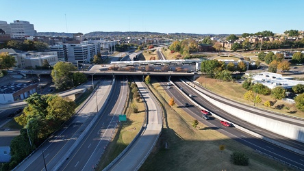
Neyland Drive and James White Parkway
-
Douglas Lake [05]
![Douglas Lake [05] (3148 visits) Douglas Lake, a manmade reservoir in east Tennessee, which is operated by the Tennessee Valley Autho... Douglas Lake [05]](../../../../i/upload/2024/07/20/20240720120359-cbebbc4a-cu_s9999x250.jpg)
-
Douglas Lake [06]
![Douglas Lake [06] (3203 visits) Douglas Lake, a manmade reservoir in east Tennessee, which is operated by the Tennessee Valley Autho... Douglas Lake [06]](../../../../i/upload/2024/07/20/20240720120405-67e59e34-cu_s9999x250.jpg)
-
Douglas Lake [08]
![Douglas Lake [08] (3109 visits) Douglas Lake, a manmade reservoir in east Tennessee, which is operated by the Tennessee Valley Autho... Douglas Lake [08]](../../../../i/upload/2024/07/20/20240720120417-8d600905-cu_s9999x250.jpg)
-
Douglas Lake [11]
![Douglas Lake [11] (2038 visits) Douglas Lake, a manmade reservoir in east Tennessee, which is operated by the Tennessee Valley Autho... Douglas Lake [11]](../../../../i/upload/2024/07/20/20240720120423-fe2fdef1-cu_s9999x250.jpg)
-
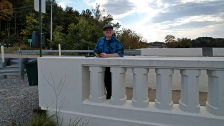
Drone selfie on Route 92 bridge
-
Douglas Lake [07]
![Douglas Lake [07] (3147 visits) Douglas Lake, a manmade reservoir in east Tennessee, which is operated by the Tennessee Valley Autho... Douglas Lake [07]](../../../../i/upload/2024/07/20/20240720120434-49f9d1b9-cu_s9999x250.jpg)
-
Douglas Lake [03]
![Douglas Lake [03] (3049 visits) Douglas Lake, a manmade reservoir in east Tennessee, which is operated by the Tennessee Valley Autho... Douglas Lake [03]](../../../../i/upload/2024/07/20/20240720120440-4ae673b8-cu_s9999x250.jpg)
-
Douglas Lake [01]
![Douglas Lake [01] (3111 visits) Douglas Lake, a manmade reservoir in east Tennessee, which is operated by the Tennessee Valley Autho... Douglas Lake [01]](../../../../i/upload/2024/07/20/20240720120446-06709267-cu_s9999x250.jpg)
-
Douglas Lake [02]
![Douglas Lake [02] (3034 visits) Douglas Lake, a manmade reservoir in east Tennessee, which is operated by the Tennessee Valley Autho... Douglas Lake [02]](../../../../i/upload/2024/07/20/20240720120452-7c1a4915-cu_s9999x250.jpg)
-
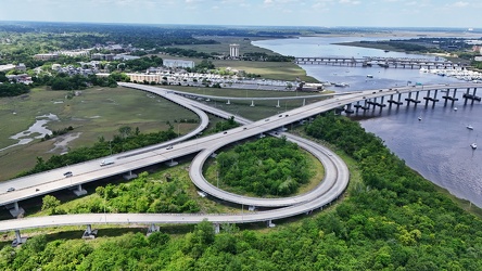
Interchange between SC 30 and SC 61
-
Robert B. Scarborough Bridge [01]
![Robert B. Scarborough Bridge [01] (2082 visits) The Robert B. Scarborough Bridge, which carries South Carolina Highway 30 (James Island Expressway) ... Robert B. Scarborough Bridge [01]](../../../../i/upload/2025/01/13/20250113163905-15e6b872-cu_s9999x250.jpg)
-
Robert B. Scarborough Bridge [02]
![Robert B. Scarborough Bridge [02] (2103 visits) The Robert B. Scarborough Bridge, which carries South Carolina Highway 30 (James Island Expressway) ... Robert B. Scarborough Bridge [02]](../../../../i/upload/2025/01/13/20250113163918-5b7c57a3-cu_s9999x250.jpg)
-
Robert B. Scarborough Bridge [03]
![Robert B. Scarborough Bridge [03] (2125 visits) The Robert B. Scarborough Bridge, which carries South Carolina Highway 30 (James Island Expressway) ... Robert B. Scarborough Bridge [03]](../../../../i/upload/2025/01/13/20250113163925-e06c07ca-cu_s9999x250.jpg)
-
Robert B. Scarborough Bridge [04]
![Robert B. Scarborough Bridge [04] (8598 visits) The Robert B. Scarborough Bridge, which carries South Carolina Highway 30 (James Island Expressway) ... Robert B. Scarborough Bridge [04]](../../../../i/upload/2025/01/13/20250113163932-a221f5cd-cu_s9999x250.jpg)
-
Robert B. Scarborough Bridge [05]
![Robert B. Scarborough Bridge [05] (8594 visits) The Robert B. Scarborough Bridge, which carries South Carolina Highway 30 (James Island Expressway) ... Robert B. Scarborough Bridge [05]](../../../../i/upload/2025/01/13/20250113163940-60ea0358-cu_s9999x250.jpg)
-
Robert B. Scarborough Bridge [06]
![Robert B. Scarborough Bridge [06] (8691 visits) The Robert B. Scarborough Bridge, which carries South Carolina Highway 30 (James Island Expressway) ... Robert B. Scarborough Bridge [06]](../../../../i/upload/2025/01/13/20250113163948-d2e65f28-cu_s9999x250.jpg)
-
Robert B. Scarborough Bridge [07]
![Robert B. Scarborough Bridge [07] (8654 visits) The Robert B. Scarborough Bridge, which carries South Carolina Highway 30 (James Island Expressway) ... Robert B. Scarborough Bridge [07]](../../../../i/upload/2025/01/13/20250113163955-5fc6be2a-cu_s9999x250.jpg)
-
Robert B. Scarborough Bridge [08]
![Robert B. Scarborough Bridge [08] (8686 visits) The Robert B. Scarborough Bridge, which carries South Carolina Highway 30 (James Island Expressway) ... Robert B. Scarborough Bridge [08]](../../../../i/upload/2025/01/13/20250113164004-1aefc547-cu_s9999x250.jpg)
-
Interchange between SC 30 and Lockwood Drive [01]
![Interchange between SC 30 and Lockwood Drive [01] (2157 visits) Interchange between South Carolina Highway 30 (James Island Expressway) and Lockwood Drive in downto... Interchange between SC 30 and Lockwood Drive [01]](../../../../i/upload/2025/01/13/20250113164013-5d467e2e-cu_s9999x250.jpg)
-
Interchange between SC 30 and Lockwood Drive [02]
![Interchange between SC 30 and Lockwood Drive [02] (2139 visits) Interchange between South Carolina Highway 30 (James Island Expressway) and Lockwood Drive in downto... Interchange between SC 30 and Lockwood Drive [02]](../../../../i/upload/2025/01/13/20250113164020-33f31887-cu_s9999x250.jpg)
-
Monitor-Merrimac Memorial Bridge-Tunnel [01]
![Monitor-Merrimac Memorial Bridge-Tunnel [01] (1636 visits) North portal island of the Monitor-Merrimac Memorial Bridge-Tunnel, a 4.6 mile long crossing of Hamp... Monitor-Merrimac Memorial Bridge-Tunnel [01]](../../../../i/upload/2025/02/18/20250218235632-5aef878d-cu_s9999x250.jpg)
-
Monitor-Merrimac Memorial Bridge-Tunnel [02]
![Monitor-Merrimac Memorial Bridge-Tunnel [02] (1609 visits) North portal island of the Monitor-Merrimac Memorial Bridge-Tunnel, a 4.6 mile long crossing of Hamp... Monitor-Merrimac Memorial Bridge-Tunnel [02]](../../../../i/upload/2025/02/18/20250218235637-581fbcca-cu_s9999x250.jpg)
-
Monitor-Merrimac Memorial Bridge-Tunnel [03]
![Monitor-Merrimac Memorial Bridge-Tunnel [03] (1629 visits) North portal island of the Monitor-Merrimac Memorial Bridge-Tunnel, a 4.6 mile long crossing of Hamp... Monitor-Merrimac Memorial Bridge-Tunnel [03]](../../../../i/upload/2025/02/18/20250218235642-270961d8-cu_s9999x250.jpg)
-
Monitor-Merrimac Memorial Bridge-Tunnel [04]
![Monitor-Merrimac Memorial Bridge-Tunnel [04] (1669 visits) North portal island of the Monitor-Merrimac Memorial Bridge-Tunnel, a 4.6 mile long crossing of Hamp... Monitor-Merrimac Memorial Bridge-Tunnel [04]](../../../../i/upload/2025/02/18/20250218235648-fca8ade5-cu_s9999x250.jpg)
-
Monitor-Merrimac Memorial Bridge-Tunnel [05]
![Monitor-Merrimac Memorial Bridge-Tunnel [05] (1643 visits) North portal island of the Monitor-Merrimac Memorial Bridge-Tunnel, a 4.6 mile long crossing of Hamp... Monitor-Merrimac Memorial Bridge-Tunnel [05]](../../../../i/upload/2025/02/18/20250218235653-19c3fdef-cu_s9999x250.jpg)
-
Monitor-Merrimac Memorial Bridge-Tunnel [06]
![Monitor-Merrimac Memorial Bridge-Tunnel [06] (1631 visits) South portal island of the Monitor-Merrimac Memorial Bridge-Tunnel, a 4.6 mile long crossing of Hamp... Monitor-Merrimac Memorial Bridge-Tunnel [06]](../../../../i/upload/2025/02/18/20250218235658-5bb810e5-cu_s9999x250.jpg)
-
Monitor-Merrimac Memorial Bridge-Tunnel [07]
![Monitor-Merrimac Memorial Bridge-Tunnel [07] (1695 visits) South portal island of the Monitor-Merrimac Memorial Bridge-Tunnel, a 4.6 mile long crossing of Hamp... Monitor-Merrimac Memorial Bridge-Tunnel [07]](../../../../i/upload/2025/02/18/20250218235704-55afa576-cu_s9999x250.jpg)
-
Monitor-Merrimac Memorial Bridge-Tunnel [08]
![Monitor-Merrimac Memorial Bridge-Tunnel [08] (1642 visits) South portal island of the Monitor-Merrimac Memorial Bridge-Tunnel, a 4.6 mile long crossing of Hamp... Monitor-Merrimac Memorial Bridge-Tunnel [08]](../../../../i/upload/2025/02/18/20250218235709-560750da-cu_s9999x250.jpg)
-
Monitor-Merrimac Memorial Bridge-Tunnel [09]
![Monitor-Merrimac Memorial Bridge-Tunnel [09] (1596 visits) South portal island of the Monitor-Merrimac Memorial Bridge-Tunnel, a 4.6 mile long crossing of Hamp... Monitor-Merrimac Memorial Bridge-Tunnel [09]](../../../../i/upload/2025/02/18/20250218235714-45502513-cu_s9999x250.jpg)
-
Monitor-Merrimac Memorial Bridge-Tunnel [10]
![Monitor-Merrimac Memorial Bridge-Tunnel [10] (1639 visits) South portal island of the Monitor-Merrimac Memorial Bridge-Tunnel, a 4.6 mile long crossing of Hamp... Monitor-Merrimac Memorial Bridge-Tunnel [10]](../../../../i/upload/2025/02/18/20250218235719-11c76977-cu_s9999x250.jpg)
-
Monitor-Merrimac Memorial Bridge-Tunnel [11]
![Monitor-Merrimac Memorial Bridge-Tunnel [11] (1646 visits) South portal island of the Monitor-Merrimac Memorial Bridge-Tunnel, a 4.6 mile long crossing of Hamp... Monitor-Merrimac Memorial Bridge-Tunnel [11]](../../../../i/upload/2025/02/18/20250218235725-ef9b2fb8-cu_s9999x250.jpg)
-
Monitor-Merrimac Memorial Bridge-Tunnel [12]
![Monitor-Merrimac Memorial Bridge-Tunnel [12] (1630 visits) South portal island of the Monitor-Merrimac Memorial Bridge-Tunnel, a 4.6 mile long crossing of Hamp... Monitor-Merrimac Memorial Bridge-Tunnel [12]](../../../../i/upload/2025/02/18/20250218235731-5172cc89-cu_s9999x250.jpg)
-
Croaker Road and Interstate 64
