-
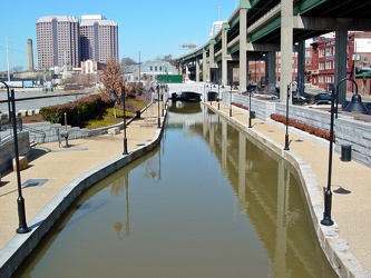
Canal Walk near Shockoe Bottom
-
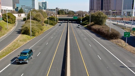
Downtown Expressway
-
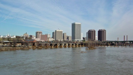
Skyline of Richmond, Virginia
-
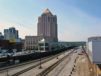
Downtown Roanoke at the railroad tracks
-
Payphone at New Market rest area [02]
![Payphone at New Market rest area [02] (2907 visits) Payphone at the rest area on Interstate 81 northbound, near New Market, Virginia.
Ben Schumin is a ... Payphone at New Market rest area [02]](../../../../../i/upload/2024/07/17/20240717101528-9876c113-cu_s9999x250.jpg)
-
Payphone at New Market rest area [01]
![Payphone at New Market rest area [01] (2951 visits) Payphone at the rest area on Interstate 81 northbound, near New Market, Virginia.
Ben Schumin is a ... Payphone at New Market rest area [01]](../../../../../i/upload/2024/07/17/20240717101532-2c8ed3e3-cu_s9999x250.jpg)
-
Richmond skyline [12]
![Richmond skyline [12] (3437 visits) The skyline of Richmond, Virginia as viewed from the Belle Isle pedestrian bridge.
More at The Schu... Richmond skyline [12]](../../../../../i/upload/2024/07/17/20240717155057-1b70ebec-cu_s9999x250.jpg)
-
Richmond skyline [11]
![Richmond skyline [11] (3348 visits) The skyline of Richmond, Virginia as viewed from Belle Isle.
More at The Schumin Web:
www.schuminwe... Richmond skyline [11]](../../../../../i/upload/2024/07/17/20240717155100-1121e622-cu_s9999x250.jpg)
-
Richmond skyline [10]
![Richmond skyline [10] (2928 visits) The skyline of Richmond, Virginia as viewed from Belle Isle.
More at The Schumin Web:
www.schuminwe... Richmond skyline [10]](../../../../../i/upload/2024/07/17/20240717155103-0850cb89-cu_s9999x250.jpg)
-
Richmond skyline [09]
![Richmond skyline [09] (3158 visits) The skyline of Richmond, Virginia as viewed from Belle Isle.
More at The Schumin Web:
www.schuminwe... Richmond skyline [09]](../../../../../i/upload/2024/07/17/20240717155106-9423a503-cu_s9999x250.jpg)
-
Richmond skyline [08]
![Richmond skyline [08] (2715 visits) The skyline of Richmond, Virginia as viewed from Belle Isle.
More at The Schumin Web:
www.schuminwe... Richmond skyline [08]](../../../../../i/upload/2024/07/17/20240717155110-33b853b1-cu_s9999x250.jpg)
-
Richmond skyline [07]
![Richmond skyline [07] (3130 visits) The skyline of Richmond, Virginia as viewed from Belle Isle.
More at The Schumin Web:
www.schuminwe... Richmond skyline [07]](../../../../../i/upload/2024/07/17/20240717155113-cec25ff6-cu_s9999x250.jpg)
-
Richmond skyline [05]
![Richmond skyline [05] (3179 visits) The skyline of Richmond, Virginia as viewed from Belle Isle.
More at The Schumin Web:
www.schuminwe... Richmond skyline [05]](../../../../../i/upload/2024/07/17/20240717155118-d2e7b5b2-cu_s9999x250.jpg)
-
Richmond skyline [04]
![Richmond skyline [04] (3048 visits) The skyline of Richmond, Virginia as viewed from Belle Isle.
More at The Schumin Web:
www.schuminwe... Richmond skyline [04]](../../../../../i/upload/2024/07/17/20240717155122-17d9c4b8-cu_s9999x250.jpg)
-
Richmond skyline [03]
![Richmond skyline [03] (4732 visits) The skyline of Richmond, Virginia as viewed from Belle Isle.
More at The Schumin Web:
www.schuminwe... Richmond skyline [03]](../../../../../i/upload/2024/07/17/20240717155130-cfb4a095-cu_s9999x250.jpg)
-
Richmond skyline [02]
![Richmond skyline [02] (2943 visits) The skyline of Richmond, Virginia as viewed from the Belle Isle pedestrian bridge.
More at The Schu... Richmond skyline [02]](../../../../../i/upload/2024/07/17/20240717155153-fa296849-cu_s9999x250.jpg)
-
Richmond skyline [01]
![Richmond skyline [01] (2827 visits) The skyline of Richmond, Virginia as viewed from the Belle Isle pedestrian bridge.
More at The Schu... Richmond skyline [01]](../../../../../i/upload/2024/07/17/20240717155204-034e37ba-cu_s9999x250.jpg)
-
US 29 Business in Culpeper, Virginia [01]
![US 29 Business in Culpeper, Virginia [01] (3197 visits) Aerial view of US 29 Business on the north side of Culpeper, Virginia. View facing approximately ea... US 29 Business in Culpeper, Virginia [01]](../../../../../i/upload/2024/07/19/20240719155959-cf1d0444-cu_s9999x250.jpg)
-
Shield for State Route 254 [01]
![Shield for State Route 254 [01] (1335 visits) Shield for State Route 254 on West Frederick Street in downtown Staunton, Virginia. This style of s... Shield for State Route 254 [01]](../../../../../i/upload/2024/07/19/20240719160500-1fdaedc1-cu_s9999x250.jpg)
-
Shield for State Route 254 [02]
![Shield for State Route 254 [02] (1350 visits) Shield for State Route 254 on West Frederick Street in downtown Staunton, Virginia. This style of s... Shield for State Route 254 [02]](../../../../../i/upload/2024/07/19/20240719160516-e72119d6-cu_s9999x250.jpg)
-
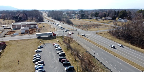
Intersection of US 340, Shenandoah Village Drive, and Gateway Drive
-
Richmond Avenue in Staunton, Virginia [01]
![Richmond Avenue in Staunton, Virginia [01] (66817 visits) Aerial view of Richmond Avenue (US 250) in Staunton, Virginia, near the intersection with Frontier D... Richmond Avenue in Staunton, Virginia [01]](../../../../../i/upload/2024/07/19/20240719161158-ddf9fe35-cu_s9999x250.jpg)
-
Richmond Avenue in Staunton, Virginia [02]
![Richmond Avenue in Staunton, Virginia [02] (66902 visits) Aerial view of Richmond Avenue (US 250) in Staunton, Virginia, near the intersection with Frontier D... Richmond Avenue in Staunton, Virginia [02]](../../../../../i/upload/2024/07/19/20240719161203-233bb776-cu_s9999x250.jpg)
-
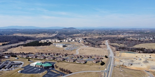
Fishersville, Virginia, near Augusta Health
-
Richmond Avenue in Staunton, Virginia [03]
![Richmond Avenue in Staunton, Virginia [03] (66718 visits) Aerial view of Richmond Avenue (US 250) in Staunton, Virginia, near the intersection with Community ... Richmond Avenue in Staunton, Virginia [03]](../../../../../i/upload/2024/07/19/20240719161212-297c1b53-cu_s9999x250.jpg)
-
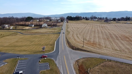
Tinkling Spring Road at Churchmans Mill Road
-
Traffic signals at US 15 and Lucketts Road [02]
![Traffic signals at US 15 and Lucketts Road [02] (1254 visits) Traffic signals at the intersection of US 15 and Lucketts Road in Loudoun County, Virginia.
Ben Sch... Traffic signals at US 15 and Lucketts Road [02]](../../../../../i/upload/2024/07/19/20240719161422-d1e94014-cu_s9999x250.jpg)
-
Traffic signals at US 15 and Lucketts Road [01]
![Traffic signals at US 15 and Lucketts Road [01] (1337 visits) Traffic signals at the intersection of US 15 and Lucketts Road in Loudoun County, Virginia.
Ben Sch... Traffic signals at US 15 and Lucketts Road [01]](../../../../../i/upload/2024/07/19/20240719161531-79fec9f3-cu_s9999x250.jpg)
-
Street signs at intersection of US 15 and Lucketts Road [01]
![Street signs at intersection of US 15 and Lucketts Road [01] (989 visits) Street signs at the intersection of US 15 and Lucketts Road in Loudoun County, Virginia.
Ben Schumi... Street signs at intersection of US 15 and Lucketts Road [01]](../../../../../i/upload/2024/07/19/20240719161537-a75c3dac-cu_s9999x250.jpg)
-
Point of Rocks Bridge [06]
![Point of Rocks Bridge [06] (3008 visits) The Point of Rocks Bridge, which carries US Route 15 over the Potomac River between Loudoun County, ... Point of Rocks Bridge [06]](../../../../../i/upload/2024/07/19/20240719161609-122bd90b-cu_s9999x250.jpg)
-
Street signs at intersection of US 15 and Lucketts Road [02]
![Street signs at intersection of US 15 and Lucketts Road [02] (1002 visits) Street signs at the intersection of US 15 and Lucketts Road in Loudoun County, Virginia.
Ben Schumi... Street signs at intersection of US 15 and Lucketts Road [02]](../../../../../i/upload/2024/07/19/20240719161623-789e37f5-cu_s9999x250.jpg)
-
Point of Rocks Bridge [07]
![Point of Rocks Bridge [07] (2959 visits) The Point of Rocks Bridge, which carries US Route 15 over the Potomac River between Loudoun County, ... Point of Rocks Bridge [07]](../../../../../i/upload/2024/07/19/20240719161650-2c49391d-cu_s9999x250.jpg)
-
Point of Rocks Bridge [08]
![Point of Rocks Bridge [08] (3055 visits) The Point of Rocks Bridge, which carries US Route 15 over the Potomac River between Loudoun County, ... Point of Rocks Bridge [08]](../../../../../i/upload/2024/07/19/20240719161700-351af3cd-cu_s9999x250.jpg)
-
Point of Rocks Bridge [09]
![Point of Rocks Bridge [09] (3099 visits) The Point of Rocks Bridge, which carries US Route 15 over the Potomac River between Loudoun County, ... Point of Rocks Bridge [09]](../../../../../i/upload/2024/07/19/20240719161708-5ce37e28-cu_s9999x250.jpg)
-
Point of Rocks Bridge [10]
![Point of Rocks Bridge [10] (3163 visits) The Point of Rocks Bridge, which carries US Route 15 over the Potomac River between Loudoun County, ... Point of Rocks Bridge [10]](../../../../../i/upload/2024/07/19/20240719161717-6572a682-cu_s9999x250.jpg)
-
Point of Rocks Bridge [11]
![Point of Rocks Bridge [11] (3198 visits) The Point of Rocks Bridge, which carries US Route 15 over the Potomac River between Loudoun County, ... Point of Rocks Bridge [11]](../../../../../i/upload/2024/07/19/20240719161730-4f51193a-cu_s9999x250.jpg)
-
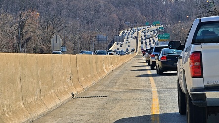
Rubbernecking on the Capital Beltway
-
US 29 Business in Culpeper, Virginia [02]
![US 29 Business in Culpeper, Virginia [02] (457651 visits) Aerial view of US 29 Business on the north side of Culpeper, Virginia. View facing approximately we... US 29 Business in Culpeper, Virginia [02]](../../../../../i/upload/2024/07/19/20240719165937-abc06307-cu_s9999x250.jpg)
-
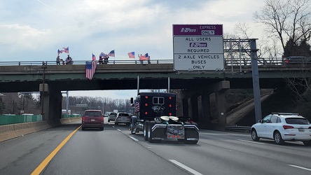
Trucker convoy
-
Interstate 81 at Route 796 [02]
![Interstate 81 at Route 796 [02] (3376 visits) Interstate 81 near Mount Jackson, Virginia, at the point where State Route 796 (Hawkins Road) crosse... Interstate 81 at Route 796 [02]](../../../../../i/upload/2024/07/20/20240720020830-706bf71d-cu_s9999x250.jpg)
-
Interstate 81 at Route 796 [01]
![Interstate 81 at Route 796 [01] (3178 visits) Interstate 81 near Mount Jackson, Virginia, at the point where State Route 796 (Hawkins Road) crosse... Interstate 81 at Route 796 [01]](../../../../../i/upload/2024/07/20/20240720020902-02c4ce7b-cu_s9999x250.jpg)
-
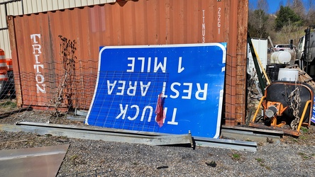
Truck rest area sign
-
Sign for State Route 188 [01]
![Sign for State Route 188 [01] (1252 visits) Signage pointing the way to State Route 188 at the intersection of Church Street and Commercial Aven... Sign for State Route 188 [01]](../../../../../i/upload/2024/07/20/20240720021810-3e9b4232-cu_s9999x250.jpg)
-
Sign for State Route 188 [02]
![Sign for State Route 188 [02] (1451 visits) Signage pointing the way to State Route 188 at the intersection of Church Street and Commercial Aven... Sign for State Route 188 [02]](../../../../../i/upload/2024/07/20/20240720021827-a0810db1-cu_s9999x250.jpg)
-
Sign for State Route 188 [03]
![Sign for State Route 188 [03] (1393 visits) Signage pointing the way to State Route 188 at the intersection of Church Street and Commercial Aven... Sign for State Route 188 [03]](../../../../../i/upload/2024/07/20/20240720021833-b69f59a5-cu_s9999x250.jpg)
-
Sign for State Route 188 [04]
![Sign for State Route 188 [04] (1517 visits) Signage pointing the way to State Route 188 at the intersection of Church Street and Commercial Aven... Sign for State Route 188 [04]](../../../../../i/upload/2024/07/20/20240720021852-b244dda6-cu_s9999x250.jpg)
-
Sign for State Route 188 [05]
![Sign for State Route 188 [05] (1489 visits) Signage pointing the way to State Route 188 at the intersection of Church Street and Commercial Aven... Sign for State Route 188 [05]](../../../../../i/upload/2024/07/20/20240720021903-7bd9cd82-cu_s9999x250.jpg)
-
Sign for State Route 188 [06]
![Sign for State Route 188 [06] (1479 visits) Signage pointing the way to State Route 188 at the intersection of Church Street and Commercial Aven... Sign for State Route 188 [06]](../../../../../i/upload/2024/07/20/20240720021915-40479437-cu_s9999x250.jpg)
-
Scott Hill Retirement Community [01]
![Scott Hill Retirement Community [01] (1755 visits) Scott Hill, a retirement community along US 60 Business in Clifton Forge, Virginia.
Ben Schumin is ... Scott Hill Retirement Community [01]](../../../../../i/upload/2024/07/20/20240720022014-a14a5661-cu_s9999x250.jpg)
-
Scott Hill Retirement Community [02]
![Scott Hill Retirement Community [02] (1690 visits) Scott Hill, a retirement community along US 60 Business in Clifton Forge, Virginia.
Ben Schumin is ... Scott Hill Retirement Community [02]](../../../../../i/upload/2024/07/20/20240720022019-7ad47a06-cu_s9999x250.jpg)
-
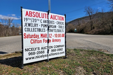
Sign advertising an auction
-
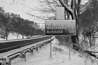
Snow-covered mileage sign on US 250
-
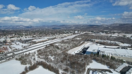
Interstate 64 corridor through Waynesboro, Virginia
-
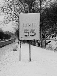
Snow-covered speed limit sign on US 250
-
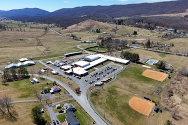
Highland County Schools
-
Aerial view of Monterey, Virginia [01]
![Aerial view of Monterey, Virginia [01] (2049 visits) Aerial view of Monterey, Virginia, a small town comprising the seat of Highland County.
More at The... Aerial view of Monterey, Virginia [01]](../../../../../i/upload/2025/01/02/20250102005918-685606f9-cu_s9999x250.jpg)
-
Aerial view of Monterey, Virginia [02]
![Aerial view of Monterey, Virginia [02] (2053 visits) Aerial view of Monterey, Virginia, a small town comprising the seat of Highland County.
More at The... Aerial view of Monterey, Virginia [02]](../../../../../i/upload/2025/01/02/20250102005923-7f7b9b83-cu_s9999x250.jpg)
-
Aerial view of Monterey, Virginia [03]
![Aerial view of Monterey, Virginia [03] (2009 visits) Aerial view of Monterey, Virginia, a small town comprising the seat of Highland County.
More at The... Aerial view of Monterey, Virginia [03]](../../../../../i/upload/2025/01/02/20250102005929-2e84a9d0-cu_s9999x250.jpg)
-
Aerial view of Monterey, Virginia [04]
![Aerial view of Monterey, Virginia [04] (2010 visits) Aerial view of Monterey, Virginia, a small town comprising the seat of Highland County.
More at The... Aerial view of Monterey, Virginia [04]](../../../../../i/upload/2025/01/02/20250102005937-281fae65-cu_s9999x250.jpg)
-
Aerial view of Monterey, Virginia [05]
![Aerial view of Monterey, Virginia [05] (2082 visits) Aerial view of Monterey, Virginia, a small town comprising the seat of Highland County.
More at The... Aerial view of Monterey, Virginia [05]](../../../../../i/upload/2025/01/02/20250102005946-79efaa38-cu_s9999x250.jpg)
-
Aerial view of Monterey, Virginia [06]
![Aerial view of Monterey, Virginia [06] (2035 visits) Aerial view of Monterey, Virginia, a small town comprising the seat of Highland County.
More at The... Aerial view of Monterey, Virginia [06]](../../../../../i/upload/2025/01/02/20250102005956-29786301-cu_s9999x250.jpg)
-
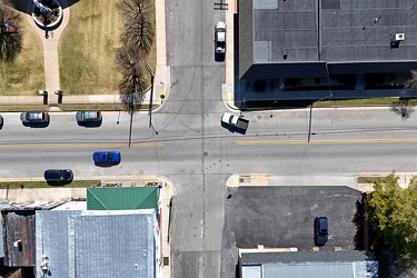
Intersection of US 250 and Spruce Street
-
US 220 south of Monterey, Virginia
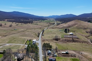
-
US 250 west of Monterey, Virginia
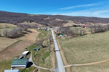
-
North end of Monterey, Virginia
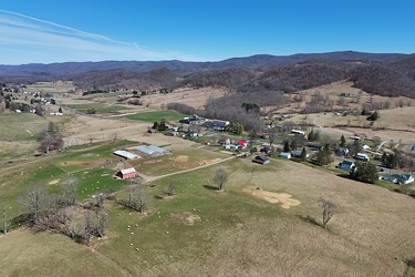
-
US 220 north of Monterey, Virginia
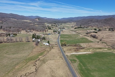
-
Routes 220 and 39 in Warm Springs, Virginia [01]
![Routes 220 and 39 in Warm Springs, Virginia [01] (1964 visits) US 220 and VA 39 in Warm Springs, Virginia, facing southwest. In this shot, US 220 runs top to bott... Routes 220 and 39 in Warm Springs, Virginia [01]](../../../../../i/upload/2025/01/02/20250102141310-79aa8afd-cu_s9999x250.jpg)
-
Routes 220 and 39 in Warm Springs, Virginia [02]
![Routes 220 and 39 in Warm Springs, Virginia [02] (1956 visits) US 220 and VA 39 in Warm Springs, Virginia, facing southwest. In this shot, US 220 is the road to t... Routes 220 and 39 in Warm Springs, Virginia [02]](../../../../../i/upload/2025/01/02/20250102141319-a5501ace-cu_s9999x250.jpg)
-
Aerial view of Hot Springs, Virginia
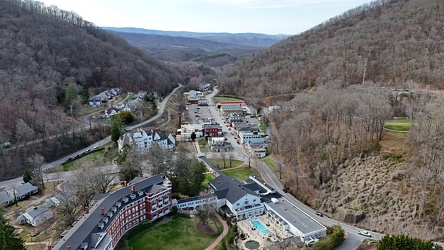
-
View along US 220 northbound in Hot Springs, Virginia
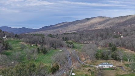
-
Interchange between US 11 and VA 262 [02]
![Interchange between US 11 and VA 262 [02] (2165 visits) Cloverleaf interchange between Virginia State Route 262 and US Route 11 near Staunton, Virginia. Ro... Interchange between US 11 and VA 262 [02]](../../../../../i/upload/2025/01/03/20250103172559-5c2ee040-cu_s9999x250.jpg)
-
Interchange between VA 262 and Old Greenville Road [01]
![Interchange between VA 262 and Old Greenville Road [01] (1901 visits) Cloverleaf interchange between Virginia State Route 262 and Old Greenville Road (VA 613) near Staunt... Interchange between VA 262 and Old Greenville Road [01]](../../../../../i/upload/2025/01/03/20250103172609-68b43692-cu_s9999x250.jpg)
-
Interchange between VA 262 and Old Greenville Road [02]
![Interchange between VA 262 and Old Greenville Road [02] (1949 visits) Cloverleaf interchange between Virginia State Route 262 and Old Greenville Road (VA 613) near Staunt... Interchange between VA 262 and Old Greenville Road [02]](../../../../../i/upload/2025/01/03/20250103172620-c2bd2a46-cu_s9999x250.jpg)
-
Buffalo Gap [02]
![Buffalo Gap [02] (898 visits) Buffalo Gap, a mountain pass through Little North Mountain, near Swoope, Virginia.
More at The Sc... Buffalo Gap [02]](../../../../../i/upload/2025/01/03/20250103200607-1abe8192-cu_s9999x250.jpg)