-
Plungefest 2011 [55]
![Plungefest 2011 [55] (25574 visits) On January 29, 2011, Special Olympics Maryland, the Maryland State Police, and a number of other org... Plungefest 2011 [55]](../../../../i/upload/2024/07/16/20240716230105-29a3b5ff-cu_s9999x250.jpg)
-
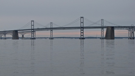
Chesapeake Bay Bridge from Sandy Point State Park
-
Interstate 70 Park and Ride [01]
![Interstate 70 Park and Ride [01] (3468 visits) Park and Ride lot at the eastern terminus of Interstate 70, just inside the city limits of Baltimore... Interstate 70 Park and Ride [01]](../../../../i/upload/2024/07/17/20240717101356-92c4631a-cu_s9999x250.jpg)
-
Interstate 70 Park and Ride [02]
![Interstate 70 Park and Ride [02] (3241 visits) Park and Ride lot at the eastern terminus of Interstate 70, just inside the city limits of Baltimore... Interstate 70 Park and Ride [02]](../../../../i/upload/2024/07/17/20240717101400-9f6381f5-cu_s9999x250.jpg)
-
Interstate 70 Park and Ride [03]
![Interstate 70 Park and Ride [03] (3185 visits) Park and Ride lot at the eastern terminus of Interstate 70, just inside the city limits of Baltimore... Interstate 70 Park and Ride [03]](../../../../i/upload/2024/07/17/20240717101402-96437861-cu_s9999x250.jpg)
-
Interstate 70 Park and Ride [04]
![Interstate 70 Park and Ride [04] (3572 visits) Park and Ride lot at the eastern terminus of Interstate 70, just inside the city limits of Baltimore... Interstate 70 Park and Ride [04]](../../../../i/upload/2024/07/17/20240717101405-2a4b47e8-cu_s9999x250.jpg)
-
Interstate 70 Park and Ride [05]
![Interstate 70 Park and Ride [05] (3190 visits) Park and Ride lot at the eastern terminus of Interstate 70, just inside the city limits of Baltimore... Interstate 70 Park and Ride [05]](../../../../i/upload/2024/07/17/20240717101408-de75e730-cu_s9999x250.jpg)
-
Interstate 70 Park and Ride [06]
![Interstate 70 Park and Ride [06] (3542 visits) Park and Ride lot at the eastern terminus of Interstate 70, just inside the city limits of Baltimore... Interstate 70 Park and Ride [06]](../../../../i/upload/2024/07/17/20240717101411-4c7a473d-cu_s9999x250.jpg)
-
Interstate 70 Park and Ride [08]
![Interstate 70 Park and Ride [08] (4716 visits) Park and Ride lot at the eastern terminus of Interstate 70, just inside the city limits of Baltimore... Interstate 70 Park and Ride [08]](../../../../i/upload/2024/07/17/20240717101415-dad1f17f-cu_s9999x250.jpg)
-
Interstate 70 Park and Ride [07]
![Interstate 70 Park and Ride [07] (4683 visits) Park and Ride lot at the eastern terminus of Interstate 70, just inside the city limits of Baltimore... Interstate 70 Park and Ride [07]](../../../../i/upload/2024/07/17/20240717101418-cb3d0cab-cu_s9999x250.jpg)
-
Interstate 70 Park and Ride [09]
![Interstate 70 Park and Ride [09] (3237 visits) Park and Ride lot at the eastern terminus of Interstate 70, just inside the city limits of Baltimore... Interstate 70 Park and Ride [09]](../../../../i/upload/2024/07/17/20240717101421-2cdea903-cu_s9999x250.jpg)
-
Interstate 70 Park and Ride [10]
![Interstate 70 Park and Ride [10] (3334 visits) Park and Ride lot at the eastern terminus of Interstate 70, just inside the city limits of Baltimore... Interstate 70 Park and Ride [10]](../../../../i/upload/2024/07/17/20240717101425-522ea9fe-cu_s9999x250.jpg)
-
Interstate 70 Park and Ride [11]
![Interstate 70 Park and Ride [11] (3214 visits) Park and Ride lot at the eastern terminus of Interstate 70, just inside the city limits of Baltimore... Interstate 70 Park and Ride [11]](../../../../i/upload/2024/07/17/20240717101428-609261b3-cu_s9999x250.jpg)
-
Interstate 70 Park and Ride [12]
![Interstate 70 Park and Ride [12] (8939 visits) Park and Ride lot at the eastern terminus of Interstate 70, just inside the city limits of Baltimore... Interstate 70 Park and Ride [12]](../../../../i/upload/2024/07/17/20240717101431-6682ec6e-cu_s9999x250.jpg)
-
Interstate 70 Park and Ride [13]
![Interstate 70 Park and Ride [13] (3236 visits) Park and Ride lot at the eastern terminus of Interstate 70, just inside the city limits of Baltimore... Interstate 70 Park and Ride [13]](../../../../i/upload/2024/07/17/20240717101434-be44361c-cu_s9999x250.jpg)
-
Interstate 70 Park and Ride [14]
![Interstate 70 Park and Ride [14] (3496 visits) Park and Ride lot at the eastern terminus of Interstate 70, just inside the city limits of Baltimore... Interstate 70 Park and Ride [14]](../../../../i/upload/2024/07/17/20240717101437-d335b061-cu_s9999x250.jpg)
-
Interstate 70 Park and Ride [15]
![Interstate 70 Park and Ride [15] (3141 visits) Park and Ride lot at the eastern terminus of Interstate 70, just inside the city limits of Baltimore... Interstate 70 Park and Ride [15]](../../../../i/upload/2024/07/17/20240717101440-5e188a30-cu_s9999x250.jpg)
-
Interstate 70 Park and Ride [16]
![Interstate 70 Park and Ride [16] (3543 visits) Park and Ride lot at the eastern terminus of Interstate 70, just inside the city limits of Baltimore... Interstate 70 Park and Ride [16]](../../../../i/upload/2024/07/17/20240717101443-659a724a-cu_s9999x250.jpg)
-
Interstate 70 Park and Ride [17]
![Interstate 70 Park and Ride [17] (2994 visits) Park and Ride lot at the eastern terminus of Interstate 70, just inside the city limits of Baltimore... Interstate 70 Park and Ride [17]](../../../../i/upload/2024/07/17/20240717101446-ebe1b286-cu_s9999x250.jpg)
-
Interstate 70 Park and Ride [18]
![Interstate 70 Park and Ride [18] (3188 visits) Park and Ride lot at the eastern terminus of Interstate 70, just inside the city limits of Baltimore... Interstate 70 Park and Ride [18]](../../../../i/upload/2024/07/17/20240717101449-12511c6d-cu_s9999x250.jpg)
-
Interstate 70 Park and Ride [19]
![Interstate 70 Park and Ride [19] (4775 visits) Park and Ride lot at the eastern terminus of Interstate 70, just inside the city limits of Baltimore... Interstate 70 Park and Ride [19]](../../../../i/upload/2024/07/17/20240717101452-5353f937-cu_s9999x250.jpg)
-
Interstate 70 Park and Ride [20]
![Interstate 70 Park and Ride [20] (3788 visits) Park and Ride lot at the eastern terminus of Interstate 70, just inside the city limits of Baltimore... Interstate 70 Park and Ride [20]](../../../../i/upload/2024/07/17/20240717101455-55518c25-cu_s9999x250.jpg)
-
View across the Baltimore Inner Harbor [02]
![View across the Baltimore Inner Harbor [02] (1507 visits) View across the Baltimore Inner Harbor, facing southeast. Federal Hill Park is visible in the right... View across the Baltimore Inner Harbor [02]](../../../../i/upload/2024/07/17/20240717225446-91be4844-cu_s9999x250.jpg)
-
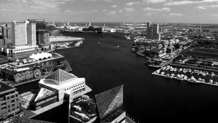
View from the Baltimore World Trade Center, facing southeast
-
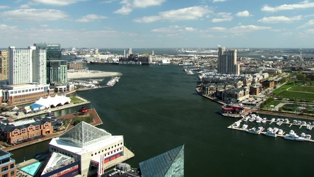
View from the Baltimore World Trade Center, facing southeast
-
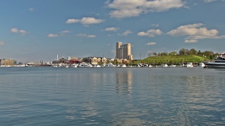
View across the Baltimore Inner Harbor
 Sideling Hill rest area [08]
![Sideling Hill rest area [08] (2126 visits) Eastbound parking lot at the Sideling Hill rest area, located along Interstate 68 in Washington Coun... Sideling Hill rest area [08]](../../../../i/upload/2024/07/17/20240717233537-4406b863-cu_s9999x250.jpg)
 Sideling Hill rest area [09]
![Sideling Hill rest area [09] (2167 visits) Eastbound parking lot at the Sideling Hill rest area, located along Interstate 68 in Washington Coun... Sideling Hill rest area [09]](../../../../i/upload/2024/07/17/20240717233542-efb1100b-cu_s9999x250.jpg)
 Sideling Hill rest area [10]
![Sideling Hill rest area [10] (2028 visits) Eastbound side of the Sideling Hill rest area, located along Interstate 68 in Washington County, Mar... Sideling Hill rest area [10]](../../../../i/upload/2024/07/17/20240717233547-516b9676-cu_s9999x250.jpg)
-
View from High Rock around sunset [01]
![View from High Rock around sunset [01] (3665 visits) View from High Rock, a rock outcropping on South Mountain in Pen Mar, Maryland, in Washington County... View from High Rock around sunset [01]](../../../../i/upload/2024/07/18/20240718125414-4cca566c-cu_s9999x250.jpg)
-
View from High Rock around sunset [02]
![View from High Rock around sunset [02] (1460 visits) View from High Rock, a rock outcropping on South Mountain in Pen Mar, Maryland, in Washington County... View from High Rock around sunset [02]](../../../../i/upload/2024/07/18/20240718125419-06cd22f4-cu_s9999x250.jpg)
-
View from High Rock around sunset [03]
![View from High Rock around sunset [03] (1481 visits) View from High Rock, a rock outcropping on South Mountain in Pen Mar, Maryland, in Washington County... View from High Rock around sunset [03]](../../../../i/upload/2024/07/18/20240718125422-7938edf7-cu_s9999x250.jpg)
-
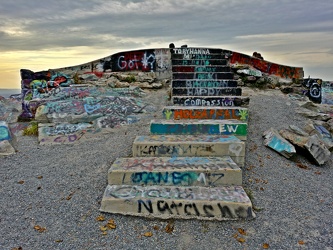
Steps to main overlook at High Rock
-
People standing on High Rock [01]
![People standing on High Rock [01] (2108 visits) People standing on and around High Rock, a rock outcropping on South Mountain in Pen Mar, Maryland, ... People standing on High Rock [01]](../../../../i/upload/2024/07/18/20240718125430-49f5c2ff-cu_s9999x250.jpg)
-
View from High Rock around sunset [04]
![View from High Rock around sunset [04] (1914 visits) View from High Rock, a rock outcropping on South Mountain in Pen Mar, Maryland, in Washington County... View from High Rock around sunset [04]](../../../../i/upload/2024/07/18/20240718125433-8a060ae7-cu_s9999x250.jpg)
-
Graffiti-covered stone at High Rock [01]
![Graffiti-covered stone at High Rock [01] (2102 visits) Graffiti-covered stone at High Rock, a rock outcropping on South Mountain in Pen Mar, Maryland, in W... Graffiti-covered stone at High Rock [01]](../../../../i/upload/2024/07/18/20240718125437-b92b052f-cu_s9999x250.jpg)
-
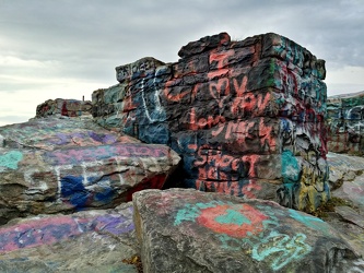
Graffiti-covered stones at High Rock
-
View from High Rock around sunset [05]
![View from High Rock around sunset [05] (1931 visits) View from High Rock, a rock outcropping on South Mountain in Pen Mar, Maryland, in Washington County... View from High Rock around sunset [05]](../../../../i/upload/2024/07/18/20240718125445-9b7d8206-cu_s9999x250.jpg)
-
View from High Rock around sunset [06]
![View from High Rock around sunset [06] (1983 visits) View from High Rock, a rock outcropping on South Mountain in Pen Mar, Maryland, in Washington County... View from High Rock around sunset [06]](../../../../i/upload/2024/07/18/20240718125449-9904b382-cu_s9999x250.jpg)
-
View from High Rock around sunset [07]
![View from High Rock around sunset [07] (1954 visits) View from High Rock, a rock outcropping on South Mountain in Pen Mar, Maryland, in Washington County... View from High Rock around sunset [07]](../../../../i/upload/2024/07/18/20240718125452-a060fd82-cu_s9999x250.jpg)
-
Graffiti-covered stone at High Rock [02]
![Graffiti-covered stone at High Rock [02] (1980 visits) Graffiti-covered stone at High Rock, a rock outcropping on South Mountain in Pen Mar, Maryland, in W... Graffiti-covered stone at High Rock [02]](../../../../i/upload/2024/07/18/20240718125456-e62dc4ce-cu_s9999x250.jpg)
-
Graffiti-covered stone at High Rock [03]
![Graffiti-covered stone at High Rock [03] (1889 visits) Graffiti-covered stone at High Rock, a rock outcropping on South Mountain in Pen Mar, Maryland, in W... Graffiti-covered stone at High Rock [03]](../../../../i/upload/2024/07/18/20240718125500-5ab7b0f5-cu_s9999x250.jpg)
-
Graffiti-covered stone at High Rock [04]
![Graffiti-covered stone at High Rock [04] (1913 visits) Graffiti-covered stone at High Rock, a rock outcropping on South Mountain in Pen Mar, Maryland, in W... Graffiti-covered stone at High Rock [04]](../../../../i/upload/2024/07/18/20240718125505-6e88d549-cu_s9999x250.jpg)
-
People standing on High Rock [02]
![People standing on High Rock [02] (1991 visits) People standing on and around High Rock, a rock outcropping on South Mountain in Pen Mar, Maryland, ... People standing on High Rock [02]](../../../../i/upload/2024/07/18/20240718125509-fb973c54-cu_s9999x250.jpg)
-
Two women sitting on High Rock

-
Two women looking at their cell phones at High Rock

-
Four teens looking at their phones on High Rock

-
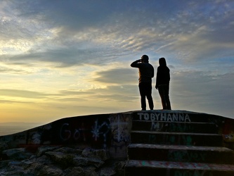
Two people standing on High Rock
-
Couple looking at their cell phones at High Rock

-
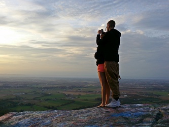
Couple taking photos from High Rock
-
View from High Rock around sunset [08]
![View from High Rock around sunset [08] (1502 visits) View from High Rock, a rock outcropping on South Mountain in Pen Mar, Maryland, in Washington County... View from High Rock around sunset [08]](../../../../i/upload/2024/07/18/20240718125539-68d743dd-cu_s9999x250.jpg)
-
View from High Rock around sunset [09]
![View from High Rock around sunset [09] (1562 visits) View from High Rock, a rock outcropping on South Mountain in Pen Mar, Maryland, in Washington County... View from High Rock around sunset [09]](../../../../i/upload/2024/07/18/20240718125542-d5f04008-cu_s9999x250.jpg)
-
View from High Rock around sunset [10]
![View from High Rock around sunset [10] (1581 visits) View from High Rock, a rock outcropping on South Mountain in Pen Mar, Maryland, in Washington County... View from High Rock around sunset [10]](../../../../i/upload/2024/07/18/20240718125546-0de77111-cu_s9999x250.jpg)
-
View from High Rock around sunset [11]
![View from High Rock around sunset [11] (1741 visits) View from High Rock, a rock outcropping on South Mountain in Pen Mar, Maryland, in Washington County... View from High Rock around sunset [11]](../../../../i/upload/2024/07/18/20240718125550-f940cb2a-cu_s9999x250.jpg)
-
View of the sunset from High Rock [01]
![View of the sunset from High Rock [01] (1787 visits) View of the sunset from High Rock, a rock outcropping on South Mountain in Pen Mar, Maryland, in Was... View of the sunset from High Rock [01]](../../../../i/upload/2024/07/18/20240718125553-1df4c653-cu_s9999x250.jpg)
-
View of the sunset from High Rock [02]
![View of the sunset from High Rock [02] (1685 visits) View of the sunset from High Rock, a rock outcropping on South Mountain in Pen Mar, Maryland, in Was... View of the sunset from High Rock [02]](../../../../i/upload/2024/07/18/20240718125557-d168466e-cu_s9999x250.jpg)
-
View of the sunset from High Rock [03]
![View of the sunset from High Rock [03] (1824 visits) View of the sunset from High Rock, a rock outcropping on South Mountain in Pen Mar, Maryland, in Was... View of the sunset from High Rock [03]](../../../../i/upload/2024/07/18/20240718125601-a2d71104-cu_s9999x250.jpg)
-
Rocks in the Potomac River [01]
![Rocks in the Potomac River [01] (1091 visits) Rocks in the Potomac River near Harpers Ferry. Viewed from the US 340 bridge.
Ben Schumin is a pro... Rocks in the Potomac River [01]](../../../../i/upload/2024/07/19/20240719103333-6083493b-cu_s9999x250.jpg)
-
Rocks in the Potomac River [02]
![Rocks in the Potomac River [02] (1042 visits) Rocks in the Potomac River near Harpers Ferry. Viewed from the US 340 bridge.
Ben Schumin is a pro... Rocks in the Potomac River [02]](../../../../i/upload/2024/07/19/20240719103338-04e1c1e1-cu_s9999x250.jpg)
-
Rocks in the Potomac River [03]
![Rocks in the Potomac River [03] (1042 visits) Rocks in the Potomac River near Harpers Ferry. Viewed from the US 340 bridge.
Ben Schumin is a pro... Rocks in the Potomac River [03]](../../../../i/upload/2024/07/19/20240719103343-404e77e5-cu_s9999x250.jpg)
-
Rocks in the Potomac River [04]
![Rocks in the Potomac River [04] (1057 visits) Rocks in the Potomac River near Harpers Ferry. Viewed from the US 340 bridge.
Ben Schumin is a pro... Rocks in the Potomac River [04]](../../../../i/upload/2024/07/19/20240719103348-1a3aef78-cu_s9999x250.jpg)
-
Rocks in the Potomac River [05]
![Rocks in the Potomac River [05] (1119 visits) Rocks in the Potomac River near Harpers Ferry. Viewed from the US 340 bridge.
Ben Schumin is a pro... Rocks in the Potomac River [05]](../../../../i/upload/2024/07/19/20240719103353-ea395458-cu_s9999x250.jpg)
-
Potomac River from US 340 bridge [03]
![Potomac River from US 340 bridge [03] (1125 visits) The Potomac River, viewed from the US 340 bridge between Maryland and Virginia.
Ben Schumin is a pr... Potomac River from US 340 bridge [03]](../../../../i/upload/2024/07/19/20240719103359-b66380e8-cu_s9999x250.jpg)
-
Potomac River from US 340 bridge [04]
![Potomac River from US 340 bridge [04] (1205 visits) The Potomac River, viewed from the US 340 bridge between Maryland and Virginia.
Ben Schumin is a pr... Potomac River from US 340 bridge [04]](../../../../i/upload/2024/07/19/20240719103405-18d26a8b-cu_s9999x250.jpg)
-
Potomac River from US 340 bridge [05]
![Potomac River from US 340 bridge [05] (1218 visits) The Potomac River, viewed from the US 340 bridge between Maryland and Virginia.
Ben Schumin is a pr... Potomac River from US 340 bridge [05]](../../../../i/upload/2024/07/19/20240719103412-5b42c5b9-cu_s9999x250.jpg)
-
Chesapeake Bay Bridge [01]
![Chesapeake Bay Bridge [01] (3111 visits) The Chesapeake Bay Bridge, a pair of bridges approximately 4.35 miles in length that carry US Routes... Chesapeake Bay Bridge [01]](../../../../i/upload/2024/07/19/20240719162332-1d4f9ead-cu_s9999x250.jpg)
-
Chesapeake Bay Bridge [02]
![Chesapeake Bay Bridge [02] (3191 visits) The Chesapeake Bay Bridge, a pair of bridges approximately 4.35 miles in length that carry US Routes... Chesapeake Bay Bridge [02]](../../../../i/upload/2024/07/19/20240719162336-59620651-cu_s9999x250.jpg)
-
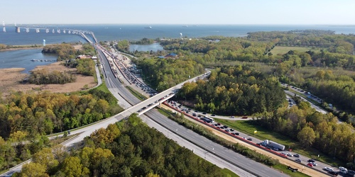
Traffic backup on Bay Bridge approach
-
Chesapeake Bay Bridge [03]
![Chesapeake Bay Bridge [03] (3152 visits) The Chesapeake Bay Bridge, a pair of bridges approximately 4.35 miles in length that carry US Routes... Chesapeake Bay Bridge [03]](../../../../i/upload/2024/07/19/20240719162426-d7b27488-cu_s9999x250.jpg)
-
Chesapeake Bay Bridge [04]
![Chesapeake Bay Bridge [04] (3403 visits) The Chesapeake Bay Bridge, a pair of bridges approximately 4.35 miles in length that carry US Routes... Chesapeake Bay Bridge [04]](../../../../i/upload/2024/07/19/20240719162503-710cfed8-cu_s9999x250.jpg)
-
Communications antenna near Sandy Point [02]
![Communications antenna near Sandy Point [02] (1836 visits) Communications antenna off of College Parkway in Annapolis, Maryland, near Sandy Point State Park, o... Communications antenna near Sandy Point [02]](../../../../i/upload/2024/07/19/20240719162507-ac6b866a-cu_s9999x250.jpg)
-
Communications antenna near Sandy Point [01]
![Communications antenna near Sandy Point [01] (1882 visits) Communications antenna off of College Parkway in Annapolis, Maryland, near Sandy Point State Park, o... Communications antenna near Sandy Point [01]](../../../../i/upload/2024/07/19/20240719162602-e02abfc3-cu_s9999x250.jpg)
-
Sign for Jonah and the Whale parking lot

-
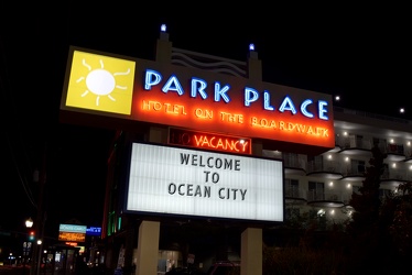
Sign for Park Place Hotel
-
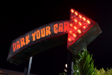
“Park Your Car” sign at Seacrets
-
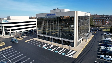
481 North Frederick Avenue
-
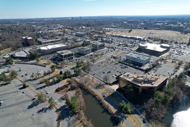
Office buildings along Lakeforest Boulevard and Russell Avenue
-
Grosvenor Tower [01]
![Grosvenor Tower [01] (2010 visits) Grosvenor Tower, a high-rise apartment building at 10301 Grosvenor Place in North Bethesda, Maryland... Grosvenor Tower [01]](../../../../i/upload/2024/07/20/20240720103850-03d439dd-cu_s9999x250.jpg)
-
Grosvenor Tower [02]
![Grosvenor Tower [02] (2174 visits) Grosvenor Tower, a high-rise apartment building at 10301 Grosvenor Place in North Bethesda, Maryland... Grosvenor Tower [02]](../../../../i/upload/2024/07/20/20240720103856-2cdc75f0-cu_s9999x250.jpg)
-
Grosvenor Tower [03]
![Grosvenor Tower [03] (2278 visits) Grosvenor Tower, a high-rise apartment building at 10301 Grosvenor Place in North Bethesda, Maryland... Grosvenor Tower [03]](../../../../i/upload/2024/07/20/20240720103902-fa63d831-cu_s9999x250.jpg)