-
Interstate 64 in Nelson County, Virginia [01]
![Interstate 64 in Nelson County, Virginia [01] (11280 visits) Interstate 64 in Nelson County, Virginia, near Rockfish Gap. US 250 runs adjacent to the freeway.
... Interstate 64 in Nelson County, Virginia [01]](../../../../../i/upload/2024/07/19/20240719115200-c8a2ce39-cu_s9999x250.jpg)
-
Interstate 64 in Nelson County, Virginia [02]
![Interstate 64 in Nelson County, Virginia [02] (11395 visits) Interstate 64 in Nelson County, Virginia, near Rockfish Gap. US 250 runs adjacent to the freeway.
... Interstate 64 in Nelson County, Virginia [02]](../../../../../i/upload/2024/07/19/20240719115847-184fa12a-cu_s9999x250.jpg)
-
Interstate 64 in Nelson County, Virginia [03]
![Interstate 64 in Nelson County, Virginia [03] (11572 visits) Interstate 64 in Nelson County, Virginia, near Rockfish Gap. US 250 runs adjacent to the freeway.
... Interstate 64 in Nelson County, Virginia [03]](../../../../../i/upload/2024/07/19/20240719115902-ff5fb9e1-cu_s9999x250.jpg)
-
Interstate 64 near Rockfish Gap [01]
![Interstate 64 near Rockfish Gap [01] (66618 visits) Interstate 64, near Rockfish Gap in Virginia.
Ben Schumin is a professional photographer who captur... Interstate 64 near Rockfish Gap [01]](../../../../../i/upload/2024/07/19/20240719120555-d0d3c2ce-cu_s9999x250.jpg)
-
Interstate 64 near Rockfish Gap [02]
![Interstate 64 near Rockfish Gap [02] (3546 visits) Interstate 64, near Rockfish Gap in Virginia. The bridge in the foreground carries Skyline Drive ov... Interstate 64 near Rockfish Gap [02]](../../../../../i/upload/2024/07/19/20240719120604-e2ad25dd-cu_s9999x250.jpg)
-
Interstate 64 near Rockfish Gap [03]
![Interstate 64 near Rockfish Gap [03] (3569 visits) Interstate 64, near Rockfish Gap in Virginia. The bridge in the foreground carries Skyline Drive ov... Interstate 64 near Rockfish Gap [03]](../../../../../i/upload/2024/07/19/20240719120613-6e2190f6-cu_s9999x250.jpg)
-
Interstate 64 near Rockfish Gap [04]
![Interstate 64 near Rockfish Gap [04] (3585 visits) Interstate 64, near Rockfish Gap in Virginia. The bridge in the foreground carries Skyline Drive ov... Interstate 64 near Rockfish Gap [04]](../../../../../i/upload/2024/07/19/20240719120620-49d9b327-cu_s9999x250.jpg)
-
Interstate 64 near Rockfish Gap [05]
![Interstate 64 near Rockfish Gap [05] (11367 visits) Interstate 64, near Rockfish Gap in Virginia. The boundary between Augusta and Nelson Counties runs... Interstate 64 near Rockfish Gap [05]](../../../../../i/upload/2024/07/19/20240719120629-90e00218-cu_s9999x250.jpg)
-
US 70 in New Bern, North Carolina [01]
![US 70 in New Bern, North Carolina [01] (4406 visits) Diamond interchange between US 70 (over) and US 17 Business (under) in New Bern, North Carolina. Vi... US 70 in New Bern, North Carolina [01]](../../../../../i/upload/2024/07/19/20240719201132-9585ba3d-cu_s9999x250.jpg)
-
US 17/NC 55 bridge over the Neuse River [02]
![US 17/NC 55 bridge over the Neuse River [02] (4945 visits) Bridge carrying US 17 and NC 55 over the Neuse River in New Bern, North Carolina.
More at The Schum... US 17/NC 55 bridge over the Neuse River [02]](../../../../../i/upload/2024/07/19/20240719201249-779b2711-cu_s9999x250.jpg)
-
US 17/NC 55 bridge over the Neuse River [03]
![US 17/NC 55 bridge over the Neuse River [03] (5176 visits) Bridge carrying US 17 and NC 55 over the Neuse River in New Bern, North Carolina.
More at The Schum... US 17/NC 55 bridge over the Neuse River [03]](../../../../../i/upload/2024/07/19/20240719201257-1230884e-cu_s9999x250.jpg)
-
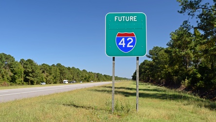
Future Interstate 42

-
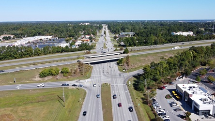
Interchange between US 70 and US 17 Business

-
US 70 in New Bern, North Carolina [02]
![US 70 in New Bern, North Carolina [02] (4603 visits) Ramps from the diamond interchange between US 70 and US 17 Business in New Bern, North Carolina. Vi... US 70 in New Bern, North Carolina [02]](../../../../../i/upload/2024/07/19/20240719201448-9f99bdf3-cu_s9999x250.jpg)
-
US 70 in New Bern, North Carolina [03]
![US 70 in New Bern, North Carolina [03] (4351 visits) US 70 in New Bern, North Carolina, just south of the diamond interchange with US 17 Business. View ... US 70 in New Bern, North Carolina [03]](../../../../../i/upload/2024/07/19/20240719201452-87399c78-cu_s9999x250.jpg)
-
US 17/NC 55 bridge over the Neuse River [01]
![US 17/NC 55 bridge over the Neuse River [01] (5073 visits) Bridge carrying US 17 and NC 55 over the Neuse River in New Bern, North Carolina.
More at The Schum... US 17/NC 55 bridge over the Neuse River [01]](../../../../../i/upload/2024/07/19/20240719201640-d3364b30-cu_s9999x250.jpg)
-
US 17/US 70/NC 55 bridge over the Trent River [03]
![US 17/US 70/NC 55 bridge over the Trent River [03] (4946 visits) Bridge carrying US 17, US 70, and NC 55 over the Trent River in New Bern, North Carolina.
More at T... US 17/US 70/NC 55 bridge over the Trent River [03]](../../../../../i/upload/2024/07/19/20240719201701-a0605be3-cu_s9999x250.jpg)
-
US 17/US 70/NC 55 bridge over the Trent River [01]
![US 17/US 70/NC 55 bridge over the Trent River [01] (5187 visits) Bridge carrying US 17, US 70, and NC 55 over the Trent River in New Bern, North Carolina.
More at T... US 17/US 70/NC 55 bridge over the Trent River [01]](../../../../../i/upload/2024/07/19/20240719201705-e6625ff1-cu_s9999x250.jpg)
-
US 17/US 70/NC 55 bridge over the Trent River [02]
![US 17/US 70/NC 55 bridge over the Trent River [02] (4876 visits) Bridge carrying US 17, US 70, and NC 55 over the Trent River in New Bern, North Carolina.
More at T... US 17/US 70/NC 55 bridge over the Trent River [02]](../../../../../i/upload/2024/07/19/20240719201747-70537f8f-cu_s9999x250.jpg)
-
End Interstate 795 [03]
![End Interstate 795 [03] (3238 visits) "End" signage for Interstate 795 in Wilson County, North Carolina, just before the interch... End Interstate 795 [03]](../../../../../i/upload/2024/07/19/20240719202045-afb766cf-cu_s9999x250.jpg)
-
Reassurance markers for US 13, US 70, and NC 111 [04]
![Reassurance markers for US 13, US 70, and NC 111 [04] (2827 visits) Sign assembly containing reassurance markers for southbound US Route 13, westbound US Route 70, and ... Reassurance markers for US 13, US 70, and NC 111 [04]](../../../../../i/upload/2024/07/19/20240719202050-eefad4c5-cu_s9999x250.jpg)
-
Farm equipment sign on I-795 [01]
![Farm equipment sign on I-795 [01] (2946 visits) Sign on northbound Interstate 795 at the point where it merges with US Route 264 in Wilson County, N... Farm equipment sign on I-795 [01]](../../../../../i/upload/2024/07/19/20240719202056-5eb4ab98-cu_s9999x250.jpg)
-
End Interstate 795 [01]
![End Interstate 795 [01] (4562 visits) "End" signage for Interstate 795 in Wilson County, North Carolina, just before the interch... End Interstate 795 [01]](../../../../../i/upload/2024/07/19/20240719202101-740e602e-cu_s9999x250.jpg)
-
Farm equipment sign on I-795 [02]
![Farm equipment sign on I-795 [02] (2970 visits) Sign on northbound Interstate 795 at the point where it merges with US Route 264 in Wilson County, N... Farm equipment sign on I-795 [02]](../../../../../i/upload/2024/07/19/20240719202106-0b40de21-cu_s9999x250.jpg)
-
Reassurance markers for US 13, US 70, and NC 111 [01]
![Reassurance markers for US 13, US 70, and NC 111 [01] (2777 visits) Sign assembly containing reassurance markers for southbound US Route 13, westbound US Route 70, and ... Reassurance markers for US 13, US 70, and NC 111 [01]](../../../../../i/upload/2024/07/19/20240719202111-08757310-cu_s9999x250.jpg)
-
Reassurance markers for US 13, US 70, and NC 111 [03]
![Reassurance markers for US 13, US 70, and NC 111 [03] (3727 visits) Sign assembly containing reassurance markers for southbound US Route 13, westbound US Route 70, and ... Reassurance markers for US 13, US 70, and NC 111 [03]](../../../../../i/upload/2024/07/19/20240719202116-04523f40-cu_s9999x250.jpg)
-
End Interstate 795 [02]
![End Interstate 795 [02] (3096 visits) "End" signage for Interstate 795 in Wilson County, North Carolina, just before the interch... End Interstate 795 [02]](../../../../../i/upload/2024/07/19/20240719202125-53d8e2f2-cu_s9999x250.jpg)
-
Reassurance markers for US 13, US 70, and NC 111 [02]
![Reassurance markers for US 13, US 70, and NC 111 [02] (4076 visits) Sign assembly containing reassurance markers for southbound US Route 13, westbound US Route 70, and ... Reassurance markers for US 13, US 70, and NC 111 [02]](../../../../../i/upload/2024/07/19/20240719202130-777f3422-cu_s9999x250.jpg)
-
Signs at intersection of TN 1/US 70 and TN 101/TN 392 [01]
![Signs at intersection of TN 1/US 70 and TN 101/TN 392 [01] (2163 visits) Route signage at the intersection of US 70, State Route 1, State Route 101, and State Route 392 near... Signs at intersection of TN 1/US 70 and TN 101/TN 392 [01]](../../../../../i/upload/2024/07/20/20240720113107-0500fd1e-cu_s9999x250.jpg)
-
Signs at intersection of TN 1/US 70 and TN 101/TN 392 [02]
![Signs at intersection of TN 1/US 70 and TN 101/TN 392 [02] (2117 visits) Route signage at the intersection of US 70, State Route 1, State Route 101, and State Route 392 near... Signs at intersection of TN 1/US 70 and TN 101/TN 392 [02]](../../../../../i/upload/2024/07/20/20240720113333-addad014-cu_s9999x250.jpg)
-
Signs at intersection of TN 1/US 70 and TN 101/TN 392 [03]
![Signs at intersection of TN 1/US 70 and TN 101/TN 392 [03] (2319 visits) Route signage at the intersection of US 70, State Route 1, State Route 101, and State Route 392 near... Signs at intersection of TN 1/US 70 and TN 101/TN 392 [03]](../../../../../i/upload/2024/07/20/20240720113359-3820c777-cu_s9999x250.jpg)
-
Signage for I-40 on US 321 [01]
![Signage for I-40 on US 321 [01] (2187 visits) Signage for Interstate 40 on US 321 in Lenoir City, Tennessee.
More at The Schumin Web:
www.schumin... Signage for I-40 on US 321 [01]](../../../../../i/upload/2024/07/20/20240720113534-f6b63e08-cu_s9999x250.jpg)
-
Signage for I-40 on US 321 [02]
![Signage for I-40 on US 321 [02] (2068 visits) Signage for westbound Interstate 40 on US 321 in Lenoir City, Tennessee.
More at The Schumin Web:
w... Signage for I-40 on US 321 [02]](../../../../../i/upload/2024/07/20/20240720113601-2fc22be3-cu_s9999x250.jpg)
-
Signage for I-40 on US 321 [03]
![Signage for I-40 on US 321 [03] (2142 visits) Signage for westbound Interstate 40 on US 321 in Lenoir City, Tennessee.
Alternate treatment of s... Signage for I-40 on US 321 [03]](../../../../../i/upload/2024/07/20/20240720113623-c53233ee-cu_s9999x250.jpg)
-
Signage for I-40 on US 321 [04]
![Signage for I-40 on US 321 [04] (2136 visits) Signage for westbound Interstate 40 on US 321 in Lenoir City, Tennessee.
Alternate treatment of s... Signage for I-40 on US 321 [04]](../../../../../i/upload/2024/07/20/20240720113639-59f19d46-cu_s9999x250.jpg)
-
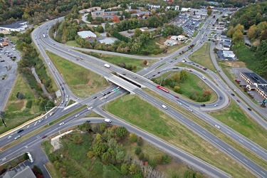
Franklin Road interchange

-
View south on Franklin Road

-
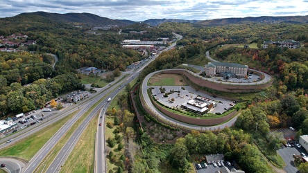
Aerial view of Roanoke, Virginia [01]
![Aerial view of Roanoke, Virginia [01] (2549 visits) Aerial view of Roanoke, Virginia.
More at The Schumin Web:
www.schuminweb.com/life-and-times/advent... Aerial view of Roanoke, Virginia [01]](../../../../../i/upload/2024/07/20/20240720121757-bb58476c-cu_s9999x250.jpg)
-
Aerial view of Roanoke, Virginia [02]
![Aerial view of Roanoke, Virginia [02] (2447 visits) Aerial view of Roanoke, Virginia.
More at The Schumin Web:
www.schuminweb.com/life-and-times/advent... Aerial view of Roanoke, Virginia [02]](../../../../../i/upload/2024/07/20/20240720121808-dccb83a0-cu_s9999x250.jpg)
-
Aerial view of Roanoke, Virginia [03]
![Aerial view of Roanoke, Virginia [03] (2469 visits) Aerial view of Roanoke, Virginia.
More at The Schumin Web:
www.schuminweb.com/life-and-times/advent... Aerial view of Roanoke, Virginia [03]](../../../../../i/upload/2024/07/20/20240720121837-3c6bbb13-cu_s9999x250.jpg)
-
Aerial view of Roanoke, Virginia [04]
![Aerial view of Roanoke, Virginia [04] (2554 visits) Aerial view of Roanoke, Virginia.
More at The Schumin Web:
www.schuminweb.com/life-and-times/advent... Aerial view of Roanoke, Virginia [04]](../../../../../i/upload/2024/07/20/20240720121854-34748718-cu_s9999x250.jpg)
-
Aerial view of Roanoke, Virginia [05]
![Aerial view of Roanoke, Virginia [05] (2450 visits) Aerial view of Roanoke, Virginia.
More at The Schumin Web:
www.schuminweb.com/life-and-times/advent... Aerial view of Roanoke, Virginia [05]](../../../../../i/upload/2024/07/20/20240720121906-5f802cee-cu_s9999x250.jpg)
-
Aerial view of Roanoke, Virginia [06]
![Aerial view of Roanoke, Virginia [06] (2347 visits) Aerial view of Roanoke, Virginia.
More at The Schumin Web:
www.schuminweb.com/life-and-times/advent... Aerial view of Roanoke, Virginia [06]](../../../../../i/upload/2024/07/20/20240720121917-3d4a6311-cu_s9999x250.jpg)
-
Eastern terminus of Interstate 26 [01]
![Eastern terminus of Interstate 26 [01] (413 visits) The eastern terminus of Interstate 26 in Charleston, South Carolina. I-26 ends at a signalized inte... Eastern terminus of Interstate 26 [01]](../../../../../i/upload/2025/05/23/20250523172345-9b22a449-cu_s9999x250.jpg)
-
Eastern terminus of Interstate 26 [02]
![Eastern terminus of Interstate 26 [02] (239 visits) The eastern terminus of Interstate 26 in Charleston, South Carolina. I-26 ends at a signalized inte... Eastern terminus of Interstate 26 [02]](../../../../../i/upload/2025/05/23/20250523172431-321f5bc1-cu_s9999x250.jpg)
-
Eastern terminus of Interstate 26 [03]
![Eastern terminus of Interstate 26 [03] (363 visits) The eastern terminus of Interstate 26 in Charleston, South Carolina. I-26 ends at a signalized inte... Eastern terminus of Interstate 26 [03]](../../../../../i/upload/2025/05/23/20250523172453-291afe72-cu_s9999x250.jpg)