-
Interchange between Limekiln Road and Interstate 83 [02]
![Interchange between Limekiln Road and Interstate 83 [02] Interchange between Interstate 83 and Limekiln Road in New Cumberland, Pennsylvania.
More at The Sc... Interchange between Limekiln Road and Interstate 83 [02]](../../../../../i/upload/2025/07/20/20250720152216-616ae1d4-cu_s9999x250.jpg)
-
Top-down view of Interstate 83

-
Intersection of US 29 and Hydraulic Road


-
Interstate 64 at State Route F182 [03]
![Interstate 64 at State Route F182 [03] (1 visits) Interstate 64 at the State Route F182 overpass, just east of Rockfish Gap in Nelson County, Virginia... Interstate 64 at State Route F182 [03]](../../../../../i/upload/2025/07/10/20250710145511-fd5b9f84-cu_s9999x250.jpg)
-
Interchange between Limekiln Road and Interstate 83 [01]
![Interchange between Limekiln Road and Interstate 83 [01] (1 visits) Interchange between Interstate 83 and Limekiln Road in New Cumberland, Pennsylvania.
More at The Sc... Interchange between Limekiln Road and Interstate 83 [01]](../../../../../i/upload/2025/07/20/20250720152205-fc5f1e22-cu_s9999x250.jpg)
-
Pennsylvania Turnpike Harrisburg West interchange [01]
![Pennsylvania Turnpike Harrisburg West interchange [01] (1 visits) The Harrisburg West interchange (242) on the Pennsylvania Turnpike, which functions as a direct conn... Pennsylvania Turnpike Harrisburg West interchange [01]](../../../../../i/upload/2025/07/20/20250720152235-82ea8b0e-cu_s9999x250.jpg)
-
Pennsylvania Turnpike Harrisburg West interchange [02]
![Pennsylvania Turnpike Harrisburg West interchange [02] (1 visits) The Harrisburg West interchange (242) on the Pennsylvania Turnpike, which functions as a direct conn... Pennsylvania Turnpike Harrisburg West interchange [02]](../../../../../i/upload/2025/07/20/20250720152248-752e1622-cu_s9999x250.jpg)
-
Interstate 83 Business Loop shield [05]

![Interstate 83 Business Loop shield [05] (1 visits) Interstate 83 Business Loop shield along South George Street in York, Pennsylvania. Business Inters... Interstate 83 Business Loop shield [05]](../../../../../i/upload/2025/07/27/20250727084715-fe927fec-cu_s9999x250.jpg)
-
Interstate 83 Business Loop shield [06]

![Interstate 83 Business Loop shield [06] (1 visits) Interstate 83 Business Loop shield along South George Street in York, Pennsylvania. Business Inters... Interstate 83 Business Loop shield [06]](../../../../../i/upload/2025/07/27/20250727084751-5008a0a7-cu_s9999x250.jpg)
-
DJI_20250326172037_0052_D MOD


-
Interstate 64 at State Route F182 [01]
![Interstate 64 at State Route F182 [01] (3 visits) Interstate 64 at the State Route F182 overpass, just east of Rockfish Gap in Nelson County, Virginia... Interstate 64 at State Route F182 [01]](../../../../../i/upload/2025/07/10/20250710145453-bbc92c0e-cu_s9999x250.jpg)
-
Interstate 64 at State Route F182 [02]
![Interstate 64 at State Route F182 [02] (3 visits) Interstate 64 at the State Route F182 overpass, just east of Rockfish Gap in Nelson County, Virginia... Interstate 64 at State Route F182 [02]](../../../../../i/upload/2025/07/10/20250710145503-3dd8f977-cu_s9999x250.jpg)
-
Claymont, Delaware at sunset [02]
![Claymont, Delaware at sunset [02] (5 visits) Aerial view of Claymont, Delaware at sunset, facing southwest. US 13 Business runs through the midd... Claymont, Delaware at sunset [02]](../../../../../i/upload/2025/07/11/20250711011104-dbf0c940-cu_s9999x250.jpg)
-
Interstate 64 at State Route F182 [04]
![Interstate 64 at State Route F182 [04] (6 visits) Interstate 64 at the State Route F182 overpass, just east of Rockfish Gap in Nelson County, Virginia... Interstate 64 at State Route F182 [04]](../../../../../i/upload/2025/07/10/20250710145527-79133bcd-cu_s9999x250.jpg)
-
Exit 240 on Interstate 81


-
Parking backwards in downtown Waynesboro

-
Claymont, Delaware at sunset [01]
![Claymont, Delaware at sunset [01] (13 visits) Aerial view of Claymont, Delaware at sunset, facing northeast. The three transportation corridors, ... Claymont, Delaware at sunset [01]](../../../../../i/upload/2025/07/11/20250711011050-9ca4b09c-cu_s9999x250.jpg)
-
Toyota HiAce

-
State Route F182 bridge

-
Aurora Borealis in Ringgold, Maryland [05]
![Aurora Borealis in Ringgold, Maryland [05] (19 visits) The Aurora Borealis, viewed from near the intersection of Maryland Routes 64 and 418 in Ringgold, Ma... Aurora Borealis in Ringgold, Maryland [05]](../../../../../i/upload/2025/06/22/20250622202656-f23cac80-cu_s9999x250.jpg)
-
Aurora Borealis in Ringgold, Maryland [03]
![Aurora Borealis in Ringgold, Maryland [03] (22 visits) The Aurora Borealis, viewed from near the intersection of Maryland Routes 64 and 418 in Ringgold, Ma... Aurora Borealis in Ringgold, Maryland [03]](../../../../../i/upload/2025/06/22/20250622202640-a2b69060-cu_s9999x250.jpg)
-
Aurora Borealis in Ringgold, Maryland [01]
![Aurora Borealis in Ringgold, Maryland [01] (23 visits) The Aurora Borealis, viewed from near the intersection of Maryland Routes 64 and 418 in Ringgold, Ma... Aurora Borealis in Ringgold, Maryland [01]](../../../../../i/upload/2025/06/22/20250622202621-86ae9709-cu_s9999x250.jpg)
-
Sudley Road just south of I-66

-
Aurora Borealis in Ringgold, Maryland [02]
![Aurora Borealis in Ringgold, Maryland [02] (25 visits) The Aurora Borealis, viewed from near the intersection of Maryland Routes 64 and 418 in Ringgold, Ma... Aurora Borealis in Ringgold, Maryland [02]](../../../../../i/upload/2025/06/22/20250622202633-ac645217-cu_s9999x250.jpg)
-
Aurora Borealis in Ringgold, Maryland [06]
![Aurora Borealis in Ringgold, Maryland [06] (25 visits) The Aurora Borealis, viewed from near the intersection of Maryland Routes 64 and 418 in Ringgold, Ma... Aurora Borealis in Ringgold, Maryland [06]](../../../../../i/upload/2025/06/22/20250622202707-22a813d0-cu_s9999x250.jpg)
-
Blue Ridge Mountains near Rockfish Gap


-
Aurora Borealis in Ringgold, Maryland [04]
![Aurora Borealis in Ringgold, Maryland [04] (30 visits) The Aurora Borealis, viewed from near the intersection of Maryland Routes 64 and 418 in Ringgold, Ma... Aurora Borealis in Ringgold, Maryland [04]](../../../../../i/upload/2025/06/22/20250622202648-68a9301c-cu_s9999x250.jpg)
-
Aerial view of the Cooper River between Charleston and Mount Pleasant

-
Arthur Ravenel Jr. Bridge [16]
![Arthur Ravenel Jr. Bridge [16] (42 visits) The Arthur Ravenel Jr. Bridge, a cable-stayed bridge that carries traffic on US 17 across the Cooper... Arthur Ravenel Jr. Bridge [16]](../../../../../i/upload/2025/06/22/20250622012519-7e2f6d64-cu_s9999x250.jpg)
-
Former CARTA bus 3426 on Interstate 26

-
Cars at the Port of Charleston [02]
![Cars at the Port of Charleston [02] (211 visits) Hundreds of recently imported cars, trucks, and SUVs wait on a lot at the Port of Charleston, South ... Cars at the Port of Charleston [02]](../../../../../i/upload/2025/05/24/20250524005846-ae512086-cu_s9999x250.jpg)
-
Arthur Ravenel Jr. Bridge [15]
![Arthur Ravenel Jr. Bridge [15] (231 visits) The Arthur Ravenel Jr. Bridge, a cable-stayed bridge that carries traffic on US 17 across the Cooper... Arthur Ravenel Jr. Bridge [15]](../../../../../i/upload/2025/06/04/20250604104506-500b2a94-cu_s9999x250.jpg)
-
Aerial view of downtown Charleston, South Carolina [05]
![Aerial view of downtown Charleston, South Carolina [05] (309 visits) Aerial view of downtown Charleston, South Carolina, from above the intersection of King and Ann Stre... Aerial view of downtown Charleston, South Carolina [05]](../../../../../i/upload/2025/05/24/20250524005405-6d254e98-cu_s9999x250.jpg)
-
Aerial view of downtown Charleston, South Carolina [01]
![Aerial view of downtown Charleston, South Carolina [01] (375 visits) Aerial view of downtown Charleston, South Carolina, from above the intersection of King and Reid Str... Aerial view of downtown Charleston, South Carolina [01]](../../../../../i/upload/2025/05/23/20250523172204-ea3abf92-cu_s9999x250.jpg)
-
View towards the Cooper River

-
Eastern terminus of Interstate 26 [02]
![Eastern terminus of Interstate 26 [02] (502 visits) The eastern terminus of Interstate 26 in Charleston, South Carolina. I-26 ends at a signalized inte... Eastern terminus of Interstate 26 [02]](../../../../../i/upload/2025/05/23/20250523172431-321f5bc1-cu_s9999x250.jpg)
-
Eastern terminus of Interstate 26 [03]
![Eastern terminus of Interstate 26 [03] (875 visits) The eastern terminus of Interstate 26 in Charleston, South Carolina. I-26 ends at a signalized inte... Eastern terminus of Interstate 26 [03]](../../../../../i/upload/2025/05/23/20250523172453-291afe72-cu_s9999x250.jpg)
-
Eastern terminus of Interstate 26 [01]
![Eastern terminus of Interstate 26 [01] (1017 visits) The eastern terminus of Interstate 26 in Charleston, South Carolina. I-26 ends at a signalized inte... Eastern terminus of Interstate 26 [01]](../../../../../i/upload/2025/05/23/20250523172345-9b22a449-cu_s9999x250.jpg)
-
Roanoke from above Main Street SW

-
Tunnel under Roanoke-Blacksburg Regional Airport [01]
![Tunnel under Roanoke-Blacksburg Regional Airport [01] (1136 visits) Tunnel under the northeastern end of runway 06/24 at Roanoke-Blacksburg Regional Airport, helping ca... Tunnel under Roanoke-Blacksburg Regional Airport [01]](../../../../../i/upload/2025/03/07/20250307082638-881970da-cu_s9999x250.jpg)
-
Tunnel under Roanoke-Blacksburg Regional Airport [02]
![Tunnel under Roanoke-Blacksburg Regional Airport [02] (1151 visits) Tunnel under the northeastern end of runway 06/24 at Roanoke-Blacksburg Regional Airport, helping ca... Tunnel under Roanoke-Blacksburg Regional Airport [02]](../../../../../i/upload/2025/03/07/20250307082646-1ee32362-cu_s9999x250.jpg)
-
Photographing the tunnel under Roanoke-Blacksburg Regional Airport

-
Junction with US 13 Business [01]
![Junction with US 13 Business [01] (1187 visits) Signage for a junction with US 13 Business along mainline US 13 in Pocomoke City, Maryland. The gre... Junction with US 13 Business [01]](../../../../../i/upload/2025/02/16/20250216105227-05f505b7-cu_s9999x250.jpg)
-
Tunnel under Roanoke-Blacksburg Regional Airport [03]
![Tunnel under Roanoke-Blacksburg Regional Airport [03] (1204 visits) Tunnel under the northeastern end of runway 06/24 at Roanoke-Blacksburg Regional Airport, helping ca... Tunnel under Roanoke-Blacksburg Regional Airport [03]](../../../../../i/upload/2025/03/07/20250307082655-ed6dde73-cu_s9999x250.jpg)
-
Area around US 13 in Pocomoke City, Maryland [02]
![Area around US 13 in Pocomoke City, Maryland [02] (1217 visits) Aerial view of an area around US 13 in Pocomoke City, Maryland in late afternoon.
More at The Schum... Area around US 13 in Pocomoke City, Maryland [02]](../../../../../i/upload/2025/02/16/20250216105020-45970493-cu_s9999x250.jpg)
-
Tunnel under Roanoke-Blacksburg Regional Airport [04]
![Tunnel under Roanoke-Blacksburg Regional Airport [04] (1221 visits) Tunnel under the northeastern end of runway 06/24 at Roanoke-Blacksburg Regional Airport, helping ca... Tunnel under Roanoke-Blacksburg Regional Airport [04]](../../../../../i/upload/2025/03/07/20250307082705-95dbd6b4-cu_s9999x250.jpg)
-
Skyline of Harrisburg, Pennsylvania [03]
![Skyline of Harrisburg, Pennsylvania [03] (1233 visits) The skyline of Harrisburg, Pennsylvania, viewed from over the Susquehanna River.
More at The Schumi... Skyline of Harrisburg, Pennsylvania [03]](../../../../../i/upload/2025/03/06/20250306111539-504a5ae0-cu_s9999x250.jpg)
-
Area around US 13 in Pocomoke City, Maryland [01]
![Area around US 13 in Pocomoke City, Maryland [01] (1240 visits) Aerial view of an area around US 13 in Pocomoke City, Maryland in late afternoon.
More at The Schum... Area around US 13 in Pocomoke City, Maryland [01]](../../../../../i/upload/2025/02/16/20250216104958-9cfd679e-cu_s9999x250.jpg)
-
Junction with US 13 Business [02]
![Junction with US 13 Business [02] (1244 visits) Signage for a junction with US 13 Business along mainline US 13 in Pocomoke City, Maryland. The gre... Junction with US 13 Business [02]](../../../../../i/upload/2025/02/16/20250216105236-6f438cfb-cu_s9999x250.jpg)
-
Skyline of Harrisburg, Pennsylvania [01]
![Skyline of Harrisburg, Pennsylvania [01] (1263 visits) The skyline of Harrisburg, Pennsylvania, viewed from over the Susquehanna River.
More at The Schumi... Skyline of Harrisburg, Pennsylvania [01]](../../../../../i/upload/2025/03/06/20250306111358-d7aca47c-cu_s9999x250.jpg)
-
Skyline of Harrisburg, Pennsylvania [04]
![Skyline of Harrisburg, Pennsylvania [04] (1264 visits) The skyline of Harrisburg, Pennsylvania, viewed from over the Susquehanna River.
More at The Schumi... Skyline of Harrisburg, Pennsylvania [04]](../../../../../i/upload/2025/03/06/20250306111610-2800b7ec-cu_s9999x250.jpg)
-
Skyline of Harrisburg, Pennsylvania [02]
![Skyline of Harrisburg, Pennsylvania [02] (1267 visits) The skyline of Harrisburg, Pennsylvania, viewed from over the Susquehanna River.
More at The Schumi... Skyline of Harrisburg, Pennsylvania [02]](../../../../../i/upload/2025/03/06/20250306111433-9c50fbcd-cu_s9999x250.jpg)
-
Hampton Roads Bridge-Tunnel, westbound [01]
![Hampton Roads Bridge-Tunnel, westbound [01] (1313 visits) The westbound tube of the Hampton Roads Bridge-Tunnel, a tunnel that carries Interstate 64 between N... Hampton Roads Bridge-Tunnel, westbound [01]](../../../../../i/upload/2025/02/17/20250217012510-5b2ab7ac-cu_s9999x250.jpg)
-
Highway through Dauphin, Pennsylvania [03]
![Highway through Dauphin, Pennsylvania [03] (1319 visits) Highway carrying US 22 and US 322 through Dauphin, Pennsylvania.
More at The Schumin Web:
www.sc... Highway through Dauphin, Pennsylvania [03]](../../../../../i/upload/2025/03/06/20250306064541-8f72e3c6-cu_s9999x250.jpg)
-
Hampton Roads Bridge-Tunnel, westbound [02]
![Hampton Roads Bridge-Tunnel, westbound [02] (1331 visits) The westbound tube of the Hampton Roads Bridge-Tunnel, a tunnel that carries Interstate 64 between N... Hampton Roads Bridge-Tunnel, westbound [02]](../../../../../i/upload/2025/02/17/20250217012521-81ed217b-cu_s9999x250.jpg)
-
Interstate 68 through Sideling Hill [08]
![Interstate 68 through Sideling Hill [08] (1343 visits) Interstate 68 as it passes through a cut in Sideling Hill in Washington County, Maryland.
More at T... Interstate 68 through Sideling Hill [08]](../../../../../i/upload/2024/07/19/20240719185626-b8442ab1-cu_s9999x250.jpg)
-
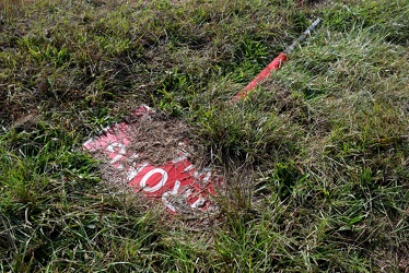
"WRONG WAY" sign on the ground
-
Norfolk Waterside Marriott [01]
![Norfolk Waterside Marriott [01] (1449 visits) The Norfolk Waterside Marriott, a high-rise hotel in downtown Norfolk, Virginia.
More at The Schumi... Norfolk Waterside Marriott [01]](../../../../../i/upload/2024/07/19/20240719092831-696580ee-cu_s9999x250.jpg)
-
Garden State Parkway milepost 10 southbound [02]
![Garden State Parkway milepost 10 southbound [02] (1452 visits) Sign assembly for milepost 10 southbound on the Garden State Parkway in Middle Township, New Jersey.... Garden State Parkway milepost 10 southbound [02]](../../../../../i/upload/2025/01/09/20250109192436-7167312f-cu_s9999x250.jpg)
-
Signage for eastern US 50/US 301 split [02]
![Signage for eastern US 50/US 301 split [02] (1463 visits) Overhead signage for the eastern split between US 50 and US 301 near Queenstown, Maryland.
More a... Signage for eastern US 50/US 301 split [02]](../../../../../i/upload/2025/02/07/20250207212412-a7ff650a-cu_s9999x250.jpg)
-
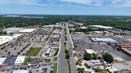
View east along Mercury Boulevard
-
Interstate 64 in Hampton, Virginia [03]
![Interstate 64 in Hampton, Virginia [03] (1476 visits) Aerial view of Interstate 64, a major highway that runs through Hampton, Virginia.
More at The Schu... Interstate 64 in Hampton, Virginia [03]](../../../../../i/upload/2025/02/17/20250217085436-66a19491-cu_s9999x250.jpg)
-
Garden State Parkway milepost 10 southbound [01]
![Garden State Parkway milepost 10 southbound [01] (1478 visits) Sign assembly for milepost 10 southbound on the Garden State Parkway in Middle Township, New Jersey.... Garden State Parkway milepost 10 southbound [01]](../../../../../i/upload/2025/01/09/20250109192431-f1398b04-cu_s9999x250.jpg)
-
Dollar Tree Corporate Office [01]
![Dollar Tree Corporate Office [01] (1490 visits) Corporate offices for Dollar Tree, located at 500 Volvo Parkway in Chesapeake, Virginia.
More at Th... Dollar Tree Corporate Office [01]](../../../../../i/upload/2025/02/19/20250219212847-eeb88fc3-cu_s9999x250.jpg)
-
Dollar Tree Corporate Office [03]
![Dollar Tree Corporate Office [03] (1490 visits) Corporate offices for Dollar Tree, located at 500 Volvo Parkway in Chesapeake, Virginia.
More at Th... Dollar Tree Corporate Office [03]](../../../../../i/upload/2025/02/19/20250219213004-a8f5a593-cu_s9999x250.jpg)
-
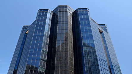
300 East Main Street
-
Norfolk Waterside Marriott [02]
![Norfolk Waterside Marriott [02] (1502 visits) The Norfolk Waterside Marriott, a high-rise hotel in downtown Norfolk, Virginia.
More at The Schumi... Norfolk Waterside Marriott [02]](../../../../../i/upload/2024/07/19/20240719092701-7384cbfc-cu_s9999x250.jpg)
-
Norfolk City Hall [03]
![Norfolk City Hall [03] (1508 visits) Norfolk City Hall, an eleven-story building in downtown Norfolk, Virginia housing government offices... Norfolk City Hall [03]](../../../../../i/upload/2024/07/19/20240719092802-c1cd2908-cu_s9999x250.jpg)
-
Norfolk City Hall [01]
![Norfolk City Hall [01] (1514 visits) Norfolk City Hall, an eleven-story building in downtown Norfolk, Virginia housing government offices... Norfolk City Hall [01]](../../../../../i/upload/2024/07/19/20240719092812-f9620385-cu_s9999x250.jpg)
-
Coin-operated viewer at Sideling Hill cut [02]
![Coin-operated viewer at Sideling Hill cut [02] (1519 visits) A coin-operated viewer at the overlook for the Sideling Hill cut, carrying Interstate 68 through Sid... Coin-operated viewer at Sideling Hill cut [02]](../../../../../i/upload/2024/07/19/20240719185629-71caeafd-cu_s9999x250.jpg)
-
Dollar Tree Corporate Office [02]
![Dollar Tree Corporate Office [02] (1522 visits) Corporate offices for Dollar Tree, located at 500 Volvo Parkway in Chesapeake, Virginia.
More at Th... Dollar Tree Corporate Office [02]](../../../../../i/upload/2025/02/19/20250219212859-e02df95f-cu_s9999x250.jpg)
-
Interstate 81 near Verona, Virginia [05]
![Interstate 81 near Verona, Virginia [05] (1523 visits) Interstate 81, as it passes through Verona, Virginia. View facing northbound.
More at The Schumin ... Interstate 81 near Verona, Virginia [05]](../../../../../i/upload/2024/11/28/20241128103806-21947d95-cu_s9999x250.jpg)
-
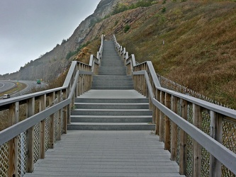
Stairs to Sideling Hill overlook
-
Interstate 81 near Verona, Virginia [04]
![Interstate 81 near Verona, Virginia [04] (1526 visits) Interstate 81, as it passes through Verona, Virginia. View facing southbound.
More at The Schumin ... Interstate 81 near Verona, Virginia [04]](../../../../../i/upload/2024/11/28/20241128103802-c0bab98c-cu_s9999x250.jpg)
-
Norfolk City Hall [02]
![Norfolk City Hall [02] (1527 visits) Norfolk City Hall, an eleven-story building in downtown Norfolk, Virginia housing government offices... Norfolk City Hall [02]](../../../../../i/upload/2024/07/19/20240719092807-5e8219eb-cu_s9999x250.jpg)
-
Dollar Tree Corporate Office [05]
![Dollar Tree Corporate Office [05] (1534 visits) Corporate offices for Dollar Tree, located at 500 Volvo Parkway in Chesapeake, Virginia.
More at Th... Dollar Tree Corporate Office [05]](../../../../../i/upload/2025/02/19/20250219213153-7311378c-cu_s9999x250.jpg)
-
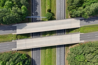
Croaker Road and Interstate 64
-
Interstate 81 near Verona, Virginia [01]
![Interstate 81 near Verona, Virginia [01] (1540 visits) Interstate 81, as it passes through Verona, Virginia. View facing southbound.
More at The Schumin ... Interstate 81 near Verona, Virginia [01]](../../../../../i/upload/2024/11/28/20241128103749-b97fb29f-cu_s9999x250.jpg)
-
Interstate 81 near Verona, Virginia [02]
![Interstate 81 near Verona, Virginia [02] (1541 visits) Interstate 81, as it passes through Verona, Virginia. View facing northbound.
More at The Schumin ... Interstate 81 near Verona, Virginia [02]](../../../../../i/upload/2024/11/28/20241128103753-ff030609-cu_s9999x250.jpg)
-
Interstate 64 in Hampton, Virginia [04]
![Interstate 64 in Hampton, Virginia [04] (1549 visits) Aerial view of Interstate 64, a major highway that runs through Hampton, Virginia.
More at The Schu... Interstate 64 in Hampton, Virginia [04]](../../../../../i/upload/2025/02/17/20250217085415-4cb12081-cu_s9999x250.jpg)