-
Roanoke from the star, January 2003 [04]
![Roanoke from the star, January 2003 [04] (3013 visits) The city of Roanoke, Virginia as seen from Mill Mountain Park on the afternoon of January 7, 2003.
... Roanoke from the star, January 2003 [04]](../../../i/upload/2024/07/14/20240714101746-72386e76-cu_s9999x250.jpg)
-
Roanoke from the star, January 2003 [03]
![Roanoke from the star, January 2003 [03] (3243 visits) The city of Roanoke, Virginia as seen from Mill Mountain Park on the afternoon of January 7, 2003.
... Roanoke from the star, January 2003 [03]](../../../i/upload/2024/07/14/20240714101748-2add7d74-cu_s9999x250.jpg)
-
Roanoke from the star, January 2003 [02]
![Roanoke from the star, January 2003 [02] (3131 visits) The city of Roanoke, Virginia as seen from Mill Mountain Park on the afternoon of January 7, 2003.
... Roanoke from the star, January 2003 [02]](../../../i/upload/2024/07/14/20240714101749-5603d0ac-cu_s9999x250.jpg)
-
Roanoke from the star, January 2003 [01]
![Roanoke from the star, January 2003 [01] (3096 visits) The city of Roanoke, Virginia as seen from Mill Mountain Park on the afternoon of January 7, 2003.
... Roanoke from the star, January 2003 [01]](../../../i/upload/2024/07/14/20240714101750-8166e277-cu_s9999x250.jpg)
-
Downtown Roanoke at the railroad tracks
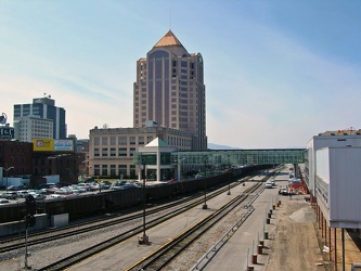
-
Roanoke from the star, March 2003
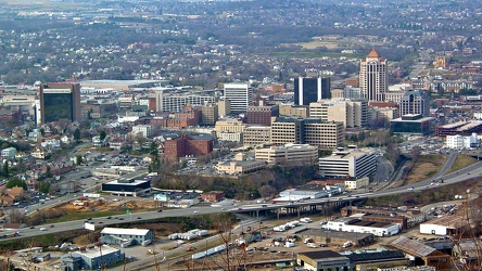
-
First Union Tower
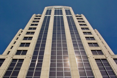
-
Roanoke, Virginia at night, 2003
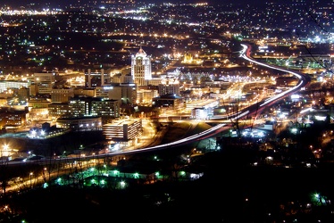
-
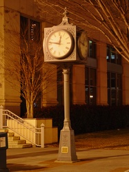
Street clock in Roanoke, Virginia
-
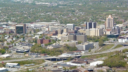
Roanoke viewed from the star, April 2006
-
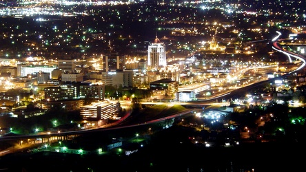
Roanoke from the star, April 2007
-
M/V Roanoke and M/V Floyd J. Lupton [02]
![M/V Roanoke and M/V Floyd J. Lupton [02] (2871 visits) The M/V Roanoke, a Hatteras Class ferryboat, passes the M/V Floyd J. Lupton, a River Class ferryboat... M/V Roanoke and M/V Floyd J. Lupton [02]](../../../i/upload/2024/07/17/20240717230519-2c47cb7c-cu_s9999x250.jpg)
-
Roanoke, Virginia [01]
![Roanoke, Virginia [01] (2192 visits) Roanoke, Virginia, as viewed from the M. Carl Andrews Overlook in Mill Mountain Park, next to the Ro... Roanoke, Virginia [01]](../../../i/upload/2024/07/17/20240717232316-4004d589-cu_s9999x250.jpg)
-
Roanoke, Virginia [02]
![Roanoke, Virginia [02] (2037 visits) Roanoke, Virginia, viewed from the M. Carl Andrews Overlook in Mill Mountain Park, next to the Roano... Roanoke, Virginia [02]](../../../i/upload/2024/07/17/20240717232320-e7ffa9b7-cu_s9999x250.jpg)
 West overlook at Mill Mountain Park
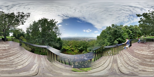
 M. Carl Andrews Overlook [01]
![M. Carl Andrews Overlook [01] (3525 visits) The M. Carl Andrews Overlook, at Mill Mountain Park in Roanoke, Virginia. The Roanoke Star is locat... M. Carl Andrews Overlook [01]](../../../i/upload/2024/07/17/20240717233104-18c6ba6a-cu_s9999x250.jpg)
 M. Carl Andrews Overlook [02]
![M. Carl Andrews Overlook [02] (3572 visits) The M. Carl Andrews Overlook, at Mill Mountain Park in Roanoke, Virginia. The Roanoke Star is locat... M. Carl Andrews Overlook [02]](../../../i/upload/2024/07/17/20240717233109-73899e0e-cu_s9999x250.jpg)
 M. Carl Andrews Overlook at night [01]
![M. Carl Andrews Overlook at night [01] (3931 visits) The M. Carl Andrews Overlook at Mill Mountain Park in Roanoke, Virginia, at night. The Roanoke Star... M. Carl Andrews Overlook at night [01]](../../../i/upload/2024/07/17/20240717233141-45aa31b5-cu_s9999x250.jpg)
 M. Carl Andrews Overlook at night [02]
![M. Carl Andrews Overlook at night [02] (3711 visits) The M. Carl Andrews Overlook at Mill Mountain Park in Roanoke, Virginia, at night. The Roanoke Star... M. Carl Andrews Overlook at night [02]](../../../i/upload/2024/07/17/20240717233145-af6ef7ac-cu_s9999x250.jpg)
-
View from M/V Roanoke
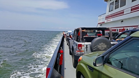
-
Sea gull flying over Hatteras Inlet
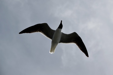
-
Superstructure of the M/V Roanoke
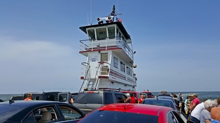
-
M/V Roanoke [01]
![M/V Roanoke [01] (2096 visits) The M/V Roanoke, a Hatteras Class ferryboat, viewed from the M/V W. Stanford White, a River Class fe... M/V Roanoke [01]](../../../i/upload/2024/07/19/20240719183448-591735fd-cu_s9999x250.jpg)
-
M/V Roanoke [02]
![M/V Roanoke [02] (2141 visits) The M/V Roanoke, a Hatteras Class ferryboat, viewed from the M/V W. Stanford White, a River Class fe... M/V Roanoke [02]](../../../i/upload/2024/07/19/20240719183452-d215af49-cu_s9999x250.jpg)
-
M/V Roanoke and M/V Floyd J. Lupton [01]
![M/V Roanoke and M/V Floyd J. Lupton [01] (2379 visits) The M/V Roanoke, a Hatteras Class ferryboat, passes the M/V Floyd J. Lupton, a River Class ferryboat... M/V Roanoke and M/V Floyd J. Lupton [01]](../../../i/upload/2024/07/19/20240719183658-4e1410fe-cu_s9999x250.jpg)
-
Shield for North Carolina Highway 48
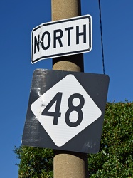
-
Roanoke, Virginia at night, 2021
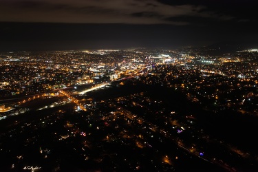
-
Electric Road
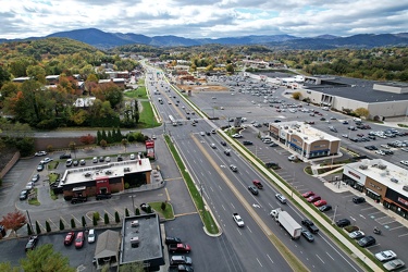
-
Franklin Road interchange
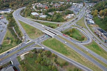
-
Elm Avenue interchange [02]
![Elm Avenue interchange [02] (2925 visits) Interchange between Interstate 581/US 220 and Elm Avenue (SR 24) in Roanoke, Virginia. The I-581 de... Elm Avenue interchange [02]](../../../i/upload/2024/07/20/20240720121652-6267da79-cu_s9999x250.jpg)
-
View south on Franklin Road
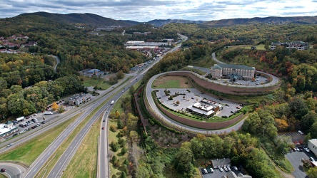
-
Aerial view of Roanoke, Virginia [01]
![Aerial view of Roanoke, Virginia [01] (1838 visits) Aerial view of Roanoke, Virginia.
More at The Schumin Web:
www.schuminweb.com/life-and-times/advent... Aerial view of Roanoke, Virginia [01]](../../../i/upload/2024/07/20/20240720121757-bb58476c-cu_s9999x250.jpg)
-
Aerial view of Roanoke, Virginia [02]
![Aerial view of Roanoke, Virginia [02] (1746 visits) Aerial view of Roanoke, Virginia.
More at The Schumin Web:
www.schuminweb.com/life-and-times/advent... Aerial view of Roanoke, Virginia [02]](../../../i/upload/2024/07/20/20240720121808-dccb83a0-cu_s9999x250.jpg)
-
Aerial view of Roanoke, Virginia [03]
![Aerial view of Roanoke, Virginia [03] (1783 visits) Aerial view of Roanoke, Virginia.
More at The Schumin Web:
www.schuminweb.com/life-and-times/advent... Aerial view of Roanoke, Virginia [03]](../../../i/upload/2024/07/20/20240720121837-3c6bbb13-cu_s9999x250.jpg)
-
Aerial view of Roanoke, Virginia [04]
![Aerial view of Roanoke, Virginia [04] (1836 visits) Aerial view of Roanoke, Virginia.
More at The Schumin Web:
www.schuminweb.com/life-and-times/advent... Aerial view of Roanoke, Virginia [04]](../../../i/upload/2024/07/20/20240720121854-34748718-cu_s9999x250.jpg)
-
Aerial view of Roanoke, Virginia [05]
![Aerial view of Roanoke, Virginia [05] (1734 visits) Aerial view of Roanoke, Virginia.
More at The Schumin Web:
www.schuminweb.com/life-and-times/advent... Aerial view of Roanoke, Virginia [05]](../../../i/upload/2024/07/20/20240720121906-5f802cee-cu_s9999x250.jpg)
-
Aerial view of Roanoke, Virginia [06]
![Aerial view of Roanoke, Virginia [06] (1658 visits) Aerial view of Roanoke, Virginia.
More at The Schumin Web:
www.schuminweb.com/life-and-times/advent... Aerial view of Roanoke, Virginia [06]](../../../i/upload/2024/07/20/20240720121917-3d4a6311-cu_s9999x250.jpg)
-
View of Mill Mountain, facing west
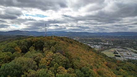
-
View from the Roanoke Star, October 2022 [01]
![View from the Roanoke Star, October 2022 [01] (2768 visits) View of Roanoke, Virginia from Mill Mountain, October 18, 2022.
More at The Schumin Web:
www.schumi... View from the Roanoke Star, October 2022 [01]](../../../i/upload/2024/07/20/20240720121935-9c3d81cd-cu_s9999x250.jpg)
-
View from the Roanoke Star, October 2022 [02]
![View from the Roanoke Star, October 2022 [02] (1514 visits) View of Roanoke, Virginia from Mill Mountain, October 18, 2022.
More at The Schumin Web:
www.schumi... View from the Roanoke Star, October 2022 [02]](../../../i/upload/2024/07/20/20240720121946-ef64a8e5-cu_s9999x250.jpg)
-
View from the Roanoke Star, October 2022 [03]
![View from the Roanoke Star, October 2022 [03] (1567 visits) View of Roanoke, Virginia from Mill Mountain, October 18, 2022.
More at The Schumin Web:
www.schumi... View from the Roanoke Star, October 2022 [03]](../../../i/upload/2024/07/20/20240720121951-aad25312-cu_s9999x250.jpg)
-
View from the Roanoke Star, October 2022 [04]
![View from the Roanoke Star, October 2022 [04] (1556 visits) View of Roanoke, Virginia from Mill Mountain, October 18, 2022.
More at The Schumin Web:
www.schumi... View from the Roanoke Star, October 2022 [04]](../../../i/upload/2024/07/20/20240720121957-f438f2a3-cu_s9999x250.jpg)
-
Valley View area, viewed from Mill Mountain
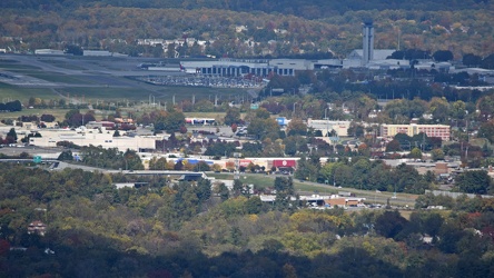
-
Poff Federal Building, viewed from Mill Mountain
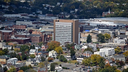
-
Elm Avenue interchange [01]
![Elm Avenue interchange [01] (2973 visits) Interchange between Interstate 581/US 220 and Elm Avenue (SR 24) in Roanoke, Virginia, viewed from M... Elm Avenue interchange [01]](../../../i/upload/2024/07/20/20240720122015-70544823-cu_s9999x250.jpg)
-
Elyse in the driver's seat of former CARTA bus 3424

-
Former CARTA bus 3424 [05]
![Former CARTA bus 3424 [05] (2331 visits) Former CARTA bus 3424, a 1996 New Flyer D35HF, now part of the collection of Commonwealth Coach &... Former CARTA bus 3424 [05]](../../../i/upload/2024/07/31/20240731130616-c2e5c174-cu_s9999x250.jpg)
-
Former CARTA bus 3424 [04]
![Former CARTA bus 3424 [04] (2295 visits) Former CARTA bus 3424, a 1996 New Flyer D35HF, now part of the collection of Commonwealth Coach &... Former CARTA bus 3424 [04]](../../../i/upload/2024/07/31/20240731130620-73cdd8ad-cu_s9999x250.jpg)
-
Former CARTA bus 3424 [03]
![Former CARTA bus 3424 [03] (8696 visits) Former CARTA bus 3424, a 1996 New Flyer D35HF, now part of the collection of Commonwealth Coach &... Former CARTA bus 3424 [03]](../../../i/upload/2024/07/31/20240731130625-b07de28b-cu_s9999x250.jpg)
-
Former CARTA bus 3424 [02]
![Former CARTA bus 3424 [02] (2311 visits) Former CARTA bus 3424, a 1996 New Flyer D35HF, now part of the collection of Commonwealth Coach &... Former CARTA bus 3424 [02]](../../../i/upload/2024/07/31/20240731130632-7fdf0078-cu_s9999x250.jpg)
-
Former CARTA bus 3424 [01]
![Former CARTA bus 3424 [01] (2321 visits) Former CARTA bus 3424, a 1996 New Flyer D35HF, now part of the collection of Commonwealth Coach &... Former CARTA bus 3424 [01]](../../../i/upload/2024/07/31/20240731130636-3bd9fdd4-cu_s9999x250.jpg)
-
Signage from the Boulevard at the Capital Centre at Black Dog Salvage [03]
![Signage from the Boulevard at the Capital Centre at Black Dog Salvage [03] (1633 visits) Signage from the Boulevard at the Capital Centre, an outdoor shopping center in Largo, Maryland that... Signage from the Boulevard at the Capital Centre at Black Dog Salvage [03]](../../../i/upload/2024/07/31/20240731130645-76b636c6-cu_s9999x250.jpg)
-
Poff Federal Building [01]
![Poff Federal Building [01] (361 visits) The Richard H. Poff Federal Building, a government office building at 210 Franklin Road SW in downto... Poff Federal Building [01]](../../../i/upload/2025/03/02/20250302134711-675ab6c7-cu_s9999x250.jpg)
-
Poff Federal Building [02]
![Poff Federal Building [02] (325 visits) The Richard H. Poff Federal Building, a government office building at 210 Franklin Road SW in downto... Poff Federal Building [02]](../../../i/upload/2025/03/02/20250302134720-6d41525c-cu_s9999x250.jpg)
-
110 Franklin Road SE
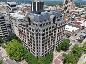
-
Hampton Inn in downtown Roanoke [01]
![Hampton Inn in downtown Roanoke [01] (354 visits) Hampton Inn hotel in downtown Roanoke, Virginia. This Hampton Inn is unusual in that it was built o... Hampton Inn in downtown Roanoke [01]](../../../i/upload/2025/03/02/20250302134739-3fb23c16-cu_s9999x250.jpg)
-
Hampton Inn in downtown Roanoke [02]
![Hampton Inn in downtown Roanoke [02] (366 visits) Hampton Inn hotel in downtown Roanoke, Virginia. This Hampton Inn is unusual in that it was built o... Hampton Inn in downtown Roanoke [02]](../../../i/upload/2025/03/02/20250302134750-3bedaef7-cu_s9999x250.jpg)
-
Carilion Administrative Services Building [01]
![Carilion Administrative Services Building [01] (322 visits) The Carilion Administrative Services Building, at 213 South Jefferson Street in downtown Roanoke, Vi... Carilion Administrative Services Building [01]](../../../i/upload/2025/03/02/20250302134801-6477a7f8-cu_s9999x250.jpg)
-
Carilion Administrative Services Building [02]
![Carilion Administrative Services Building [02] (342 visits) The Carilion Administrative Services Building, at 213 South Jefferson Street in downtown Roanoke, Vi... Carilion Administrative Services Building [02]](../../../i/upload/2025/03/02/20250302134813-241abfec-cu_s9999x250.jpg)
-
Wells Fargo Tower [01]
![Wells Fargo Tower [01] (311 visits) The Wells Fargo Tower, an office building in downtown Roanoke, Virginia. The building, completed in... Wells Fargo Tower [01]](../../../i/upload/2025/03/02/20250302134825-e3412be2-cu_s9999x250.jpg)
-
Wells Fargo Tower [02]
![Wells Fargo Tower [02] (313 visits) The Wells Fargo Tower, an office building in downtown Roanoke, Virginia. The building, completed in... Wells Fargo Tower [02]](../../../i/upload/2025/03/02/20250302134831-92a15775-cu_s9999x250.jpg)
-
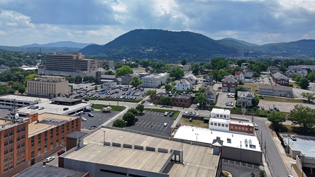
Downtown Roanoke facing Mill Mountain
-
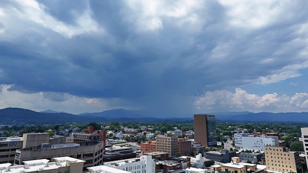
Storm cloud approaching Roanoke, Virginia
-
Elm Avenue interchange [03]
![Elm Avenue interchange [03] (713 visits) Interchange between Interstate 581/US 220 and Elm Avenue (SR 24) in Roanoke, Virginia. The I-581 de... Elm Avenue interchange [03]](../../../i/upload/2025/03/03/20250303170720-a5bd3de6-cu_s9999x250.jpg)
-
Elm Avenue interchange [04]
![Elm Avenue interchange [04] (706 visits) Interchange between Interstate 581/US 220 and Elm Avenue (SR 24) in Roanoke, Virginia. The I-581 de... Elm Avenue interchange [04]](../../../i/upload/2025/03/03/20250303170729-c4512aea-cu_s9999x250.jpg)
-
Wells Fargo Tower [03]
![Wells Fargo Tower [03] (317 visits) The Wells Fargo Tower, an office building in downtown Roanoke, Virginia. The building, completed in... Wells Fargo Tower [03]](../../../i/upload/2025/03/03/20250303170735-d26842f9-cu_s9999x250.jpg)
-
Wells Fargo Tower [04]
![Wells Fargo Tower [04] (306 visits) The Wells Fargo Tower, an office building in downtown Roanoke, Virginia. The building, completed in... Wells Fargo Tower [04]](../../../i/upload/2025/03/03/20250303170817-77f8c38e-cu_s9999x250.jpg)
-
Wells Fargo Tower [05]
![Wells Fargo Tower [05] (296 visits) The Wells Fargo Tower, an office building in downtown Roanoke, Virginia. The building, completed in... Wells Fargo Tower [05]](../../../i/upload/2025/03/03/20250303170920-70ca29f8-cu_s9999x250.jpg)
-
Wells Fargo Tower [06]
![Wells Fargo Tower [06] (314 visits) The Wells Fargo Tower, an office building in downtown Roanoke, Virginia. The building, completed in... Wells Fargo Tower [06]](../../../i/upload/2025/03/03/20250303171038-5db0edf1-cu_s9999x250.jpg)
-
Tunnel under Roanoke-Blacksburg Regional Airport [01]
![Tunnel under Roanoke-Blacksburg Regional Airport [01] (268 visits) Tunnel under the northeastern end of runway 06/24 at Roanoke-Blacksburg Regional Airport, helping ca... Tunnel under Roanoke-Blacksburg Regional Airport [01]](../../../i/upload/2025/03/07/20250307082638-881970da-cu_s9999x250.jpg)
-
Tunnel under Roanoke-Blacksburg Regional Airport [02]
![Tunnel under Roanoke-Blacksburg Regional Airport [02] (278 visits) Tunnel under the northeastern end of runway 06/24 at Roanoke-Blacksburg Regional Airport, helping ca... Tunnel under Roanoke-Blacksburg Regional Airport [02]](../../../i/upload/2025/03/07/20250307082646-1ee32362-cu_s9999x250.jpg)
-
Tunnel under Roanoke-Blacksburg Regional Airport [03]
![Tunnel under Roanoke-Blacksburg Regional Airport [03] (312 visits) Tunnel under the northeastern end of runway 06/24 at Roanoke-Blacksburg Regional Airport, helping ca... Tunnel under Roanoke-Blacksburg Regional Airport [03]](../../../i/upload/2025/03/07/20250307082655-ed6dde73-cu_s9999x250.jpg)
-
Tunnel under Roanoke-Blacksburg Regional Airport [04]
![Tunnel under Roanoke-Blacksburg Regional Airport [04] (320 visits) Tunnel under the northeastern end of runway 06/24 at Roanoke-Blacksburg Regional Airport, helping ca... Tunnel under Roanoke-Blacksburg Regional Airport [04]](../../../i/upload/2025/03/07/20250307082705-95dbd6b4-cu_s9999x250.jpg)
-
Photographing the tunnel under Roanoke-Blacksburg Regional Airport

-
Roanoke from above Main Street SW
