-
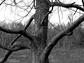
Tree at scenic overlook
-
Roanoke from the star, January 2003 [04]
![Roanoke from the star, January 2003 [04] (2978 visits) The city of Roanoke, Virginia as seen from Mill Mountain Park on the afternoon of January 7, 2003.
... Roanoke from the star, January 2003 [04]](../../../../i/upload/2024/07/14/20240714101746-72386e76-cu_s9999x250.jpg)
-
Roanoke from the star, January 2003 [03]
![Roanoke from the star, January 2003 [03] (3210 visits) The city of Roanoke, Virginia as seen from Mill Mountain Park on the afternoon of January 7, 2003.
... Roanoke from the star, January 2003 [03]](../../../../i/upload/2024/07/14/20240714101748-2add7d74-cu_s9999x250.jpg)
-
Roanoke from the star, January 2003 [02]
![Roanoke from the star, January 2003 [02] (3084 visits) The city of Roanoke, Virginia as seen from Mill Mountain Park on the afternoon of January 7, 2003.
... Roanoke from the star, January 2003 [02]](../../../../i/upload/2024/07/14/20240714101749-5603d0ac-cu_s9999x250.jpg)
-
Roanoke from the star, January 2003 [01]
![Roanoke from the star, January 2003 [01] (3038 visits) The city of Roanoke, Virginia as seen from Mill Mountain Park on the afternoon of January 7, 2003.
... Roanoke from the star, January 2003 [01]](../../../../i/upload/2024/07/14/20240714101750-8166e277-cu_s9999x250.jpg)
-
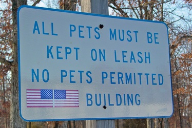
"ALL PETS MUST BE KEPT ON LEASH"
-
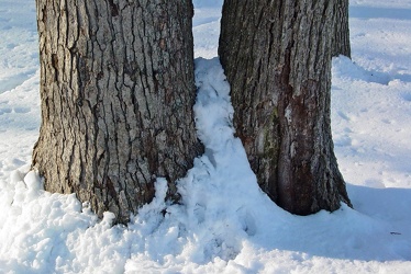
Snow around two tree trunks
-
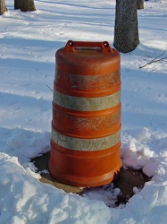
Construction barrel at Manassas rest area
-
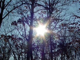
Sun through the trees at Manassas rest area
-
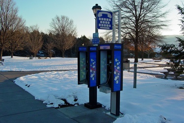
Payphones at New Market rest area
-
RCA Building [01]
![RCA Building [01] (1979 visits) The RCA Building, located at 1901 North Moore Street in Arlington, Virginia's Rosslyn neighborhood. ... RCA Building [01]](../../../../i/upload/2024/07/14/20240714101955-50d1842e-cu_s9999x250.jpg)
-
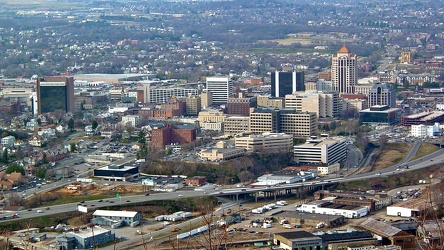
Roanoke from the star, March 2003
-
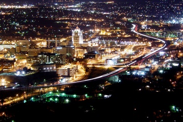
Roanoke, Virginia at night, 2003
-
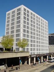
1815 North Fort Myer Drive
-
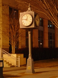
Street clock in Roanoke, Virginia
-
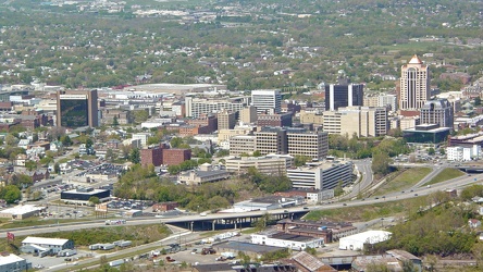
Roanoke viewed from the star, April 2006
-
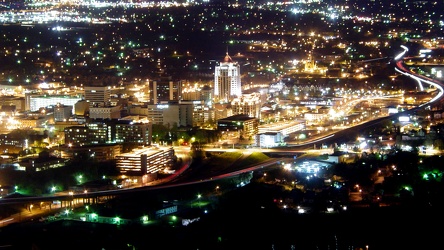
Roanoke from the star, April 2007
-
Roanoke, Virginia [01]
![Roanoke, Virginia [01] (2180 visits) Roanoke, Virginia, as viewed from the M. Carl Andrews Overlook in Mill Mountain Park, next to the Ro... Roanoke, Virginia [01]](../../../../i/upload/2024/07/17/20240717232316-4004d589-cu_s9999x250.jpg)
-
Roanoke, Virginia [02]
![Roanoke, Virginia [02] (2025 visits) Roanoke, Virginia, viewed from the M. Carl Andrews Overlook in Mill Mountain Park, next to the Roano... Roanoke, Virginia [02]](../../../../i/upload/2024/07/17/20240717232320-e7ffa9b7-cu_s9999x250.jpg)
-
Ivy rest area [01]
![Ivy rest area [01] (2736 visits) Rest area on Interstate 64 westbound, near Ivy, Virginia (milepost 113).
Ben Schumin is a professio... Ivy rest area [01]](../../../../i/upload/2024/07/17/20240717232803-9c60e629-cu_s9999x250.jpg)
-
Ivy rest area [02]
![Ivy rest area [02] (2794 visits) Rest area on Interstate 64 westbound, near Ivy, Virginia (milepost 113).
Ben Schumin is a professio... Ivy rest area [02]](../../../../i/upload/2024/07/17/20240717232807-2e81efde-cu_s9999x250.jpg)
-
Ivy rest area [03]
![Ivy rest area [03] (2827 visits) Rest area on Interstate 64 westbound, near Ivy, Virginia (milepost 113).
Ben Schumin is a professio... Ivy rest area [03]](../../../../i/upload/2024/07/17/20240717232811-236d66ef-cu_s9999x250.jpg)
 West overlook at Mill Mountain Park
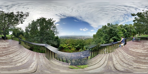
 M. Carl Andrews Overlook [01]
![M. Carl Andrews Overlook [01] (3502 visits) The M. Carl Andrews Overlook, at Mill Mountain Park in Roanoke, Virginia. The Roanoke Star is locat... M. Carl Andrews Overlook [01]](../../../../i/upload/2024/07/17/20240717233104-18c6ba6a-cu_s9999x250.jpg)
 M. Carl Andrews Overlook [02]
![M. Carl Andrews Overlook [02] (3549 visits) The M. Carl Andrews Overlook, at Mill Mountain Park in Roanoke, Virginia. The Roanoke Star is locat... M. Carl Andrews Overlook [02]](../../../../i/upload/2024/07/17/20240717233109-73899e0e-cu_s9999x250.jpg)
 M. Carl Andrews Overlook at night [01]
![M. Carl Andrews Overlook at night [01] (3905 visits) The M. Carl Andrews Overlook at Mill Mountain Park in Roanoke, Virginia, at night. The Roanoke Star... M. Carl Andrews Overlook at night [01]](../../../../i/upload/2024/07/17/20240717233141-45aa31b5-cu_s9999x250.jpg)
 M. Carl Andrews Overlook at night [02]
![M. Carl Andrews Overlook at night [02] (3681 visits) The M. Carl Andrews Overlook at Mill Mountain Park in Roanoke, Virginia, at night. The Roanoke Star... M. Carl Andrews Overlook at night [02]](../../../../i/upload/2024/07/17/20240717233145-af6ef7ac-cu_s9999x250.jpg)
-
View from Dirt Farm Brewing [02]
![View from Dirt Farm Brewing [02] (1636 visits) View from the patio at Dirt Farm Brewing in Bluemont, Virginia, facing approximately east. On a cle... View from Dirt Farm Brewing [02]](../../../../i/upload/2024/07/18/20240718230423-b1ac8dea-cu_s9999x250.jpg)
-
View from Dirt Farm Brewing [01]
![View from Dirt Farm Brewing [01] (1793 visits) View from the patio at Dirt Farm Brewing in Bluemont, Virginia, facing approximately east. On a cle... View from Dirt Farm Brewing [01]](../../../../i/upload/2024/07/18/20240718230427-e0fe1b23-cu_s9999x250.jpg)
-
Buffalo Gap [01]
![Buffalo Gap [01] (1737 visits) Buffalo Gap, a mountain pass through Little North Mountain, near Swoope, Virginia.
Ben Schumin is... Buffalo Gap [01]](../../../../i/upload/2024/07/19/20240719164455-62064f1c-cu_s9999x250.jpg)
-
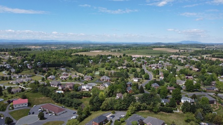
Pelham neighborhood in Waynesboro, Virginia
-
8000 Towers Crescent Drive [10]
![8000 Towers Crescent Drive [10] (1016 visits) Office building at 8000 Towers Crescent Drive in the Tysons Corner area of Fairfax County, Virginia.... 8000 Towers Crescent Drive [10]](../../../../i/upload/2024/07/19/20240719172233-5c1581ea-cu_s9999x250.jpg)
-
8000 Towers Crescent Drive [04]
![8000 Towers Crescent Drive [04] (921 visits) Office building at 8000 Towers Crescent Drive in the Tysons Corner area of Fairfax County, Virginia.... 8000 Towers Crescent Drive [04]](../../../../i/upload/2024/07/19/20240719172245-de059167-cu_s9999x250.jpg)
-
8000 Towers Crescent Drive [11]
![8000 Towers Crescent Drive [11] (1119 visits) Office building at 8000 Towers Crescent Drive in the Tysons Corner area of Fairfax County, Virginia.... 8000 Towers Crescent Drive [11]](../../../../i/upload/2024/07/19/20240719172252-268f7911-cu_s9999x250.jpg)
-
8000 Towers Crescent Drive [07]
![8000 Towers Crescent Drive [07] (1013 visits) Office building at 8000 Towers Crescent Drive in the Tysons Corner area of Fairfax County, Virginia.... 8000 Towers Crescent Drive [07]](../../../../i/upload/2024/07/19/20240719172303-4f5bb9b7-cu_s9999x250.jpg)
-
8000 Towers Crescent Drive [09]
![8000 Towers Crescent Drive [09] (1023 visits) Office building at 8000 Towers Crescent Drive in the Tysons Corner area of Fairfax County, Virginia.... 8000 Towers Crescent Drive [09]](../../../../i/upload/2024/07/19/20240719172309-02335904-cu_s9999x250.jpg)
-
8000 Towers Crescent Drive [12]
![8000 Towers Crescent Drive [12] (1106 visits) Office building at 8000 Towers Crescent Drive in the Tysons Corner area of Fairfax County, Virginia.... 8000 Towers Crescent Drive [12]](../../../../i/upload/2024/07/19/20240719172315-275fb6ef-cu_s9999x250.jpg)
-
8000 Towers Crescent Drive [03]
![8000 Towers Crescent Drive [03] (955 visits) Office building at 8000 Towers Crescent Drive in the Tysons Corner area of Fairfax County, Virginia.... 8000 Towers Crescent Drive [03]](../../../../i/upload/2024/07/19/20240719172321-c36f709f-cu_s9999x250.jpg)
-
8000 Towers Crescent Drive [05]
![8000 Towers Crescent Drive [05] (936 visits) Office building at 8000 Towers Crescent Drive in the Tysons Corner area of Fairfax County, Virginia.... 8000 Towers Crescent Drive [05]](../../../../i/upload/2024/07/19/20240719172332-b0849ac7-cu_s9999x250.jpg)
-
8000 Towers Crescent Drive [08]
![8000 Towers Crescent Drive [08] (1532 visits) Office building at 8000 Towers Crescent Drive in the Tysons Corner area of Fairfax County, Virginia.... 8000 Towers Crescent Drive [08]](../../../../i/upload/2024/07/19/20240719172337-d905a4d4-cu_s9999x250.jpg)
-
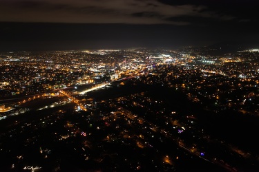
Roanoke, Virginia at night, 2021
-
Interstate 81 at Route 796 [02]
![Interstate 81 at Route 796 [02] (3317 visits) Interstate 81 near Mount Jackson, Virginia, at the point where State Route 796 (Hawkins Road) crosse... Interstate 81 at Route 796 [02]](../../../../i/upload/2024/07/20/20240720020830-706bf71d-cu_s9999x250.jpg)
-
Interstate 81 at Route 796 [01]
![Interstate 81 at Route 796 [01] (3120 visits) Interstate 81 near Mount Jackson, Virginia, at the point where State Route 796 (Hawkins Road) crosse... Interstate 81 at Route 796 [01]](../../../../i/upload/2024/07/20/20240720020902-02c4ce7b-cu_s9999x250.jpg)
-
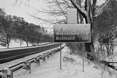
Snow-covered mileage sign on US 250
-
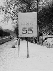
Snow-covered speed limit sign on US 250
-
West Broad Street at Staples Mill Road [01]
![West Broad Street at Staples Mill Road [01] (3237 visits) Aerial view of West Broad Street at the intersection with Staples Mill Road in Richmond, Virginia. ... West Broad Street at Staples Mill Road [01]](../../../../i/upload/2024/07/20/20240720091824-c8526d69-cu_s9999x250.jpg)
-
West Broad Street at Staples Mill Road [02]
![West Broad Street at Staples Mill Road [02] (70017 visits) Aerial view of West Broad Street at the intersection with Staples Mill Road in Richmond, Virginia. ... West Broad Street at Staples Mill Road [02]](../../../../i/upload/2024/07/20/20240720092012-1df12de7-cu_s9999x250.jpg)
-
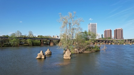
Small island in the James River
-
Rapids on the James River [01]
![Rapids on the James River [01] (2610 visits) Rapids and a small waterfall on the James River in Richmond, Virginia. The Manchester Bridge and T.... Rapids on the James River [01]](../../../../i/upload/2024/07/20/20240720093011-a767724e-cu_s9999x250.jpg)
-
Rapids on the James River [02]
![Rapids on the James River [02] (2500 visits) Rapids and a small waterfall on the James River in Richmond, Virginia. The Manchester Bridge and T.... Rapids on the James River [02]](../../../../i/upload/2024/07/20/20240720093135-219eaaa3-cu_s9999x250.jpg)
-
Hairpin turn on US 250 [01]
![Hairpin turn on US 250 [01] (2921 visits) Hairpin turn on US 250 in Highland County, Virginia, as it ascends Shenandoah Mountain.
Ben Schumin... Hairpin turn on US 250 [01]](../../../../i/upload/2024/07/20/20240720094126-511d5875-cu_s9999x250.jpg)
-
Hairpin turn on US 250 [02]
![Hairpin turn on US 250 [02] (2973 visits) Hairpin turn on US 250 in Highland County, Virginia, as it ascends Shenandoah Mountain.
Ben Schumin... Hairpin turn on US 250 [02]](../../../../i/upload/2024/07/20/20240720094131-dc588684-cu_s9999x250.jpg)
-
Elm Avenue interchange [02]
![Elm Avenue interchange [02] (2912 visits) Interchange between Interstate 581/US 220 and Elm Avenue (SR 24) in Roanoke, Virginia. The I-581 de... Elm Avenue interchange [02]](../../../../i/upload/2024/07/20/20240720121652-6267da79-cu_s9999x250.jpg)
-
Aerial view of Roanoke, Virginia [01]
![Aerial view of Roanoke, Virginia [01] (1827 visits) Aerial view of Roanoke, Virginia.
More at The Schumin Web:
www.schuminweb.com/life-and-times/advent... Aerial view of Roanoke, Virginia [01]](../../../../i/upload/2024/07/20/20240720121757-bb58476c-cu_s9999x250.jpg)
-
Aerial view of Roanoke, Virginia [02]
![Aerial view of Roanoke, Virginia [02] (1735 visits) Aerial view of Roanoke, Virginia.
More at The Schumin Web:
www.schuminweb.com/life-and-times/advent... Aerial view of Roanoke, Virginia [02]](../../../../i/upload/2024/07/20/20240720121808-dccb83a0-cu_s9999x250.jpg)
-
Aerial view of Roanoke, Virginia [03]
![Aerial view of Roanoke, Virginia [03] (1773 visits) Aerial view of Roanoke, Virginia.
More at The Schumin Web:
www.schuminweb.com/life-and-times/advent... Aerial view of Roanoke, Virginia [03]](../../../../i/upload/2024/07/20/20240720121837-3c6bbb13-cu_s9999x250.jpg)
-
Aerial view of Roanoke, Virginia [04]
![Aerial view of Roanoke, Virginia [04] (1827 visits) Aerial view of Roanoke, Virginia.
More at The Schumin Web:
www.schuminweb.com/life-and-times/advent... Aerial view of Roanoke, Virginia [04]](../../../../i/upload/2024/07/20/20240720121854-34748718-cu_s9999x250.jpg)
-
Aerial view of Roanoke, Virginia [05]
![Aerial view of Roanoke, Virginia [05] (1724 visits) Aerial view of Roanoke, Virginia.
More at The Schumin Web:
www.schuminweb.com/life-and-times/advent... Aerial view of Roanoke, Virginia [05]](../../../../i/upload/2024/07/20/20240720121906-5f802cee-cu_s9999x250.jpg)
-
Aerial view of Roanoke, Virginia [06]
![Aerial view of Roanoke, Virginia [06] (1648 visits) Aerial view of Roanoke, Virginia.
More at The Schumin Web:
www.schuminweb.com/life-and-times/advent... Aerial view of Roanoke, Virginia [06]](../../../../i/upload/2024/07/20/20240720121917-3d4a6311-cu_s9999x250.jpg)
-
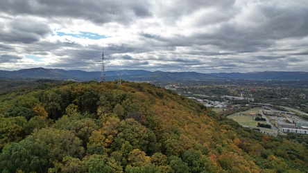
View of Mill Mountain, facing west
-
View from the Roanoke Star, October 2022 [01]
![View from the Roanoke Star, October 2022 [01] (2761 visits) View of Roanoke, Virginia from Mill Mountain, October 18, 2022.
More at The Schumin Web:
www.schumi... View from the Roanoke Star, October 2022 [01]](../../../../i/upload/2024/07/20/20240720121935-9c3d81cd-cu_s9999x250.jpg)
-
View from the Roanoke Star, October 2022 [02]
![View from the Roanoke Star, October 2022 [02] (1508 visits) View of Roanoke, Virginia from Mill Mountain, October 18, 2022.
More at The Schumin Web:
www.schumi... View from the Roanoke Star, October 2022 [02]](../../../../i/upload/2024/07/20/20240720121946-ef64a8e5-cu_s9999x250.jpg)
-
View from the Roanoke Star, October 2022 [03]
![View from the Roanoke Star, October 2022 [03] (1562 visits) View of Roanoke, Virginia from Mill Mountain, October 18, 2022.
More at The Schumin Web:
www.schumi... View from the Roanoke Star, October 2022 [03]](../../../../i/upload/2024/07/20/20240720121951-aad25312-cu_s9999x250.jpg)
-
View from the Roanoke Star, October 2022 [04]
![View from the Roanoke Star, October 2022 [04] (1551 visits) View of Roanoke, Virginia from Mill Mountain, October 18, 2022.
More at The Schumin Web:
www.schumi... View from the Roanoke Star, October 2022 [04]](../../../../i/upload/2024/07/20/20240720121957-f438f2a3-cu_s9999x250.jpg)
-
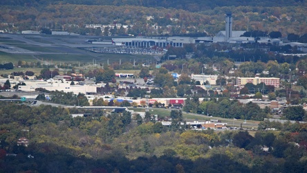
Valley View area, viewed from Mill Mountain
-
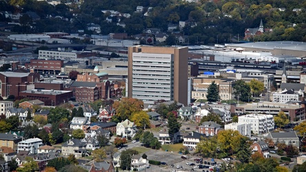
Poff Federal Building, viewed from Mill Mountain
-
Elm Avenue interchange [01]
![Elm Avenue interchange [01] (2956 visits) Interchange between Interstate 581/US 220 and Elm Avenue (SR 24) in Roanoke, Virginia, viewed from M... Elm Avenue interchange [01]](../../../../i/upload/2024/07/20/20240720122015-70544823-cu_s9999x250.jpg)
-
Routes 220 and 39 in Warm Springs, Virginia [01]
![Routes 220 and 39 in Warm Springs, Virginia [01] (1916 visits) US 220 and VA 39 in Warm Springs, Virginia, facing southwest. In this shot, US 220 runs top to bott... Routes 220 and 39 in Warm Springs, Virginia [01]](../../../../i/upload/2025/01/02/20250102141310-79aa8afd-cu_s9999x250.jpg)
-
Routes 220 and 39 in Warm Springs, Virginia [02]
![Routes 220 and 39 in Warm Springs, Virginia [02] (1906 visits) US 220 and VA 39 in Warm Springs, Virginia, facing southwest. In this shot, US 220 is the road to t... Routes 220 and 39 in Warm Springs, Virginia [02]](../../../../i/upload/2025/01/02/20250102141319-a5501ace-cu_s9999x250.jpg)
-
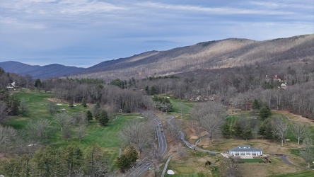
View along US 220 northbound in Hot Springs, Virginia
-
Buffalo Gap [02]
![Buffalo Gap [02] (834 visits) Buffalo Gap, a mountain pass through Little North Mountain, near Swoope, Virginia.
More at The Sc... Buffalo Gap [02]](../../../../i/upload/2025/01/03/20250103200607-1abe8192-cu_s9999x250.jpg)
-
Traffic circle under construction [01]
![Traffic circle under construction [01] (778 visits) Traffic circle under construction north of Mudd Tavern Road (VA 606) in Thornburg, Virginia.
More a... Traffic circle under construction [01]](../../../../i/upload/2025/02/22/20250222022330-4bbf063c-cu_s9999x250.jpg)
-
Traffic circle under construction [02]
![Traffic circle under construction [02] (815 visits) Traffic circle under construction north of Mudd Tavern Road (VA 606) in Thornburg, Virginia.
More a... Traffic circle under construction [02]](../../../../i/upload/2025/02/22/20250222022336-e9f87960-cu_s9999x250.jpg)
-
Traffic circle under construction [03]
![Traffic circle under construction [03] (810 visits) Traffic circle under construction north of Mudd Tavern Road (VA 606) in Thornburg, Virginia.
More a... Traffic circle under construction [03]](../../../../i/upload/2025/02/22/20250222022342-e895dd00-cu_s9999x250.jpg)
-
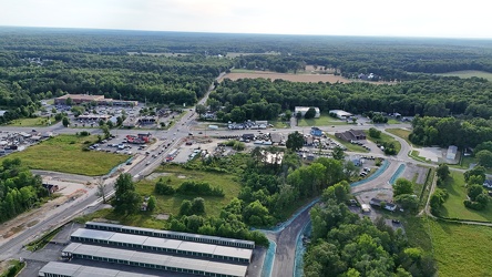
Aerial view of Thornburg, Virginia
-
110 Franklin Road SE
