-
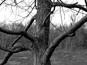
Tree at scenic overlook
-
Sunset from I-64 overlook [03]
![Sunset from I-64 overlook [03] (1926 visits) Sunset, viewed from the scenic overlook at milepost 103 on Interstate 64 eastbound in Albemarle Coun... Sunset from I-64 overlook [03]](../../../../i/upload/2024/07/13/20240713234247-066d4e9b-cu_s9999x250.jpg)
-
Sunset from I-64 overlook [01]
![Sunset from I-64 overlook [01] (1919 visits) Sunset, viewed from the scenic overlook at milepost 103 on Interstate 64 eastbound in Albemarle Coun... Sunset from I-64 overlook [01]](../../../../i/upload/2024/07/13/20240713234248-69674cad-cu_s9999x250.jpg)
-
Sunset from I-64 overlook [02]
![Sunset from I-64 overlook [02] (1925 visits) Sunset, viewed from the scenic overlook at milepost 103 on Interstate 64 eastbound in Albemarle Coun... Sunset from I-64 overlook [02]](../../../../i/upload/2024/07/13/20240713234249-3f6e970a-cu_s9999x250.jpg)
-
Sunset from I-64 overlook [04]
![Sunset from I-64 overlook [04] (1897 visits) Sunset, viewed from the scenic overlook at milepost 103 on Interstate 64 eastbound in Albemarle Coun... Sunset from I-64 overlook [04]](../../../../i/upload/2024/07/13/20240713234251-97a8e10e-cu_s9999x250.jpg)
-
Roanoke from the star, January 2003 [04]
![Roanoke from the star, January 2003 [04] (3159 visits) The city of Roanoke, Virginia as seen from Mill Mountain Park on the afternoon of January 7, 2003.
... Roanoke from the star, January 2003 [04]](../../../../i/upload/2024/07/14/20240714101746-72386e76-cu_s9999x250.jpg)
-
Roanoke from the star, January 2003 [03]
![Roanoke from the star, January 2003 [03] (3373 visits) The city of Roanoke, Virginia as seen from Mill Mountain Park on the afternoon of January 7, 2003.
... Roanoke from the star, January 2003 [03]](../../../../i/upload/2024/07/14/20240714101748-2add7d74-cu_s9999x250.jpg)
-
Roanoke from the star, January 2003 [02]
![Roanoke from the star, January 2003 [02] (3275 visits) The city of Roanoke, Virginia as seen from Mill Mountain Park on the afternoon of January 7, 2003.
... Roanoke from the star, January 2003 [02]](../../../../i/upload/2024/07/14/20240714101749-5603d0ac-cu_s9999x250.jpg)
-
Roanoke from the star, January 2003 [01]
![Roanoke from the star, January 2003 [01] (3257 visits) The city of Roanoke, Virginia as seen from Mill Mountain Park on the afternoon of January 7, 2003.
... Roanoke from the star, January 2003 [01]](../../../../i/upload/2024/07/14/20240714101750-8166e277-cu_s9999x250.jpg)
-
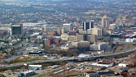
Roanoke from the star, March 2003
-
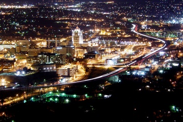
Roanoke, Virginia at night, 2003
-
Demolition of 1117 North 19th Street [02]
![Demolition of 1117 North 19th Street [02] (1979 visits) Demolition of 1117 North 19th Street in Arlington, Virginia's Rosslyn neighborhood. The building wa... Demolition of 1117 North 19th Street [02]](../../../../i/upload/2024/07/14/20240714234453-bdd3fcad-cu_s9999x250.jpg)
-
Demolition of 1117 North 19th Street [01]
![Demolition of 1117 North 19th Street [01] (1904 visits) Demolition of 1117 North 19th Street in Arlington, Virginia's Rosslyn neighborhood. The building wa... Demolition of 1117 North 19th Street [01]](../../../../i/upload/2024/07/14/20240714234455-3ed3f7f8-cu_s9999x250.jpg)
-
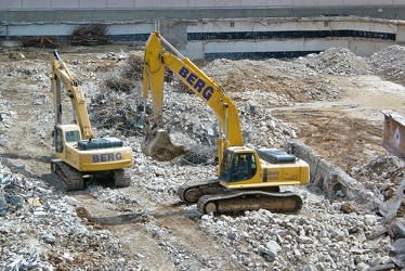
Heavy equipment at 1117 North 19th Street site
-
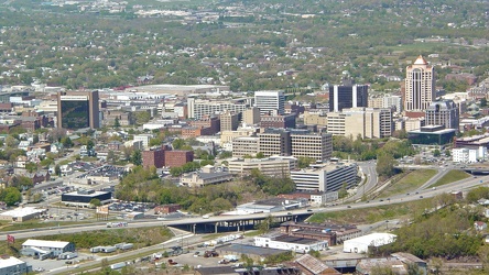
Roanoke viewed from the star, April 2006
-
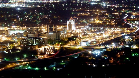
Roanoke from the star, April 2007
-
RCA Building [02]
![RCA Building [02] (1114 visits) The RCA Building, located at 1901 North Moore Street in Arlington, Virginia's Rosslyn neighborhood. ... RCA Building [02]](../../../../i/upload/2024/07/15/20240715215220-6ad114bc-cu_s9999x250.jpg)
-
RCA Building [03]
![RCA Building [03] (1369 visits) The RCA Building, located at 1901 North Moore Street in Arlington, Virginia's Rosslyn neighborhood. ... RCA Building [03]](../../../../i/upload/2024/07/15/20240715215224-c6ab740d-cu_s9999x250.jpg)
-
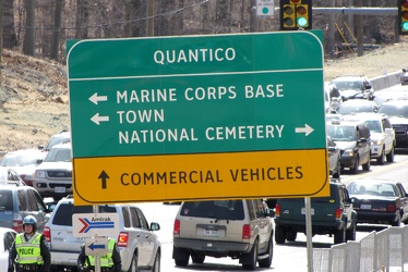
Road sign at intersection of US 1 and Joplin and Fuller Roads
-
Roanoke, Virginia [01]
![Roanoke, Virginia [01] (2261 visits) Roanoke, Virginia, as viewed from the M. Carl Andrews Overlook in Mill Mountain Park, next to the Ro... Roanoke, Virginia [01]](../../../../i/upload/2024/07/17/20240717232316-4004d589-cu_s9999x250.jpg)
-
Roanoke, Virginia [02]
![Roanoke, Virginia [02] (2096 visits) Roanoke, Virginia, viewed from the M. Carl Andrews Overlook in Mill Mountain Park, next to the Roano... Roanoke, Virginia [02]](../../../../i/upload/2024/07/17/20240717232320-e7ffa9b7-cu_s9999x250.jpg)
 West overlook at Mill Mountain Park
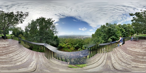
 M. Carl Andrews Overlook [01]
![M. Carl Andrews Overlook [01] (3626 visits) The M. Carl Andrews Overlook, at Mill Mountain Park in Roanoke, Virginia. The Roanoke Star is locat... M. Carl Andrews Overlook [01]](../../../../i/upload/2024/07/17/20240717233104-18c6ba6a-cu_s9999x250.jpg)
 M. Carl Andrews Overlook [02]
![M. Carl Andrews Overlook [02] (3671 visits) The M. Carl Andrews Overlook, at Mill Mountain Park in Roanoke, Virginia. The Roanoke Star is locat... M. Carl Andrews Overlook [02]](../../../../i/upload/2024/07/17/20240717233109-73899e0e-cu_s9999x250.jpg)
 M. Carl Andrews Overlook at night [01]
![M. Carl Andrews Overlook at night [01] (4018 visits) The M. Carl Andrews Overlook at Mill Mountain Park in Roanoke, Virginia, at night. The Roanoke Star... M. Carl Andrews Overlook at night [01]](../../../../i/upload/2024/07/17/20240717233141-45aa31b5-cu_s9999x250.jpg)
 M. Carl Andrews Overlook at night [02]
![M. Carl Andrews Overlook at night [02] (3804 visits) The M. Carl Andrews Overlook at Mill Mountain Park in Roanoke, Virginia, at night. The Roanoke Star... M. Carl Andrews Overlook at night [02]](../../../../i/upload/2024/07/17/20240717233145-af6ef7ac-cu_s9999x250.jpg)
-
View from Dirt Farm Brewing [02]
![View from Dirt Farm Brewing [02] (1713 visits) View from the patio at Dirt Farm Brewing in Bluemont, Virginia, facing approximately east. On a cle... View from Dirt Farm Brewing [02]](../../../../i/upload/2024/07/18/20240718230423-b1ac8dea-cu_s9999x250.jpg)
-
View from Dirt Farm Brewing [01]
![View from Dirt Farm Brewing [01] (1861 visits) View from the patio at Dirt Farm Brewing in Bluemont, Virginia, facing approximately east. On a cle... View from Dirt Farm Brewing [01]](../../../../i/upload/2024/07/18/20240718230427-e0fe1b23-cu_s9999x250.jpg)
-
Interstate 64 in Nelson County, Virginia [01]
![Interstate 64 in Nelson County, Virginia [01] (10606 visits) Interstate 64 in Nelson County, Virginia, near Rockfish Gap. US 250 runs adjacent to the freeway.
... Interstate 64 in Nelson County, Virginia [01]](../../../../i/upload/2024/07/19/20240719115200-c8a2ce39-cu_s9999x250.jpg)
-
Interstate 64 in Nelson County, Virginia [02]
![Interstate 64 in Nelson County, Virginia [02] (10766 visits) Interstate 64 in Nelson County, Virginia, near Rockfish Gap. US 250 runs adjacent to the freeway.
... Interstate 64 in Nelson County, Virginia [02]](../../../../i/upload/2024/07/19/20240719115847-184fa12a-cu_s9999x250.jpg)
-
Interstate 64 in Nelson County, Virginia [03]
![Interstate 64 in Nelson County, Virginia [03] (10961 visits) Interstate 64 in Nelson County, Virginia, near Rockfish Gap. US 250 runs adjacent to the freeway.
... Interstate 64 in Nelson County, Virginia [03]](../../../../i/upload/2024/07/19/20240719115902-ff5fb9e1-cu_s9999x250.jpg)
-
Blue Ridge Mountains near Rockfish Gap [01]
![Blue Ridge Mountains near Rockfish Gap [01] (1514 visits) The Blue Ridge Mountains, viewed from above the Interstate 64 scenic overlook in Nelson County, Virg... Blue Ridge Mountains near Rockfish Gap [01]](../../../../i/upload/2024/07/19/20240719115911-d105cde8-cu_s9999x250.jpg)
-
Blue Ridge Mountains near Rockfish Gap [02]
![Blue Ridge Mountains near Rockfish Gap [02] (1478 visits) The Blue Ridge Mountains, viewed from above the Interstate 64 scenic overlook in Nelson County, Virg... Blue Ridge Mountains near Rockfish Gap [02]](../../../../i/upload/2024/07/19/20240719115926-47f38290-cu_s9999x250.jpg)
-
West Main and West Broad Streets, facing west
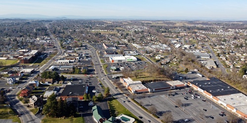
-
Downtown Waynesboro, Virginia, facing west
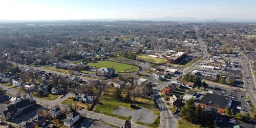
-
Water tower off of Highview Court [01]
![Water tower off of Highview Court [01] (2507 visits) Water tower located off of Highview Court in Culpeper, Virginia.
Ben Schumin is a professional phot... Water tower off of Highview Court [01]](../../../../i/upload/2024/07/19/20240719155951-3e8ac8cb-cu_s9999x250.jpg)
-
West Main Street in Waynesboro, Virginia [01]
![West Main Street in Waynesboro, Virginia [01] (55685 visits) View down West Main Street (US 250) in the west end of Waynesboro, Virginia, near the former Kmart b... West Main Street in Waynesboro, Virginia [01]](../../../../i/upload/2024/07/19/20240719164545-b5a50599-cu_s9999x250.jpg)
-
West Main Street in Waynesboro, Virginia [02]
![West Main Street in Waynesboro, Virginia [02] (9971 visits) View down West Main Street (US 250) in the west end of Waynesboro, Virginia, near the Sheetz conveni... West Main Street in Waynesboro, Virginia [02]](../../../../i/upload/2024/07/19/20240719164551-0b8407a8-cu_s9999x250.jpg)
-
West Main Street in Waynesboro, Virginia [03]
![West Main Street in Waynesboro, Virginia [03] (10789 visits) View down West Main Street (US 250) in the west end of Waynesboro, Virginia, near St. Mark's United ... West Main Street in Waynesboro, Virginia [03]](../../../../i/upload/2024/07/19/20240719164555-f7feeafe-cu_s9999x250.jpg)
-
West Main Street in Waynesboro, Virginia [04]
![West Main Street in Waynesboro, Virginia [04] (323308 visits) View down West Main Street (US 250) in the west end of Waynesboro, Virginia, near the Westwood Villa... West Main Street in Waynesboro, Virginia [04]](../../../../i/upload/2024/07/19/20240719164600-4379cef1-cu_s9999x250.jpg)
-
Water tower off of Highview Court [03]
![Water tower off of Highview Court [03] (2513 visits) Water tower located off of Highview Court in Culpeper, Virginia.
Ben Schumin is a professional phot... Water tower off of Highview Court [03]](../../../../i/upload/2024/07/19/20240719165926-2140749f-cu_s9999x250.jpg)
-
Water tower off of Highview Court [04]
![Water tower off of Highview Court [04] (2449 visits) Water tower located off of Highview Court in Culpeper, Virginia.
Ben Schumin is a professional phot... Water tower off of Highview Court [04]](../../../../i/upload/2024/07/19/20240719165929-ea38ce5a-cu_s9999x250.jpg)
-
Neighborhood in Culpeper, Virginia
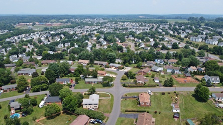
-
Water tower off of Highview Court [05]
![Water tower off of Highview Court [05] (2477 visits) Water tower located off of Highview Court in Culpeper, Virginia.
Ben Schumin is a professional phot... Water tower off of Highview Court [05]](../../../../i/upload/2024/07/19/20240719170010-e6966844-cu_s9999x250.jpg)
-
Water tower off of Highview Court [02]
![Water tower off of Highview Court [02] (2509 visits) Water tower located off of Highview Court in Culpeper, Virginia.
Ben Schumin is a professional phot... Water tower off of Highview Court [02]](../../../../i/upload/2024/07/19/20240719170014-68ef8ad3-cu_s9999x250.jpg)
-
US 29 North, near Hilton Heights Road [01]
![US 29 North, near Hilton Heights Road [01] (3058 visits) US 29 north of Charlottesville, Virginia, near Hilton Heights Road, facing northbound.
Ben Schumin ... US 29 North, near Hilton Heights Road [01]](../../../../i/upload/2024/07/19/20240719171702-b12048d7-cu_s9999x250.jpg)
-
US 29 North, near Hilton Heights Road [02]
![US 29 North, near Hilton Heights Road [02] (3073 visits) US 29 north of Charlottesville, Virginia, near Hilton Heights Road, facing northbound.
Ben Schumin ... US 29 North, near Hilton Heights Road [02]](../../../../i/upload/2024/07/19/20240719171717-5729f873-cu_s9999x250.jpg)
-
DoubleTree Hotel in Charlottesville, Virginia [01]
![DoubleTree Hotel in Charlottesville, Virginia [01] (1882 visits) DoubleTree Hotel on Hilton Heights Road in Charlottesville, Virginia. This hotel was built in 1984,... DoubleTree Hotel in Charlottesville, Virginia [01]](../../../../i/upload/2024/07/19/20240719171742-a365fe34-cu_s9999x250.jpg)
-
US 29 near Woodbrook Drive [01]
![US 29 near Woodbrook Drive [01] (11467 visits) US 29 north of Charlottesville, Virginia, near Woodbrook Drive, facing northbound.
Ben Schumin is a... US 29 near Woodbrook Drive [01]](../../../../i/upload/2024/07/19/20240719171851-a0a055c4-cu_s9999x250.jpg)
-
US 29 near Woodbrook Drive [02]
![US 29 near Woodbrook Drive [02] (11442 visits) US 29 north of Charlottesville, Virginia, near Woodbrook Drive, facing northbound.
Ben Schumin is a... US 29 near Woodbrook Drive [02]](../../../../i/upload/2024/07/19/20240719171856-fdca65ff-cu_s9999x250.jpg)
-
US 250 at the west end of Waynesboro, Virginia
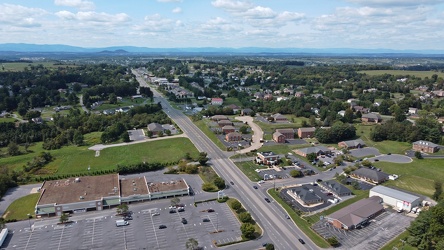
-
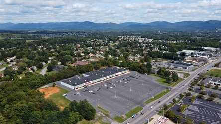
Waynesboro, Virginia, facing approximately east
-
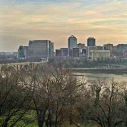
Rosslyn from Georgetown University Library
-
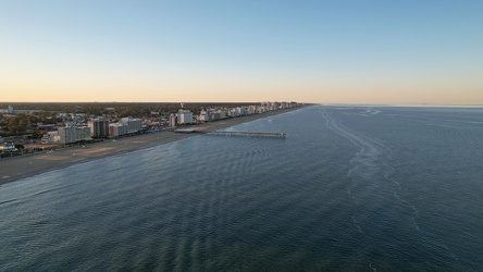
Aerial view of Virginia Beach from over the ocean
-
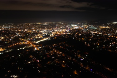
Roanoke, Virginia at night, 2021
-
Church Hill neighborhood [01]
![Church Hill neighborhood [01] (11659 visits) Aerial view of the Church Hill neighborhood of Richmond, Virginia, photographed from west of Interst... Church Hill neighborhood [01]](../../../../i/upload/2024/07/20/20240720092724-5ad8079d-cu_s9999x250.jpg)
-
Church Hill neighborhood [02]
![Church Hill neighborhood [02] (11635 visits) Aerial view of the Church Hill neighborhood of Richmond, Virginia, photographed from west of Interst... Church Hill neighborhood [02]](../../../../i/upload/2024/07/20/20240720092729-c1c95489-cu_s9999x250.jpg)
-
Hairpin turn on US 250 [01]
![Hairpin turn on US 250 [01] (2963 visits) Hairpin turn on US 250 in Highland County, Virginia, as it ascends Shenandoah Mountain.
Ben Schumin... Hairpin turn on US 250 [01]](../../../../i/upload/2024/07/20/20240720094126-511d5875-cu_s9999x250.jpg)
-
Hairpin turn on US 250 [02]
![Hairpin turn on US 250 [02] (3014 visits) Hairpin turn on US 250 in Highland County, Virginia, as it ascends Shenandoah Mountain.
Ben Schumin... Hairpin turn on US 250 [02]](../../../../i/upload/2024/07/20/20240720094131-dc588684-cu_s9999x250.jpg)
-
Verona, Virginia over Mill Place Commerce Park [01]
![Verona, Virginia over Mill Place Commerce Park [01] (1463 visits) Aerial view of Verona, Virginia from above the Mill Place Commerce Park. This photo shows a view fa... Verona, Virginia over Mill Place Commerce Park [01]](../../../../i/upload/2024/07/20/20240720110653-ef33b991-cu_s9999x250.jpg)
-
Verona, Virginia over Mill Place Commerce Park [02]
![Verona, Virginia over Mill Place Commerce Park [02] (1798 visits) Aerial view of Verona, Virginia from above the Mill Place Commerce Park. This view faces approximat... Verona, Virginia over Mill Place Commerce Park [02]](../../../../i/upload/2024/07/20/20240720110708-9b94d246-cu_s9999x250.jpg)
-
Verona, Virginia over Mill Place Commerce Park [05]
![Verona, Virginia over Mill Place Commerce Park [05] (1566 visits) Aerial view of Verona, Virginia from above the Mill Place Commerce Park. This photo shows a view fa... Verona, Virginia over Mill Place Commerce Park [05]](../../../../i/upload/2024/07/20/20240720110734-c309d24d-cu_s9999x250.jpg)
-
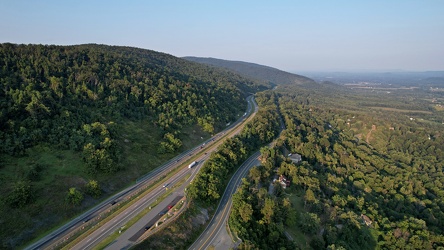
Interstate 64 east of Rockfish Gap
-
Elm Avenue interchange [02]
![Elm Avenue interchange [02] (2999 visits) Interchange between Interstate 581/US 220 and Elm Avenue (SR 24) in Roanoke, Virginia. The I-581 de... Elm Avenue interchange [02]](../../../../i/upload/2024/07/20/20240720121652-6267da79-cu_s9999x250.jpg)
-
Aerial view of Roanoke, Virginia [01]
![Aerial view of Roanoke, Virginia [01] (1887 visits) Aerial view of Roanoke, Virginia.
More at The Schumin Web:
www.schuminweb.com/life-and-times/advent... Aerial view of Roanoke, Virginia [01]](../../../../i/upload/2024/07/20/20240720121757-bb58476c-cu_s9999x250.jpg)
-
Aerial view of Roanoke, Virginia [02]
![Aerial view of Roanoke, Virginia [02] (1787 visits) Aerial view of Roanoke, Virginia.
More at The Schumin Web:
www.schuminweb.com/life-and-times/advent... Aerial view of Roanoke, Virginia [02]](../../../../i/upload/2024/07/20/20240720121808-dccb83a0-cu_s9999x250.jpg)
-
Aerial view of Roanoke, Virginia [03]
![Aerial view of Roanoke, Virginia [03] (1829 visits) Aerial view of Roanoke, Virginia.
More at The Schumin Web:
www.schuminweb.com/life-and-times/advent... Aerial view of Roanoke, Virginia [03]](../../../../i/upload/2024/07/20/20240720121837-3c6bbb13-cu_s9999x250.jpg)
-
Aerial view of Roanoke, Virginia [04]
![Aerial view of Roanoke, Virginia [04] (1880 visits) Aerial view of Roanoke, Virginia.
More at The Schumin Web:
www.schuminweb.com/life-and-times/advent... Aerial view of Roanoke, Virginia [04]](../../../../i/upload/2024/07/20/20240720121854-34748718-cu_s9999x250.jpg)
-
Aerial view of Roanoke, Virginia [05]
![Aerial view of Roanoke, Virginia [05] (1782 visits) Aerial view of Roanoke, Virginia.
More at The Schumin Web:
www.schuminweb.com/life-and-times/advent... Aerial view of Roanoke, Virginia [05]](../../../../i/upload/2024/07/20/20240720121906-5f802cee-cu_s9999x250.jpg)
-
Aerial view of Roanoke, Virginia [06]
![Aerial view of Roanoke, Virginia [06] (1696 visits) Aerial view of Roanoke, Virginia.
More at The Schumin Web:
www.schuminweb.com/life-and-times/advent... Aerial view of Roanoke, Virginia [06]](../../../../i/upload/2024/07/20/20240720121917-3d4a6311-cu_s9999x250.jpg)
-
View from the Roanoke Star, October 2022 [01]
![View from the Roanoke Star, October 2022 [01] (2801 visits) View of Roanoke, Virginia from Mill Mountain, October 18, 2022.
More at The Schumin Web:
www.schumi... View from the Roanoke Star, October 2022 [01]](../../../../i/upload/2024/07/20/20240720121935-9c3d81cd-cu_s9999x250.jpg)
-
View from the Roanoke Star, October 2022 [02]
![View from the Roanoke Star, October 2022 [02] (1549 visits) View of Roanoke, Virginia from Mill Mountain, October 18, 2022.
More at The Schumin Web:
www.schumi... View from the Roanoke Star, October 2022 [02]](../../../../i/upload/2024/07/20/20240720121946-ef64a8e5-cu_s9999x250.jpg)
-
View from the Roanoke Star, October 2022 [03]
![View from the Roanoke Star, October 2022 [03] (1609 visits) View of Roanoke, Virginia from Mill Mountain, October 18, 2022.
More at The Schumin Web:
www.schumi... View from the Roanoke Star, October 2022 [03]](../../../../i/upload/2024/07/20/20240720121951-aad25312-cu_s9999x250.jpg)
-
View from the Roanoke Star, October 2022 [04]
![View from the Roanoke Star, October 2022 [04] (1593 visits) View of Roanoke, Virginia from Mill Mountain, October 18, 2022.
More at The Schumin Web:
www.schumi... View from the Roanoke Star, October 2022 [04]](../../../../i/upload/2024/07/20/20240720121957-f438f2a3-cu_s9999x250.jpg)
-
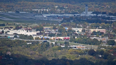
Valley View area, viewed from Mill Mountain
-
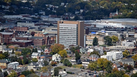
Poff Federal Building, viewed from Mill Mountain
-
Elm Avenue interchange [01]
![Elm Avenue interchange [01] (3035 visits) Interchange between Interstate 581/US 220 and Elm Avenue (SR 24) in Roanoke, Virginia, viewed from M... Elm Avenue interchange [01]](../../../../i/upload/2024/07/20/20240720122015-70544823-cu_s9999x250.jpg)
-
Former CARTA bus 3424 [05]
![Former CARTA bus 3424 [05] (2363 visits) Former CARTA bus 3424, a 1996 New Flyer D35HF, now part of the collection of Commonwealth Coach &... Former CARTA bus 3424 [05]](../../../../i/upload/2024/07/31/20240731130616-c2e5c174-cu_s9999x250.jpg)