-
Tunnel under Roanoke-Blacksburg Regional Airport [01]
![Tunnel under Roanoke-Blacksburg Regional Airport [01] (220 visits) Tunnel under the northeastern end of runway 06/24 at Roanoke-Blacksburg Regional Airport, helping ca... Tunnel under Roanoke-Blacksburg Regional Airport [01]](../../../../i/upload/2025/03/07/20250307082638-881970da-cu_s9999x250.jpg)
-
Tunnel under Roanoke-Blacksburg Regional Airport [02]
![Tunnel under Roanoke-Blacksburg Regional Airport [02] (227 visits) Tunnel under the northeastern end of runway 06/24 at Roanoke-Blacksburg Regional Airport, helping ca... Tunnel under Roanoke-Blacksburg Regional Airport [02]](../../../../i/upload/2025/03/07/20250307082646-1ee32362-cu_s9999x250.jpg)
-
Tunnel under Roanoke-Blacksburg Regional Airport [03]
![Tunnel under Roanoke-Blacksburg Regional Airport [03] (266 visits) Tunnel under the northeastern end of runway 06/24 at Roanoke-Blacksburg Regional Airport, helping ca... Tunnel under Roanoke-Blacksburg Regional Airport [03]](../../../../i/upload/2025/03/07/20250307082655-ed6dde73-cu_s9999x250.jpg)
-
Tunnel under Roanoke-Blacksburg Regional Airport [04]
![Tunnel under Roanoke-Blacksburg Regional Airport [04] (277 visits) Tunnel under the northeastern end of runway 06/24 at Roanoke-Blacksburg Regional Airport, helping ca... Tunnel under Roanoke-Blacksburg Regional Airport [04]](../../../../i/upload/2025/03/07/20250307082705-95dbd6b4-cu_s9999x250.jpg)
-
Photographing the tunnel under Roanoke-Blacksburg Regional Airport

-
Hampton Roads Bridge-Tunnel, westbound [01]
![Hampton Roads Bridge-Tunnel, westbound [01] (368 visits) The westbound tube of the Hampton Roads Bridge-Tunnel, a tunnel that carries Interstate 64 between N... Hampton Roads Bridge-Tunnel, westbound [01]](../../../../i/upload/2025/02/17/20250217012510-5b2ab7ac-cu_s9999x250.jpg)
-
Hampton Roads Bridge-Tunnel, westbound [02]
![Hampton Roads Bridge-Tunnel, westbound [02] (375 visits) The westbound tube of the Hampton Roads Bridge-Tunnel, a tunnel that carries Interstate 64 between N... Hampton Roads Bridge-Tunnel, westbound [02]](../../../../i/upload/2025/02/17/20250217012521-81ed217b-cu_s9999x250.jpg)
-
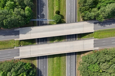
Croaker Road and Interstate 64
-
Elm Avenue interchange [04]
![Elm Avenue interchange [04] (655 visits) Interchange between Interstate 581/US 220 and Elm Avenue (SR 24) in Roanoke, Virginia. The I-581 de... Elm Avenue interchange [04]](../../../../i/upload/2025/03/03/20250303170729-c4512aea-cu_s9999x250.jpg)
-
Elm Avenue interchange [03]
![Elm Avenue interchange [03] (664 visits) Interchange between Interstate 581/US 220 and Elm Avenue (SR 24) in Roanoke, Virginia. The I-581 de... Elm Avenue interchange [03]](../../../../i/upload/2025/03/03/20250303170720-a5bd3de6-cu_s9999x250.jpg)
-
Interstate 64 in Hampton, Virginia [03]
![Interstate 64 in Hampton, Virginia [03] (676 visits) Aerial view of Interstate 64, a major highway that runs through Hampton, Virginia.
More at The Schu... Interstate 64 in Hampton, Virginia [03]](../../../../i/upload/2025/02/17/20250217085436-66a19491-cu_s9999x250.jpg)
-
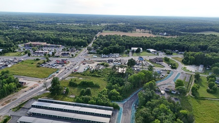
Aerial view of Thornburg, Virginia
-
Interstate 64 in Hampton, Virginia [02]
![Interstate 64 in Hampton, Virginia [02] (683 visits) Aerial view of Interstate 64, a major highway that runs through Hampton, Virginia.
More at The Schu... Interstate 64 in Hampton, Virginia [02]](../../../../i/upload/2025/02/17/20250217085501-e9021d57-cu_s9999x250.jpg)
-
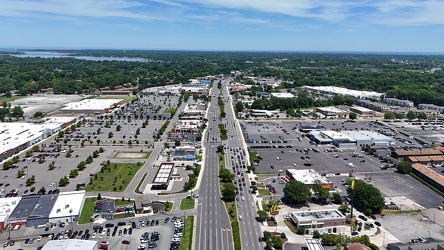
View east along Mercury Boulevard
-
Interstate 64 in Hampton, Virginia [04]
![Interstate 64 in Hampton, Virginia [04] (723 visits) Aerial view of Interstate 64, a major highway that runs through Hampton, Virginia.
More at The Schu... Interstate 64 in Hampton, Virginia [04]](../../../../i/upload/2025/02/17/20250217085415-4cb12081-cu_s9999x250.jpg)
-
Traffic circle under construction [01]
![Traffic circle under construction [01] (729 visits) Traffic circle under construction north of Mudd Tavern Road (VA 606) in Thornburg, Virginia.
More a... Traffic circle under construction [01]](../../../../i/upload/2025/02/22/20250222022330-4bbf063c-cu_s9999x250.jpg)
-
Thornburg interchange on Interstate 95 [01]
![Thornburg interchange on Interstate 95 [01] (729 visits) Thornburg interchange (exit 118) on Interstate 95 in Virginia. This interchange interacts with Mudd... Thornburg interchange on Interstate 95 [01]](../../../../i/upload/2025/02/22/20250222022415-31ccb499-cu_s9999x250.jpg)
-
Traffic circle under construction [03]
![Traffic circle under construction [03] (759 visits) Traffic circle under construction north of Mudd Tavern Road (VA 606) in Thornburg, Virginia.
More a... Traffic circle under construction [03]](../../../../i/upload/2025/02/22/20250222022342-e895dd00-cu_s9999x250.jpg)
-
Buffalo Gap [02]
![Buffalo Gap [02] (767 visits) Buffalo Gap, a mountain pass through Little North Mountain, near Swoope, Virginia.
More at The Sc... Buffalo Gap [02]](../../../../i/upload/2025/01/03/20250103200607-1abe8192-cu_s9999x250.jpg)
-
Traffic circle under construction [02]
![Traffic circle under construction [02] (769 visits) Traffic circle under construction north of Mudd Tavern Road (VA 606) in Thornburg, Virginia.
More a... Traffic circle under construction [02]](../../../../i/upload/2025/02/22/20250222022336-e9f87960-cu_s9999x250.jpg)
-
Interstate 81 near Verona, Virginia [01]
![Interstate 81 near Verona, Virginia [01] (794 visits) Interstate 81, as it passes through Verona, Virginia. View facing southbound.
More at The Schumin ... Interstate 81 near Verona, Virginia [01]](../../../../i/upload/2024/11/28/20241128103749-b97fb29f-cu_s9999x250.jpg)
-
Thornburg interchange on Interstate 95 [02]
![Thornburg interchange on Interstate 95 [02] (797 visits) Thornburg interchange (exit 118) on Interstate 95 in Virginia. This interchange interacts with Mudd... Thornburg interchange on Interstate 95 [02]](../../../../i/upload/2025/02/22/20250222022420-229d3507-cu_s9999x250.jpg)
-
Interstate 81 near Verona, Virginia [02]
![Interstate 81 near Verona, Virginia [02] (813 visits) Interstate 81, as it passes through Verona, Virginia. View facing northbound.
More at The Schumin ... Interstate 81 near Verona, Virginia [02]](../../../../i/upload/2024/11/28/20241128103753-ff030609-cu_s9999x250.jpg)
-
Interstate 81 near Verona, Virginia [04]
![Interstate 81 near Verona, Virginia [04] (814 visits) Interstate 81, as it passes through Verona, Virginia. View facing southbound.
More at The Schumin ... Interstate 81 near Verona, Virginia [04]](../../../../i/upload/2024/11/28/20241128103802-c0bab98c-cu_s9999x250.jpg)
-
Interstate 64 in Hampton, Virginia [01]
![Interstate 64 in Hampton, Virginia [01] (819 visits) Aerial view of Interstate 64, a major highway that runs through Hampton, Virginia. The Hampton Coli... Interstate 64 in Hampton, Virginia [01]](../../../../i/upload/2025/02/17/20250217090951-2400e489-cu_s9999x250.jpg)
-
Interstate 81 near Verona, Virginia [03]
![Interstate 81 near Verona, Virginia [03] (820 visits) Interstate 81, as it passes through Verona, Virginia. View facing southbound.
More at The Schumin ... Interstate 81 near Verona, Virginia [03]](../../../../i/upload/2024/11/28/20241128103757-213af6d5-cu_s9999x250.jpg)
-
Interstate 81 near Verona, Virginia [05]
![Interstate 81 near Verona, Virginia [05] (820 visits) Interstate 81, as it passes through Verona, Virginia. View facing northbound.
More at The Schumin ... Interstate 81 near Verona, Virginia [05]](../../../../i/upload/2024/11/28/20241128103806-21947d95-cu_s9999x250.jpg)
-
Street signs at intersection of US 15 and Lucketts Road [01]
![Street signs at intersection of US 15 and Lucketts Road [01] (930 visits) Street signs at the intersection of US 15 and Lucketts Road in Loudoun County, Virginia.
Ben Schumi... Street signs at intersection of US 15 and Lucketts Road [01]](../../../../i/upload/2024/07/19/20240719161537-a75c3dac-cu_s9999x250.jpg)
-
Street signs at intersection of US 15 and Lucketts Road [02]
![Street signs at intersection of US 15 and Lucketts Road [02] (941 visits) Street signs at the intersection of US 15 and Lucketts Road in Loudoun County, Virginia.
Ben Schumi... Street signs at intersection of US 15 and Lucketts Road [02]](../../../../i/upload/2024/07/19/20240719161623-789e37f5-cu_s9999x250.jpg)
-
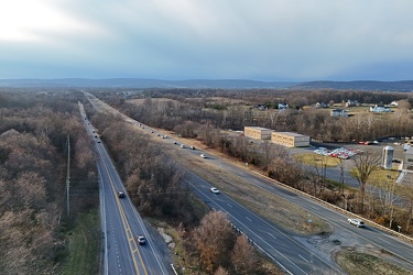
Route 7 in Purcellville, Virginia
-
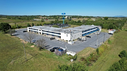
Motel 6 near Staunton, Virginia
-
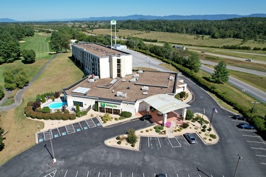
Holiday Inn near Staunton, Virginia
-
View from Greenstone Overlook [01]
![View from Greenstone Overlook [01] (1101 visits) View from Greenstone Overlook on the Blue Ridge Parkway in Virginia. The city of Waynesboro is visi... View from Greenstone Overlook [01]](../../../../i/upload/2024/07/20/20240720111153-a1731cde-cu_s9999x250.jpg)
-
View from Greenstone Overlook [03]
![View from Greenstone Overlook [03] (1105 visits) View from Greenstone Overlook on the Blue Ridge Parkway in Virginia. The city of Waynesboro is visi... View from Greenstone Overlook [03]](../../../../i/upload/2024/07/20/20240720111131-8fba13c3-cu_s9999x250.jpg)
-
View from Greenstone Overlook [02]
![View from Greenstone Overlook [02] (1108 visits) View from Greenstone Overlook on the Blue Ridge Parkway in Virginia. The city of Waynesboro is visi... View from Greenstone Overlook [02]](../../../../i/upload/2024/07/20/20240720111014-00eb3527-cu_s9999x250.jpg)
-
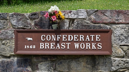
Confederate Breastworks sign
-
Interstate 264 after Midtown Tunnel [02]
![Interstate 264 after Midtown Tunnel [02] (1132 visits) Interstate 264 westbound in Portsmouth, Virginia, just after traffic exits the Midtown Tunnel.
More... Interstate 264 after Midtown Tunnel [02]](../../../../i/upload/2024/07/19/20240719101945-e18e6752-cu_s9999x250.jpg)
-
View from Ravens Roost overlook [01]
![View from Ravens Roost overlook [01] (1167 visits) View from Ravens Roost overlook on the Blue Ridge Parkway in Virginia.
More at The Schumin Web:
www... View from Ravens Roost overlook [01]](../../../../i/upload/2024/07/20/20240720111047-eedd86a4-cu_s9999x250.jpg)
-
View from Greenstone Overlook [04]
![View from Greenstone Overlook [04] (1168 visits) View from Greenstone Overlook on the Blue Ridge Parkway in Virginia. The city of Waynesboro is visi... View from Greenstone Overlook [04]](../../../../i/upload/2024/07/20/20240720111020-03746e7e-cu_s9999x250.jpg)
-
Traffic signals at US 15 and Lucketts Road [02]
![Traffic signals at US 15 and Lucketts Road [02] (1181 visits) Traffic signals at the intersection of US 15 and Lucketts Road in Loudoun County, Virginia.
Ben Sch... Traffic signals at US 15 and Lucketts Road [02]](../../../../i/upload/2024/07/19/20240719161422-d1e94014-cu_s9999x250.jpg)
-
Sign for State Route 188 [01]
![Sign for State Route 188 [01] (1187 visits) Signage pointing the way to State Route 188 at the intersection of Church Street and Commercial Aven... Sign for State Route 188 [01]](../../../../i/upload/2024/07/20/20240720021810-3e9b4232-cu_s9999x250.jpg)
-
View from Ravens Roost overlook [03]
![View from Ravens Roost overlook [03] (1193 visits) View from Ravens Roost overlook on the Blue Ridge Parkway in Virginia.
More at The Schumin Web:
www... View from Ravens Roost overlook [03]](../../../../i/upload/2024/07/20/20240720111242-329db50f-cu_s9999x250.jpg)
-
View from Ravens Roost overlook [02]
![View from Ravens Roost overlook [02] (1204 visits) View from Ravens Roost overlook on the Blue Ridge Parkway in Virginia.
More at The Schumin Web:
www... View from Ravens Roost overlook [02]](../../../../i/upload/2024/07/20/20240720111052-9d9ea25e-cu_s9999x250.jpg)
-
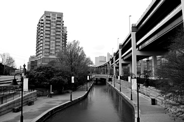
Canal Walk in Shockoe Bottom, facing west
-
Traffic signals at US 15 and Lucketts Road [01]
![Traffic signals at US 15 and Lucketts Road [01] (1238 visits) Traffic signals at the intersection of US 15 and Lucketts Road in Loudoun County, Virginia.
Ben Sch... Traffic signals at US 15 and Lucketts Road [01]](../../../../i/upload/2024/07/19/20240719161531-79fec9f3-cu_s9999x250.jpg)
-
Shield for State Route 254 [01]
![Shield for State Route 254 [01] (1257 visits) Shield for State Route 254 on West Frederick Street in downtown Staunton, Virginia. This style of s... Shield for State Route 254 [01]](../../../../i/upload/2024/07/19/20240719160500-1fdaedc1-cu_s9999x250.jpg)
-
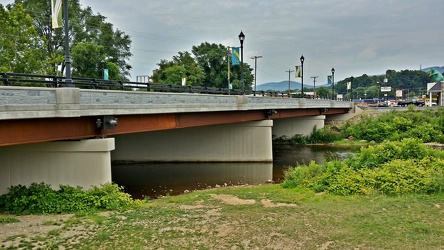
Broad Street bridge
-
Shield for State Route 254 [02]
![Shield for State Route 254 [02] (1269 visits) Shield for State Route 254 on West Frederick Street in downtown Staunton, Virginia. This style of s... Shield for State Route 254 [02]](../../../../i/upload/2024/07/19/20240719160516-e72119d6-cu_s9999x250.jpg)
-
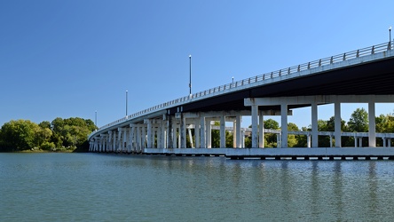
Bridge over the Hampton River
-
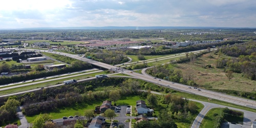
Intersection of US 340 and West Virginia Routes 9 and 51
-
Interstate 85 and US 460 reassurance markers [02]
![Interstate 85 and US 460 reassurance markers [02] (1276 visits) Reassurance markers for Interstate 85 southbound and US 460 westbound, about three miles from the sp... Interstate 85 and US 460 reassurance markers [02]](../../../../i/upload/2024/07/20/20240720092125-c916fd33-cu_s9999x250.jpg)
-
Bottle cap embedded in gravel [01]
![Bottle cap embedded in gravel [01] (1276 visits) Bottle cap embedded in the gravel in the parking lot of the Fort Edward Johnson wayside along US 250... Bottle cap embedded in gravel [01]](../../../../i/upload/2024/07/20/20240720094006-f13f59c7-cu_s9999x250.jpg)
-
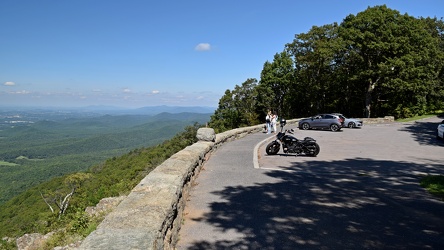
Ravens Roost overlook
-
Point of Rocks Bridge [04]
![Point of Rocks Bridge [04] (1285 visits) The Point of Rocks Bridge, which carries US Route 15 over the Potomac River between Loudoun County, ... Point of Rocks Bridge [04]](../../../../i/upload/2024/07/19/20240719122649-6c75d4bd-cu_s9999x250.jpg)
-
Place where a plaque used to be at Ravens Roost overlook [02]
![Place where a plaque used to be at Ravens Roost overlook [02] (1293 visits) The place where a National Park Service plaque used to be located atop a raised portion of the retai... Place where a plaque used to be at Ravens Roost overlook [02]](../../../../i/upload/2024/07/20/20240720111248-a6c2e1fa-cu_s9999x250.jpg)
-
View from Rockfish Valley Overlook [01]
![View from Rockfish Valley Overlook [01] (1299 visits) View from the Rockfish Valley Overlook, the second overlook on the Blue Ridge Parkway when traveling... View from Rockfish Valley Overlook [01]](../../../../i/upload/2024/07/20/20240720111351-549da1ab-cu_s9999x250.jpg)
-
Interstate 85 and US 460 reassurance markers [03]
![Interstate 85 and US 460 reassurance markers [03] (1301 visits) Reassurance markers for Interstate 85 southbound and US 460 westbound, about three miles from the sp... Interstate 85 and US 460 reassurance markers [03]](../../../../i/upload/2024/07/20/20240720092209-42a70fc2-cu_s9999x250.jpg)
-
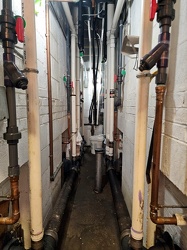
Plumbing chase at Crozet rest area
-
Sign for State Route 188 [03]
![Sign for State Route 188 [03] (1320 visits) Signage pointing the way to State Route 188 at the intersection of Church Street and Commercial Aven... Sign for State Route 188 [03]](../../../../i/upload/2024/07/20/20240720021833-b69f59a5-cu_s9999x250.jpg)
-
Place where a plaque used to be at Ravens Roost overlook [03]
![Place where a plaque used to be at Ravens Roost overlook [03] (1324 visits) The place where a National Park Service plaque used to be located atop a raised portion of the retai... Place where a plaque used to be at Ravens Roost overlook [03]](../../../../i/upload/2024/07/20/20240720111008-7c125d7a-cu_s9999x250.jpg)
-
Place where a plaque used to be at Ravens Roost overlook [01]
![Place where a plaque used to be at Ravens Roost overlook [01] (1324 visits) The place where a National Park Service plaque used to be located atop a raised portion of the retai... Place where a plaque used to be at Ravens Roost overlook [01]](../../../../i/upload/2024/07/20/20240720111142-228a886f-cu_s9999x250.jpg)
-
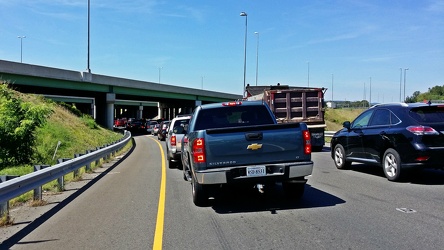
Interstate 66, Exit 43A westbound
-
Exit 225 on Interstate 81 [03]
![Exit 225 on Interstate 81 [03] (1332 visits) Exit 225 on Interstate 81 in Augusta County, Virginia, providing an interchange with Virginia State ... Exit 225 on Interstate 81 [03]](../../../../i/upload/2024/08/24/20240824104656-4dd28daf-cu_s9999x250.jpg)
-
Eastern terminus of US 60 [01]
![Eastern terminus of US 60 [01] (1334 visits) "END" signage on a lamppost at the eastern terminus of US 60 in Virginia Beach, Virginia. ... Eastern terminus of US 60 [01]](../../../../i/upload/2024/07/19/20240719101721-73bf3c40-cu_s9999x250.jpg)
-
Exit 225 on Interstate 81 [01]
![Exit 225 on Interstate 81 [01] (1336 visits) Exit 225 on Interstate 81 in Augusta County, Virginia, providing an interchange with Virginia State ... Exit 225 on Interstate 81 [01]](../../../../i/upload/2024/08/24/20240824104647-af96033b-cu_s9999x250.jpg)
-
Point of Rocks Bridge [03]
![Point of Rocks Bridge [03] (1338 visits) The Point of Rocks Bridge, which carries US Route 15 over the Potomac River between Loudoun County, ... Point of Rocks Bridge [03]](../../../../i/upload/2024/07/19/20240719121604-b7b9e112-cu_s9999x250.jpg)
-
Point of Rocks Bridge [01]
![Point of Rocks Bridge [01] (1342 visits) The Point of Rocks Bridge, which carries US Route 15 over the Potomac River between Loudoun County, ... Point of Rocks Bridge [01]](../../../../i/upload/2024/07/19/20240719121631-a890c001-cu_s9999x250.jpg)
-
Potomac Mills road sign [03]
![Potomac Mills road sign [03] (1350 visits) Sign for the Potomac Mills shopping mall, tall enough to be seen from far away, and very visible fro... Potomac Mills road sign [03]](../../../../i/upload/2024/07/19/20240719212214-3e2bb96d-cu_s9999x250.jpg)
-
Reassurance marker for US 460 Business westbound [01]
![Reassurance marker for US 460 Business westbound [01] (1353 visits) Reassurance marker for westbound US 460 Business on South Crater Road in Petersburg, Virginia.
More... Reassurance marker for US 460 Business westbound [01]](../../../../i/upload/2024/07/19/20240719195429-a75b711e-cu_s9999x250.jpg)
-
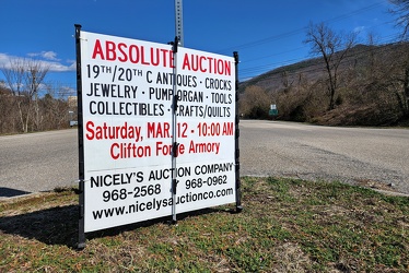
Sign advertising an auction
-
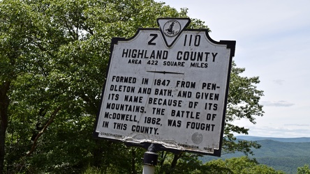
Historical marker for Highland County on US 250
-
Sign for State Route 188 [02]
![Sign for State Route 188 [02] (1362 visits) Signage pointing the way to State Route 188 at the intersection of Church Street and Commercial Aven... Sign for State Route 188 [02]](../../../../i/upload/2024/07/20/20240720021827-a0810db1-cu_s9999x250.jpg)
-
Exit 225 on Interstate 81 [02]
![Exit 225 on Interstate 81 [02] (1366 visits) Exit 225 on Interstate 81 in Augusta County, Virginia, providing an interchange with Virginia State ... Exit 225 on Interstate 81 [02]](../../../../i/upload/2024/08/24/20240824104650-f35998e0-cu_s9999x250.jpg)
-
Potomac Mills road sign [02]
![Potomac Mills road sign [02] (1370 visits) Sign for the Potomac Mills shopping mall, tall enough to be seen from far away, and very visible fro... Potomac Mills road sign [02]](../../../../i/upload/2024/07/19/20240719212209-0d605676-cu_s9999x250.jpg)
-
Verona, Virginia over Mill Place Commerce Park [01]
![Verona, Virginia over Mill Place Commerce Park [01] (1373 visits) Aerial view of Verona, Virginia from above the Mill Place Commerce Park. This photo shows a view fa... Verona, Virginia over Mill Place Commerce Park [01]](../../../../i/upload/2024/07/20/20240720110653-ef33b991-cu_s9999x250.jpg)
-
View from Rockfish Valley Overlook [02]
![View from Rockfish Valley Overlook [02] (1374 visits) View from the Rockfish Valley Overlook, the second overlook on the Blue Ridge Parkway when traveling... View from Rockfish Valley Overlook [02]](../../../../i/upload/2024/07/20/20240720111356-80017404-cu_s9999x250.jpg)
-
Eastern terminus of US 60 [02]
![Eastern terminus of US 60 [02] (1383 visits) "END" signage on a lamppost at the eastern terminus of US 60 in Virginia Beach, Virginia. ... Eastern terminus of US 60 [02]](../../../../i/upload/2024/07/19/20240719101751-9221fd2b-cu_s9999x250.jpg)
-
Point of Rocks Bridge [02]
![Point of Rocks Bridge [02] (1383 visits) The Point of Rocks Bridge, which carries US Route 15 over the Potomac River between Loudoun County, ... Point of Rocks Bridge [02]](../../../../i/upload/2024/07/19/20240719121627-117c91a4-cu_s9999x250.jpg)
-
Reassurance marker for US 460 Business westbound [02]
![Reassurance marker for US 460 Business westbound [02] (1384 visits) Reassurance marker for westbound US 460 Business on South Crater Road in Petersburg, Virginia.
More... Reassurance marker for US 460 Business westbound [02]](../../../../i/upload/2024/07/19/20240719195435-3d345c43-cu_s9999x250.jpg)
-
Sign for State Route 188 [06]
![Sign for State Route 188 [06] (1387 visits) Signage pointing the way to State Route 188 at the intersection of Church Street and Commercial Aven... Sign for State Route 188 [06]](../../../../i/upload/2024/07/20/20240720021915-40479437-cu_s9999x250.jpg)