-
Water tower in Savage, Maryland [01]
![Water tower in Savage, Maryland [01] (1338 visits) Water tower off of US 1 in Savage, Maryland on the Allied Trailer property. The top of the structur... Water tower in Savage, Maryland [01]](../../../i/upload/2024/07/19/20240719103821-63a6197c-cu_s9999x250.jpg)
-
Neon sign at Giant Food in Laurel, Maryland [05]
![Neon sign at Giant Food in Laurel, Maryland [05] (1368 visits) Vintage neon sign for the Giant Food store at Laurel Shopping Center in Laurel, Maryland.
Ben Schum... Neon sign at Giant Food in Laurel, Maryland [05]](../../../i/upload/2024/07/19/20240719103854-6056903e-cu_s9999x250.jpg)
-
Neon sign at Giant Food in Laurel, Maryland [12]
![Neon sign at Giant Food in Laurel, Maryland [12] (1624 visits) Vintage neon sign for the Giant Food store at Laurel Shopping Center in Laurel, Maryland.
Ben Schum... Neon sign at Giant Food in Laurel, Maryland [12]](../../../i/upload/2024/07/19/20240719103904-318215f7-cu_s9999x250.jpg)
-
Neon sign at Giant Food in Laurel, Maryland [11]
![Neon sign at Giant Food in Laurel, Maryland [11] (1501 visits) Vintage neon sign for the Giant Food store at Laurel Shopping Center in Laurel, Maryland.
Ben Schum... Neon sign at Giant Food in Laurel, Maryland [11]](../../../i/upload/2024/07/19/20240719103909-64e9c191-cu_s9999x250.jpg)
-
Neon sign at Giant Food in Laurel, Maryland [10]
![Neon sign at Giant Food in Laurel, Maryland [10] (1390 visits) Vintage neon sign for the Giant Food store at Laurel Shopping Center in Laurel, Maryland.
Ben Schum... Neon sign at Giant Food in Laurel, Maryland [10]](../../../i/upload/2024/07/19/20240719103914-98743bec-cu_s9999x250.jpg)
-
Neon sign at Giant Food in Laurel, Maryland [09]
![Neon sign at Giant Food in Laurel, Maryland [09] (1258 visits) Vintage neon sign for the Giant Food store at Laurel Shopping Center in Laurel, Maryland.
Alterna... Neon sign at Giant Food in Laurel, Maryland [09]](../../../i/upload/2024/07/19/20240719103919-da9d88cc-cu_s9999x250.jpg)
-
Neon sign at Giant Food in Laurel, Maryland [08]
![Neon sign at Giant Food in Laurel, Maryland [08] (1390 visits) Vintage neon sign for the Giant Food store at Laurel Shopping Center in Laurel, Maryland.
Alterna... Neon sign at Giant Food in Laurel, Maryland [08]](../../../i/upload/2024/07/19/20240719103924-8bb1061e-cu_s9999x250.jpg)
-
Neon sign at Giant Food in Laurel, Maryland [07]
![Neon sign at Giant Food in Laurel, Maryland [07] (1230 visits) Vintage neon sign for the Giant Food store at Laurel Shopping Center in Laurel, Maryland.
Ben Schum... Neon sign at Giant Food in Laurel, Maryland [07]](../../../i/upload/2024/07/19/20240719103929-4009fcd8-cu_s9999x250.jpg)
-
Neon sign at Giant Food in Laurel, Maryland [06]
![Neon sign at Giant Food in Laurel, Maryland [06] (1413 visits) Vintage neon sign for the Giant Food store at Laurel Shopping Center in Laurel, Maryland.
Ben Schum... Neon sign at Giant Food in Laurel, Maryland [06]](../../../i/upload/2024/07/19/20240719103934-84b3f041-cu_s9999x250.jpg)
-
Neon sign at Giant Food in Laurel, Maryland [04]
![Neon sign at Giant Food in Laurel, Maryland [04] (1189 visits) Vintage neon sign for the Giant Food store at Laurel Shopping Center in Laurel, Maryland.
Ben Schum... Neon sign at Giant Food in Laurel, Maryland [04]](../../../i/upload/2024/07/19/20240719103939-4e125380-cu_s9999x250.jpg)
-
Neon sign at Giant Food in Laurel, Maryland [03]
![Neon sign at Giant Food in Laurel, Maryland [03] (2023 visits) Vintage neon sign for the Giant Food store at Laurel Shopping Center in Laurel, Maryland.
Ben Schum... Neon sign at Giant Food in Laurel, Maryland [03]](../../../i/upload/2024/07/19/20240719103943-7135247e-cu_s9999x250.jpg)
-
Neon sign at Giant Food in Laurel, Maryland [02]
![Neon sign at Giant Food in Laurel, Maryland [02] (1305 visits) Vintage neon sign for the Giant Food store at Laurel Shopping Center in Laurel, Maryland.
Ben Schum... Neon sign at Giant Food in Laurel, Maryland [02]](../../../i/upload/2024/07/19/20240719103948-46cddff5-cu_s9999x250.jpg)
-
Neon sign at Giant Food in Laurel, Maryland [01]
![Neon sign at Giant Food in Laurel, Maryland [01] (1180 visits) Vintage neon sign for the Giant Food store at Laurel Shopping Center in Laurel, Maryland.
Ben Schum... Neon sign at Giant Food in Laurel, Maryland [01]](../../../i/upload/2024/07/19/20240719103953-25c5181a-cu_s9999x250.jpg)
-
PetSmart on Route 7
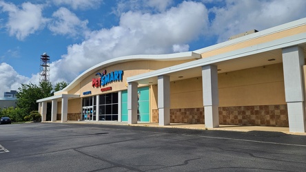
-
Signage for Maryland Route 418 [02]
![Signage for Maryland Route 418 [02] (635 visits) Signage for Maryland Route 418 at the intersection with Maryland Route 64 in Ringgold.
Ben Schumin ... Signage for Maryland Route 418 [02]](../../../i/upload/2024/07/19/20240719104708-e45266e6-cu_s9999x250.jpg)
-
Signage for Maryland Route 64 [03]
![Signage for Maryland Route 64 [03] (796 visits) Signage for Maryland Route 64 at the intersection with Maryland Route 418 in Ringgold.
Ben Schumin ... Signage for Maryland Route 64 [03]](../../../i/upload/2024/07/19/20240719104750-3ae2140a-cu_s9999x250.jpg)
-
Blinker signals in Ringgold, Maryland [05]
![Blinker signals in Ringgold, Maryland [05] (1285 visits) Blinker signals supplementing a four-way stop at the intersection of Maryland Routes 64 and 418 in R... Blinker signals in Ringgold, Maryland [05]](../../../i/upload/2024/07/19/20240719104755-52af4492-cu_s9999x250.jpg)
-
Blinker signals in Ringgold, Maryland [04]
![Blinker signals in Ringgold, Maryland [04] (1382 visits) Blinker signals supplementing a four-way stop at the intersection of Maryland Routes 64 and 418 in R... Blinker signals in Ringgold, Maryland [04]](../../../i/upload/2024/07/19/20240719104800-95af76d6-cu_s9999x250.jpg)
-
Blinker signals in Ringgold, Maryland [03]
![Blinker signals in Ringgold, Maryland [03] (1370 visits) Blinker signals supplementing a four-way stop at the intersection of Maryland Routes 64 and 418 in R... Blinker signals in Ringgold, Maryland [03]](../../../i/upload/2024/07/19/20240719104805-6afa45cc-cu_s9999x250.jpg)
-
Signage for Maryland Route 418 [03]
![Signage for Maryland Route 418 [03] (695 visits) Signage for Maryland Route 418 at the intersection with Maryland Route 64 in Ringgold.
Ben Schumin ... Signage for Maryland Route 418 [03]](../../../i/upload/2024/07/19/20240719104810-b8c9b800-cu_s9999x250.jpg)
-
Signage for Maryland Route 418 [01]
![Signage for Maryland Route 418 [01] (667 visits) Signage for Maryland Route 418 at the intersection with Maryland Route 64 in Ringgold.
Ben Schumin ... Signage for Maryland Route 418 [01]](../../../i/upload/2024/07/19/20240719104816-bdac4667-cu_s9999x250.jpg)
-
Signage for Maryland Route 64 [02]
![Signage for Maryland Route 64 [02] (830 visits) Signage for Maryland Route 64 at the intersection with Maryland Route 418 in Ringgold.
Alternate ... Signage for Maryland Route 64 [02]](../../../i/upload/2024/07/19/20240719104820-3e6fadc3-cu_s9999x250.jpg)
-
Signage for Maryland Route 64 [01]
![Signage for Maryland Route 64 [01] (701 visits) Signage for Maryland Route 64 at the intersection with Maryland Route 418 in Ringgold.
Alternate ... Signage for Maryland Route 64 [01]](../../../i/upload/2024/07/19/20240719104825-f479389a-cu_s9999x250.jpg)
-
Blinker signals in Ringgold, Maryland [02]
![Blinker signals in Ringgold, Maryland [02] (1419 visits) Blinker signals supplementing a four-way stop at the intersection of Maryland Routes 64 and 418 in R... Blinker signals in Ringgold, Maryland [02]](../../../i/upload/2024/07/19/20240719104829-0c02a370-cu_s9999x250.jpg)
-
Blinker signals in Ringgold, Maryland [01]
![Blinker signals in Ringgold, Maryland [01] (1287 visits) Blinker signals supplementing a four-way stop at the intersection of Maryland Routes 64 and 418 in R... Blinker signals in Ringgold, Maryland [01]](../../../i/upload/2024/07/19/20240719104834-c83d81b6-cu_s9999x250.jpg)
-
South Mountain rest area and welcome center, westbound [02]
![South Mountain rest area and welcome center, westbound [02] (806 visits) Restroom building at the South Mountain rest area and welcome center on Interstate 70 westbound in F... South Mountain rest area and welcome center, westbound [02]](../../../i/upload/2024/07/19/20240719104930-9f63ecbf-cu_s9999x250.jpg)
-
South Mountain rest area and welcome center, westbound [01]
![South Mountain rest area and welcome center, westbound [01] (765 visits) Restroom building at the South Mountain rest area and welcome center on Interstate 70 westbound in F... South Mountain rest area and welcome center, westbound [01]](../../../i/upload/2024/07/19/20240719104934-09257e0d-cu_s9999x250.jpg)
-
Variable message sign encouraging social distancing
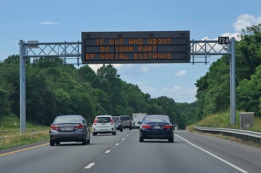
-
Overhead sign over South Queen Street
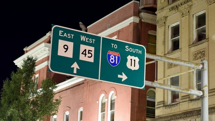
-
Fire hydrant along Maryland 176
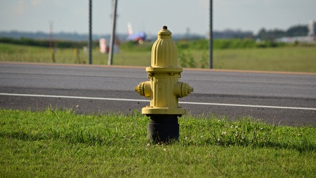
-
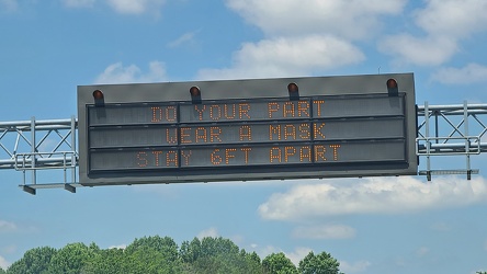
Variable message sign encouraging mask wearing and social distancing
-
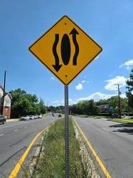
Sign indicating that traffic moves around the median
-
"WRONG WAY" sign at Devil's Den [01]
!["WRONG WAY" sign at Devil's Den [01] (874 visits) "WRONG WAY" sign on the parking loop for Devil's Den, near Gettysburg, Pennsylvania.
Ben ... "WRONG WAY" sign at Devil's Den [01]](../../../i/upload/2024/07/19/20240719112651-9d21816c-cu_s9999x250.jpg)
-
"WRONG WAY" sign at Devil's Den [02]
!["WRONG WAY" sign at Devil's Den [02] (875 visits) "WRONG WAY" sign on the parking loop for Devil's Den, near Gettysburg, Pennsylvania.
Ben ... "WRONG WAY" sign at Devil's Den [02]](../../../i/upload/2024/07/19/20240719112657-4e4c319d-cu_s9999x250.jpg)
-
Dirt graffiti
-
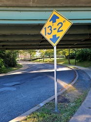
Low clearance sign at West Falls Church station
-
Intersection of Routes 64 and 418 [03]
![Intersection of Routes 64 and 418 [03] (1277 visits) Intersection of Routes 64 and 418 in Ringgold, Maryland. The two roads meet at a four-way stop, gov... Intersection of Routes 64 and 418 [03]](../../../i/upload/2024/07/19/20240719114429-bdff0353-cu_s9999x250.jpg)
-
Intersection of Routes 64 and 418 [02]
![Intersection of Routes 64 and 418 [02] (1148 visits) Intersection of Routes 64 and 418 in Ringgold, Maryland. The two roads meet at a four-way stop, gov... Intersection of Routes 64 and 418 [02]](../../../i/upload/2024/07/19/20240719114434-f7b1a6bf-cu_s9999x250.jpg)
-
Intersection of Routes 64 and 418 [05]
![Intersection of Routes 64 and 418 [05] (1343 visits) Intersection of Routes 64 and 418 in Ringgold, Maryland. The two roads meet at a four-way stop, gov... Intersection of Routes 64 and 418 [05]](../../../i/upload/2024/07/19/20240719114438-ea16106f-cu_s9999x250.jpg)
-
Intersection of Routes 64 and 418 [04]
![Intersection of Routes 64 and 418 [04] (1209 visits) Intersection of Routes 64 and 418 in Ringgold, Maryland. The two roads meet at a four-way stop, gov... Intersection of Routes 64 and 418 [04]](../../../i/upload/2024/07/19/20240719114443-599ce985-cu_s9999x250.jpg)
-
Intersection of Routes 64 and 418 [01]
![Intersection of Routes 64 and 418 [01] (1360 visits) Intersection of Routes 64 and 418 in Ringgold, Maryland. The two roads meet at a four-way stop, gov... Intersection of Routes 64 and 418 [01]](../../../i/upload/2024/07/19/20240719114447-7f7699d7-cu_s9999x250.jpg)
-
Interstate 64 in Nelson County, Virginia [01]
![Interstate 64 in Nelson County, Virginia [01] (6730 visits) Interstate 64 in Nelson County, Virginia, near Rockfish Gap. US 250 runs adjacent to the freeway.
... Interstate 64 in Nelson County, Virginia [01]](../../../i/upload/2024/07/19/20240719115200-c8a2ce39-cu_s9999x250.jpg)
-
Interstate 64 in Nelson County, Virginia [02]
![Interstate 64 in Nelson County, Virginia [02] (6811 visits) Interstate 64 in Nelson County, Virginia, near Rockfish Gap. US 250 runs adjacent to the freeway.
... Interstate 64 in Nelson County, Virginia [02]](../../../i/upload/2024/07/19/20240719115847-184fa12a-cu_s9999x250.jpg)
-
Interstate 64 in Nelson County, Virginia [03]
![Interstate 64 in Nelson County, Virginia [03] (7026 visits) Interstate 64 in Nelson County, Virginia, near Rockfish Gap. US 250 runs adjacent to the freeway.
... Interstate 64 in Nelson County, Virginia [03]](../../../i/upload/2024/07/19/20240719115902-ff5fb9e1-cu_s9999x250.jpg)
-
Blue Ridge Mountains near Rockfish Gap [01]
![Blue Ridge Mountains near Rockfish Gap [01] (1087 visits) The Blue Ridge Mountains, viewed from above the Interstate 64 scenic overlook in Nelson County, Virg... Blue Ridge Mountains near Rockfish Gap [01]](../../../i/upload/2024/07/19/20240719115911-d105cde8-cu_s9999x250.jpg)
-
Blue Ridge Mountains near Rockfish Gap [02]
![Blue Ridge Mountains near Rockfish Gap [02] (1010 visits) The Blue Ridge Mountains, viewed from above the Interstate 64 scenic overlook in Nelson County, Virg... Blue Ridge Mountains near Rockfish Gap [02]](../../../i/upload/2024/07/19/20240719115926-47f38290-cu_s9999x250.jpg)
-
Intersection of US 340 and VA 608 [01]
![Intersection of US 340 and VA 608 [01] (44960 visits) Intersection of US 340 and Virginia state secondary route 608 in Stuarts Draft, Virginia.
Ben Schum... Intersection of US 340 and VA 608 [01]](../../../i/upload/2024/07/19/20240719120550-1673ec68-cu_s9999x250.jpg)
-
Interstate 64 near Rockfish Gap [01]
![Interstate 64 near Rockfish Gap [01] (41924 visits) Interstate 64, near Rockfish Gap in Virginia.
Ben Schumin is a professional photographer who captur... Interstate 64 near Rockfish Gap [01]](../../../i/upload/2024/07/19/20240719120555-d0d3c2ce-cu_s9999x250.jpg)
-
Intersection of US 340 and VA 608 [02]
![Intersection of US 340 and VA 608 [02] (45059 visits) Intersection of US 340 and Virginia state secondary route 608 in Stuarts Draft, Virginia.
Ben Schum... Intersection of US 340 and VA 608 [02]](../../../i/upload/2024/07/19/20240719120559-2af4c901-cu_s9999x250.jpg)
-
Interstate 64 near Rockfish Gap [02]
![Interstate 64 near Rockfish Gap [02] (1915 visits) Interstate 64, near Rockfish Gap in Virginia. The bridge in the foreground carries Skyline Drive ov... Interstate 64 near Rockfish Gap [02]](../../../i/upload/2024/07/19/20240719120604-e2ad25dd-cu_s9999x250.jpg)
-
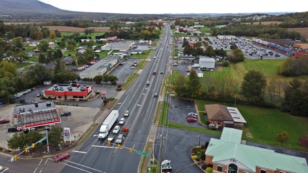
US 340 south in Stuarts Draft
-
Interstate 64 near Rockfish Gap [03]
![Interstate 64 near Rockfish Gap [03] (1925 visits) Interstate 64, near Rockfish Gap in Virginia. The bridge in the foreground carries Skyline Drive ov... Interstate 64 near Rockfish Gap [03]](../../../i/upload/2024/07/19/20240719120613-6e2190f6-cu_s9999x250.jpg)
-
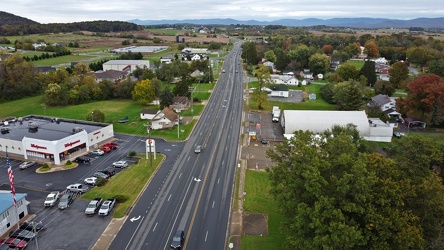
US 340 north in Stuarts Draft
-
Interstate 64 near Rockfish Gap [04]
![Interstate 64 near Rockfish Gap [04] (1931 visits) Interstate 64, near Rockfish Gap in Virginia. The bridge in the foreground carries Skyline Drive ov... Interstate 64 near Rockfish Gap [04]](../../../i/upload/2024/07/19/20240719120620-49d9b327-cu_s9999x250.jpg)
-
Interstate 64 near Rockfish Gap [05]
![Interstate 64 near Rockfish Gap [05] (6827 visits) Interstate 64, near Rockfish Gap in Virginia. The boundary between Augusta and Nelson Counties runs... Interstate 64 near Rockfish Gap [05]](../../../i/upload/2024/07/19/20240719120629-90e00218-cu_s9999x250.jpg)
-
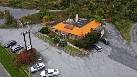
Former Howard Johnson's on Afton Mountain, October 2020
-
Men's restroom at Mason Dixon Welcome Center [01]
![Men's restroom at Mason Dixon Welcome Center [01] (2841 visits) Urinals in the men's restroom at the Mason Dixon Welcome Center off of US 15 in Emmitsburg, Maryland... Men's restroom at Mason Dixon Welcome Center [01]](../../../i/upload/2024/07/19/20240719120817-58bfd1d6-cu_s9999x250.jpg)
-
Men's restroom at Mason Dixon Welcome Center [02]
![Men's restroom at Mason Dixon Welcome Center [02] (1860 visits) Men's restroom at the Mason Dixon Welcome Center off of US 15 in Emmitsburg, Maryland.
Ben Schumin ... Men's restroom at Mason Dixon Welcome Center [02]](../../../i/upload/2024/07/19/20240719120914-461a9dad-cu_s9999x250.jpg)
-
Point of Rocks Bridge [03]
![Point of Rocks Bridge [03] (891 visits) The Point of Rocks Bridge, which carries US Route 15 over the Potomac River between Loudoun County, ... Point of Rocks Bridge [03]](../../../i/upload/2024/07/19/20240719121604-b7b9e112-cu_s9999x250.jpg)
-
Point of Rocks Bridge [05]
![Point of Rocks Bridge [05] (943 visits) Overhead view of the Point of Rocks Bridge, which carries US Route 15 over the Potomac River between... Point of Rocks Bridge [05]](../../../i/upload/2024/07/19/20240719121622-d2dfa3a8-cu_s9999x250.jpg)
-
Point of Rocks Bridge [02]
![Point of Rocks Bridge [02] (896 visits) The Point of Rocks Bridge, which carries US Route 15 over the Potomac River between Loudoun County, ... Point of Rocks Bridge [02]](../../../i/upload/2024/07/19/20240719121627-117c91a4-cu_s9999x250.jpg)
-
Point of Rocks Bridge [01]
![Point of Rocks Bridge [01] (912 visits) The Point of Rocks Bridge, which carries US Route 15 over the Potomac River between Loudoun County, ... Point of Rocks Bridge [01]](../../../i/upload/2024/07/19/20240719121631-a890c001-cu_s9999x250.jpg)
-
Point of Rocks Bridge [04]
![Point of Rocks Bridge [04] (895 visits) The Point of Rocks Bridge, which carries US Route 15 over the Potomac River between Loudoun County, ... Point of Rocks Bridge [04]](../../../i/upload/2024/07/19/20240719122649-6c75d4bd-cu_s9999x250.jpg)
-
Exit sign at South Mountain rest area [01]
![Exit sign at South Mountain rest area [01] (1316 visits) Exit sign in a restroom at the eastbound South Mountain rest area along Interstate 70 in Frederick C... Exit sign at South Mountain rest area [01]](../../../i/upload/2024/07/19/20240719122919-930ba30b-cu_s9999x250.jpg)
-
Exit sign at South Mountain rest area [03]
![Exit sign at South Mountain rest area [03] (1470 visits) Exit sign in a restroom at the eastbound South Mountain rest area along Interstate 70 in Frederick C... Exit sign at South Mountain rest area [03]](../../../i/upload/2024/07/19/20240719122923-c26813d4-cu_s9999x250.jpg)
-
Exit sign at South Mountain rest area [02]
![Exit sign at South Mountain rest area [02] (1347 visits) Exit sign in a restroom at the eastbound South Mountain rest area along Interstate 70 in Frederick C... Exit sign at South Mountain rest area [02]](../../../i/upload/2024/07/19/20240719122928-5400c48b-cu_s9999x250.jpg)
-
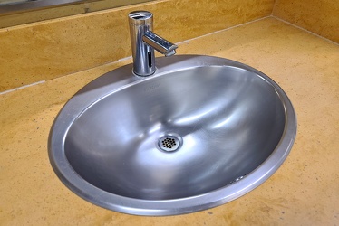
Sink at South Mountain rest area
-
Emergency lighting at South Mountain rest area [01]
![Emergency lighting at South Mountain rest area [01] (958 visits) Emergency lighting in a restroom at the eastbound South Mountain rest area along Interstate 70 in Fr... Emergency lighting at South Mountain rest area [01]](../../../i/upload/2024/07/19/20240719122938-599d96e7-cu_s9999x250.jpg)
-
Emergency lighting at South Mountain rest area [02]
![Emergency lighting at South Mountain rest area [02] (969 visits) Emergency lighting in a restroom at the eastbound South Mountain rest area along Interstate 70 in Fr... Emergency lighting at South Mountain rest area [02]](../../../i/upload/2024/07/19/20240719122942-cb6229f4-cu_s9999x250.jpg)
-
Thunderbolt siren on Waterloo Road [09]
![Thunderbolt siren on Waterloo Road [09] (1380 visits) Federal Signal Thunderbolt siren on Waterloo Road in Jessup, Maryland.
Ben Schumin is a professiona... Thunderbolt siren on Waterloo Road [09]](../../../i/upload/2024/07/19/20240719123009-6c144b95-cu_s9999x250.jpg)
-
Thunderbolt siren on Waterloo Road [08]
![Thunderbolt siren on Waterloo Road [08] (1367 visits) Federal Signal Thunderbolt siren on Waterloo Road in Jessup, Maryland.
Ben Schumin is a professiona... Thunderbolt siren on Waterloo Road [08]](../../../i/upload/2024/07/19/20240719123015-656c36f8-cu_s9999x250.jpg)
-
Thunderbolt siren on Waterloo Road [07]
![Thunderbolt siren on Waterloo Road [07] (1313 visits) Federal Signal Thunderbolt siren on Waterloo Road in Jessup, Maryland.
Ben Schumin is a professio... Thunderbolt siren on Waterloo Road [07]](../../../i/upload/2024/07/19/20240719123021-6280af38-cu_s9999x250.jpg)
-
Thunderbolt siren on Waterloo Road [04]
![Thunderbolt siren on Waterloo Road [04] (1300 visits) Federal Signal Thunderbolt siren on Waterloo Road in Jessup, Maryland.
Ben Schumin is a professiona... Thunderbolt siren on Waterloo Road [04]](../../../i/upload/2024/07/19/20240719123027-3d68e044-cu_s9999x250.jpg)
-
Thunderbolt siren on Waterloo Road [17]
![Thunderbolt siren on Waterloo Road [17] (1676 visits) Federal Signal Thunderbolt siren on Waterloo Road in Jessup, Maryland.
Ben Schumin is a professiona... Thunderbolt siren on Waterloo Road [17]](../../../i/upload/2024/07/19/20240719123041-b055bb9b-cu_s9999x250.jpg)
-
Thunderbolt siren on Waterloo Road [06]
![Thunderbolt siren on Waterloo Road [06] (1326 visits) Federal Signal Thunderbolt siren on Waterloo Road in Jessup, Maryland.
Ben Schumin is a professiona... Thunderbolt siren on Waterloo Road [06]](../../../i/upload/2024/07/19/20240719123051-7e086530-cu_s9999x250.jpg)
-
Thunderbolt siren on Waterloo Road [14]
![Thunderbolt siren on Waterloo Road [14] (1726 visits) Federal Signal Thunderbolt siren on Waterloo Road in Jessup, Maryland.
Ben Schumin is a professiona... Thunderbolt siren on Waterloo Road [14]](../../../i/upload/2024/07/19/20240719123109-b2ee955c-cu_s9999x250.jpg)
-
Thunderbolt siren on Waterloo Road [03]
![Thunderbolt siren on Waterloo Road [03] (1302 visits) Federal Signal Thunderbolt siren on Waterloo Road in Jessup, Maryland.
Ben Schumin is a professio... Thunderbolt siren on Waterloo Road [03]](../../../i/upload/2024/07/19/20240719123119-88946528-cu_s9999x250.jpg)
-
Thunderbolt siren on Waterloo Road [02]
![Thunderbolt siren on Waterloo Road [02] (1328 visits) Federal Signal Thunderbolt siren on Waterloo Road in Jessup, Maryland.
Ben Schumin is a professiona... Thunderbolt siren on Waterloo Road [02]](../../../i/upload/2024/07/19/20240719123124-850462bc-cu_s9999x250.jpg)
-
Thunderbolt siren on Waterloo Road [05]
![Thunderbolt siren on Waterloo Road [05] (1302 visits) Federal Signal Thunderbolt siren on Waterloo Road in Jessup, Maryland.
Ben Schumin is a professiona... Thunderbolt siren on Waterloo Road [05]](../../../i/upload/2024/07/19/20240719123140-3aa65998-cu_s9999x250.jpg)
-
Thunderbolt siren on Waterloo Road [13]
![Thunderbolt siren on Waterloo Road [13] (1756 visits) Federal Signal Thunderbolt siren on Waterloo Road in Jessup, Maryland.
Ben Schumin is a professiona... Thunderbolt siren on Waterloo Road [13]](../../../i/upload/2024/07/19/20240719123150-b08d1dd1-cu_s9999x250.jpg)