-
Downtown Waynesboro, Virginia [01]
![Downtown Waynesboro, Virginia [01] (4146 visits) Downtown Waynesboro, Virginia, looking east down West Main Street, viewed from near Augusta Cleaners... Downtown Waynesboro, Virginia [01]](../../../i/upload/2024/07/14/20240714171043-04dcc319-cu_s9999x250.jpg)
-
Downtown Waynesboro, Virginia [02]
![Downtown Waynesboro, Virginia [02] (1621 visits) Downtown Waynesboro, Virginia, looking east down West Main Street, viewed from near Augusta Cleaners... Downtown Waynesboro, Virginia [02]](../../../i/upload/2024/07/15/20240715141255-6a81b88f-cu_s9999x250.jpg)
 WTBO [01]
![WTBO [01] (2239 visits) The grounds of WTBO, an AM and FM radio station located on Wills Mountain in Cumberland, Maryland.
... WTBO [01]](../../../i/upload/2024/07/17/20240717233638-86b8fb7c-cu_s9999x250.jpg)
 WTBO [02]
![WTBO [02] (2158 visits) The grounds of WTBO, an AM and FM radio station located on Wills Mountain in Cumberland, Maryland.
... WTBO [02]](../../../i/upload/2024/07/17/20240717233644-def667dd-cu_s9999x250.jpg)
 WTBO [03]
![WTBO [03] (2233 visits) The grounds of WTBO, an AM and FM radio station located on Wills Mountain in Cumberland, Maryland.
... WTBO [03]](../../../i/upload/2024/07/17/20240717233650-40f8f696-cu_s9999x250.jpg)
-
Forest Springs Drive [02]
![Forest Springs Drive [02] (3265 visits) Aerial view of Forest Springs Drive, a residential street in Stuarts Draft, Virginia. View facing n... Forest Springs Drive [02]](../../../i/upload/2024/07/19/20240719130110-e8de25d6-cu_s9999x250.jpg)
-
Forest Springs Drive [03]
![Forest Springs Drive [03] (3390 visits) Aerial view of Forest Springs Drive, a residential street in Stuarts Draft, Virginia. View facing s... Forest Springs Drive [03]](../../../i/upload/2024/07/19/20240719130115-cc787080-cu_s9999x250.jpg)
-
West Main Street in Waynesboro, Virginia [02]
![West Main Street in Waynesboro, Virginia [02] (3341 visits) Downtown Waynesboro, Virginia, looking east down West Main Street, near the intersection with Church... West Main Street in Waynesboro, Virginia [02]](../../../i/upload/2024/07/19/20240719130153-2ee52d33-cu_s9999x250.jpg)
-
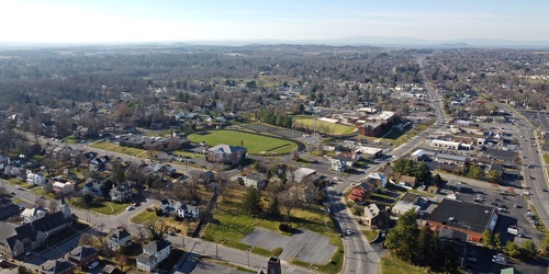
Downtown Waynesboro, Virginia, facing west
-
West Main Street in Waynesboro, Virginia [01]
![West Main Street in Waynesboro, Virginia [01] (3449 visits) Downtown Waynesboro, Virginia, looking east down West Main Street, near the intersection with Church... West Main Street in Waynesboro, Virginia [01]](../../../i/upload/2024/07/19/20240719130232-6088860d-cu_s9999x250.jpg)
-
West Main Street in Waynesboro, Virginia [03]
![West Main Street in Waynesboro, Virginia [03] (13344 visits) Downtown Waynesboro, Virginia, looking east down West Main Street, near the intersection with Church... West Main Street in Waynesboro, Virginia [03]](../../../i/upload/2024/07/19/20240719130237-f1099710-cu_s9999x250.jpg)
-
US 29 Business in Culpeper, Virginia [01]
![US 29 Business in Culpeper, Virginia [01] (3167 visits) Aerial view of US 29 Business on the north side of Culpeper, Virginia. View facing approximately ea... US 29 Business in Culpeper, Virginia [01]](../../../i/upload/2024/07/19/20240719155959-cf1d0444-cu_s9999x250.jpg)
-
Springer Road and Sugarcamp Lane [01]
![Springer Road and Sugarcamp Lane [01] (2733 visits) Aerial view of Springer Road and Sugarcamp Lane, which together form a single residential street in ... Springer Road and Sugarcamp Lane [01]](../../../i/upload/2024/07/19/20240719160916-bbfef2f3-cu_s9999x250.jpg)
-
Springer Road and Sugarcamp Lane [02]
![Springer Road and Sugarcamp Lane [02] (2815 visits) Aerial view of Springer Road and Sugarcamp Lane, which together form a single residential street in ... Springer Road and Sugarcamp Lane [02]](../../../i/upload/2024/07/19/20240719160920-a73a3b63-cu_s9999x250.jpg)
-
Forest Springs Drive [04]
![Forest Springs Drive [04] (2591 visits) Aerial view of Forest Springs Drive, a residential street in Stuarts Draft, Virginia, facing north.
... Forest Springs Drive [04]](../../../i/upload/2024/07/19/20240719160944-be5023e1-cu_s9999x250.jpg)
-
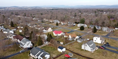
Cooper Drive
-
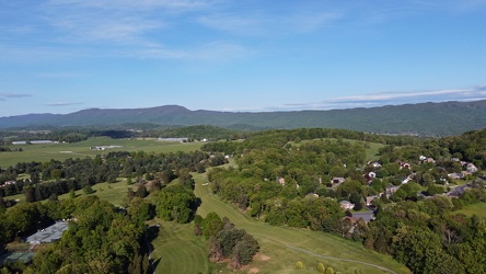
Harrisonburg east of Route 33
-
Commercial area south of Interstate 81 in Harrisonburg [02]
![Commercial area south of Interstate 81 in Harrisonburg [02] (3956 visits) Commercial area on the west side of East Market Street (US 33), facing north.
Ben Schumin is a prof... Commercial area south of Interstate 81 in Harrisonburg [02]](../../../i/upload/2024/07/19/20240719163830-45dce8e7-cu_s9999x250.jpg)
-
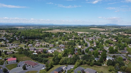
Pelham neighborhood in Waynesboro, Virginia
-
Downtown Clifton Forge, Virginia
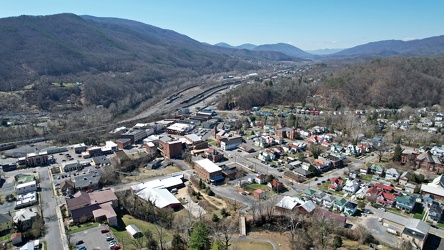
-
Neighborhood in Clifton Forge, Virginia [01]
![Neighborhood in Clifton Forge, Virginia [01] (1186 visits) Aerial view of a neighborhood in Clifton Forge, Virginia, near downtown.
Ben Schumin is a professio... Neighborhood in Clifton Forge, Virginia [01]](../../../i/upload/2024/07/20/20240720021719-e5828a4e-cu_s9999x250.jpg)
-
Neighborhood in Clifton Forge, Virginia [02]
![Neighborhood in Clifton Forge, Virginia [02] (1354 visits) Aerial view of a neighborhood in Clifton Forge, Virginia, near downtown.
Ben Schumin is a professio... Neighborhood in Clifton Forge, Virginia [02]](../../../i/upload/2024/07/20/20240720021736-578bac29-cu_s9999x250.jpg)
-
Neighborhoods in Covington, Virginia
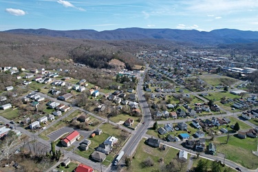
-
East Main Street in Waynesboro, Virginia
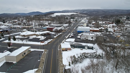
-
Interstate 64 corridor through Waynesboro, Virginia
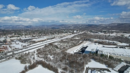
-
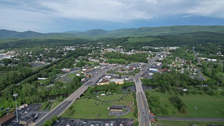
East Main and Broad Streets in Waynesboro, Virginia
-
Mountain with a bare patch [02]
![Mountain with a bare patch [02] (988 visits) A mountain with a bare patch along US 220 at the Virginia-West Virginia line in Pendleton County, We... Mountain with a bare patch [02]](../../../i/upload/2024/07/20/20240720094112-5450497c-cu_s9999x250.jpg)
-
Farm on the Virginia-West Virginia border [01]
![Farm on the Virginia-West Virginia border [01] (2880 visits) Farm on the border between Highland County, Virginia and Pendleton County, West Virginia. The bound... Farm on the Virginia-West Virginia border [01]](../../../i/upload/2024/07/20/20240720094156-2b1215da-cu_s9999x250.jpg)
-
Mountain with a bare patch [01]
![Mountain with a bare patch [01] (1006 visits) A mountain with a bare patch along US 220 at the Virginia-West Virginia line in Pendleton County, We... Mountain with a bare patch [01]](../../../i/upload/2024/07/20/20240720094201-2326a710-cu_s9999x250.jpg)
-
Forest Springs Estates [01]
![Forest Springs Estates [01] (2271 visits) Aerial view of the Forest Springs Estates neighborhood in Stuarts Draft, Virginia, taken from approx... Forest Springs Estates [01]](../../../i/upload/2024/07/20/20240720103408-ac9f7d40-cu_s9999x250.jpg)
-
Forest Springs Estates [02]
![Forest Springs Estates [02] (2847 visits) Aerial view of the Forest Springs Estates neighborhood in Stuarts Draft, Virginia, taken from approx... Forest Springs Estates [02]](../../../i/upload/2024/07/20/20240720103645-80215d0c-cu_s9999x250.jpg)
-
Forest Springs Estates [03]
![Forest Springs Estates [03] (2833 visits) Aerial view of the Forest Springs Estates neighborhood in Stuarts Draft, Virginia, showing the inter... Forest Springs Estates [03]](../../../i/upload/2024/07/20/20240720103650-60296a18-cu_s9999x250.jpg)
-
Forest Springs Estates [04]
![Forest Springs Estates [04] (2881 visits) Aerial view of the Forest Springs Estates neighborhood in Stuarts Draft, Virginia, showing Ceocia La... Forest Springs Estates [04]](../../../i/upload/2024/07/20/20240720103655-f8465d58-cu_s9999x250.jpg)
-
Forest Springs Estates [05]
![Forest Springs Estates [05] (1807 visits) Aerial view of the Forest Springs Estates neighborhood in Stuarts Draft, Virginia, taken above the i... Forest Springs Estates [05]](../../../i/upload/2024/07/20/20240720103700-12ed86ac-cu_s9999x250.jpg)
-
Forest Springs Estates [06]
![Forest Springs Estates [06] (1669 visits) Aerial view of the Forest Springs Estates neighborhood in Stuarts Draft, Virginia, facing south.
Be... Forest Springs Estates [06]](../../../i/upload/2024/07/20/20240720103705-68728b22-cu_s9999x250.jpg)
-
Forest Springs Estates [07]
![Forest Springs Estates [07] (2927 visits) Aerial view of the Forest Springs Estates neighborhood in Stuarts Draft, Virginia, showing the inter... Forest Springs Estates [07]](../../../i/upload/2024/07/20/20240720103710-4e810037-cu_s9999x250.jpg)
-
Forest Springs Estates [08]
![Forest Springs Estates [08] (2966 visits) Aerial view of the Forest Springs Estates neighborhood in Stuarts Draft, Virginia, showing Clements ... Forest Springs Estates [08]](../../../i/upload/2024/07/20/20240720103715-d25d2920-cu_s9999x250.jpg)
-
Forest Springs Estates [09]
![Forest Springs Estates [09] (2923 visits) Aerial view of the Forest Springs Estates neighborhood in Stuarts Draft, Virginia, showing Tomahawk ... Forest Springs Estates [09]](../../../i/upload/2024/07/20/20240720103720-56045695-cu_s9999x250.jpg)
-
Forest Springs Estates [10]
![Forest Springs Estates [10] (1730 visits) Aerial view of the Forest Springs Estates neighborhood in Stuarts Draft, Virginia, taken from above ... Forest Springs Estates [10]](../../../i/upload/2024/07/20/20240720103726-e7eeb2c5-cu_s9999x250.jpg)
-
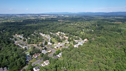
Southeastern end of Ridgeview Acres
-
West Dumplin Valley Road [03]
![West Dumplin Valley Road [03] (2939 visits) Businesses along West Dumplin Valley Road, which runs just south of Interstate 40, in Sevierville, T... West Dumplin Valley Road [03]](../../../i/upload/2024/07/20/20240720120238-68c626bc-cu_s9999x250.jpg)
-
West Dumplin Valley Road [02]
![West Dumplin Valley Road [02] (2915 visits) Businesses along West Dumplin Valley Road, which runs just south of Interstate 40, in Sevierville, T... West Dumplin Valley Road [02]](../../../i/upload/2024/07/20/20240720120306-846e6bb2-cu_s9999x250.jpg)
-
West Dumplin Valley Road [01]
![West Dumplin Valley Road [01] (2860 visits) Businesses along West Dumplin Valley Road, which runs just south of Interstate 40, in Sevierville, T... West Dumplin Valley Road [01]](../../../i/upload/2024/07/20/20240720120315-42535554-cu_s9999x250.jpg)
-
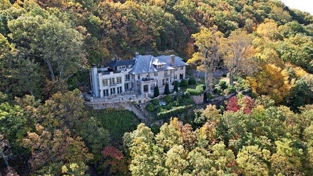
1801 Prospect Road SE
-
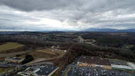
View west from Staunton Mall
-
Aerial view of Smithsburg, Maryland [01]
![Aerial view of Smithsburg, Maryland [01] (1118 visits) Aerial view of Smithsburg, Maryland.
Ben Schumin is a professional photographer who captures the in... Aerial view of Smithsburg, Maryland [01]](../../../i/upload/2024/07/20/20240720155756-7d354d6c-cu_s9999x250.jpg)
-
Aerial view of Smithsburg, Maryland [02]
![Aerial view of Smithsburg, Maryland [02] (1235 visits) Aerial view of Smithsburg, Maryland.
Ben Schumin is a professional photographer who captures the in... Aerial view of Smithsburg, Maryland [02]](../../../i/upload/2024/07/20/20240720155800-cb15da92-cu_s9999x250.jpg)
-
Aerial view of Smithsburg, Maryland [03]
![Aerial view of Smithsburg, Maryland [03] (1032 visits) Aerial view of Smithsburg, Maryland.
Ben Schumin is a professional photographer who captures the in... Aerial view of Smithsburg, Maryland [03]](../../../i/upload/2024/07/20/20240720155805-a9f3e7ed-cu_s9999x250.jpg)
-
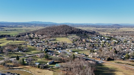
Round Hill
-
Aerial view of Monterey, Virginia [01]
![Aerial view of Monterey, Virginia [01] (2014 visits) Aerial view of Monterey, Virginia, a small town comprising the seat of Highland County.
More at The... Aerial view of Monterey, Virginia [01]](../../../i/upload/2025/01/02/20250102005918-685606f9-cu_s9999x250.jpg)
-
Aerial view of Monterey, Virginia [02]
![Aerial view of Monterey, Virginia [02] (2028 visits) Aerial view of Monterey, Virginia, a small town comprising the seat of Highland County.
More at The... Aerial view of Monterey, Virginia [02]](../../../i/upload/2025/01/02/20250102005923-7f7b9b83-cu_s9999x250.jpg)
-
Aerial view of Monterey, Virginia [03]
![Aerial view of Monterey, Virginia [03] (1981 visits) Aerial view of Monterey, Virginia, a small town comprising the seat of Highland County.
More at The... Aerial view of Monterey, Virginia [03]](../../../i/upload/2025/01/02/20250102005929-2e84a9d0-cu_s9999x250.jpg)
-
Aerial view of Monterey, Virginia [04]
![Aerial view of Monterey, Virginia [04] (1973 visits) Aerial view of Monterey, Virginia, a small town comprising the seat of Highland County.
More at The... Aerial view of Monterey, Virginia [04]](../../../i/upload/2025/01/02/20250102005937-281fae65-cu_s9999x250.jpg)
-
Aerial view of Monterey, Virginia [05]
![Aerial view of Monterey, Virginia [05] (2041 visits) Aerial view of Monterey, Virginia, a small town comprising the seat of Highland County.
More at The... Aerial view of Monterey, Virginia [05]](../../../i/upload/2025/01/02/20250102005946-79efaa38-cu_s9999x250.jpg)
-
Aerial view of Monterey, Virginia [06]
![Aerial view of Monterey, Virginia [06] (1993 visits) Aerial view of Monterey, Virginia, a small town comprising the seat of Highland County.
More at The... Aerial view of Monterey, Virginia [06]](../../../i/upload/2025/01/02/20250102005956-29786301-cu_s9999x250.jpg)
-
Roanoke from above Main Street SW
