 Delaware House, September 2014 [07]
![Delaware House, September 2014 [07] (65122 visits) Main seating area at the Delaware Welcome Center, also known as Delaware House, the northernmost of ... Delaware House, September 2014 [07]](../../../i/upload/2024/07/17/20240717233430-e09d0a82-cu_s9999x250.jpg)
 South Mountain rest area, westbound [01]
![South Mountain rest area, westbound [01] (3147 visits) South Mountain rest area and welcome center on Interstate 70 westbound in Frederick County, Maryland... South Mountain rest area, westbound [01]](../../../i/upload/2024/07/17/20240717233435-e2f89cc0-cu_s9999x250.jpg)
 South Mountain rest area, westbound [02]
![South Mountain rest area, westbound [02] (3200 visits) South Mountain rest area and welcome center on Interstate 70 westbound in Frederick County, Maryland... South Mountain rest area, westbound [02]](../../../i/upload/2024/07/17/20240717233440-268e200a-cu_s9999x250.jpg)
 South Mountain rest area, westbound [03]
![South Mountain rest area, westbound [03] (3400 visits) South Mountain rest area and welcome center on Interstate 70 westbound in Frederick County, Maryland... South Mountain rest area, westbound [03]](../../../i/upload/2024/07/17/20240717233445-c0e160fc-cu_s9999x250.jpg)
 South Mountain rest area, westbound [04]
![South Mountain rest area, westbound [04] (3178 visits) South Mountain rest area and welcome center on Interstate 70 westbound in Frederick County, Maryland... South Mountain rest area, westbound [04]](../../../i/upload/2024/07/17/20240717233450-8d5d68a3-cu_s9999x250.jpg)
 South Mountain rest area, westbound [05]
![South Mountain rest area, westbound [05] (3241 visits) South Mountain rest area and welcome center on Interstate 70 westbound in Frederick County, Maryland... South Mountain rest area, westbound [05]](../../../i/upload/2024/07/17/20240717233455-aa6194ef-cu_s9999x250.jpg)
 Sideling Hill rest area [01]
![Sideling Hill rest area [01] (1988 visits) Eastbound side of the Sideling Hill rest area, located along Interstate 68 in Washington County, Mar... Sideling Hill rest area [01]](../../../i/upload/2024/07/17/20240717233459-e7ba195c-cu_s9999x250.jpg)
 Sideling Hill rest area [02]
![Sideling Hill rest area [02] (1850 visits) Eastbound access to the footbridge across the highway at the Sideling Hill rest area, located along ... Sideling Hill rest area [02]](../../../i/upload/2024/07/17/20240717233505-c4590774-cu_s9999x250.jpg)
 Sideling Hill rest area [03]
![Sideling Hill rest area [03] (1738 visits) Footbridge across Interstate 68, allowing views of the cut through the mountain, at the Sideling Hil... Sideling Hill rest area [03]](../../../i/upload/2024/07/17/20240717233511-e61616ff-cu_s9999x250.jpg)
 Sideling Hill rest area [04]
![Sideling Hill rest area [04] (1860 visits) Westbound access to the footbridge across the highway at the Sideling Hill rest area, located along ... Sideling Hill rest area [04]](../../../i/upload/2024/07/17/20240717233516-e5cc17b4-cu_s9999x250.jpg)
 Sideling Hill rest area [05]
![Sideling Hill rest area [05] (1785 visits) Path to the westbound parking area and restrooms at the Sideling Hill rest area, located along Inter... Sideling Hill rest area [05]](../../../i/upload/2024/07/17/20240717233521-b99b80cb-cu_s9999x250.jpg)
 Sideling Hill rest area [06]
![Sideling Hill rest area [06] (1724 visits) Stairs to a raised viewing area on the eastbound side of the Sideling Hill rest area, located along ... Sideling Hill rest area [06]](../../../i/upload/2024/07/17/20240717233527-43e4656c-cu_s9999x250.jpg)
 Sideling Hill rest area [07]
![Sideling Hill rest area [07] (1869 visits) Raised viewing area on the eastbound side of the Sideling Hill rest area, located along Interstate 6... Sideling Hill rest area [07]](../../../i/upload/2024/07/17/20240717233531-9f6ca0ea-cu_s9999x250.jpg)
 Sideling Hill rest area [08]
![Sideling Hill rest area [08] (1965 visits) Eastbound parking lot at the Sideling Hill rest area, located along Interstate 68 in Washington Coun... Sideling Hill rest area [08]](../../../i/upload/2024/07/17/20240717233537-4406b863-cu_s9999x250.jpg)
 Sideling Hill rest area [09]
![Sideling Hill rest area [09] (2017 visits) Eastbound parking lot at the Sideling Hill rest area, located along Interstate 68 in Washington Coun... Sideling Hill rest area [09]](../../../i/upload/2024/07/17/20240717233542-efb1100b-cu_s9999x250.jpg)
 Sideling Hill rest area [10]
![Sideling Hill rest area [10] (1891 visits) Eastbound side of the Sideling Hill rest area, located along Interstate 68 in Washington County, Mar... Sideling Hill rest area [10]](../../../i/upload/2024/07/17/20240717233547-516b9676-cu_s9999x250.jpg)
 Western Maryland Scenic Railroad station [05]
![Western Maryland Scenic Railroad station [05] (3073 visits) Station for the Western Maryland Scenic Railroad in Cumberland, Maryland.
More at The Schumin Web:
... Western Maryland Scenic Railroad station [05]](../../../i/upload/2024/07/17/20240717233553-3b21af47-cu_s9999x250.jpg)
 Western Maryland Scenic Railroad station [06]
![Western Maryland Scenic Railroad station [06] (3964 visits) Station for the Western Maryland Scenic Railroad in Cumberland, Maryland.
More at The Schumin Web:
... Western Maryland Scenic Railroad station [06]](../../../i/upload/2024/07/17/20240717233558-d030848d-cu_s9999x250.jpg)
 Western Maryland Scenic Railroad tracks [03]
![Western Maryland Scenic Railroad tracks [03] (3859 visits) Tracks for the Western Maryland Scenic Railroad in Cumberland, Maryland.
More at The Schumin Web:
w... Western Maryland Scenic Railroad tracks [03]](../../../i/upload/2024/07/17/20240717233606-3c9ba6bb-cu_s9999x250.jpg)
 Western Maryland Scenic Railroad tracks [04]
![Western Maryland Scenic Railroad tracks [04] (1263 visits) Tracks for the Western Maryland Scenic Railroad in Cumberland, Maryland.
More at The Schumin Web:... Western Maryland Scenic Railroad tracks [04]](../../../i/upload/2024/07/17/20240717233611-ca37197a-cu_s9999x250.jpg)
-
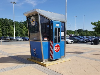
Historic tollbooth at Delaware House
-
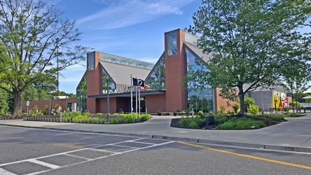
Maryland House
-
Interstate 83 Business Loop shield [03]
![Interstate 83 Business Loop shield [03] (2276 visits) Interstate 83 Business Loop shield along South George Street in York, Pennsylvania. Business Inters... Interstate 83 Business Loop shield [03]](../../../i/upload/2024/07/18/20240718215224-67ce2306-cu_s9999x250.jpg)
-
Interstate 83 Business Loop shield [02]
![Interstate 83 Business Loop shield [02] (2052 visits) Interstate 83 Business Loop shield along North George Street in York, Pennsylvania. Business Inters... Interstate 83 Business Loop shield [02]](../../../i/upload/2024/07/18/20240718215335-deeb6951-cu_s9999x250.jpg)
-
Interstate 83 Business Loop shield [04]
![Interstate 83 Business Loop shield [04] (2191 visits) Interstate 83 Business Loop shield along South George Street in York, Pennsylvania. Business Inters... Interstate 83 Business Loop shield [04]](../../../i/upload/2024/07/18/20240718215410-0c93b23e-cu_s9999x250.jpg)
-
Interstate 83 Business Loop shield [01]
![Interstate 83 Business Loop shield [01] (3922 visits) Interstate 83 Business Loop shield along North George Street in York, Pennsylvania. Business Inters... Interstate 83 Business Loop shield [01]](../../../i/upload/2024/07/18/20240718215421-ed21b8c5-cu_s9999x250.jpg)
-
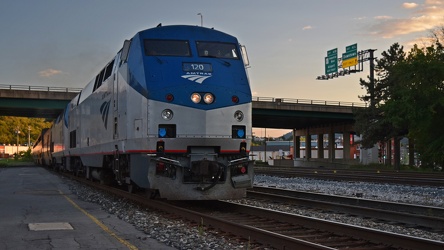
Amtrak 120 arriving at Cumberland
-
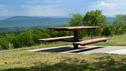
Picnic table at Sideling Hill Welcome Center
-
View from Sideling Hill Welcome Center
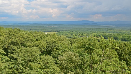
-
Footbridge over Interstate 68 at Sideling Hill
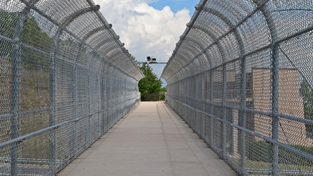
-
Rainstorm near Sideling Hill cut
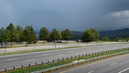
-
Interstate 68 cut through Sideling Hill [04]
![Interstate 68 cut through Sideling Hill [04] (1965 visits) Cut in Sideling Hill, carrying Interstate 68 between Washington and Allegany Counties in Maryland.
... Interstate 68 cut through Sideling Hill [04]](../../../i/upload/2024/07/18/20240718220107-eeb97b29-cu_s9999x250.jpg)
-
Interstate 68 cut through Sideling Hill [03]
![Interstate 68 cut through Sideling Hill [03] (1727 visits) Cut in Sideling Hill, carrying Interstate 68 between Washington and Allegany Counties in Maryland.
... Interstate 68 cut through Sideling Hill [03]](../../../i/upload/2024/07/18/20240718220111-2f9132e9-cu_s9999x250.jpg)
-
Interstate 68 cut through Sideling Hill [02]
![Interstate 68 cut through Sideling Hill [02] (3185 visits) Cut in Sideling Hill, carrying Interstate 68 between Washington and Allegany Counties in Maryland.
... Interstate 68 cut through Sideling Hill [02]](../../../i/upload/2024/07/18/20240718220116-e8da0915-cu_s9999x250.jpg)
-
Interstate 68 cut through Sideling Hill [01]
![Interstate 68 cut through Sideling Hill [01] (3697 visits) Cut in Sideling Hill, carrying Interstate 68 between Washington and Allegany Counties in Maryland.
... Interstate 68 cut through Sideling Hill [01]](../../../i/upload/2024/07/18/20240718220120-0789991f-cu_s9999x250.jpg)
-
Traffic light in Bala Cynwyd

-
Schuylkill Expressway
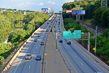
-
Schuylkill River
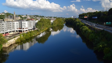
-
Former location of Your Game Bar and Grille [01]
![Former location of Your Game Bar and Grille [01] (5051 visits) Former location of "Your Game Bar and Grille" in Breezewood, Pennsylvania. Originally bui... Former location of Your Game Bar and Grille [01]](../../../i/upload/2024/07/18/20240718220415-3de3db1d-cu_s9999x250.jpg)
-
Former location of Your Game Bar and Grille [02]
![Former location of Your Game Bar and Grille [02] (4909 visits) Former location of "Your Game Bar and Grille" in Breezewood, Pennsylvania. Originally bui... Former location of Your Game Bar and Grille [02]](../../../i/upload/2024/07/18/20240718220418-6fa2fec9-cu_s9999x250.jpg)
-
Interstate 66 westbound, near Gainesville
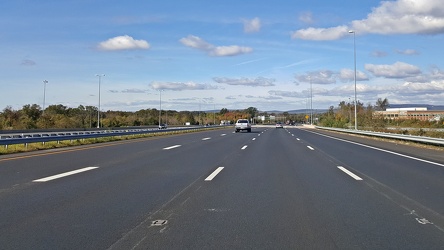
-
Monitor-Merrimac Memorial Bridge-Tunnel
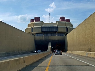
-
Sideling Hill cut
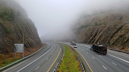
-
Sign assembly in Marathon, New York [03]
![Sign assembly in Marathon, New York [03] (4060 visits) Sign assembly at the intersection of Broome Street (US 11), Cortland Street (US 11) and Main Street ... Sign assembly in Marathon, New York [03]](../../../i/upload/2024/07/18/20240718230658-c073cb2b-cu_s9999x250.jpg)
-
Sign assembly in Marathon, New York [02]
![Sign assembly in Marathon, New York [02] (2427 visits) Sign assembly at the intersection of Broome Street (US 11), Cortland Street (US 11) and Main Street ... Sign assembly in Marathon, New York [02]](../../../i/upload/2024/07/18/20240718230702-0ea9af31-cu_s9999x250.jpg)
-
Sign assembly in Marathon, New York [01]
![Sign assembly in Marathon, New York [01] (2204 visits) Sign assembly at the intersection of Broome Street (US 11), Cortland Street (US 11) and Main Street ... Sign assembly in Marathon, New York [01]](../../../i/upload/2024/07/18/20240718230705-2fd63957-cu_s9999x250.jpg)
-
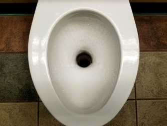
Composting toilet at a rest area
-
Maryland 68 vs. Interstate 68 sign [01]
![Maryland 68 vs. Interstate 68 sign [01] (2991 visits) Sign on westbound Interstate 70 ahead of exit 18, indicating that the next exit is for Maryland Rout... Maryland 68 vs. Interstate 68 sign [01]](../../../i/upload/2024/07/19/20240719004016-a5d58dda-cu_s9999x250.jpg)
-
Maryland 68 vs. Interstate 68 sign [02]
![Maryland 68 vs. Interstate 68 sign [02] (1599 visits) Sign on westbound Interstate 70 ahead of exit 18, indicating that the next exit is for Maryland Rout... Maryland 68 vs. Interstate 68 sign [02]](../../../i/upload/2024/07/19/20240719004125-0cff4906-cu_s9999x250.jpg)
-
Abandoned Days Inn near Warfordsburg, Pennsylvania [24]
![Abandoned Days Inn near Warfordsburg, Pennsylvania [24] (1803 visits) Main sign, facing Interstate 70, at the former Days Inn near Warfordsburg, Pennsylvania.
The 65-r... Abandoned Days Inn near Warfordsburg, Pennsylvania [24]](../../../i/upload/2024/07/19/20240719091046-1f6c2ec2-cu_s9999x250.jpg)
-
Abandoned Days Inn near Warfordsburg, Pennsylvania [26]
![Abandoned Days Inn near Warfordsburg, Pennsylvania [26] (1883 visits) Main sign, facing Interstate 70, at the former Days Inn near Warfordsburg, Pennsylvania.
The 65-r... Abandoned Days Inn near Warfordsburg, Pennsylvania [26]](../../../i/upload/2024/07/19/20240719091055-4c9414dd-cu_s9999x250.jpg)
-
Abandoned Days Inn near Warfordsburg, Pennsylvania [25]
![Abandoned Days Inn near Warfordsburg, Pennsylvania [25] (3045 visits) Main sign, facing Interstate 70, at the former Days Inn near Warfordsburg, Pennsylvania.
The 65-roo... Abandoned Days Inn near Warfordsburg, Pennsylvania [25]](../../../i/upload/2024/07/19/20240719091100-5bc7dd63-cu_s9999x250.jpg)
-
Signage for Exit 49 on Interstate 295 [05]
![Signage for Exit 49 on Interstate 295 [05] (1540 visits) Overhead sign for Exit 49 (US 33) on Interstate 295 eastbound in Glen Allen, Virginia.
More at The ... Signage for Exit 49 on Interstate 295 [05]](../../../i/upload/2024/07/19/20240719092857-ab204ec0-cu_s9999x250.jpg)
-
Signage for Exit 49 on Interstate 295 [06]
![Signage for Exit 49 on Interstate 295 [06] (1513 visits) Overhead sign for Exit 49 (US 33) on Interstate 295 eastbound in Glen Allen, Virginia.
More at The ... Signage for Exit 49 on Interstate 295 [06]](../../../i/upload/2024/07/19/20240719092924-a67ffbc2-cu_s9999x250.jpg)
-
Signage for Exit 49 on Interstate 295 [04]
![Signage for Exit 49 on Interstate 295 [04] (2831 visits) Overhead sign for Exit 49 (US 33) on Interstate 295 eastbound in Glen Allen, Virginia.
More at The ... Signage for Exit 49 on Interstate 295 [04]](../../../i/upload/2024/07/19/20240719092929-00e8a658-cu_s9999x250.jpg)
-
Signage for Exit 49 on Interstate 295 [03]
![Signage for Exit 49 on Interstate 295 [03] (2828 visits) Overhead sign for Exit 49 (US 33) on Interstate 295 eastbound in Glen Allen, Virginia.
More at The ... Signage for Exit 49 on Interstate 295 [03]](../../../i/upload/2024/07/19/20240719092934-ceaf9b98-cu_s9999x250.jpg)
-
Signage for Exit 49 on Interstate 295 [02]
![Signage for Exit 49 on Interstate 295 [02] (1435 visits) Overhead sign for Exit 49 (US 33) on Interstate 295 eastbound in Glen Allen, Virginia.
More at The ... Signage for Exit 49 on Interstate 295 [02]](../../../i/upload/2024/07/19/20240719092939-b220cdd7-cu_s9999x250.jpg)
-
Signage for Exit 49 on Interstate 295 [01]
![Signage for Exit 49 on Interstate 295 [01] (2800 visits) Overhead sign for Exit 49 (US 33) on Interstate 295 eastbound in Glen Allen, Virginia.
More at The ... Signage for Exit 49 on Interstate 295 [01]](../../../i/upload/2024/07/19/20240719093116-72eb08f8-cu_s9999x250.jpg)
-
Goochland rest area, westbound [03]
![Goochland rest area, westbound [03] (1747 visits) Restroom building at the Goochland Safety Rest Area on Interstate 64 westbound in Manakin-Sabot, Vir... Goochland rest area, westbound [03]](../../../i/upload/2024/07/19/20240719093121-0aeca88a-cu_s9999x250.jpg)
-
Goochland rest area, westbound [02]
![Goochland rest area, westbound [02] (1721 visits) Restroom building at the Goochland Safety Rest Area on Interstate 64 westbound in Manakin-Sabot, Vir... Goochland rest area, westbound [02]](../../../i/upload/2024/07/19/20240719093125-c06aafb1-cu_s9999x250.jpg)
-
Goochland rest area, westbound [01]
![Goochland rest area, westbound [01] (1737 visits) Restroom building at the Goochland Safety Rest Area on Interstate 64 westbound in Manakin-Sabot, Vir... Goochland rest area, westbound [01]](../../../i/upload/2024/07/19/20240719093130-dbdf3bb4-cu_s9999x250.jpg)
-
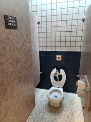
Child/toddler friendly stall at New Kent rest area
-
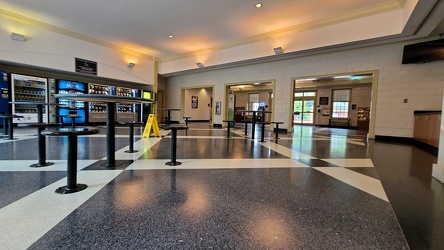
Interior of New Kent rest area, westbound
-
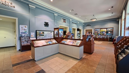
Interior of New Kent rest area, eastbound
-
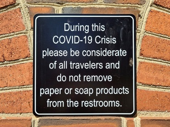
COVID-19 rest area signage
-
Interstate 264 after Midtown Tunnel [01]
![Interstate 264 after Midtown Tunnel [01] (1499 visits) Interstate 264 westbound in Portsmouth, Virginia, just after traffic exits the Midtown Tunnel.
More... Interstate 264 after Midtown Tunnel [01]](../../../i/upload/2024/07/19/20240719101939-87dbaa40-cu_s9999x250.jpg)
-
Interstate 264 after Midtown Tunnel [02]
![Interstate 264 after Midtown Tunnel [02] (1154 visits) Interstate 264 westbound in Portsmouth, Virginia, just after traffic exits the Midtown Tunnel.
More... Interstate 264 after Midtown Tunnel [02]](../../../i/upload/2024/07/19/20240719101945-e18e6752-cu_s9999x250.jpg)
-
Interstate 264 after Midtown Tunnel [04]
![Interstate 264 after Midtown Tunnel [04] (2928 visits) Interstate 264 westbound in Portsmouth, Virginia, just after traffic exits the Midtown Tunnel.
More... Interstate 264 after Midtown Tunnel [04]](../../../i/upload/2024/07/19/20240719102003-a91bfec6-cu_s9999x250.jpg)
-
Interstate 264 after Midtown Tunnel [03]
![Interstate 264 after Midtown Tunnel [03] (2761 visits) Interstate 264 westbound in Portsmouth, Virginia, just after traffic exits the Midtown Tunnel.
More... Interstate 264 after Midtown Tunnel [03]](../../../i/upload/2024/07/19/20240719102008-7fa5c14e-cu_s9999x250.jpg)
-
South Mountain rest area and welcome center, westbound [02]
![South Mountain rest area and welcome center, westbound [02] (1207 visits) Restroom building at the South Mountain rest area and welcome center on Interstate 70 westbound in F... South Mountain rest area and welcome center, westbound [02]](../../../i/upload/2024/07/19/20240719104930-9f63ecbf-cu_s9999x250.jpg)
-
South Mountain rest area and welcome center, westbound [01]
![South Mountain rest area and welcome center, westbound [01] (1174 visits) Restroom building at the South Mountain rest area and welcome center on Interstate 70 westbound in F... South Mountain rest area and welcome center, westbound [01]](../../../i/upload/2024/07/19/20240719104934-09257e0d-cu_s9999x250.jpg)
-
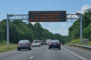
Variable message sign encouraging social distancing
-
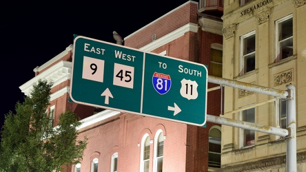
Overhead sign over South Queen Street
-
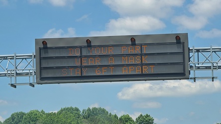
Variable message sign encouraging mask wearing and social distancing
-
Low clearance sign at West Falls Church station
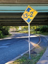
-
Interstate 64 in Nelson County, Virginia [01]
![Interstate 64 in Nelson County, Virginia [01] (10530 visits) Interstate 64 in Nelson County, Virginia, near Rockfish Gap. US 250 runs adjacent to the freeway.
... Interstate 64 in Nelson County, Virginia [01]](../../../i/upload/2024/07/19/20240719115200-c8a2ce39-cu_s9999x250.jpg)
-
Interstate 64 in Nelson County, Virginia [02]
![Interstate 64 in Nelson County, Virginia [02] (10689 visits) Interstate 64 in Nelson County, Virginia, near Rockfish Gap. US 250 runs adjacent to the freeway.
... Interstate 64 in Nelson County, Virginia [02]](../../../i/upload/2024/07/19/20240719115847-184fa12a-cu_s9999x250.jpg)
-
Interstate 64 in Nelson County, Virginia [03]
![Interstate 64 in Nelson County, Virginia [03] (10875 visits) Interstate 64 in Nelson County, Virginia, near Rockfish Gap. US 250 runs adjacent to the freeway.
... Interstate 64 in Nelson County, Virginia [03]](../../../i/upload/2024/07/19/20240719115902-ff5fb9e1-cu_s9999x250.jpg)
-
Blue Ridge Mountains near Rockfish Gap [01]
![Blue Ridge Mountains near Rockfish Gap [01] (1468 visits) The Blue Ridge Mountains, viewed from above the Interstate 64 scenic overlook in Nelson County, Virg... Blue Ridge Mountains near Rockfish Gap [01]](../../../i/upload/2024/07/19/20240719115911-d105cde8-cu_s9999x250.jpg)
-
Blue Ridge Mountains near Rockfish Gap [02]
![Blue Ridge Mountains near Rockfish Gap [02] (1427 visits) The Blue Ridge Mountains, viewed from above the Interstate 64 scenic overlook in Nelson County, Virg... Blue Ridge Mountains near Rockfish Gap [02]](../../../i/upload/2024/07/19/20240719115926-47f38290-cu_s9999x250.jpg)