-
Operation Sea Arrrgh 2009 [09]
![Operation Sea Arrrgh 2009 [09] (3204 visits) Activist Luke Kuhn takes a photograph during the "Operation Sea Arrrgh" demonstration, whi... Operation Sea Arrrgh 2009 [09]](../../../i/upload/2024/07/16/20240716002457-0e99bb1d-cu_s9999x250.jpg)
-
Fire alarm photo shoot [04]
![Fire alarm photo shoot [04] (4593 visits) A digital camera is set up on a tripod to photograph a Wheelock 7002 for display on The Schumin Web.... Fire alarm photo shoot [04]](../../../i/upload/2024/07/17/20240717102137-7ff2333f-cu_s9999x250.jpg)
-
Fire alarm photo shoot [03]
![Fire alarm photo shoot [03] (4070 visits) A digital camera is set up on a tripod to photograph a Fire-Lite 450 for display on The Schumin Web.... Fire alarm photo shoot [03]](../../../i/upload/2024/07/17/20240717102139-f0d3c4df-cu_s9999x250.jpg)
-
Fire alarm photo shoot [02]
![Fire alarm photo shoot [02] (5000 visits) A digital camera is set up on a tripod to photograph a Simplex 2901-9838 with 4903-9101 strobe plate... Fire alarm photo shoot [02]](../../../i/upload/2024/07/17/20240717102142-4b2871d0-cu_s9999x250.jpg)
-
Fire alarm photo shoot [01]
![Fire alarm photo shoot [01] (4901 visits) A digital camera is set up on a tripod to photograph a Wheelock 7002T for display on The Schumin Web... Fire alarm photo shoot [01]](../../../i/upload/2024/07/17/20240717102146-be767d48-cu_s9999x250.jpg)
-
Elyse takes a photo

-
Elyse takes a selfie

-
Essex Place, Candle Ridge, and Picton of Birlstone [02]
![Essex Place, Candle Ridge, and Picton of Birlstone [02] (2074 visits) Aerial view of the Essex Place, Candle Ridge, and Picton of Birlstone areas of Montgomery Village, M... Essex Place, Candle Ridge, and Picton of Birlstone [02]](../../../i/upload/2024/07/19/20240719165355-16cfcb21-cu_s9999x250.jpg)
-
Ravenglass Way [02]
![Ravenglass Way [02] (2232 visits) Aerial view of Ravenglass Way, a street in the Essex Place area of Montgomery Village, Maryland.
Be... Ravenglass Way [02]](../../../i/upload/2024/07/19/20240719165400-daa550de-cu_s9999x250.jpg)
-
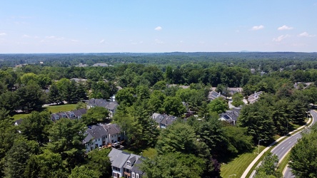
Essex Place and Candle Ridge
-
Montgomery Village, facing approximately west [01]
![Montgomery Village, facing approximately west [01] (2077 visits) View of Montgomery Village and beyond, facing approximately west, from above the Lake Marion Communi... Montgomery Village, facing approximately west [01]](../../../i/upload/2024/07/19/20240719165409-be458691-cu_s9999x250.jpg)
-
Essex Place, Candle Ridge, and Picton of Birlstone [03]
![Essex Place, Candle Ridge, and Picton of Birlstone [03] (1848 visits) Aerial view of the Essex Place, Candle Ridge, and Picton of Birlstone areas of Montgomery Village, M... Essex Place, Candle Ridge, and Picton of Birlstone [03]](../../../i/upload/2024/07/19/20240719165413-01ec57b3-cu_s9999x250.jpg)
-
Ravenglass Way [06]
![Ravenglass Way [06] (1656 visits) Aerial view of Ravenglass Way, a street in the Essex Place area of Montgomery Village, Maryland.
Be... Ravenglass Way [06]](../../../i/upload/2024/07/19/20240719165418-83524ec4-cu_s9999x250.jpg)
-
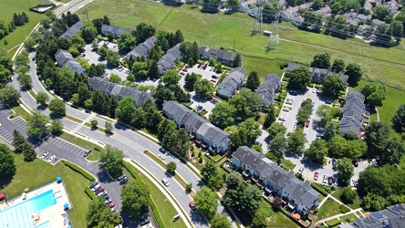
Hawk Run Terrace
-
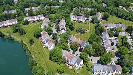
The Reach
-
Lake Marion Community Center pool [06]
![Lake Marion Community Center pool [06] (7323 visits) Swimming pool at the Lake Marion Community Center in Montgomery Village, Maryland.
Ben Schumin is a... Lake Marion Community Center pool [06]](../../../i/upload/2024/07/19/20240719165432-05e5d3a1-cu_s9999x250.jpg)
-
Lake Marion Community Center pool [05]
![Lake Marion Community Center pool [05] (3334 visits) Swimming pool at the Lake Marion Community Center in Montgomery Village, Maryland.
Ben Schumin is a... Lake Marion Community Center pool [05]](../../../i/upload/2024/07/19/20240719165437-13657538-cu_s9999x250.jpg)
-
Ravenglass Way [04]
![Ravenglass Way [04] (1690 visits) Aerial view of Ravenglass Way, a street in the Essex Place area of Montgomery Village, Maryland.
Be... Ravenglass Way [04]](../../../i/upload/2024/07/19/20240719165443-3e6bc6d8-cu_s9999x250.jpg)
-
Ravenglass Way [03]
![Ravenglass Way [03] (1703 visits) Aerial view of Ravenglass Way, a street in the Essex Place area of Montgomery Village, Maryland.
Be... Ravenglass Way [03]](../../../i/upload/2024/07/19/20240719165447-3df0a484-cu_s9999x250.jpg)
-
Ravenglass Way [01]
![Ravenglass Way [01] (1914 visits) Aerial view of Ravenglass Way, a street in the Essex Place area of Montgomery Village, Maryland.
Be... Ravenglass Way [01]](../../../i/upload/2024/07/19/20240719165451-c6237496-cu_s9999x250.jpg)
-
Essex Place, Candle Ridge, and Picton of Birlstone [01]
![Essex Place, Candle Ridge, and Picton of Birlstone [01] (1886 visits) Aerial view of the Essex Place, Candle Ridge, and Picton of Birlstone areas of Montgomery Village, M... Essex Place, Candle Ridge, and Picton of Birlstone [01]](../../../i/upload/2024/07/19/20240719165455-a51c05df-cu_s9999x250.jpg)
-
Montgomery Village, facing approximately west [02]
![Montgomery Village, facing approximately west [02] (1819 visits) View of Montgomery Village and beyond, facing approximately west, from above the Lake Marion Communi... Montgomery Village, facing approximately west [02]](../../../i/upload/2024/07/19/20240719165500-7c01f836-cu_s9999x250.jpg)
-
Ravenglass Way [05]
![Ravenglass Way [05] (1697 visits) Aerial view of Ravenglass Way, a street in the Essex Place area of Montgomery Village, Maryland.
Be... Ravenglass Way [05]](../../../i/upload/2024/07/19/20240719165505-1a967166-cu_s9999x250.jpg)
-
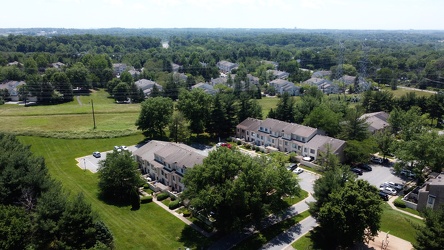
Picton of Birlstone and Glenbrooke
-
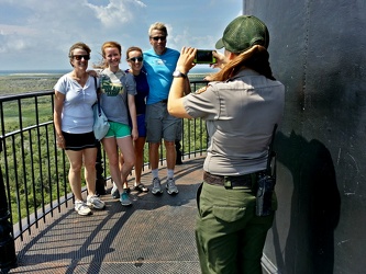
Park ranger taking a photo of a family
-
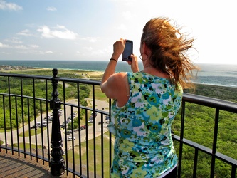
Woman taking photo from Cape Hatteras Lighthouse
-
Stuarts Draft, Virginia above Wayne Avenue [02]
![Stuarts Draft, Virginia above Wayne Avenue [02] (1989 visits) View of Stuarts Draft, Virginia from above Wayne Avenue (VA-639).
Ben Schumin is a professional pho... Stuarts Draft, Virginia above Wayne Avenue [02]](../../../i/upload/2024/07/20/20240720094514-88dd2f1e-cu_s9999x250.jpg)
-
Stuarts Draft, Virginia above Wayne Avenue [01]
![Stuarts Draft, Virginia above Wayne Avenue [01] (2931 visits) View of Stuarts Draft, Virginia from above Wayne Avenue (VA-639).
Ben Schumin is a professional pho... Stuarts Draft, Virginia above Wayne Avenue [01]](../../../i/upload/2024/07/20/20240720094536-55029349-cu_s9999x250.jpg)
-
Stuarts Draft, Virginia above Wayne Avenue [03]
![Stuarts Draft, Virginia above Wayne Avenue [03] (2022 visits) View of Stuarts Draft, Virginia from above Wayne Avenue (VA-639).
Ben Schumin is a professional pho... Stuarts Draft, Virginia above Wayne Avenue [03]](../../../i/upload/2024/07/20/20240720094705-d02b94dc-cu_s9999x250.jpg)
-
Stuarts Draft, Virginia above Wayne Avenue [05]
![Stuarts Draft, Virginia above Wayne Avenue [05] (2948 visits) View of Stuarts Draft, Virginia from above Wayne Avenue (VA-639).
Ben Schumin is a professional pho... Stuarts Draft, Virginia above Wayne Avenue [05]](../../../i/upload/2024/07/20/20240720094711-10b1bf16-cu_s9999x250.jpg)
-
Staunton Mall demolition progress [01]
![Staunton Mall demolition progress [01] (11190 visits) Demolition progress at the former Staunton Mall, on June 4, 2022. Staunton Mall closed at the end o... Staunton Mall demolition progress [01]](../../../i/upload/2024/07/20/20240720094721-3ee75140-cu_s9999x250.jpg)
-
Stuarts Draft, Virginia above Wayne Avenue [04]
![Stuarts Draft, Virginia above Wayne Avenue [04] (2933 visits) View of Stuarts Draft, Virginia from above Wayne Avenue (VA-639).
Ben Schumin is a professional pho... Stuarts Draft, Virginia above Wayne Avenue [04]](../../../i/upload/2024/07/20/20240720094817-ef62e5b8-cu_s9999x250.jpg)
-
Staunton Mall demolition progress [02]
![Staunton Mall demolition progress [02] (10980 visits) Demolition progress at the former Staunton Mall, on June 4, 2022. Staunton Mall closed at the end o... Staunton Mall demolition progress [02]](../../../i/upload/2024/07/20/20240720094834-10815454-cu_s9999x250.jpg)
-
Staunton Mall demolition progress [03]
![Staunton Mall demolition progress [03] (16690 visits) Demolition progress at the former Staunton Mall, on June 4, 2022. Staunton Mall closed at the end o... Staunton Mall demolition progress [03]](../../../i/upload/2024/07/20/20240720094856-469c8a58-cu_s9999x250.jpg)
-
Staunton Mall demolition progress [04]
![Staunton Mall demolition progress [04] (10961 visits) Demolition progress at the former Staunton Mall, on June 4, 2022. Staunton Mall closed at the end o... Staunton Mall demolition progress [04]](../../../i/upload/2024/07/20/20240720094910-4d40fd8d-cu_s9999x250.jpg)
-
Staunton Mall demolition progress [05]
![Staunton Mall demolition progress [05] (10832 visits) Demolition progress at the former Staunton Mall, on June 4, 2022. Staunton Mall closed at the end o... Staunton Mall demolition progress [05]](../../../i/upload/2024/07/20/20240720094926-e55c77ac-cu_s9999x250.jpg)
-
Staunton Mall demolition progress [06]
![Staunton Mall demolition progress [06] (15770 visits) Demolition progress at the former Staunton Mall, on June 4, 2022. Staunton Mall closed at the end o... Staunton Mall demolition progress [06]](../../../i/upload/2024/07/20/20240720094937-ecc4de7d-cu_s9999x250.jpg)
-
Staunton Mall demolition progress [07]
![Staunton Mall demolition progress [07] (10871 visits) Demolition progress at the former Staunton Mall, on June 4, 2022. Staunton Mall closed at the end o... Staunton Mall demolition progress [07]](../../../i/upload/2024/07/20/20240720094948-1bc034f4-cu_s9999x250.jpg)
-
Staunton Mall demolition progress [08]
![Staunton Mall demolition progress [08] (10788 visits) Demolition progress at the former Staunton Mall, on June 4, 2022. Staunton Mall closed at the end o... Staunton Mall demolition progress [08]](../../../i/upload/2024/07/20/20240720094958-ee15f940-cu_s9999x250.jpg)
-
Staunton Mall demolition progress [09]
![Staunton Mall demolition progress [09] (10853 visits) Demolition progress at the former Staunton Mall, on June 4, 2022. Staunton Mall closed at the end o... Staunton Mall demolition progress [09]](../../../i/upload/2024/07/20/20240720095008-f0672151-cu_s9999x250.jpg)
-
Staunton Mall demolition progress [10]
![Staunton Mall demolition progress [10] (10651 visits) Demolition progress at the former Staunton Mall, on June 4, 2022. Staunton Mall closed at the end o... Staunton Mall demolition progress [10]](../../../i/upload/2024/07/20/20240720095013-6a523428-cu_s9999x250.jpg)
-
Staunton Mall demolition progress [11]
![Staunton Mall demolition progress [11] (10716 visits) Demolition progress at the former Staunton Mall, on June 4, 2022. Staunton Mall closed at the end o... Staunton Mall demolition progress [11]](../../../i/upload/2024/07/20/20240720095020-69c6479f-cu_s9999x250.jpg)
-
Staunton Mall demolition progress [12]
![Staunton Mall demolition progress [12] (10795 visits) Demolition progress at the former Staunton Mall, on June 4, 2022. Staunton Mall closed at the end o... Staunton Mall demolition progress [12]](../../../i/upload/2024/07/20/20240720095025-0e8f8a28-cu_s9999x250.jpg)
-
Staunton Mall demolition progress [13]
![Staunton Mall demolition progress [13] (10628 visits) Demolition progress at the former Staunton Mall, on June 4, 2022. Staunton Mall closed at the end o... Staunton Mall demolition progress [13]](../../../i/upload/2024/07/20/20240720095030-36861678-cu_s9999x250.jpg)
-
Staunton Mall demolition progress [14]
![Staunton Mall demolition progress [14] (10807 visits) Demolition progress at the former Staunton Mall, on June 4, 2022. Staunton Mall closed at the end o... Staunton Mall demolition progress [14]](../../../i/upload/2024/07/20/20240720095035-5b83b77b-cu_s9999x250.jpg)
-
Staunton Mall demolition progress [15]
![Staunton Mall demolition progress [15] (10563 visits) Demolition progress at the former Staunton Mall, on June 4, 2022. Staunton Mall closed at the end o... Staunton Mall demolition progress [15]](../../../i/upload/2024/07/20/20240720095041-5d83cc15-cu_s9999x250.jpg)
-
Staunton Mall demolition progress [16]
![Staunton Mall demolition progress [16] (63115 visits) Demolition progress at the former Staunton Mall, on June 4, 2022. Staunton Mall closed at the end o... Staunton Mall demolition progress [16]](../../../i/upload/2024/07/20/20240720095045-65b25eae-cu_s9999x250.jpg)
-
Staunton Mall demolition progress [17]
![Staunton Mall demolition progress [17] (10762 visits) Demolition progress at the former Staunton Mall, on June 4, 2022. Staunton Mall closed at the end o... Staunton Mall demolition progress [17]](../../../i/upload/2024/07/20/20240720095051-cb7a3ea4-cu_s9999x250.jpg)
-
Staunton Mall demolition progress [18]
![Staunton Mall demolition progress [18] (10560 visits) Demolition progress at the former Staunton Mall, on June 4, 2022. Staunton Mall closed at the end o... Staunton Mall demolition progress [18]](../../../i/upload/2024/07/20/20240720095056-3de94bf3-cu_s9999x250.jpg)
-
Staunton Mall demolition progress [19]
![Staunton Mall demolition progress [19] (10644 visits) Demolition progress at the former Staunton Mall, on June 4, 2022. Staunton Mall closed at the end o... Staunton Mall demolition progress [19]](../../../i/upload/2024/07/20/20240720095101-dff03ab4-cu_s9999x250.jpg)
-
Ravenglass Way [07]
![Ravenglass Way [07] (1621 visits) Aerial view of Ravenglass Way, a street in the Essex Place area of Montgomery Village, Maryland.
Be... Ravenglass Way [07]](../../../i/upload/2024/07/20/20240720095503-d67a39a0-cu_s9999x250.jpg)
-
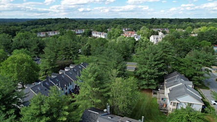
Essex Place and The Reach
-
Ravenglass Way [09]
![Ravenglass Way [09] (1916 visits) Aerial view of Ravenglass Way, a street in the Essex Place area of Montgomery Village, Maryland.
Be... Ravenglass Way [09]](../../../i/upload/2024/07/20/20240720095518-d5c71399-cu_s9999x250.jpg)
-
Ravenglass Way [08]
![Ravenglass Way [08] (1685 visits) Aerial view of Ravenglass Way, a street in the Essex Place area of Montgomery Village, Maryland.
Be... Ravenglass Way [08]](../../../i/upload/2024/07/20/20240720095523-39780d00-cu_s9999x250.jpg)
-
Point State Park [03]
![Point State Park [03] (1423 visits) Aerial view of Point State Park, at the location where the Allegheny and Monongahela Rivers join to ... Point State Park [03]](../../../i/upload/2024/07/20/20240720160819-8b6d68d8-cu_s9999x250.jpg)
-
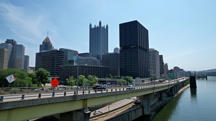
Interstate 376 in downtown Pittsburgh
-
Aerial view of downtown Pittsburgh [02]
![Aerial view of downtown Pittsburgh [02] (1360 visits) Golden Triangle area of Pittsburgh, Pennsylvania, viewed from above the Monongahela River.
More at ... Aerial view of downtown Pittsburgh [02]](../../../i/upload/2024/07/20/20240720160827-b3b76350-cu_s9999x250.jpg)
-
Point State Park [02]
![Point State Park [02] (1378 visits) Aerial view of Point State Park, at the location where the Allegheny and Monongahela Rivers join to ... Point State Park [02]](../../../i/upload/2024/07/20/20240720160835-290aa4ba-cu_s9999x250.jpg)
-
End of the Monongahela River

-
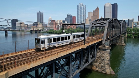
Panhandle Bridge
-
Fort Pitt Bridge [01]
![Fort Pitt Bridge [01] (2991 visits) The Fort Pitt Bridge, which carries traffic on Interstate 376 over the Monongahela River between the... Fort Pitt Bridge [01]](../../../i/upload/2024/07/20/20240720160848-94f396df-cu_s9999x250.jpg)
-
Aerial view of downtown Pittsburgh [01]
![Aerial view of downtown Pittsburgh [01] (2864 visits) Golden Triangle area of Pittsburgh, Pennsylvania, viewed from above the Monongahela River.
More at ... Aerial view of downtown Pittsburgh [01]](../../../i/upload/2024/07/20/20240720160852-35325d56-cu_s9999x250.jpg)
-
Fort Pitt Bridge [02]
![Fort Pitt Bridge [02] (3089 visits) The Fort Pitt Bridge, which carries traffic on Interstate 376 over the Monongahela River between the... Fort Pitt Bridge [02]](../../../i/upload/2024/07/20/20240720160856-8c4cf883-cu_s9999x250.jpg)
-
Oakland neighborhood in Pittsburgh [02]
![Oakland neighborhood in Pittsburgh [02] (2818 visits) Aerial view of the Oakland neighborhood in Pittsburgh, Pennsylvania.
More at The Schumin Web:
www.s... Oakland neighborhood in Pittsburgh [02]](../../../i/upload/2024/07/20/20240720160905-e13411a5-cu_s9999x250.jpg)
-
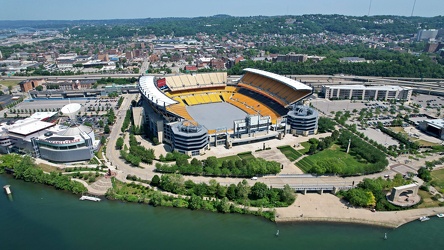
Acrisure Stadium
-
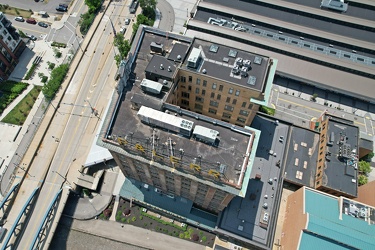
Landmarks Building
-
Point State Park [01]
![Point State Park [01] (1330 visits) Aerial view of Point State Park, at the location where the Allegheny and Monongahela Rivers join to ... Point State Park [01]](../../../i/upload/2024/07/20/20240720160921-2109340f-cu_s9999x250.jpg)
-
Aerial view of East Liberty Presbyterian Church [02]
![Aerial view of East Liberty Presbyterian Church [02] (2913 visits) Aerial view of East Liberty Presbyterian Church, also known as the Cathedral of Hope, a large church... Aerial view of East Liberty Presbyterian Church [02]](../../../i/upload/2024/07/20/20240720160925-113a640a-cu_s9999x250.jpg)
-
Aerial view of East Liberty Presbyterian Church [04]
![Aerial view of East Liberty Presbyterian Church [04] (2909 visits) Aerial view of East Liberty Presbyterian Church, also known as the Cathedral of Hope, a large church... Aerial view of East Liberty Presbyterian Church [04]](../../../i/upload/2024/07/20/20240720160929-16fd7e34-cu_s9999x250.jpg)
-
Aerial view of East Liberty Presbyterian Church [06]
![Aerial view of East Liberty Presbyterian Church [06] (2887 visits) Aerial view of East Liberty Presbyterian Church, also known as the Cathedral of Hope, a large church... Aerial view of East Liberty Presbyterian Church [06]](../../../i/upload/2024/07/20/20240720160933-a6419b30-cu_s9999x250.jpg)
-
Aerial view of East Liberty Presbyterian Church [11]
![Aerial view of East Liberty Presbyterian Church [11] (2875 visits) Aerial view of East Liberty Presbyterian Church, also known as the Cathedral of Hope, a large church... Aerial view of East Liberty Presbyterian Church [11]](../../../i/upload/2024/07/20/20240720160938-8f5a529e-cu_s9999x250.jpg)
-
Aerial view of East Liberty Presbyterian Church [12]
![Aerial view of East Liberty Presbyterian Church [12] (2956 visits) Aerial view of East Liberty Presbyterian Church, also known as the Cathedral of Hope, a large church... Aerial view of East Liberty Presbyterian Church [12]](../../../i/upload/2024/07/20/20240720160942-7f513a92-cu_s9999x250.jpg)
-
Aerial view of East Liberty Presbyterian Church [20]
![Aerial view of East Liberty Presbyterian Church [20] (2964 visits) Aerial view of East Liberty Presbyterian Church, also known as the Cathedral of Hope, a large church... Aerial view of East Liberty Presbyterian Church [20]](../../../i/upload/2024/07/20/20240720160946-69e2d66b-cu_s9999x250.jpg)
-
Aerial view of East Liberty Presbyterian Church [23]
![Aerial view of East Liberty Presbyterian Church [23] (2988 visits) Aerial view of East Liberty Presbyterian Church, also known as the Cathedral of Hope, a large church... Aerial view of East Liberty Presbyterian Church [23]](../../../i/upload/2024/07/20/20240720160950-71281329-cu_s9999x250.jpg)
-
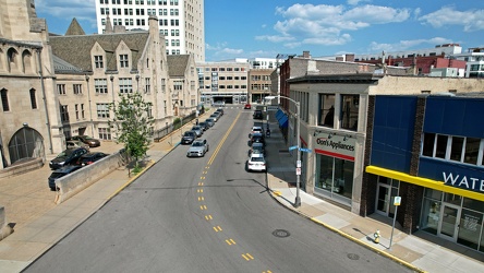
Baum Boulevard, facing east
-
Aerial view of East Liberty Presbyterian Church [10]
![Aerial view of East Liberty Presbyterian Church [10] (2908 visits) Aerial view of East Liberty Presbyterian Church, also known as the Cathedral of Hope, a large church... Aerial view of East Liberty Presbyterian Church [10]](../../../i/upload/2024/07/20/20240720161000-0209603e-cu_s9999x250.jpg)
-
Aerial view of East Liberty Presbyterian Church [13]
![Aerial view of East Liberty Presbyterian Church [13] (2871 visits) Aerial view of East Liberty Presbyterian Church, also known as the Cathedral of Hope, a large church... Aerial view of East Liberty Presbyterian Church [13]](../../../i/upload/2024/07/20/20240720161004-3f71162c-cu_s9999x250.jpg)
-
Aerial view of East Liberty Presbyterian Church [18]
![Aerial view of East Liberty Presbyterian Church [18] (2966 visits) Aerial view of East Liberty Presbyterian Church, also known as the Cathedral of Hope, a large church... Aerial view of East Liberty Presbyterian Church [18]](../../../i/upload/2024/07/20/20240720161008-f23a38fa-cu_s9999x250.jpg)
-
Aerial view of East Liberty Presbyterian Church [21]
![Aerial view of East Liberty Presbyterian Church [21] (2934 visits) Aerial view of East Liberty Presbyterian Church, also known as the Cathedral of Hope, a large church... Aerial view of East Liberty Presbyterian Church [21]](../../../i/upload/2024/07/20/20240720161013-99e0adfe-cu_s9999x250.jpg)
-
Aerial view of East Liberty Presbyterian Church [08]
![Aerial view of East Liberty Presbyterian Church [08] (2931 visits) Aerial view of East Liberty Presbyterian Church, also known as the Cathedral of Hope, a large church... Aerial view of East Liberty Presbyterian Church [08]](../../../i/upload/2024/07/20/20240720161021-d331e071-cu_s9999x250.jpg)