-
Sandy Point State Park [40]
![Sandy Point State Park [40] (5671 visits) Sandy Point State Park is a public park located on the western shore of the Chesapeake Bay, at the f... Sandy Point State Park [40]](../../../i/upload/2024/07/17/20240717154127-6d2dd348-cu_s9999x250.jpg)
-
Sandy Point State Park [41]
![Sandy Point State Park [41] (3142 visits) Sandy Point State Park is a public park located on the western shore of the Chesapeake Bay, at the f... Sandy Point State Park [41]](../../../i/upload/2024/07/17/20240717154130-4c9c2082-cu_s9999x250.jpg)
-
Sandy Point State Park [42]
![Sandy Point State Park [42] (2741 visits) Sandy Point State Park is a public park located on the western shore of the Chesapeake Bay, at the f... Sandy Point State Park [42]](../../../i/upload/2024/07/17/20240717154133-72e008c2-cu_s9999x250.jpg)
-
Sandy Point State Park [43]
![Sandy Point State Park [43] (2802 visits) Sandy Point State Park is a public park located on the western shore of the Chesapeake Bay, at the f... Sandy Point State Park [43]](../../../i/upload/2024/07/17/20240717154135-92bb84b6-cu_s9999x250.jpg)
-
Sandy Point State Park [44]
![Sandy Point State Park [44] (2457 visits) Sandy Point State Park is a public park located on the western shore of the Chesapeake Bay, at the f... Sandy Point State Park [44]](../../../i/upload/2024/07/17/20240717154138-16d1f1b3-cu_s9999x250.jpg)
-
Sandy Point State Park [45]
![Sandy Point State Park [45] (2394 visits) Sandy Point State Park is a public park located on the western shore of the Chesapeake Bay, at the f... Sandy Point State Park [45]](../../../i/upload/2024/07/17/20240717154141-549a2e57-cu_s9999x250.jpg)
-
Sandy Point State Park [46]
![Sandy Point State Park [46] (3713 visits) Sandy Point State Park is a public park located on the western shore of the Chesapeake Bay, at the f... Sandy Point State Park [46]](../../../i/upload/2024/07/17/20240717154143-90c031b6-cu_s9999x250.jpg)
-
Sandy Point State Park [47]
![Sandy Point State Park [47] (3296 visits) Sandy Point State Park is a public park located on the western shore of the Chesapeake Bay, at the f... Sandy Point State Park [47]](../../../i/upload/2024/07/17/20240717154146-832f17df-cu_s9999x250.jpg)
-
Sandy Point State Park [48]
![Sandy Point State Park [48] (3930 visits) Sandy Point State Park is a public park located on the western shore of the Chesapeake Bay, at the f... Sandy Point State Park [48]](../../../i/upload/2024/07/17/20240717154148-cf45007f-cu_s9999x250.jpg)
-
Sandy Point State Park [49]
![Sandy Point State Park [49] (2235 visits) Sandy Point State Park is a public park located on the western shore of the Chesapeake Bay, at the f... Sandy Point State Park [49]](../../../i/upload/2024/07/17/20240717154151-98890a0d-cu_s9999x250.jpg)
-
Sandy Point State Park [50]
![Sandy Point State Park [50] (2169 visits) Sandy Point State Park is a public park located on the western shore of the Chesapeake Bay, at the f... Sandy Point State Park [50]](../../../i/upload/2024/07/17/20240717154153-cc00f985-cu_s9999x250.jpg)
-
Sandy Point State Park [51]
![Sandy Point State Park [51] (2631 visits) Sandy Point State Park is a public park located on the western shore of the Chesapeake Bay, at the f... Sandy Point State Park [51]](../../../i/upload/2024/07/17/20240717154155-ff08231a-cu_s9999x250.jpg)
-
Sandy Point State Park [52]
![Sandy Point State Park [52] (4380 visits) Sandy Point State Park is a public park located on the western shore of the Chesapeake Bay, at the f... Sandy Point State Park [52]](../../../i/upload/2024/07/17/20240717154158-b2623bce-cu_s9999x250.jpg)
-
Sandy Point State Park [53]
![Sandy Point State Park [53] (4105 visits) Sandy Point State Park is a public park located on the western shore of the Chesapeake Bay, at the f... Sandy Point State Park [53]](../../../i/upload/2024/07/17/20240717154201-c87c3324-cu_s9999x250.jpg)
-
Sandy Point State Park [54]
![Sandy Point State Park [54] (2015 visits) Sandy Point State Park is a public park located on the western shore of the Chesapeake Bay, at the f... Sandy Point State Park [54]](../../../i/upload/2024/07/17/20240717154203-3425174b-cu_s9999x250.jpg)
-
Sandy Point State Park [55]
![Sandy Point State Park [55] (4257 visits) Sandy Point State Park is a public park located on the western shore of the Chesapeake Bay, at the f... Sandy Point State Park [55]](../../../i/upload/2024/07/17/20240717154206-429c635c-cu_s9999x250.jpg)
-
Sandy Point State Park [56]
![Sandy Point State Park [56] (3219 visits) Sandy Point State Park is a public park located on the western shore of the Chesapeake Bay, at the f... Sandy Point State Park [56]](../../../i/upload/2024/07/17/20240717154209-3f4aa69d-cu_s9999x250.jpg)
-
Sandy Point State Park [57]
![Sandy Point State Park [57] (3063 visits) Sandy Point State Park is a public park located on the western shore of the Chesapeake Bay, at the f... Sandy Point State Park [57]](../../../i/upload/2024/07/17/20240717154212-ab2e7884-cu_s9999x250.jpg)
-
Sandy Point State Park [64]
![Sandy Point State Park [64] (5496 visits) Sandy Point State Park is a public park located on the western shore of the Chesapeake Bay, at the f... Sandy Point State Park [64]](../../../i/upload/2024/07/17/20240717154215-a3c7730a-cu_s9999x250.jpg)
-
Sandy Point State Park [63]
![Sandy Point State Park [63] (4837 visits) Sandy Point State Park is a public park located on the western shore of the Chesapeake Bay, at the f... Sandy Point State Park [63]](../../../i/upload/2024/07/17/20240717154217-23f3d2b4-cu_s9999x250.jpg)
-
Mountains near New Market, Virginia

-
Cloudy skies over Lake Michigan [03]
![Cloudy skies over Lake Michigan [03] (1167 visits) Cloudy skies over Lake Michigan, seen from Evanston, Illinois.
Ben Schumin is a professional photog... Cloudy skies over Lake Michigan [03]](../../../i/upload/2024/07/17/20240717160708-fc8bdc4b-cu_s9999x250.jpg)
-
Cloudy skies over Lake Michigan [04]
![Cloudy skies over Lake Michigan [04] (1269 visits) Cloudy skies over Lake Michigan, seen from Evanston, Illinois.
Ben Schumin is a professional photog... Cloudy skies over Lake Michigan [04]](../../../i/upload/2024/07/17/20240717160714-d52fcd77-cu_s9999x250.jpg)
-
Former Borders Books in Evanston, Illinois
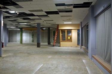
-
324 Davis Street
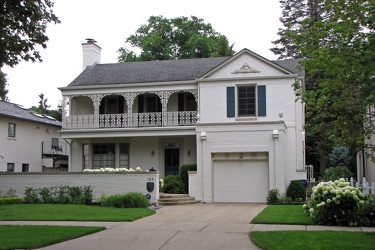
-
Construction of SKYlofts building
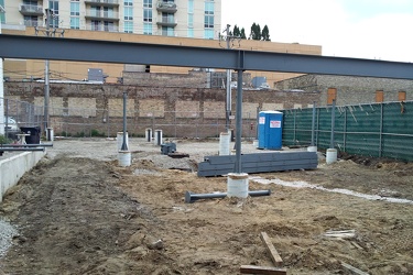
-
Damaged traffic signal in Evanston, Illinois [01]
![Damaged traffic signal in Evanston, Illinois [01] (2711 visits) Damaged traffic signal at the intersection of Davis Street and Sherman Avenue in Evanston, Illinois.... Damaged traffic signal in Evanston, Illinois [01]](../../../i/upload/2024/07/17/20240717161150-31349774-cu_s9999x250.jpg)
-
Damaged traffic signal in Evanston, Illinois [02]
![Damaged traffic signal in Evanston, Illinois [02] (2738 visits) Damaged traffic signal at the intersection of Davis Street and Sherman Avenue in Evanston, Illinois.... Damaged traffic signal in Evanston, Illinois [02]](../../../i/upload/2024/07/17/20240717161159-52dd8877-cu_s9999x250.jpg)
-
Sign for exit 344 on Interstate 94 in Kenosha, Wisconsin
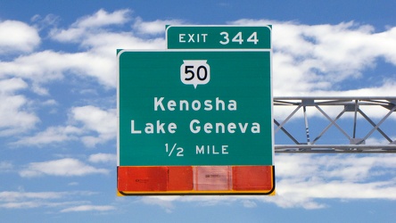
-
Mars Cheese Castle sign [04]
![Mars Cheese Castle sign [04] (3490 visits) Roadside sign for Mars Cheese Castle, a specialty grocery store and restaurant in Kenosha, Wisconsin... Mars Cheese Castle sign [04]](../../../i/upload/2024/07/17/20240717161208-a50c7ebf-cu_s9999x250.jpg)
-
Interstate 94 westbound [02]
![Interstate 94 westbound [02] (7908 visits) Westbound Interstate 94 in Libertyville, Illinois, just south of the interchange with Rockland Road.... Interstate 94 westbound [02]](../../../i/upload/2024/07/17/20240717161211-25917077-cu_s9999x250.jpg)
-
Interstate 94 westbound [01]
![Interstate 94 westbound [01] (2557 visits) Westbound Interstate 94 in Northfield, Illinois, just south of the interchange with Willow Road.
Be... Interstate 94 westbound [01]](../../../i/upload/2024/07/17/20240717161215-d073d806-cu_s9999x250.jpg)
-
Motorcycle riders on Touhy Avenue

-
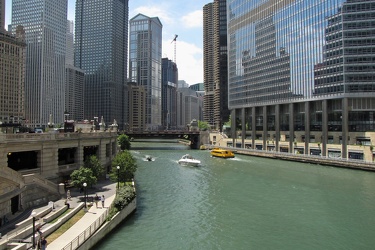
Chicago River from DuSable Bridge, facing southwest
-
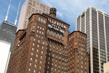
Allerton Hotel
-
Tribune Tower [02]
![Tribune Tower [02] (2552 visits) West facade of the Tribune Tower on North Michigan Avenue in Chicago, Illinois.
Ben Schumin is a pr... Tribune Tower [02]](../../../i/upload/2024/07/17/20240717161308-bf9f325b-cu_s9999x250.jpg)
-
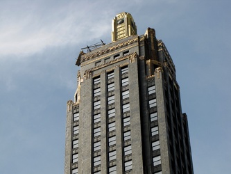
Carbide & Carbon Building
-
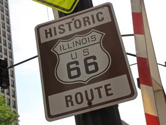
Historic Route 66 sign
-
InterContinental Chicago Magnificent Mile
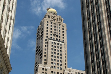
-
Tribune Tower [03]
![Tribune Tower [03] (2571 visits) West facade of the Tribune Tower on North Michigan Avenue in Chicago, Illinois.
Ben Schumin is a pr... Tribune Tower [03]](../../../i/upload/2024/07/17/20240717161328-db596776-cu_s9999x250.jpg)
-
Disguised cell phone tower
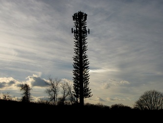
-
Roanoke Star in late afternoon [01]
![Roanoke Star in late afternoon [01] (3191 visits) The Roanoke Star on Mill Mountain in late afternoon, already lit up for the evening.
Ben Schumin is... Roanoke Star in late afternoon [01]](../../../i/upload/2024/07/17/20240717174347-cd231bce-cu_s9999x250.jpg)
-
Roanoke Star in late afternoon [02]
![Roanoke Star in late afternoon [02] (3314 visits) The Roanoke Star on Mill Mountain in late afternoon, already lit up for the evening.
Ben Schumin is... Roanoke Star in late afternoon [02]](../../../i/upload/2024/07/17/20240717174350-7973dee3-cu_s9999x250.jpg)
-
Roanoke Star in late afternoon [03]
![Roanoke Star in late afternoon [03] (3322 visits) The Roanoke Star on Mill Mountain in late afternoon, already lit up for the evening.
Ben Schumin is... Roanoke Star in late afternoon [03]](../../../i/upload/2024/07/17/20240717174352-0d471422-cu_s9999x250.jpg)
-
Roanoke Star in late afternoon [04]
![Roanoke Star in late afternoon [04] (3294 visits) The Roanoke Star on Mill Mountain in late afternoon, already lit up for the evening.
Ben Schumin is... Roanoke Star in late afternoon [04]](../../../i/upload/2024/07/17/20240717174356-4dad7186-cu_s9999x250.jpg)
-
Roanoke Star in late afternoon [05]
![Roanoke Star in late afternoon [05] (3330 visits) The Roanoke Star on Mill Mountain in late afternoon, already lit up for the evening.
Ben Schumin is... Roanoke Star in late afternoon [05]](../../../i/upload/2024/07/17/20240717174359-566ae553-cu_s9999x250.jpg)
-
Roanoke Star in late afternoon [06]
![Roanoke Star in late afternoon [06] (7738 visits) The Roanoke Star on Mill Mountain in late afternoon, already lit up for the evening.
Ben Schumin is... Roanoke Star in late afternoon [06]](../../../i/upload/2024/07/17/20240717174401-3d2affe9-cu_s9999x250.jpg)
-
North end of Lake Artemesia [01]
![North end of Lake Artemesia [01] (1090 visits) The north end of Lake Artemesia, near the parking area. Some people are fishing along the edge of t... North end of Lake Artemesia [01]](../../../i/upload/2024/07/17/20240717225603-3d151a07-cu_s9999x250.jpg)
-
North end of Lake Artemesia [02]
![North end of Lake Artemesia [02] (1078 visits) The north end of Lake Artemesia, near the parking area.
Ben Schumin is a professional photographer ... North end of Lake Artemesia [02]](../../../i/upload/2024/07/17/20240717225606-388cdd99-cu_s9999x250.jpg)
-
North end of Lake Artemesia [03]
![North end of Lake Artemesia [03] (1160 visits) The north end of Lake Artemesia, near the parking area.
Ben Schumin is a professional photographer ... North end of Lake Artemesia [03]](../../../i/upload/2024/07/17/20240717225608-75f55469-cu_s9999x250.jpg)
-
Birdhouse at Lake Artemesia [01]
![Birdhouse at Lake Artemesia [01] (1169 visits) Purple Martin birdhouse on a pole in the Lake Artemesia Natural Area in College Park, Maryland.
Ben... Birdhouse at Lake Artemesia [01]](../../../i/upload/2024/07/17/20240717225611-350c1301-cu_s9999x250.jpg)
-
Birdhouse at Lake Artemesia [02]
![Birdhouse at Lake Artemesia [02] (1234 visits) Purple Martin birdhouse on a pole in the Lake Artemesia Natural Area in College Park, Maryland.
Ben... Birdhouse at Lake Artemesia [02]](../../../i/upload/2024/07/17/20240717225614-155ec568-cu_s9999x250.jpg)
-
"TOWEL DISPENSER HERE"
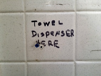
-
Dock in Lake Artemesia
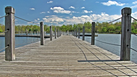
-
North end of southern part of Lake Artemesia
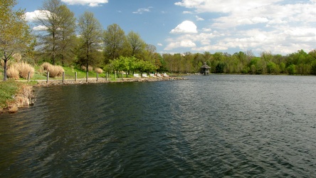
-
Cloud over Lake Artemesia [01]
![Cloud over Lake Artemesia [01] (1086 visits) A cloud briefly hides the sun over Lake Artemesia, a manmade lake in Prince George's County, Marylan... Cloud over Lake Artemesia [01]](../../../i/upload/2024/07/17/20240717225625-c1f513c9-cu_s9999x250.jpg)
-
Cloud over Lake Artemesia [02]
![Cloud over Lake Artemesia [02] (1138 visits) A cloud briefly hides the sun over Lake Artemesia, a manmade lake in Prince George's County, Marylan... Cloud over Lake Artemesia [02]](../../../i/upload/2024/07/17/20240717225628-b4880a1f-cu_s9999x250.jpg)
-
North end of southern part of Lake Artemesia
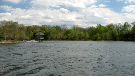
-
Lake Artemesia gazebo
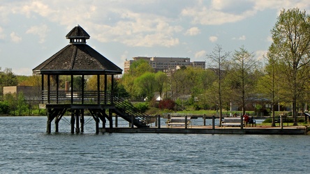
-
Lake Artemesia, facing west
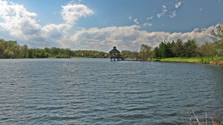
-
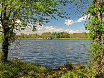
Lake Artemesia, facing northwest
-
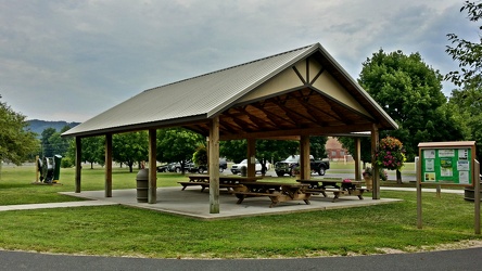
Picnic shelter at Constitution Park
-
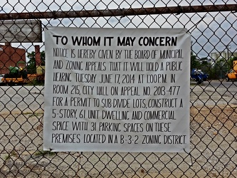
Zoning notice
-
The Roanoke Star [01]
![The Roanoke Star [01] (2454 visits) The Roanoke Star, viewed in daylight on a mostly cloudy day.
Ben Schumin is a professional photogra... The Roanoke Star [01]](../../../i/upload/2024/07/17/20240717232323-3abdab6e-cu_s9999x250.jpg)
-
The Roanoke Star [02]
![The Roanoke Star [02] (2421 visits) The Roanoke Star, viewed in daylight on a mostly cloudy day.
Ben Schumin is a professional photogra... The Roanoke Star [02]](../../../i/upload/2024/07/17/20240717232326-b34d321f-cu_s9999x250.jpg)
-
The Roanoke Star [03]
![The Roanoke Star [03] (2280 visits) The Roanoke Star, viewed in daylight on a mostly cloudy day.
Ben Schumin is a professional photogra... The Roanoke Star [03]](../../../i/upload/2024/07/17/20240717232329-c6f0486e-cu_s9999x250.jpg)
 M. Carl Andrews Overlook [01]
![M. Carl Andrews Overlook [01] (3534 visits) The M. Carl Andrews Overlook, at Mill Mountain Park in Roanoke, Virginia. The Roanoke Star is locat... M. Carl Andrews Overlook [01]](../../../i/upload/2024/07/17/20240717233104-18c6ba6a-cu_s9999x250.jpg)
 M. Carl Andrews Overlook [02]
![M. Carl Andrews Overlook [02] (3579 visits) The M. Carl Andrews Overlook, at Mill Mountain Park in Roanoke, Virginia. The Roanoke Star is locat... M. Carl Andrews Overlook [02]](../../../i/upload/2024/07/17/20240717233109-73899e0e-cu_s9999x250.jpg)
 Parking area behind the Roanoke Star
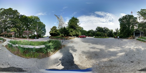
 M. Carl Andrews Overlook at night [01]
![M. Carl Andrews Overlook at night [01] (3935 visits) The M. Carl Andrews Overlook at Mill Mountain Park in Roanoke, Virginia, at night. The Roanoke Star... M. Carl Andrews Overlook at night [01]](../../../i/upload/2024/07/17/20240717233141-45aa31b5-cu_s9999x250.jpg)
 M. Carl Andrews Overlook at night [02]
![M. Carl Andrews Overlook at night [02] (3715 visits) The M. Carl Andrews Overlook at Mill Mountain Park in Roanoke, Virginia, at night. The Roanoke Star... M. Carl Andrews Overlook at night [02]](../../../i/upload/2024/07/17/20240717233145-af6ef7ac-cu_s9999x250.jpg)
-
Southern end of Graffiti Highway [01]
![Southern end of Graffiti Highway [01] (2362 visits) Earthen barrier marking the southern end of the Graffiti Highway, viewed from outside of the abandon... Southern end of Graffiti Highway [01]](../../../i/upload/2024/07/18/20240718225724-3e8c1137-cu_s9999x250.jpg)
-
Southern end of Graffiti Highway [02]
![Southern end of Graffiti Highway [02] (2334 visits) Earthen barrier marking the southern end of the Graffiti Highway. The active roadway is located bey... Southern end of Graffiti Highway [02]](../../../i/upload/2024/07/18/20240718225728-609ba646-cu_s9999x250.jpg)
-
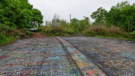
North end of the Graffiti Highway
-
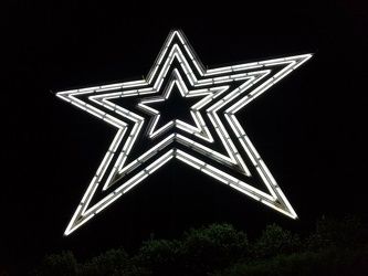
The Roanoke Star, 2018
-
View from Dirt Farm Brewing [02]
![View from Dirt Farm Brewing [02] (1653 visits) View from the patio at Dirt Farm Brewing in Bluemont, Virginia, facing approximately east. On a cle... View from Dirt Farm Brewing [02]](../../../i/upload/2024/07/18/20240718230423-b1ac8dea-cu_s9999x250.jpg)
-
View from Dirt Farm Brewing [01]
![View from Dirt Farm Brewing [01] (1810 visits) View from the patio at Dirt Farm Brewing in Bluemont, Virginia, facing approximately east. On a cle... View from Dirt Farm Brewing [01]](../../../i/upload/2024/07/18/20240718230427-e0fe1b23-cu_s9999x250.jpg)
-
N625AE landing at Baltimore-Washington International Airport (BWI) [04]
![N625AE landing at Baltimore-Washington International Airport (BWI) [04] (1922 visits) N625AE, an Embraer ERJ-145LR (EMB-145LR) operated by Piedmont Airlines as American Eagle, lands at B... N625AE landing at Baltimore-Washington International Airport (BWI) [04]](../../../i/upload/2024/07/19/20240719004632-30644c1d-cu_s9999x250.jpg)
-
N625AE landing at Baltimore-Washington International Airport (BWI) [05]
![N625AE landing at Baltimore-Washington International Airport (BWI) [05] (1896 visits) N625AE, an Embraer ERJ-145LR (EMB-145LR) operated by Piedmont Airlines as American Eagle, lands at B... N625AE landing at Baltimore-Washington International Airport (BWI) [05]](../../../i/upload/2024/07/19/20240719004637-f7feb219-cu_s9999x250.jpg)
-
N625AE landing at Baltimore-Washington International Airport (BWI) [01]
![N625AE landing at Baltimore-Washington International Airport (BWI) [01] (1869 visits) N625AE, an Embraer ERJ-145LR (EMB-145LR) operated by Piedmont Airlines as American Eagle, lands at B... N625AE landing at Baltimore-Washington International Airport (BWI) [01]](../../../i/upload/2024/07/19/20240719004641-7b3441a3-cu_s9999x250.jpg)