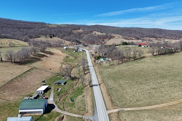
-
US 250 west of Monterey, Virginia
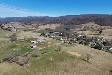
-
North end of Monterey, Virginia
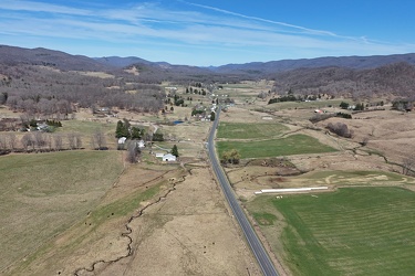
-
US 220 north of Monterey, Virginia
-
Buffalo Gap [02]
![Buffalo Gap [02] (786 visits) Buffalo Gap, a mountain pass through Little North Mountain, near Swoope, Virginia.
More at The Sc... Buffalo Gap [02]](../../../i/upload/2025/01/03/20250103200607-1abe8192-cu_s9999x250.jpg)
-
Marshland next to the Ashley River [01]
![Marshland next to the Ashley River [01] (562 visits) Marshland adjacent to the Ashley River in Charleston, South Carolina.
More at The Schumin Web:
www.... Marshland next to the Ashley River [01]](../../../i/upload/2025/01/13/20250113131004-713341fe-cu_s9999x250.jpg)
-
Marshland next to the Ashley River [02]
![Marshland next to the Ashley River [02] (562 visits) Marshland adjacent to the Ashley River in Charleston, South Carolina.
More at The Schumin Web:
www.... Marshland next to the Ashley River [02]](../../../i/upload/2025/01/13/20250113131013-08259dca-cu_s9999x250.jpg)
-
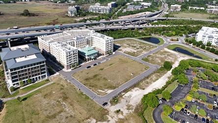
Undeveloped land in Mount Pleasant
-
Eastern end of the Chesapeake Bay Bridge [01]
![Eastern end of the Chesapeake Bay Bridge [01] (1052 visits) The Chesapeake Bay Bridge is a pair of bridges approximately 4.35 miles in length that carry US Rout... Eastern end of the Chesapeake Bay Bridge [01]](../../../i/upload/2025/02/07/20250207135752-9d02b521-cu_s9999x250.jpg)
-
Eastern end of the Chesapeake Bay Bridge [02]
![Eastern end of the Chesapeake Bay Bridge [02] (989 visits) The Chesapeake Bay Bridge is a pair of bridges approximately 4.35 miles in length that carry US Rout... Eastern end of the Chesapeake Bay Bridge [02]](../../../i/upload/2025/02/07/20250207135805-4b074040-cu_s9999x250.jpg)
-
Eastern end of the Chesapeake Bay Bridge [03]
![Eastern end of the Chesapeake Bay Bridge [03] (1052 visits) The Chesapeake Bay Bridge is a pair of bridges approximately 4.35 miles in length that carry US Rout... Eastern end of the Chesapeake Bay Bridge [03]](../../../i/upload/2025/02/07/20250207135903-c1f151c4-cu_s9999x250.jpg)
-
Eastern end of the Chesapeake Bay Bridge [04]
![Eastern end of the Chesapeake Bay Bridge [04] (1121 visits) The Chesapeake Bay Bridge is a pair of bridges approximately 4.35 miles in length that carry US Rout... Eastern end of the Chesapeake Bay Bridge [04]](../../../i/upload/2025/02/07/20250207140003-1549325d-cu_s9999x250.jpg)
-
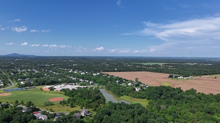
Aerial view of Poolesville, Maryland
-
Aerial view of the Roanoke Star [01]
![Aerial view of the Roanoke Star [01] (745 visits) Aerial view of the Roanoke Star, a landmark atop Mill Mountain in Roanoke, Virginia.
Ben Schumin is... Aerial view of the Roanoke Star [01]](../../../i/upload/2025/03/03/20250303104030-b2af10f4-cu_s9999x250.jpg)
-
Aerial view of the Roanoke Star [02]
![Aerial view of the Roanoke Star [02] (732 visits) Aerial view of the Roanoke Star, a landmark atop Mill Mountain in Roanoke, Virginia.
Ben Schumin is... Aerial view of the Roanoke Star [02]](../../../i/upload/2025/03/03/20250303104038-bfb5c40b-cu_s9999x250.jpg)
-
Aerial view of the Roanoke Star [03]
![Aerial view of the Roanoke Star [03] (721 visits) Aerial view of the Roanoke Star, a landmark atop Mill Mountain in Roanoke, Virginia.
Ben Schumin is... Aerial view of the Roanoke Star [03]](../../../i/upload/2025/03/03/20250303104044-0107081b-cu_s9999x250.jpg)
-
Aerial view of the Roanoke Star [04]
![Aerial view of the Roanoke Star [04] (739 visits) Aerial view of the Roanoke Star, a landmark atop Mill Mountain in Roanoke, Virginia.
Ben Schumin is... Aerial view of the Roanoke Star [04]](../../../i/upload/2025/03/03/20250303104050-2b9f8ca3-cu_s9999x250.jpg)
-
Aerial view of the Roanoke Star [05]
![Aerial view of the Roanoke Star [05] (720 visits) Aerial view of the Roanoke Star, a landmark atop Mill Mountain in Roanoke, Virginia.
Ben Schumin is... Aerial view of the Roanoke Star [05]](../../../i/upload/2025/03/03/20250303104057-ffa64f72-cu_s9999x250.jpg)
-
Aerial view of the Roanoke Star [06]
![Aerial view of the Roanoke Star [06] (743 visits) Aerial view of the Roanoke Star, a landmark atop Mill Mountain in Roanoke, Virginia.
Ben Schumin is... Aerial view of the Roanoke Star [06]](../../../i/upload/2025/03/03/20250303104103-f82a90f2-cu_s9999x250.jpg)
-
Aerial view of the Roanoke Star [07]
![Aerial view of the Roanoke Star [07] (722 visits) Aerial view of the Roanoke Star, a landmark atop Mill Mountain in Roanoke, Virginia.
Ben Schumin is... Aerial view of the Roanoke Star [07]](../../../i/upload/2025/03/03/20250303104109-3e9db85e-cu_s9999x250.jpg)
-
Aerial view of the Roanoke Star [08]
![Aerial view of the Roanoke Star [08] (711 visits) Aerial view of the Roanoke Star, a landmark atop Mill Mountain in Roanoke, Virginia.
Ben Schumin is... Aerial view of the Roanoke Star [08]](../../../i/upload/2025/03/03/20250303104116-72f4bf50-cu_s9999x250.jpg)
-
Aerial view of the Roanoke Star [09]
![Aerial view of the Roanoke Star [09] (731 visits) Aerial view of the Roanoke Star, a landmark atop Mill Mountain in Roanoke, Virginia.
Ben Schumin is... Aerial view of the Roanoke Star [09]](../../../i/upload/2025/03/03/20250303104122-0547d183-cu_s9999x250.jpg)
-
Aerial view of the Roanoke Star [10]
![Aerial view of the Roanoke Star [10] (734 visits) Aerial view of the Roanoke Star, a landmark atop Mill Mountain in Roanoke, Virginia.
Ben Schumin is... Aerial view of the Roanoke Star [10]](../../../i/upload/2025/03/03/20250303104127-fefb7546-cu_s9999x250.jpg)
-
Aerial view of the Roanoke Star [11]
![Aerial view of the Roanoke Star [11] (755 visits) Aerial view of the Roanoke Star, a landmark atop Mill Mountain in Roanoke, Virginia.
Ben Schumin is... Aerial view of the Roanoke Star [11]](../../../i/upload/2025/03/03/20250303104133-3d023ab1-cu_s9999x250.jpg)
-
Aerial view of the Roanoke Star [12]
![Aerial view of the Roanoke Star [12] (779 visits) Aerial view of the Roanoke Star, a landmark atop Mill Mountain in Roanoke, Virginia.
Ben Schumin is... Aerial view of the Roanoke Star [12]](../../../i/upload/2025/03/03/20250303104139-be18f38c-cu_s9999x250.jpg)
-
Aerial view of the Roanoke Star [13]
![Aerial view of the Roanoke Star [13] (771 visits) Aerial view of the Roanoke Star, a landmark atop Mill Mountain in Roanoke, Virginia.
Ben Schumin is... Aerial view of the Roanoke Star [13]](../../../i/upload/2025/03/03/20250303104145-f725aaf6-cu_s9999x250.jpg)
-
Site of former P. Buckley Moss Museum [01]
![Site of former P. Buckley Moss Museum [01] (247 visits) Site of the former P. Buckley Moss Museum in Waynesboro, Virginia. The museum, which featured works... Site of former P. Buckley Moss Museum [01]](../../../i/upload/2025/03/03/20250303185841-9c77b6ab-cu_s9999x250.jpg)
-
Site of former P. Buckley Moss Museum [02]
![Site of former P. Buckley Moss Museum [02] (244 visits) Site of the former P. Buckley Moss Museum in Waynesboro, Virginia. The museum, which featured works... Site of former P. Buckley Moss Museum [02]](../../../i/upload/2025/03/03/20250303185847-e161c5f3-cu_s9999x250.jpg)
-
Site of former P. Buckley Moss Museum [03]
![Site of former P. Buckley Moss Museum [03] (220 visits) Site of the former P. Buckley Moss Museum in Waynesboro, Virginia. The museum, which featured works... Site of former P. Buckley Moss Museum [03]](../../../i/upload/2025/03/03/20250303185852-c9c1e69f-cu_s9999x250.jpg)
-
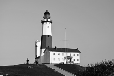
Montauk Point Light
