-
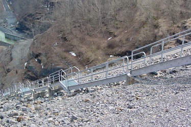
Stairs on Gathright Dam
-
Road over Gathright Dam [02]
![Road over Gathright Dam [02] (1602 visits) Road carrying traffic over Gathright Dam, an earthen and rolled rock-fill embankment dam on the Jack... Road over Gathright Dam [02]](../../../../i/upload/2024/07/14/20240714102132-396c8a23-cu_s9999x250.jpg)
-
Road over Gathright Dam [01]
![Road over Gathright Dam [01] (1651 visits) Road carrying traffic over Gathright Dam, an earthen and rolled rock-fill embankment dam on the Jack... Road over Gathright Dam [01]](../../../../i/upload/2024/07/14/20240714102138-0aa862c7-cu_s9999x250.jpg)
-
No parking sign on Gathright Dam [01]
![No parking sign on Gathright Dam [01] (1952 visits) "No parking" sign on the road over Gathright Dam. Parking is prohibited on the dam itself... No parking sign on Gathright Dam [01]](../../../../i/upload/2024/07/14/20240714102141-459f947d-cu_s9999x250.jpg)
-
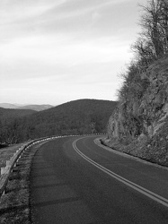
Blue Ridge Parkway at milepost 7
-
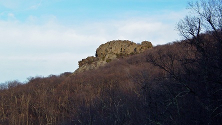
Humpback Rock, viewed from below
-
Cliff over the Blue Ridge Parkway [02]
![Cliff over the Blue Ridge Parkway [02] (2644 visits) Rock cliffs over the Blue Ridge Parkway, approximately seven miles south of Rockfish Gap.
Ben Schum... Cliff over the Blue Ridge Parkway [02]](../../../../i/upload/2024/07/15/20240715141127-8869144a-cu_s9999x250.jpg)
-
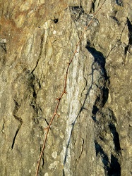
Thorns across a rock
-
Cliff over the Blue Ridge Parkway [01]
![Cliff over the Blue Ridge Parkway [01] (2457 visits) Rock cliffs over the Blue Ridge Parkway, approximately seven miles south of Rockfish Gap.
Ben Schum... Cliff over the Blue Ridge Parkway [01]](../../../../i/upload/2024/07/15/20240715141130-0117e715-cu_s9999x250.jpg)
-
Skyline Drive [01]
![Skyline Drive [01] (6279 visits) Southern end of Skyline Drive at Rockfish Gap, facing north. Due to snow conditions, this section o... Skyline Drive [01]](../../../../i/upload/2024/07/17/20240717224204-be6fd01b-cu_s9999x250.jpg)
-
Interstate 64 at Rockfish Gap [01]
![Interstate 64 at Rockfish Gap [01] (2408 visits) Interstate 64 at Rockfish Gap, viewed from the bridge to Skyline Drive at milepost 99, facing east.
... Interstate 64 at Rockfish Gap [01]](../../../../i/upload/2024/07/17/20240717224207-b7307f80-cu_s9999x250.jpg)
-
Interstate 64 at Rockfish Gap [02]
![Interstate 64 at Rockfish Gap [02] (2285 visits) Interstate 64 at Rockfish Gap, viewed from the bridge to Skyline Drive at milepost 99, facing east.
... Interstate 64 at Rockfish Gap [02]](../../../../i/upload/2024/07/17/20240717224209-142db162-cu_s9999x250.jpg)
-
Skyline Drive [02]
![Skyline Drive [02] (3796 visits) Southern end of Skyline Drive at Rockfish Gap, facing north. Due to snow conditions, this section o... Skyline Drive [02]](../../../../i/upload/2024/07/17/20240717224212-6e52dad3-cu_s9999x250.jpg)
-
Footprints on Skyline Drive bridge [01]
![Footprints on Skyline Drive bridge [01] (3946 visits) Footprints in the snow on the bridge carrying Skyline Drive over Interstate 64 at Rockfish Gap.
Ben... Footprints on Skyline Drive bridge [01]](../../../../i/upload/2024/07/17/20240717224215-a9df1920-cu_s9999x250.jpg)
-
Footprints on Skyline Drive bridge [02]
![Footprints on Skyline Drive bridge [02] (3894 visits) Footprints in the snow on the bridge carrying Skyline Drive over Interstate 64 at Rockfish Gap.
Ben... Footprints on Skyline Drive bridge [02]](../../../../i/upload/2024/07/17/20240717224219-2c9361e4-cu_s9999x250.jpg)
-
Interstate 64 at Rockfish Gap [02]
![Interstate 64 at Rockfish Gap [02] (2267 visits) Interstate 64 at Rockfish Gap, viewed from the bridge to Skyline Drive at milepost 99, facing west.
... Interstate 64 at Rockfish Gap [02]](../../../../i/upload/2024/07/17/20240717224221-105e5513-cu_s9999x250.jpg)
-
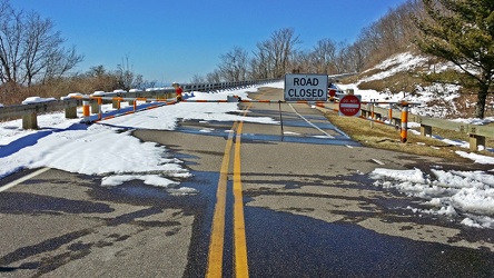
Skyline Drive barricade
-
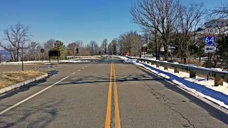
Road between Skyline Drive and the Blue Ridge Parkway
-
US 29 Business in Culpeper, Virginia [01]
![US 29 Business in Culpeper, Virginia [01] (3110 visits) Aerial view of US 29 Business on the north side of Culpeper, Virginia. View facing approximately ea... US 29 Business in Culpeper, Virginia [01]](../../../../i/upload/2024/07/19/20240719155959-cf1d0444-cu_s9999x250.jpg)
-
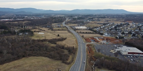
View down Lew Dewitt Boulevard
-
Springer Road and Sugarcamp Lane [01]
![Springer Road and Sugarcamp Lane [01] (2700 visits) Aerial view of Springer Road and Sugarcamp Lane, which together form a single residential street in ... Springer Road and Sugarcamp Lane [01]](../../../../i/upload/2024/07/19/20240719160916-bbfef2f3-cu_s9999x250.jpg)
-
Springer Road and Sugarcamp Lane [02]
![Springer Road and Sugarcamp Lane [02] (2779 visits) Aerial view of Springer Road and Sugarcamp Lane, which together form a single residential street in ... Springer Road and Sugarcamp Lane [02]](../../../../i/upload/2024/07/19/20240719160920-a73a3b63-cu_s9999x250.jpg)
-
Forest Springs Drive [04]
![Forest Springs Drive [04] (2547 visits) Aerial view of Forest Springs Drive, a residential street in Stuarts Draft, Virginia, facing north.
... Forest Springs Drive [04]](../../../../i/upload/2024/07/19/20240719160944-be5023e1-cu_s9999x250.jpg)
-
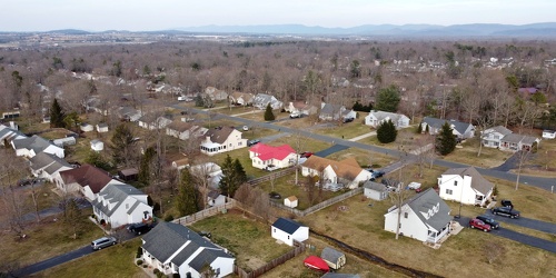
Cooper Drive
-
Richmond Avenue in Staunton, Virginia [01]
![Richmond Avenue in Staunton, Virginia [01] (66688 visits) Aerial view of Richmond Avenue (US 250) in Staunton, Virginia, near the intersection with Frontier D... Richmond Avenue in Staunton, Virginia [01]](../../../../i/upload/2024/07/19/20240719161158-ddf9fe35-cu_s9999x250.jpg)
-
Richmond Avenue in Staunton, Virginia [02]
![Richmond Avenue in Staunton, Virginia [02] (66763 visits) Aerial view of Richmond Avenue (US 250) in Staunton, Virginia, near the intersection with Frontier D... Richmond Avenue in Staunton, Virginia [02]](../../../../i/upload/2024/07/19/20240719161203-233bb776-cu_s9999x250.jpg)
-
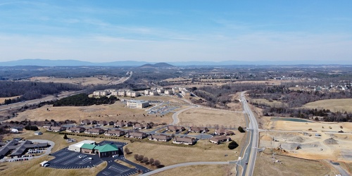
Fishersville, Virginia, near Augusta Health
-
Richmond Avenue in Staunton, Virginia [03]
![Richmond Avenue in Staunton, Virginia [03] (66594 visits) Aerial view of Richmond Avenue (US 250) in Staunton, Virginia, near the intersection with Community ... Richmond Avenue in Staunton, Virginia [03]](../../../../i/upload/2024/07/19/20240719161212-297c1b53-cu_s9999x250.jpg)
-
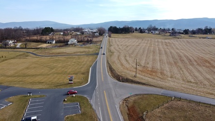
Tinkling Spring Road at Churchmans Mill Road
-
US 29 Business in Culpeper, Virginia [02]
![US 29 Business in Culpeper, Virginia [02] (457472 visits) Aerial view of US 29 Business on the north side of Culpeper, Virginia. View facing approximately we... US 29 Business in Culpeper, Virginia [02]](../../../../i/upload/2024/07/19/20240719165937-abc06307-cu_s9999x250.jpg)
-
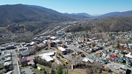
Downtown Clifton Forge, Virginia
-
Neighborhood in Clifton Forge, Virginia [01]
![Neighborhood in Clifton Forge, Virginia [01] (1153 visits) Aerial view of a neighborhood in Clifton Forge, Virginia, near downtown.
Ben Schumin is a professio... Neighborhood in Clifton Forge, Virginia [01]](../../../../i/upload/2024/07/20/20240720021719-e5828a4e-cu_s9999x250.jpg)
-
Neighborhood in Clifton Forge, Virginia [02]
![Neighborhood in Clifton Forge, Virginia [02] (1317 visits) Aerial view of a neighborhood in Clifton Forge, Virginia, near downtown.
Ben Schumin is a professio... Neighborhood in Clifton Forge, Virginia [02]](../../../../i/upload/2024/07/20/20240720021736-578bac29-cu_s9999x250.jpg)
-
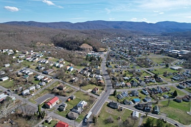
Neighborhoods in Covington, Virginia
-
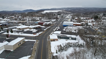
East Main Street in Waynesboro, Virginia
-
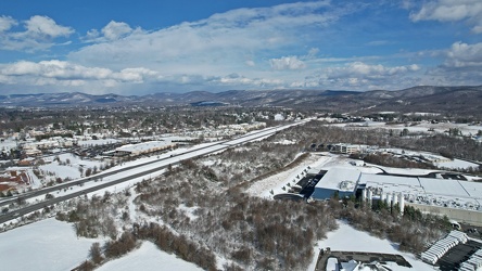
Interstate 64 corridor through Waynesboro, Virginia
-
Blue Ridge Tunnel [15]
![Blue Ridge Tunnel [15] (12614 visits) Tripod and camera set up at the western portal of the Blue Ridge Tunnel, an historic railroad tunnel... Blue Ridge Tunnel [15]](../../../../i/upload/2024/07/20/20240720144651-6fd9392c-cu_s9999x250.jpg)
-
Blue Ridge Tunnel [05]
![Blue Ridge Tunnel [05] (2971 visits) Interior of the Blue Ridge Tunnel, an historic railroad tunnel that carried rail traffic underneath ... Blue Ridge Tunnel [05]](../../../../i/upload/2024/07/20/20240720144657-e1250c4d-cu_s9999x250.jpg)
-
Blue Ridge Tunnel [04]
![Blue Ridge Tunnel [04] (3294 visits) Interior of the Blue Ridge Tunnel, an historic railroad tunnel that carried rail traffic underneath ... Blue Ridge Tunnel [04]](../../../../i/upload/2024/07/20/20240720144703-da172605-cu_s9999x250.jpg)
-
Blue Ridge Tunnel [09]
![Blue Ridge Tunnel [09] (2969 visits) Interior of the Blue Ridge Tunnel, an historic railroad tunnel that carried rail traffic underneath ... Blue Ridge Tunnel [09]](../../../../i/upload/2024/07/20/20240720144710-7ab1d7c8-cu_s9999x250.jpg)
-
Blue Ridge Tunnel [08]
![Blue Ridge Tunnel [08] (3026 visits) Interior of the Blue Ridge Tunnel, an historic railroad tunnel that carried rail traffic underneath ... Blue Ridge Tunnel [08]](../../../../i/upload/2024/07/20/20240720144716-42807dae-cu_s9999x250.jpg)
-
Blue Ridge Tunnel [11]
![Blue Ridge Tunnel [11] (2995 visits) Interior of the Blue Ridge Tunnel, an historic railroad tunnel that carried rail traffic underneath ... Blue Ridge Tunnel [11]](../../../../i/upload/2024/07/20/20240720144723-1e7c34bf-cu_s9999x250.jpg)
-
Blue Ridge Tunnel [03]
![Blue Ridge Tunnel [03] (3089 visits) Eastern portal of the Blue Ridge Tunnel, an historic railroad tunnel that carried rail traffic under... Blue Ridge Tunnel [03]](../../../../i/upload/2024/07/20/20240720144728-9e74f1bb-cu_s9999x250.jpg)
-
Blue Ridge Tunnel [02]
![Blue Ridge Tunnel [02] (3035 visits) Eastern portal of the Blue Ridge Tunnel, an historic railroad tunnel that carried rail traffic under... Blue Ridge Tunnel [02]](../../../../i/upload/2024/07/20/20240720144734-129eb4a4-cu_s9999x250.jpg)
-
Blue Ridge Tunnel [07]
![Blue Ridge Tunnel [07] (2947 visits) Interior of the Blue Ridge Tunnel, an historic railroad tunnel that carried rail traffic underneath ... Blue Ridge Tunnel [07]](../../../../i/upload/2024/07/20/20240720144740-6c95fb19-cu_s9999x250.jpg)
-
Blue Ridge Tunnel [06]
![Blue Ridge Tunnel [06] (2971 visits) Interior of the Blue Ridge Tunnel, an historic railroad tunnel that carried rail traffic underneath ... Blue Ridge Tunnel [06]](../../../../i/upload/2024/07/20/20240720144746-c53c4054-cu_s9999x250.jpg)
-
Blue Ridge Tunnel [14]
![Blue Ridge Tunnel [14] (3250 visits) Western portal of the Blue Ridge Tunnel, an historic railroad tunnel that carried rail traffic under... Blue Ridge Tunnel [14]](../../../../i/upload/2024/07/20/20240720144751-ae0e4ca1-cu_s9999x250.jpg)
-
Blue Ridge Tunnel [10]
![Blue Ridge Tunnel [10] (3195 visits) A stream of frozen water comes out of a wall of the Blue Ridge Tunnel, an historic railroad tunnel t... Blue Ridge Tunnel [10]](../../../../i/upload/2024/07/20/20240720144758-38e59beb-cu_s9999x250.jpg)
-
Blue Ridge Tunnel [13]
![Blue Ridge Tunnel [13] (3120 visits) A cell phone flashlight accidentally forms streaks on the image during a long-exposure photo of the ... Blue Ridge Tunnel [13]](../../../../i/upload/2024/07/20/20240720144804-bc9e7dc8-cu_s9999x250.jpg)
-
Blue Ridge Tunnel [01]
![Blue Ridge Tunnel [01] (3161 visits) Eastern portal of the Blue Ridge Tunnel, an historic railroad tunnel that carried rail traffic under... Blue Ridge Tunnel [01]](../../../../i/upload/2024/07/20/20240720144812-60655c76-cu_s9999x250.jpg)
-
Blue Ridge Tunnel [12]
![Blue Ridge Tunnel [12] (3040 visits) Interior of the Blue Ridge Tunnel, an historic railroad tunnel that carried rail traffic underneath ... Blue Ridge Tunnel [12]](../../../../i/upload/2024/07/20/20240720144818-8e5bbd5c-cu_s9999x250.jpg)
-
Blue Ridge Tunnel [16]
![Blue Ridge Tunnel [16] (12785 visits) Tripod and camera set up at the western portal of the Blue Ridge Tunnel, an historic railroad tunnel... Blue Ridge Tunnel [16]](../../../../i/upload/2024/07/20/20240720144824-fe9d4abd-cu_s9999x250.jpg)
-
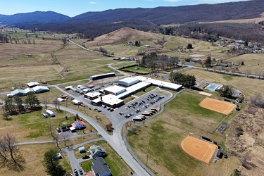
Highland County Schools
-
Aerial view of Monterey, Virginia [01]
![Aerial view of Monterey, Virginia [01] (1943 visits) Aerial view of Monterey, Virginia, a small town comprising the seat of Highland County.
More at The... Aerial view of Monterey, Virginia [01]](../../../../i/upload/2025/01/02/20250102005918-685606f9-cu_s9999x250.jpg)
-
Aerial view of Monterey, Virginia [02]
![Aerial view of Monterey, Virginia [02] (1950 visits) Aerial view of Monterey, Virginia, a small town comprising the seat of Highland County.
More at The... Aerial view of Monterey, Virginia [02]](../../../../i/upload/2025/01/02/20250102005923-7f7b9b83-cu_s9999x250.jpg)
-
Aerial view of Monterey, Virginia [03]
![Aerial view of Monterey, Virginia [03] (1902 visits) Aerial view of Monterey, Virginia, a small town comprising the seat of Highland County.
More at The... Aerial view of Monterey, Virginia [03]](../../../../i/upload/2025/01/02/20250102005929-2e84a9d0-cu_s9999x250.jpg)
-
Aerial view of Monterey, Virginia [04]
![Aerial view of Monterey, Virginia [04] (1909 visits) Aerial view of Monterey, Virginia, a small town comprising the seat of Highland County.
More at The... Aerial view of Monterey, Virginia [04]](../../../../i/upload/2025/01/02/20250102005937-281fae65-cu_s9999x250.jpg)
-
Aerial view of Monterey, Virginia [05]
![Aerial view of Monterey, Virginia [05] (1968 visits) Aerial view of Monterey, Virginia, a small town comprising the seat of Highland County.
More at The... Aerial view of Monterey, Virginia [05]](../../../../i/upload/2025/01/02/20250102005946-79efaa38-cu_s9999x250.jpg)
-
Aerial view of Monterey, Virginia [06]
![Aerial view of Monterey, Virginia [06] (1926 visits) Aerial view of Monterey, Virginia, a small town comprising the seat of Highland County.
More at The... Aerial view of Monterey, Virginia [06]](../../../../i/upload/2025/01/02/20250102005956-29786301-cu_s9999x250.jpg)
-
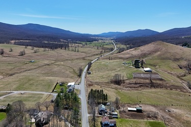
US 220 south of Monterey, Virginia
-
US 250 west of Monterey, Virginia
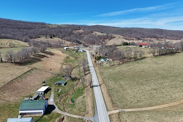
-
North end of Monterey, Virginia
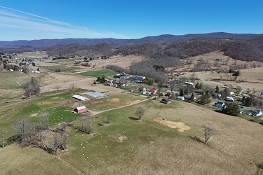
-
US 220 north of Monterey, Virginia
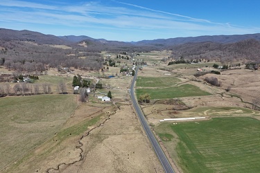
-
Routes 220 and 39 in Warm Springs, Virginia [01]
![Routes 220 and 39 in Warm Springs, Virginia [01] (1839 visits) US 220 and VA 39 in Warm Springs, Virginia, facing southwest. In this shot, US 220 runs top to bott... Routes 220 and 39 in Warm Springs, Virginia [01]](../../../../i/upload/2025/01/02/20250102141310-79aa8afd-cu_s9999x250.jpg)
-
Routes 220 and 39 in Warm Springs, Virginia [02]
![Routes 220 and 39 in Warm Springs, Virginia [02] (1838 visits) US 220 and VA 39 in Warm Springs, Virginia, facing southwest. In this shot, US 220 is the road to t... Routes 220 and 39 in Warm Springs, Virginia [02]](../../../../i/upload/2025/01/02/20250102141319-a5501ace-cu_s9999x250.jpg)
-
Aerial view of Hot Springs, Virginia
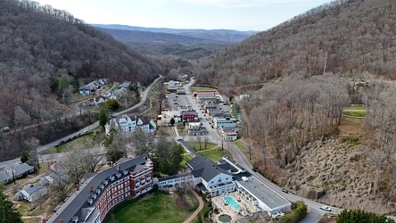
-
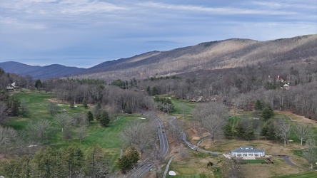
View along US 220 northbound in Hot Springs, Virginia
-
No parking sign on Gathright Dam [02]
![No parking sign on Gathright Dam [02] (685 visits) No parking sign on the road across Gathright Dam, an embankment dam in Alleghany County, Virginia th... No parking sign on Gathright Dam [02]](../../../../i/upload/2025/01/02/20250102213928-b14b8899-cu_s9999x250.jpg)
-
Buffalo Gap [02]
![Buffalo Gap [02] (765 visits) Buffalo Gap, a mountain pass through Little North Mountain, near Swoope, Virginia.
More at The Sc... Buffalo Gap [02]](../../../../i/upload/2025/01/03/20250103200607-1abe8192-cu_s9999x250.jpg)