-
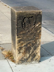
Boundary marker between Maryland and DC
-
Sandy Point State Park [17]
![Sandy Point State Park [17] (10574 visits) Sandy Point State Park is a public park located on the western shore of the Chesapeake Bay, at the f... Sandy Point State Park [17]](../../../../i/upload/2024/07/17/20240717154014-be41eb94-cu_s9999x250.jpg)
-
Sandy Point State Park [18]
![Sandy Point State Park [18] (10590 visits) Sandy Point State Park is a public park located on the western shore of the Chesapeake Bay, at the f... Sandy Point State Park [18]](../../../../i/upload/2024/07/17/20240717154017-ca30a51c-cu_s9999x250.jpg)
-
Sandy Point State Park [20]
![Sandy Point State Park [20] (2164 visits) Sandy Point State Park is a public park located on the western shore of the Chesapeake Bay, at the f... Sandy Point State Park [20]](../../../../i/upload/2024/07/17/20240717154034-68af9714-cu_s9999x250.jpg)
-
Sandy Point State Park [21]
![Sandy Point State Park [21] (2522 visits) Sandy Point State Park is a public park located on the western shore of the Chesapeake Bay, at the f... Sandy Point State Park [21]](../../../../i/upload/2024/07/17/20240717154038-08e83126-cu_s9999x250.jpg)
-
Sandy Point State Park [22]
![Sandy Point State Park [22] (2844 visits) Sandy Point State Park is a public park located on the western shore of the Chesapeake Bay, at the f... Sandy Point State Park [22]](../../../../i/upload/2024/07/17/20240717154040-7e275d80-cu_s9999x250.jpg)
-
Sandy Point State Park [23]
![Sandy Point State Park [23] (2427 visits) Sandy Point State Park is a public park located on the western shore of the Chesapeake Bay, at the f... Sandy Point State Park [23]](../../../../i/upload/2024/07/17/20240717154043-4dc7ea44-cu_s9999x250.jpg)
-
Sandy Point State Park [24]
![Sandy Point State Park [24] (3039 visits) Sandy Point State Park is a public park located on the western shore of the Chesapeake Bay, at the f... Sandy Point State Park [24]](../../../../i/upload/2024/07/17/20240717154045-1afae40e-cu_s9999x250.jpg)
-
Sandy Point State Park [25]
![Sandy Point State Park [25] (2329 visits) Sandy Point State Park is a public park located on the western shore of the Chesapeake Bay, at the f... Sandy Point State Park [25]](../../../../i/upload/2024/07/17/20240717154048-8e13e657-cu_s9999x250.jpg)
-
Sandy Point State Park [26]
![Sandy Point State Park [26] (2529 visits) Sandy Point State Park is a public park located on the western shore of the Chesapeake Bay, at the f... Sandy Point State Park [26]](../../../../i/upload/2024/07/17/20240717154051-2d01ed85-cu_s9999x250.jpg)
-
Sandy Point State Park [29]
![Sandy Point State Park [29] (2507 visits) Sandy Point State Park is a public park located on the western shore of the Chesapeake Bay, at the f... Sandy Point State Park [29]](../../../../i/upload/2024/07/17/20240717154058-28dd221e-cu_s9999x250.jpg)
-
Sandy Point State Park [32]
![Sandy Point State Park [32] (2806 visits) Sandy Point State Park is a public park located on the western shore of the Chesapeake Bay, at the f... Sandy Point State Park [32]](../../../../i/upload/2024/07/17/20240717154107-ae095df9-cu_s9999x250.jpg)
-
Sandy Point State Park [37]
![Sandy Point State Park [37] (2615 visits) Sandy Point State Park is a public park located on the western shore of the Chesapeake Bay, at the f... Sandy Point State Park [37]](../../../../i/upload/2024/07/17/20240717154119-d4d32e67-cu_s9999x250.jpg)
-
Sandy Point State Park [46]
![Sandy Point State Park [46] (3669 visits) Sandy Point State Park is a public park located on the western shore of the Chesapeake Bay, at the f... Sandy Point State Park [46]](../../../../i/upload/2024/07/17/20240717154143-90c031b6-cu_s9999x250.jpg)
-
Potomac River from US 340 bridge [01]
![Potomac River from US 340 bridge [01] (3178 visits) The Potomac River, viewed from the US 340 bridge between Maryland and Virginia.
More at The Schumin... Potomac River from US 340 bridge [01]](../../../../i/upload/2024/07/17/20240717160356-3d771bff-cu_s9999x250.jpg)
-
Potomac River from US 340 bridge [02]
![Potomac River from US 340 bridge [02] (1418 visits) The Potomac River, viewed from the US 340 bridge between Maryland and Virginia.
More at The Schumin... Potomac River from US 340 bridge [02]](../../../../i/upload/2024/07/17/20240717160407-a08a06a9-cu_s9999x250.jpg)
-
Volkswagen Beetle on Blair Stone Lane [01]
![Volkswagen Beetle on Blair Stone Lane [01] (1343 visits) Classic Volkswagen Beetle on Blair Stone Lane in Aspen Hill, Maryland.
Ben Schumin is a professiona... Volkswagen Beetle on Blair Stone Lane [01]](../../../../i/upload/2024/07/17/20240717224908-e87f9070-cu_s9999x250.jpg)
-
Volkswagen Beetle on Blair Stone Lane [02]
![Volkswagen Beetle on Blair Stone Lane [02] (1273 visits) Classic Volkswagen Beetle on Blair Stone Lane in Aspen Hill, Maryland.
Ben Schumin is a professiona... Volkswagen Beetle on Blair Stone Lane [02]](../../../../i/upload/2024/07/17/20240717224911-17fad279-cu_s9999x250.jpg)
-
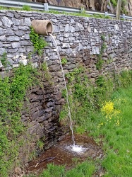
Drainage pipe
-
Abandoned house [01]
![Abandoned house [01] (2166 visits) Abandoned house along Harpers Ferry Road, adjacent to Maryland Heights and the CSX railroad bridge.
... Abandoned house [01]](../../../../i/upload/2024/07/17/20240717230055-c63c5bfc-cu_s9999x250.jpg)
-
Abandoned house [02]
![Abandoned house [02] (2346 visits) Abandoned house along Harpers Ferry Road, adjacent to Maryland Heights and the CSX railroad bridge.
... Abandoned house [02]](../../../../i/upload/2024/07/17/20240717230058-5d1cb340-cu_s9999x250.jpg)
-
Abandoned rowhouse at North Calvert and East Read Streets [01]
![Abandoned rowhouse at North Calvert and East Read Streets [01] (1986 visits) Fire-damaged and abandoned rowhouse at the intersection of North Calvert and East Read Streets in Ba... Abandoned rowhouse at North Calvert and East Read Streets [01]](../../../../i/upload/2024/07/17/20240717231156-4875201d-cu_s9999x250.jpg)
-
Abandoned rowhouse at North Calvert and East Read Streets [02]
![Abandoned rowhouse at North Calvert and East Read Streets [02] (2167 visits) Fire-damaged and abandoned rowhouse at the intersection of North Calvert and East Read Streets in Ba... Abandoned rowhouse at North Calvert and East Read Streets [02]](../../../../i/upload/2024/07/17/20240717231200-c1bee20f-cu_s9999x250.jpg)
-
Abandoned rowhouse at North Calvert and East Read Streets [03]
![Abandoned rowhouse at North Calvert and East Read Streets [03] (3071 visits) Fire-damaged and abandoned rowhouse at the intersection of North Calvert and East Read Streets in Ba... Abandoned rowhouse at North Calvert and East Read Streets [03]](../../../../i/upload/2024/07/17/20240717231204-3ffcc48a-cu_s9999x250.jpg)
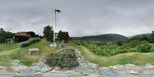
 View from Hilltop House
 South Mountain rest area, westbound [01]
![South Mountain rest area, westbound [01] (3159 visits) South Mountain rest area and welcome center on Interstate 70 westbound in Frederick County, Maryland... South Mountain rest area, westbound [01]](../../../../i/upload/2024/07/17/20240717233435-e2f89cc0-cu_s9999x250.jpg)
 South Mountain rest area, westbound [02]
![South Mountain rest area, westbound [02] (3208 visits) South Mountain rest area and welcome center on Interstate 70 westbound in Frederick County, Maryland... South Mountain rest area, westbound [02]](../../../../i/upload/2024/07/17/20240717233440-268e200a-cu_s9999x250.jpg)
 South Mountain rest area, westbound [03]
![South Mountain rest area, westbound [03] (3412 visits) South Mountain rest area and welcome center on Interstate 70 westbound in Frederick County, Maryland... South Mountain rest area, westbound [03]](../../../../i/upload/2024/07/17/20240717233445-c0e160fc-cu_s9999x250.jpg)
 South Mountain rest area, westbound [04]
![South Mountain rest area, westbound [04] (3188 visits) South Mountain rest area and welcome center on Interstate 70 westbound in Frederick County, Maryland... South Mountain rest area, westbound [04]](../../../../i/upload/2024/07/17/20240717233450-8d5d68a3-cu_s9999x250.jpg)
 South Mountain rest area, westbound [05]
![South Mountain rest area, westbound [05] (3248 visits) South Mountain rest area and welcome center on Interstate 70 westbound in Frederick County, Maryland... South Mountain rest area, westbound [05]](../../../../i/upload/2024/07/17/20240717233455-aa6194ef-cu_s9999x250.jpg)
 Western Maryland Scenic Railroad station [05]
![Western Maryland Scenic Railroad station [05] (3080 visits) Station for the Western Maryland Scenic Railroad in Cumberland, Maryland.
More at The Schumin Web:
... Western Maryland Scenic Railroad station [05]](../../../../i/upload/2024/07/17/20240717233553-3b21af47-cu_s9999x250.jpg)
 Western Maryland Scenic Railroad station [06]
![Western Maryland Scenic Railroad station [06] (3972 visits) Station for the Western Maryland Scenic Railroad in Cumberland, Maryland.
More at The Schumin Web:
... Western Maryland Scenic Railroad station [06]](../../../../i/upload/2024/07/17/20240717233558-d030848d-cu_s9999x250.jpg)
 Western Maryland Scenic Railroad tracks [03]
![Western Maryland Scenic Railroad tracks [03] (3870 visits) Tracks for the Western Maryland Scenic Railroad in Cumberland, Maryland.
More at The Schumin Web:
w... Western Maryland Scenic Railroad tracks [03]](../../../../i/upload/2024/07/17/20240717233606-3c9ba6bb-cu_s9999x250.jpg)
-
View from High Rock around sunset [01]
![View from High Rock around sunset [01] (3552 visits) View from High Rock, a rock outcropping on South Mountain in Pen Mar, Maryland, in Washington County... View from High Rock around sunset [01]](../../../../i/upload/2024/07/18/20240718125414-4cca566c-cu_s9999x250.jpg)
-
View from High Rock around sunset [02]
![View from High Rock around sunset [02] (1346 visits) View from High Rock, a rock outcropping on South Mountain in Pen Mar, Maryland, in Washington County... View from High Rock around sunset [02]](../../../../i/upload/2024/07/18/20240718125419-06cd22f4-cu_s9999x250.jpg)
-
View from High Rock around sunset [03]
![View from High Rock around sunset [03] (1376 visits) View from High Rock, a rock outcropping on South Mountain in Pen Mar, Maryland, in Washington County... View from High Rock around sunset [03]](../../../../i/upload/2024/07/18/20240718125422-7938edf7-cu_s9999x250.jpg)
-
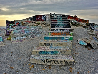
Steps to main overlook at High Rock
-
People standing on High Rock [01]
![People standing on High Rock [01] (1984 visits) People standing on and around High Rock, a rock outcropping on South Mountain in Pen Mar, Maryland, ... People standing on High Rock [01]](../../../../i/upload/2024/07/18/20240718125430-49f5c2ff-cu_s9999x250.jpg)
-
View from High Rock around sunset [04]
![View from High Rock around sunset [04] (1808 visits) View from High Rock, a rock outcropping on South Mountain in Pen Mar, Maryland, in Washington County... View from High Rock around sunset [04]](../../../../i/upload/2024/07/18/20240718125433-8a060ae7-cu_s9999x250.jpg)
-
Graffiti-covered stone at High Rock [01]
![Graffiti-covered stone at High Rock [01] (1978 visits) Graffiti-covered stone at High Rock, a rock outcropping on South Mountain in Pen Mar, Maryland, in W... Graffiti-covered stone at High Rock [01]](../../../../i/upload/2024/07/18/20240718125437-b92b052f-cu_s9999x250.jpg)
-
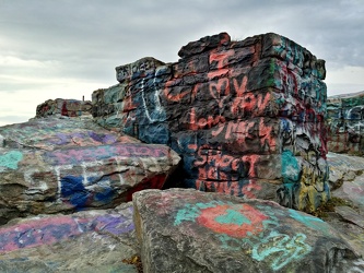
Graffiti-covered stones at High Rock
-
View from High Rock around sunset [05]
![View from High Rock around sunset [05] (1820 visits) View from High Rock, a rock outcropping on South Mountain in Pen Mar, Maryland, in Washington County... View from High Rock around sunset [05]](../../../../i/upload/2024/07/18/20240718125445-9b7d8206-cu_s9999x250.jpg)
-
View from High Rock around sunset [06]
![View from High Rock around sunset [06] (1859 visits) View from High Rock, a rock outcropping on South Mountain in Pen Mar, Maryland, in Washington County... View from High Rock around sunset [06]](../../../../i/upload/2024/07/18/20240718125449-9904b382-cu_s9999x250.jpg)
-
View from High Rock around sunset [07]
![View from High Rock around sunset [07] (1844 visits) View from High Rock, a rock outcropping on South Mountain in Pen Mar, Maryland, in Washington County... View from High Rock around sunset [07]](../../../../i/upload/2024/07/18/20240718125452-a060fd82-cu_s9999x250.jpg)
-
Graffiti-covered stone at High Rock [02]
![Graffiti-covered stone at High Rock [02] (1872 visits) Graffiti-covered stone at High Rock, a rock outcropping on South Mountain in Pen Mar, Maryland, in W... Graffiti-covered stone at High Rock [02]](../../../../i/upload/2024/07/18/20240718125456-e62dc4ce-cu_s9999x250.jpg)
-
Graffiti-covered stone at High Rock [03]
![Graffiti-covered stone at High Rock [03] (1775 visits) Graffiti-covered stone at High Rock, a rock outcropping on South Mountain in Pen Mar, Maryland, in W... Graffiti-covered stone at High Rock [03]](../../../../i/upload/2024/07/18/20240718125500-5ab7b0f5-cu_s9999x250.jpg)
-
Graffiti-covered stone at High Rock [04]
![Graffiti-covered stone at High Rock [04] (1798 visits) Graffiti-covered stone at High Rock, a rock outcropping on South Mountain in Pen Mar, Maryland, in W... Graffiti-covered stone at High Rock [04]](../../../../i/upload/2024/07/18/20240718125505-6e88d549-cu_s9999x250.jpg)
-
People standing on High Rock [02]
![People standing on High Rock [02] (1877 visits) People standing on and around High Rock, a rock outcropping on South Mountain in Pen Mar, Maryland, ... People standing on High Rock [02]](../../../../i/upload/2024/07/18/20240718125509-fb973c54-cu_s9999x250.jpg)
-
Two women sitting on High Rock

-
Two women looking at their cell phones at High Rock

-
Four teens looking at their phones on High Rock

-
Two people standing on High Rock

-
Couple looking at their cell phones at High Rock

-
Couple taking photos from High Rock

-
View from High Rock around sunset [08]
![View from High Rock around sunset [08] (1396 visits) View from High Rock, a rock outcropping on South Mountain in Pen Mar, Maryland, in Washington County... View from High Rock around sunset [08]](../../../../i/upload/2024/07/18/20240718125539-68d743dd-cu_s9999x250.jpg)
-
View from High Rock around sunset [09]
![View from High Rock around sunset [09] (1460 visits) View from High Rock, a rock outcropping on South Mountain in Pen Mar, Maryland, in Washington County... View from High Rock around sunset [09]](../../../../i/upload/2024/07/18/20240718125542-d5f04008-cu_s9999x250.jpg)
-
View from High Rock around sunset [10]
![View from High Rock around sunset [10] (1478 visits) View from High Rock, a rock outcropping on South Mountain in Pen Mar, Maryland, in Washington County... View from High Rock around sunset [10]](../../../../i/upload/2024/07/18/20240718125546-0de77111-cu_s9999x250.jpg)
-
View from High Rock around sunset [11]
![View from High Rock around sunset [11] (1640 visits) View from High Rock, a rock outcropping on South Mountain in Pen Mar, Maryland, in Washington County... View from High Rock around sunset [11]](../../../../i/upload/2024/07/18/20240718125550-f940cb2a-cu_s9999x250.jpg)
-
View of the sunset from High Rock [01]
![View of the sunset from High Rock [01] (1687 visits) View of the sunset from High Rock, a rock outcropping on South Mountain in Pen Mar, Maryland, in Was... View of the sunset from High Rock [01]](../../../../i/upload/2024/07/18/20240718125553-1df4c653-cu_s9999x250.jpg)
-
View of the sunset from High Rock [02]
![View of the sunset from High Rock [02] (1579 visits) View of the sunset from High Rock, a rock outcropping on South Mountain in Pen Mar, Maryland, in Was... View of the sunset from High Rock [02]](../../../../i/upload/2024/07/18/20240718125557-d168466e-cu_s9999x250.jpg)
-
View of the sunset from High Rock [03]
![View of the sunset from High Rock [03] (1723 visits) View of the sunset from High Rock, a rock outcropping on South Mountain in Pen Mar, Maryland, in Was... View of the sunset from High Rock [03]](../../../../i/upload/2024/07/18/20240718125601-a2d71104-cu_s9999x250.jpg)
-
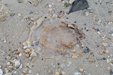
Beached mushroom cap jellyfish
-
Rocks in the Potomac River [01]
![Rocks in the Potomac River [01] (980 visits) Rocks in the Potomac River near Harpers Ferry. Viewed from the US 340 bridge.
Ben Schumin is a pro... Rocks in the Potomac River [01]](../../../../i/upload/2024/07/19/20240719103333-6083493b-cu_s9999x250.jpg)
-
Rocks in the Potomac River [02]
![Rocks in the Potomac River [02] (929 visits) Rocks in the Potomac River near Harpers Ferry. Viewed from the US 340 bridge.
Ben Schumin is a pro... Rocks in the Potomac River [02]](../../../../i/upload/2024/07/19/20240719103338-04e1c1e1-cu_s9999x250.jpg)
-
Rocks in the Potomac River [03]
![Rocks in the Potomac River [03] (927 visits) Rocks in the Potomac River near Harpers Ferry. Viewed from the US 340 bridge.
Ben Schumin is a pro... Rocks in the Potomac River [03]](../../../../i/upload/2024/07/19/20240719103343-404e77e5-cu_s9999x250.jpg)
-
Rocks in the Potomac River [04]
![Rocks in the Potomac River [04] (941 visits) Rocks in the Potomac River near Harpers Ferry. Viewed from the US 340 bridge.
Ben Schumin is a pro... Rocks in the Potomac River [04]](../../../../i/upload/2024/07/19/20240719103348-1a3aef78-cu_s9999x250.jpg)
-
Rocks in the Potomac River [05]
![Rocks in the Potomac River [05] (1003 visits) Rocks in the Potomac River near Harpers Ferry. Viewed from the US 340 bridge.
Ben Schumin is a pro... Rocks in the Potomac River [05]](../../../../i/upload/2024/07/19/20240719103353-ea395458-cu_s9999x250.jpg)
-
Potomac River from US 340 bridge [03]
![Potomac River from US 340 bridge [03] (1014 visits) The Potomac River, viewed from the US 340 bridge between Maryland and Virginia.
Ben Schumin is a pr... Potomac River from US 340 bridge [03]](../../../../i/upload/2024/07/19/20240719103359-b66380e8-cu_s9999x250.jpg)
-
Potomac River from US 340 bridge [04]
![Potomac River from US 340 bridge [04] (1097 visits) The Potomac River, viewed from the US 340 bridge between Maryland and Virginia.
Ben Schumin is a pr... Potomac River from US 340 bridge [04]](../../../../i/upload/2024/07/19/20240719103405-18d26a8b-cu_s9999x250.jpg)
-
Potomac River from US 340 bridge [05]
![Potomac River from US 340 bridge [05] (1113 visits) The Potomac River, viewed from the US 340 bridge between Maryland and Virginia.
Ben Schumin is a pr... Potomac River from US 340 bridge [05]](../../../../i/upload/2024/07/19/20240719103412-5b42c5b9-cu_s9999x250.jpg)
-
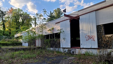
Former Aerolab Supply building
-
Grave of Zachariah MacCubbin Waters [01]
![Grave of Zachariah MacCubbin Waters [01] (1068 visits) Grave of Zachariah MacCubbin Waters at Goshen Mennonite Cemetery in Montgomery County, Maryland.
Be... Grave of Zachariah MacCubbin Waters [01]](../../../../i/upload/2024/07/19/20240719105617-1fe8d42e-cu_s9999x250.jpg)
-
Grave of Zachariah MacCubbin Waters [02]
![Grave of Zachariah MacCubbin Waters [02] (1101 visits) Grave of Zachariah MacCubbin Waters at Goshen Mennonite Cemetery in Montgomery County, Maryland.
Be... Grave of Zachariah MacCubbin Waters [02]](../../../../i/upload/2024/07/19/20240719105621-1b560cf1-cu_s9999x250.jpg)
-
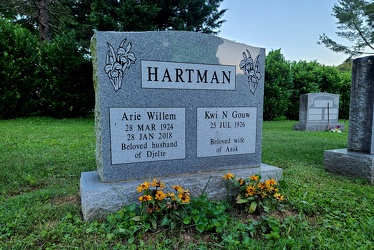
Hartman plot at Goshen Mennonite Cemetery
-
Hope Hill Cemetery [08]
![Hope Hill Cemetery [08] (2917 visits) Grave of Charles E. Cosley at Hope Hill Cemetery in Urbana, Maryland.
Ben Schumin is a professional... Hope Hill Cemetery [08]](../../../../i/upload/2024/07/19/20240719105908-e21902bd-cu_s9999x250.jpg)
-
Hope Hill Cemetery [07]
![Hope Hill Cemetery [07] (1359 visits) Grave of Madeline A. Holland Cosley at Hope Hill Cemetery in Urbana, Maryland.
Ben Schumin is a pro... Hope Hill Cemetery [07]](../../../../i/upload/2024/07/19/20240719105915-6e1cae78-cu_s9999x250.jpg)
-
Hope Hill Cemetery [05]
![Hope Hill Cemetery [05] (1461 visits) Grave of James T. Lee at Hope Hill Cemetery in Urbana, Maryland.
Ben Schumin is a professional phot... Hope Hill Cemetery [05]](../../../../i/upload/2024/07/19/20240719110003-e4826257-cu_s9999x250.jpg)
-
Hope Hill Cemetery [04]
![Hope Hill Cemetery [04] (1370 visits) Grave of Calvin H. Diggs at Hope Hill Cemetery in Urbana, Maryland.
Ben Schumin is a professional p... Hope Hill Cemetery [04]](../../../../i/upload/2024/07/19/20240719110010-55e4472d-cu_s9999x250.jpg)
-
Hope Hill Cemetery [03]
![Hope Hill Cemetery [03] (1674 visits) Grave of Reginald Demond Diggs at Hope Hill Cemetery in Urbana, Maryland.
Ben Schumin is a professi... Hope Hill Cemetery [03]](../../../../i/upload/2024/07/19/20240719110015-574903d6-cu_s9999x250.jpg)
-
Hope Hill Cemetery [02]
![Hope Hill Cemetery [02] (1351 visits) Grave of Yvonne L. Howard at Hope Hill Cemetery in Urbana, Maryland.
Ben Schumin is a professiona... Hope Hill Cemetery [02]](../../../../i/upload/2024/07/19/20240719110021-72a26e4b-cu_s9999x250.jpg)