-
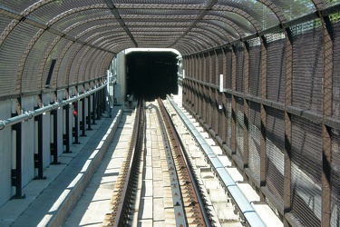
Short section of track in cages
-
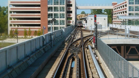
Largo interlocking
-
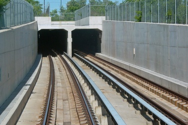
Tunnel portal outside Addison Road station
-
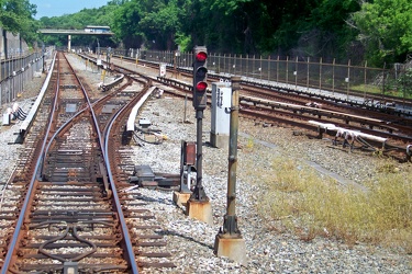
Silver Spring pocket track
-
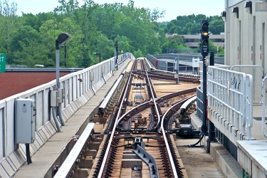
Largo Town Center interlocking
-
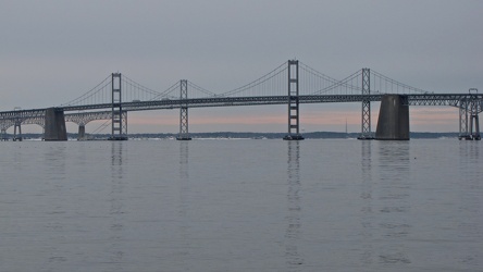
Chesapeake Bay Bridge from Sandy Point State Park
-
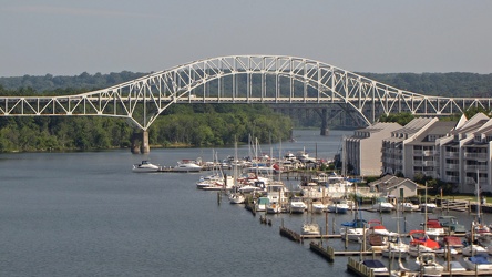
Thomas J. Hatem Memorial Bridge
-
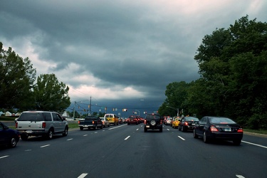
Storm clouds at Georgia Avenue and Norbeck Road
-
Georgia Avenue and Dennis Avenue
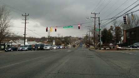
-
Traffic signal communication splicing box along Great Seneca Highway [01]
![Traffic signal communication splicing box along Great Seneca Highway [01] (3383 visits) Traffic signal communication splicing box along Great Seneca Highway (MD 119) in Germantown, Marylan... Traffic signal communication splicing box along Great Seneca Highway [01]](../../../../i/upload/2024/07/17/20240717225201-c9532446-cu_s9999x250.jpg)
-
Traffic signal communication splicing box along Great Seneca Highway [02]
![Traffic signal communication splicing box along Great Seneca Highway [02] (3442 visits) Traffic signal communication splicing box along Great Seneca Highway (MD 119) in Germantown, Marylan... Traffic signal communication splicing box along Great Seneca Highway [02]](../../../../i/upload/2024/07/17/20240717225205-bb6762c9-cu_s9999x250.jpg)
-
Germantown sign [01]
![Germantown sign [01] (2081 visits) Sign for Germantown on northbound Great Seneca Highway (MD 119) in Montgomery County, Maryland.
Ben... Germantown sign [01]](../../../../i/upload/2024/07/17/20240717225208-2e6d8cf5-cu_s9999x250.jpg)
-
Germantown sign [02]
![Germantown sign [02] (2346 visits) Sign for Germantown on northbound Great Seneca Highway (MD 119) in Montgomery County, Maryland.
Ben... Germantown sign [02]](../../../../i/upload/2024/07/17/20240717225211-8a697e7e-cu_s9999x250.jpg)
-
Germantown sign [03]
![Germantown sign [03] (1916 visits) Sign for Germantown on northbound Great Seneca Highway (MD 119) in Montgomery County, Maryland.
Ben... Germantown sign [03]](../../../../i/upload/2024/07/17/20240717225214-b1e075c3-cu_s9999x250.jpg)
-
Germantown sign [04]
![Germantown sign [04] (2035 visits) Sign for Germantown on northbound Great Seneca Highway (MD 119) in Montgomery County, Maryland.
Ben... Germantown sign [04]](../../../../i/upload/2024/07/17/20240717225218-e9d1efc2-cu_s9999x250.jpg)
-
Pedestrian bridge over railroad tracks [01]
![Pedestrian bridge over railroad tracks [01] (3300 visits) Enclosed pedestrian bridge over tracks for the CSX Capital Subdivision and Metro's E Route (used for... Pedestrian bridge over railroad tracks [01]](../../../../i/upload/2024/07/17/20240717225530-ceafb4d6-cu_s9999x250.jpg)
-
Pedestrian bridge over railroad tracks [02]
![Pedestrian bridge over railroad tracks [02] (2754 visits) Enclosed pedestrian bridge over tracks for the CSX Capital Subdivision and Metro's E Route (used for... Pedestrian bridge over railroad tracks [02]](../../../../i/upload/2024/07/17/20240717225534-85dfcb83-cu_s9999x250.jpg)
-
Pedestrian bridge over railroad tracks [03]
![Pedestrian bridge over railroad tracks [03] (2208 visits) Enclosed pedestrian bridge over tracks for the CSX Capital Subdivision and Metro's E Route (used for... Pedestrian bridge over railroad tracks [03]](../../../../i/upload/2024/07/17/20240717225538-a51c9a7b-cu_s9999x250.jpg)
-
Pedestrian bridge over railroad tracks [04]
![Pedestrian bridge over railroad tracks [04] (3024 visits) Enclosed pedestrian bridge over tracks for the CSX Capital Subdivision and Metro's E Route (used for... Pedestrian bridge over railroad tracks [04]](../../../../i/upload/2024/07/17/20240717225542-53a9ebf9-cu_s9999x250.jpg)
-
Pedestrian bridge over railroad tracks [05]
![Pedestrian bridge over railroad tracks [05] (3031 visits) Enclosed pedestrian bridge over tracks for the CSX Capital Subdivision and Metro's E Route (used for... Pedestrian bridge over railroad tracks [05]](../../../../i/upload/2024/07/17/20240717225546-deffa9ba-cu_s9999x250.jpg)
-
Pedestrian bridge over railroad tracks [06]
![Pedestrian bridge over railroad tracks [06] (2155 visits) Enclosed pedestrian bridge over tracks for the CSX Capital Subdivision and Metro's E Route (used for... Pedestrian bridge over railroad tracks [06]](../../../../i/upload/2024/07/17/20240717225549-2521e2ec-cu_s9999x250.jpg)
-
Washington Metro bridge over Paint Branch Trail
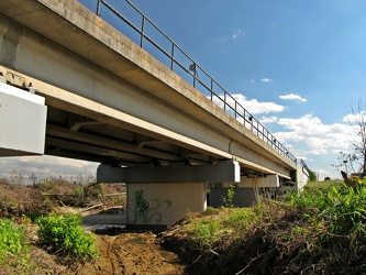
-
Green Line train crosses bridge over Paint Branch Trail
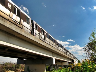
-
Intercounty Connector at Longmead Crossing Drive
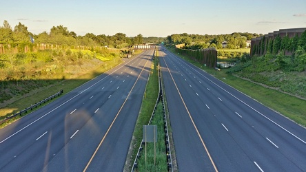
-
Intercounty Connector bike trail [01]
![Intercounty Connector bike trail [01] (1995 visits) Bike trail paralleling the Intercounty Connector and Wintergate Drive, facing westbound.
Ben Schumi... Intercounty Connector bike trail [01]](../../../../i/upload/2024/07/17/20240717230853-3f3f70f4-cu_s9999x250.jpg)
-
Intercounty Connector at Norbeck Road
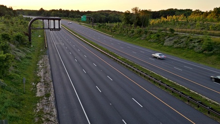
-
Intercounty Connector
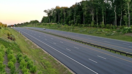
-
Intercounty Connector bike trail [02]
![Intercounty Connector bike trail [02] (2059 visits) Bike trail paralleling the Intercounty Connector, facing westbound.
Ben Schumin is a professional p... Intercounty Connector bike trail [02]](../../../../i/upload/2024/07/17/20240717230902-e4af2704-cu_s9999x250.jpg)
-
Intercounty Connector bike trail [03]
![Intercounty Connector bike trail [03] (1942 visits) Bike trail paralleling the Intercounty Connector, facing eastbound.
Ben Schumin is a professional p... Intercounty Connector bike trail [03]](../../../../i/upload/2024/07/17/20240717230905-fd85639a-cu_s9999x250.jpg)
-
Intercounty Connector toll gantry
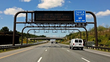
-
Bridges for Maryland Route 100
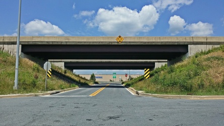
-
US 301 sign at St. Charles Towne Center
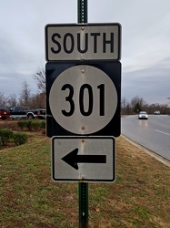
-
Maryland 68 vs. Interstate 68 sign [01]
![Maryland 68 vs. Interstate 68 sign [01] (3043 visits) Sign on westbound Interstate 70 ahead of exit 18, indicating that the next exit is for Maryland Rout... Maryland 68 vs. Interstate 68 sign [01]](../../../../i/upload/2024/07/19/20240719004016-a5d58dda-cu_s9999x250.jpg)
-
Maryland 68 vs. Interstate 68 sign [02]
![Maryland 68 vs. Interstate 68 sign [02] (1649 visits) Sign on westbound Interstate 70 ahead of exit 18, indicating that the next exit is for Maryland Rout... Maryland 68 vs. Interstate 68 sign [02]](../../../../i/upload/2024/07/19/20240719004125-0cff4906-cu_s9999x250.jpg)
-
Point of Rocks [01]
![Point of Rocks [01] (1810 visits) The Point of Rocks Bridge, which carries US 15 over the Potomac River between Loudoun County, Virgin... Point of Rocks [01]](../../../../i/upload/2024/07/19/20240719101023-a2888aa2-cu_s9999x250.jpg)
-
Point of Rocks [04]
![Point of Rocks [04] (1328 visits) The Potomac River at Point of Rocks, just downstream from the Point of Rocks Bridge.
More at The Sc... Point of Rocks [04]](../../../../i/upload/2024/07/19/20240719101050-da7edd4a-cu_s9999x250.jpg)
-
Signage for Maryland Route 418 [02]
![Signage for Maryland Route 418 [02] (944 visits) Signage for Maryland Route 418 at the intersection with Maryland Route 64 in Ringgold.
Ben Schumin ... Signage for Maryland Route 418 [02]](../../../../i/upload/2024/07/19/20240719104708-e45266e6-cu_s9999x250.jpg)
-
Signage for Maryland Route 64 [03]
![Signage for Maryland Route 64 [03] (1117 visits) Signage for Maryland Route 64 at the intersection with Maryland Route 418 in Ringgold.
Ben Schumin ... Signage for Maryland Route 64 [03]](../../../../i/upload/2024/07/19/20240719104750-3ae2140a-cu_s9999x250.jpg)
-
Blinker signals in Ringgold, Maryland [05]
![Blinker signals in Ringgold, Maryland [05] (1885 visits) Blinker signals supplementing a four-way stop at the intersection of Maryland Routes 64 and 418 in R... Blinker signals in Ringgold, Maryland [05]](../../../../i/upload/2024/07/19/20240719104755-52af4492-cu_s9999x250.jpg)
-
Blinker signals in Ringgold, Maryland [04]
![Blinker signals in Ringgold, Maryland [04] (1942 visits) Blinker signals supplementing a four-way stop at the intersection of Maryland Routes 64 and 418 in R... Blinker signals in Ringgold, Maryland [04]](../../../../i/upload/2024/07/19/20240719104800-95af76d6-cu_s9999x250.jpg)
-
Blinker signals in Ringgold, Maryland [03]
![Blinker signals in Ringgold, Maryland [03] (1978 visits) Blinker signals supplementing a four-way stop at the intersection of Maryland Routes 64 and 418 in R... Blinker signals in Ringgold, Maryland [03]](../../../../i/upload/2024/07/19/20240719104805-6afa45cc-cu_s9999x250.jpg)
-
Signage for Maryland Route 418 [03]
![Signage for Maryland Route 418 [03] (1011 visits) Signage for Maryland Route 418 at the intersection with Maryland Route 64 in Ringgold.
Ben Schumin ... Signage for Maryland Route 418 [03]](../../../../i/upload/2024/07/19/20240719104810-b8c9b800-cu_s9999x250.jpg)
-
Signage for Maryland Route 418 [01]
![Signage for Maryland Route 418 [01] (990 visits) Signage for Maryland Route 418 at the intersection with Maryland Route 64 in Ringgold.
Ben Schumin ... Signage for Maryland Route 418 [01]](../../../../i/upload/2024/07/19/20240719104816-bdac4667-cu_s9999x250.jpg)
-
Signage for Maryland Route 64 [02]
![Signage for Maryland Route 64 [02] (1145 visits) Signage for Maryland Route 64 at the intersection with Maryland Route 418 in Ringgold.
Alternate ... Signage for Maryland Route 64 [02]](../../../../i/upload/2024/07/19/20240719104820-3e6fadc3-cu_s9999x250.jpg)
-
Signage for Maryland Route 64 [01]
![Signage for Maryland Route 64 [01] (1055 visits) Signage for Maryland Route 64 at the intersection with Maryland Route 418 in Ringgold.
Alternate ... Signage for Maryland Route 64 [01]](../../../../i/upload/2024/07/19/20240719104825-f479389a-cu_s9999x250.jpg)
-
Blinker signals in Ringgold, Maryland [02]
![Blinker signals in Ringgold, Maryland [02] (2023 visits) Blinker signals supplementing a four-way stop at the intersection of Maryland Routes 64 and 418 in R... Blinker signals in Ringgold, Maryland [02]](../../../../i/upload/2024/07/19/20240719104829-0c02a370-cu_s9999x250.jpg)
-
Blinker signals in Ringgold, Maryland [01]
![Blinker signals in Ringgold, Maryland [01] (1899 visits) Blinker signals supplementing a four-way stop at the intersection of Maryland Routes 64 and 418 in R... Blinker signals in Ringgold, Maryland [01]](../../../../i/upload/2024/07/19/20240719104834-c83d81b6-cu_s9999x250.jpg)
-
Variable message sign encouraging social distancing
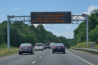
-
Variable message sign encouraging mask wearing and social distancing
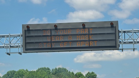
-
Dirt graffiti
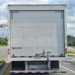
-
Intersection of Routes 64 and 418 [03]
![Intersection of Routes 64 and 418 [03] (1841 visits) Intersection of Routes 64 and 418 in Ringgold, Maryland. The two roads meet at a four-way stop, gov... Intersection of Routes 64 and 418 [03]](../../../../i/upload/2024/07/19/20240719114429-bdff0353-cu_s9999x250.jpg)
-
Intersection of Routes 64 and 418 [02]
![Intersection of Routes 64 and 418 [02] (1679 visits) Intersection of Routes 64 and 418 in Ringgold, Maryland. The two roads meet at a four-way stop, gov... Intersection of Routes 64 and 418 [02]](../../../../i/upload/2024/07/19/20240719114434-f7b1a6bf-cu_s9999x250.jpg)
-
Intersection of Routes 64 and 418 [05]
![Intersection of Routes 64 and 418 [05] (1860 visits) Intersection of Routes 64 and 418 in Ringgold, Maryland. The two roads meet at a four-way stop, gov... Intersection of Routes 64 and 418 [05]](../../../../i/upload/2024/07/19/20240719114438-ea16106f-cu_s9999x250.jpg)
-
Intersection of Routes 64 and 418 [04]
![Intersection of Routes 64 and 418 [04] (1710 visits) Intersection of Routes 64 and 418 in Ringgold, Maryland. The two roads meet at a four-way stop, gov... Intersection of Routes 64 and 418 [04]](../../../../i/upload/2024/07/19/20240719114443-599ce985-cu_s9999x250.jpg)
-
Intersection of Routes 64 and 418 [01]
![Intersection of Routes 64 and 418 [01] (1877 visits) Intersection of Routes 64 and 418 in Ringgold, Maryland. The two roads meet at a four-way stop, gov... Intersection of Routes 64 and 418 [01]](../../../../i/upload/2024/07/19/20240719114447-7f7699d7-cu_s9999x250.jpg)
-
Point of Rocks Bridge [03]
![Point of Rocks Bridge [03] (1412 visits) The Point of Rocks Bridge, which carries US Route 15 over the Potomac River between Loudoun County, ... Point of Rocks Bridge [03]](../../../../i/upload/2024/07/19/20240719121604-b7b9e112-cu_s9999x250.jpg)
-
Point of Rocks Bridge [05]
![Point of Rocks Bridge [05] (1491 visits) Overhead view of the Point of Rocks Bridge, which carries US Route 15 over the Potomac River between... Point of Rocks Bridge [05]](../../../../i/upload/2024/07/19/20240719121622-d2dfa3a8-cu_s9999x250.jpg)
-
Point of Rocks Bridge [02]
![Point of Rocks Bridge [02] (1451 visits) The Point of Rocks Bridge, which carries US Route 15 over the Potomac River between Loudoun County, ... Point of Rocks Bridge [02]](../../../../i/upload/2024/07/19/20240719121627-117c91a4-cu_s9999x250.jpg)
-
Point of Rocks Bridge [01]
![Point of Rocks Bridge [01] (1414 visits) The Point of Rocks Bridge, which carries US Route 15 over the Potomac River between Loudoun County, ... Point of Rocks Bridge [01]](../../../../i/upload/2024/07/19/20240719121631-a890c001-cu_s9999x250.jpg)
-
Point of Rocks Bridge [04]
![Point of Rocks Bridge [04] (1367 visits) The Point of Rocks Bridge, which carries US Route 15 over the Potomac River between Loudoun County, ... Point of Rocks Bridge [04]](../../../../i/upload/2024/07/19/20240719122649-6c75d4bd-cu_s9999x250.jpg)
-
Point of Rocks Bridge [06]
![Point of Rocks Bridge [06] (2973 visits) The Point of Rocks Bridge, which carries US Route 15 over the Potomac River between Loudoun County, ... Point of Rocks Bridge [06]](../../../../i/upload/2024/07/19/20240719161609-122bd90b-cu_s9999x250.jpg)
-
Point of Rocks Bridge [07]
![Point of Rocks Bridge [07] (2925 visits) The Point of Rocks Bridge, which carries US Route 15 over the Potomac River between Loudoun County, ... Point of Rocks Bridge [07]](../../../../i/upload/2024/07/19/20240719161650-2c49391d-cu_s9999x250.jpg)
-
Point of Rocks Bridge [08]
![Point of Rocks Bridge [08] (3021 visits) The Point of Rocks Bridge, which carries US Route 15 over the Potomac River between Loudoun County, ... Point of Rocks Bridge [08]](../../../../i/upload/2024/07/19/20240719161700-351af3cd-cu_s9999x250.jpg)
-
Point of Rocks Bridge [09]
![Point of Rocks Bridge [09] (3069 visits) The Point of Rocks Bridge, which carries US Route 15 over the Potomac River between Loudoun County, ... Point of Rocks Bridge [09]](../../../../i/upload/2024/07/19/20240719161708-5ce37e28-cu_s9999x250.jpg)
-
Point of Rocks Bridge [10]
![Point of Rocks Bridge [10] (3130 visits) The Point of Rocks Bridge, which carries US Route 15 over the Potomac River between Loudoun County, ... Point of Rocks Bridge [10]](../../../../i/upload/2024/07/19/20240719161717-6572a682-cu_s9999x250.jpg)
-
Point of Rocks Bridge [11]
![Point of Rocks Bridge [11] (3166 visits) The Point of Rocks Bridge, which carries US Route 15 over the Potomac River between Loudoun County, ... Point of Rocks Bridge [11]](../../../../i/upload/2024/07/19/20240719161730-4f51193a-cu_s9999x250.jpg)
-
Chesapeake Bay Bridge [01]
![Chesapeake Bay Bridge [01] (3087 visits) The Chesapeake Bay Bridge, a pair of bridges approximately 4.35 miles in length that carry US Routes... Chesapeake Bay Bridge [01]](../../../../i/upload/2024/07/19/20240719162332-1d4f9ead-cu_s9999x250.jpg)
-
Chesapeake Bay Bridge [02]
![Chesapeake Bay Bridge [02] (3171 visits) The Chesapeake Bay Bridge, a pair of bridges approximately 4.35 miles in length that carry US Routes... Chesapeake Bay Bridge [02]](../../../../i/upload/2024/07/19/20240719162336-59620651-cu_s9999x250.jpg)
-
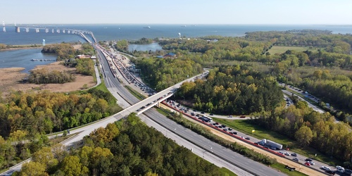
Traffic backup on Bay Bridge approach
-
Aerial view of Glen Burnie, Maryland [01]
![Aerial view of Glen Burnie, Maryland [01] (1659 visits) Aerial view of Glen Burnie, Maryland, taken near Marley Station Mall.
Ben Schumin is a professional... Aerial view of Glen Burnie, Maryland [01]](../../../../i/upload/2024/07/19/20240719162345-6a1470e1-cu_s9999x250.jpg)
-
Chesapeake Bay Bridge [03]
![Chesapeake Bay Bridge [03] (3128 visits) The Chesapeake Bay Bridge, a pair of bridges approximately 4.35 miles in length that carry US Routes... Chesapeake Bay Bridge [03]](../../../../i/upload/2024/07/19/20240719162426-d7b27488-cu_s9999x250.jpg)
-
Chesapeake Bay Bridge [04]
![Chesapeake Bay Bridge [04] (3378 visits) The Chesapeake Bay Bridge, a pair of bridges approximately 4.35 miles in length that carry US Routes... Chesapeake Bay Bridge [04]](../../../../i/upload/2024/07/19/20240719162503-710cfed8-cu_s9999x250.jpg)
-
Clarksburg Road bridge over Little Seneca Lake [04]
![Clarksburg Road bridge over Little Seneca Lake [04] (3432 visits) Bridge carrying Clarksburg Road (Maryland Route 121) over Little Seneca Lake in Boyds, Maryland. Li... Clarksburg Road bridge over Little Seneca Lake [04]](../../../../i/upload/2024/07/19/20240719164909-eab2208d-cu_s9999x250.jpg)
-
Clarksburg Road bridge over Little Seneca Lake [03]
![Clarksburg Road bridge over Little Seneca Lake [03] (2684 visits) Bridge carrying Clarksburg Road (Maryland Route 121) over Little Seneca Lake in Boyds, Maryland. Li... Clarksburg Road bridge over Little Seneca Lake [03]](../../../../i/upload/2024/07/19/20240719164913-53b65146-cu_s9999x250.jpg)
-
Clarksburg Road bridge over Little Seneca Lake [01]
![Clarksburg Road bridge over Little Seneca Lake [01] (1265 visits) Bridge carrying Clarksburg Road (Maryland Route 121) over Little Seneca Lake in Boyds, Maryland. Li... Clarksburg Road bridge over Little Seneca Lake [01]](../../../../i/upload/2024/07/19/20240719164917-35ced0ed-cu_s9999x250.jpg)
-
Clarksburg Road bridge over Little Seneca Lake [02]
![Clarksburg Road bridge over Little Seneca Lake [02] (2617 visits) Bridge carrying Clarksburg Road (Maryland Route 121) over Little Seneca Lake in Boyds, Maryland. Li... Clarksburg Road bridge over Little Seneca Lake [02]](../../../../i/upload/2024/07/19/20240719164928-43aa6e0f-cu_s9999x250.jpg)
-
Clarksburg Road bridge over Little Seneca Lake [05]
![Clarksburg Road bridge over Little Seneca Lake [05] (2774 visits) Bridge carrying Clarksburg Road (Maryland Route 121) over Little Seneca Lake in Boyds, Maryland. Li... Clarksburg Road bridge over Little Seneca Lake [05]](../../../../i/upload/2024/07/19/20240719164946-4e860e8a-cu_s9999x250.jpg)
-
Purple streetlight at Jennings Chapel Road and Route 97 [04]
![Purple streetlight at Jennings Chapel Road and Route 97 [04] (1929 visits) Streetlight at the intersection of Jennings Chapel Road and Maryland Route 97 in Howard County, Mary... Purple streetlight at Jennings Chapel Road and Route 97 [04]](../../../../i/upload/2024/07/20/20240720091715-4db229fd-cu_s9999x250.jpg)
-
Purple streetlight at Jennings Chapel Road and Route 97 [01]
![Purple streetlight at Jennings Chapel Road and Route 97 [01] (2312 visits) Streetlight at the intersection of Jennings Chapel Road and Maryland Route 97 in Howard County, Mary... Purple streetlight at Jennings Chapel Road and Route 97 [01]](../../../../i/upload/2024/07/20/20240720091721-aca69960-cu_s9999x250.jpg)
-
Purple streetlight at Jennings Chapel Road and Route 97 [02]
![Purple streetlight at Jennings Chapel Road and Route 97 [02] (1713 visits) Streetlight at the intersection of Jennings Chapel Road and Maryland Route 97 in Howard County, Mary... Purple streetlight at Jennings Chapel Road and Route 97 [02]](../../../../i/upload/2024/07/20/20240720091726-02de12bb-cu_s9999x250.jpg)